
Highlands, North Carolina
Encyclopedia
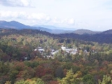
Highlands is an incorporated town
in Macon County
in the U.S. state
of North Carolina
. Located on a plateau
in the southern Appalachian Mountains
, within the Nantahala National Forest
, it lies mostly in southeastern Macon County and slightly in southwestern Jackson County
, in the Highlands and Cashiers township
s, respectively. The permanent population was 924 at the 2010 census. The population swells to 10,000-15,000 during the season from spring to fall
.
to Savannah
and from New Orleans to New York
. They felt that the place where these lines met would eventually become a great trading center and commercial crossroads.
In the 1930s the town became a golfing mecca when Bobby Jones
of Atlanta and some of his well-heeled golfing buddies founded the Highlands Country Club. Today that club is one of seven successful residential country club communities in the area. The Highlands Country Club is south of Highlands on Dillard Road (North Carolina Highway 106).
According to the United States Census Bureau
, the community has a total area of 6.2 square miles (16.1 km²), of which 6.1 square miles (15.8 km²) is land and 0.1 square mile (0.258998811 km²), or 1.94%, is water.
The official average elevation
within town limits is 4118 feet (1,255 m), making it one of the highest incorporated municipalities east of the Mississippi. The annual rainfall approaches 90 inches (2,286 mm) due to the orographic lifting effect of storms coming from the lower elevations. This rainfall and, counterintuitively, the abundant sunshine, create a lush and verdant microclimate which delights botanists
.
Highlands owes its cooler weather to its altitude. Astride the Eastern Continental Divide
, at just over 4100 ft (1,249.7 m), the town's elevation contributes to its relatively cool summers and abundant rainfall, averaging 87.57 inches (2,224.3 mm) per year. Average snow
fall is only 6 inches (15.2 cm), largely due to the fact that Highlands is further south and east in the Appalachian Mountains
. Areas of similar elevation on the northwest side of Appalachian region, such as Banner Elk, are not as protected from periodic blasts of Arctic air and receive more substantial snowfall. Regardless, Highlands is one of the very rare locations at this latitude that has an average high of 78°F or 26°C in July, far lower than the rest of the American South.
The town is dotted with many antique dealers, a well-known auction house, restaurants (six of which have received awards from Wine Spectator
), shops, and inns, as well as several buildings on the National Register of Historic Places
. For the performing arts there are four theaters: The Highlands Playhouse (founded in 1938), the Instant Theatre Company (founded in 1981), the Highlands Community Players (founded in 1995), and the Martin-Lipscomb Performing Arts Center, which hosts touring groups. For the visual arts there is The Bascom - A Center for the Visual Arts, a new facility named for the artist and playwright, Louise Rand Bascom Barratt.
The historic (NRHP-listed) Lee's Inn, with an enormous tree growing through the middle of its dining room, was lost to an electrical fire in the 1980s and was not rebuilt. The historic Old Edwards Inn (also NRHP-listed) continues to operate as an inn and spa catering to the affluent.
, known as the Hudson Library. The Hudson Library is part of the Fontana Regional Library, which serves Swain, Jackson, and Macon counties. The Hudson Library also housed The Bascom until May 2009; The Bascom is a nonprofit visual arts center that is constructing its own facility near town.
Highlands has a post office
, with ZIP code
28741 covering all of Highlands township and adjacent parts of Sugar Fork township. It is within area code 828
, and all telephone numbers served by the town's exchange begin with 526-, with seven-digit dialing allowed. Since buying GTE
, Verizon is now the telephone company
for the area. It also offers DSL high-speed Internet.
Cable television
and cable modem
services for the town of Highlands are contracted to Northland Cable TV, and later Highlands Cable Group. Both systems must carry local TV stations from the Asheville
/Hendersonville
and Greenville
/Spartanburg
areas. Additionally, because there are so many visitors and residents from metro Atlanta
, Northland carries three major-network stations from Atlanta: WSB-TV
2 (ABC), WAGA
TV 5 (Fox), and WGTV TV 8 (PBS, via GPB). (WXIA-TV
11 [NBC] was never carried because it was exclusive to big-dish satellite TV, ironically seen as far away as the Caribbean. WGCL-TV
46 [CBS] is not carried because CBS was on 5 at the time that the system was set up, and Fox did not exist.) It also continues to carry WPCH-TV 17 (Peachtree TV), even after it was split from TBS after it was Superstation
WTBS. It is one of the only cable systems that carries three different statewide Public Broadcasting Service
(PBS) state networks: GPB
, UNCTV, and SCETV.
Highlands is the city of license
for two radio station
s. WHLC
FM 104.5 broadcast
s from a house on Cashiers Road just north of town and is one of the only stations to still have an easy listening
format
. Its omnidirectional
broadcast range extends into all three surrounding states, going furthest into upstate South Carolina due to the lack of mountains there. W269AY on 101.7 relays Western North Carolina Public Radio from Asheville. UNCTV is relayed in analog on W27BD, and in digital on W35CK-D.
, along the Mountain Waters Scenic Byway
alongside the Cullasaja River
. Cashiers Road and north Fourth Street carry U.S. 64 east, going north and then northeast toward Cashiers
, with views of Whiteside Mountain
. Walhalla Road and south Fourth Street carry N.C. 28 briefly south, west around the south side of downtown, and then south again toward Pine Mountain, Georgia and Walhalla, South Carolina
, keeping the number 28 in all three states. Dillard Road carries N.C. 106 southwest toward Scaly Mountain and Sky Valley, becoming Georgia 246, crossing the state line five times, and soon ending at U.S. 441 in Dillard
. There are also other state secondary roads maintained by NCDOT, with Buck Creek Road (N.C. 1535/1538) acting as a very curvy bypass route around the town.
There is no public transportation within or through the town. The nearest municipal airport is Macon County Airport
, between Franklin and Iotla. While it is also the nearest automated airport weather station
, conditions there do not accurately reflect Highlands, as there is a major difference in elevation, and therefore temperature
and precipitation
. A USFS RAWS automated weather station (HGLN7) operates from north-northwest of Highlands, along Flat Mountain Road (N.C. 1544).

s, and there is at least one outfitter
store in town. As Highlands is in such a mountainous area, there are many scenic places to hike. With Highlands being home to various waterfall
s, many hiking trails lead to these falls.
and other in-town and surrounding-area lakes. Some areas are public and others are private fishing grounds. There are also several rivers, including the Cullasaja River
that begins in town, and the Chattooga River
to the southeast.
located in the Nantahala National Forest
, northwest of Highlands. With a short curve of roadway located behind the falls, it has the distinction of being the only waterfall in the state that one can drive a vehicle under. Bridal Veil Falls flows on a tributary of the Cullasaja River
through the Nantahala National Forest. The falls flows over an overhanging bluff that allows visitors to walk behind the falls and remain dry when the waterflow is low. During periods of drought, the stream may nearly dry up, though visitors will get wet if the waterflow is moderate or high. Bridal Veil Falls is located on the side of U.S. Highway 64 2.3 miles (3.7 km) northwest of town. Highway 64 originally used the curve of roadway behind the falls exclusively so that all traffic went behind them; however, this caused problems with icing
of the roadway during freezing weather, and it was re-routed around the front of the falls since. There is a parking area on the side of the road, where visitors can park and view the falls as well. In 2003, a massive boulder slid off the left side of the falls, blocking that side of the drive-under completely. However, in July 2007, that boulder was removed by a local developer.
in the Nantahala National Forest
and is part of the Mountain Waters Scenic Byway
. Cullasaja comes from a Cherokee
word meaning "honey locust
place". The falls is the last major waterfall on the Cullasaja River. The falls is a long cascade over the course of 0.2 mile (0.321868 km). The height of the falls is given as 200 feet (61 m) in Kevin Adams' book, North Carolina Waterfalls and 250 feet (76.2 m) by NCWaterfalls.com. However, Google Earth gives a height (based on the elevation of the water at the top of the falls and the elevation of the plunge pool at the bottom of the falls) of 137 feet (41.8 m). It is easy to catch a glimpse of the falls as you drive by; however, getting a better view of the falls is not easy. The falls are located beside a series of blind curves on Highway 64
with sheer rock cliffs above and below the road. There is only one small pull-off near the falls, but walking on the road puts visitors in danger of being hit by a passing vehicle.
in the Nantahala National Forest
, northwest of Highlands on the Cullasaja River
. It is part of a series of waterfalls on an 8.7 miles (14 km) stretch of the river that eventually ends with Cullasaja Falls
. Dry Falls flows over an overhanging bluff that allows visitors to walk up under the falls and remain relatively dry when the waterflow is low, hence its name. Visitors will get wet if the waterflow is high. The falls has been called Dry Falls for a long time, but has also gone by a few other names, including High Falls, Pitcher Falls, and Cullasaja Falls. Dry Falls is located on the side of U.S. Highway 64 3.1 miles (5 km) north of Highlands. There is a parking area on the side of the road, where visitors can park before walking the short path with stairs to the falls. During 2008-2009 the Forest Service made improvements to the parking area, which included renovation and expansion and the addition of bathroom facilities. A new walkway and overlook were also constructed adjacent to the parking area.
located beside US Highway 64 west of Highlands. It is best known for the large, deep pool at the bottom and is a popular place for swimming during warm weather.
of 2000, there were 909 people, 445 households, and 253 families residing in the town. The population density
was 150.0 people per square mile (57.9/km²). There were 1,713 housing units at an average density of 282.7 per square mile (109.1/km²). The racial makeup of the town was 98.46% White, 0.11% Asian, 0.88% from other races
, and 0.55% from two or more races. Hispanic or Latino of any race were 2.97% of the population.
There were 445 households out of which 18.0% had children under the age of 18 living with them, 48.8% were married couples
living together, 6.1% had a female householder with no husband present, and 43.1% were non-families. 36.9% of all households were made up of individuals and 15.7% had someone living alone who was 65 years of age or older. The average household size was 2.04 and the average family size was 2.66.
In the town the population was spread out with 16.4% under the age of 18, 5.4% from 18 to 24, 19.9% from 25 to 44, 33.4% from 45 to 64, and 24.9% who were 65 years of age or older. The median age was 51 years. For every 100 females there were 91.4 males. For every 100 females age 18 and over, there were 84.5 males.
The median income for a household in the town was $33,750, and the median income for a family was $46,875. Males had a median income of $31,964 versus $20,662 for females. The per capita income
for the town was $24,120. About 4.2% of families and 7.5% of the population were below the poverty line, including 2.2% of those under age 18 and 13.5% of those age 65 or over.
:
In Georgia
:
Town
A town is a human settlement larger than a village but smaller than a city. The size a settlement must be in order to be called a "town" varies considerably in different parts of the world, so that, for example, many American "small towns" seem to British people to be no more than villages, while...
in Macon County
Macon County, North Carolina
- Geographic features :Of the in Macon County, are federal lands that lie within the Nantahala National Forest and are administered by the United States Forest Service. Of the of USFS land, lie in the Highlands Ranger District and the remaining lie in the Wayah Ranger District...
in the U.S. state
U.S. state
A U.S. state is any one of the 50 federated states of the United States of America that share sovereignty with the federal government. Because of this shared sovereignty, an American is a citizen both of the federal entity and of his or her state of domicile. Four states use the official title of...
of North Carolina
North Carolina
North Carolina is a state located in the southeastern United States. The state borders South Carolina and Georgia to the south, Tennessee to the west and Virginia to the north. North Carolina contains 100 counties. Its capital is Raleigh, and its largest city is Charlotte...
. Located on a plateau
Plateau
In geology and earth science, a plateau , also called a high plain or tableland, is an area of highland, usually consisting of relatively flat terrain. A highly eroded plateau is called a dissected plateau...
in the southern Appalachian Mountains
Appalachian Mountains
The Appalachian Mountains #Whether the stressed vowel is or ,#Whether the "ch" is pronounced as a fricative or an affricate , and#Whether the final vowel is the monophthong or the diphthong .), often called the Appalachians, are a system of mountains in eastern North America. The Appalachians...
, within the Nantahala National Forest
Nantahala National Forest
The Nantahala National Forest, established in 1920, is a national forest located in the American state of North Carolina. The word "Nantahala" is a Cherokee word meaning "Land of the Noonday Sun." The name is appropriate as, in some spots, the sun only reaches the floors of the deep gorges of the...
, it lies mostly in southeastern Macon County and slightly in southwestern Jackson County
Jackson County, North Carolina
Jackson County is a county located in the southwest of the U.S. state of North Carolina. As of 2010, the population was 40,271. Since 1913 its county seat has been Sylva, replacing Webster.-History:...
, in the Highlands and Cashiers township
Township
The word township is used to refer to different kinds of settlements in different countries. Township is generally associated with an urban area. However there are many exceptions to this rule. In Australia, the United States, and Canada, they may be settlements too small to be considered urban...
s, respectively. The permanent population was 924 at the 2010 census. The population swells to 10,000-15,000 during the season from spring to fall
Autumn
Autumn is one of the four temperate seasons. Autumn marks the transition from summer into winter usually in September or March when the arrival of night becomes noticeably earlier....
.
History
Highlands was founded in 1875 after its two founders, Samuel Truman Kelsey and Clinton Carter Hutchinson, drew lines from ChicagoChicago
Chicago is the largest city in the US state of Illinois. With nearly 2.7 million residents, it is the most populous city in the Midwestern United States and the third most populous in the US, after New York City and Los Angeles...
to Savannah
Savannah, Georgia
Savannah is the largest city and the county seat of Chatham County, in the U.S. state of Georgia. Established in 1733, the city of Savannah was the colonial capital of the Province of Georgia and later the first state capital of Georgia. Today Savannah is an industrial center and an important...
and from New Orleans to New York
New York
New York is a state in the Northeastern region of the United States. It is the nation's third most populous state. New York is bordered by New Jersey and Pennsylvania to the south, and by Connecticut, Massachusetts and Vermont to the east...
. They felt that the place where these lines met would eventually become a great trading center and commercial crossroads.
In the 1930s the town became a golfing mecca when Bobby Jones
Bobby Jones (golfer)
Robert Tyre "Bobby" Jones Jr. was an American amateur golfer, and a lawyer by profession. Jones was the most successful amateur golfer ever to compete on a national and international level...
of Atlanta and some of his well-heeled golfing buddies founded the Highlands Country Club. Today that club is one of seven successful residential country club communities in the area. The Highlands Country Club is south of Highlands on Dillard Road (North Carolina Highway 106).
Geography
Highlands is located at 35°3′15"N 83°12′8"W (35.054129, -83.202351).According to the United States Census Bureau
United States Census Bureau
The United States Census Bureau is the government agency that is responsible for the United States Census. It also gathers other national demographic and economic data...
, the community has a total area of 6.2 square miles (16.1 km²), of which 6.1 square miles (15.8 km²) is land and 0.1 square mile (0.258998811 km²), or 1.94%, is water.
The official average elevation
Elevation
The elevation of a geographic location is its height above a fixed reference point, most commonly a reference geoid, a mathematical model of the Earth's sea level as an equipotential gravitational surface ....
within town limits is 4118 feet (1,255 m), making it one of the highest incorporated municipalities east of the Mississippi. The annual rainfall approaches 90 inches (2,286 mm) due to the orographic lifting effect of storms coming from the lower elevations. This rainfall and, counterintuitively, the abundant sunshine, create a lush and verdant microclimate which delights botanists
Botany
Botany, plant science, or plant biology is a branch of biology that involves the scientific study of plant life. Traditionally, botany also included the study of fungi, algae and viruses...
.
Climate
| Monthly normal and record temperatures | |||||
|---|---|---|---|---|---|
| Mon. | Rec. low |
Avg. low |
Avg. mean |
Avg. high |
Rec. high |
| Jan. | -19°F -28°C |
23°F -5°C |
33°F 1°C |
42°F 6°C |
70°F 21°C |
| Feb. | -9°F -23°C |
25°F -4°C |
36°F 2°C |
46°F 8°C |
73°F 23°C |
| Mar. | -1°F -18°C |
31°F -1°C |
43°F 6°C |
54°F 12°C |
78°F 26°C |
| April | 13°F -11°C |
38°F 3°C |
50°F 10°C |
62°F 17°C |
83°F 6°C |
| May | 28°F -2°C |
46°F 8°C |
58°F 14°C |
69°F 21°C |
86°F 30°C |
| June | 35°F 2°C |
53°F 12°C |
64°F 18°C |
75°F 24°C |
91°F 33°C |
| July | 43°F 6°C |
57°F 14°C |
68°F 20°C |
78°F 26°C |
93°F 34°C |
| Aug. | 43°F 6°C |
56°F 13°C |
66°F 19°C |
76°F 24°C |
91°F 33°C |
| Sep. | 30°F -1°C |
51°F 11°C |
61°F 16°C |
71°F 22°C |
89°F 32°C |
| Oct. | 20°F -7°C |
40°F 4°C |
51°F 11°C |
62°F 17°C |
82°F 28°C |
| Nov. | -3°F -19°C |
32°F 0°C |
42°F 6°C |
52°F 11°C |
77°F 25°C |
| Dec. | -11°F -24°C |
26°F -3°C |
35°F 2°C |
44°F 7°C |
72°F 22°C |
Highlands owes its cooler weather to its altitude. Astride the Eastern Continental Divide
Eastern Continental Divide
The Eastern Continental Divide, in conjunction with other continental divides of North America, demarcates two watersheds of the Atlantic Ocean: the Gulf of Mexico watershed and the Atlantic Seaboard watershed. Prior to 1760, the divide represented the boundary between British and French colonial...
, at just over 4100 ft (1,249.7 m), the town's elevation contributes to its relatively cool summers and abundant rainfall, averaging 87.57 inches (2,224.3 mm) per year. Average snow
Snow
Snow is a form of precipitation within the Earth's atmosphere in the form of crystalline water ice, consisting of a multitude of snowflakes that fall from clouds. Since snow is composed of small ice particles, it is a granular material. It has an open and therefore soft structure, unless packed by...
fall is only 6 inches (15.2 cm), largely due to the fact that Highlands is further south and east in the Appalachian Mountains
Appalachian Mountains
The Appalachian Mountains #Whether the stressed vowel is or ,#Whether the "ch" is pronounced as a fricative or an affricate , and#Whether the final vowel is the monophthong or the diphthong .), often called the Appalachians, are a system of mountains in eastern North America. The Appalachians...
. Areas of similar elevation on the northwest side of Appalachian region, such as Banner Elk, are not as protected from periodic blasts of Arctic air and receive more substantial snowfall. Regardless, Highlands is one of the very rare locations at this latitude that has an average high of 78°F or 26°C in July, far lower than the rest of the American South.
Tourism
Highlands is becoming more and more a two-season community; a summer-season community and an ever growing winter-season community. The summer season (generally March through November) draws large numbers of Southerners from the oppressive summertime heat and humidity found throughout much of the region to enjoy the beautiful mountains, cool days, fine dining, and hometown Main Street experience. More and more the town is increasing its winter season draw through its offering of arts, culinary, holiday and romantic events.The town is dotted with many antique dealers, a well-known auction house, restaurants (six of which have received awards from Wine Spectator
Wine Spectator
Wine Spectator is a lifestyle magazine that focuses on wine and wine culture. It publishes 15 issues per year with content that includes news, articles, profiles, and general entertainment pieces...
), shops, and inns, as well as several buildings on the National Register of Historic Places
National Register of Historic Places
The National Register of Historic Places is the United States government's official list of districts, sites, buildings, structures, and objects deemed worthy of preservation...
. For the performing arts there are four theaters: The Highlands Playhouse (founded in 1938), the Instant Theatre Company (founded in 1981), the Highlands Community Players (founded in 1995), and the Martin-Lipscomb Performing Arts Center, which hosts touring groups. For the visual arts there is The Bascom - A Center for the Visual Arts, a new facility named for the artist and playwright, Louise Rand Bascom Barratt.
The historic (NRHP-listed) Lee's Inn, with an enormous tree growing through the middle of its dining room, was lost to an electrical fire in the 1980s and was not rebuilt. The historic Old Edwards Inn (also NRHP-listed) continues to operate as an inn and spa catering to the affluent.
Public utilities and services
There is one public school in the town, Highlands School, as well as a public libraryPublic library
A public library is a library that is accessible by the public and is generally funded from public sources and operated by civil servants. There are five fundamental characteristics shared by public libraries...
, known as the Hudson Library. The Hudson Library is part of the Fontana Regional Library, which serves Swain, Jackson, and Macon counties. The Hudson Library also housed The Bascom until May 2009; The Bascom is a nonprofit visual arts center that is constructing its own facility near town.
Highlands has a post office
Post office
A post office is a facility forming part of a postal system for the posting, receipt, sorting, handling, transmission or delivery of mail.Post offices offer mail-related services such as post office boxes, postage and packaging supplies...
, with ZIP code
ZIP Code
ZIP codes are a system of postal codes used by the United States Postal Service since 1963. The term ZIP, an acronym for Zone Improvement Plan, is properly written in capital letters and was chosen to suggest that the mail travels more efficiently, and therefore more quickly, when senders use the...
28741 covering all of Highlands township and adjacent parts of Sugar Fork township. It is within area code 828
Area code 828
In the North American Numbering Plan, 828 is the telephone area code for the western mountain region of the U.S. state of North Carolina, including Asheville. The city of Hickory is often grouped with the Charlotte metropolitan area, but uses 828 rather than Charlotte's 704/980 area code overlay...
, and all telephone numbers served by the town's exchange begin with 526-, with seven-digit dialing allowed. Since buying GTE
GTE
GTE Corporation, formerly General Telephone & Electronics Corporation was the largest independent telephone company in the United States during the days of the Bell System....
, Verizon is now the telephone company
Telephone company
A telephone company is a service provider of telecommunications services such as telephony and data communications access. Many were at one time nationalized or state-regulated monopolies...
for the area. It also offers DSL high-speed Internet.
Cable television
Cable television
Cable television is a system of providing television programs to consumers via radio frequency signals transmitted to televisions through coaxial cables or digital light pulses through fixed optical fibers located on the subscriber's property, much like the over-the-air method used in traditional...
and cable modem
Cable modem
A cable modem is a type of network bridge and modem that provides bi-directional data communication via radio frequency channels on a HFC and RFoG infrastructure. Cable modems are primarily used to deliver broadband Internet access in the form of cable Internet, taking advantage of the high...
services for the town of Highlands are contracted to Northland Cable TV, and later Highlands Cable Group. Both systems must carry local TV stations from the Asheville
Asheville, North Carolina
Asheville is a city in and the county seat of Buncombe County, North Carolina, United States. It is the largest city in Western North Carolina, and the 11th largest city in North Carolina. The City is home to the United States National Climatic Data Center , which is the world's largest active...
/Hendersonville
Hendersonville, North Carolina
Hendersonville is a city in Henderson County, North Carolina, USA, southeast of Asheville. In 1900, 1,917 persons lived in Hendersonville; in 1910, 2,818; and in 1940, 5,381 people lived here. As of the 2010 census, the city population was 12,223, up fivefold in one century. It is the county...
and Greenville
Greenville, South Carolina
-Law and government:The city of Greenville adopted the Council-Manager form of municipal government in 1976.-History:The area was part of the Cherokee Nation's protected grounds after the Treaty of 1763, which ended the French and Indian War. No White man was allowed to enter, though some families...
/Spartanburg
Spartanburg, South Carolina
thgSpartanburg is the largest city in and the county seat of Spartanburg County, South Carolina, United States. It is the second-largest city of the three primary cities in the Upstate region of South Carolina, and is located northwest of Columbia, west of Charlotte, and about northeast of...
areas. Additionally, because there are so many visitors and residents from metro Atlanta
Metro Atlanta
The Atlanta metropolitan area or metro Atlanta, officially designated by the US Census Bureau as the Atlanta-Sandy Springs-Marietta Metropolitan Statistical Area, is the most populous metro area in the U.S. state of Georgia and the ninth-largest metropolitan statistical area in the United States...
, Northland carries three major-network stations from Atlanta: WSB-TV
WSB-TV
WSB-TV, virtual channel 2.1 , is the ABC affiliate in Atlanta, Georgia. It is the flagship television station of Cox Enterprises and its Cox Media Group subsidiary...
2 (ABC), WAGA
WAGA (TV)
WAGA-TV, virtual channel 5.1 is an owned-and-operated television station of the News Corporation-owned Fox Television Network and based in Atlanta, Georgia, United States...
TV 5 (Fox), and WGTV TV 8 (PBS, via GPB). (WXIA-TV
WXIA-TV
WXIA-TV, virtual channel 11.1 , is the NBC-affiliated television station in Atlanta, Georgia. Popularly known by its 11 Alive moniker, WXIA is owned by the Gannett Company in a duopoly with MyNetworkTV affiliate WATL...
11 [NBC] was never carried because it was exclusive to big-dish satellite TV, ironically seen as far away as the Caribbean. WGCL-TV
WGCL-TV
WGCL-TV, virtual channel 46.1 is the CBS-affiliated television station serving the Atlanta, Georgia area. Its city of license is Atlanta, and the station is owned by Meredith Corporation, making it the largest-market CBS station not owned by the network...
46 [CBS] is not carried because CBS was on 5 at the time that the system was set up, and Fox did not exist.) It also continues to carry WPCH-TV 17 (Peachtree TV), even after it was split from TBS after it was Superstation
Superstation
Superstation in United States television can have several meanings. In its most precise meaning, a superstation is defined by the Federal Communications Commission as "A television broadcast station, other than a network station, licensed by the FCC that is secondarily transmitted by a satellite...
WTBS. It is one of the only cable systems that carries three different statewide Public Broadcasting Service
Public Broadcasting Service
The Public Broadcasting Service is an American non-profit public broadcasting television network with 354 member TV stations in the United States which hold collective ownership. Its headquarters is in Arlington, Virginia....
(PBS) state networks: GPB
Georgia Public Broadcasting
Georgia Public Broadcasting is the public broadcasting radio and television state network in the U.S. state of Georgia. It is operated by the Georgia Public Telecommunications Commission....
, UNCTV, and SCETV.
Highlands is the city of license
City of license
A city of license or community of license, in American and Canadian broadcasting, is the community that a radio station or television station is officially licensed to serve by that country's broadcast regulator....
for two radio station
Radio station
Radio broadcasting is a one-way wireless transmission over radio waves intended to reach a wide audience. Stations can be linked in radio networks to broadcast a common radio format, either in broadcast syndication or simulcast or both...
s. WHLC
WHLC (FM)
In 2003, it also made applications for 106.5 in Cashiers, 97.1 in Lake Toxaway, 99.1 in Franklin, and 105.3 in "Scaly" in North Carolina, and for 94.9 in Easley and 101.7 in Greenville, South Carolina. , these are still pending....
FM 104.5 broadcast
Broadcast
Broadcast or Broadcasting may refer to:* Broadcasting, the transmission of audio and video signals* Broadcast, an individual television program or radio program* Broadcast , an English electronic music band...
s from a house on Cashiers Road just north of town and is one of the only stations to still have an easy listening
Easy listening
Easy listening is a broad style of popular music and radio format that emerged in the 1950s, evolving out of big band music, and related to MOR music as played on many AM radio stations. It encompasses the exotica, beautiful music, light music, lounge music, ambient music, and space age pop genres...
format
Radio format
A radio format or programming format not to be confused with broadcast programming describes the overall content broadcast on a radio station. Radio formats are frequently employed as a marketing tool, and constantly evolve...
. Its omnidirectional
Omnidirectional antenna
In radio communication, an omnidirectional antenna is an antenna which radiates radio wave power uniformly in all directions in one plane, with the radiated power decreasing with elevation angle above or below the plane, dropping to zero on the antenna's axis. This radiation pattern is often...
broadcast range extends into all three surrounding states, going furthest into upstate South Carolina due to the lack of mountains there. W269AY on 101.7 relays Western North Carolina Public Radio from Asheville. UNCTV is relayed in analog on W27BD, and in digital on W35CK-D.
Transportation
There are four major roads in and out of town. Franklin Road and most of Main Street carry U.S. 64 west and N.C. 28 north, going briefly west and then northwest to FranklinFranklin, North Carolina
Franklin is a town in Franklin Township, Macon County, North Carolina, United States, within the Nantahala National Forest. The population was 3,490 as of the 2000 census. It is the county seat of Macon County. Franklin is an official Appalachian Trail friendly destination...
, along the Mountain Waters Scenic Byway
Mountain Waters Scenic Byway
The Mountain Waters Scenic Byway is a two-lane highway in North Carolina, which travels through the Nantahala National Forest in Macon and Swain County, North Carolina counties. The first part of this byway follows the combined route of U.S...
alongside the Cullasaja River
Cullasaja River
The Cullasaja River is a short river located entirely in Macon County, North Carolina. It is a tributary of the Little Tennessee River , into which it flows near the county seat of Franklin. It originates to the southeast, near Highlands, the county's only other town...
. Cashiers Road and north Fourth Street carry U.S. 64 east, going north and then northeast toward Cashiers
Cashiers, North Carolina
Cashiers is a census-designated place and unincorporated village located in southern Jackson County, North Carolina. As of the 2010 census, the community had a total population of 157. During the summer season , the population swells to 20,000...
, with views of Whiteside Mountain
Whiteside Mountain
Whiteside Mountain is a mountain in Jackson County, North Carolina between Cashiers, Highlands, North Carolina, and the Georgia border. Whiteside Mountain can boast the highest cliffs in Eastern North America...
. Walhalla Road and south Fourth Street carry N.C. 28 briefly south, west around the south side of downtown, and then south again toward Pine Mountain, Georgia and Walhalla, South Carolina
Walhalla, South Carolina
Walhalla is a mountain city in Oconee County, South Carolina, United States. It is located from Clemson University in Clemson, South Carolina and is also located in the Appalachian Mountains of South Carolina. The population was 3,801 at the 2000 census. It is the county seat of Oconee County...
, keeping the number 28 in all three states. Dillard Road carries N.C. 106 southwest toward Scaly Mountain and Sky Valley, becoming Georgia 246, crossing the state line five times, and soon ending at U.S. 441 in Dillard
Dillard, Georgia
Dillard is a city in Rabun County, Georgia, United States. census, the city population was 198.-Geography:Dillard is located at .According to the United States Census Bureau, Dillard has a total area of , all of it land...
. There are also other state secondary roads maintained by NCDOT, with Buck Creek Road (N.C. 1535/1538) acting as a very curvy bypass route around the town.
There is no public transportation within or through the town. The nearest municipal airport is Macon County Airport
Macon County Airport
Macon County Airport is the municipal airport in Macon County, North Carolina. It is located in the Iotla Valley of the Great Smoky Mountains, 3 miles northwest of the county seat of Franklin and just southeast of the Iotla community, all within Franklin township.- Facilities :New terminal building...
, between Franklin and Iotla. While it is also the nearest automated airport weather station
Automated airport weather station
Automated airport weather stations are automated sensor suites which are designed to serve aviation and meteorological observing needs for safe and efficient aviation operations and weather forecasting...
, conditions there do not accurately reflect Highlands, as there is a major difference in elevation, and therefore temperature
Temperature
Temperature is a physical property of matter that quantitatively expresses the common notions of hot and cold. Objects of low temperature are cold, while various degrees of higher temperatures are referred to as warm or hot...
and precipitation
Precipitation (meteorology)
In meteorology, precipitation In meteorology, precipitation In meteorology, precipitation (also known as one of the classes of hydrometeors, which are atmospheric water phenomena is any product of the condensation of atmospheric water vapor that falls under gravity. The main forms of precipitation...
. A USFS RAWS automated weather station (HGLN7) operates from north-northwest of Highlands, along Flat Mountain Road (N.C. 1544).
Recreation
Hiking
The nature and hiking trails around Highlands are popular with backpackerBackpacking (wilderness)
Backpacking combines the activities of hiking and camping for an overnight stay in backcountry wilderness...
s, and there is at least one outfitter
Outfitter
An outfitter is a shop or person that sells men's clothes . More specifically, it is a company or individual who provides or deals in equipment and supplies for the pursuit of certain activities. The term is most closely associated with outdoor activities such as rafting, hunting, fishing,...
store in town. As Highlands is in such a mountainous area, there are many scenic places to hike. With Highlands being home to various waterfall
Waterfall
A waterfall is a place where flowing water rapidly drops in elevation as it flows over a steep region or a cliff.-Formation:Waterfalls are commonly formed when a river is young. At these times the channel is often narrow and deep. When the river courses over resistant bedrock, erosion happens...
s, many hiking trails lead to these falls.
Fishing
Fishing is available in Highlands, at Harris LakeHarris Lake (Highlands, North Carolina)
Harris Lake is located just outside of Downtown Highlands, North Carolina. It is a popular spot for fishing and picnicking. Harris Lake is home to many geese, swans and ducks.Harris Lake is located at ....
and other in-town and surrounding-area lakes. Some areas are public and others are private fishing grounds. There are also several rivers, including the Cullasaja River
Cullasaja River
The Cullasaja River is a short river located entirely in Macon County, North Carolina. It is a tributary of the Little Tennessee River , into which it flows near the county seat of Franklin. It originates to the southeast, near Highlands, the county's only other town...
that begins in town, and the Chattooga River
Chattooga River
The Chattooga River is the main tributary of the Tugaloo River. Its headwaters are located southwest of Cashiers, North Carolina, and it stretches to where it has its confluence with the Tallulah River within Lake Tugalo, held back by the Tugalo Dam...
to the southeast.
Bridal Veil Falls
Bridal Veil Falls is a 45 feet (13.7 m) waterfallWaterfall
A waterfall is a place where flowing water rapidly drops in elevation as it flows over a steep region or a cliff.-Formation:Waterfalls are commonly formed when a river is young. At these times the channel is often narrow and deep. When the river courses over resistant bedrock, erosion happens...
located in the Nantahala National Forest
Nantahala National Forest
The Nantahala National Forest, established in 1920, is a national forest located in the American state of North Carolina. The word "Nantahala" is a Cherokee word meaning "Land of the Noonday Sun." The name is appropriate as, in some spots, the sun only reaches the floors of the deep gorges of the...
, northwest of Highlands. With a short curve of roadway located behind the falls, it has the distinction of being the only waterfall in the state that one can drive a vehicle under. Bridal Veil Falls flows on a tributary of the Cullasaja River
Cullasaja River
The Cullasaja River is a short river located entirely in Macon County, North Carolina. It is a tributary of the Little Tennessee River , into which it flows near the county seat of Franklin. It originates to the southeast, near Highlands, the county's only other town...
through the Nantahala National Forest. The falls flows over an overhanging bluff that allows visitors to walk behind the falls and remain dry when the waterflow is low. During periods of drought, the stream may nearly dry up, though visitors will get wet if the waterflow is moderate or high. Bridal Veil Falls is located on the side of U.S. Highway 64 2.3 miles (3.7 km) northwest of town. Highway 64 originally used the curve of roadway behind the falls exclusively so that all traffic went behind them; however, this caused problems with icing
Ice
Ice is water frozen into the solid state. Usually ice is the phase known as ice Ih, which is the most abundant of the varying solid phases on the Earth's surface. It can appear transparent or opaque bluish-white color, depending on the presence of impurities or air inclusions...
of the roadway during freezing weather, and it was re-routed around the front of the falls since. There is a parking area on the side of the road, where visitors can park and view the falls as well. In 2003, a massive boulder slid off the left side of the falls, blocking that side of the drive-under completely. However, in July 2007, that boulder was removed by a local developer.
Cullasaja Falls
Cullasaja Falls is located on the Cullasaja RiverCullasaja River
The Cullasaja River is a short river located entirely in Macon County, North Carolina. It is a tributary of the Little Tennessee River , into which it flows near the county seat of Franklin. It originates to the southeast, near Highlands, the county's only other town...
in the Nantahala National Forest
Nantahala National Forest
The Nantahala National Forest, established in 1920, is a national forest located in the American state of North Carolina. The word "Nantahala" is a Cherokee word meaning "Land of the Noonday Sun." The name is appropriate as, in some spots, the sun only reaches the floors of the deep gorges of the...
and is part of the Mountain Waters Scenic Byway
Mountain Waters Scenic Byway
The Mountain Waters Scenic Byway is a two-lane highway in North Carolina, which travels through the Nantahala National Forest in Macon and Swain County, North Carolina counties. The first part of this byway follows the combined route of U.S...
. Cullasaja comes from a Cherokee
Cherokee
The Cherokee are a Native American people historically settled in the Southeastern United States . Linguistically, they are part of the Iroquoian language family...
word meaning "honey locust
Honey locust
The Honey locust, Gleditsia triacanthos, is a deciduous tree native to central North America. It is mostly found in the moist soil of river valleys ranging from southeastern South Dakota to New Orleans and central Texas, and as far east as eastern Massachusetts.-Description:Honey locusts, Gleditsia...
place". The falls is the last major waterfall on the Cullasaja River. The falls is a long cascade over the course of 0.2 mile (0.321868 km). The height of the falls is given as 200 feet (61 m) in Kevin Adams' book, North Carolina Waterfalls and 250 feet (76.2 m) by NCWaterfalls.com. However, Google Earth gives a height (based on the elevation of the water at the top of the falls and the elevation of the plunge pool at the bottom of the falls) of 137 feet (41.8 m). It is easy to catch a glimpse of the falls as you drive by; however, getting a better view of the falls is not easy. The falls are located beside a series of blind curves on Highway 64
U.S. Route 64
U.S. Route 64 is an east–west United States highway that runs for 2,326 miles from eastern North Carolina to just southwest of the Four Corners in northeast Arizona. The western terminus is at U.S. Route 160 in Teec Nos Pos, Arizona. The highway's eastern terminus is at NC 12 and U.S. Route...
with sheer rock cliffs above and below the road. There is only one small pull-off near the falls, but walking on the road puts visitors in danger of being hit by a passing vehicle.
Dry Falls
Dry Falls, also known as Upper Cullasaja Falls, is a 65 feet (19.8 m) waterfallWaterfall
A waterfall is a place where flowing water rapidly drops in elevation as it flows over a steep region or a cliff.-Formation:Waterfalls are commonly formed when a river is young. At these times the channel is often narrow and deep. When the river courses over resistant bedrock, erosion happens...
in the Nantahala National Forest
Nantahala National Forest
The Nantahala National Forest, established in 1920, is a national forest located in the American state of North Carolina. The word "Nantahala" is a Cherokee word meaning "Land of the Noonday Sun." The name is appropriate as, in some spots, the sun only reaches the floors of the deep gorges of the...
, northwest of Highlands on the Cullasaja River
Cullasaja River
The Cullasaja River is a short river located entirely in Macon County, North Carolina. It is a tributary of the Little Tennessee River , into which it flows near the county seat of Franklin. It originates to the southeast, near Highlands, the county's only other town...
. It is part of a series of waterfalls on an 8.7 miles (14 km) stretch of the river that eventually ends with Cullasaja Falls
Cullasaja Falls
Cullasaja Falls is a waterfall in Southwestern North Carolina. The waterfall is located on the Cullasaja River in the Nantahala National Forest and is part of the Mountain Waters Scenic Byway. Cullasaja comes from a Cherokee word meaning "honey locust place."-Geology:The falls is the last major...
. Dry Falls flows over an overhanging bluff that allows visitors to walk up under the falls and remain relatively dry when the waterflow is low, hence its name. Visitors will get wet if the waterflow is high. The falls has been called Dry Falls for a long time, but has also gone by a few other names, including High Falls, Pitcher Falls, and Cullasaja Falls. Dry Falls is located on the side of U.S. Highway 64 3.1 miles (5 km) north of Highlands. There is a parking area on the side of the road, where visitors can park before walking the short path with stairs to the falls. During 2008-2009 the Forest Service made improvements to the parking area, which included renovation and expansion and the addition of bathroom facilities. A new walkway and overlook were also constructed adjacent to the parking area.
Quarry Falls
Quarry Falls (aka Bust Your Butt Falls) is a small waterfallWaterfall
A waterfall is a place where flowing water rapidly drops in elevation as it flows over a steep region or a cliff.-Formation:Waterfalls are commonly formed when a river is young. At these times the channel is often narrow and deep. When the river courses over resistant bedrock, erosion happens...
located beside US Highway 64 west of Highlands. It is best known for the large, deep pool at the bottom and is a popular place for swimming during warm weather.
Other waterfalls
- Glen Falls
- Lower Cullasaja Falls
- Quarry FallsQuarry Falls (Macon County)Quarry Falls is a small waterfall located beside US Hwy. 64 west of Highlands, North Carolina. It is best known for the large, deep pool at the bottom and is a popular place for swimming during warm weather...
- Silver Run FallsSilver Run FallsSilver Run Falls is a 20 foot waterfall a few miles from the town of Cashiers, North Carolina. It is popular with locals and tourists alike. The falls are located after a flat, 200 yard trail. Additionally, there is a second secret falls located above Silver Run...
- Whitewater Falls
- Upper Whitewater Falls
- Lower Whitewater Falls
Demographics
As of the censusCensus
A census is the procedure of systematically acquiring and recording information about the members of a given population. It is a regularly occurring and official count of a particular population. The term is used mostly in connection with national population and housing censuses; other common...
of 2000, there were 909 people, 445 households, and 253 families residing in the town. The population density
Population density
Population density is a measurement of population per unit area or unit volume. It is frequently applied to living organisms, and particularly to humans...
was 150.0 people per square mile (57.9/km²). There were 1,713 housing units at an average density of 282.7 per square mile (109.1/km²). The racial makeup of the town was 98.46% White, 0.11% Asian, 0.88% from other races
Race (United States Census)
Race and ethnicity in the United States Census, as defined by the Federal Office of Management and Budget and the United States Census Bureau, are self-identification data items in which residents choose the race or races with which they most closely identify, and indicate whether or not they are...
, and 0.55% from two or more races. Hispanic or Latino of any race were 2.97% of the population.
There were 445 households out of which 18.0% had children under the age of 18 living with them, 48.8% were married couples
Marriage
Marriage is a social union or legal contract between people that creates kinship. It is an institution in which interpersonal relationships, usually intimate and sexual, are acknowledged in a variety of ways, depending on the culture or subculture in which it is found...
living together, 6.1% had a female householder with no husband present, and 43.1% were non-families. 36.9% of all households were made up of individuals and 15.7% had someone living alone who was 65 years of age or older. The average household size was 2.04 and the average family size was 2.66.
In the town the population was spread out with 16.4% under the age of 18, 5.4% from 18 to 24, 19.9% from 25 to 44, 33.4% from 45 to 64, and 24.9% who were 65 years of age or older. The median age was 51 years. For every 100 females there were 91.4 males. For every 100 females age 18 and over, there were 84.5 males.
The median income for a household in the town was $33,750, and the median income for a family was $46,875. Males had a median income of $31,964 versus $20,662 for females. The per capita income
Per capita income
Per capita income or income per person is a measure of mean income within an economic aggregate, such as a country or city. It is calculated by taking a measure of all sources of income in the aggregate and dividing it by the total population...
for the town was $24,120. About 4.2% of families and 7.5% of the population were below the poverty line, including 2.2% of those under age 18 and 13.5% of those age 65 or over.
Nearby towns
In North CarolinaNorth Carolina
North Carolina is a state located in the southeastern United States. The state borders South Carolina and Georgia to the south, Tennessee to the west and Virginia to the north. North Carolina contains 100 counties. Its capital is Raleigh, and its largest city is Charlotte...
:
- Scaly MountainScaly Mountain, North CarolinaScaly Mountain is a small unincorporated community along North Carolina highway 106, southwest of Highlands, North Carolina and northeast of Dillard, Georgia , and nearest to Sky Valley, Georgia just to the south-southwest...
- FranklinFranklin, North CarolinaFranklin is a town in Franklin Township, Macon County, North Carolina, United States, within the Nantahala National Forest. The population was 3,490 as of the 2000 census. It is the county seat of Macon County. Franklin is an official Appalachian Trail friendly destination...
- CashiersCashiers, North CarolinaCashiers is a census-designated place and unincorporated village located in southern Jackson County, North Carolina. As of the 2010 census, the community had a total population of 157. During the summer season , the population swells to 20,000...
In Georgia
Georgia (U.S. state)
Georgia is a state located in the southeastern United States. It was established in 1732, the last of the original Thirteen Colonies. The state is named after King George II of Great Britain. Georgia was the fourth state to ratify the United States Constitution, on January 2, 1788...
:
- Sky ValleySky Valley, GeorgiaSky Valley is a town in Rabun County, Georgia, United States and is nestled in a scenic mountain valley on the northwest slopes of Rabun Bald, Georgia's second-highest peak. As of the 2000 census, the city had a total population of 250....
- DillardDillard, GeorgiaDillard is a city in Rabun County, Georgia, United States. census, the city population was 198.-Geography:Dillard is located at .According to the United States Census Bureau, Dillard has a total area of , all of it land...
- Mountain CityMountain City, GeorgiaMountain City is an incorporated town in Rabun County, Georgia, United States. The population was 829 at the 2000 census. The town straddles the Eastern Continental Divide in a deep gap in the Blue Ridge Mountain front. The gap allows U.S...
- Pine Mountain
- ClaytonClayton, GeorgiaClayton is a city in Rabun County, Georgia, United States. The population was 2,019 at the 2000 census. The city is the county seat of Rabun County and is located in the Blue Ridge Mountains.-History:...
Further reading
- Good Reading Material, Mostly Bound and New: The Hudson Library, 1884-1994 by Randolph P. Shaffner
- Publisher: Hudson Library of Highlands, North Carolina (1994)
- ISBN: 0-9640078-3-5 A written history of the town library.
- Heart of the Blue Ridge Highlands, North Carolina by Randolph P. Shaffner
- Publisher: Faraway Publishing (2004)
- ISBN: 0-9710130-3-9 A written history of the town of Highlands, NC from its foundation to the publication of this book.
- Highlands by Randolph P. Shaffner
- Publisher: Arcadia Publishing, Images of America series (2008)
- ISBN: 0-7385-5403-0 A pictorial history of the town of Highlands, NC before and after its founding, from 1820-1930.
External links
- Town of Highlands official website
- The Highlander
- Highlands Chamber of Commerce
- HighlandsInfo.com, a website of the Highlands Newspaper
- "Highlands Historical Society" - a complete resource for local history
- Panoramic virtual tour of Highlands town center