

City of Carlisle
Encyclopedia
The City of Carlisle is a local government district of Cumbria
, England, with the status of a city
and non-metropolitan district
. It is named after its largest settlement, Carlisle, but covers a far larger area which includes the towns of Brampton
and Longtown
, as well as outlying villages including Dalston
, Scotby
and Wetheral
. The city has a population of 100,739, and an area of 1039.97 square kilometres (402 sq mi), making it the largest city in England by area (although the majority of its territory is not urbanised, but rural
).
The current city boundaries were set as part of the provisions of the Local Government Act 1972
, and cover an amalgamation of two former local government districts—the City and County Borough of Carlisle
and the Border Rural District
of Cumberland
. The City of Carlisle shares a border with Scotland
(to the north), and is bounded on the southwest by the borough of Allerdale
, and on the south by Eden
. The county of Northumberland
is to the east.
Although the present boundaries date to the 20th century, the city traces its origins to a 1st-century Roman
outpost associated with Hadrian's Wall
. The Brythonic
settlement that expanded from this outpost was destroyed by the Danes in 875. Thereafter the region formed part of the Southern Uplands
of Scotland, until colonised under King William II of England
in 1092. William II built Carlisle Castle
, which houses a military museum. Carlisle Cathedral
, founded in the 12th century, is one of the smallest in England.
A border city
, and the second most northerly city in England, Carlisle predominantly spans the flood plain of the River Eden
. Commercially, it is linked to the rest of England via the M6 motorway
, and to the Scottish Lowlands
via the A74(M) and M74 motorways.
and Local Government Act 1894
, local government in England had been administered via a national framework of rural district
s, urban district
s, municipal borough
s and county borough
s, which (apart from the latter which were independent), shared power with strategic county council
s of the administrative counties
. The areas that were incorporated into the City of Carlilse in 1974 had formed part of the Border Rural District
from the administrative county of Cumberland
, and the politically independent County Borough of Carlisle
.
After the exploration of reform during the mid-20th century, such as the proposals made by the Redcliffe-Maud Report
in the late 1960s, the Local Government Act 1972
restructured local government in England by creating a system of two-tier metropolitan and non-metropolitan counties
and districts throughout the country. The act formally established the City of Carlisle as a local government district of the new shire county
of Cumbria
on 1 April 1974. The new dual local authorities of Carlisle City Council and Cumbria County Council
had been running since elections in 1973
however. The leading article in The Times
on the day the Local Government Act came into effect noted that the "new arrangement is a compromise which seeks to reconcile familiar geography which commands a certain amount of affection and loyalty, with the scale of operations on which modern planning methods can work effectively".
In 2011 Carlisle played host to Radio 1's Big Weekend which featured The Foo Fighters, Lady Gaga
and The Strokes
.
(MPs) for two parliamentary constituencies. As of the 2010 general election, Conservative Party
MPs represent the constituencies of Carlisle
and Penrith and The Border
, John Stevenson
an Rory Stewart
respectively. The City of Carlisle is part of the North West England
constituency in the European Parliament
. North West England elects nine MEPs, as at 2008 made up of four Conservatives, three from the Labour Party, one Liberal Democrat
, and one member of the United Kingdom Independence Party
.
have broadly been in control of the council since its formation in 1974. From 1979 to 1998 they had an overall majority. Since then the Conservative Party
has periodically taken control or there has been no overall control
. The council has a constitution detailing how they should operate in performing their duties.
Carlisle City Council shares power with the strategic Cumbria County Council
.
of the City of Carlisle. Together they form the Carlisle City Council. Councillors are elected and accountable to the residents of their wards.
es form the bottom tier of local government in England; parish councils are involved in planning permission
, management of town and parish centres, and promoting tourism. The City of Carlisle is almost entirely parished, the exception being the central settlement of Carlisle—an unparished area
. As of 2008, there were 34 civil parishes in the city, which are:
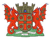 The coat of arms of Carlisle City Council are those granted to the city council of the County Borough of Carlisle by the College of Arms
on 7 July 1924. These arms are derived from more ancient designs of or relating to Carlisle and its governance.
The city council's coat of arms are emblematic of the city's history. The arms incorporate a golden shield with a red cross, upon a green mount, surmounted by a mural crown
, relating to Carlisle's history as an ancient walled city. This is supported by two red wyvern
s—legendary dragons used in heraldry—their wings strewn with golden roses, with reference to the city's Brythonic history
. The motto beneath the arms comes from Thomas Wolsey's speech to Thomas Cromwell
, in Shakespeare's play, Henry VIII
.
. It encompasses Cumbria's county town
, Carlisle, and its surrounding rural
hinterland
, which together total 1039.97 square kilometres (402 sq mi) , making the city the largest in England by area. Although 70% of the city's 100,750 people live in central Carlisle, 98% of the city's land use
is rural. The city is traversed by several major rivers, including the Caldew
, Eden
, and Petteril
, and is bisected by the M6
, A74(M) and M74 motorways.
Along the City of Carlisle's northern extent is the Solway Firth
, which forms the western section of the Anglo-Scottish border
, and thus divides the city from Dumfries and Galloway
, one of the council areas of Scotland. To the east is the English county of Northumberland
; to the south is the district of Eden
and to the west and south-west the borough of Allerdale
, both in the county of Cumbria.
Much of the city spans the flood plain of the River Eden resulting in large parts of the district being vulnerable to flood
ing. Two further tributaries, the Petteril
and Caldew
nearly surround the historic walled centre.
Carlisle experiences an oceanic climate
(Köppen climate classification
Cfb).
As of the 2001 UK census
, the City of Carlisle had a total population of 100,739. Of the 43,963 households in the city, 37.0% were married couples living together, 32.1% were one-person households, 7.6% were co-habiting
couples and 9.2% were lone parents. These figures were similar to the national averages.
The population density was 96.9 /km2 and for every 100 females, there were 93.7 males. Of those aged 16–74 in Carlisle, 31.9% had no academic qualifications
, significantly higher than 28.9% in all of England. Although Carlisle's ethnic breakdown is similar to that of the wider county of Cumbria, it different to that of England. In comparison to national averages, Carlisle has a low proportion of non-whites.
In 1841, 15.7% of Carlisle's population was middle class
compared to 14% in England and Wales; this increased to 18.9% in 1931 (15% nationally) and 35.7% in 2001 (48% nationally). Carlisle's proportion of working class
people increased slowly from 1841 to 1931, changing from 33.0% to 37.9 while the national average changed from 37% to 36% in the same period. Since 1931 it has fallen and risen again to 34.0% in 2001 (26% nationally). The rest of the population was made up of clerical workers and skilled manual workers.
.
As of the United Kingdom Census 2001
, Carlisle had 73,431 residents aged 16 to 74. Of these people, 2.4% were students with jobs, 3.1% students without jobs, 4.9% looking after home or family, 6.1% permanently sick or disabled and 2.3% economically inactive for other reasons.
In 2001, of 46,858 residents of the City of Carlisle in employment, the industry of employment was 20.4% retail and wholesale, 15.9% manufacturing, 11.1% health and social work, 8.1% property and business services, 7.7% transport and communications, 7.3% construction, 6.4% education, 5.9% hotels and restaurants, 5.8% public administration and defence, 3.1% agriculture, 2.3% finance, 0.7% energy and water supply, 0.3% mining, and 4.5% other. This was roughly in line with national figures, although the proportion of jobs in agriculture which was more than the national average of 1.5% and the percentage of people working in finance was less than half the national average of 4.8%; the proportion of people working in property was also below the national average of 13.2%.
, serves Carlisle, Cumbria. However, as of 2011, Carlisle Lake District Airport does not provide any commercial passenger flights operated by any airline to any destination. Subject to planning application approval by Carlisle City Council, Aer Arann
hope to commence a link from Carlisle Lake District Airport to Stobart Air's other base at London Southend Airport
before the 2012 Summer Olympics
begin in London
.
arrangements with two northern border cities
on mainland Europe
. They are Flensburg
in northern Germany
and Słupsk in northern Poland
.
Cumbria
Cumbria , is a non-metropolitan county in North West England. The county and Cumbria County Council, its local authority, came into existence in 1974 after the passage of the Local Government Act 1972. Cumbria's largest settlement and county town is Carlisle. It consists of six districts, and in...
, England, with the status of a city
City status in the United Kingdom
City status in the United Kingdom is granted by the British monarch to a select group of communities. The holding of city status gives a settlement no special rights other than that of calling itself a "city". Nonetheless, this appellation carries its own prestige and, consequently, competitions...
and non-metropolitan district
Non-metropolitan district
Non-metropolitan districts, or colloquially shire districts, are a type of local government district in England. As created, they are sub-divisions of non-metropolitan counties in a so-called "two-tier" arrangement...
. It is named after its largest settlement, Carlisle, but covers a far larger area which includes the towns of Brampton
Brampton, Carlisle, Cumbria
Brampton is a small market town and civil parish within the City of Carlisle district of Cumbria, England about 9 miles east of Carlisle and 2 miles south of Hadrian's Wall. It is situated off the A69 road which bypasses it...
and Longtown
Longtown, Cumbria
Longtown is a small town in northern Cumbria, England, with a population of around 3,000. It is in the parish of Arthuret and on the River Esk, not far from the Anglo-Scottish border. Nearby was the Battle of Arfderydd....
, as well as outlying villages including Dalston
Dalston, Cumbria
Dalston is a large village and civil parish within the City of Carlisle district of Cumbria, England. It is situated on the B5299 road about four miles south-south-west of Carlisle city centre, and approximately five miles from Junction 42 of the M6 motorway.The village has a population of around...
, Scotby
Scotby
Scotby is a village in the City of Carlisle district of Cumbria, England, United Kingdom. It is separated from Carlisle itself only by the M6 Motorway, and is close to other dormitory villages in the area, such as Wetheral, Cumwhinton and Aglionby....
and Wetheral
Wetheral
Wetheral is a village and civil parish in Cumbria, England. The village serves mostly as a dormitory town for nearby Carlisle. As of the 2001 census, the population of the Wetheral Ward is 4,039. The civil parish of Wetheral is slightly larger, with a population of 5,203...
. The city has a population of 100,739, and an area of 1039.97 square kilometres (402 sq mi), making it the largest city in England by area (although the majority of its territory is not urbanised, but rural
Rural
Rural areas or the country or countryside are areas that are not urbanized, though when large areas are described, country towns and smaller cities will be included. They have a low population density, and typically much of the land is devoted to agriculture...
).
The current city boundaries were set as part of the provisions of the Local Government Act 1972
Local Government Act 1972
The Local Government Act 1972 is an Act of Parliament in the United Kingdom that reformed local government in England and Wales on 1 April 1974....
, and cover an amalgamation of two former local government districts—the City and County Borough of Carlisle
County Borough of Carlisle
Carlisle was, from 1835 to 1974, a local government district in the northwest of England, coterminate with Carlisle. In 1835, following the Municipal Corporations Act 1835, Carlisle was constituted a municipal borough of Cumberland, but was promoted to county borough status in 1914, within its...
and the Border Rural District
Border Rural District
Border was a rural district of Cumberland, England from 1934 to 1974.It was formed by a County Review Order in 1934, by a merger of Longtown Rural District, most of Brampton Rural District and nearly all of Carlisle Rural District, as well as a part of Penrith Rural District...
of Cumberland
Cumberland
Cumberland is a historic county of North West England, on the border with Scotland, from the 12th century until 1974. It formed an administrative county from 1889 to 1974 and now forms part of Cumbria....
. The City of Carlisle shares a border with Scotland
Scotland
Scotland is a country that is part of the United Kingdom. Occupying the northern third of the island of Great Britain, it shares a border with England to the south and is bounded by the North Sea to the east, the Atlantic Ocean to the north and west, and the North Channel and Irish Sea to the...
(to the north), and is bounded on the southwest by the borough of Allerdale
Allerdale
Allerdale is a non-metropolitan district of Cumbria, England, with borough status. Its council is based in Workington and the borough has a population of 93,492 according to the 2001 census....
, and on the south by Eden
Eden, Cumbria
Eden is a local government district in Cumbria, England. Its council is based in Penrith. It is named after the River Eden which flows north through the district toward Carlisle....
. The county of Northumberland
Northumberland
Northumberland is the northernmost ceremonial county and a unitary district in North East England. For Eurostat purposes Northumberland is a NUTS 3 region and is one of three boroughs or unitary districts that comprise the "Northumberland and Tyne and Wear" NUTS 2 region...
is to the east.
Although the present boundaries date to the 20th century, the city traces its origins to a 1st-century Roman
Roman Britain
Roman Britain was the part of the island of Great Britain controlled by the Roman Empire from AD 43 until ca. AD 410.The Romans referred to the imperial province as Britannia, which eventually comprised all of the island of Great Britain south of the fluid frontier with Caledonia...
outpost associated with Hadrian's Wall
Hadrian's Wall
Hadrian's Wall was a defensive fortification in Roman Britain. Begun in AD 122, during the rule of emperor Hadrian, it was the first of two fortifications built across Great Britain, the second being the Antonine Wall, lesser known of the two because its physical remains are less evident today.The...
. The Brythonic
Britons (historical)
The Britons were the Celtic people culturally dominating Great Britain from the Iron Age through the Early Middle Ages. They spoke the Insular Celtic language known as British or Brythonic...
settlement that expanded from this outpost was destroyed by the Danes in 875. Thereafter the region formed part of the Southern Uplands
Southern Uplands
The Southern Uplands are the southernmost and least populous of mainland Scotland's three major geographic areas . The term is used both to describe the geographical region and to collectively denote the various ranges of hills within this region...
of Scotland, until colonised under King William II of England
William II of England
William II , the third son of William I of England, was King of England from 1087 until 1100, with powers over Normandy, and influence in Scotland. He was less successful in extending control into Wales...
in 1092. William II built Carlisle Castle
Carlisle Castle
Carlisle Castle is situated in Carlisle, in the English county of Cumbria, near the ruins of Hadrian's Wall. The castle is over 900 years old and has been the scene of many historical episodes in British history. Given the proximity of Carlisle to the border between England and Scotland, it...
, which houses a military museum. Carlisle Cathedral
Carlisle Cathedral
The Cathedral Church of the Holy and Undivided Trinity, otherwise called Carlisle Cathedral, is the seat of the Anglican Bishop of Carlisle. It is located in Carlisle, in Cumbria, North West England...
, founded in the 12th century, is one of the smallest in England.
A border city
Border town
A border town is a town or city close to the boundary between two countries, states or regions. Usually the term implies that it is one of the things the town is most famous for. Border towns can have highly cosmopolitan communities, a feature they share with port cities...
, and the second most northerly city in England, Carlisle predominantly spans the flood plain of the River Eden
River Eden, Cumbria
The River Eden is a river that flows through Cumbria, England on its way to the Solway Firth.-Course of river:The Eden rises in Black Fell Moss, Mallerstang, on the high ground between High Seat, Yorkshire Dales and Hugh Seat. Here it forms the boundary between the counties of Cumbria and North...
. Commercially, it is linked to the rest of England via the M6 motorway
M6 motorway
The M6 motorway runs from junction 19 of the M1 at the Catthorpe Interchange, near Rugby via Birmingham then heads north, passing Stoke-on-Trent, Manchester, Preston, Carlisle and terminating at the Gretna junction . Here, just short of the Scottish border it becomes the A74 which continues to...
, and to the Scottish Lowlands
Scottish Lowlands
The Scottish Lowlands is a name given to the Southern half of Scotland.The area is called a' Ghalldachd in Scottish Gaelic, and the Lawlands ....
via the A74(M) and M74 motorways.
History
Following both the Local Government Act 1888Local Government Act 1888
The Local Government Act 1888 was an Act of the Parliament of the United Kingdom, which established county councils and county borough councils in England and Wales...
and Local Government Act 1894
Local Government Act 1894
The Local Government Act 1894 was an Act of the Parliament of the United Kingdom that reformed local government in England and Wales outside the County of London. The Act followed the reforms carried out at county level under the Local Government Act 1888...
, local government in England had been administered via a national framework of rural district
Rural district
Rural districts were a type of local government area – now superseded – established at the end of the 19th century in England, Wales, and Ireland for the administration of predominantly rural areas at a level lower than that of the administrative counties.-England and Wales:In England...
s, urban district
Urban district
In the England, Wales and Ireland, an urban district was a type of local government district that covered an urbanised area. Urban districts had an elected Urban District Council , which shared local government responsibilities with a county council....
s, municipal borough
Municipal borough
Municipal boroughs were a type of local government district which existed in England and Wales between 1835 and 1974, in Northern Ireland from 1840 to 1973 and in the Republic of Ireland from 1840 to 2002...
s and county borough
County borough
County borough is a term introduced in 1889 in the United Kingdom of Great Britain and Ireland , to refer to a borough or a city independent of county council control. They were abolished by the Local Government Act 1972 in England and Wales, but continue in use for lieutenancy and shrievalty in...
s, which (apart from the latter which were independent), shared power with strategic county council
County council
A county council is the elected administrative body governing an area known as a county. This term has slightly different meanings in different countries.-United Kingdom:...
s of the administrative counties
Administrative counties of England
Administrative counties were a level of subnational division of England used for the purposes of local government from 1889 to 1974. They were created by the Local Government Act 1888 as the areas for which county councils were elected. Some large counties were divided into several administrative...
. The areas that were incorporated into the City of Carlilse in 1974 had formed part of the Border Rural District
Border Rural District
Border was a rural district of Cumberland, England from 1934 to 1974.It was formed by a County Review Order in 1934, by a merger of Longtown Rural District, most of Brampton Rural District and nearly all of Carlisle Rural District, as well as a part of Penrith Rural District...
from the administrative county of Cumberland
Cumberland
Cumberland is a historic county of North West England, on the border with Scotland, from the 12th century until 1974. It formed an administrative county from 1889 to 1974 and now forms part of Cumbria....
, and the politically independent County Borough of Carlisle
County Borough of Carlisle
Carlisle was, from 1835 to 1974, a local government district in the northwest of England, coterminate with Carlisle. In 1835, following the Municipal Corporations Act 1835, Carlisle was constituted a municipal borough of Cumberland, but was promoted to county borough status in 1914, within its...
.
After the exploration of reform during the mid-20th century, such as the proposals made by the Redcliffe-Maud Report
Redcliffe-Maud Report
The Redcliffe–Maud Report is the name generally given to the report published by the Royal Commission on Local Government in England 1966–1969 under the chairmanship of Lord Redcliffe-Maud.-Terms of reference and membership:...
in the late 1960s, the Local Government Act 1972
Local Government Act 1972
The Local Government Act 1972 is an Act of Parliament in the United Kingdom that reformed local government in England and Wales on 1 April 1974....
restructured local government in England by creating a system of two-tier metropolitan and non-metropolitan counties
Metropolitan and non-metropolitan counties of England
Metropolitan and non-metropolitan counties are one of the four levels of subdivisions of England used for the purposes of local government outside Greater London. As originally constituted, the metropolitan and non-metropolitan counties each consisted of multiple districts, had a county council and...
and districts throughout the country. The act formally established the City of Carlisle as a local government district of the new shire county
Shire county
A non-metropolitan county, or shire county, is a county-level entity in England that is not a metropolitan county. The counties typically have populations of 300,000 to 1.4 million. The term shire county is, however, an unofficial usage. Many of the non-metropolitan counties bear historic names...
of Cumbria
Cumbria
Cumbria , is a non-metropolitan county in North West England. The county and Cumbria County Council, its local authority, came into existence in 1974 after the passage of the Local Government Act 1972. Cumbria's largest settlement and county town is Carlisle. It consists of six districts, and in...
on 1 April 1974. The new dual local authorities of Carlisle City Council and Cumbria County Council
Cumbria County Council
Cumbria County Council is the county council of Cumbria, a county in the North West of England. Established in 1974, following its first elections held a year before that, it is an elected local government body responsible for the most significant local services in the county, including county...
had been running since elections in 1973
United Kingdom local elections, 1973
The first elections to the new local authorities established by the Local Government Act 1972 in England and Wales and the new Northern Ireland district councils created by the Local Government Act 1972 took place in 1973...
however. The leading article in The Times
The Times
The Times is a British daily national newspaper, first published in London in 1785 under the title The Daily Universal Register . The Times and its sister paper The Sunday Times are published by Times Newspapers Limited, a subsidiary since 1981 of News International...
on the day the Local Government Act came into effect noted that the "new arrangement is a compromise which seeks to reconcile familiar geography which commands a certain amount of affection and loyalty, with the scale of operations on which modern planning methods can work effectively".
In 2011 Carlisle played host to Radio 1's Big Weekend which featured The Foo Fighters, Lady Gaga
Lady GaGa
Stefani Joanne Angelina Germanotta , better known by her stage name Lady Gaga, is an American singer and songwriter. Born and raised in New York City, she primarily studied at the Convent of the Sacred Heart and briefly attended New York University's Tisch School of the Arts before withdrawing to...
and The Strokes
The Strokes
The Strokes are an American indie rock band formed in 1999 in New York City. Consisting of Julian Casablancas , Nick Valensi , Albert Hammond, Jr. , Nikolai Fraiture and Fabrizio Moretti ....
.
Parliamentary constituencies
The residents of the City of Carlisle are represented in the House of Commons of the United Kingdom by Members of ParliamentMember of Parliament
A Member of Parliament is a representative of the voters to a :parliament. In many countries with bicameral parliaments, the term applies specifically to members of the lower house, as upper houses often have a different title, such as senate, and thus also have different titles for its members,...
(MPs) for two parliamentary constituencies. As of the 2010 general election, Conservative Party
Conservative Party (UK)
The Conservative Party, formally the Conservative and Unionist Party, is a centre-right political party in the United Kingdom that adheres to the philosophies of conservatism and British unionism. It is the largest political party in the UK, and is currently the largest single party in the House...
MPs represent the constituencies of Carlisle
Carlisle (UK Parliament constituency)
Carlisle is a constituency represented in the House of Commons of the Parliament of the United Kingdom. It elects one Member of Parliament by the first past the post system of election. It was a Labour seat from 1964 until 2010, although the Conservatives came close to victory in the elections in...
and Penrith and The Border
Penrith and The Border (UK Parliament constituency)
Penrith and The Border is a county constituency of the House of Commons of the Parliament of the United Kingdom. It is represented by one Member of Parliament elected by the first past the post system of election. This Cumbrian constituency was first contested in 1950.-History:The constutuency is...
, John Stevenson
John Stevenson
-Military:*John Dunlap Stevenson, Union Civil War general*John D. Stevenson *John H. Stevenson , member of the American Navy during the American Civil War and the Spanish-American War-Politicians:...
an Rory Stewart
Rory Stewart
Roderick 'Rory' James Nugent Stewart OBE FRSL MP DUniv is a British academic, author, and Conservative politician. Since May 2010, he has been the Member of Parliament for Penrith and the Border, in the county of Cumbria, North West England.- Overview :Stewart was a senior coalition official in a...
respectively. The City of Carlisle is part of the North West England
North West England (European Parliament constituency)
North West England is a constituency of the European Parliament. For the 2009 elections it elects 8 MEPs using the d'Hondt method of party-list proportional representation.-Boundaries:...
constituency in the European Parliament
European Parliament
The European Parliament is the directly elected parliamentary institution of the European Union . Together with the Council of the European Union and the Commission, it exercises the legislative function of the EU and it has been described as one of the most powerful legislatures in the world...
. North West England elects nine MEPs, as at 2008 made up of four Conservatives, three from the Labour Party, one Liberal Democrat
Liberal Democrats
The Liberal Democrats are a social liberal political party in the United Kingdom which supports constitutional and electoral reform, progressive taxation, wealth taxation, human rights laws, cultural liberalism, banking reform and civil liberties .The party was formed in 1988 by a merger of the...
, and one member of the United Kingdom Independence Party
United Kingdom Independence Party
The United Kingdom Independence Party is a eurosceptic and right-wing populist political party in the United Kingdom. Whilst its primary goal is the UK's withdrawal from the European Union, the party has expanded beyond its single-issue image to develop a more comprehensive party platform.UKIP...
.
Council
In 1974, Carlisle City Council was created to administer the newly formed non-metropolitan district. The council offices are located in Carlisle, at the Civic Centre. The Labour PartyLabour Party (UK)
The Labour Party is a centre-left democratic socialist party in the United Kingdom. It surpassed the Liberal Party in general elections during the early 1920s, forming minority governments under Ramsay MacDonald in 1924 and 1929-1931. The party was in a wartime coalition from 1940 to 1945, after...
have broadly been in control of the council since its formation in 1974. From 1979 to 1998 they had an overall majority. Since then the Conservative Party
Conservative Party (UK)
The Conservative Party, formally the Conservative and Unionist Party, is a centre-right political party in the United Kingdom that adheres to the philosophies of conservatism and British unionism. It is the largest political party in the UK, and is currently the largest single party in the House...
has periodically taken control or there has been no overall control
No overall control
Within the context of local councils of the United Kingdom, the term No Overall Control refers to a situation in which no single party achieves a majority of seats and is analogous to a hung parliament...
. The council has a constitution detailing how they should operate in performing their duties.
Carlisle City Council shares power with the strategic Cumbria County Council
Cumbria County Council
Cumbria County Council is the county council of Cumbria, a county in the North West of England. Established in 1974, following its first elections held a year before that, it is an elected local government body responsible for the most significant local services in the county, including county...
.
| Party | Seats | Current Council (2011–12) | ||||||||||||||||||||||||||||||||||||||||||||||||||||
|---|---|---|---|---|---|---|---|---|---|---|---|---|---|---|---|---|---|---|---|---|---|---|---|---|---|---|---|---|---|---|---|---|---|---|---|---|---|---|---|---|---|---|---|---|---|---|---|---|---|---|---|---|---|---|
| Labour Labour Party (UK) The Labour Party is a centre-left democratic socialist party in the United Kingdom. It surpassed the Liberal Party in general elections during the early 1920s, forming minority governments under Ramsay MacDonald in 1924 and 1929-1931. The party was in a wartime coalition from 1940 to 1945, after... |
23 | |||||||||||||||||||||||||||||||||||||||||||||||||||||
| Conservative Conservative Party (UK) The Conservative Party, formally the Conservative and Unionist Party, is a centre-right political party in the United Kingdom that adheres to the philosophies of conservatism and British unionism. It is the largest political party in the UK, and is currently the largest single party in the House... |
22 | |||||||||||||||||||||||||||||||||||||||||||||||||||||
| Lib Dems | 5 | |||||||||||||||||||||||||||||||||||||||||||||||||||||
| Independent Independent (politician) In politics, an independent or non-party politician is an individual not affiliated to any political party. Independents may hold a centrist viewpoint between those of major political parties, a viewpoint more extreme than any major party, or they may have a viewpoint based on issues that they do... |
2 |
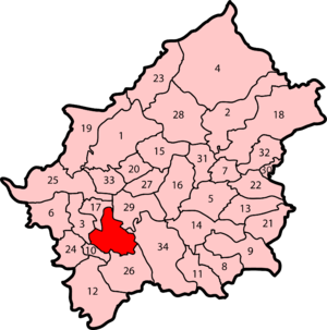
Electoral wards
There are 52 councillors representing the electoral wardsWards of the United Kingdom
A ward in the United Kingdom is an electoral district at sub-national level represented by one or more councillors. It is the primary unit of British administrative and electoral geography .-England:...
of the City of Carlisle. Together they form the Carlisle City Council. Councillors are elected and accountable to the residents of their wards.
| Ward name | Population | Councillors' party | Ref. |
|---|---|---|---|
| Belah Belah For the Biblical character, see List of minor Biblical figures#Bela.For the chiefly Australian tree of the genus Casuarina, see Beefwood.Belah is a suburb of Carlisle in the City of Carlisle district, in the county of Cumbria, England.... |
5,986 | 3 Conservatives | |
| Belle Vue Belle Vue, Cumbria Belle Vue is a suburb of Carlisle, Cumbria, United Kingdom.The area is mostly residential and is situated on the western edge of the city's urban area and borders or is close to Newtown, Raffles, Sandsfield Park and Morton West.... |
5,625 | 2 Labour, 1 Conservative | |
| Botcherby Botcherby Botcherby is a suburb and council estate in Carlisle in Cumbria, England, UK and was formerly a village.-History:Botcherby was first named in 1170 and became part of Carlisle in 1912... |
5,866 | 2 Labour, 1 Independent | |
| Brampton Brampton, Carlisle, Cumbria Brampton is a small market town and civil parish within the City of Carlisle district of Cumbria, England about 9 miles east of Carlisle and 2 miles south of Hadrian's Wall. It is situated off the A69 road which bypasses it... |
4,361 | 2 Conservatives | |
| Burgh | 1,973 | 1 Conservative | |
| Castle | 5,452 | 2 Liberal Democrats, 1 Labour | |
| Currock | 5,927 | 3 Labour | |
| Dalston Dalston, Cumbria Dalston is a large village and civil parish within the City of Carlisle district of Cumbria, England. It is situated on the B5299 road about four miles south-south-west of Carlisle city centre, and approximately five miles from Junction 42 of the M6 motorway.The village has a population of around... |
5,943 | 2 Conservatives, 1 Liberal Democrat | |
| Denton Holme Denton Holme Denton Holme is an inner city district in Carlisle, Cumbria, England.Denton Holme is usually regarded as a "village within the city" and is situated to the immediate south west of the city centre on the western bank of the River Caldew... |
5,172 | 3 Labour | |
| Great Corby Great Corby Great Corby is a village in northern Cumbria, England, above the eastern bank of a wooded gorge on the River Eden. Directly across the river from Great Corby is the village of Wetheral. The two villages are linked by a railway viaduct... and Geltsdale |
2,028 | 1 Conservative | |
| Harraby | 5,685 | 3 Labour | |
| Hayton | 2,031 | 1 Independent | |
| Irthing | 1,979 | 1 Conservative | |
| Longtown Longtown, Cumbria Longtown is a small town in northern Cumbria, England, with a population of around 3,000. It is in the parish of Arthuret and on the River Esk, not far from the Anglo-Scottish border. Nearby was the Battle of Arfderydd.... and Rockcliffe |
3,973 | 2 Conservatives | |
| Lyne | 1,937 | 1 Conservative | |
| Morton | 5,942 | 2 Labour, 1 Liberal Democrat | |
| St Aidans | 5,670 | 3 Labour | |
| Stanwix Rural Stanwix Rural Stanwix Rural is a civil parish in the City of Carlisle district of Cumbria immediately to the north east of Carlisle itself – parts of the Carlisle urban area are in the parish boundaries.... |
3,976 | 2 Conservatives | |
| Stanwix Stanwix Stanwix is a district of Carlisle, Cumbria in North West England. It is located on the north side of River Eden, across from Carlisle city centre. Although long counted as a suburb it did not officially become part of the city until 1912 when part of the civil parish of Stanwix became part of the... Urban |
5,724 | 3 Conservatives | |
| Upperby | 5,487 | 3 Labour | |
| Wetheral Wetheral Wetheral is a village and civil parish in Cumbria, England. The village serves mostly as a dormitory town for nearby Carlisle. As of the 2001 census, the population of the Wetheral Ward is 4,039. The civil parish of Wetheral is slightly larger, with a population of 5,203... |
4,039 | 2 Conservatives | |
| Yewdale | 5,963 | 2 Labour, 1 Conservative | |
Parishes
Civil parishCivil parish
In England, a civil parish is a territorial designation and, where they are found, the lowest tier of local government below districts and counties...
es form the bottom tier of local government in England; parish councils are involved in planning permission
Planning permission
Planning permission or planning consent is the permission required in the United Kingdom in order to be allowed to build on land, or change the use of land or buildings. Within the UK the occupier of any land or building will need title to that land or building , but will also need "planning...
, management of town and parish centres, and promoting tourism. The City of Carlisle is almost entirely parished, the exception being the central settlement of Carlisle—an unparished area
Unparished area
In England, an unparished area is an area that is not covered by a civil parish. Most urbanised districts of England are either entirely or partly unparished. Many towns and some cities in otherwise rural districts are also unparished areas and therefore no longer have a town council or city...
. As of 2008, there were 34 civil parishes in the city, which are:
|
 |
|
Coat of arms
College of Arms
The College of Arms, or Heralds’ College, is an office regulating heraldry and granting new armorial bearings for England, Wales and Northern Ireland...
on 7 July 1924. These arms are derived from more ancient designs of or relating to Carlisle and its governance.
The city council's coat of arms are emblematic of the city's history. The arms incorporate a golden shield with a red cross, upon a green mount, surmounted by a mural crown
Mural crown
-Usage in ancient times:In Hellenistic culture, a mural crown identified the goddess Tyche, the embodiment of the fortune of a city, familiar to Romans as Fortuna...
, relating to Carlisle's history as an ancient walled city. This is supported by two red wyvern
Wyvern
A wyvern or wivern is a legendary winged reptilian creature with a dragon's head, two legs , and a barbed tail. The wyvern is found in heraldry. There exists a purely sea-dwelling variant, termed the Sea-Wyvern which has a fish tail in place of a barbed dragon's tail...
s—legendary dragons used in heraldry—their wings strewn with golden roses, with reference to the city's Brythonic history
Britons (historical)
The Britons were the Celtic people culturally dominating Great Britain from the Iron Age through the Early Middle Ages. They spoke the Insular Celtic language known as British or Brythonic...
. The motto beneath the arms comes from Thomas Wolsey's speech to Thomas Cromwell
Thomas Cromwell, 1st Earl of Essex
Thomas Cromwell, 1st Earl of Essex, , was an English statesman who served as chief minister of King Henry VIII of England from 1532 to 1540....
, in Shakespeare's play, Henry VIII
Henry VIII (play)
The Famous History of the Life of King Henry the Eight is a history play by William Shakespeare and John Fletcher, based on the life of Henry VIII of England. An alternative title, All is True, is recorded in contemporary documents, the title Henry VIII not appearing until the play's publication...
.
Geography
The City of Carlisle is located at the extreme north of North West EnglandNorth West England
North West England, informally known as The North West, is one of the nine official regions of England.North West England had a 2006 estimated population of 6,853,201 the third most populated region after London and the South East...
. It encompasses Cumbria's county town
County town
A county town is a county's administrative centre in the United Kingdom or Ireland. County towns are usually the location of administrative or judicial functions, or established over time as the de facto main town of a county. The concept of a county town eventually became detached from its...
, Carlisle, and its surrounding rural
Rural
Rural areas or the country or countryside are areas that are not urbanized, though when large areas are described, country towns and smaller cities will be included. They have a low population density, and typically much of the land is devoted to agriculture...
hinterland
Hinterland
The hinterland is the land or district behind a coast or the shoreline of a river. Specifically, by the doctrine of the hinterland, the word is applied to the inland region lying behind a port, claimed by the state that owns the coast. The area from which products are delivered to a port for...
, which together total 1039.97 square kilometres (402 sq mi) , making the city the largest in England by area. Although 70% of the city's 100,750 people live in central Carlisle, 98% of the city's land use
Land use
Land use is the human use of land. Land use involves the management and modification of natural environment or wilderness into built environment such as fields, pastures, and settlements. It has also been defined as "the arrangements, activities and inputs people undertake in a certain land cover...
is rural. The city is traversed by several major rivers, including the Caldew
River Caldew
The River Caldew is a river running through Cumbria in England. Historically, the county watered by the Caldew was Cumberland.The Caldew's source is high up on Skiddaw, between the summit and Sale How, in the Lake District, from where it runs east through a valley between Bowscale Fell and Carrock...
, Eden
River Eden, Cumbria
The River Eden is a river that flows through Cumbria, England on its way to the Solway Firth.-Course of river:The Eden rises in Black Fell Moss, Mallerstang, on the high ground between High Seat, Yorkshire Dales and Hugh Seat. Here it forms the boundary between the counties of Cumbria and North...
, and Petteril
River Petteril
The River Petteril is a river running through the English county of Cumbria.The source of the Petteril is near Penruddock and Motherby, from where the young river runs northeast through Greystoke, Blencow and Newton Reigny, before passing under the M6 motorway, after which the river turns north,...
, and is bisected by the M6
M6 motorway
The M6 motorway runs from junction 19 of the M1 at the Catthorpe Interchange, near Rugby via Birmingham then heads north, passing Stoke-on-Trent, Manchester, Preston, Carlisle and terminating at the Gretna junction . Here, just short of the Scottish border it becomes the A74 which continues to...
, A74(M) and M74 motorways.
Along the City of Carlisle's northern extent is the Solway Firth
Solway Firth
The Solway Firth is a firth that forms part of the border between England and Scotland, between Cumbria and Dumfries and Galloway. It stretches from St Bees Head, just south of Whitehaven in Cumbria, to the Mull of Galloway, on the western end of Dumfries and Galloway. The Isle of Man is also very...
, which forms the western section of the Anglo-Scottish border
Anglo-Scottish border
The Anglo-Scottish border is the official border and mark of entry between Scotland and England. It runs for 154 km between the River Tweed on the east coast and the Solway Firth in the west. It is Scotland's only land border...
, and thus divides the city from Dumfries and Galloway
Dumfries and Galloway
Dumfries and Galloway is one of 32 unitary council areas of Scotland. It was one of the nine administrative 'regions' of mainland Scotland created in 1975 by the Local Government etc. Act 1973...
, one of the council areas of Scotland. To the east is the English county of Northumberland
Northumberland
Northumberland is the northernmost ceremonial county and a unitary district in North East England. For Eurostat purposes Northumberland is a NUTS 3 region and is one of three boroughs or unitary districts that comprise the "Northumberland and Tyne and Wear" NUTS 2 region...
; to the south is the district of Eden
Eden, Cumbria
Eden is a local government district in Cumbria, England. Its council is based in Penrith. It is named after the River Eden which flows north through the district toward Carlisle....
and to the west and south-west the borough of Allerdale
Allerdale
Allerdale is a non-metropolitan district of Cumbria, England, with borough status. Its council is based in Workington and the borough has a population of 93,492 according to the 2001 census....
, both in the county of Cumbria.
Much of the city spans the flood plain of the River Eden resulting in large parts of the district being vulnerable to flood
Flood
A flood is an overflow of an expanse of water that submerges land. The EU Floods directive defines a flood as a temporary covering by water of land not normally covered by water...
ing. Two further tributaries, the Petteril
River Petteril
The River Petteril is a river running through the English county of Cumbria.The source of the Petteril is near Penruddock and Motherby, from where the young river runs northeast through Greystoke, Blencow and Newton Reigny, before passing under the M6 motorway, after which the river turns north,...
and Caldew
River Caldew
The River Caldew is a river running through Cumbria in England. Historically, the county watered by the Caldew was Cumberland.The Caldew's source is high up on Skiddaw, between the summit and Sale How, in the Lake District, from where it runs east through a valley between Bowscale Fell and Carrock...
nearly surround the historic walled centre.
Carlisle experiences an oceanic climate
Oceanic climate
An oceanic climate, also called marine west coast climate, maritime climate, Cascadian climate and British climate for Köppen climate classification Cfb and subtropical highland for Köppen Cfb or Cwb, is a type of climate typically found along the west coasts at the middle latitudes of some of the...
(Köppen climate classification
Köppen climate classification
The Köppen climate classification is one of the most widely used climate classification systems. It was first published by Crimea German climatologist Wladimir Köppen in 1884, with several later modifications by Köppen himself, notably in 1918 and 1936...
Cfb).
Demography
| Carlisle compared | |||
|---|---|---|---|
| 2001 UK Census United Kingdom Census 2001 A nationwide census, known as Census 2001, was conducted in the United Kingdom on Sunday, 29 April 2001. This was the 20th UK Census and recorded a resident population of 58,789,194.... |
Carlisle | Cumbria | England |
| Total population | 100,739 | 487,607 | 49,138,831 |
| White | 99.1% | 99.3% | 90.9% |
| Asian | 0.3% | 0.2% | 4.6% |
| Black | 0.1% | 0.1% | 2.3% |
As of the 2001 UK census
United Kingdom Census 2001
A nationwide census, known as Census 2001, was conducted in the United Kingdom on Sunday, 29 April 2001. This was the 20th UK Census and recorded a resident population of 58,789,194....
, the City of Carlisle had a total population of 100,739. Of the 43,963 households in the city, 37.0% were married couples living together, 32.1% were one-person households, 7.6% were co-habiting
Cohabitation
Cohabitation usually refers to an arrangement whereby two people decide to live together on a long-term or permanent basis in an emotionally and/or sexually intimate relationship. The term is most frequently applied to couples who are not married...
couples and 9.2% were lone parents. These figures were similar to the national averages.
The population density was 96.9 /km2 and for every 100 females, there were 93.7 males. Of those aged 16–74 in Carlisle, 31.9% had no academic qualifications
National Qualifications Framework
The National Qualifications Framework is a credit transfer system developed for qualifications in England, Wales and Northern Ireland....
, significantly higher than 28.9% in all of England. Although Carlisle's ethnic breakdown is similar to that of the wider county of Cumbria, it different to that of England. In comparison to national averages, Carlisle has a low proportion of non-whites.
In 1841, 15.7% of Carlisle's population was middle class
Middle class
The middle class is any class of people in the middle of a societal hierarchy. In Weberian socio-economic terms, the middle class is the broad group of people in contemporary society who fall socio-economically between the working class and upper class....
compared to 14% in England and Wales; this increased to 18.9% in 1931 (15% nationally) and 35.7% in 2001 (48% nationally). Carlisle's proportion of working class
Working class
Working class is a term used in the social sciences and in ordinary conversation to describe those employed in lower tier jobs , often extending to those in unemployment or otherwise possessing below-average incomes...
people increased slowly from 1841 to 1931, changing from 33.0% to 37.9 while the national average changed from 37% to 36% in the same period. Since 1931 it has fallen and risen again to 34.0% in 2001 (26% nationally). The rest of the population was made up of clerical workers and skilled manual workers.
Population change
The table below details the population change since 1801, including the percentage change since the last available census data. Although the City of Carlisle has existed as a district since 1974, figures have been generated by combining data from the towns, villages, and civil parishes that would later be constituent parts of the city.| Population growth Population growth Population growth is the change in a population over time, and can be quantified as the change in the number of individuals of any species in a population using "per unit time" for measurement.... in City of Carlisle since 1801 |
|||||||||||||||||||||
|---|---|---|---|---|---|---|---|---|---|---|---|---|---|---|---|---|---|---|---|---|---|
| Year | 1801 | 1811 | 1821 | 1831 | 1841 | 1851 | 1861 | 1871 | 1881 | 1891 | 1901 | 1911 | 1921 | 1931 | 1941 | 1951 | 1961 | 1971 | 1981 | 1991 | 2001 |
| Population | 32,825 | 37,176 | 43,500 | 49,571 | 51,972 | 57,378 | 61,857 | 66,336 | 70,816 | 71,950 | 74,989 | 78,160 | 80,640 | 83,200 | 90,127 | 97,667 | 99,124 | 100,607 | 99,507 | 101,948 | 100,798 |
| % change | – | +13.3 | +17.0 | +14.0 | +4.8 | +10.4 | +7.8 | +7.2 | +6.8 | +1.6 | +4.2 | +4.2 | +3.2 | +3.2 | +8.3 | +8.4 | +1.5 | +1.5 | −1.1 | +2.5 | -1.2 |
| Source: Vision of Britain |
|||||||||||||||||||||
Religion
As of the 2001 UK census, 80.7% of Carlisle's residents reported themselves as Christian, 0.1% Muslim, 0.1% Buddhist, and 0.1% Hindu and 0.1% had an alternative religion. 11.0% had no religion and 7.8% did not state any religion. The city is covered by the Roman Catholic Diocese of Lancaster, and the Church of England Diocese of CarlisleDiocese of Carlisle
The Diocese of Carlisle was created in 1133 by Henry I out of part of the Diocese of Durham, although many people of Celtic descent in the area looked to Glasgow for spiritual leadership. The first bishop was Æthelwold, formerly the king's confessor and now prior of the Augustinian priory at...
.
Economy
| Carlisle compared | |||
|---|---|---|---|
| 2001 UK Census United Kingdom Census 2001 A nationwide census, known as Census 2001, was conducted in the United Kingdom on Sunday, 29 April 2001. This was the 20th UK Census and recorded a resident population of 58,789,194.... |
City of Carlisle | Cumbria | England |
| Population of working age | 73,431 | 354,183 | 35,532,091 |
| Full time employment | 39.0% | 36.9% | 40.8% |
| Part time employment | 14.6% | 13.6% | 11.8% |
| Self employed | 8.2% | 9.9% | 8.3% |
| Unemployed | 3.5% | 3.4% | 3.3% |
| Retired | 15.8% | 16.7% | 13.5% |
As of the United Kingdom Census 2001
United Kingdom Census 2001
A nationwide census, known as Census 2001, was conducted in the United Kingdom on Sunday, 29 April 2001. This was the 20th UK Census and recorded a resident population of 58,789,194....
, Carlisle had 73,431 residents aged 16 to 74. Of these people, 2.4% were students with jobs, 3.1% students without jobs, 4.9% looking after home or family, 6.1% permanently sick or disabled and 2.3% economically inactive for other reasons.
In 2001, of 46,858 residents of the City of Carlisle in employment, the industry of employment was 20.4% retail and wholesale, 15.9% manufacturing, 11.1% health and social work, 8.1% property and business services, 7.7% transport and communications, 7.3% construction, 6.4% education, 5.9% hotels and restaurants, 5.8% public administration and defence, 3.1% agriculture, 2.3% finance, 0.7% energy and water supply, 0.3% mining, and 4.5% other. This was roughly in line with national figures, although the proportion of jobs in agriculture which was more than the national average of 1.5% and the percentage of people working in finance was less than half the national average of 4.8%; the proportion of people working in property was also below the national average of 13.2%.
Transportation
Carlisle Lake District Airport, owned by the Stobart GroupStobart Group
Stobart Group Ltd is a large British multimodal logistics company, with interests in Transport and Distribution, Estates, Infrastructure and Civils, Air and Biomass, through operations in the United Kingdom, Ireland and Belgium...
, serves Carlisle, Cumbria. However, as of 2011, Carlisle Lake District Airport does not provide any commercial passenger flights operated by any airline to any destination. Subject to planning application approval by Carlisle City Council, Aer Arann
Aer Arann
Aer Arann is a regional airline based in Dublin, Ireland. Aer Arann operates scheduled services from Ireland and the Isle of Man to destinations in Ireland, the United Kingdom, and France, with a fleet of 18 aircraft. Aer Arann has expanded from a single aircraft to Ireland's third largest airline...
hope to commence a link from Carlisle Lake District Airport to Stobart Air's other base at London Southend Airport
London Southend Airport
London Southend Airport or Southend Airport is a regional airport in the district of Rochford within Essex, England.During the 1960s, Southend was the third-busiest airport in the United Kingdom. It remained London's third-busiest airport in terms of passengers handled until the end of the 1970s,...
before the 2012 Summer Olympics
2012 Summer Olympics
The 2012 Summer Olympic Games, officially known as the "London 2012 Olympic Games", are scheduled to take place in London, England, United Kingdom from 27 July to 12 August 2012...
begin in London
London
London is the capital city of :England and the :United Kingdom, the largest metropolitan area in the United Kingdom, and the largest urban zone in the European Union by most measures. Located on the River Thames, London has been a major settlement for two millennia, its history going back to its...
.
Twin cities
Carlisle has formal twinningTown twinning
Twin towns and sister cities are two of many terms used to describe the cooperative agreements between towns, cities, and even counties in geographically and politically distinct areas to promote cultural and commercial ties.- Terminology :...
arrangements with two northern border cities
Border town
A border town is a town or city close to the boundary between two countries, states or regions. Usually the term implies that it is one of the things the town is most famous for. Border towns can have highly cosmopolitan communities, a feature they share with port cities...
on mainland Europe
Europe
Europe is, by convention, one of the world's seven continents. Comprising the westernmost peninsula of Eurasia, Europe is generally 'divided' from Asia to its east by the watershed divides of the Ural and Caucasus Mountains, the Ural River, the Caspian and Black Seas, and the waterways connecting...
. They are Flensburg
Flensburg
Flensburg is an independent town in the north of the German state of Schleswig-Holstein. Flensburg is the centre of the region of Southern Schleswig...
in northern Germany
Northern Germany
- Geography :The key terrain features of North Germany are the marshes along the coastline of the North Sea and Baltic Sea, and the geest and heaths inland. Also prominent are the low hills of the Baltic Uplands, the ground moraines, end moraines, sandur, glacial valleys, bogs, and Luch...
and Słupsk in northern Poland
Poland
Poland , officially the Republic of Poland , is a country in Central Europe bordered by Germany to the west; the Czech Republic and Slovakia to the south; Ukraine, Belarus and Lithuania to the east; and the Baltic Sea and Kaliningrad Oblast, a Russian exclave, to the north...
.
| Country | Place | County / District / Region / State | Date | |||
|---|---|---|---|---|---|---|
| Germany Germany Germany , officially the Federal Republic of Germany , is a federal parliamentary republic in Europe. The country consists of 16 states while the capital and largest city is Berlin. Germany covers an area of 357,021 km2 and has a largely temperate seasonal climate... ! style="background: #CCCCFF; c>lor: #000000" ! |  |
Flensburg Flensburg Flensburg is an independent town in the north of the German state of Schleswig-Holstein. Flensburg is the centre of the region of Southern Schleswig... ! style="background: #>FFFFF; color: #000000" ! |  |
Schleswig-Holstein Schleswig-Holstein Schleswig-Holstein is the northernmost of the sixteen states of Germany, comprising most of the historical duchy of Holstein and the southern part of the former Duchy of Schleswig... |
1961 | |||
| Poland Poland Poland , officially the Republic of Poland , is a country in Central Europe bordered by Germany to the west; the Czech Republic and Slovakia to the south; Ukraine, Belarus and Lithuania to the east; and the Baltic Sea and Kaliningrad Oblast, a Russian exclave, to the north... ! style="background: #CCCCFF; co>or: #000000" ! | |
Słupsk ! style="background: #FFF>FF; color: #000000" ! |  |
Pomeranian Voivodeship Pomeranian Voivodeship Pomeranian Voivodeship, or Pomerania Province , is a voivodeship, or province, in north-central Poland. It comprises most of Pomerelia , as well as an area east of the Vistula River... |
1987 |

