
Cardiff city centre
Encyclopedia

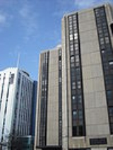
Central business district
A central business district is the commercial and often geographic heart of a city. In North America this part of a city is commonly referred to as "downtown" or "city center"...
of Cardiff
Cardiff
Cardiff is the capital, largest city and most populous county of Wales and the 10th largest city in the United Kingdom. The city is Wales' chief commercial centre, the base for most national cultural and sporting institutions, the Welsh national media, and the seat of the National Assembly for...
, Wales
Wales
Wales is a country that is part of the United Kingdom and the island of Great Britain, bordered by England to its east and the Atlantic Ocean and Irish Sea to its west. It has a population of three million, and a total area of 20,779 km²...
. The area is tightly bounded by the River Taff
River Taff
The River Taff is a large river in Wales. It rises as two rivers in the Brecon Beacons — the Taf Fechan and the Taf Fawr — before joining to form the Taff north of Merthyr Tydfil...
to the west, the Civic centre to the north and railway lines and two railway stations - Central
Cardiff Central railway station
Cardiff Central railway station is a major railway station on the South Wales Main Line in Cardiff, Wales.It is the largest and busiest station in Wales and one of the major stations of the British rail network, the tenth busiest station in the United Kingdom outside of London , based on 2007/08...
and Queen Street - to the south and east respectively. Cardiff became a city in 1905.
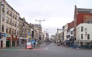
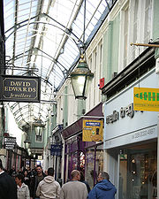
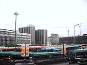
The city centre in Cardiff consists of principal shopping streets, Queen Street and St. Mary's Street, large shopping centres, and numerous arcades and lanes that house some more smaller and often specialist shops and boutiques.
The city centre is going through a number of redevelopment projects, including St. David's 2, which extended the shopping district southwards, creating 100 new stores and a flagship John Lewis
John Lewis (department store)
-Recent developments:In June 2004, John Lewis announced plans to open its first store in Northern Ireland at the Sprucefield Park development, the province's largest out of town shopping centre, located outside Lisburn and from Belfast. The application was approved in June 2005 and the opening of...
, the only branch in Wales and the largest outside London
London
London is the capital city of :England and the :United Kingdom, the largest metropolitan area in the United Kingdom, and the largest urban zone in the European Union by most measures. Located on the River Thames, London has been a major settlement for two millennia, its history going back to its...
. Compared to nearby cities, the new St David's Centre has more retail space than the whole of Newport
Newport
Newport is a city and unitary authority area in Wales. Standing on the banks of the River Usk, it is located about east of Cardiff and is the largest urban area within the historic county boundaries of Monmouthshire and the preserved county of Gwent...
or Swansea
Swansea
Swansea is a coastal city and county in Wales. Swansea is in the historic county boundaries of Glamorgan. Situated on the sandy South West Wales coast, the county area includes the Gower Peninsula and the Lliw uplands...
.
In 2008–9, the annual footfall of shoppers was 55 million, and is expected to have risen to 66 million by 2009–10. Cardiff is the sixth most successful shopping destination in the United Kingdom
United Kingdom
The United Kingdom of Great Britain and Northern IrelandIn the United Kingdom and Dependencies, other languages have been officially recognised as legitimate autochthonous languages under the European Charter for Regional or Minority Languages...
– behind London, Glasgow, Birmingham, Manchester and Liverpool.
History

Edward VII of the United Kingdom
Edward VII was King of the United Kingdom and the British Dominions and Emperor of India from 22 January 1901 until his death in 1910...
in 1905.
In the 1960s, planners described Cardiff city centre as "worn out, inconvenient, drab and dangerous". The centre had escaped the extensive wartime bomb damage inflicted on other cities, so little redevelopment took place in the 1950s and 1960s. The Buchanan Plan of 1964 envisaged a highly-ambitious extended city centre, crossed with urban motorways. The council scrapped the proposed motorway network and focused on the small commercial core of the city; its proposed redevelopment scheme, in partnership with a private developer, would have seen almost all of the city centre (except St Mary Street and Working Street) demolished, replaced by modernist
Modern architecture
Modern architecture is generally characterized by simplification of form and creation of ornament from the structure and theme of the building. It is a term applied to an overarching movement, with its exact definition and scope varying widely...
office towers of up to 21 storeys and pedestrianised decks linking multi-storey car park
Multi-storey car park
A multi-storey car-park is a building designed specifically to be for car parking and where there are a number of floors or levels on which parking takes place...
s to covered shopping malls.
By the time the legal agreement to implement 'Centreplan 70' was signed, the 1973 property crash had made it unviable. However, one legacy of the scheme was the future segregation of office and retail development, with the west end of Newport Road as the principal office area with secondary concentrations on Churchill Way, Greyfriars Road and Westgate Street.
Development in the 1970s and 80s was more piecemeal than envisaged in Centreplan, with the building of the St. David's Centre and St David's Hall, new multi-storey car parks, and the grant-supported construction of 14-storey Holiday Inn (now the Marriott) and World Trade Centre (now the Cardiff International Arena), which gave a fillip to the city's conference and exhibition business. In the mid-1980s developers returned to Queen Street, creating three medium-sized malls, helping it to become one of the best performing shopping streets in the country in terms of footfall and rental levels.
In the 1990s the Mill Lane cafe quarter was developed in partnership with the Welsh Development Agency
Welsh Development Agency
The Welsh Development Agency was a QUANGO and later an Assembly Sponsored Public Body established in 1976 to encourage business development and investment in Wales, to clear derelict land and to encourage growth of local businesses...
, a pedestrian forecourt was created for the refurbished Central railway station, a new walkway was constructed alongside the Taff and the Millennium Stadium
Millennium Stadium
The Millennium Stadium is the national stadium of Wales, located in the capital, Cardiff. It is the home of the Wales national rugby union team and also frequently stages games of the Wales national football team, but is also host to many other large scale events, such as the Super Special Stage...
was built on the site of the National Ground and Empire Pool. The latter became, according to official publicists, one of the icons of Cardiff's new image.
Castle Quarter
The Castle QuarterCastle Quarter
Castle Quarter is a commercial area in the north of the city centre of Cardiff, Wales.The Castle Quarter includes some of Cardiff's Victorian and Edwardian arcades: Castle Arcade, High Street Arcade and Duke Street Arcade, and principal shopping streets: St Mary Street, High Street, Castle Street...
includes some of Cardiff's Victorian and Edwardian arcades: Castle Arcade, High Street Arcade and Duke Street Arcade, and principal shopping streets: St Mary Street, High Street
St. Mary Street/High Street
St. Mary Street and High Street are major commercial streets in the Castle Quarter of Cardiff city centre, Wales, which form a major north–south thoroughfare in the centre. High Street begins at the junction of Castle Street on the A4161 and ends at the junction of Church Street and Quay Street,...
, Castle Street and Duke Street.
Development of the area began in February 2010 and is expected to be completed by July 2011. Cardiff Council
Cardiff Council
The County Council of the City and County of Cardiff is the governing body for Cardiff, one of the Principal Areas of Wales. The council consists of 75 councillors, representing 29 electoral wards. The authority is properly styled as The County Council of the City and County of Cardiff or in...
says that work to create the Castle Quarter as a pedestrian friendly environment for High Street and St Mary Street is designed to enhance the city centre.
Castle Street/Duke Street/Kingsway

Canton, Cardiff
Canton is an inner-city district and community in the west of Cardiff, capital of Wales, lying west of the city's civic centre. One of the most ethnically diverse of Cardiff's suburbs, with a significant Asian population such as Pakistanis and Indians, Canton has a population just in excess of...
and begins after Cardiff Bridge, over the River Taff
River Taff
The River Taff is a large river in Wales. It rises as two rivers in the Brecon Beacons — the Taf Fechan and the Taf Fawr — before joining to form the Taff north of Merthyr Tydfil...
. It becomes Duke Street after the junction with High Street before turning north and becoming Kingsway, leading to Cardiff Civic Centre
Cathays Park
In addition to the large lawn in front of the City Hall, Cathays Park includes three formal gardens. All of the spaces are within conservation areas and many of the surrounding buildings are listed. The open spaces are very important to the image of the city. Several important buildings overlook...
. From west to east, streets that begin from the southern side of this stretch are Westgate Street, Womanby Street, High Street (St Marys Street), St Johns Street (The Hayes), Queen Street and Greyfriars Road. Cardiff Castle
Cardiff Castle
Cardiff Castle is a medieval castle and Victorian architecture Gothic revival mansion, transformed from a Norman keep erected over a Roman fort in the Castle Quarter of Cardiff, the capital of Wales. The Castle is a Grade I Listed Building.-The Roman fort:...
and Bute Park
Bute Park
Bute Park in Cardiff, Wales, is an extensive area of mature parkland easily accessible from the city centre. Flanked by the River Taff, Sophia Gardens, Pontcanna Fields and Cardiff Castle, Bute Park is a very popular 'green lung' full of historic and wildlife interest. Few cities have such a...
dominate the northern side of the street. On the southern side are pubs, bars, retail and hotel units. Castle Arcade and Duke Street Arcades begin from this stretch.
St. Mary Street and High Street
Bristol Channel floods, 1607
The Bristol Channel floods, which occurred on 30 January 1607 , resulted in the drowning of a large number of people and the destruction of a large amount of farmland and livestock...
of 1607. Today the stretch of road is the home of a number of bar
Bar (establishment)
A bar is a business establishment that serves alcoholic drinks — beer, wine, liquor, and cocktails — for consumption on the premises.Bars provide stools or chairs that are placed at tables or counters for their patrons. Some bars have entertainment on a stage, such as a live band, comedians, go-go...
s, night clubs and restaurant
Restaurant
A restaurant is an establishment which prepares and serves food and drink to customers in return for money. Meals are generally served and eaten on premises, but many restaurants also offer take-out and food delivery services...
s, as well as branches of many major bank
Bank
A bank is a financial institution that serves as a financial intermediary. The term "bank" may refer to one of several related types of entities:...
s. Also fronting onto the street is Howells department store, which stretches from just after Cardiff Central Market to the corner of Wharton Street. From August 2007 the street was closed to private vehicles, leaving only buses, cycles and taxis allowed to access the whole street. The street is usually closed to all traffic every Friday and Saturday night to allow the efflux from night clubs and pubs located in that part of the street to clear. It is also closed when major events take place such as at the Millennium Stadium
Millennium Stadium
The Millennium Stadium is the national stadium of Wales, located in the capital, Cardiff. It is the home of the Wales national rugby union team and also frequently stages games of the Wales national football team, but is also host to many other large scale events, such as the Super Special Stage...
. The Prince Of Wales is a prominent J D Wetherspoon
Wetherspoons
J D Wetherspoon plc is a British pub chain based in Watford. Founded as a single pub in 1979 by Tim Martin, the company now owns 815 outlets. The chain champions cask ale, low prices, long opening hours, and no music. The company also operates the Lloyds No...
establishment at the junction with Wood Street, which leads to Central Station. At the northern end of the street is Castle Street and Cardiff Castle
Cardiff Castle
Cardiff Castle is a medieval castle and Victorian architecture Gothic revival mansion, transformed from a Norman keep erected over a Roman fort in the Castle Quarter of Cardiff, the capital of Wales. The Castle is a Grade I Listed Building.-The Roman fort:...
. To the south is Callaghan Square.
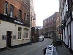
Womanby Street
Womanby Street is one of Cardiff's oldest streets. It is home to the well known nightclub and music venue Clwb Ifor BachClwb Ifor Bach
Clwb Ifor Bach is a Cardiff nightclub, music venue, Welsh-language club and community centre. It is known to the Cardiff Welsh-speaking community as Clwb and is often known by others on the Cardiff music scene as The Welsh Club....
. It is accessed from Castle Street, in between Westgate Street and High Street.
Queen Street and vicinity

Victoria of the United Kingdom
Victoria was the monarch of the United Kingdom of Great Britain and Ireland from 20 June 1837 until her death. From 1 May 1876, she used the additional title of Empress of India....
in 1886. Queen Street was pedestrianised in 1974 and is served by Cardiff Queen Street railway station
Cardiff Queen Street railway station
Cardiff Queen Street railway station is Wales' second busiest railway station in Cardiff, Wales. It is one of 20 stations in the city and two in the city centre, the other being Cardiff Central...
on Station Terrace. It meets Dumfries Place/Newport Road at its eastern end, Duke Street/Castle Street at its western, and Park Place approximately half-way along. Further down Park Place is the New Theatre
New Theatre (Cardiff)
The New Theatre although it usually uses its English name as a title) is one of the principal theatres in Cardiff, capital city of Wales, and celebrated its centenary in 2006...
, a local landmark is Principality House, head office of the Principality Building Society
Principality Building Society
Principality is a Welsh building society based in Cardiff, the capital of Wales. With assets of just under £6bn it is the largest building society in Wales and the seventh largest in the United Kingdom. Principality Building Society is mutual, which means it is owned by its members rather than...
. To the north running parallel is Greyfriars Road, referring to the site of an old monastery, a traditional office location that has recently seen conversion to bars, apartments and hotels as offices move to the new business parks on the edge of the city, or to the better connected southern end of the city centre.
Cathays Park (Civic Centre)
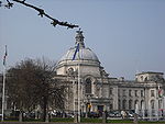
Cathays Park
In addition to the large lawn in front of the City Hall, Cathays Park includes three formal gardens. All of the spaces are within conservation areas and many of the surrounding buildings are listed. The open spaces are very important to the image of the city. Several important buildings overlook...
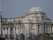
is the civic centre of Cardiff. The Edwardian architecture of Cardiff City Hall, National Museum and Gallery of Wales
National Museum Cardiff
National Museum Cardiff is a museum and art gallery in Cardiff, Wales. The museum is part of the wider network of Amgueddfa Cymru – National Museum Wales...
, Cardiff University
Cardiff University
Cardiff University is a leading research university located in the Cathays Park area of Cardiff, Wales, United Kingdom. It received its Royal charter in 1883 and is a member of the Russell Group of Universities. The university is consistently recognised as providing high quality research-based...
, Cardiff Crown Court
Cardiff Crown Court
Cardiff Crown Court is a historic building situated in Cathays Park, Cardiff, Wales. The building is a Grade I listed building. The Crown Court is part of the Wales Circuit of Her Majesty's Courts Service.-External links:*...
, and the administrative headquarters of the Welsh Assembly Government
Welsh Assembly Government
The Welsh Government is the devolved government of Wales. It is accountable to the National Assembly for Wales, the legislature which represents the interests of the people of Wales and makes laws for Wales...
dominate the area. .Behind the City Hall is the Welsh National War Memorial
Welsh National War Memorial
The Welsh National War Memorial is situated in Alexandra Gardens, Cathays Park, Cardiff. The memorial was designed by Sir Ninian Comper and unveiled in June 1928 by the Prince of Wales...
. Bute Park
Bute Park
Bute Park in Cardiff, Wales, is an extensive area of mature parkland easily accessible from the city centre. Flanked by the River Taff, Sophia Gardens, Pontcanna Fields and Cardiff Castle, Bute Park is a very popular 'green lung' full of historic and wildlife interest. Few cities have such a...
also dominates the north-west of the area, running behind Cardiff Castle
Cardiff Castle
Cardiff Castle is a medieval castle and Victorian architecture Gothic revival mansion, transformed from a Norman keep erected over a Roman fort in the Castle Quarter of Cardiff, the capital of Wales. The Castle is a Grade I Listed Building.-The Roman fort:...
along the River Taff southward to Westgate Street and northward to Gabalfa
Gabalfa
Gabalfa is a district in the north of the city of Cardiff, capital of Wales. It is characterised by an enormous fly over road which is part of the large Gabalfa Interchange, and crosses the A48 road in a north-south direction. The area is also the site of the All Nations Centre.The name is derived...
. Cardiff's Winter Wonderland ice rink
Ice rink
An ice rink is a frozen body of water and/or hardened chemicals where people can skate or play winter sports. Besides recreational ice skating, some of its uses include ice hockey, figure skating and curling as well as exhibitions, contests and ice shows...
and fairground returns to the front lawn of the City Hall every winter.
Boulevard de Nantes
Nantes
Nantes is a city in western France, located on the Loire River, from the Atlantic coast. The city is the 6th largest in France, while its metropolitan area ranks 8th with over 800,000 inhabitants....
and Stuttgart
Stuttgart
Stuttgart is the capital of the state of Baden-Württemberg in southern Germany. The sixth-largest city in Germany, Stuttgart has a population of 600,038 while the metropolitan area has a population of 5.3 million ....
er Strasse, named after Cardiff's twin cities, run through the southern end and act as a northern bypass of parallel Queen Street for the A4161. To the west, it is connected to Kingsway (leading to Castle Street and St Mary Street), and Dumfries Place/ Newport Road to the east. Park Place runs north to south through the area, linking it to the A470 in the north and Queen Street in the south
Dumfries Place/Newport Road

Earl of Dumfries
Earl of Dumfries is a title in the Peerage of Scotland. It was originally created for William Crichton, 9th Lord Crichton of Sanquhar, in 1633, and stayed in the Crichton family until the death of the fourth earl in 1758, at which point the title passed to first the Dalrymple and then the McDouall...
, a courtesy title given to the Marquis of Bute's eldest son.
This major road leading east from Queen Street towards the neighbouring city of Newport
Newport
Newport is a city and unitary authority area in Wales. Standing on the banks of the River Usk, it is located about east of Cardiff and is the largest urban area within the historic county boundaries of Monmouthshire and the preserved county of Gwent...
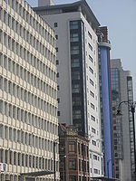
has been one of the prime office locations of central Cardiff since the 1960s. Some of the original buildings have recently been converted from office use to residential (e.g. The Aspect, Admiral House) or hotel use including the Mercure Holland House
Holland House, Cardiff
Holland House, also known as Macdonald Holland House, is a high-rise hotel in Cardiff, Wales. The 60-metre high building has 15 floors and is the seventh tallest building in Cardiff.-History:...
. Occupancy of the remaining commercial property has increased, reflecting a shortage of office space in the city and there is now little scope for further conversion. Newport Road is also home to several buildings owned by Cardiff University
Cardiff University
Cardiff University is a leading research university located in the Cathays Park area of Cardiff, Wales, United Kingdom. It received its Royal charter in 1883 and is a member of the Russell Group of Universities. The university is consistently recognised as providing high quality research-based...
, and Shand House, occupied by Cardiff Institute for the Blind
Cardiff institute for the blind
Cardiff Institute for the Blind is Cardiff's oldest charity, founded in 1865 and offering support to visually impaired residents of Cardiff and the Vale of Glamorgan.- History of CIB :...
.
Newport Road is also the site for the Cardiff Royal Infirmary, now providing long term care and rehabilitation. The hospital once housed 500 beds and provided the main A&E service for Cardiff before the University Hospital of Wales
University Hospital of Wales
University Hospital of Wales , opened in November 1971, is a major 1000-bed hospital situated in the inner city district of Heath in Cardiff, Wales...
took over these functions.
Churchill Way
Churchill Way runs parallel to the west of Station Terrace (Cardiff Queen Street station) and joins Queen Street in the north and Bute Terrace in the south. The Capitol CentreCapitol Centre
Capitol Centre is an indoor shopping centre in the city of Cardiff, Wales. The building is built on the site of the former Capitol Cinema and theatre, and is situated at the eastern end of Queen Street near the Dumfries Place bus terminus and Cardiff Queen Street railway station.It advertises...
is on the corner with Queen Street. Further along this road are office and modern apartment developments. The Cardiff office of the Driving Standards Agency
Driving Standards Agency
The Driving Standards Agency is an executive agency of the UK Department for Transport .DSA’s vision is 'Safe Driving for Life'. Its overall mission is to contribute to the public service agreement objective to achieve 40% reduction in riders and drivers killed or seriously injured in road...
, former British Gas
Centrica
Centrica plc is a multinational utility company, based in the United Kingdom but also with interests in North America. Centrica is the largest supplier of gas to domestic customers in the UK, and one of the largest suppliers of electricity, operating under the trading names "Scottish Gas" in...
offices in Helmont House
Helmont House
Helmont House is a high-rise hotel and office tower in Cardiff, Wales. Completed in 1984, the high building has 12 floors and is the tenth tallest building in Cardiff...
, and an Ibis
Ibis
The ibises are a group of long-legged wading birds in the family Threskiornithidae....
Hotel are located on this street.
Cardiff Masonic Hall occupies a major site on the corner of Guildford Street, adjacent to Chrurchill Way
South-western city centre
_cardiff_.jpg)
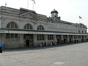
Wood Street
Wood Street is the main access point for Cardiff Central railwayCardiff Central railway station
Cardiff Central railway station is a major railway station on the South Wales Main Line in Cardiff, Wales.It is the largest and busiest station in Wales and one of the major stations of the British rail network, the tenth busiest station in the United Kingdom outside of London , based on 2007/08...
and Central bus
Cardiff Central bus station
Cardiff Central bus station is the main bus transport interchange in Cardiff, the capital city of Wales. With 34 stands, it is the largest bus station in the city and in Wales. It is located adjacent to Cardiff Central railway station forming a major bus-rail-cycle-taxi interchange.The station used...
stations, with the latter undergoing reconstruction since early 2008. The street also has bus stands running along the length of the street as well and allows access to the. Travelling westwards along this street are the Millennium Stadium
Millennium Stadium
The Millennium Stadium is the national stadium of Wales, located in the capital, Cardiff. It is the home of the Wales national rugby union team and also frequently stages games of the Wales national football team, but is also host to many other large scale events, such as the Super Special Stage...
, Millenium Plaza (with bars, night clubs, comedy clubs and a Vue cinema
Vue
Vue or VUE may refer to:Software:* VUE, Hewlett-Packard's Visual User Environment* VUE , a concept mapping tool* E-on Vue, 3D landscape generation software from e-on softwareOther uses:...
), Stadium House, Media Wales (offices of the South Wales Echo
South Wales Echo
The South Wales Echo is a daily tabloid newspaper published in Cardiff, Wales and distributed throughout the surrounding area.The newspaper was founded in 1884 and was based in Thomson House, Cardiff city centre. It is published by Media Wales Ltd , part of the Trinity Mirror group...
and Western Mail) and Southgate House, (which houses among other organisations the Cardiff offices for the Armed Forces).
Westgate Street
Westgate Street runs parallel just west of St Marys Street for about half of the latter's length, linked by several alleys and lanes. Linking Castle Street and Wood Street, Cardiff Arms ParkCardiff Arms Park
Cardiff Arms Park , also known as The Arms Park, is primarily known as a rugby union stadium, but it also has a bowling green, and is situated in the centre of Cardiff, Wales. The Arms Park was host to the British Empire and Commonwealth Games in 1958, and hosted four games in the 1991 Rugby World...
and the Millennium Stadium
Millennium Stadium
The Millennium Stadium is the national stadium of Wales, located in the capital, Cardiff. It is the home of the Wales national rugby union team and also frequently stages games of the Wales national football team, but is also host to many other large scale events, such as the Super Special Stage...
dominate its western side, whereas hotels, pubs and bars dominate its eastern side.
The Hayes

Department store
A department store is a retail establishment which satisfies a wide range of the consumer's personal and residential durable goods product needs; and at the same time offering the consumer a choice of multiple merchandise lines, at variable price points, in all product categories...
Howells, Spillers Records
Spillers Records
Spillers Records, established in 1894, is the oldest record shop in the world. It is located in Cardiff, Wales. In addition to selling music, it is the city's main location for buying tickets for alternative music concerts....
, St David's Hall
St David's Hall
St David's Hall is a performing arts and conference venue in the heart of Cardiff city centre, the capital of Wales...
and elegant Victorian
Victorian architecture
The term Victorian architecture refers collectively to several architectural styles employed predominantly during the middle and late 19th century. The period that it indicates may slightly overlap the actual reign, 20 June 1837 – 22 January 1901, of Queen Victoria. This represents the British and...
arcade
Arcade (architecture)
An arcade is a succession of arches, each counterthrusting the next, supported by columns or piers or a covered walk enclosed by a line of such arches on one or both sides. In warmer or wet climates, exterior arcades provide shelter for pedestrians....
s are found. The Hayes used to be home to David Morgan department store
David Morgan (department store)
thumb|David Morgan Ltd logoDavid Morgan was an independent department store in Cardiff that ceased operating in January 2005 after 125 years of trading. It opened on October 31, 1879 and closed its doors for the final time on Saturday 30 January 2005....
, a historic local landmark. Since its closure in 2005, the Grade I listed David Morgan Buildings have been subdivided into several retail units, and the upper floors converted into 56 luxury apartments. The exterior of the building received a comprehensive refurbishment, with the facade being restored to its original design following many alterations since its construction in the late 1800s.
The eastern side of the Hayes is fronted by the new St. Davids shopping centre. Prior to this it was home to Oxford Arcade, a post war construction that dated quickly and was underused given its central location.
This area also features the new Cardiff Central Library
Cardiff Central Library
Cardiff Central Library , is the main library in the city centre of Cardiff, Wales. Four buildings have been named as such, with the newest building opening on 14 March 2009 and officially being opened a few months later on 18 June 2009 by the Manic Street Preachers...
which opened in March 2009. The previous Central Library closed in 2006 for the construction of the St. David's shopping centre and was located a few hundred yards north.
As part of the St Davids development, the Hayes has be pedestrianised and repaved, and a new public square was be created at its southern end with large, interactive public artwork as its centrepiece including Alliance
Alliance (sculpture)
Alliance is a high sculpture in the centre of Cardiff, Wales. The sculpture consists of a large stainless steel and enamelled metal arrow column and a hoop, which glows in the dark, and falls and rises with the tide....
, a 25 metres (82 ft) high sculpture consisting of a large stainless steel and enamelled metal arrow column and a hoop, which glows in the dark, and falls and rises with the tide.
Caroline Street
Caroline Street is a pedestrianised link between St Mary Street and The Hayes. The street has been a host to all kinds of stores but has seen a surge in chip and kebab shops, and as such is commonly known as Chippy Lane. Around 2003, the north side of the street was redeveloped after the demolition of the old Brains Brewery. In its place were luxury flats encircling the Old Brewery Quarter, where new shops, bars and restaurants were erected. The pavement on the street was re-tiled as part of this development.Callaghan Square
This development, built in 1999, extends the central business district south of the mainline railway. Eventually the main development will include approximately 850,000 square feet (77,000 m²) of office space and other uses, of which approximately 350,000 square feet (33,000 m²) is complete (with the largest occupiers being Eversheds and British Gas). Further phases are unlikely to be built on a speculative basis. The initial masterplan suggest that the final phase, yet to be commenced, will also include hotel and residential use. Nearby offices on Tresillian Way (housing The AA, and Lloyds TSB Black Horse finance amongst others) plus further potential developments have turned the area relatively quickly into one of the largest office locations in Central Cardiff. Within a few years total office space in the area will exceed 1 million square feet (90,000 m²).Custom House Street/Bute Terrace/Adam Street
These two roads have traditionally formed the southern and south-eastern boundaries of the central business districtCentral business district
A central business district is the commercial and often geographic heart of a city. In North America this part of a city is commonly referred to as "downtown" or "city center"...
of Cardiff, and in recent years have seen a great deal of new development with much due in the next few years. Recent developments such as the 23 story Altolusso
Altolusso
Altolusso is a residential skyscraper in Cardiff, Wales. The building is 72 metres high and has 23 floors.The tower was the tallest residential building in Wales upon its completion in 2005, and remains one of the tallest buildings in Cardiff and in Wales.The Y-shaped building contains 292 luxury...
apartment complex, and the Big Sleep Hotel are set to be joined by (from west to east), a new 11 story office building (on the site of the old Central Hotel - destroyed by fire in the early 2000s); the Meridian Gate
Meridian Gate, Cardiff
Meridian Gate is a hotel and residential skyscraper complex in Cardiff, Wales. Meridian Gate comprises two buildings, the taller of which is 63 metres high, has 21 floors and contains the largest hotel in Cardiff, operated by Radisson Blu. It is the joint-fifth tallest building in Cardiff...
development (consisting of 11-story apartment block and a 21-story Radisson SAS Hotel); a new John Lewis department store as part of the St. David's 2 shopping expansion; Harlech Court (consisting of apartments and a rooftop restaurant); the University of Glamorgan
University of Glamorgan
The University of Glamorgan is a university based in Pontypridd, Rhondda Cynon Taf, Wales with campuses in Treforest, Glyntaff, Merthyr Tydfil, Tyn y Wern and Cardiff...
's new ATRiuM
Atrium (Cardiff)
ATRiuM is a campus of the University of Glamorgan, in Cardiff, Wales.Opened on 29 November 2007, it is home to one of the University's five faculties, CCI...
campus (which opened in 2007) along with the 21-story Tŷ Pont Haearn
Tŷ Pont Haearn
Tŷ Pont Haearn is a tall residential building in Cardiff, Wales. The 21-storey building comprises 17 floors of 144 student flats on top of a four storey public car park. Tŷ Pont Haearn is the joint-fifth tallest building in Cardiff.-Construction:...
student halls; and 3 further residential towers (of up to 13 stories) with lower floor retail and commercial use.
Access
From the north, North Road (A470) meets the city centre at the junction with Castle Street and Boulevard de Nantes, with the latter route forming a northern and eastern by-pass, meeting Newport Road (A4161) and then Callaghan Square, just south of the city centre.From the west, the centre is accessed from Castle Street (A4161), Wood Street and Penarth Road (A4160), with St. Mary's Street connecting the three, but is restricted to no-car traffic. Penarth Road terminates at Callaghan Square.
From the south, Lloyd George Avenue (A470), Bute Street and the Central Link (A4234) originate from Cardiff Bay
Cardiff Bay
Cardiff Bay is the area created by the Cardiff Barrage in South Cardiff, the capital of Wales. The regeneration of Cardiff Bay is now widely regarded as one of the most successful regeneration projects in the United Kingdom. The Bay is supplied by two rivers to form a freshwater lake round the...
and meet the city centre at Callaghan Square.
Transport in the city centre
Bus
The vast majority Cardiff BusCardiff Bus
Cardiff Bus is the dominant operator of bus services in Cardiff, Wales and the surrounding area, including Barry and Penarth. Its hub is Cardiff central bus station...
services run to or through the city centre, approaching from the west along either Tudor Street or Westgate Street, from the north along North Road or Newport Road, from the east along Newport Road and from the south along Callaghan Square. Most services circle the city centre, creating a "bus box". Some terminate or pass through Cardiff Central bus station
Cardiff Central bus station
Cardiff Central bus station is the main bus transport interchange in Cardiff, the capital city of Wales. With 34 stands, it is the largest bus station in the city and in Wales. It is located adjacent to Cardiff Central railway station forming a major bus-rail-cycle-taxi interchange.The station used...
, off Wood Street, which is currently being redeveloped. Other major interchanges include The Hayes, Dumfries Place, Westgate Street, Greyfriars Road and St. Mary Street, with taxi stands being located next to most of these.
Cardiff Bus operates the Free b
Free b
Free b was a zero-fare shuttle bus that operated in Cardiff city centre, Wales. The route circled the edges of the city centre anti-clockwise. The service was operated by Cardiff Bus.-History:...
service, a free shuttle bus that circles the city centre every 10 minutes, linking major bus and rail interchanges, as well as the stops of the four Park and Ride
Park and ride
Park and ride facilities are car parks with connections to public transport that allow commuters and other people wishing to travel into city centres to leave their vehicles and transfer to a bus, rail system , or carpool for the rest of their trip...
services. The Baycar
Baycar
Baycar is a bus service in Cardiff, serving the city centre and Cardiff Bay.The service forms part of the wider Cardiff Bus network, but is unique in that the entire Baycar bus system includes its own branded vehicles, bus shelters and boards.-History:The service was introduced in 2006 to connect...
service also circles the city centre every 10 minutes before continuing to Cardiff Bay
Cardiff Bay
Cardiff Bay is the area created by the Cardiff Barrage in South Cardiff, the capital of Wales. The regeneration of Cardiff Bay is now widely regarded as one of the most successful regeneration projects in the United Kingdom. The Bay is supplied by two rivers to form a freshwater lake round the...
.
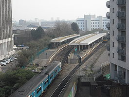
Rail
The city centre is served by two railway stations. Cardiff Queen Street is in the east of the centre and is the city's main hub for urban services to the rest of Cardiff, its valleysSouth Wales Valleys
The South Wales Valleys are a number of industrialised valleys in South Wales, stretching from eastern Carmarthenshire in the west to western Monmouthshire in the east and from the Heads of the Valleys in the north to the lower-lying, pastoral country of the Vale of Glamorgan and the coastal plain...
and the Vale of Glamorgan
Vale of Glamorgan
The Vale of Glamorgan is a county borough in Wales; an exceptionally rich agricultural area, it lies in the southern part of Glamorgan, South Wales...
. Cardiff Central
Cardiff Central railway station
Cardiff Central railway station is a major railway station on the South Wales Main Line in Cardiff, Wales.It is the largest and busiest station in Wales and one of the major stations of the British rail network, the tenth busiest station in the United Kingdom outside of London , based on 2007/08...
, located in the south of the city centre, is largest station in the city and one of the busiest in the United Kingdom, focusing on mainline services. Central railway station is located next to Central bus station forming an interchange.
Cathays railway station
Cathays railway station
Cathays railway station is a railway station lying on the Merthyr Tydfil and Rhondda lines in the Cathays district of Cardiff, Wales. The station is 2 kilometres north of Cardiff Central....
, Grangetown railway station
Grangetown railway station
Grangetown railway station is a railway station serving the Grangetown district of Cardiff in Wales. It is located on the Vale of Glamorgan Line 1 mile south west of Cardiff Central towards Bridgend via Barry, Penarth and Barry Island....
and Ninian Park railway station
Ninian Park railway station
Ninian Park railway station serves the Leckwith and South Canton areas of Cardiff, which lies just outside Cardiff city centre.The station, which is situated west of Cardiff Central, was opened when the City Line reopened to passenger services in 1987, using platforms previously used only for...
are all within 1.5 miles (2.4 km) of the centre serving edges of the city centre.
Road
The A470A470 road
The A470 is a major long-distance connective spine road in Wales, running from Cardiff on the south coast to Llandudno on the north coast. It covers approximately 186 miles , over a zig-zagging route through the entirety of the country's mountainous central region, including the Brecon Beacons and...
bypasses the centre to the east running southbound to Cardiff Bay
Cardiff Bay
Cardiff Bay is the area created by the Cardiff Barrage in South Cardiff, the capital of Wales. The regeneration of Cardiff Bay is now widely regarded as one of the most successful regeneration projects in the United Kingdom. The Bay is supplied by two rivers to form a freshwater lake round the...
and northbound to North Cardiff, Pontypridd
Pontypridd
Pontypridd is both a community and a principal town of Rhondda Cynon Taf, Wales and is situated 12 miles/19 km north of the Welsh capital city of Cardiff...
, Merthyr Tydfil
Merthyr Tydfil
Merthyr Tydfil is a town in Wales, with a population of about 30,000. Although once the largest town in Wales, it is now ranked as the 15th largest urban area in Wales. It also gives its name to a county borough, which has a population of around 55,000. It is located in the historic county of...
and Brecon
Brecon
Brecon is a long-established market town and community in southern Powys, Mid Wales, with a population of 7,901. It was the county town of the historic county of Brecknockshire; although its role as such was eclipsed with the formation of Powys, it remains an important local centre...
. The A470 road meets the A4232
A4232 road
The A4232, which is also known either as the Peripheral Distributor Road or the Cardiff Link Road , is a distributor road in Cardiff, the capital of Wales....
at Cardiff Bay
Cardiff Bay
Cardiff Bay is the area created by the Cardiff Barrage in South Cardiff, the capital of Wales. The regeneration of Cardiff Bay is now widely regarded as one of the most successful regeneration projects in the United Kingdom. The Bay is supplied by two rivers to form a freshwater lake round the...
, leading to Culverhouse Cross
Culverhouse Cross
Culverhouse Cross is suburban district in the west of Cardiff, capital of Wales, lying on the border with the Vale of Glamorgan.The busy Culverhouse Cross roundabout is an important part of the primary road network to the west of the city and connects the A4232 , the A4050 , and...
and the M4 motorway
M4 motorway
The M4 motorway links London with South Wales. It is part of the unsigned European route E30. Other major places directly accessible from M4 junctions are Reading, Swindon, Bristol, Newport, Cardiff and Swansea...
, and also meets the A48 Camarthen-Gloucester road
A48 road
The A48 is a major trunk road in Great Britain. It runs from the A40 at Highnam west of Gloucester to the A40 at Carmarthen. Before the construction of the M4 motorway and the first Severn Bridge in the mid 1960s it was the principal route into South Wales. For most of its journey through Wales,...
at Gabalfa
Gabalfa
Gabalfa is a district in the north of the city of Cardiff, capital of Wales. It is characterised by an enormous fly over road which is part of the large Gabalfa Interchange, and crosses the A48 road in a north-south direction. The area is also the site of the All Nations Centre.The name is derived...
, north of the centre.
Some city centre taxis can be hailed. They are usually, but not always, black with a white bonnet or hackney carriages.
Water
The Cardiff WaterbusCardiff Waterbus
The Cardiff Waterbus celebrated its 10 year anniversary in April 2010. The fleet have clocked up 50,000 miles since operating on the routes, carrying an estimated 1,000,000 passengers.-External links:**...
has stops at Cardiff Castle and Taff Mead Embankment, next to the Millennium Stadium
Millennium Stadium
The Millennium Stadium is the national stadium of Wales, located in the capital, Cardiff. It is the home of the Wales national rugby union team and also frequently stages games of the Wales national football team, but is also host to many other large scale events, such as the Super Special Stage...
, with services to Cardiff Bay
Cardiff Bay
Cardiff Bay is the area created by the Cardiff Barrage in South Cardiff, the capital of Wales. The regeneration of Cardiff Bay is now widely regarded as one of the most successful regeneration projects in the United Kingdom. The Bay is supplied by two rivers to form a freshwater lake round the...
.
Cycle
A cycle hire system, similar to those in other large cities, launched in September 2009, and includes 70 bikes and 35 hire points (initially 7) around the centre and the south of the city. The current stations are: Central Station; Cardiff Bay Station; County Hall; Cardiff Bay Visitors’ Centre; Churchill Way; City Hall and eastern Queen Street. It is necessary to register before using bike. The first half an hour is free after which a small hourly fee is payable.External links
| Pontcanna Pontcanna Pontcanna is a western district of the city of Cardiff, Wales. Its area is bounded approximately by Llandaff Fields to the north, the Riverside district and Cowbridge Road to the south, the River Taff to the west and the district of Canton to the east.Pontcanna is a very well to do area of wide... |
Cathays Cathays Cathays is a district in the north of Cardiff, capital of Wales. It is an old suburb of Cardiff established in 1875. It is very densely populated and contains many older terraced houses giving it a Victorian era atmosphere... |
Roath Roath Roath is a district in the east/north-east of the city of Cardiff, capital of Wales.It lies just east/north east of the city centre, stretching from Adamsdown in the south to Roath Park in the north. Roath contains the Plasnewydd electoral ward. The name is believed to originate from Irish ráth,... |
| Riverside Riverside, Cardiff Riverside is an inner-city southern area of Cardiff, capital of Wales. Riverside is also the name of the electoral ward, which can be split into two very different parts, Riverside and Pontcanna... |
City centre | Adamsdown Adamsdown Adamsdown is an inner city area and community in the south of Cardiff, the capital city of Wales.-History:In mediaeval times, Adamsdown lay just outside the east walls of Cardiff and was owned by the lords of Glamorgan. The area may be named after an Adam Kygnot, a porter at Cardiff Castle around... |
| Grangetown Grangetown, Cardiff Grangetown is a community in the south of Cardiff, capital of Wales. It is one of the largest districts in the south of the city and is bordered by Riverside, Canton and Butetown. The River Taff winds its way through the area... |
Butetown Butetown Butetown is a community in the south of the city of Cardiff, the capital of Wales. It was originally a model housing estate built in the early nineteenth century by John Crichton-Stuart, 2nd Marquess of Bute, for whose title the area was named... |
Splott Splott Splott is a district in the south of the city of Cardiff, capital of Wales, just east of the city centre. It was built up in the late 19th century on the land of two farms of the same name: Upper Splott and Lower Splott Farms. Splott is characterised by its once vast steelworks and rows of tightly... |