

British military narrow gauge railways
Encyclopedia
Official Secrets Act
The Official Secrets Act is a stock short title used in the United Kingdom, Ireland, India and Malaysia and formerly in New Zealand for legislation that provides for the protection of state secrets and official information, mainly related to national security.-United Kingdom:*The Official Secrets...
and other government restrictions, so many of them are less well documented.
The industrial use of narrow-gauge railways was quite extensive amongst the various military and civilian explosive factories, for example ICI Nobel's works at Ardeer and the Agency Explosive Factories run by ICI Nobel in the Second World War. To give an example, the Ministry of Supply
Ministry of Supply
The Ministry of Supply was a department of the UK Government formed in 1939 to co-ordinate the supply of equipment to all three British armed forces, headed by the Minister of Supply. There was, however, a separate ministry responsible for aircraft production and the Admiralty retained...
(MOS) Factory Dalbeattie used gauge with a variety of bogie trucks mostly pushed by teams of three to six women. Stores, explosives, chemicals, rubbish and sewage, were all transported on this narrow-gauge system, which used at least 8 miles (13 km) of track.
Weapons range railways
| Name | Opened | Closed | Gauge | Location | Notes |
|---|---|---|---|---|---|
| DOE Secretary of State for the Environment The Secretary of State for the Environment was a UK cabinet position, responsible for the Department of the Environment . This was created by Edward Heath as a combination of the Ministry of Housing and Local Government, the Ministry of Transport and the Ministry of Public Building and Works on 15... Okehampton Gun Ranges |
? | after 1979 | Okehampton Okehampton Okehampton is a town and civil parish in West Devon in the English county of Devon. It is situated at the northern edge of Dartmoor, and has an estimated population of 7,155.-History:... , England England England is a country that is part of the United Kingdom. It shares land borders with Scotland to the north and Wales to the west; the Irish Sea is to the north west, the Celtic Sea to the south west, with the North Sea to the east and the English Channel to the south separating it from continental... |
Target railway | |
| DOE Secretary of State for the Environment The Secretary of State for the Environment was a UK cabinet position, responsible for the Department of the Environment . This was created by Edward Heath as a combination of the Ministry of Housing and Local Government, the Ministry of Transport and the Ministry of Public Building and Works on 15... Redesdale Ranges target railway |
? | ? | Redesdale Redesdale Redesdale is a valley iin the western part of the county of Northumberland, in northeast England. This area contains the valley of the River Rede, a tributary of the North Tyne River. Redesdale includes the settlements of Elsdon, Otterburn, Rochester, Byrness and Carter Bar.Historically this... , England England England is a country that is part of the United Kingdom. It shares land borders with Scotland to the north and Wales to the west; the Irish Sea is to the north west, the Celtic Sea to the south west, with the North Sea to the east and the English Channel to the south separating it from continental... |
Target railway | |
| Fort George Range | ? | ? | Inverness Inverness Inverness is a city in the Scottish Highlands. It is the administrative centre for the Highland council area, and is regarded as the capital of the Highlands of Scotland... , Scotland Scotland Scotland is a country that is part of the United Kingdom. Occupying the northern third of the island of Great Britain, it shares a border with England to the south and is bounded by the North Sea to the east, the Atlantic Ocean to the north and west, and the North Channel and Irish Sea to the... |
Target railway | |
| Lydd Ranges Lydd Ranges Lydd Ranges is a military firing range south of Lydd, in Kent, England. It extends as far as the coast.It has been used for military training for over 150 years and is part of the Dungeness, Romney Marsh and Rye Bay Site of Special Scientific Interest... |
1936 | Present | Lydd Lydd Lydd is a town in Kent, England, lying on the Romney Marsh. It is one of the larger towns on the Marsh, and the most southerly town in Kent. Actually located on Denge Marsh, Lydd was one of the first sandy islands to form as the bay evolved into what is now called the Romney Marsh... , England England England is a country that is part of the United Kingdom. It shares land borders with Scotland to the north and Wales to the west; the Irish Sea is to the north west, the Celtic Sea to the south west, with the North Sea to the east and the English Channel to the south separating it from continental... |
Principally a target railway, though also carries personnel and equipment around the ranges. At least 39 locomotives and powered trollies have worked here. | |
| Lulworth Ranges | ? | Present | Lulworth area, Dorset, England England England is a country that is part of the United Kingdom. It shares land borders with Scotland to the north and Wales to the west; the Irish Sea is to the north west, the Celtic Sea to the south west, with the North Sea to the east and the English Channel to the south separating it from continental... |
Electrically powered Rail Targetory System (paras 14-18) visible on the OS Map, Google Earth and from surrounding hills. | |
| National Rifle Association National Rifle Association of the United Kingdom The National Rifle Association of the United Kingdom is the governing body of full bore rifle and pistol shooting sports in the United Kingdom.- History :... Bisley Tramways |
1898 | after 1971 | Bisley Bisley, Surrey Bisley is a large village in Surrey, England, which is notable for rifle shooting. Bisley's immediate neighbours are West End, Chobham and Knaphill.- History :... , England England England is a country that is part of the United Kingdom. It shares land borders with Scotland to the north and Wales to the west; the Irish Sea is to the north west, the Celtic Sea to the south west, with the North Sea to the east and the English Channel to the south separating it from continental... |
The NRA originally had a temporary shooting range and railway on Wimbledon Common but in 1888 moved to Bisley. Initially using a Merryweather steam tram locomotive, later using diesel locomotives. | |
| RAF Hell's Mouth RAF Hell's Mouth RAF Hell's Mouth was a World War II Royal Air Force grass airfield at Hell's Mouth, on the Llŷn Peninsula near Abersoch, Gwynedd.... target railway |
late 1930s | 1945 | ? | Abersoch Abersoch Abersoch is a large village in the community of Llanengan in Gwynedd, Wales. It is a popular coastal seaside resort with approximately 1,000 inhabitants, on the east-facing south coast of the Llŷn Peninsula at the southern terminus of the A499. It is about south-west of Pwllheli and south-west of... , Wales Wales Wales is a country that is part of the United Kingdom and the island of Great Britain, bordered by England to its east and the Atlantic Ocean and Irish Sea to its west. It has a population of three million, and a total area of 20,779 km²... |
A target range Shooting range A shooting range or firing range is a specialized facility designed for firearms practice. Each facility is typically overseen by one or more supervisory personnel, called variously a range master or "RSO – Range Safety Officer" in the United States or a range conducting officer or "RCO" in the UK... railway operated by hand or rope-hauled in the dunes southeast of the airfield. |
| Romney Marsh weapons range railway | before 1975 | present ? | New Romney New Romney New Romney is a small town in Kent, England, on the edge of Romney Marsh, an area of flat, rich agricultural land reclaimed from the sea after the harbour began to be silted up. New Romney was once a sea port, with the harbour adjacent to the church, but is now more than a mile from the sea... , England England England is a country that is part of the United Kingdom. It shares land borders with Scotland to the north and Wales to the west; the Irish Sea is to the north west, the Celtic Sea to the south west, with the North Sea to the east and the English Channel to the south separating it from continental... |
Locomotive-worked network of lines across Romney Marsh |
Armaments depots and ordnance factories
| Name | Opened | Closed | Gauge | Location | Notes |
|---|---|---|---|---|---|
| CAD Eastriggs Depot railway | ? | Present | Eastriggs Eastriggs Eastriggs is a village in the south of Dumfries and Galloway. It has a small number of shops, a restaurant, post office, public house, working men's club and a church... , Scotland Scotland Scotland is a country that is part of the United Kingdom. Occupying the northern third of the island of Great Britain, it shares a border with England to the south and is bounded by the North Sea to the east, the Atlantic Ocean to the north and west, and the North Channel and Irish Sea to the... |
Extensive WW II World War II World War II, or the Second World War , was a global conflict lasting from 1939 to 1945, involving most of the world's nations—including all of the great powers—eventually forming two opposing military alliances: the Allies and the Axis... armaments depot line using parts of the site of the former HM Factory, Gretna HM Factory, Gretna His Majesty's Factory, Gretna, or H.M. Factory, Gretna as it was usually known, was a UK government World War I Cordite factory, adjacent to the Solway Firth, near Gretna, Dumfries and Galloway... . A sub-depot of CAD Longtown. |
|
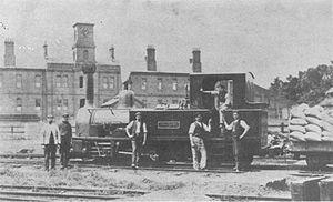
| Priddy's Hard Priddy's Hard Priddy's Hard is an area of Gosport, in Hampshire, England now being developed for housing with part of the site retained as a museum. However, for some two hundred years it was a restricted-access site; first becoming a fort and then an armaments depot for Royal Navy and British Army weapons,... |
about 1850 | about 1960 | and also later | Gosport Gosport Gosport is a town, district and borough situated on the south coast of England, within the county of Hampshire. It has approximately 80,000 permanent residents with a further 5,000-10,000 during the summer months... , England England England is a country that is part of the United Kingdom. It shares land borders with Scotland to the north and Wales to the west; the Irish Sea is to the north west, the Celtic Sea to the south west, with the North Sea to the east and the English Channel to the south separating it from continental... |
Ammunition transport railway, within the Royal Naval Armaments Depot Royal Naval Armaments Depot A Royal Naval Armament Depot was a group of armament depots dedicated to supplying the needs of the Royal Navy as well as the Royal Air Force, British Army and foreign/commonwealth governments; they were sister depots of Royal Naval Cordite Factories, Royal Naval Torpedo and Royal Naval Mine Depots... , between store houses and piers. Eight battery-electric locomotives were used after 1929. |
| Chatham Dockyard Chatham Dockyard Chatham Dockyard, located on the River Medway and of which two-thirds is in Gillingham and one third in Chatham, Kent, England, came into existence at the time when, following the Reformation, relations with the Catholic countries of Europe had worsened, leading to a requirement for additional... |
1860s | 1930s | Chatham Chatham, Medway Chatham is one of the Medway towns located within the Medway unitary authority, in North Kent, in South East England.Although the dockyard has long been closed and is now being redeveloped into a business and residential community as well as a museum featuring the famous submarine, HMS Ocelot,... , England England England is a country that is part of the United Kingdom. It shares land borders with Scotland to the north and Wales to the west; the Irish Sea is to the north west, the Celtic Sea to the south west, with the North Sea to the east and the English Channel to the south separating it from continental... |
Internal rail system serving the dockyard. | |
| Chattenden and Upnor Railway Chattenden and Upnor Railway The Chattenden and Upnor Railway was a narrow gauge railway serving the military barracks and depot at Upnor and associated munitions and training depots... |
1885 | 1961 | Chattenden Chattenden Chattenden is a small village in Hoo Parish, in Medway in Kent, UK. It lies to the north of the A228 and the village of Wainscott, at the top of Four Elms Hill.Chattenden means 'Forest Settlement' from the elements ceto and ham dun... , England England England is a country that is part of the United Kingdom. It shares land borders with Scotland to the north and Wales to the west; the Irish Sea is to the north west, the Celtic Sea to the south west, with the North Sea to the east and the English Channel to the south separating it from continental... |
Light railway serving Chattenden barracks and armament stores | |
| Davington Light Railway Davington Light Railway The Davington Light Railway was a narrow gauge railway built to serve the armaments factories near Davington, in Kent, England. It ran between Davington and Uplees.-History:... |
1916 | 1918 | Faversham Faversham Faversham is a market town and civil parish in the Swale borough of Kent, England. The parish of Faversham grew up around an ancient sea port on Faversham Creek and was the birthplace of the explosives industry in England.-History:... , England England England is a country that is part of the United Kingdom. It shares land borders with Scotland to the north and Wales to the west; the Irish Sea is to the north west, the Celtic Sea to the south west, with the North Sea to the east and the English Channel to the south separating it from continental... |
Short-lived metre-gauge line serving an Admiralty Admiralty The Admiralty was formerly the authority in the Kingdom of England, and later in the United Kingdom, responsible for the command of the Royal Navy... munitions factory. The three locomotives were sold to Brazil where at least one survived until 1988. |
|
| HM Factory, Gretna HM Factory, Gretna His Majesty's Factory, Gretna, or H.M. Factory, Gretna as it was usually known, was a UK government World War I Cordite factory, adjacent to the Solway Firth, near Gretna, Dumfries and Galloway... |
? | 1917 | Gretna Gretna, Dumfries and Galloway Gretna is a town in Dumfries and Galloway, Scotland. Because they are near the Anglo-Scottish border, nearby Gretna Green and to a lesser extent Gretna, are historically linked to weddings because of the more liberal marriage laws in Scotland... , Scotland Scotland Scotland is a country that is part of the United Kingdom. Occupying the northern third of the island of Great Britain, it shares a border with England to the south and is bounded by the North Sea to the east, the Atlantic Ocean to the north and west, and the North Channel and Irish Sea to the... |
Extensive WW I World War I World War I , which was predominantly called the World War or the Great War from its occurrence until 1939, and the First World War or World War I thereafter, was a major war centred in Europe that began on 28 July 1914 and lasted until 11 November 1918... Cordite Cordite Cordite is a family of smokeless propellants developed and produced in the United Kingdom from 1889 to replace gunpowder as a military propellant. Like gunpowder, cordite is classified as a low explosive because of its slow burning rates and consequently low brisance... factory line |
|
| Lodge Hill and Upnor Railway | 1873 | 1885 | Chattenden Chattenden Chattenden is a small village in Hoo Parish, in Medway in Kent, UK. It lies to the north of the A228 and the village of Wainscott, at the top of Four Elms Hill.Chattenden means 'Forest Settlement' from the elements ceto and ham dun... , England England England is a country that is part of the United Kingdom. It shares land borders with Scotland to the north and Wales to the west; the Irish Sea is to the north west, the Celtic Sea to the south west, with the North Sea to the east and the English Channel to the south separating it from continental... |
Served the construction of the Chattenden and Upnor Railway. | |
| Royal Air Force Royal Air Force The Royal Air Force is the aerial warfare service branch of the British Armed Forces. Formed on 1 April 1918, it is the oldest independent air force in the world... Chilmark Depot railway |
late 1930s | 1995 | ? | Chilmark, Wiltshire Chilmark, Wiltshire Chilmark is a Wiltshire village of some 150 houses straddling the B3089 road twelve miles west of Salisbury. The parish church was given by Henry VIII to the brother in law of his last wife... , England England England is a country that is part of the United Kingdom. It shares land borders with Scotland to the north and Wales to the west; the Irish Sea is to the north west, the Celtic Sea to the south west, with the North Sea to the east and the English Channel to the south separating it from continental... |
Extensive WW II World War II World War II, or the Second World War , was a global conflict lasting from 1939 to 1945, involving most of the world's nations—including all of the great powers—eventually forming two opposing military alliances: the Allies and the Axis... armaments depot lines using underground Chilmark Quarries Chilmark Quarries Chilmark Quarries is a 9.65 hectare biological and geological Site of Special Scientific Interest, in the ravine south of the village of Chilmark in Wiltshire, notified in 1977.... and above-ground storage at satellite site at Dinton, Wiltshire Dinton, Wiltshire Dinton is a village in Wiltshire, England, on the B3089 road about 8 miles west of Salisbury. The population was 597 at the 2001 census.-Present day:... . |
| RAF Royal Air Force The Royal Air Force is the aerial warfare service branch of the British Armed Forces. Formed on 1 April 1918, it is the oldest independent air force in the world... Fauld Depot railway RAF Fauld Explosion The RAF Fauld explosion was a military accident which occurred at 11:11am on Monday, 27 November 1944 at the RAF Fauld underground munitions storage depot... |
? | by 1979 | Fauld, England England England is a country that is part of the United Kingdom. It shares land borders with Scotland to the north and Wales to the west; the Irish Sea is to the north west, the Celtic Sea to the south west, with the North Sea to the east and the English Channel to the south separating it from continental... |
Underground ammunition store during WWII World War II World War II, or the Second World War , was a global conflict lasting from 1939 to 1945, involving most of the world's nations—including all of the great powers—eventually forming two opposing military alliances: the Allies and the Axis... with supply railway. |
|
| Royal Arsenal Railway Royal Arsenal Railway The Royal Arsenal Railway was a private military railway. It ran inside the Royal Arsenal, Woolwich, south east London.The earliest parts of this railway system proper were constructed to standard gauge from 1859 onwards as a to replace an ad hoc arrangement of individual plateways... |
1873 | 1966 | and | Woolwich Woolwich Woolwich is a district in south London, England, located in the London Borough of Greenwich. The area is identified in the London Plan as one of 35 major centres in Greater London.Woolwich formed part of Kent until 1889 when the County of London was created... , England England England is a country that is part of the United Kingdom. It shares land borders with Scotland to the north and Wales to the west; the Irish Sea is to the north west, the Celtic Sea to the south west, with the North Sea to the east and the English Channel to the south separating it from continental... |
Extensive internal rail system serving the Royal Arsenal Royal Arsenal The Royal Arsenal, Woolwich, originally known as the Woolwich Warren, carried out armaments manufacture, ammunition proofing and explosives research for the British armed forces. It was sited on the south bank of the River Thames in Woolwich in south-east London, England.-Early history:The Warren... . |
| RCAF Royal Canadian Air Force The history of the Royal Canadian Air Force begins in 1920, when the air force was created as the Canadian Air Force . In 1924 the CAF was renamed the Royal Canadian Air Force and granted royal sanction by King George V. The RCAF existed as an independent service until 1968... Seaford Head target railway |
after 1939 | by 1945 | Seaford Head, Wales Wales Wales is a country that is part of the United Kingdom and the island of Great Britain, bordered by England to its east and the Atlantic Ocean and Irish Sea to its west. It has a population of three million, and a total area of 20,779 km²... |
Horse drawn target range Shooting range A shooting range or firing range is a specialized facility designed for firearms practice. Each facility is typically overseen by one or more supervisory personnel, called variously a range master or "RSO – Range Safety Officer" in the United States or a range conducting officer or "RCO" in the UK... railway about 1 mile long. |
|
| RNAD Broughton Moor railway RNAD Broughton Moor RNAD Broughton Moor is a decommissioned Royal Naval Armaments Depot located between Great Broughton and Broughton Moor in the County of Cumbria, England.... |
before 1943 | 1992 | Broughton Moor Broughton Moor Broughton Moor is a village and civil parish in the Borough of Allerdale in Cumbria, England. It is situated on an extensive moor about north of Broughton and north west of Cockermouth. According to the 2001 census it had a population of 726. The village is about south of Maryport. The... , England England England is a country that is part of the United Kingdom. It shares land borders with Scotland to the north and Wales to the west; the Irish Sea is to the north west, the Celtic Sea to the south west, with the North Sea to the east and the English Channel to the south separating it from continental... |
Locomotive-worked line hauling ammunition around the depot. | |
| RNAD Dean Hill Depot railway | before 1942 | 2003 | West Dean West Dean, Wiltshire West Dean is a small village in Wiltshire, England. The village was mentioned in the Cartularium saxonicum for the year 880 as Deone, as Duene in the Domesday Book, as Westdone in 1265, and as Westdune in 1270.... , England England England is a country that is part of the United Kingdom. It shares land borders with Scotland to the north and Wales to the west; the Irish Sea is to the north west, the Celtic Sea to the south west, with the North Sea to the east and the English Channel to the south separating it from continental... |
Locomotive-worked line hauling ammunition around the depot. | |
| ROF Bishopton ROF Bishopton The Royal Ordnance Factory Bishopton was a UK Ministry of Supply, World War II, Explosive ROF. It is sited adjacent to the town of Bishopton, Renfrewshire, in Scotland.... |
1940 | 1950s - 2000 | Bishopton Bishopton, Renfrewshire Bishopton is a large village in Renfrewshire, Scotland, a few miles west of Erskine.-Transport links:Bishopton sits a couple of miles from the southern end of the Erskine Bridge, which spans the River Clyde between Renfrewshire and West Dunbartonshire. Part way along the B815 road is a computer... , Scotland Scotland Scotland is a country that is part of the United Kingdom. Occupying the northern third of the island of Great Britain, it shares a border with England to the south and is bounded by the North Sea to the east, the Atlantic Ocean to the north and west, and the North Channel and Irish Sea to the... |
Approx 80 miles of internal rail system serving the World War II Cordite Cordite Cordite is a family of smokeless propellants developed and produced in the United Kingdom from 1889 to replace gunpowder as a military propellant. Like gunpowder, cordite is classified as a low explosive because of its slow burning rates and consequently low brisance... factories. |
|
| Royal Navy Royal Navy The Royal Navy is the naval warfare service branch of the British Armed Forces. Founded in the 16th century, it is the oldest service branch and is known as the Senior Service... Holton Heath Cordite Factory |
1914 | 1946 | Holton Heath Holton Heath Holton Heath is an area of the parish of Wareham St. Martin, Dorset, England. The area includes a trading estate, on the site of the former Royal Navy Cordite Factory, Holton Heath, . East of the trading estate is the Holton Heath National Nature Reserve, currently closed to the public.The area is... , England England England is a country that is part of the United Kingdom. It shares land borders with Scotland to the north and Wales to the west; the Irish Sea is to the north west, the Celtic Sea to the south west, with the North Sea to the east and the English Channel to the south separating it from continental... |
Extensive explosives factory complex using battery electric and fireless steam locomotives | |
| Royal Navy Royal Navy The Royal Navy is the naval warfare service branch of the British Armed Forces. Founded in the 16th century, it is the oldest service branch and is known as the Senior Service... Stokes Bay railway |
1880s | 1919 | Stokes Bay Stokes Bay Stokes Bay is an area of the Solent that lies just south of Gosport, between Portsmouth and Lee-on-the-Solent, Hampshire. There is a shingle beach that has a great view of Ryde and East Cowes on the Isle of Wight to the south and also Fawley in the south west. The village of Alverstoke is close by... , England England England is a country that is part of the United Kingdom. It shares land borders with Scotland to the north and Wales to the west; the Irish Sea is to the north west, the Celtic Sea to the south west, with the North Sea to the east and the English Channel to the south separating it from continental... |
Steam locomotive worked line. | |
| Royal Navy Underwater Weapons Establishment | after 1979 | Weymouth, England England England is a country that is part of the United Kingdom. It shares land borders with Scotland to the north and Wales to the west; the Irish Sea is to the north west, the Celtic Sea to the south west, with the North Sea to the east and the English Channel to the south separating it from continental... |
Battery-electric locomotive worked line. | ||
| Vickers Engineering Wyke Regis Pier railway | before 1921 | 1968 | Wyke Regis Wyke Regis Wyke Regis is a village in south Dorset, England. The village is part of the south western suburbs of Weymouth, on the northern shore of Portland Harbour and the south-eastern end of Chesil Beach. Wyke is south of the county town, Dorchester... , England England England is a country that is part of the United Kingdom. It shares land borders with Scotland to the north and Wales to the west; the Irish Sea is to the north west, the Celtic Sea to the south west, with the North Sea to the east and the English Channel to the south separating it from continental... |
Pier railway used to transport torpedoes from the factory to ships. |
Supply depots
| Name | Opened | Closed | Gauge | Location | Notes |
|---|---|---|---|---|---|
| Deptford Special Reserve Depot | 1916 | 1919 | Deptford Deptford Deptford is a district of south London, England, located on the south bank of the River Thames. It is named after a ford of the River Ravensbourne, and from the mid 16th century to the late 19th was home to Deptford Dockyard, the first of the Royal Navy Dockyards.Deptford and the docks are... , England England England is a country that is part of the United Kingdom. It shares land borders with Scotland to the north and Wales to the west; the Irish Sea is to the north west, the Celtic Sea to the south west, with the North Sea to the east and the English Channel to the south separating it from continental... |
Extensive WW I World War I World War I , which was predominantly called the World War or the Great War from its occurrence until 1939, and the First World War or World War I thereafter, was a major war centred in Europe that began on 28 July 1914 and lasted until 11 November 1918... food supply depot line. At least four steam locomotives worked here, two or three of which went to the Sand Hutton Light Railway after the war. |
Fortifications
| Name | Opened | Closed | Gauge | Location | Notes |
|---|---|---|---|---|---|
| Braefoot Bay | ? | 5 inch | Aberdour Aberdour Aberdour is a scenic and historic village on the south coast of Fife, Scotland. It is on the north shore of the Firth of Forth, looking south to the island of Inchcolm and its Abbey, and to Leith and Edinburgh beyond. According to the 2006 population estimate, the village has a population of... , Scotland Scotland Scotland is a country that is part of the United Kingdom. Occupying the northern third of the island of Great Britain, it shares a border with England to the south and is bounded by the North Sea to the east, the Atlantic Ocean to the north and west, and the North Channel and Irish Sea to the... |
Fortification supply railway | |
| Flat Holm Flat Holm Flat Holm is a limestone island lying in the Bristol Channel approximately from Lavernock Point in the Vale of Glamorgan, but in the City and County of Cardiff. It includes the most southerly point of Wales.... |
? | ? | Bristol Channel Bristol Channel The Bristol Channel is a major inlet in the island of Great Britain, separating South Wales from Devon and Somerset in South West England. It extends from the lower estuary of the River Severn to the North Atlantic Ocean... , Wales Wales Wales is a country that is part of the United Kingdom and the island of Great Britain, bordered by England to its east and the Atlantic Ocean and Irish Sea to its west. It has a population of three million, and a total area of 20,779 km²... |
Fortification supply railway | |
| Hoo Ness Tramway | before 1914 | after 1979 | Hoo Ness, England England England is a country that is part of the United Kingdom. It shares land borders with Scotland to the north and Wales to the west; the Irish Sea is to the north west, the Celtic Sea to the south west, with the North Sea to the east and the English Channel to the south separating it from continental... |
Locomotive-worked tramway. May have been gauge previously | |
| Hurst Castle Hurst Castle Hurst Castle on the south coast of England is one of Henry VIII's Device Forts, built at the end of a long shingle barrier beach at the west end of the Solent to guard the approaches to Southampton. Hurst Castle was sited at the narrow entrance to the Solent where the ebb and flow of the tides... |
1895 | 1956 | Hurst Castle Hurst Castle Hurst Castle on the south coast of England is one of Henry VIII's Device Forts, built at the end of a long shingle barrier beach at the west end of the Solent to guard the approaches to Southampton. Hurst Castle was sited at the narrow entrance to the Solent where the ebb and flow of the tides... , England England England is a country that is part of the United Kingdom. It shares land borders with Scotland to the north and Wales to the west; the Irish Sea is to the north west, the Celtic Sea to the south west, with the North Sea to the east and the English Channel to the south separating it from continental... |
Line for moving ammunition and supplies around the castle. Used hand and donkey hauled wagons. Much track still in situ. | |
| South Heighton railway | 1941 | 1941 | Newhaven Newhaven, East Sussex Newhaven is a town in the Lewes District of East Sussex in England. It lies at the mouth of the River Ouse, on the English Channel coast, and is a ferry port for services to France.-Origins:... , England England England is a country that is part of the United Kingdom. It shares land borders with Scotland to the north and Wales to the west; the Irish Sea is to the north west, the Celtic Sea to the south west, with the North Sea to the east and the English Channel to the south separating it from continental... |
Hand-worked line to aid construction of HMS Forward HMS Forward (shore establishment 1939) HMS Forward was a shore establishment of the British Royal Navy during World War II. It was based at South Heighton, just outside Newhaven, East Sussex.-Service history:... underground command centre. |
|
| Steep Holm railway | 1880s | 1946 | ? | Steep Holm Steep Holm Steep Holm is an English island lying in the Bristol Channel. The island covers at high tide, expanding to at mean low water. At its highest point it is above mean sea level. It lies within the historic boundaries of Somerset and administratively, it forms part of North Somerset... , North Somerset North Somerset North Somerset is a unitary authority in England. Its area covers part of the ceremonial county of Somerset but it is administered independently of the non-metropolitan county. Its administrative headquarters is in the town hall in Weston-super-Mare.... , England England England is a country that is part of the United Kingdom. It shares land borders with Scotland to the north and Wales to the west; the Irish Sea is to the north west, the Celtic Sea to the south west, with the North Sea to the east and the English Channel to the south separating it from continental... |
Fortification supply railway. Palmerston forts Palmerston Forts The Palmerston Forts are a group of forts and associated structures, around the coast of Britain.The forts were built during the Victorian period on the recommendations of the 1860 Royal Commission on the Defence of the United Kingdom, following concerns about the strength of the French Navy, and... , shown on 1886 Ordnance Survey Ordnance Survey Ordnance Survey , an executive agency and non-ministerial government department of the Government of the United Kingdom, is the national mapping agency for Great Britain, producing maps of Great Britain , and one of the world's largest producers of maps.The name reflects its creation together with... maps. Relaid in World War II. Finally Demolished 1946. |
Training camps
| Name | Opened | Closed | Gauge | Location | Notes |
|---|---|---|---|---|---|
| Kinmel Camp Railway Kinmel Camp Railway The Kinmel Camp Railway was a long standard gauge railway built to serve Kinmel Camp near Rhyl in north Wales.- History :Kinmel Camp was a training camp opened by the British Army in 1915 to train soldiers during the First World War... |
1914 | 1917 | St. Asaph, Wales Wales Wales is a country that is part of the United Kingdom and the island of Great Britain, bordered by England to its east and the Atlantic Ocean and Irish Sea to its west. It has a population of three million, and a total area of 20,779 km²... |
Locomotive-worked construction railway for the Kinmel Camp | |
| Longmoor Camp Railway Longmoor Military Railway The Longmoor Military Railway was a British military railway in Hampshire, built by the Royal Engineers from 1903 in order to train soldiers on railway construction and operations.-Route:... |
1903 | 1907 | Weaversdown, England England England is a country that is part of the United Kingdom. It shares land borders with Scotland to the north and Wales to the west; the Irish Sea is to the north west, the Celtic Sea to the south west, with the North Sea to the east and the English Channel to the south separating it from continental... |
Early construction line used to assist in the demolition of army huts. Relaid Gauge conversion In rail transport, gauge conversion is the process of converting a railway from one rail gauge to another, through the alteration of the railway tracks... as standard gauge Standard gauge The standard gauge is a widely-used track gauge . Approximately 60% of the world's existing railway lines are built to this gauge... starting in 1905. |
|
| Longmoor Military Railway Longmoor Military Railway The Longmoor Military Railway was a British military railway in Hampshire, built by the Royal Engineers from 1903 in order to train soldiers on railway construction and operations.-Route:... |
Weaversdown, England England England is a country that is part of the United Kingdom. It shares land borders with Scotland to the north and Wales to the west; the Irish Sea is to the north west, the Celtic Sea to the south west, with the North Sea to the east and the English Channel to the south separating it from continental... |
Narrow gauge line at the extensive railway training centre at Longmoor | |||
| Strensall Ranges, HQ Strensall Training Centre, | 1870 | Present | ? | Strensall Strensall Strensall is a village and civil parish in the unitary authority of the City of York in North Yorkshire, England, on the River Foss north of York and north-east of Haxby. Prior to 1996 it had been part of the Ryedale district. It covers an area of 2,908 acres.... , York York York is a walled city, situated at the confluence of the Rivers Ouse and Foss in North Yorkshire, England. The city has a rich heritage and has provided the backdrop to major political events throughout much of its two millennia of existence... , England England England is a country that is part of the United Kingdom. It shares land borders with Scotland to the north and Wales to the west; the Irish Sea is to the north west, the Celtic Sea to the south west, with the North Sea to the east and the English Channel to the south separating it from continental... |
Principally Stores railway, to carry equipment around the ranges. 1165Yds long. |
| RAF Royal Air Force The Royal Air Force is the aerial warfare service branch of the British Armed Forces. Formed on 1 April 1918, it is the oldest independent air force in the world... Calshot Camp railway RAF Calshot RAF Calshot was initially a seaplane and flying boat station, and latterly an RAF marine craft maintenance and training unit. It was located at the end of Calshot Spit in Southampton Water, Hampshire, England, at... |
1919 | 1946 | Calshot Calshot Calshot is a coastal village in Hampshire, England at the west corner of Southampton_Water where it joins the Solent. A settlement at the site is believed to have existed since the fifth century AD... , England England England is a country that is part of the United Kingdom. It shares land borders with Scotland to the north and Wales to the west; the Irish Sea is to the north west, the Celtic Sea to the south west, with the North Sea to the east and the English Channel to the south separating it from continental... |
Short line serving Calshot camp and pier. Steam locomotives were used, one of which is preserved on the Talyllyn Railway Talyllyn Railway The Talyllyn Railway is a narrow-gauge preserved railway in Wales running for from Tywyn on the Mid-Wales coast to Nant Gwernol near the village of Abergynolwyn. The line was opened in 1866 to carry slate from the quarries at Bryn Eglwys to Tywyn, and was the first narrow gauge railway in Britain... as "Douglas". |
Others
| Name | Opened | Closed | Gauge | Location | Notes |
|---|---|---|---|---|---|
| Royal Navy Royal Navy The Royal Navy is the naval warfare service branch of the British Armed Forces. Founded in the 16th century, it is the oldest service branch and is known as the Senior Service... Haslar Hospital |
by 1910 | 1918 | Haslar Haslar Haslar is place in England, at the southern tip of Alverstoke, on the Gosport peninsula, Hampshire. It takes its name from Anglo-Saxon hæsel-ōra = "hazel - landing place"... , England England England is a country that is part of the United Kingdom. It shares land borders with Scotland to the north and Wales to the west; the Irish Sea is to the north west, the Celtic Sea to the south west, with the North Sea to the east and the English Channel to the south separating it from continental... |
Hand worked line to move ammunitions and stores around the hospital site. |