
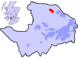
Bishopton, Renfrewshire
Encyclopedia
Bishopton is a large village in Renfrewshire
, Scotland
, a few miles west of Erskine
.
, which spans the River Clyde
between Renfrewshire
and West Dunbartonshire
. Part way along the B815 road is a computer
factory; which was built in the late 1980s by Compaq
Computers. Compaq merged with Hewlett-Packard
in 2002. However, this factory is considered to be a part of larger town Erskine
. A chain ferry
transported vehicles across the River Clyde before the bridge was built. The former Ferry Master's house still survives on the south side of the Clyde.
Bishopton is served by the, double track
, electrified
, Inverclyde railway line
, (former Caledonian Railway
), Gourock
and Wemyss Bay
branches; with frequent train services in both directions. The ROF Bishopton railway sidings
joined the railway line just west of Bishopton railway station
; but they have been closed for some years.
The A8 passes through Bishopton; and the M8 motorway runs parallel to the A8, with access to Bishopton from both junctions 30 and 31.
- manufacturing Royal Ordnance Factory
, ROF Bishopton
, was built in World War II
on farm
land, acquired by compulsory purchase, on the other side of the railway line. Over 2,000 acre
s (8 km²) of land from up to seven farms was used to build this factory. The land included Dargavel House, which still survives. The southern end of the site included the majority of the land formerly used by the First World War National Filling Factory, Georgetown. The ROF was privatised in 1984, being sold to British Aerospace
(now BAE Systems
) and has now closed down.
After privatisation the Ministry of Defence Police
(MOD Police) moved out and the former MOD Police Social Club at Holm Park, and its adjoining sports field, became part of Bishopton. The former MOD Police houses at both Holm Park and Rossland were sold off to private buyers. Bishopton's Medical Centre was built in a corner of this sports field, opposite the shops.
BAE Systems and Redrow have submitted controversial proposals to use a large part of this site for building new housing which would, at least, double the size of Bishopton. Local residents have indicated their concern at the proposals by voting in a local referendum, held on the 4 April 2005, organised by local action groups and council. The results showed that out of the 1485 who voted, 100 (6.7%) were for the development, 1361 (91.6%) were against it, 19 (1.3%) were not concerned and there were 5 (0.3%) spoiled votes. The major concerns they have are with the size of the expansion - with the associated knock-on effects to the local infrastructure - and fears of the high levels of contamination that are likely to be found on the site.
In December 2008 Renfrewshire Council granted outline planning consent for the development and detailed planning consent for a related motorway junction off the A8/M8.
Renfrewshire
Renfrewshire is one of 32 council areas used for local government in Scotland. Located in the west central Lowlands, it is one of three council areas contained within the boundaries of the historic county of Renfrewshire, the others being Inverclyde to the west and East Renfrewshire to the east...
, Scotland
Scotland
Scotland is a country that is part of the United Kingdom. Occupying the northern third of the island of Great Britain, it shares a border with England to the south and is bounded by the North Sea to the east, the Atlantic Ocean to the north and west, and the North Channel and Irish Sea to the...
, a few miles west of Erskine
Erskine
Erskine is a town in the council area of Renfrewshire, and historic county of the same name, in the west central Lowlands of Scotland.It lies on the southern bank of the River Clyde, providing the lowest crossing to the north bank of the river at Erskine Bridge connecting the town to Old Kilpatrick...
.
Transport links
Bishopton sits a couple of miles from the southern end of the Erskine BridgeErskine Bridge
The Erskine Bridge is a cable-stayed box girder bridge spanning the River Clyde in west central Scotland, connecting West Dunbartonshire with Renfrewshire....
, which spans the River Clyde
River Clyde
The River Clyde is a major river in Scotland. It is the ninth longest river in the United Kingdom, and the third longest in Scotland. Flowing through the major city of Glasgow, it was an important river for shipbuilding and trade in the British Empire....
between Renfrewshire
Renfrewshire
Renfrewshire is one of 32 council areas used for local government in Scotland. Located in the west central Lowlands, it is one of three council areas contained within the boundaries of the historic county of Renfrewshire, the others being Inverclyde to the west and East Renfrewshire to the east...
and West Dunbartonshire
West Dunbartonshire
West Dunbartonshire is one of the 32 local government council areas of Scotland. Bordering onto the west of the City of Glasgow, containing many of Glasgow's commuter towns and villages as well as the city's suburbs, West Dunbartonshire also borders onto Argyll and Bute, Stirling, East...
. Part way along the B815 road is a computer
Computer
A computer is a programmable machine designed to sequentially and automatically carry out a sequence of arithmetic or logical operations. The particular sequence of operations can be changed readily, allowing the computer to solve more than one kind of problem...
factory; which was built in the late 1980s by Compaq
Compaq
Compaq Computer Corporation is a personal computer company founded in 1982. Once the largest supplier of personal computing systems in the world, Compaq existed as an independent corporation until 2002, when it was acquired for US$25 billion by Hewlett-Packard....
Computers. Compaq merged with Hewlett-Packard
Hewlett-Packard
Hewlett-Packard Company or HP is an American multinational information technology corporation headquartered in Palo Alto, California, USA that provides products, technologies, softwares, solutions and services to consumers, small- and medium-sized businesses and large enterprises, including...
in 2002. However, this factory is considered to be a part of larger town Erskine
Erskine
Erskine is a town in the council area of Renfrewshire, and historic county of the same name, in the west central Lowlands of Scotland.It lies on the southern bank of the River Clyde, providing the lowest crossing to the north bank of the river at Erskine Bridge connecting the town to Old Kilpatrick...
. A chain ferry
Cable ferry
A cable ferry is guided and in many cases propelled across a river or other larger body of water by cables connected to both shores. They are also called chain ferries, floating bridges, or punts....
transported vehicles across the River Clyde before the bridge was built. The former Ferry Master's house still survives on the south side of the Clyde.
Bishopton is served by the, double track
Double track
A double track railway usually involves running one track in each direction, compared to a single track railway where trains in both directions share the same track.- Overview :...
, electrified
Railway electrification system
A railway electrification system supplies electrical energy to railway locomotives and multiple units as well as trams so that they can operate without having an on-board prime mover. There are several different electrification systems in use throughout the world...
, Inverclyde railway line
Inverclyde Line
The Inverclyde Line is a railway line running from Glasgow Central station through Paisley and a series of stations to the south of the River Clyde and the Firth of Clyde, terminating at Gourock and Wemyss Bay, where it connects to Caledonian MacBrayne ferry services...
, (former Caledonian Railway
Caledonian Railway
The Caledonian Railway was a major Scottish railway company. It was formed in the early 19th century and it was absorbed almost a century later into the London, Midland and Scottish Railway, in the 1923 railway grouping, by means of the Railways Act 1921...
), Gourock
Gourock
Gourock is a town falling within the Inverclyde council area and formerly forming a burgh of the historic county of Renfrewshire in the west central Lowlands of Scotland. It has in the past functioned as a seaside resort on the Firth of Clyde...
and Wemyss Bay
Wemyss Bay
Wemyss Bay is a village on the coast of the Firth of Clyde falling within the Inverclyde council area and historic county of Renfrewshire in the west central Lowlands of Scotland. The name may derive from the Gaelic uaimh, meaning 'cave'...
branches; with frequent train services in both directions. The ROF Bishopton railway sidings
Rail siding
A siding, in rail terminology, is a low-speed track section distinct from a running line or through route such as a main line or branch line or spur. It may connect to through track or to other sidings at either end...
joined the railway line just west of Bishopton railway station
Bishopton railway station
Bishopton railway station serves the town of Bishopton in Renfrewshire, Scotland. The station is on the Inverclyde Line, west of .- Services :...
; but they have been closed for some years.
The A8 passes through Bishopton; and the M8 motorway runs parallel to the A8, with access to Bishopton from both junctions 30 and 31.
The former ROF Bishopton site
A very large explosiveExplosive ROF
An Explosive ROF was a UK Government-owned Royal Ordnance Factory , which specialised in manufacturing explosives during and after World War II...
- manufacturing Royal Ordnance Factory
Royal Ordnance Factory
Royal Ordnance Factories was the collective name of the UK government's munitions factories in and after World War II. Until privatisation in 1987 they were the responsibility of the Ministry of Supply and later the Ministry of Defence....
, ROF Bishopton
ROF Bishopton
The Royal Ordnance Factory Bishopton was a UK Ministry of Supply, World War II, Explosive ROF. It is sited adjacent to the town of Bishopton, Renfrewshire, in Scotland....
, was built in World War II
World War II
World War II, or the Second World War , was a global conflict lasting from 1939 to 1945, involving most of the world's nations—including all of the great powers—eventually forming two opposing military alliances: the Allies and the Axis...
on farm
Farm
A farm is an area of land, or, for aquaculture, lake, river or sea, including various structures, devoted primarily to the practice of producing and managing food , fibres and, increasingly, fuel. It is the basic production facility in food production. Farms may be owned and operated by a single...
land, acquired by compulsory purchase, on the other side of the railway line. Over 2,000 acre
Acre
The acre is a unit of area in a number of different systems, including the imperial and U.S. customary systems. The most commonly used acres today are the international acre and, in the United States, the survey acre. The most common use of the acre is to measure tracts of land.The acre is related...
s (8 km²) of land from up to seven farms was used to build this factory. The land included Dargavel House, which still survives. The southern end of the site included the majority of the land formerly used by the First World War National Filling Factory, Georgetown. The ROF was privatised in 1984, being sold to British Aerospace
British Aerospace
British Aerospace plc was a UK aircraft, munitions and defence-systems manufacturer. Its head office was in the Warwick House in the Farnborough Aerospace Centre in Farnborough, Hampshire...
(now BAE Systems
BAE Systems
BAE Systems plc is a British multinational defence, security and aerospace company headquartered in London, United Kingdom, that has global interests, particularly in North America through its subsidiary BAE Systems Inc. BAE is among the world's largest military contractors; in 2009 it was the...
) and has now closed down.
After privatisation the Ministry of Defence Police
Ministry of Defence Police
The Ministry of Defence Police is a civilian police force which is part of the United Kingdom's Ministry of Defence. The force is part of the larger government agency, the Ministry of Defence Police and Guarding Agency , together with the Ministry of Defence Guard Service...
(MOD Police) moved out and the former MOD Police Social Club at Holm Park, and its adjoining sports field, became part of Bishopton. The former MOD Police houses at both Holm Park and Rossland were sold off to private buyers. Bishopton's Medical Centre was built in a corner of this sports field, opposite the shops.
BAE Systems and Redrow have submitted controversial proposals to use a large part of this site for building new housing which would, at least, double the size of Bishopton. Local residents have indicated their concern at the proposals by voting in a local referendum, held on the 4 April 2005, organised by local action groups and council. The results showed that out of the 1485 who voted, 100 (6.7%) were for the development, 1361 (91.6%) were against it, 19 (1.3%) were not concerned and there were 5 (0.3%) spoiled votes. The major concerns they have are with the size of the expansion - with the associated knock-on effects to the local infrastructure - and fears of the high levels of contamination that are likely to be found on the site.
In December 2008 Renfrewshire Council granted outline planning consent for the development and detailed planning consent for a related motorway junction off the A8/M8.
Neighbourhoods in Bishopton
- The Calas -- Located towards the south-east of the village heading out towards PaisleyPaisleyPaisley is the largest town in the historic county of Renfrewshire in the west central Lowlands of Scotland and serves as the administrative centre for the Renfrewshire council area...
, the area is named locally as 'The Calas' as the houses built in this area in the early 2000s were built by the Cala Group. This is the newest part of the village to be constructed. - Craighead -- Part of a major post-war development of Bishopton, Craighead covers the area of housing which branches off of Craighead Road, including housing on Cawdor Crescent, Carrick Road, Morar Crescent, Teviot Drive, Ettrick Drive and Yarrow Crescent.
- Kingston -- Full of both new and older house ajoining Old Greenock, Greenock and Stuart Roads.
- Holmpark -- The housing in Holmpark was used by the MoD police who worked in the former ROF Bishopton site but is now owned by private home owners. Holmpark includes the Bishopton Sports and Social Club and the rugby football pitch used by the local rugby team.
- Rossland -- Another relatively new development in Bishopton on the south side of the village. Constructed by Wimpey, Rossland covers Bridgend, Rossland Crescent, Rossland Gardens and Rossland View. It also includes the Greater Western Rossland Woods, an area of woodland adjacant to the former ROF Bishopton site and two 11-a-side football pitches.
- Stuart Road -- Covering the majority of housing on the northern side of the village, the Stuart Road area includes the housing on Stuart Road and all of the other side streets that branch off of Stuart Road (such as Bruce Road, Mar Avenue etc.)
- White City -- A council housing scheme located on the north-west of the village heading towards Langbank and Greenock, it is nicknamed 'White City' due to the number of council (and ex-council) buildings being painted white and being built in a compact area. White City includes housing on Porton Place, West Porton, Lyle Crescent, Blantyre Drive and Wraisland Crescent.
External links
- Bishopton's Community Web Site InBishopton.org.uk
- Bishopton Broncos Basketball Club bishoptonbroncos.com
- The Gazette (local paper) the-gazette.co.uk