

Airborne Real-time Cueing Hyperspectral Enhanced Reconnaissance
Encyclopedia
Aerial photography
Aerial photography is the taking of photographs of the ground from an elevated position. The term usually refers to images in which the camera is not supported by a ground-based structure. Cameras may be hand held or mounted, and photographs may be taken by a photographer, triggered remotely or...
can.
It is the most sophisticated unclassified hyperspectral imaging
Hyperspectral imaging
Hyperspectral imaging collects and processes information from across the electromagnetic spectrum. Much as the human eye sees visible light in three bands , spectral imaging divides the spectrum into many more bands...
system available, according to U.S. Government officials.
ARCHER can automatically scan detailed imaging for a given signature of the object being sought (such as a missing aircraft), for abnormalities in the surrounding area, or for changes from previous recorded spectral signatures.
It is has direct applications for search and rescue
Search and rescue
Search and rescue is the search for and provision of aid to people who are in distress or imminent danger.The general field of search and rescue includes many specialty sub-fields, mostly based upon terrain considerations...
, counterdrug
War on Drugs
The War on Drugs is a campaign of prohibition and foreign military aid and military intervention being undertaken by the United States government, with the assistance of participating countries, intended to both define and reduce the illegal drug trade...
, disaster relief and impact assessment, and homeland security
Homeland security
Homeland security is an umbrella term for security efforts to protect states against terrorist activity. Specifically, is a concerted national effort to prevent terrorist attacks within the U.S., reduce America’s vulnerability to terrorism, and minimize the damage and recover from attacks that do...
, and has been deployed by the Civil Air Patrol
Civil Air Patrol
Civil Air Patrol is a Congressionally chartered, federally supported, non-profit corporation that serves as the official civilian auxiliary of the United States Air Force . CAP is a volunteer organization with an aviation-minded membership that includes people from all backgrounds, lifestyles, and...
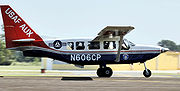
(CAP) in the United States on the Australian built Gippsland GA8
Gippsland GA8
The Gippsland GA8 Airvan is a single-engined utility aircraft manufactured by Gippsland Aeronautics of Victoria, Australia. It can seat eight including one pilot.-Development:...
Airvan fixed-wing aircraft
Fixed-wing aircraft
A fixed-wing aircraft is an aircraft capable of flight using wings that generate lift due to the vehicle's forward airspeed. Fixed-wing aircraft are distinct from rotary-wing aircraft in which wings rotate about a fixed mast and ornithopters in which lift is generated by flapping wings.A powered...
. CAP, the civilian
Civilian
A civilian under international humanitarian law is a person who is not a member of his or her country's armed forces or other militia. Civilians are distinct from combatants. They are afforded a degree of legal protection from the effects of war and military occupation...
auxiliary
Auxiliaries
An auxiliary force is a group affiliated with, but not part of, a military or police organization. In some cases, auxiliaries are armed forces operating in the same manner as regular soldiers...
of the United States Air Force
United States Air Force
The United States Air Force is the aerial warfare service branch of the United States Armed Forces and one of the American uniformed services. Initially part of the United States Army, the USAF was formed as a separate branch of the military on September 18, 1947 under the National Security Act of...
, is a volunteer education and public service
Public services
Public services is a term usually used to mean services provided by government to its citizens, either directly or by financing private provision of services. The term is associated with a social consensus that certain services should be available to all, regardless of income...
non-profit organization
Non-profit organization
Nonprofit organization is neither a legal nor technical definition but generally refers to an organization that uses surplus revenues to achieve its goals, rather than distributing them as profit or dividends...
that conducts aircraft search and rescue in the U.S.
Overview
ARCHER is a daytime non-invasive technology, which works by analyzing an object’s reflected light. It can detect objects at night, underwater, under dense cover, underground, under snow or inside buildings. The system uses a special camera facing down through a quartz glass portal in the belly of the aircraft, which is typically flown at a standard mission altitude of 2500 feet (800 meters) and 100 knots (50 meters/second) ground speed.The system software was developed by Space Computer Corporation of Los Angeles, California
Los Angeles, California
Los Angeles , with a population at the 2010 United States Census of 3,792,621, is the most populous city in California, USA and the second most populous in the United States, after New York City. It has an area of , and is located in Southern California...
and the system hardware is supplied by NovaSol Corp
Novasol
Novasol also referred to as Novasol N.V. / S.A. or Novasol Chemicals is a Belgium based Chemical Company providing a selected range of solvents, monomers, plasticizers and synthesis raw materials to customers worldwide...
. of Honolulu, Hawaii
Honolulu, Hawaii
Honolulu is the capital and the most populous city of the U.S. state of Hawaii. Honolulu is the southernmost major U.S. city. Although the name "Honolulu" refers to the urban area on the southeastern shore of the island of Oahu, the city and county government are consolidated as the City and...
specifically for CAP. The ARCHER system is based on hyperspectral technology research and testing previously undertaken by the United States Naval Research Laboratory
United States Naval Research Laboratory
The United States Naval Research Laboratory is the corporate research laboratory for the United States Navy and the United States Marine Corps and conducts a program of scientific research and development. NRL opened in 1923 at the instigation of Thomas Edison...
(NRL) and Air Force Research Laboratory
Air Force Research Laboratory
The Air Force Research Laboratory is a scientific research organization operated by the United States Air Force Materiel Command dedicated to leading the discovery, development, and integration of affordable aerospace warfighting technologies; planning and executing the Air Force science and...
(AFRL).
CAP developed ARCHER in cooperation with the NRL, AFRL and the United States Coast Guard Research & Development Center
United States Coast Guard Research & Development Center
The United States Coast Guard Research & Development Center located in New London, Connecticut is the Coast Guard's center for operational analysis and mission execution solutions...
in the largest interagency project CAP has undertaken in its 63-year history.
Since 2003, almost US$5 million authorized under the 2002 Defense Appropriations Act
Appropriation bill
An appropriation bill or running bill is a legislative motion which authorizes the government to spend money. It is a bill that sets money aside for specific spending...
has been spent on development and deployment. , CAP reported completing the initial deployment of 16 aircraft throughout the U.S. and training over 100 operators, but had only used the system on a few search and rescue missions, and had not credited it with being the first to find any wreckage.
In searches in Georgia and Maryland during 2007, ARCHER located the aircraft wreckage, but both accidents had no survivors, according to Col. Drew Alexa, director of advanced technology, and the ARCHER program manager at CAP. An ARCHER equipped aircraft from the Utah
Utah
Utah is a state in the Western United States. It was the 45th state to join the Union, on January 4, 1896. Approximately 80% of Utah's 2,763,885 people live along the Wasatch Front, centering on Salt Lake City. This leaves vast expanses of the state nearly uninhabited, making the population the...
Wing of the Civil Air Patrol was used in the search for adventurer Steve Fossett
Steve Fossett
James Stephen Fossett was an American commodities trader, businessman, and adventurer. Fossett is the first person to fly solo nonstop around the world in a balloon...
in September 2007. ARCHER did not locate Mr. Fossett, but was instrumental in uncovering eight previously uncharted crash sites in the high desert area of Nevada
Nevada
Nevada is a state in the western, mountain west, and southwestern regions of the United States. With an area of and a population of about 2.7 million, it is the 7th-largest and 35th-most populous state. Over two-thirds of Nevada's people live in the Las Vegas metropolitan area, which contains its...
,
some decades old.
Col. Alexa described the system to the press in 2007: "The human eye sees basically three bands of light. The ARCHER sensor sees 50. It can see things that are anomalous in the vegetation such as metal or something from an airplane wreckage." Major Cynthia Ryan of the Nevada
Nevada
Nevada is a state in the western, mountain west, and southwestern regions of the United States. With an area of and a population of about 2.7 million, it is the 7th-largest and 35th-most populous state. Over two-thirds of Nevada's people live in the Las Vegas metropolitan area, which contains its...
Civil Air Patrol, while also describing the system to the press in 2007, stated, "ARCHER is essentially something used by the geosciences. It's pretty sophisticated stuff … beyond what the human eye can generally see," She elaborated further, "It might see boulders, it might see trees, it might see mountains, sagebrush, whatever, but it goes 'not that' or 'yes, that'. The amazing part of this is that it can see as little as 10 per cent of the target, and extrapolate from there."
In addition to the primary search and rescue mission, CAP has also tested additional uses for ARCHER. For example, an ARCHER equipped CAP GA8 was used in a pilot project in Missouri
Missouri
Missouri is a US state located in the Midwestern United States, bordered by Iowa, Illinois, Kentucky, Tennessee, Arkansas, Oklahoma, Kansas and Nebraska. With a 2010 population of 5,988,927, Missouri is the 18th most populous state in the nation and the fifth most populous in the Midwest. It...
in August 2005 to assess the suitability of the system for tracking hazardous material releases into the environment, and one was deployed to track oil spill
Oil spill
An oil spill is the release of a liquid petroleum hydrocarbon into the environment, especially marine areas, due to human activity, and is a form of pollution. The term is mostly used to describe marine oil spills, where oil is released into the ocean or coastal waters...
s in the aftermath of Hurricane Rita
Hurricane Rita
Hurricane Rita was the fourth-most intense Atlantic hurricane ever recorded and the most intense tropical cyclone ever observed in the Gulf of Mexico. Rita caused $11.3 billion in damage on the U.S. Gulf Coast in September 2005...
in Texas
Texas
Texas is the second largest U.S. state by both area and population, and the largest state by area in the contiguous United States.The name, based on the Caddo word "Tejas" meaning "friends" or "allies", was applied by the Spanish to the Caddo themselves and to the region of their settlement in...
during September 2005.
Since then, in the case of a flight originating in Missouri, the ARCHER system proved its usefulness in October 2006, when it found the wreckage in Antlers, Okla. The National Transportation and Safety Board was extremely pleased with the data ARCHER provided, which was later used to locate aircraft debris spread over miles of rough, wooded terrain. In July 2007, the ARCHER system identified a flood-borne oil spill originating in a Kansas oil refinery, that extended downstream and had invaded previously unsuspected reservoir areas. The client agencies (EPA, Coast Guard, and other federal and state agencies) found the data essential to quick remediation. In September 2008, a Civil Air Patrol GA-8 from Texas Wing searched for a missing aircraft from Arkansas. It was found in Oklahoma, identified simultaneously by ground searchers and the overflying ARCHER system. Rather than a direct find, this was a validation of the system’s accuracy and efficacy. In the subsequent recovery, it was found that the ARCHER plotted the debris area with great accuracy.
Technical description
The major ARCHER subsystem components include:- advanced hyperspectral imagingHyperspectral imagingHyperspectral imaging collects and processes information from across the electromagnetic spectrum. Much as the human eye sees visible light in three bands , spectral imaging divides the spectrum into many more bands...
(HSI) system with a resolution of one square meter per pixel. - panchromaticPanchromaticPanchromatic film is a type of black-and-white photographic film that is sensitive to all wavelengths of visible light. A panchromatic film therefore produces a realistic reproduction of a scene as it appears to the human eye. Almost all modern photographic film is panchromatic, but some types are...
high-resolution imaging (HRI) camera with a resolution of 8 cm x 8 cm (3 in x 3 in) per pixel. - global positioning systemGlobal Positioning SystemThe Global Positioning System is a space-based global navigation satellite system that provides location and time information in all weather, anywhere on or near the Earth, where there is an unobstructed line of sight to four or more GPS satellites...
(GPS) integrated with an inertial navigation systemInertial navigation systemAn inertial navigation system is a navigation aid that uses a computer, motion sensors and rotation sensors to continuously calculate via dead reckoning the position, orientation, and velocity of a moving object without the need for external references...
(INS)
Hyperspectral imager
The passive hyperspectral imaging spectroscopyImaging spectroscopy
Imaging spectroscopy is similar to color photography, but each pixel acquires many bands of light intensity data from the spectrum, instead of just the three bands of the RGB color model...
remote sensor observes a target in multi-spectral
Spectrum
A spectrum is a condition that is not limited to a specific set of values but can vary infinitely within a continuum. The word saw its first scientific use within the field of optics to describe the rainbow of colors in visible light when separated using a prism; it has since been applied by...
bands. The HSI camera separates the image spectra
Electromagnetic spectrum
The electromagnetic spectrum is the range of all possible frequencies of electromagnetic radiation. The "electromagnetic spectrum" of an object is the characteristic distribution of electromagnetic radiation emitted or absorbed by that particular object....
into 52 "bins" from 500 nanometers
Nanometre
A nanometre is a unit of length in the metric system, equal to one billionth of a metre. The name combines the SI prefix nano- with the parent unit name metre .The nanometre is often used to express dimensions on the atomic scale: the diameter...
(nm) wavelength
Wavelength
In physics, the wavelength of a sinusoidal wave is the spatial period of the wave—the distance over which the wave's shape repeats.It is usually determined by considering the distance between consecutive corresponding points of the same phase, such as crests, troughs, or zero crossings, and is a...
at the blue end of the visible spectrum
Visible spectrum
The visible spectrum is the portion of the electromagnetic spectrum that is visible to the human eye. Electromagnetic radiation in this range of wavelengths is called visible light or simply light. A typical human eye will respond to wavelengths from about 390 to 750 nm. In terms of...
to 1100 nm in the infrared
Infrared
Infrared light is electromagnetic radiation with a wavelength longer than that of visible light, measured from the nominal edge of visible red light at 0.74 micrometres , and extending conventionally to 300 µm...
, giving the camera a spectral resolution
Spectral resolution
The spectral resolution of a spectrograph, or, more generally, of a frequency spectrum, is a measure of its ability to resolve features in the electromagnetic spectrum...
of 11.5 nm. Although ARCHER records data in all 52 bands, the computational algorithms only use the first 40 bands, from 500 nm to 960 nm because the bands above 960 nm are too noisy
Signal-to-noise ratio
Signal-to-noise ratio is a measure used in science and engineering that compares the level of a desired signal to the level of background noise. It is defined as the ratio of signal power to the noise power. A ratio higher than 1:1 indicates more signal than noise...
to be useful. For comparison, the normal human eye will respond to wavelengths from approximately 400 to 700 nm
1 E-7 m
To help compare different orders of magnitude this page lists lengths between 10−7 and 10−6 m .Distances shorter than 100 nm*100 nm — greatest particle size that can fit through a surgical mask...
, and is trichromatic, meaning the eye's cone cells only sense light in three spectral bands.
As the ARCHER aircraft flies over a search area, reflected sunlight
Sunlight
Sunlight, in the broad sense, is the total frequency spectrum of electromagnetic radiation given off by the Sun. On Earth, sunlight is filtered through the Earth's atmosphere, and solar radiation is obvious as daylight when the Sun is above the horizon.When the direct solar radiation is not blocked...
is collected by the HSI camera lens. The collected light passes through a set of lenses that focus the light to form an image of the ground. The imaging system uses a pushbroom approach to image acquisition. With the pushbroom approach, the focusing slit reduces the image height to the equivalent of one vertical pixel, creating a horizontal line image.
The horizontal line image is then projected onto a diffraction grating, which is a very finely etched reflecting surface that disperses light into its spectra. The diffraction grating is specially constructed and positioned to create a two-dimensional (2D) spectrum image from the horizontal line image. The spectra are projected vertically, i.e., perpendicular to the line image, by the design and arrangement of the diffraction grating.
The 2D spectrum image projects onto a charge-coupled device
Charge-coupled device
A charge-coupled device is a device for the movement of electrical charge, usually from within the device to an area where the charge can be manipulated, for example conversion into a digital value. This is achieved by "shifting" the signals between stages within the device one at a time...
(CCD) two-dimensional image sensor, which is aligned so that the horizontal pixels are parallel to the image's horizontal. As a result, the vertical pixels are coincident to the spectra produced from the diffraction grating. Each column of pixels receives the spectrum of one horizontal pixel from the original image. The arrangement of vertical pixel sensors in the CCD divides the spectrum into distinct and non-overlapping intervals. The CCD output consists of electrical signals for 52 spectral bands for each of 504 horizontal image pixels.
The on-board computer records the CCD output signal at a frame rate of sixty times each second. At an aircraft altitude of 2,500 ft AGL and a speed of 100 knots, a 60 Hz frame rate equates to a ground image resolution of approximately one square meter per pixel. Thus, every frame captured from the CCD contains the spectral data for a ground swath that is approximately one meter long and 500 meters wide.
High-resolution imager
A high-resolution imaging (HRI) black-and-white, or panchromatic, camera is mounted adjacent to the HSI camera to enable both cameras to capture the same reflected light. The HRI camera uses a pushbroom approach just like the HSI camera with a similar lens and slit arrangement to limit the incoming light to a thin, wide beam. However, the HRI camera does not have a diffraction grating to disperse the incoming reflected light. Instead, the light is directed to a wider CCD to capture more image data. Because it captures a single line of the ground image per frame, it is called a line scan camera. The HRI CCD is 6,144 pixels wide and one pixel high. It operates at a frame rate of 720 Hz. At ARCHER search speed and altitude (100 knots over the ground at 2,500 ft AGL) each pixel in the black-and-white image represents a 3 inch by 3 inch area of the ground. This high resolution adds the capability to identify some objects.Processing
A monitor in the cockpit displays detailed images in real time, and the system also logs the image and Global Positioning SystemGlobal Positioning System
The Global Positioning System is a space-based global navigation satellite system that provides location and time information in all weather, anywhere on or near the Earth, where there is an unobstructed line of sight to four or more GPS satellites...
data at a rate of 30 Gigabyte
Gigabyte
The gigabyte is a multiple of the unit byte for digital information storage. The prefix giga means 109 in the International System of Units , therefore 1 gigabyte is...
s (GB) per hour for later analysis. The on-board data processing system performs numerous real-time processing functions including data acquisition
Data acquisition
Data acquisition is the process of sampling signals that measure real world physical conditions and converting the resulting samples into digital numeric values that can be manipulated by a computer. Data acquisition systems typically convert analog waveforms into digital values for processing...
and recording, raw data correction, target detection, cueing and chipping, precision image geo-registration
Georeference
To georeference something means to define its existence in physical space. That is, establishing its location in terms of map projections or coordinate systems. The term is used both when establishing the relation between raster or vector images and coordinates, and when determining the spatial...
, and display and dissemination of image products and target cue information.
ARCHER has three methods for locating targets:
- signature matching where reflected light is matched to spectral signatures
- anomaly detection using a statistical model of the pixelPixelIn digital imaging, a pixel, or pel, is a single point in a raster image, or the smallest addressable screen element in a display device; it is the smallest unit of picture that can be represented or controlled....
s in the image to determine the probability that a pixel does not match the profile, and - change detection which executes a pixel-by-pixel comparison of the current image against ground conditions that were obtained in a previous mission over the same area.
In change detection, scene changes are identified, and new, moved or departed targets are highlighted for evaluation. In spectral signature matching, the system can be programmed with the parameters of a missing aircraft, such as paint colors, to alert the operators of possible wreckage. It can also be used to look for specific materials, such as petroleum products or other chemicals released into the environment, or even ordinary items like commonly available blue polyethylene
Polyethylene
Polyethylene or polythene is the most widely used plastic, with an annual production of approximately 80 million metric tons...
tarpaulin
Tarpaulin
A tarpaulin, colloquially tarp, is a large sheet of strong, flexible, water-resistant or waterproof material, often cloth such as canvas or polyester coated with urethane, or made of plastics such as polyethylene. In some places such as Australia, and in military slang, a tarp may be known as a...
s. In an impact assessment role, information on the location of blue tarps used to temporarily repair buildings damaged in a storm can help direct disaster relief efforts; in a counterdrug role, a blue tarp located in a remote area could be associated with illegal activity.