

U.S. Route 59 in Texas
Encyclopedia

U.S. state
A U.S. state is any one of the 50 federated states of the United States of America that share sovereignty with the federal government. Because of this shared sovereignty, an American is a citizen both of the federal entity and of his or her state of domicile. Four states use the official title of...
of Texas
Texas
Texas is the second largest U.S. state by both area and population, and the largest state by area in the contiguous United States.The name, based on the Caddo word "Tejas" meaning "friends" or "allies", was applied by the Spanish to the Caddo themselves and to the region of their settlement in...
, U.S. 59
U.S. Route 59
U.S. Route 59 is a north–south United States highway . A latecomer to the U.S. numbered route system, U.S. 59 is now a border-to-border route, Part of NAFTA Corridor Highway System. It parallels U.S. Route 75 for nearly its entire route, never much more than away, until it veers southwest...
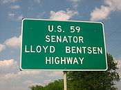
is named the Lloyd Bentsen Highway, after Lloyd Bentsen
Lloyd Bentsen
Lloyd Millard Bentsen, Jr. was a four-term United States senator from Texas and the Democratic Party nominee for Vice President in 1988 on the Michael Dukakis ticket. He also served in the House of Representatives from 1949 to 1955. In his later political life, he was Chairman of the Senate...
, former U.S. Senator from Texas. In northern Houston, US 59 is the Eastex Freeway (from Downtown
Downtown Houston
Downtown Houston is the largest business district of Houston, Texas, United States. Downtown Houston, the city's central business district, contains the headquarters of many prominent companies. There is an extensive network of pedestrian tunnels and skywalks connecting the buildings of the district...
to Humble
Humble, Texas
Humble is a city in Harris County, Texas within the Houston–Sugar Land–Baytown metropolitan area.As of the 2000 census, the city population was 14,579. The city shares a zip code with the small Houston neighborhood of Bordersville, although people who live in Bordersville still have Humble...
). To the south, it is the Southwest Freeway (from Rosenberg
Rosenberg, Texas
Rosenberg is a city located in the U.S. state of Texas within Fort Bend County and is part of the Houston–Sugar Land–Baytown metropolitan area. The population was 31,676 at the 2010 census...
to Downtown Houston
Downtown Houston
Downtown Houston is the largest business district of Houston, Texas, United States. Downtown Houston, the city's central business district, contains the headquarters of many prominent companies. There is an extensive network of pedestrian tunnels and skywalks connecting the buildings of the district...
), which is one of the busiest sections of freeway in the United States
United States
The United States of America is a federal constitutional republic comprising fifty states and a federal district...
with a vehicle count, as of 2006, over 330,000 vehicles per day just outside the Loop
Interstate 610 (Texas)
Interstate 610 is a freeway that forms a forty-two-mile loop around the downtown sector of city of Houston, Texas. Interstate 610, colloquially known as "The Loop", "Loop 610", "The 610 Loop", or just "610", traditionally marks the border between the inner city of Houston and its surrounding areas...
. To make things more confusing, 70 miles to the east, in Beaumont, Texas, U.S. 69, heading north of IH 10, is also officially known as Eastex Freeway, and is an evacuation route, as well.
US 59 (overlapped by US 71) actually straddles the border between Texas and Arkansas north of Interstate 30 near Texarkana, with the east side of the highway in Arkansas and the west side of the highway on the Texas side. In the past, both highways remained on the border past I-30 as State Line Avenue
State Line Avenue
State Line Avenue is a north–south arterial road in Texarkana, United States. It follows approximately eleven miles of the Texas-Arkansas state line, and divides the city into two separate municipal units...
to downtown Texarkana; today, only US 71 does so. Nearly 90% of this route is designated to become part of Interstate 69
Interstate 69
Interstate 69 is an Interstate Highway in the United States. It exists in two parts: a completed highway from Indianapolis, Indiana, northeast to the Canadian border in Port Huron, Michigan, and a mostly proposed extension southwest to the Mexican border in Texas...
in the future. Currently 75 mph is allowed on US 59 in Duval County only.
The total length of the southernmost segment of U.S. Route 59 that passes through Texas and terminates near the Mexican border is some 615 miles.
History
The US 96 designation was originally applied in 1926 from Rosenberg, TexasRosenberg, Texas
Rosenberg is a city located in the U.S. state of Texas within Fort Bend County and is part of the Houston–Sugar Land–Baytown metropolitan area. The population was 31,676 at the 2010 census...
, near Houston
Houston, Texas
Houston is the fourth-largest city in the United States, and the largest city in the state of Texas. According to the 2010 U.S. Census, the city had a population of 2.1 million people within an area of . Houston is the seat of Harris County and the economic center of , which is the ...
to Pharr
Pharr, Texas
Pharr is a city in Hidalgo County, Texas, United States. As of the 2010 census, the city population was 70,400. Pharr is connected by bridge to the Mexican city of Reynosa, Tamaulipas...
in the Rio Grande
Rio Grande
The Rio Grande is a river that flows from southwestern Colorado in the United States to the Gulf of Mexico. Along the way it forms part of the Mexico – United States border. Its length varies as its course changes...
valley. This diagonal route, south of U.S. 90
U.S. Route 90 in Texas
US 90 is a major east-west highway in the US state of Texas with large portions of it running concurrently with I-10. US 90 begins at I-10 in Van Horn, travels through the two largest cities in Texas, San Antonio and Houston, and continues on into the state of Louisiana.-Van Horn to San Antonio:US...
, did not violate the convention of even numbers for east–west routes. The highway's east–west nature was boosted in 1934 when US 96 was rerouted from Alice
Alice, Texas
At the 2000 census, there were 19,010 people, 6,400 households and 4,915 families residing in the city. The population density was 1,597.4 per square mile . There were 6,998 housing units at an average density of 588.0 per square mile...
to Laredo
Laredo, Texas
Laredo is the county seat of Webb County, Texas, United States, located on the north bank of the Rio Grande in South Texas, across from Nuevo Laredo, Tamaulipas, Mexico. According to the 2010 census, the city population was 236,091 making it the 3rd largest on the United States-Mexican border,...
.
Laredo to Interstate 37
US 59 begins in LaredoLaredo, Texas
Laredo is the county seat of Webb County, Texas, United States, located on the north bank of the Rio Grande in South Texas, across from Nuevo Laredo, Tamaulipas, Mexico. According to the 2010 census, the city population was 236,091 making it the 3rd largest on the United States-Mexican border,...
at an intersection with I-35
Interstate 35 in Texas
Interstate 35 in Texas is a major north–south Interstate Highway running from Laredo near the United States-Mexico border to the Red River north of Gainesville where it crosses into Oklahoma. Along its route, it passes through the cities of San Antonio, Austin, and Waco before it splits into two...
about 2 miles north of the Mexican
Mexico
The United Mexican States , commonly known as Mexico , is a federal constitutional republic in North America. It is bordered on the north by the United States; on the south and west by the Pacific Ocean; on the southeast by Guatemala, Belize, and the Caribbean Sea; and on the east by the Gulf of...
border. Traveling in a mostly northeast direction, US 59 intersects Loop 20
Texas State Highway Loop 20
Loop 20, also known as the Bob Bullock Loop and Cuatro Vientos Road, is a highway loop that runs to the north and east of the city of Laredo, Texas. Loop 20 extends from the World Trade International Bridge at its northern point to Mangana-Hein Road at its southern point...
just north of Laredo International Airport
Laredo International Airport
-Air cargo operators & destinations :* ABX Air * FedEx Express * UPS Airlines -Accidents and incidents:...
heads towards Freer
Freer, Texas
Freer is a city in Duval County, Texas, United States. The population was 3,241 at the 2000 census. The city and county are heavily Hispanic in ethnicity and Democratic in voting history. From the 1930s-1960s, the county was dominated by the political boss, called a patron in South Texas, George...
. In Duval County, the speed limit on US 59 is 75 miles per hour, the highest speed limit on the highway. US 59 shares a short congruency with SH 44 in and around Freer. From Freer, US 59 passes through the southeastern part of McMullen County, but does not intersect any highways. The highway continues northeast, intersecting US 281 in George West
George West, Texas
George West is a city in Live Oak County, Texas, United States. The population was 2,524 at the 2000 census. It is the county seat of Live Oak County. George West was named the "storytelling capital of Texas" in 2005 by the Texas Senate; and it hosts the George West Storyfest, a festival that...
, before intersecting I-37
Interstate 37
Interstate 37 is a intrastate Interstate Highway located within the U.S. state of Texas. The highway was first designated in 1959 as a route between Corpus Christi and San Antonio. Construction in the urban areas of Corpus Christi and San Antonio began in the 1960s and the segments of the...
about 55 miles north of Corpus Christi
Corpus Christi, Texas
Corpus Christi is a coastal city in the South Texas region of the U.S. state of Texas. The county seat of Nueces County, it also extends into Aransas, Kleberg, and San Patricio counties. The MSA population in 2008 was 416,376. The population was 305,215 at the 2010 census making it the...
. Between Laredo and Interstate 37, US 59 passes through many rural areas and ranching sites.
Interstate 37 to Houston
From I-37, US 59 heads northeast passing through BeevilleBeeville, Texas
Beeville is a city in Bee County, Texas, United States. The population was 13,129 at the 2000 census. It is the county seat of Bee County...
. US 59 bypasses Victoria
Victoria, Texas
Victoria is a city in and the seat of Victoria County, Texas, United States. The population was 60,603 at the 2000 census. The three counties of the Victoria Metropolitan Statistical Area had a population of 111,163 at the 2000 census,...
to the south, and becomes a divided highway, and has a series of interchanges, until it becomes a freeway south of Houston in Rosenburg
Rosenberg, Texas
Rosenberg is a city located in the U.S. state of Texas within Fort Bend County and is part of the Houston–Sugar Land–Baytown metropolitan area. The population was 31,676 at the 2010 census...
. Between Houston and Victoria, US 59 passes through Edna
Edna, Texas
Edna is a city in Jackson County, Texas, United States. The population was 5,899 at the 2000 census. It is the county seat of Jackson County.Edna is the gateway to Lake Texana, which covers the site of Texana, Texas...
, El Campo
El Campo, Texas
El Campo is a city in Wharton County, Texas, United States. The population was 10,945 at the 2000 census, making it the largest city in Wharton County.-Geography:...
, and Wharton
Wharton, Texas
Wharton is a city in Wharton County, Texas, United States. The population was 9,237 at the 2000 census. It is the county seat of Wharton County and is located on the Colorado River of Texas just south of U.S...
. US 59 intersects many major Texas highways in Houston, including I-10
Interstate 10 in Texas
Interstate 10 is the major east–west Interstate Highway in the Southern United States. In the U.S. state of Texas, it runs east from El Paso, near the border with New Mexico, through San Antonio and Houston to the border with Louisiana in Orange, Texas....
(which goes to San Antonio and Beaumont
Beaumont, Texas
Beaumont is a city in and county seat of Jefferson County, Texas, United States, within the Beaumont–Port Arthur Metropolitan Statistical Area. The city's population was 118,296 at the 2010 census. With Port Arthur and Orange, it forms the Golden Triangle, a major industrial area on the...
) and I-45
Interstate 45
Interstate 45 is an intrastate Interstate Highway located entirely within the U.S. state of Texas. It connects the cities of Dallas and Houston, continuing southeast from Houston to Galveston over the Galveston Causeway to the Gulf of Mexico...
(which goes to Dallas and Galveston
Galveston, Texas
Galveston is a coastal city located on Galveston Island in the U.S. state of Texas. , the city had a total population of 47,743 within an area of...
). Future I-69
Interstate 69
Interstate 69 is an Interstate Highway in the United States. It exists in two parts: a completed highway from Indianapolis, Indiana, northeast to the Canadian border in Port Huron, Michigan, and a mostly proposed extension southwest to the Mexican border in Texas...
may not overlap US 59 in Houston, but have its own route around the city, possibly on current SH 99 (Grand Parkway).
Houston to Marshall
Leaving Houston, US 59 intersects Beltway 8 again on the northside of town, passing by Bush Intercontinental Airport and heads into HumbleHumble, Texas
Humble is a city in Harris County, Texas within the Houston–Sugar Land–Baytown metropolitan area.As of the 2000 census, the city population was 14,579. The city shares a zip code with the small Houston neighborhood of Bordersville, although people who live in Bordersville still have Humble...
. Between Houston and Livingston, most of US 59 is a limited-access freeway. US 59 passes through or bypasses the towns of Cleveland
Cleveland, Texas
Cleveland is a city in Liberty County, Texas, United States. The population was 7,605 at the 2000 census.-History:In 1854, a church and convent was built by Father Peter La Cour near the town's present site...
and Livingston
Livingston, Texas
Livingston is a town in Polk County, Texas, United States. The population was 5,433 at the 2000 census. It is the county seat of Polk County. Livingston was settled in 1835 as Springfield. Its name was changed to Livingston and became the county seat of Polk County in 1846.The Alabama-Coushatta...
. 46 miles north of Livingston, US 59 bypasses Lufkin
Lufkin, Texas
Lufkin is a city in Angelina County, Texas, United States. Founded in 1882, the population was 35,067 in 2010. It is the county seat of Angelina County, and is situated in Deep East Texas.-History:...
, where it overlaps US 69
U.S. Route 69
U.S. Route 69 is a north–south United States highway. When it was first created, it was only long, but it has since been expanded into a Minnesota to Texas cross-country route. The highway's southern terminus is in Port Arthur, Texas at an intersection with State Highway 87...
. 10 miles north of Lufkin, US 59 bypasses Nacogdoches
Nacogdoches, Texas
Nacogdoches is a city in Nacogdoches County, Texas, in the United States. The 2010 census recorded the city's population to be 32,996. It is the county seat of Nacogdoches County and is situated in East Texas. Nacogdoches is a sister city of Natchitoches, Louisiana.Nacogdoches is the home of...
and heads in an almost entirely east-west direction. Drivers wishing to stay on US 59, must turn left in Tenaha
Tenaha, Texas
Tenaha is a town in Shelby County, Texas, United States- established February 2, 1886. The population was 1,046 at the 2000 census. The town's name is taken from the Caddo language for "Muddy Water". Tenaha is a town in Shelby County, Texas, United States- established February 2, 1886. The...
, where the highway intersects US 96
U.S. Route 96
U.S. Route 96 is a north–south U.S. Route in the U.S. state of Texas. Its number is a violation of the standard numbering convention, as even-numbered two-digit highways are east–west routes by rule....
and ends it's overlap with US 84
U.S. Route 84
U.S. Route 84 is an east–west United States highway. It started as a short Georgia-Alabama route in the original 1926 scheme, but now extends all the way to Colorado. The highway's eastern terminus is a short distance east of Midway, Georgia, at an intersection with I-95. The road continues...
. US 59 passes through Carthage
Carthage, Texas
Carthage is a city in Panola County, Texas, United States. The population was 6,664 at the 2000 census. It is the county seat of Panola County, and is situated in East Texas near the Louisiana state line.-Geography:...
before intersecting I-20
Interstate 20 in Texas
Interstate 20 in Texas is a major east–west Interstate Highway in the Southern United States, running east from a junction with Interstate 10 east of Kent, Texas, through the Dallas-Fort Worth Metroplex to the border with Louisiana near Waskom, Texas...
south of Marshall
Marshall, Texas
Marshall is a city in Harrison County in the northeastern corner of Texas. Marshall is a major cultural and educational center in East Texas and the tri-state area. As of the 2010 U.S. Census, the population of Marshall was about 23,523...
.
Marshall to Texarkana
US 59 intersects US 80U.S. Route 80
U.S. Route 80 is an east–west United States highway, much of which was once part of the early auto trail known as the Dixie Overland Highway. As the "0" in the route number indicates, it was originally a cross-country route, from the Atlantic to the Pacific...
in Marshall
Marshall, Texas
Marshall is a city in Harrison County in the northeastern corner of Texas. Marshall is a major cultural and educational center in East Texas and the tri-state area. As of the 2010 U.S. Census, the population of Marshall was about 23,523...
, where US 59 is known as East End Boulevard (due to the fact the highway runs on the east side of town, near the city limits). US 59 passes through Jefferson
Jefferson, Texas
Jefferson is an historic city in Marion County in northeastern Texas, United States. The population was 2,024 at the 2000 census. It is the county seat of Marion County, Texas, and is situated in East Texas...
, 15 miles east of Caddo Lake
Caddo Lake
Caddo Lake is a lake and wetland located on the border between Texas and Louisiana, in northern Harrison County and southern Marion County in Texas and western Caddo Parish in Louisiana. The lake is named after the Southeastern culture of Native Americans called Caddoans or Caddo, who lived in...
. US 59 passes through the towns of Linden
Linden, Texas
Linden is a city in Cass County, Texas, United States. The population was 2,256 at the 2000 census. It is the county seat of Cass County.-Geography:Linden is located at ....
and Atlanta
Atlanta, Texas
Atlanta is a city in Cass County, Texas, United States. As of the 2000 census, the city had a total population of 5,745.-Geography:Atlanta is located at ....
before arriving in Bowie County
Bowie County, Texas
Bowie County is a county located in the U.S. state of Texas. It is part of the Texarkana, Texas - Texarkana, Arkansas, Metropolitan Statistical Area. As of 2000, the population was 89,306. Its legal county seat is Boston, though its courthouse is located in New Boston...
. US 59 intersects SH 93 south of Texarkana
Texarkana, Texas
Texarkana is a city in Bowie County, Texas, United States. It effectively functions as one half of a city which crosses a state line — the other half, the city of Texarkana, Arkansas, lies on the other side of State Line Avenue...
, the old highway through the city. Shortly after, US 59 intersects Spur 151
Loop (Texarkana)
The Loop is a beltway around Texarkana, a twin city in the U.S. states of Arkansas and Texas, running about 16 miles . Consisting of Highway 245 - sometimes called Loop 245 - in Arkansas, and Loop 151 and a section of U.S. Highway 59 in Texas, it forms a three-quarter loop around the east, south...
, where US 59 becomes a freeway on the westside of the city. US 59 intersects I-30, and overlaps I-30 until exit 223B, at the state line. After leaving I-30, US 59 joins US 71
U.S. Route 71
U.S. Route 71 is a north–south United States highway. This original 1926 route has remained largely unchanged by encroaching Interstate highways. Currently, the highway's northern terminus is in International Falls, Minnesota at the Canadian border, at the southern end of the Fort...
, where both highways run on the state line between Texas
Texas
Texas is the second largest U.S. state by both area and population, and the largest state by area in the contiguous United States.The name, based on the Caddo word "Tejas" meaning "friends" or "allies", was applied by the Spanish to the Caddo themselves and to the region of their settlement in...
and Arkansas
Arkansas
Arkansas is a state located in the southern region of the United States. Its name is an Algonquian name of the Quapaw Indians. Arkansas shares borders with six states , and its eastern border is largely defined by the Mississippi River...
, where both highways continue north towards DeQueen, Arkansas.
Junction list
| County | Location | # Exit number An exit number is a number assigned to a road junction, usually an exit from a freeway. It is usually marked on the same sign as the destinations of the exit, as well as a sign in the gore.... Mile |
Junction | Notes |
|---|---|---|---|---|
| Webb Webb County, Texas Webb County is a county located in the U.S. state of Texas. The official 2010 population for the county is 250,304. In 2000, its population was 193,117, and in 2006 its population had been estimated to have reached to 231,470. Its county seat is Laredo... |
Laredo Laredo, Texas Laredo is the county seat of Webb County, Texas, United States, located on the north bank of the Rio Grande in South Texas, across from Nuevo Laredo, Tamaulipas, Mexico. According to the 2010 census, the city population was 236,091 making it the 3rd largest on the United States-Mexican border,... |
– San Antonio | ||
| Duval | South end of SH 44 concurrency | |||
| Freer Freer, Texas Freer is a city in Duval County, Texas, United States. The population was 3,241 at the 2000 census. The city and county are heavily Hispanic in ethnicity and Democratic in voting history. From the 1930s-1960s, the county was dominated by the political boss, called a patron in South Texas, George... |
||||
| North end of SH 44 concurrency | ||||
| McMullen | No major junctions in McMullen County | |||
| Live Oak | ||||
| George West George West, Texas George West is a city in Live Oak County, Texas, United States. The population was 2,524 at the 2000 census. It is the county seat of Live Oak County. George West was named the "storytelling capital of Texas" in 2005 by the Texas Senate; and it hosts the George West Storyfest, a festival that... |
, San Antonio | |||
| – San Antonio, Corpus Christi Corpus Christi, Texas Corpus Christi is a coastal city in the South Texas region of the U.S. state of Texas. The county seat of Nueces County, it also extends into Aransas, Kleberg, and San Patricio counties. The MSA population in 2008 was 416,376. The population was 305,215 at the 2010 census making it the... |
||||
| Bee Bee County, Texas Bee County is a county located in the U.S. state of Texas. Bee County was founded December 8, 1857. As of 2010, the population was 31,861. Its county seat is Beeville. Bee County is named for Barnard E... |
||||
| Beeville Beeville, Texas Beeville is a city in Bee County, Texas, United States. The population was 13,129 at the 2000 census. It is the county seat of Bee County... |
||||
| Goliad | Berclair Berclair, Texas Berclair is an unincorporated community in Goliad County, Texas, United States. It is part of the Victoria, Texas Metropolitan Statistical Area.-History:... |
|||
| South end of SH 239 concurrency | ||||
| Goliad Goliad, Texas Goliad is a city in Goliad County, Texas, United States. It had a population of 1975 at the 2000 census. Founded on the San Antonio River, it is the county seat of Goliad County. It is part of the Victoria, Texas Metropolitan Statistical Area. Goliad is located on U.S. Highway 59, named also for... |
North end of SH 239 concurrency | |||
| Fannin Fannin, Texas Fannin is an unincorporated community in eastern Goliad County, Texas, United States. Its elevation is 141 feet . It is part of the Victoria, Texas Metropolitan Statistical Area.-Recreation:... |
||||
| Victoria Victoria County, Texas Victoria County is a county located in the U.S. state of Texas. In 2000, its population was 84,088. Its county seat is Victoria. It is included in the Victoria, Texas Metropolitan Statistical Area.-Geography:According to the U.S... |
||||
| Gap in freeway | ||||
| Victoria Victoria, Texas Victoria is a city in and the seat of Victoria County, Texas, United States. The population was 60,603 at the 2000 census. The three counties of the Victoria Metropolitan Statistical Area had a population of 111,163 at the 2000 census,... |
||||
| Jackson | ||||
| Edna Edna, Texas Edna is a city in Jackson County, Texas, United States. The population was 5,899 at the 2000 census. It is the county seat of Jackson County.Edna is the gateway to Lake Texana, which covers the site of Texana, Texas... |
Interchange | |||
| Interchange | ||||
| Wharton | ||||
| Interchange | ||||
| El Campo El Campo, Texas El Campo is a city in Wharton County, Texas, United States. The population was 10,945 at the 2000 census, making it the largest city in Wharton County.-Geography:... |
Interchange | |||
| Interchange | ||||
| Interchange | ||||
| Interchange | ||||
| Wharton Wharton, Texas Wharton is a city in Wharton County, Texas, United States. The population was 9,237 at the 2000 census. It is the county seat of Wharton County and is located on the Colorado River of Texas just south of U.S... |
Interchange | |||
| Interchange | ||||
| Interchange | ||||
| Fort Bend Fort Bend County, Texas Fort Bend County is a county located along the Gulf Coast region in the U.S. state of Texas within the Houston–Sugar Land–Baytown metropolitan area. In 2000 its population was 354,452, while the 2010 U.S... |
||||
| Southbound exit and entrance | ||||
| Southbound exit and entrance | ||||
| Rosenberg Rosenberg, Texas Rosenberg is a city located in the U.S. state of Texas within Fort Bend County and is part of the Houston–Sugar Land–Baytown metropolitan area. The population was 31,676 at the 2010 census... |
Interchange | |||
| South end of freeway | ||||
| Frontage Road | Southbound exit and northbound entrance | |||
| Reading Road | ||||
| Williams Way Boulevard | ||||
| Sugar Land Sugar Land, Texas Sugar Land is a city in the U.S. state of Texas within the metropolitan area and Fort Bend County. Sugar Land is one of the most affluent and fastest-growing cities in Texas, having grown more than 158 percent in the last decade. In the time period of 2000–2007, Sugar Land also enjoyed a... |
||||
| Brazos River Brazos River The Brazos River, called the Rio de los Brazos de Dios by early Spanish explorers , is the longest river in Texas and the 11th longest river in the United States at from its source at the head of Blackwater Draw, Curry County, New Mexico to its mouth at the Gulf of Mexico with a drainage... Turnaround |
||||
| University Boulevard | ||||
| Sweetwater Boulevard, First Colony Boulevard | ||||
| Sugar Lakes Drive, Williams Trace Boulevard | ||||
| Dairy Ashford Road, Sugar Creek Boulevard | ||||
|
|-
|rowspan=1|Stafford
Stafford, Texas
Stafford is a city in the U.S. state of Texas within the Houston–Sugar Land–Baytown metropolitan area. The city is mostly in Fort Bend County with a small portion in Harris County. As of the 2000 U.S. Census, Stafford's population was 15,681....
|
|Kirkwood Road, West Airport Boulevard
|
|-
|rowspan=52|Harris
Harris County, Texas
As of the 2010 Census, the population of the county was 4,092,459, White Americans made up 56.6% of Harris County's population; non-Hispanic whites represented 33.0% of the population. Black Americans made up 18.9% of the population. Native Americans made up 0.7% of Harris County's population...
|rowspan=37|Houston
|
|
|
|-
|
|
|
|-
|
|
|Northbound exit is via the FM 1092 exit
|-
|
|Bissonnet Street
|
|-
|
|South Gessner Road, Beechnut Street
|
|-
|
|Fondren Road, Bellaire Boulevard
|
|-
|
|Hillcroft Avenue
|
|-
|
|
|Northbound exit only
|-
|
|
|Southbound exit and northbound entrance
|-
|
|Westpark Drive
|Northbound exit is via the Hillcroft Avenue exit
|-
|
|Fountainview Drive
|Southbound exit and northbound entrance
|-
|
|Chimney Rock Road
|
|-
|
|
|
|-
|
|Newcastle Drive, Weslayan Road
|
|-
|
|Edloe Street, Weslayan Road
|
|-
|
|Buffalo Speedway
Buffalo Speedway
Buffalo Speedway is a street in Houston, Texas. It starts in the upper class River Oaks neighborhood on the west side of Houston at an with Westheimer Road. It ends at West Bellfort Street on the southwest side...
|Northbound exit is via the Edloe Street exit
|-
|
|Kirby Drive
|
|-
|
|Greenbriar Drive, South Shepherd Drive
|
|-
|
|
|Northbound exit and southbound entrance
|-
|
|Main Street
|Northbound exit and southbound entrance
|-
|
|Fannin Street
|Southbound exit and northbound entrance
|-
|
|
|
|-
|
|McGowen Avenue, Tuam Avenue
|Southbound exit and northbound entrance
|-
|
|
|
|-
|
|Gray Avenue, Pierce Avenue
|Northbound exit and southbound entrance
|-
|
|Polk Street – Downtown Houston
Downtown Houston
Downtown Houston is the largest business district of Houston, Texas, United States. Downtown Houston, the city's central business district, contains the headquarters of many prominent companies. There is an extensive network of pedestrian tunnels and skywalks connecting the buildings of the district...
|Northbound exit only
|-
|
|Jackson Street – Downtown Houston
Downtown Houston
Downtown Houston is the largest business district of Houston, Texas, United States. Downtown Houston, the city's central business district, contains the headquarters of many prominent companies. There is an extensive network of pedestrian tunnels and skywalks connecting the buildings of the district...
, George R. Brown Convention Center
George R. Brown Convention Center
The George R. Brown Convention Center opened on September 26, 1987 on the east side of Downtown Houston, Texas, United States.The center was named for the prominent Houstonian George R. Brown, an entrepreneur, civic leader and philanthropist. Brown’s Texas Eastern Corporation donated six of the 11...
|Southbound exit and northbound entrance
|-
|
|
|
|-
|
|Lyons Avenue, Quitman Street
|
|-
|
|Collingsworth Street, Cavalcade Street, Kelley Street
|
|-
|
|Cavalcade Street
|Southbound exit and northbound entrance
|-
|
|
|
|-
|
|Crosstimbers Road, Kelley Street
|
|-
|
|Laura Koppe Road
|Southbound exit is via the Tidwell Road exit
|-
|
|Tidwell Road
|
|-
|
|Parker Road, Saunders Road, Jensen Drive
|
|-
|
|Little York Road
|
|-
|
|
|Hopper Road
|Northbound exit is via the Little York Road exit
|-
|
|
|East Mount Houston Road
|
|-
|
|
|Aldine Mail Route
|
|-
|
|
|Lauder Road
|Northbound exit is via the Aldine Mail Route exit
|-
|
|
|Old Humble Road, Lee Road
|Northbound exit and southbound entrance
|-
|
|
|
|
|-
|rowspan=5|Houston
|
|
|
|-
|
|
|Northbound exit is via FM 525 exit
|-
|
|Greens Road
|
|-
|
|Rankin Road
|
|-
|
|Will Clayton Parkway – Bush Intercontinental Airport
|
|-
|rowspan=3|Humble
Humble, Texas
Humble is a city in Harris County, Texas within the Houston–Sugar Land–Baytown metropolitan area.As of the 2000 census, the city population was 14,579. The city shares a zip code with the small Houston neighborhood of Bordersville, although people who live in Bordersville still have Humble...
|
|Frontage Road
|Northbound exit and southbound entrance
|-
|
|
|
|-
|
|Townsen Boulevard
|Northbound exit and southbound entrance
|-
|
|
| / Sorters-McClellan Road
|Northbound exit and southbound entrance
|-
|rowspan=13|Montgomery
Montgomery County, Texas
Montgomery County is a county located in the U.S. state of Texas within the Houston–Sugar Land–Baytown metropolitan area. The county was created by an act of the Congress of the Republic of Texas on December 14, 1837. The county was named for the town of Montgomery, Texas. In 2000, its...
|
|
|Kingwood Drive
|
|-
|
|
|Northpark Drive
|
|-
|
|
|
|
|-
|
|
|Community Drive
|
|-
|
|
|
|
|-
|
|
|
|Southbound exit and northbound entrance
|-
|
|
|Roman Forest Boulevard
|
|-
|rowspan=2|Woodbranch
Woodbranch, Texas
Woodbranch is a city in Montgomery County, Texas, United States. The population was 1,305 at the 2000 census.-Geography:Woodbranch is located at ....
|
|
|
|-
|
|Local traffic only
|Southbound exit only
|-
|
|
|Creekwood Lane
|
|-
|Splendora
Splendora, Texas
Splendora is a town in Montgomery County, Texas, United States. The population was 1,275 at the 2000 census.-Geography:Splendora is located at ....
|
|
|
|-
|
|
|East River Drive
|
|-
|
|
|Fostoria Road
|
|-
|align=center colspan=5|North end of freeway
|-
|rowspan=4|Liberty
Liberty County, Texas
Liberty County is a county located in Texas within the Houston–Sugar Land–Baytown metropolitan area. As of the 2010 United States Census, the population was 75,643. Its county seat is Liberty.-Geography:According to the U.S...
|
|
|
|Two exits northbound
|-
|rowspan=3|Cleveland
Cleveland, Texas
Cleveland is a city in Liberty County, Texas, United States. The population was 7,605 at the 2000 census.-History:In 1854, a church and convent was built by Father Peter La Cour near the town's present site...
|
|
|
|-
|
|
|
|-
|
|
|
|-
|rowspan=6|San Jacinto
|
|
|
|
|-
|rowspan=3|Shepherd
Shepherd, Texas
Shepherd is a city in San Jacinto County, Texas, United States. The population was 2,029 at the 2000 census. The Cox Radio Tower, one of the tallest constructions in the USA, is located near Shepherd.-Geography:...
|
|
|
|-
|
|
|Interchange
|-
|
|
|
|-
|
|
|
|
|-
|
|
|
|
|-
|rowspan=21|Polk
|rowspan=3|Goodrich
Goodrich, Texas
Goodrich is a city in Polk County, Texas, United States. The population was 243 at the 2000 census.-Geography:Goodrich is located at .According to the United States Census Bureau, the city has a total area of , all of it land....
|
|
|
|-
|
|
|
|-
|
|
|
|-
|rowspan=7|Livingston
Livingston, Texas
Livingston is a town in Polk County, Texas, United States. The population was 5,433 at the 2000 census. It is the county seat of Polk County. Livingston was settled in 1835 as Springfield. Its name was changed to Livingston and became the county seat of Polk County in 1846.The Alabama-Coushatta...
|
|
|Southbound exit is part of exit 436A
|-
|436A
| – Lake Livingston State Park
|
|-
|436D
|Frontage Road
|Northbound exit and southbound entrance
|-
|434B
|Frontage Road
|Southbound exit and northbound entrance
|-
|
|
|
|-
|432B
|Frontage Road – Pedigo Park
|Southbound exit and northbound entrance
|-
|434D
|
|
|-
|
|
|
|
|-
|rowspan=2|Leggett
Leggett, Texas
Leggett is an unincorporated community in Polk County, Texas, United States. It is located at the junction of U.S. Highway 59 and Farm to Market Road 942. As of 2000, the community had approximately 500 residents....
|
|
|
|-
|
|
|Short concurrency with FM 942 in Leggett
|-
|
|
|
|
|-
|
|
|
|
|-
|
|
|
|
|-
|
|
|
|
|-
|rowspan=4|Corrigan
Corrigan, Texas
Corrigan is a town in Polk County, Texas in the United States of America. The town was named for Pat Corrigan, a train conductor. The population was 1,721 at the 2000 census.-Geography:Corrigan is located at ....
|
|
|
|-
|
|
|
|-
|
|
|
|-
|
|
|
|-
|rowspan=20|Angelina
Angelina County, Texas
Angelina County is a county located in the U.S. state of Texas. Angelina County was formed in 1846 from Nacogdoches County. As of 2000, the population was 80,130. Its county seat is Lufkin. Angelina is named for a Hainai Native American woman who assisted early Spanish missionaries and was named...
|
|
|
|
|-
|rowspan=3|Diboll
Diboll, Texas
Diboll is a city in Angelina County, Texas, United States. The population was 4,476 at the 2010 census. Diboll is named for J. C. Diboll, a local timber salesman.-Geography:Diboll is located at ....
|
|
|
|-
|
|
|
|-
|
|
|
|-
|
|
|
|
|-
|
|
|
|
|-
|rowspan=10|Lufkin
Lufkin, Texas
Lufkin is a city in Angelina County, Texas, United States. Founded in 1882, the population was 35,067 in 2010. It is the county seat of Angelina County, and is situated in Deep East Texas.-History:...
|
|
|
|-
|
|
|
|-
|
|
|Interchange, south end of Loop 287 concurrency
|-
|
|
|Interchange
|-
|
|
|
|-
|
|
|Northbound exit, southbound entrance
|-
|
|
|Southbound exit, northbound entrance
|-
|
|
|Southbound exit, northbound entrance
|-
|
|
|Interchange
|-
|
|
|North end of US 69 / Loop 287 concurrency
|-
|
|
|
|
|-
|
|
|
|
|-
|
|
|
|
|-
|
|
|
|
|-
|rowspan=15|Nacogdoches
Nacogdoches County, Texas
As of the census of 2000, there were 59,203 people, 22,006 households, and 14,039 families residing in the county. The population density was 62 people per square mile . There were 25,051 housing units at an average density of 26 per square mile...
|rowspan=7|Nacogdoches
Nacogdoches, Texas
Nacogdoches is a city in Nacogdoches County, Texas, in the United States. The 2010 census recorded the city's population to be 32,996. It is the county seat of Nacogdoches County and is situated in East Texas. Nacogdoches is a sister city of Natchitoches, Louisiana.Nacogdoches is the home of...
|
|
|Interchange, south end of Loop 224 concurrency
|-
|
|
|Interchange
|-
|
|
|Interchange
|-
|
|
|Interchange
|-
|
|
|
|-
|
|
|Interchange
|-
|
|
|Interchange, north end of Loop 224 concurrency
|-
|
|
|
|
|-
|
|
|
|Interchange
|-
|
|
|
|
|-
|Appleby
Appleby, Texas
Appleby is a city in Nacogdoches County, Texas, United States. The population was 474 at the 2010 census.-Geography:Appleby is located at .According to the United States Census Bureau, the city has a total area of , all of it land....
|
|
|
|-
|
|
|
|
|-
|rowspan=3|Garrison
Garrison, Texas
Garrison is a city in Nacogdoches County, Texas, United States. The population was 895 at the 2010 census.-Geography:Garrison is located at ....
|
|
|
|-
|
|
|
|-
|
|
|
|-
|Rusk
Rusk County, Texas
As of the census of 2000, there were 47,372 people, 17,364 households, and 12,727 families residing in the county. The population density was 51 people per square mile . There were 19,867 housing units at an average density of 22 per square mile...
!colspan=4|No major junctions in Rusk County
|-
|rowspan=11|Shelby
Shelby County, Texas
*Arcadia*Brooklyn*Center*Dreka *Huxley*Joaquin*Possum Trot*Shelbyville *Tenaha*Timpson*Weaver-Education:The following school districts serve Shelby County:*Center ISD*Excelsior ISD...
|
|
|
|
|-
|rowspan=4|Timpson
Timpson, Texas
Timpson is a city in Shelby County, Texas, United States. The population was 1,094 at the 2000 census. The community is named after T.B Timpson, a railroad engineer.- History :...
|
|
|South end of US 84 concurrency
|-
|
|
|
|-
|
|
|
|-
|
|
|
|-
|
|
|
|
|-
|rowspan=5|Tenaha
Tenaha, Texas
Tenaha is a town in Shelby County, Texas, United States- established February 2, 1886. The population was 1,046 at the 2000 census. The town's name is taken from the Caddo language for "Muddy Water". Tenaha is a town in Shelby County, Texas, United States- established February 2, 1886. The...
|
|
|
|-
|
|
|
|-
|
|
|
|-
|
|
|Interchange, north end of US 84 concurrency
|-
|
|
|
|-
|rowspan=9|Panola
Panola County, Texas
As of the census of 2000, there were 22,756 people, 8,821 households, and 6,395 families residing in the county. The population density was 28 people per square mile . There were 10,524 housing units at an average density of 13 per square mile...
|
|
|
|
|-
|
|
|
|
|-
|
|
|
|Interchange
|-
|rowspan=2|Carthage
Carthage, Texas
Carthage is a city in Panola County, Texas, United States. The population was 6,664 at the 2000 census. It is the county seat of Panola County, and is situated in East Texas near the Louisiana state line.-Geography:...
|
|
|
|-
|
|
|Interchange, south end of US 79 concurrency
|-
|
|
|
|Interchange, north end of US 79 concurrency
|-
|
|
|
|
|-
|
|
|
|
|-
|
|
|
|
|-
|rowspan=11|Harrison
Harrison County, Texas
Harrison County is a county of the U.S. state of Texas. In 2000, its population was 62,110. It is named for Jonas Harrison, a lawyer and Texas revolutionary. It is located in the Ark-La-Tex region...
|
|
|
|
|-
|
|
|
|
|-
|
|
|
|
|-
|rowspan=6|Marshall
Marshall, Texas
Marshall is a city in Harrison County in the northeastern corner of Texas. Marshall is a major cultural and educational center in East Texas and the tri-state area. As of the 2010 U.S. Census, the population of Marshall was about 23,523...
|
| – Dallas, Shreveport
Shreveport, Louisiana
Shreveport is the third largest city in Louisiana. It is the principal city of the fourth largest metropolitan area in the state of Louisiana and is the 109th-largest city in the United States....
|
|-
|
|
|South end of SH 43 concurrency
|-
|
|
|
|-
|
|
|
|-
|
|
|North end of SH 43 concurrency
|-
|
|
|
|-
|
|
|
|
|-
|Woodlawn
Woodlawn, Texas
Woodlawn is a rural unincorporated community in north-central Harrison County, Texas, United States. Woodlawn is located 8 miles north of the county seat, Marshall, on U.S. Route 59.The Marshall Independent School District serves area students....
|
|
|
|-
|rowspan=3|Marion
Marion County, Texas
As of the census of 2000, there were 10,941 people, 4,610 households, and 3,120 families residing in the county. The population density was 29 people per square mile . There were 6,384 housing units at an average density of 17 per square mile...
|
|
|
|
|-
|Jefferson
Jefferson, Texas
Jefferson is an historic city in Marion County in northeastern Texas, United States. The population was 2,024 at the 2000 census. It is the county seat of Marion County, Texas, and is situated in East Texas...
|
|
|
|-
|
|
|
|
|-
|rowspan=19|Cass
Cass County, Texas
As of the census of 2000, there were 30,438 people, 12,190 households, and 8,654 families residing in the county. The population density was 32 people per square mile . There were 13,890 housing units at an average density of 15 per square mile...
|
|
|
|
|-
|rowspan=4|Linden
Linden, Texas
Linden is a city in Cass County, Texas, United States. The population was 2,256 at the 2000 census. It is the county seat of Cass County.-Geography:Linden is located at ....
|
|
|
|-
|
|
|
|-
|
|
|
|-
|
|
|
|-
|
|
|
|
|-
|
|
|
|
|-
|
|
|
|
|-
|
|
|
|
|-
|rowspan=7|Atlanta
Atlanta, Texas
Atlanta is a city in Cass County, Texas, United States. As of the 2000 census, the city had a total population of 5,745.-Geography:Atlanta is located at ....
|
|
|South end of SH 77 concurrency
|-
|
|
|North end of SH 77 concurrency
|-
|
|
|
|-
|
|
|
|-
|
|
|
|-
|
|
|
|-
|
|
|
|-
|
|
|
|
|-
|
|
|
|
|-
|
|
|
|
|-
|rowspan=14|Bowie
Bowie County, Texas
Bowie County is a county located in the U.S. state of Texas. It is part of the Texarkana, Texas - Texarkana, Arkansas, Metropolitan Statistical Area. As of 2000, the population was 89,306. Its legal county seat is Boston, though its courthouse is located in New Boston...
|
|
|
|
|-
|
|
|
|
|-
|
|
|
|
|-
|
|
|
|
|-
|rowspan=10|Texarkana
Texarkana, Texas
Texarkana is a city in Bowie County, Texas, United States. It effectively functions as one half of a city which crosses a state line — the other half, the city of Texarkana, Arkansas, lies on the other side of State Line Avenue...
|
|
|
|-
|
!colspan=2|South end of freeway
|-
|
|
|
|-
|
|Westlawn Drive – Wake Village
Wake Village, Texas
Wake Village is a city in Bowie County, Texas, United States, and a suburb of Texarkana, Texas. It is part of the Texarkana, Texas - Texarkana, Arkansas Metropolitan Statistical Area...
|
|-
|
|
|
|-
|
| – Dallas
|South end of I-30 concurrency
|-
|220B
|
|
|-
|222
|
|
|-
|223A
| – Little Rock
Little Rock, Arkansas
Little Rock is the capital and the largest city of the U.S. state of Arkansas. The Metropolitan Statistical Area had a population of 699,757 people in the 2010 census...
|Northbound exit ramp enters Arkansas, north end of I-30 concurrency, south end of US 71 concurrency
|-
!colspan=3|North end of freeway. Continues into Arkansas
Arkansas
Arkansas is a state located in the southern region of the United States. Its name is an Algonquian name of the Quapaw Indians. Arkansas shares borders with six states , and its eastern border is largely defined by the Mississippi River...
|-
|}