
Tramlink
Encyclopedia
Tramlink is a tramway system in south London
in the United Kingdom which began operation in May 2000. The service is operated by London Tramlink
, part of Transport for London
(TfL).
Tramlink serves seven National Rail
stations but has only one interchange with the London Underground
(at Wimbledon station
for the District Line
) and one with London Overground
(at West Croydon
for the East London Line
); one of the factors leading to its creation was that the area around Croydon
has no Underground service.
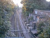
Tramlink runs on a mixture of street track shared with other traffic, dedicated track in public roads, and off-street track consisting of new rights-of-way, former railway lines, and one section of alignment, though not track, shared with a third rail
electrified Network Rail
line.
(LRT) put the project to Parliament and the Croydon Tramlink Act 1994 resulted which gave LRT the legal power to build and run Tramlink.
In 1996 Tramtrack Croydon Limited (TCL) won a 99 year Private Finance Initiative
(PFI) contract to design, build, operate and maintain the Tramlink system. Under this contract Tramtrack Croydon Ltd kept the revenue generated by Tramlink and LRT had to pay compensation to TCL for any changes to the fares and ticketing policy introduced later.
TCL subcontracted the operation of the tram system to CentreWest Buses, now part of First London
. TCL was a partnership comprising First Group, Bombardier Transportation
(the builders of the system's tramcars), Sir Robert McAlpine
and Amey Construction Ltd (who built the system), and Royal Bank of Scotland
and 3i
(who arranged the finances).
 There are three routes on the tram link, detailed in a later section: Route 1 – Elmers End to Croydon; Route 2 – Beckenham Junction to Croydon; and Route 3 – New Addington to Wimbledon.
Route 2 runs parallel to the Crystal Palace to Beckenham Junction line of the Southern
network between Birkbeck
and Beckenham Junction
, the National Rail
track had been singled some years earlier.
From Elmers End to Woodside route 1, and also route 2 from Arena, take part of the former British Rail
branch line to Addiscombe
then diverges to reach Addiscombe tram stop which is 500 metres west of the now demolished railway station. At Woodside, the old station buildings still stand disused, and the original platforms have been replaced by accessible low platforms.
From Woodside to near Sandilands (routes 1 & 2) and from near Sandilands almost to Lloyd Park (route 3) Tramlink follows the former Woodside and South Croydon Railway
, including the Park Hill (or Sandilands) tunnels.
The section of Route 3 between Wimbledon and West Croydon follows the old single-track British Rail
route for the most part, which was closed on 31 May 1997 so that it could be converted for Tramlink. Within this section, from near Phipps Bridge to near Reeves Corner, route 3 follows the Surrey Iron Railway
. This gives Tramlink a claim to the world's oldest aligned trackbed. beside Mitcham tram stop had its name long before Tramlink. A partial obstruction of the route near this point has necessitated the use of gauntlet track.
A Victorian footbridge beside Waddon New Road was dismantled to make way for the flyover that takes Tramlink over the West Croydon to Sutton railway line. The footbridge has been re-erected at Corfe Castle
station on the Swanage Railway
(although alternative evidence suggests that this was, in fact, a similar footbridge removed from the site of the former Merton Park Railway Station
.)
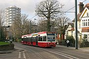
In October 2008 TfL introduced a new colour scheme to the vehicles, using the blue, white and green of the routes' symbol on TfL maps, to distinguish the trams from its buses operating in the area.
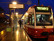
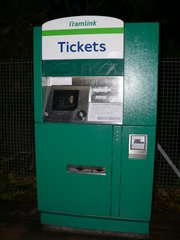
 The tram stops have low platforms, 35 cm (13.8 in) above rail level. Stops are un-staffed and have automated ticket machines for ticket sales. In general, access between the platforms involves crossing the tracks by pedestrian level crossing.
There are 39 tram stops, most being 32.2 m (105.6 ft) long. They are virtually level with the doors and are all wider than 2 m (6.6 ft). This allows for wheelchairs, prams, pushchairs and the elderly to board the tram easily with no steps. In street sections, the pavement is integrated with the tram stop.
Tramlink uses some former main-line stations on the Wimbledon–West Croydon and Elmers End–Coombe Road stretches of line that were taken over. The railway platforms have been demolished and rebuilt to Tramlink specifications, except at Elmers End and Wimbledon where the track level was raised to meet the higher platforms, to enable cross-platform interchange
.
Thirty eight stops opened as part of the phased introduction of tram services in May 2000. Centrale tram stop
in Tamworth Road opened on 10 December 2005, increasing journey times slightly. As turnround times are already quite tight this raised the issue of buying an extra tram to maintain punctuality. Partly for this reason, but also to take into account the planned restructuring of services (subsequently introduced in July 2006), TfL had issued tenders for a new tram. However, nothing resulted from this.
All stops have disabled access, raised paving, CCTV, a Passenger Help Point, a Passenger Information Display (PID), litter bins, a ticket machine, a noticeboard and lamp-posts, and most also have seats and a shelter.
The PIDs display the destination and expected arrival times of the next two trams. They can also display any message the controllers want to display, such as information on delays or even direct instructions to vandals to stop placing objects on the track.
, but is shown on the "London Connections" map. The original route structure was Line 1 Wimbledon
to Elmers End
, Line 2 Croydon to Beckenham Junction
, and Line 3 Croydon to New Addington
. On 23 July 2006 the route network was restructured, with route 1 from Elmers End to Croydon and route 2 from Beckenham Junction to Croydon, running every 10 minutes Monday – Saturday daytime, every 30 minutes at other times, and route 3 from New Addington to Wimbledon every 7.5 minutes Monday – Saturday daytime, every 15 minutes at other times.
Since being taken over by TfL all routes have a maximum service interval of fifteen minutes service during all operational hours.

) green.) However, the distinction is still made in practice, as trams from Elmers End on Route 1 change their numbers in central Croydon
to Route 2 (Beckenham Junction) and do the reverse when working in the other direction.
 As part of the TfL network, all TfL Bus Passes are valid on Tramlink – as are Travelcard
s that include any of zones 3, 4, 5 and 6.
Cash fares and pay-as-you-go Oyster Card
fares are the same as on London Buses
, although special fares may apply when using Tramlink feeder buses.
When using Oyster Cards, passengers must touch in on the platform before boarding the tram. Special arrangements apply at Wimbledon station
, where the Tramlink stop is located within the National Rail
and London Underground
station.
CR4000
trams built by Bombardier Transportation
in Vienna
. The trams are numbered beginning at 2530, continuing from the highest-numbered tram, number 2529 on London's former tram network
, which closed in 1952.
All trams have now been refurbished, including a repaint into a new livery.
, it was reported that four more trams were planned, and to avoid the extra costs of a short production run, Tramlink was seeking to lease these from Edinburgh Trams, where the construction of new track and depot is facing long delays, but the rolling stock was due for delivery from early in 2010. The Edinburgh Tram
will be manufactured by CAF
of Spain. To accommodate the extra capacity, some sections of single-track line may be doubled.
In January 2011 Tramtrack Croydon began tendering for the supply of an additional 10 new or second-hand trams for Tramlink to be supplied from the end of summer 2011. The trams will be used between Therapia Lane and Elmers End.
On 18 August 2011 TfL announced that Stadler Rail
had won a £16 million contract to supply six Variobahn
trams similar to vehicles used by Bybanen
in Bergen
, Norway. They are to enter service in spring 2012.
An initial review of potential Tramlink extensions has been prepared and discussed with interested parties. TfL now wishes to carry out initial development and evaluation work on the following routes:
Other extension proposals include Lewisham, Bromley town centre, Biggin Hill Airport/Village and a local spur/loop to penetrate further into Purley Way retail/industrial park.
Starting in the west, there are two corridors that suggest bringing Tramlink to Sutton town centre. The first of these, proposing operations principally between Wimbledon and Sutton, has been in view even before Tramlink opened. Indeed, presumptuously, the trams were delivered with destination displays for this as “line 4” already included on blind sets.
Tramlink route 4
, was the only extension being formally developed. The proposed route linked Harrington Road stop with Crystal Palace, and Crystal Palace directly with Beckenham Junction, both terminating at Crystal Palace Parade. There were three options on how to get to the Parade: on-street, off-street and a mixture of the two. Following recent consultation the off-street option is favoured, with trams running along existing railway as far as Crystal Palace Station
, and then running round the western edge of Crystal Palace Park (within the current park's perimeter) to the bus terminus near the parade. TfL have currently stated that due to lack of funding the plans for this extension will not be taken forward, but also say that they are committed to including new proposals for extensions to the tram as part of a future bid to Government.
The alignment is presently served by a number of busy bus services and if built, would give Tramlink patrons direct interchange with the Northern Line at Morden. A south-to-east curve may also be considered at Morden Road to permit direct operations that link St Helier to Mitcham and Croydon.
 To the north and south of Croydon are some busy bus corridors, which themselves derive from earlier tram routes. These include the Purley
– Croydon – Streatham
corridor, which is proposed for conversion to tram operation.
To the south of Croydon, the proposal is for the new route to diverge from the existing central Croydon loop and use a highway alignment, probably using South End and Brighton Road, to Purley. Beyond Purley, an extension to Coulsdon
will be investigated. As this would be close to the M23 motorway
, a possibility would be the construction of a park and ride
site. However, finding a good alignment will be more difficult south of Purley, where Brighton Road carries the heavy traffic of the A23 trunk road
.
To the north of Croydon, it is again proposed to use a highway alignment based on London Road. To the south of Thornton Heath Pond, the use of a shared carriageway is a possibility. North of this point, the road becomes the A23 again, but there are likely to be some opportunities for trambaan type segregation to Norbury
and between Norbury and Streatham, although Norbury itself is a pinch point. The proposal is to terminate the line at Streatham railway station
, providing an interchange to the extended East London Line
.
, Bromley
town centre, Lewisham
, and Purley Way
. If initial examination shows promise, further work could follow to firm up more detailed routings for these proposals.
news reader (and tram enthusiast) Nicholas Owen. The Announcer system is as follows: This tram is for Wimbledon, The next stop will be Merton Park
South London
South London is the southern part of London, England, United Kingdom.According to the 2011 official Boundary Commission for England definition, South London includes the London boroughs of Bexley, Bromley, Croydon, Greenwich, Kingston, Lambeth, Lewisham, Merton, Southwark, Sutton and...
in the United Kingdom which began operation in May 2000. The service is operated by London Tramlink
London Tramlink
London Tramlink is an arm of Transport for London, which manages the second generation of tram services within London, UK. Current and planned tram systems are:*Tramlink operates a three-route system in the area of South London around Croydon...
, part of Transport for London
Transport for London
Transport for London is the local government body responsible for most aspects of the transport system in Greater London in England. Its role is to implement the transport strategy and to manage transport services across London...
(TfL).
Tramlink serves seven National Rail
National Rail
National Rail is a title used by the Association of Train Operating Companies as a generic term to define the passenger rail services operated in Great Britain...
stations but has only one interchange with the London Underground
London Underground
The London Underground is a rapid transit system serving a large part of Greater London and some parts of Buckinghamshire, Hertfordshire and Essex in England...
(at Wimbledon station
Wimbledon station
Wimbledon station is a National Rail, London Underground, and Tramlink station located in Wimbledon in the London Borough of Merton, and is the only London station that provides an interchange between rail, Underground, and Tramlink services...
for the District Line
District Line
The District line is a line of the London Underground, coloured green on the Tube map. It is a "sub-surface" line, running through the central area in shallow cut-and-cover tunnels. It is the busiest of the sub-surface lines. Out of the 60 stations served, 25 are underground...
) and one with London Overground
London Overground
London Overground is a suburban rail network in London and Hertfordshire. It has been operated by London Overground Rail Operations since 2007 as part of the National Rail network, under the franchise control and branding of Transport for London...
(at West Croydon
West Croydon station
West Croydon station is a transport interchange for National Rail and Tramlink services, as well as London Buses. It is in the London Borough of Croydon and Travelcard Zone 5...
for the East London Line
East London Line
The East London Line is a London Overground line which runs north to south through the East End, Docklands and South areas of London.Built in 1869 by the East London Railway Company, which reused the Thames Tunnel, originally intended for horse-drawn carriages, the line became part of the London...
); one of the factors leading to its creation was that the area around Croydon
London Borough of Croydon
The London Borough of Croydon is a London borough in South London, England and is part of Outer London. It covers an area of and is the largest London borough by population. It is the southernmost borough of London. At its centre is the historic town of Croydon from which the borough takes its name...
has no Underground service.
Tramlink runs on a mixture of street track shared with other traffic, dedicated track in public roads, and off-street track consisting of new rights-of-way, former railway lines, and one section of alignment, though not track, shared with a third rail
Third rail
A third rail is a method of providing electric power to a railway train, through a semi-continuous rigid conductor placed alongside or between the rails of a railway track. It is used typically in a mass transit or rapid transit system, which has alignments in its own corridors, fully or almost...
electrified Network Rail
Network Rail
Network Rail is the government-created owner and operator of most of the rail infrastructure in Great Britain .; it is not responsible for railway infrastructure in Northern Ireland...
line.
Construction
In 1990 Croydon Council with the then London Regional TransportLondon Regional Transport
London Regional Transport was the organisation responsible for the public transport network in Greater London, UK from 1984-2000. In common with all London transport authorities from 1933 to 2000, the public name and operational brand of the organisation was London Transport.The organisation was...
(LRT) put the project to Parliament and the Croydon Tramlink Act 1994 resulted which gave LRT the legal power to build and run Tramlink.
In 1996 Tramtrack Croydon Limited (TCL) won a 99 year Private Finance Initiative
Private Finance Initiative
The private finance initiative is a way of creating "public–private partnerships" by funding public infrastructure projects with private capital...
(PFI) contract to design, build, operate and maintain the Tramlink system. Under this contract Tramtrack Croydon Ltd kept the revenue generated by Tramlink and LRT had to pay compensation to TCL for any changes to the fares and ticketing policy introduced later.
TCL subcontracted the operation of the tram system to CentreWest Buses, now part of First London
First London
.First London is one of many operators of London Buses and owned by First Group. They did also run the Tramlink network, in a partnership with Tramtrack Croydon before June 2008. Their registered office is at Paddington station in London...
. TCL was a partnership comprising First Group, Bombardier Transportation
Bombardier Transportation
Bombardier Transportation is the rail equipment division of the Canadian firm, Bombardier Inc. Bombardier Transportation is one of the world's largest companies in the rail-equipment manufacturing and servicing industry. Its headquarters are in Berlin, Germany....
(the builders of the system's tramcars), Sir Robert McAlpine
Sir Robert McAlpine
Sir Robert McAlpine Ltd. is a private British company headquartered in London. It carries out engineering and construction for the oil and gas, petrochemical, power generation, nuclear, pharmaceutical, defence, chemical, water and mining industries.-History:...
and Amey Construction Ltd (who built the system), and Royal Bank of Scotland
Royal Bank of Scotland
The Royal Bank of Scotland Group is a British banking and insurance holding company in which the UK Government holds an 84% stake. This stake is held and managed through UK Financial Investments Limited, whose voting rights are limited to 75% in order for the bank to retain its listing on the...
and 3i
3i
3i Group plc is a multinational private equity and venture capital company headquartered in London, United Kingdom. It has offices in 13 countries across Asia, Europe and the Americas and had total assets under management of £12.7 billion as at 31 March 2011...
(who arranged the finances).
Former lines re-used
Route 2 runs parallel to the Crystal Palace to Beckenham Junction line of the Southern
Southern (train operating company)
Southern is a train operating company in the United Kingdom. Officially named Southern Railway Ltd., it is a subsidiary of Govia, a joint venture between transport groups Go-Ahead Group and Keolis, and has operated the South Central rail franchise since October 2000 and the Gatwick Express service...
network between Birkbeck
Birkbeck station
Birkbeck station is a railway station and light rail stop in the London Borough of Bromley in the southern suburbs of London. It is located on Elmers End Road and alongside Beckenham Crematorium.- Network rail :...
and Beckenham Junction
Beckenham Junction station
Beckenham Junction is a railway station and a tram terminus in Beckenham, south east London. It is in the London Borough of Bromley and Travelcard Zone 4, 8.6 miles from London Victoria....
, the National Rail
National Rail
National Rail is a title used by the Association of Train Operating Companies as a generic term to define the passenger rail services operated in Great Britain...
track had been singled some years earlier.
From Elmers End to Woodside route 1, and also route 2 from Arena, take part of the former British Rail
British Rail
British Railways , which from 1965 traded as British Rail, was the operator of most of the rail transport in Great Britain between 1948 and 1997. It was formed from the nationalisation of the "Big Four" British railway companies and lasted until the gradual privatisation of British Rail, in stages...
branch line to Addiscombe
Addiscombe railway station
Addiscombe was a terminus station in the district of Addiscombe . It was on Lower Addiscombe Road between Hastings Road and Grant Road. The East India Way housing development now stands on the site....
then diverges to reach Addiscombe tram stop which is 500 metres west of the now demolished railway station. At Woodside, the old station buildings still stand disused, and the original platforms have been replaced by accessible low platforms.
From Woodside to near Sandilands (routes 1 & 2) and from near Sandilands almost to Lloyd Park (route 3) Tramlink follows the former Woodside and South Croydon Railway
Woodside and South Croydon Railway
The Woodside and South Croydon Joint Railway was a short, relatively short-lived and unsuccessful railway in the London Borough of Croydon in London, England. Its site is now largely occupied by Tramlink.- Route :- History :...
, including the Park Hill (or Sandilands) tunnels.
The section of Route 3 between Wimbledon and West Croydon follows the old single-track British Rail
British Rail
British Railways , which from 1965 traded as British Rail, was the operator of most of the rail transport in Great Britain between 1948 and 1997. It was formed from the nationalisation of the "Big Four" British railway companies and lasted until the gradual privatisation of British Rail, in stages...
route for the most part, which was closed on 31 May 1997 so that it could be converted for Tramlink. Within this section, from near Phipps Bridge to near Reeves Corner, route 3 follows the Surrey Iron Railway
Surrey Iron Railway
The Surrey Iron Railway was a horse drawn plateway whose width approximated to a standard gauge railway that linked the former Surrey towns of Wandsworth and Croydon via Mitcham...
. This gives Tramlink a claim to the world's oldest aligned trackbed. beside Mitcham tram stop had its name long before Tramlink. A partial obstruction of the route near this point has necessitated the use of gauntlet track.
A Victorian footbridge beside Waddon New Road was dismantled to make way for the flyover that takes Tramlink over the West Croydon to Sutton railway line. The footbridge has been re-erected at Corfe Castle
Corfe Castle railway station
Corfe Castle railway station is a railway station located in the village of Corfe Castle, in the English county of Dorset. Originally an intermediate station on the London and South Western Railway branch line from Wareham to Swanage, the line and station were closed by British Rail in 1972...
station on the Swanage Railway
Swanage Railway
The Swanage Railway is a long heritage railway in the Purbeck district of Dorset, England. The railway follows the route of the Purbeck branch line between Norden railway station, Corfe Castle railway station, Harman's Cross railway station, Herston Halt railway station and Swanage...
(although alternative evidence suggests that this was, in fact, a similar footbridge removed from the site of the former Merton Park Railway Station
Merton Park railway station
Merton Park railway station was a railway station in Merton, Surrey , serving both the West Croydon to Wimbledon Line and the Tooting, Merton and Wimbledon Railway...
.)
Buyout by Transport for London
In March 2008 TfL announced that it had reached agreement to buy Tramtrack Croydon Limited (TCL) for £98m. The purchase was finalised on 28 June 2008. The background to this purchase relates to the requirement that TfL (who took over from London Regional Transport in 2000) compensates TCL for the consequences of any changes to the fares and ticketing policy introduced since 1996. In 2007 that payment was £4m, with an annual increase in rate.In October 2008 TfL introduced a new colour scheme to the vehicles, using the blue, white and green of the routes' symbol on TfL maps, to distinguish the trams from its buses operating in the area.
Stops
There are 39 tram stops, most being 32.2 m (105.6 ft) long. They are virtually level with the doors and are all wider than 2 m (6.6 ft). This allows for wheelchairs, prams, pushchairs and the elderly to board the tram easily with no steps. In street sections, the pavement is integrated with the tram stop.
Tramlink uses some former main-line stations on the Wimbledon–West Croydon and Elmers End–Coombe Road stretches of line that were taken over. The railway platforms have been demolished and rebuilt to Tramlink specifications, except at Elmers End and Wimbledon where the track level was raised to meet the higher platforms, to enable cross-platform interchange
Cross-platform interchange
A cross-platform interchange is a type of interchange between different lines in a metro system. The term originates with the London Underground; such layouts exist in other networks but are not commonly so named...
.
Thirty eight stops opened as part of the phased introduction of tram services in May 2000. Centrale tram stop
Centrale tram stop
Centrale tram stop is a halt on the Tramlink service in Croydon town centre, serving the Centrale shopping centre. The tram stop was provided and paid for as part of the development of the shopping centre....
in Tamworth Road opened on 10 December 2005, increasing journey times slightly. As turnround times are already quite tight this raised the issue of buying an extra tram to maintain punctuality. Partly for this reason, but also to take into account the planned restructuring of services (subsequently introduced in July 2006), TfL had issued tenders for a new tram. However, nothing resulted from this.
All stops have disabled access, raised paving, CCTV, a Passenger Help Point, a Passenger Information Display (PID), litter bins, a ticket machine, a noticeboard and lamp-posts, and most also have seats and a shelter.
The PIDs display the destination and expected arrival times of the next two trams. They can also display any message the controllers want to display, such as information on delays or even direct instructions to vandals to stop placing objects on the track.
Routes
Tramlink is not shown on the standard tube mapTube map
The Tube map is a schematic transit map representing the lines and stations of London's rapid transit railway systems, namely the London Underground , the Docklands Light Railway and London Overground....
, but is shown on the "London Connections" map. The original route structure was Line 1 Wimbledon
Wimbledon station
Wimbledon station is a National Rail, London Underground, and Tramlink station located in Wimbledon in the London Borough of Merton, and is the only London station that provides an interchange between rail, Underground, and Tramlink services...
to Elmers End
Elmers End station
Elmers End station is a railway station and tram terminus in Elmers End, South London, England. It is in the London Borough of Bromley, and Travelcard Zone 4 south of London Charing Cross....
, Line 2 Croydon to Beckenham Junction
Beckenham Junction station
Beckenham Junction is a railway station and a tram terminus in Beckenham, south east London. It is in the London Borough of Bromley and Travelcard Zone 4, 8.6 miles from London Victoria....
, and Line 3 Croydon to New Addington
New Addington tram stop
New Addington is a terminal tram stop serving New Addington, in the London Borough of Croydon, in the southern suburbs of London. The tram stop is served by Tramlink route 3, which connects New Addington with Wimbledon via central Croydon.-Connections:...
. On 23 July 2006 the route network was restructured, with route 1 from Elmers End to Croydon and route 2 from Beckenham Junction to Croydon, running every 10 minutes Monday – Saturday daytime, every 30 minutes at other times, and route 3 from New Addington to Wimbledon every 7.5 minutes Monday – Saturday daytime, every 15 minutes at other times.
Since being taken over by TfL all routes have a maximum service interval of fifteen minutes service during all operational hours.
Then to East Croydon and back as Route 2 to Beckenham Junction |
Route 2 >lime)
Then to East Croydon and back as Route 1 to Elmers End |
Route 3 >green)
Then back to Wandle Park
Then to East Croydon and back to New Addington |
Change in Route Colours
When Transport for London took over operation and ownership a new network map was designed, combining Routes 1 and 2 as one service, coloured "Trams Green" (lime). (Originally, Line 1 was coloured yellow, Line 2 was red, and Line 3 was a darker (District lineDistrict Line
The District line is a line of the London Underground, coloured green on the Tube map. It is a "sub-surface" line, running through the central area in shallow cut-and-cover tunnels. It is the busiest of the sub-surface lines. Out of the 60 stations served, 25 are underground...
) green.) However, the distinction is still made in practice, as trams from Elmers End on Route 1 change their numbers in central Croydon
Croydon
Croydon is a town in South London, England, located within the London Borough of Croydon to which it gives its name. It is situated south of Charing Cross...
to Route 2 (Beckenham Junction) and do the reverse when working in the other direction.
Fares and ticketing
Travelcard
The Travelcard is an inter-modal travel ticket for unlimited use on the London Underground, London Overground, Docklands Light Railway, Tramlink, London Buses and National Rail services in the Greater London area. Travelcards can be purchased for a period of time varying from one day to a year,...
s that include any of zones 3, 4, 5 and 6.
Cash fares and pay-as-you-go Oyster Card
Oyster card
The Oyster card is a form of electronic ticketing used on public transport services within the Greater London area of the United Kingdom. It is promoted by Transport for London and is valid on a number of different travel systems across London including London Underground, buses, the Docklands...
fares are the same as on London Buses
London Buses
London Buses is the subsidiary of Transport for London that manages bus services within Greater London, UK. Buses are required to carry similar red colour schemes and conform to the same fare scheme...
, although special fares may apply when using Tramlink feeder buses.
When using Oyster Cards, passengers must touch in on the platform before boarding the tram. Special arrangements apply at Wimbledon station
Wimbledon station
Wimbledon station is a National Rail, London Underground, and Tramlink station located in Wimbledon in the London Borough of Merton, and is the only London station that provides an interchange between rail, Underground, and Tramlink services...
, where the Tramlink stop is located within the National Rail
National Rail
National Rail is a title used by the Association of Train Operating Companies as a generic term to define the passenger rail services operated in Great Britain...
and London Underground
London Underground
The London Underground is a rapid transit system serving a large part of Greater London and some parts of Buckinghamshire, Hertfordshire and Essex in England...
station.
Rolling stock
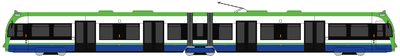
Tramlink is operated with 24 articulated low floor Flexity SwiftFlexity Swift
The Flexity Swift tram is a family of urban and inter-urban light-rail vehicles manufactured by Bombardier Transportation for a wide number of customers across Europe...
CR4000
CR4000
The CR4000 is a 76% low floor model of Flexity Swift tram built by Bombardier Transportation in Bautzen and Vienna between 1998 and 2000 and operated by London Tramlink.-The CR4000:...
trams built by Bombardier Transportation
Bombardier Transportation
Bombardier Transportation is the rail equipment division of the Canadian firm, Bombardier Inc. Bombardier Transportation is one of the world's largest companies in the rail-equipment manufacturing and servicing industry. Its headquarters are in Berlin, Germany....
in Vienna
Vienna
Vienna is the capital and largest city of the Republic of Austria and one of the nine states of Austria. Vienna is Austria's primary city, with a population of about 1.723 million , and is by far the largest city in Austria, as well as its cultural, economic, and political centre...
. The trams are numbered beginning at 2530, continuing from the highest-numbered tram, number 2529 on London's former tram network
Trams in London
There have been two separate generations of trams in London, from 1860 to 1952 and from 2000. Between 1952 and 2000, no trams ran at all in London.- Horse trams :...
, which closed in 1952.
All trams have now been refurbished, including a repaint into a new livery.
, it was reported that four more trams were planned, and to avoid the extra costs of a short production run, Tramlink was seeking to lease these from Edinburgh Trams, where the construction of new track and depot is facing long delays, but the rolling stock was due for delivery from early in 2010. The Edinburgh Tram
Edinburgh Tram (vehicle)
The Edinburgh Tram is a bespoke fleet of 27 trams built by Construcciones y Auxiliar de Ferrocarriles, better known as CAF of Beasain, in the Basque country of Spain between 2009 and 2011 for use on the future Edinburgh Tram line in Edinburgh, Scotland....
will be manufactured by CAF
Construcciones y Auxiliar de Ferrocarriles
Construcciones y Auxiliar de Ferrocarriles is a rail equipment manufacturer based in Beasain in the Basque Country, Spain. Equipment manufactured by CAF includes light rail vehicles, rapid transit trains, railroad cars and locomotives, as well as variable gauge axles that can be fitted on any...
of Spain. To accommodate the extra capacity, some sections of single-track line may be doubled.
In January 2011 Tramtrack Croydon began tendering for the supply of an additional 10 new or second-hand trams for Tramlink to be supplied from the end of summer 2011. The trams will be used between Therapia Lane and Elmers End.
On 18 August 2011 TfL announced that Stadler Rail
Stadler Rail
Stadler Rail AG , based in Bussnang, Switzerland, is a Swiss manufacturer of rail passenger cars.In 1942 Ernst Stadler founded the Stadler Engineering Office which later became Stadler Rail.- Factories :...
had won a £16 million contract to supply six Variobahn
Variotram
Variotram is a German-designed articulated low-floor tram model. Since its introduction in 1993, the Variotram has been manufactured variously by ABB, Adtranz, Bombardier Transportation, and since 2001 by Stadler Rail. As of 2009, 254 trams have been ordered, with an additional 110 on option...
trams similar to vehicles used by Bybanen
Bergen Light Rail
Bergen Light Rail is a light rail system in Bergen, Norway. The first stage of the project is a fifteen-station, stretch between the city center and Nesttun, which opened on 22 June 2010...
in Bergen
Bergen
Bergen is the second largest city in Norway with a population of as of , . Bergen is the administrative centre of Hordaland county. Greater Bergen or Bergen Metropolitan Area as defined by Statistics Norway, has a population of as of , ....
, Norway. They are to enter service in spring 2012.
| Class | Image | Top speed | Number | Built | |
|---|---|---|---|---|---|
| mph | km/h | ||||
| CR4000 CR4000 The CR4000 is a 76% low floor model of Flexity Swift tram built by Bombardier Transportation in Bautzen and Vienna between 1998 and 2000 and operated by London Tramlink.-The CR4000:... |
50 | 80 | 24 | 1998–2000 | |
| Variobahn Variotram Variotram is a German-designed articulated low-floor tram model. Since its introduction in 1993, the Variotram has been manufactured variously by ABB, Adtranz, Bombardier Transportation, and since 2001 by Stadler Rail. As of 2009, 254 trams have been ordered, with an additional 110 on option... |
50 | 80 | 6 | 2011-2012 |
Projected extensions
The Mayor's Transport Strategy for London states that extensions to the Tramlink network could be developed at relatively modest cost where there is potential demand from existing and new development to support concentrated passenger movements, and where Tramlink technology might be cost effective. Proposal 4D7 says that "The Mayor will explore the potential for extending the Tramlink network where doing so could help meet the objectives of the Transport Strategy cost effectively" and sought initial views on the viability of a number of extensions by summer 2002.An initial review of potential Tramlink extensions has been prepared and discussed with interested parties. TfL now wishes to carry out initial development and evaluation work on the following routes:
| Extension | Route | |
|---|---|---|
| Sutton Town Centre/Station Sutton, London Sutton is a large suburban town in southwest London, England, and the administrative headquarters of the London Borough of Sutton. It is located south-southwest of Charing Cross and is one of the major metropolitan centres identified in the London Plan. The town was connected to central London by... – Wimbledon Wimbledon, London Wimbledon is a district in the south west area of London, England, located south of Wandsworth, and east of Kingston upon Thames. It is situated within Greater London. It is home to the Wimbledon Tennis Championships and New Wimbledon Theatre, and contains Wimbledon Common, one of the largest areas... |
Through St Helier St. Helier, London St. Helier is a residential estate in the London boroughs of Merton and Sutton. The portion of the estate north of Green Lane and Bishopsford Road is in Merton, the rest is in Sutton.-History:... , Morden Morden Morden is a district in the London Borough of Merton. It is located approximately South-southwest of central London between Merton Park , Mitcham , Sutton and Worcester Park .- Origin of name :... and Morden Road Morden Road tram stop Morden Road tram stop is a stop on the Tramlink service in the London Borough of Merton. It is on the site of the former Morden Road railway station on the Wimbledon-West Croydon line, which closed to heavy rail traffic in 1997.... (including via St. Helier Hospital St. Helier Hospital St Helier Hospital is a hospital in the London Borough of Sutton. It is owned and run by Epsom and St Helier University Hospitals NHS Trust.... and direct routes and routing variants within Sutton Town Centre) |
|
| Sutton Sutton, London Sutton is a large suburban town in southwest London, England, and the administrative headquarters of the London Borough of Sutton. It is located south-southwest of Charing Cross and is one of the major metropolitan centres identified in the London Plan. The town was connected to central London by... – Tooting Tooting Tooting is a district in south London, England, located in the London Borough of Wandsworth. It is situated south south-west of Charing Cross. The area is identified in the London Plan as one of 35 major centres in Greater London.-History:... |
Through St Helier St. Helier, London St. Helier is a residential estate in the London boroughs of Merton and Sutton. The portion of the estate north of Green Lane and Bishopsford Road is in Merton, the rest is in Sutton.-History:... and Mitcham Mitcham Mitcham is a district in the south west area of London, in the London Borough of Merton. A suburban area, Mitcham is located on the border of Inner London and Outer London. It is both residentially and financially developed, well served by Transport for London, and home to Mitcham Town Centre,... (including routing variants via Mitcham Junction and direct) |
|
| Mitcham Junction – Mitcham town centre Mitcham Mitcham is a district in the south west area of London, in the London Borough of Merton. A suburban area, Mitcham is located on the border of Inner London and Outer London. It is both residentially and financially developed, well served by Transport for London, and home to Mitcham Town Centre,... |
Through Mitcham Common Mitcham Common Mitcham Common or Seven Islands is 182 hectares of common land situated in South London. It is predominantly in the London borough of Merton, with parts straddling the borders with Sutton and Croydon.- History :... |
|
| Central Croydon Croydon Croydon is a town in South London, England, located within the London Borough of Croydon to which it gives its name. It is situated south of Charing Cross... – Coulsdon Coulsdon Coulsdon is a town on the southernmost boundary of the London Borough of Croydon. It is surrounded by the Metropolitan Green Belt of the Farthing Down, Coulsdon Common and Kenley Common... |
Through Purley/Purley Station Purley, London Purley is a place in the London Borough of Croydon, England. It is a suburban development situated 11.7 miles south of Charing Cross.The name derives from "pirlea", which means 'Peartree lea'. Purley has a population of about 72,000.... and could involve a Park and Ride Park and ride Park and ride facilities are car parks with connections to public transport that allow commuters and other people wishing to travel into city centres to leave their vehicles and transfer to a bus, rail system , or carpool for the rest of their trip... scheme |
|
| Central Croydon Croydon Croydon is a town in South London, England, located within the London Borough of Croydon to which it gives its name. It is situated south of Charing Cross... – Brixton Brixton Brixton is a district in the London Borough of Lambeth in south London, England. It is south south-east of Charing Cross. The area is identified in the London Plan as one of 35 major centres in Greater London.... |
Through Thornton Heath Thornton Heath Thornton Heath is a district of south London, England, in the London Borough of Croydon. It is situated south-southeast of Charing Cross.-Geography:... , Norbury Norbury Norbury is a town in the London Borough of Croydon, also crossing the London Borough of Merton. It shares the postcode London SW16 with nearby Streatham. Norbury is south of Charing Cross.-History:... , Streatham Streatham Streatham is a district in Surrey, England, located in the London Borough of Lambeth. It is situated south of Charing Cross. The area is identified in the London Plan as one of 35 major centres in Greater London.-History:... and Streatham Hill as well as past Mayday Hospital Mayday University Hospital Croydon University Hospital, formerly Mayday Hospital is a large NHS hospital in the borough of Croydon in south London, England, and is in the administrative area of NHS Croydon - Croydon Primary Care Trust. It is administratively a part of Croydon Health Services. It is a teaching hospital.It is... |
|
| Harrington Road/Beckenham Junction Beckenham Junction station Beckenham Junction is a railway station and a tram terminus in Beckenham, south east London. It is in the London Borough of Bromley and Travelcard Zone 4, 8.6 miles from London Victoria.... – Crystal Palace Crystal Palace, London Crystal Palace is a residential area in south London, England named from the former local landmark, The Crystal Palace, which occupied the area from 1854 to 1936. The area is located approximately 8 miles south east of Charing Cross, and offers impressive views over the capital... |
Various route options including (below) | |
- from Harrington Road and Birkbeck
- Crystal PalaceCrystal Palace, LondonCrystal Palace is a residential area in south London, England named from the former local landmark, The Crystal Palace, which occupied the area from 1854 to 1936. The area is located approximately 8 miles south east of Charing Cross, and offers impressive views over the capital...
- Crystal Palace
- from Church Street and Wellesey Road
- South CroydonSouth CroydonSouth Croydon is a locality in Greater London, the area surrounding the valley south of central Croydon about 1 km in radius, centred on the Red Deer public house on the Brighton Road. It is part of the South Croydon post town and in the London Borough of Croydon...
- PurleyPurley, LondonPurley is a place in the London Borough of Croydon, England. It is a suburban development situated 11.7 miles south of Charing Cross.The name derives from "pirlea", which means 'Peartree lea'. Purley has a population of about 72,000....
- South Croydon
- from Reeves Corner and West Croydon
- Thornton Heath Pond
- Norbury
- StreathamStreathamStreatham is a district in Surrey, England, located in the London Borough of Lambeth. It is situated south of Charing Cross. The area is identified in the London Plan as one of 35 major centres in Greater London.-History:...
(connection with Thameslink) - Streatham Hill (connection with SouthernSouthern (train operating company)Southern is a train operating company in the United Kingdom. Officially named Southern Railway Ltd., it is a subsidiary of Govia, a joint venture between transport groups Go-Ahead Group and Keolis, and has operated the South Central rail franchise since October 2000 and the Gatwick Express service...
) - BrixtonBrixton tube stationBrixton tube station, a station on the London Underground opened on July 23, 1971, is the southern terminus of the Victoria line.It is located in Brixton Road, and is about 100m from Brixton railway station . From the ticket hall, three escalators take passengers to and from the platforms...
(connection with Victoria LineVictoria LineThe Victoria line is a deep-level London Underground line running from the south to the north-east of London. It is coloured light blue on the Tube map...
)
- from Wimbledon (follows Thameslink to Sutton)
- Wimbledon ChaseWimbledon Chase railway stationWimbledon Chase railway station is in the London Borough of Merton in South London. The station is served by First Capital Connect trains, and is on the Thameslink loop...
- South MertonSouth Merton railway stationSouth Merton railway station is in the London Borough of Merton in South London. The station is served by First Capital Connect trains, and is on the Thameslink loop. It is in Travelcard Zone 4.-History:...
- Morden SouthMorden South railway stationMorden South railway station is in Morden in the London Borough of Merton. The station is served by First Capital Connect trains, and is on the Thameslink loop...
- St Helier
- Sutton CommonSutton Common railway stationSutton Common railway station is in the London Borough of Sutton in South London. The station is served by First Capital Connect trains, and is on the Thameslink loop. It is in Travelcard Zone 4.-History:...
- West SuttonWest Sutton railway stationWest Sutton railway station is in the London Borough of Sutton in South London. The station is served by First Capital Connect trains, and is on the Thameslink loop. It is in Travelcard Zone 5.-History:...
- SuttonSutton, LondonSutton is a large suburban town in southwest London, England, and the administrative headquarters of the London Borough of Sutton. It is located south-southwest of Charing Cross and is one of the major metropolitan centres identified in the London Plan. The town was connected to central London by...
- Mitcham (intersection at current stop)
- TootingTootingTooting is a district in south London, England, located in the London Borough of Wandsworth. It is situated south south-west of Charing Cross. The area is identified in the London Plan as one of 35 major centres in Greater London.-History:...
(connection with Thameslink) - Tooting BroadwayTooting Broadway tube stationTooting Broadway is a London Underground station in Tooting, South London. The station is on the Northern Line, between and stations. It is located on the corner of Tooting High Street and Mitcham Road...
(connection with Northern lineNorthern LineThe Northern line is a London Underground line. It is coloured black on the Tube map.For most of its length it is a deep-level tube line. The line carries 206,734,000 passengers per year. This is the highest number of any line on the London Underground system, but the Northern line is unique in...
)
- Wimbledon Chase
Other extension proposals include Lewisham, Bromley town centre, Biggin Hill Airport/Village and a local spur/loop to penetrate further into Purley Way retail/industrial park.
Starting in the west, there are two corridors that suggest bringing Tramlink to Sutton town centre. The first of these, proposing operations principally between Wimbledon and Sutton, has been in view even before Tramlink opened. Indeed, presumptuously, the trams were delivered with destination displays for this as “line 4” already included on blind sets.
Extension D / Route 4
Then back to Penge Road
Then to East Croydon and back to Beckenham Junction or Crystal Palace |
Tramlink route 4
Tramlink route 4
Tramlink route 4 is a tram route which will be operated as part of the Tramlink network in south London. The route will be operated by Transport for London .- Background :This is currently the only extension being developed and built...
, was the only extension being formally developed. The proposed route linked Harrington Road stop with Crystal Palace, and Crystal Palace directly with Beckenham Junction, both terminating at Crystal Palace Parade. There were three options on how to get to the Parade: on-street, off-street and a mixture of the two. Following recent consultation the off-street option is favoured, with trams running along existing railway as far as Crystal Palace Station
Crystal Palace railway station
Crystal Palace railway station is in the London Borough of Bromley in south London. It is located in the Anerley area between the town centres of Crystal Palace and Penge...
, and then running round the western edge of Crystal Palace Park (within the current park's perimeter) to the bus terminus near the parade. TfL have currently stated that due to lack of funding the plans for this extension will not be taken forward, but also say that they are committed to including new proposals for extensions to the tram as part of a future bid to Government.
Extension A
The Sutton to Wimbledon proposal utilises the existing Tramlink infrastructure between Wimbledon and Morden Road stop. The cramped tram terminus inside Wimbledon station is barely adequate for its present function. If another service is to arrive at Wimbledon a new terminus will need to be created. Diverging from the present Croydon route the Sutton line might adopt segregated alignment within the highway along Morden Road, serving Morden station interchange. It would probably use Aberconway Road to reach Morden Hall Road before using the spacious St Helier Avenue as the direct route to St Helier, Rose Hill. St Helier Hospital is an important local traffic objective that Tramlink ought to serve, despite the need to deviate from the direct route into Sutton via Angel Hill. A number of variants in Sutton Town centre are to be examined to see how the shopping centre, station and office complex can be accessed.The alignment is presently served by a number of busy bus services and if built, would give Tramlink patrons direct interchange with the Northern Line at Morden. A south-to-east curve may also be considered at Morden Road to permit direct operations that link St Helier to Mitcham and Croydon.
Extension B
The other Sutton proposal – to Tooting – is more ambitious and undoubtedly contains many more challenges than Sutton/Wimbledon link. Apart from workshop/depot facilities and a curve required to link the line into the existing system, this extension would share no infrastructure with the existing Tramlink. Were “line 4” to be realised ahead of this proposal, the Tooting line would of course then have the St Helier to Sutton section in common. North of St Helier, the alignment is likely to fit across parkland and open space to take in the Willow Lane Industrial Estate before serving Mitcham town centre. Some commonality would be enjoyed here with the short separate proposal to provide a spur from Mitcham Junction to Mitcham town centre. From here, the Tooting projection would seek to use the pedestrianised town centre section before sharing carriageway with all traffic in the part of London Road south of Figge’s Marsh, with room for segregation beyond the junction with Streatham Road. The most difficult leg arises immediately the Merton/Wandsworth boundary is crossed and the most effective way of reaching Tooting Broadway from this point will stir much debate.North and south from Croydon
Purley, London
Purley is a place in the London Borough of Croydon, England. It is a suburban development situated 11.7 miles south of Charing Cross.The name derives from "pirlea", which means 'Peartree lea'. Purley has a population of about 72,000....
– Croydon – Streatham
Streatham
Streatham is a district in Surrey, England, located in the London Borough of Lambeth. It is situated south of Charing Cross. The area is identified in the London Plan as one of 35 major centres in Greater London.-History:...
corridor, which is proposed for conversion to tram operation.
To the south of Croydon, the proposal is for the new route to diverge from the existing central Croydon loop and use a highway alignment, probably using South End and Brighton Road, to Purley. Beyond Purley, an extension to Coulsdon
Coulsdon
Coulsdon is a town on the southernmost boundary of the London Borough of Croydon. It is surrounded by the Metropolitan Green Belt of the Farthing Down, Coulsdon Common and Kenley Common...
will be investigated. As this would be close to the M23 motorway
M23 motorway
The M23 motorway is a motorway in England. The motorway runs from south of Hooley in Surrey, where it splits from the A23, to Pease Pottage, south of Crawley in West Sussex where it rejoins the A23. The northern end of the motorway starts at junction 7 on what is effectively a spur north from...
, a possibility would be the construction of a park and ride
Park and ride
Park and ride facilities are car parks with connections to public transport that allow commuters and other people wishing to travel into city centres to leave their vehicles and transfer to a bus, rail system , or carpool for the rest of their trip...
site. However, finding a good alignment will be more difficult south of Purley, where Brighton Road carries the heavy traffic of the A23 trunk road
A23 road
The A23 road is a major road in the United Kingdom between London and Brighton, East Sussex. It became an arterial route following the construction of Westminster Bridge in 1750 and the consequent improvement of roads leading to the bridge south of the river by the Turnpike Trusts...
.
To the north of Croydon, it is again proposed to use a highway alignment based on London Road. To the south of Thornton Heath Pond, the use of a shared carriageway is a possibility. North of this point, the road becomes the A23 again, but there are likely to be some opportunities for trambaan type segregation to Norbury
Norbury
Norbury is a town in the London Borough of Croydon, also crossing the London Borough of Merton. It shares the postcode London SW16 with nearby Streatham. Norbury is south of Charing Cross.-History:...
and between Norbury and Streatham, although Norbury itself is a pinch point. The proposal is to terminate the line at Streatham railway station
Streatham railway station
Streatham railway station is a station in central Streatham in south London. It is off Streatham High Road, and is in Travelcard Zone 3.Services are provided by First Capital Connect and Southern. First Capital Connect services go north to Luton and Bedford via Blackfriars, the City and St Pancras,...
, providing an interchange to the extended East London Line
East London Line
The East London Line is a London Overground line which runs north to south through the East End, Docklands and South areas of London.Built in 1869 by the East London Railway Company, which reused the Thames Tunnel, originally intended for horse-drawn carriages, the line became part of the London...
.
Other extensions
Work currently commissioned will also check out proposals to extend Tramlink to Biggin HillBiggin Hill
Biggin Hill is an area and electoral ward in the outskirts of the London Borough of Bromley in southeast London, United Kingdom.-History:Historically the settlement was known as Aperfield and formed part of the parish of Cudham...
, Bromley
Bromley
Bromley is a large suburban town in south east London, England and the administrative headquarters of the London Borough of Bromley. It was historically a market town, and prior to 1963 was in the county of Kent and formed the administrative centre of the Municipal Borough of Bromley...
town centre, Lewisham
Lewisham
Lewisham is a district in South London, England, located in the London Borough of Lewisham. It is situated south-east of Charing Cross. The area is identified in the London Plan as one of 35 major centres in Greater London.-History:...
, and Purley Way
Purley Way
Purley Way is a section of the A23 trunk road in the London Borough of Croydon, in the areas of Purley, Waddon and West Croydon, and has given its name to the out-of-town shopping area alongside it with a catchment area covering most of South London. It was designed as a bypass for Croydon and was...
. If initial examination shows promise, further work could follow to firm up more detailed routings for these proposals.
Accidents and incidents
- On 7 September 2008 a bus operating on route 468London Buses route 468London Buses route 468 is a Transport for London contracted bus route in London, United Kingdom. The service is currently contracted to Go-Ahead London.-History:...
was involved in a collision with tram 2534 in George Street, Croydon. One person was killed in the accident. A BMW car was also involved in the accident. The victim was thought to have been a pedestrian waiting to cross the road, but it later transpired that he was in fact a passenger thrown through the upper front window of the bus. The driver of the bus was later convicted of causing death by dangerous driving.
- On 15 November 2010, a boy of 7 was hit by a tram at Fieldway tram stopFieldway tram stopFieldway tram stop is a light rail stop serving the Fieldway residential area of New Addington, in the London Borough of Croydon in the southern suburbs of London. It is adjacent to a northbound bus stop on the A2022 Lodge Lane....
, whilst crossing over the tracks on the way to school. He was taken to St George's HospitalSt George's HospitalFounded in 1733, St George’s Hospital is one of the UK's largest teaching hospitals. It shares its main hospital site in Tooting, England with the St George's, University of London which trains NHS staff and carries out advanced medical research....
with serious leg injuries.
- On 5 April 2011, a woman tripped over and was dragged under a moving tram. She was taken to hospital in a serious condition. The woman is believed to have been running to catch the tram outside East Croydon Station when she tripped and fell.
- On 8th August 2011, sections of the track and overhead line equipment between Reeves CornerReeves Corner tram stopReeves Corner tram stop is a halt on the Tramlink service in central Croydon.It is normally only served by trams coming from Wimbledon to Croydon; trams going in the opposite direction pass the station on the other side of the road without stopping....
and Church StreetChurch Street tram stopChurch Street is a tram stop for westbound Tramlink trams in central Croydon. It serves all routes, with routes 1 and 2 turning right, to continue around the 'Croydon Loop', whereas route 3 carries on westward towards Wimbledon.-External links:...
were severely damaged by fire when the House of ReevesHouse of ReevesHouse of Reeves is a family-run furniture retailer in Croydon, south London, England.The store was founded in 1867 as Ye Olde Curiositie Shoppe on Church Street — opposite Croydon Parish Church — by Edwin Reeves, a barrel maker from Sherborne, Dorset. He passed the business to his son, William. The...
store 40 metres away was set alight during the riots in London2011 England riotsBetween 6 and 10 August 2011, several London boroughs and districts of cities and towns across England suffered widespread rioting, looting and arson....
. Tramlink services were suspended when rioting and looting began in the area at around 21:30. The fire was at a junction of tram points between the lines running to Reeves Corner, Church Street and CentraleCentrale tram stopCentrale tram stop is a halt on the Tramlink service in Croydon town centre, serving the Centrale shopping centre. The tram stop was provided and paid for as part of the development of the shopping centre....
tram stops, meaning that all trams were blocked from getting into Croydon from the west of the line.
Onboard announcements
The onboard announcements in a male voice are made by BBCBBC
The British Broadcasting Corporation is a British public service broadcaster. Its headquarters is at Broadcasting House in the City of Westminster, London. It is the largest broadcaster in the world, with about 23,000 staff...
news reader (and tram enthusiast) Nicholas Owen. The Announcer system is as follows: This tram is for Wimbledon, The next stop will be Merton Park
See also
- Transport for LondonTransport for LondonTransport for London is the local government body responsible for most aspects of the transport system in Greater London in England. Its role is to implement the transport strategy and to manage transport services across London...
(owner) - Light Rail Transit AssociationLight Rail Transit AssociationThe Light Rail Transit Association is a non-profit organisation whose purpose is to advocate and encourage research into the retention and development of light rail and tramway/streetcar systems...
- CroydonCroydonCroydon is a town in South London, England, located within the London Borough of Croydon to which it gives its name. It is situated south of Charing Cross...
- Docklands Light RailwayDocklands Light RailwayThe Docklands Light Railway is an automated light metro or light rail system opened on 31 August 1987 to serve the redeveloped Docklands area of London...