
Indiana State Road 28
Encyclopedia
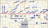
State Road 28 is an east–west road in central Indiana in the United States
that crosses the entire state from east to west, covering a distance of about 153 miles (246.2 km) and passing about 20 miles (32.2 km) to the north of the state capitol of Indianapolis
.
state line where it continues the route of Illinois Route 119
, about 7.5 miles (12.1 km) west of West Lebanon
. The eastern terminus is at the Ohio
state line where Ohio State Route 571
continues the route, near State Road 32
in the border-town of Union City
. For most of its length it is an undivided two-lane road which mainly travels through flat, open farm land, avoiding the hillier and more wooded areas that begin not far to the south. It is divided for about 1 miles (1.6 km) just west of Frankfort, where it passes the Frankfort Municipal Airport.
State Road 28 has concurrencies with four U.S. routes, as well as four other Indiana state roads; these are described below.
United States
The United States of America is a federal constitutional republic comprising fifty states and a federal district...
that crosses the entire state from east to west, covering a distance of about 153 miles (246.2 km) and passing about 20 miles (32.2 km) to the north of the state capitol of Indianapolis
Indianapolis
Indianapolis is the capital of the U.S. state of Indiana, and the county seat of Marion County, Indiana. As of the 2010 United States Census, the city's population is 839,489. It is by far Indiana's largest city and, as of the 2010 U.S...
.
Route description
The western terminus of State Road 28 is at the IllinoisIllinois
Illinois is the fifth-most populous state of the United States of America, and is often noted for being a microcosm of the entire country. With Chicago in the northeast, small industrial cities and great agricultural productivity in central and northern Illinois, and natural resources like coal,...
state line where it continues the route of Illinois Route 119
Illinois Route 119
Illinois Route 119 is an east–west state road in east-central Illinois. It runs from the intersection of U.S. Route 136 and Illinois Route 1 east of Henning to State Road 28 at the Indiana state line, well west of Williamsport, Indiana. This is a distance of .- Route description :Illinois 119...
, about 7.5 miles (12.1 km) west of West Lebanon
West Lebanon, Indiana
West Lebanon is a town in Pike Township, Warren County, Indiana, United States. The population was 723 at the 2010 census.-History:West Lebanon was laid out and platted in the fall of 1830 by Ebenezer Purviance, John G. Jemison and Andrew Fleming, and consisted of 64 lots...
. The eastern terminus is at the Ohio
Ohio
Ohio is a Midwestern state in the United States. The 34th largest state by area in the U.S.,it is the 7th‑most populous with over 11.5 million residents, containing several major American cities and seven metropolitan areas with populations of 500,000 or more.The state's capital is Columbus...
state line where Ohio State Route 571
Ohio State Route 571
Ohio State Route 571 is an east–west State Route highway in west-central Ohio, part of a state-wide road transportation system. It indirectly connects the cities of Union City and Greenville with Springfield via a final on U.S. Route 40...
continues the route, near State Road 32
Indiana State Road 32
State Road 32 in the U.S. State of Indiana is an east–west highway in central Indiana that crosses the entire state, covering a distance of about .-Route description:...
in the border-town of Union City
Union City, Indiana
Union City is a city in Wayne Township, Randolph County, Indiana, United States. As of the 2010 census, the city had a population of 3,584.Union City was a stop along the Pittsburgh, Cincinnati, Chicago and St. Louis Railroad, a forerunner of the Pennsylvania Railroad that connected Pittsburgh to...
. For most of its length it is an undivided two-lane road which mainly travels through flat, open farm land, avoiding the hillier and more wooded areas that begin not far to the south. It is divided for about 1 miles (1.6 km) just west of Frankfort, where it passes the Frankfort Municipal Airport.
State Road 28 has concurrencies with four U.S. routes, as well as four other Indiana state roads; these are described below.