
Streets and highways of Chicago
Encyclopedia
Roads and freeways in Chicago summarizes the main thoroughfares and the numbering system used in Chicago and its surrounding suburbs.

's street
s were laid out in a grid that grew from the city's original townsite plat. Streets following the Public Land Survey System
section lines later became arterial streets in outlying sections. As new additions to the city were platted, city ordinance required them to be laid out with eight streets to the mile in one direction and 16 in the other direction. A scattering of diagonal streets, many of them originally Indian trails, also cross the city. Many additional diagonal streets were recommended in the Plan of Chicago
, but only the extension of Ogden Avenue
was ever constructed. In the 1950s and 1960s, a network of superhighways was built radiating from the city center.
As the city grew and annexed adjacent towns, problems arose with duplicate street names and a confusing numbering system based on the Chicago River. On June 22, 1908, the city council adopted a system proposed by Edward P. Brennan; amended June 21, 1909. The changes were effective September 1, 1909 for most of the city. Addresses
in Chicago and some suburbs are numbered outward from baselines at State Street
, which runs north and south, and Madison Street
, which runs east and west.
A book was published in 1909 by The Chicago Directory Company indexing the old and new street numbers for most of Chicago. This volume is available on line in pdf format indexed by initial letter, Plan of Re-Numbering, City of Chicago, August 1909. The opening text of this useful book says:
"EXPLANATORY
The new house numbering plan passed by the City Council June 22, 1908, to be in force and effect September 1, 1909, makes Madison Street from Lake Michigan to the city limits on the west the base line for numbering all north and south streets and streets running in northerly or southerly direction. For east and west streets and streets running in a generally east and west direction the base line is State Street from the southern city boundary line to North Avenue, thence extended by an imaginary line through Lincoln Park and Lake Michigan."
The downtown area did not conform to this system until April 1, 1911, per an amendment to the law on June 20, 1910. Downtown was defined as Lake Michigan on the east, Roosevelt Road (Twelfth Street) on the south, and the Chicago River on the north and west. The addition to cover downtown was published, and is also on line as a pdf indexed by downtown street name.
This additional paragraph explained the downtown changes:
"The 1909 address change did not affect downtown Chicago, between the river and Roosevelt Road, the river and Lake Michigan. The ordinance was amended June 20, 1910 to include the downtown area. The new addresses for the “loop” went into use on April 1, 1911."
Chicago house numbers are generally assigned at the rate of 800 to a mile. The only exceptions are from Madison to 31st Street, just south of downtown. Roosevelt Road (previously Twelfth St) is one mile south of Madison with 1200 addresses to the mile, Cermak Road (previously 22nd Street) is two miles south of Madison with 1000 addresses to the mile, and 31st Street (3100 S) is three miles south of Madison with 900 addresses to the mile. South of 31st Street, the pattern of 800 to the mile resumes, with 39th Street the next major street, 47th after that, and so on. Individual house numbers are normally assigned at the rate of one per 10 feet of frontage. Thus the last two digits of house numbers generally go only as high as 67 before the next block number is reached. Higher house numbers are found on diagonal streets and have sometimes been assigned by request.
The blocks are normally counted out by "hundreds," so that Chicagoans routinely give directions by saying things such as "about twelve hundred north on Western" or "around twenty-four hundred west on Division" (which both describe the intersection of Western Avenue (2400 W) and Division Street
(1200 N)).
South of Madison Street most of the east-west streets are simply numbered. The street numbering is aligned with the house numbering
, so that 95th Street is exactly 9500 South. "Half-block" east-west thoroughfares in this area are numbered and called places; 95th Place would lie just south of and parallel to 95th Street, and just north of 96th Street.
Every four blocks (half-mile) is a major secondary street. For example, Division Street
(1200 N) is less important than either Chicago Avenue (800 N) or North Avenue (1600 N), but is still a major thoroughfare. However, this is not always the case; for example, on the city's Far North Side, Peterson Avenue (6000 N) is a more heavily trafficked street than Bryn Mawr Avenue (5600 N), which sits exactly at the 7-mile marker. U.S. Route 14
is routed along Peterson between Clark Street
at 1600 W and Cicero Avenue
at 4800 W, whereas Bryn Mawr is discontinuous, split into two segments in this part of the city by Rosehill Cemetery between Damen and Western Avenues.
Even-numbered addresses are found on the north and west sides of a street, and odd numbers are found on the south and east sides, irrespective of the streets' position relative to the corner of State and Madison.
Diagonals, even if they were to run exactly 45 degrees off of the cardinal directions, are numbered as if they were north-south or east-west streets. Examples are North Lincoln Avenue and Ogden Avenue, which bends at Madison and changes from North Ogden to West Ogden.
The northernmost street in Chicago is Juneway Terrace (7800 N), just north of Howard Street. The southern boundary is 138th Street. The eastern boundary of Chicago is Avenue A/State Line Road (4100 E) along and south of 106th Street, and the furthest west the city extends is in the portion of O'Hare International Airport
that lies in DuPage County
, just east of Elmhurst/York Road.
(4000 W), one will cross a mile-long stretch of streets which have names starting with the letter K (From east to west: Keystone, Karlov, Kedvale, Keeler, Tripp, Kildare, Kolin, Kostner, Kenneth, Kilbourn, Kolmar, Kenton, Knox, Kilpatrick, Keating), giving rise to the expression "K-town." These streets are found approximately in the 11th mile west of the Indiana state line, and so begin with the 11th letter of the alphabet. A mile later, just past Cicero (4800 W), the starting letter changes to L, and mile by mile the letters progress up to P. Additionally, for most of the first mile west of the Illinois/Indiana state line, streets are lettered from Avenue A at the state line (4100 E) to Avenue O (3430 E), forming the A group. The areas that might otherwise be the B through J groups are the older parts of the city where street names were already well established before this system was developed (although some small groups of streets seem to have been given names intended to conform to the system), and the Q group (8800 to 9600 W) would fall west of the city, as the only land in Chicago west of 8800 West is O'Hare Airport, undeveloped forest preserve, and a small strip of land connecting O'Hare to the rest of the city and containing only Foster Avenue.
is located near the intersection of 54th Avenue and Cermak Road
(22nd Street) in Cicero
. This is 54 blocks west of State Street in Chicago. A minor street 54½ blocks west of State Street would be called 54th Court.
This pattern continues as far west as Plainfield
, which has a 252nd Avenue. Suburbs that follow the Chicago numbering system include Niles
, Rosemont
, Morton Grove
, Skokie
, Lincolnwood
, Franklin Park
, River Grove
, Evergreen Park
, Oak Lawn
, Oak Forest
, Matteson
, Channahon
, unincorporated parts of Des Plaines
, and other parts of Cook County
, Will, and DuPage Counties. Other suburbs, including Evanston
, Park Ridge
, Oak Park
, Glenview
and Wilmette
use their own numbering systems. Lake County IL uses State and Madison as a base line as do DuPage County. For example, 32W234 in DuPage is 32 miles west of State St., 38964 in Lake County would be 38 miles north of Madison St. and is normally used without the direction letter.
Some Chicago suburbs in adjoining Northwest Indiana
also use the Chicago numbering system. These include East Chicago
, Whiting
, and Hammond
. There are even examples further south in Lake County
in Dyer
and Schererville
such as 205th Place through 215th Street (these examples coordinate with the Chicago grid, not the Gary street system). Other municipalities, such as Munster
, Highland
, and Griffith
are based on the Gary, Indiana
numbering system, beginning with 5th Avenue in Gary and increasing numerically as one travels southward. Examples in far south Lake County, Indiana
near Lowell
and Cedar Lake
include 109th Avenue, 117th Avenue and 203rd Avenue.
The aforementioned pattern also occurs in Waukegan, Illinois
, with Washington Street being the baseline between north and south. Nearby municipalities such as Gurnee
, Park City
, and North Chicago
continue with the Waukegan numbering pattern, while rural areas in Lake County, Illinois
follow the Chicago grid.
(No part of Lake Avenue, Central Road, Golf Road, Dempster Street, Oakton Street, 143rd Street, or 159th Street actually lies within the boundaries of Chicago. These streets are included for reference, since they are a continuation of the Chicago mile street pattern into the suburbs.)
The half-mile numbered streets on the South Side are all secondary streets: 35th, 43rd, 51st, 59th, etc.; all are numbered aside from Marquette Road, running at 6700 S, west from Martin Luther King Jr. Drive (400 E) to the city's western limit at Cicero Ave
(4800 W), near Chicago Midway International Airport. East of King to near Lake Michigan
at 2400 E, it is called 67th Street, and Marquette is aligned one block to the north on what would be 66th Street.
(No part of Old Orchard Road, Church Street, or Main Street actually lies within the boundaries of Chicago. These streets are included for reference, since they are a continuation of the Chicago mile street pattern into the suburbs.)
The numbering system is also copied in Milwaukee.
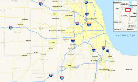 The city of Chicago proper has seven major interstate highways crossing through it. However, the various roadways are more typically known to Chicagoans not by their Interstate numbers but rather by various given names. The local vernacular uses "Expressway" for most Interstate grade highways; however, it is most common for Chicagoans to omit the designation entirely and refer to the highway by just its name, i. e. "The Eisenhower," or "The Dan Ryan" will be immediately comprehensible to any Chicagoan.
Street layout
ChicagoChicago
Chicago is the largest city in the US state of Illinois. With nearly 2.7 million residents, it is the most populous city in the Midwestern United States and the third most populous in the US, after New York City and Los Angeles...
's street
Street
A street is a paved public thoroughfare in a built environment. It is a public parcel of land adjoining buildings in an urban context, on which people may freely assemble, interact, and move about. A street can be as simple as a level patch of dirt, but is more often paved with a hard, durable...
s were laid out in a grid that grew from the city's original townsite plat. Streets following the Public Land Survey System
Public Land Survey System
The Public Land Survey System is a method used in the United States to survey and identify land parcels, particularly for titles and deeds of rural, wild or undeveloped land. Its basic units of area are the township and section. It is sometimes referred to as the rectangular survey system,...
section lines later became arterial streets in outlying sections. As new additions to the city were platted, city ordinance required them to be laid out with eight streets to the mile in one direction and 16 in the other direction. A scattering of diagonal streets, many of them originally Indian trails, also cross the city. Many additional diagonal streets were recommended in the Plan of Chicago
Burnham Plan
The Burnham Plan is a popular name for the 1909 Plan of Chicago, co-authored by Daniel Burnham and Edward H. Bennett. It recommended an integrated series of projects including new and widened streets, parks, new railroad and harbor facilities, and civic buildings...
, but only the extension of Ogden Avenue
Ogden Avenue (Chicago)
Ogden Avenue is an arterial street extending from the Near West Side of Chicago to Aurora, Illinois.The street follows the route of the Southwestern Plank Road, which opened in 1848 across swampy terrain between Chicago and Riverside, Illinois, and was extended to Naperville by 1851.The 1909 Plan...
was ever constructed. In the 1950s and 1960s, a network of superhighways was built radiating from the city center.
As the city grew and annexed adjacent towns, problems arose with duplicate street names and a confusing numbering system based on the Chicago River. On June 22, 1908, the city council adopted a system proposed by Edward P. Brennan; amended June 21, 1909. The changes were effective September 1, 1909 for most of the city. Addresses
Address (geography)
An address is a collection of information, presented in a mostly fixed format, used for describing the location of a building, apartment, or other structure or a plot of land, generally using political boundaries and street names as references, along with other identifiers such as house or...
in Chicago and some suburbs are numbered outward from baselines at State Street
State Street (Chicago)
State Street is a large south-north street in Chicago, Illinois, USA and its south suburbs. It begins on the Near North Side at North Avenue. For much of its course, it lies between Wabash Avenue on the east and Dearborn Street/Lafayette Avenue on the west...
, which runs north and south, and Madison Street
Madison Street (Chicago)
Madison Street is a major east-west street in Chicago, Illinois. Prior to human intervention, the Chicago River emptied into Lake Michigan at the present day intersection of Madison Street and Michigan Avenue....
, which runs east and west.
A book was published in 1909 by The Chicago Directory Company indexing the old and new street numbers for most of Chicago. This volume is available on line in pdf format indexed by initial letter, Plan of Re-Numbering, City of Chicago, August 1909. The opening text of this useful book says:
"EXPLANATORY
The new house numbering plan passed by the City Council June 22, 1908, to be in force and effect September 1, 1909, makes Madison Street from Lake Michigan to the city limits on the west the base line for numbering all north and south streets and streets running in northerly or southerly direction. For east and west streets and streets running in a generally east and west direction the base line is State Street from the southern city boundary line to North Avenue, thence extended by an imaginary line through Lincoln Park and Lake Michigan."
The downtown area did not conform to this system until April 1, 1911, per an amendment to the law on June 20, 1910. Downtown was defined as Lake Michigan on the east, Roosevelt Road (Twelfth Street) on the south, and the Chicago River on the north and west. The addition to cover downtown was published, and is also on line as a pdf indexed by downtown street name.
This additional paragraph explained the downtown changes:
"The 1909 address change did not affect downtown Chicago, between the river and Roosevelt Road, the river and Lake Michigan. The ordinance was amended June 20, 1910 to include the downtown area. The new addresses for the “loop” went into use on April 1, 1911."
Chicago house numbers are generally assigned at the rate of 800 to a mile. The only exceptions are from Madison to 31st Street, just south of downtown. Roosevelt Road (previously Twelfth St) is one mile south of Madison with 1200 addresses to the mile, Cermak Road (previously 22nd Street) is two miles south of Madison with 1000 addresses to the mile, and 31st Street (3100 S) is three miles south of Madison with 900 addresses to the mile. South of 31st Street, the pattern of 800 to the mile resumes, with 39th Street the next major street, 47th after that, and so on. Individual house numbers are normally assigned at the rate of one per 10 feet of frontage. Thus the last two digits of house numbers generally go only as high as 67 before the next block number is reached. Higher house numbers are found on diagonal streets and have sometimes been assigned by request.
The blocks are normally counted out by "hundreds," so that Chicagoans routinely give directions by saying things such as "about twelve hundred north on Western" or "around twenty-four hundred west on Division" (which both describe the intersection of Western Avenue (2400 W) and Division Street
Division Street (Chicago)
Division Street is a major east-west street in Chicago, Illinois, located at 1200 North . Division Street begins in the Gold Coast neighborhood near Lake Shore Drive, passes through Polonia Triangle at Milwaukee Avenue into Wicker Park and continues to Chicago's city limits and into the city's...
(1200 N)).
South of Madison Street most of the east-west streets are simply numbered. The street numbering is aligned with the house numbering
House numbering
House numbering is the system of giving a unique number to each building in a street or area, with the intention of making it easier to locate a particular building. The house number is often part of a postal address....
, so that 95th Street is exactly 9500 South. "Half-block" east-west thoroughfares in this area are numbered and called places; 95th Place would lie just south of and parallel to 95th Street, and just north of 96th Street.
Every four blocks (half-mile) is a major secondary street. For example, Division Street
Division Street (Chicago)
Division Street is a major east-west street in Chicago, Illinois, located at 1200 North . Division Street begins in the Gold Coast neighborhood near Lake Shore Drive, passes through Polonia Triangle at Milwaukee Avenue into Wicker Park and continues to Chicago's city limits and into the city's...
(1200 N) is less important than either Chicago Avenue (800 N) or North Avenue (1600 N), but is still a major thoroughfare. However, this is not always the case; for example, on the city's Far North Side, Peterson Avenue (6000 N) is a more heavily trafficked street than Bryn Mawr Avenue (5600 N), which sits exactly at the 7-mile marker. U.S. Route 14
U.S. Route 14
U.S. Route 14 , an east–west route, is one of the original United States highways of 1926. It currently has a length of 1,398 miles , but it had a peak length of 1,429 miles . For much of its length, it runs roughly parallel to Interstate 90.As of 2004, the highway's eastern terminus is in...
is routed along Peterson between Clark Street
Clark Street (Chicago)
Clark Street is a north-south street in Chicago, Illinois that runs close to the shore of Lake Michigan from the northern city boundary with Evanston, to 2200 South in the city street numbering system...
at 1600 W and Cicero Avenue
Illinois Route 50
Illinois Route 50 is a north–south state road in northeastern Illinois. It runs from the junction with U.S. Route 45 in West Kankakee north to U.S. Route 41 in Skokie. This is a distance of . In Chicago and the suburbs it's known as Cicero Avenue...
at 4800 W, whereas Bryn Mawr is discontinuous, split into two segments in this part of the city by Rosehill Cemetery between Damen and Western Avenues.
Even-numbered addresses are found on the north and west sides of a street, and odd numbers are found on the south and east sides, irrespective of the streets' position relative to the corner of State and Madison.
Diagonals, even if they were to run exactly 45 degrees off of the cardinal directions, are numbered as if they were north-south or east-west streets. Examples are North Lincoln Avenue and Ogden Avenue, which bends at Madison and changes from North Ogden to West Ogden.
The northernmost street in Chicago is Juneway Terrace (7800 N), just north of Howard Street. The southern boundary is 138th Street. The eastern boundary of Chicago is Avenue A/State Line Road (4100 E) along and south of 106th Street, and the furthest west the city extends is in the portion of O'Hare International Airport
O'Hare International Airport
Chicago O'Hare International Airport , also known as O'Hare Airport, O'Hare Field, Chicago Airport, Chicago International Airport, or simply O'Hare, is a major airport located in the northwestern-most corner of Chicago, Illinois, United States, northwest of the Chicago Loop...
that lies in DuPage County
DuPage County, Illinois
As of the 2010 Census, the population of the county was 916,924, White Americans made up 77.9% of Dupage County's population; non-Hispanic whites represented 70.5% of the population. Black Americans made up 4.6% of the population. Native Americans made up 0.3% of Dupage County's population...
, just east of Elmhurst/York Road.
Street names
While all north-south streets within city limits are named, rather than numbered, smaller streets in some areas are named in groups all starting with the same letter; thus, when traveling westward on a Chicago street, starting just past Pulaski RoadPulaski Road (Chicago)
Pulaski Road is a major north-south thoroughfare in the city of Chicago, at 4000 W., or exactly five miles west of State Street. It is named after revolutionary war hero Casimir Pulaski...
(4000 W), one will cross a mile-long stretch of streets which have names starting with the letter K (From east to west: Keystone, Karlov, Kedvale, Keeler, Tripp, Kildare, Kolin, Kostner, Kenneth, Kilbourn, Kolmar, Kenton, Knox, Kilpatrick, Keating), giving rise to the expression "K-town." These streets are found approximately in the 11th mile west of the Indiana state line, and so begin with the 11th letter of the alphabet. A mile later, just past Cicero (4800 W), the starting letter changes to L, and mile by mile the letters progress up to P. Additionally, for most of the first mile west of the Illinois/Indiana state line, streets are lettered from Avenue A at the state line (4100 E) to Avenue O (3430 E), forming the A group. The areas that might otherwise be the B through J groups are the older parts of the city where street names were already well established before this system was developed (although some small groups of streets seem to have been given names intended to conform to the system), and the Q group (8800 to 9600 W) would fall west of the city, as the only land in Chicago west of 8800 West is O'Hare Airport, undeveloped forest preserve, and a small strip of land connecting O'Hare to the rest of the city and containing only Foster Avenue.
Suburbs
Some suburbs number their east-west streets in a continuation of the Chicago pattern, and even more number their houses according to the Chicago grid. A few suburbs also number their north-south avenues according to the Chicago grid, although such numbering vanished from Chicago itself long ago (the alphabetical naming scheme was devised to help eliminate it). For example, the 54th/Cermak terminus of the Pink LinePink Line (Chicago Transit Authority)
The Pink Line is a rapid transit line in Chicago, run by the Chicago Transit Authority as part of the Chicago 'L' system. It began operation for a 180-day trial period on June 25, 2006, running between 54th/Cermak Station in Cicero, Illinois and the Loop in downtown Chicago...
is located near the intersection of 54th Avenue and Cermak Road
Cermak Road
Cermak Road, formerly 22nd Street, is a major east-west artery on Chicago's south side and western suburbs. It is named for assassinated Chicago mayor Anton Cermak.-Points of interest:...
(22nd Street) in Cicero
Cicero, Illinois
Cicero is an incorporated town in Cook County, Illinois, United States. The population was 83,891 at the 2010 census. Cicero is named for the town of Cicero, New York, which in turn was named for Marcus Tullius Cicero, the Roman statesman and orator....
. This is 54 blocks west of State Street in Chicago. A minor street 54½ blocks west of State Street would be called 54th Court.
This pattern continues as far west as Plainfield
Plainfield, Illinois
Plainfield is a village in Will County, Illinois, United States. As of the 2007 special census, the population is 37,334.The Village includes land in Plainfield and Wheatland townships. Part of Plainfield is located in Kendall County...
, which has a 252nd Avenue. Suburbs that follow the Chicago numbering system include Niles
Niles, Illinois
Niles is a village in Maine and Niles Townships, Cook County, Illinois, United States. The 2010 population from the U.S. Census Bureau is 29,803.The current mayor of Niles is Robert M. Callero.-History:Niles was first settled in 1827....
, Rosemont
Rosemont, Illinois
Rosemont is a village in Cook County, Illinois, United States located immediately northwest of Chicago. The village was incorporated in 1956, though it had been settled long before that...
, Morton Grove
Morton Grove, Illinois
Morton Grove is a village in Cook County, Illinois, United States. The population was 22,451 at the 2000 census.The Village President of Morton Grove since April 27, 2009, is Daniel J...
, Skokie
Skokie, Illinois
Skokie is a village in Cook County, Illinois, United States. Its name comes from a Native American word for "fire". A Chicago suburb, for many years Skokie promoted itself as "The World's Largest Village". Its population, per the 2000 census, was 63,348...
, Lincolnwood
Lincolnwood, Illinois
Lincolnwood is a village in Cook County, Illinois, United States. The population was 12,359 at the 2000 census.-Geography:Lincolnwood is located at ....
, Franklin Park
Franklin Park, Illinois
Franklin Park is a village in Cook County, Illinois, United States. The population was 19,800 at the 2004 census.-Geography:Franklin Park is located at ....
, River Grove
River Grove, Illinois
River Grove is a village in Cook County, Illinois, United States. The population was 10,668 at the 2000 census.-Geography:River Grove is located at .According to the United States Census Bureau, the village has a total area of ....
, Evergreen Park
Evergreen Park, Illinois
Evergreen Park is a village in Cook County, Illinois, United States. The population was 25,044 at the 2009 census.-Geography:Evergreen Park is located at . The suburb is surrounded by the city of Chicago on three of its sides, while Oak Lawn and Hometown border it on the west...
, Oak Lawn
Oak Lawn, Illinois
Oak Lawn is a village in Cook County, Illinois, United States. The population was 55,245 at the 2000 census.Oak Lawn is a suburb of the city of Chicago, located southwest of the city...
, Oak Forest
Oak Forest, Illinois
Oak Forest is a suburban city about south/southwest of downtown Chicago in Bremen Township in Cook County, Illinois, United States. The population was 28,051 at the 2000 census.-History:...
, Matteson
Matteson, Illinois
Matteson is a village in Cook and Will Counties, Illinois, United States. The population was 12,928 at the 2000 census and an estimated 17,080 as of July 2007.-Geography:Matteson is located at ....
, Channahon
Channahon, Illinois
Channahon is a village in Grundy and Will counties in the U.S. state of Illinois. The population was 12,560 at the 2010 census. Channahon is also the name of the township in which most of the village resides...
, unincorporated parts of Des Plaines
Des Plaines, Illinois
Des Plaines is a city in Cook County, Illinois, United States. It has adopted the official nickname of "City of Destiny." As of the 2000 census, the city had a total population of 58,720. It is a suburb of Chicago, and is next to O'Hare International Airport...
, and other parts of Cook County
Cook County, Illinois
Cook County is a county in the U.S. state of Illinois, with its county seat in Chicago. It is the second most populous county in the United States after Los Angeles County. The county has 5,194,675 residents, which is 40.5 percent of all Illinois residents. Cook County's population is larger than...
, Will, and DuPage Counties. Other suburbs, including Evanston
Evanston, Illinois
Evanston is a suburban municipality in Cook County, Illinois 12 miles north of downtown Chicago, bordering Chicago to the south, Skokie to the west, and Wilmette to the north, with an estimated population of 74,360 as of 2003. It is one of the North Shore communities that adjoin Lake Michigan...
, Park Ridge
Park Ridge, Illinois
-Climate:-Demographics:As of the census of 2000, there were 37,775 people, 14,219 households, and 10,465 families residing in the city. The population density was 5,374.6 people per square mile . There were 14,646 housing units at an average density of 2,083.8 per square mile...
, Oak Park
Oak Park, Illinois
Oak Park, Illinois is a suburb bordering the west side of the city of Chicago in Cook County, Illinois, United States. It is the twenty-fifth largest municipality in Illinois. Oak Park has easy access to downtown Chicago due to public transportation such as the Chicago 'L' Blue and Green lines,...
, Glenview
Glenview, Cook County, Illinois
Glenview is a suburban village located approximately north of downtown Chicago in Cook County, Illinois. As of the 2000 census, the village population was 41,847...
and Wilmette
Wilmette, Illinois
Wilmette is a village in New Trier Township, Cook County, Illinois, United States. It is located north of Chicago's downtown district and has a population of 27,651. Wilmette is considered a bedroom community in the North Shore district...
use their own numbering systems. Lake County IL uses State and Madison as a base line as do DuPage County. For example, 32W234 in DuPage is 32 miles west of State St., 38964 in Lake County would be 38 miles north of Madison St. and is normally used without the direction letter.
Some Chicago suburbs in adjoining Northwest Indiana
Northwest Indiana
Northwest Indiana, also known as the South Shore and The Calumet Region or simply The Region, comprises Lake, Porter, LaPorte, Newton and Jasper counties in Indiana. This region neighbors Lake Michigan and is part of the Chicago metropolitan area...
also use the Chicago numbering system. These include East Chicago
East Chicago, Indiana
East Chicago is a city in Lake County, Indiana. The population was 29,698 at the 2010 census.-Geography:East Chicago is located at ....
, Whiting
Whiting, Indiana
Whiting is a city located in the Chicago Metropolitan Area in Lake County, Indiana, which was founded in 1889. The city is located on the southern shore of Lake Michigan. It is roughly 16 miles from the Chicago Loop and just short of two miles from Chicago's South Side. Whiting is home to Whiting...
, and Hammond
Hammond, Indiana
Hammond is a city in Lake County, Indiana, United States. It is part of the Chicago metropolitan area. The population was 80,830 at the 2010 census.-Geography:Hammond is located at ....
. There are even examples further south in Lake County
Lake County, Indiana
Lake County is a county located in the U.S. state of Indiana. In 2010, its population was 496,005, making it Indiana's second-most populous county. The county seat is Crown Point. This county is part of Northwest Indiana and the Chicago metropolitan area. The county contains a mix of urban,...
in Dyer
Dyer, Indiana
As of the census of 2010, there were 16,390 people residing in the town. The population density was 2,731.67 people per square mile . There were 6,125 housing units at an average density of 1,020.83 per square mile...
and Schererville
Schererville, Indiana
Schererville is a town in St. John Township, Lake County, Indiana, United States. It is part of the Chicago metropolitan area. The population was 29,243 at the 2010 census.- History :...
such as 205th Place through 215th Street (these examples coordinate with the Chicago grid, not the Gary street system). Other municipalities, such as Munster
Munster, Indiana
Munster is a town located in North Township, Lake County, in Northwest Indiana in the United States. This bedroom community lies in the Chicago metropolitan area, approximately southeast of the Chicago Loop, and shares municipal boundaries with Hammond to the north, Highland to the east, Dyer and...
, Highland
Highland, Lake County, Indiana
Highland is a town in Lake County, Indiana, United States. The population was 23,727 at the 2010 census. The town was incorporated on April 4, 1910...
, and Griffith
Griffith, Indiana
Griffith is a town in Calumet and St. John townships, Lake County, Indiana. It is a part of the Chicago metropolitan area. The population was 16,893 at the 2010 census.-Geography:...
are based on the Gary, Indiana
Gary, Indiana
Gary is a city in Lake County, Indiana, United States. The city is in the southeastern portion of the Chicago metropolitan area and is 25 miles from downtown Chicago. The population is 80,294 at the 2010 census, making it the seventh-largest city in the state. It borders Lake Michigan and is known...
numbering system, beginning with 5th Avenue in Gary and increasing numerically as one travels southward. Examples in far south Lake County, Indiana
Lake County, Indiana
Lake County is a county located in the U.S. state of Indiana. In 2010, its population was 496,005, making it Indiana's second-most populous county. The county seat is Crown Point. This county is part of Northwest Indiana and the Chicago metropolitan area. The county contains a mix of urban,...
near Lowell
Lowell, Indiana
-Demographics:At the 2000 census, there were 7,505 people, 2,697 households and 2,030 families residing in the town. The population density was 1,839.2 per square mile . There were 2,809 housing units at an average density of 688.4 per square mile...
and Cedar Lake
Cedar Lake, Indiana
-Demographics:As of the census of 2000, there were 9,279 people, 3,394 households, and 2,450 families residing in the town. The population density was 1,366.3 people per square mile . There were 3,681 housing units at an average density of 542.0 per square mile...
include 109th Avenue, 117th Avenue and 203rd Avenue.
The aforementioned pattern also occurs in Waukegan, Illinois
Waukegan, Illinois
Waukegan is a city and county seat of Lake County, Illinois. As of the 2000 census, the city had a total population of 87,901. The 2010 population was 89,078. It is the ninth-largest city in Illinois by population...
, with Washington Street being the baseline between north and south. Nearby municipalities such as Gurnee
Gurnee, Illinois
Gurnee is a village in Lake County, Illinois, United States. The population was 28,834 at the 2000 census, and estimated to be 30,772 in 2005. The village borders the city of Waukegan and is considered a part of the Chicago metropolitan area. Gurnee is perhaps best known for being the location of...
, Park City
Park City, Illinois
Park City is a small community located in the Warren and Waukegan townships of Lake County, Illinois, United States. The population was 6,637 at the 2000 census, broken up into three wards....
, and North Chicago
North Chicago, Illinois
North Chicago is an outer suburb/exurb of the Chicago metropolitan area and is an incorporated city in Lake County, Illinois, United States. The population was 35,918 at the 2000 census....
continue with the Waukegan numbering pattern, while rural areas in Lake County, Illinois
Lake County, Illinois
Lake County is a county in the northeastern corner of the state of Illinois, on the shore of Lake Michigan. According to the 2010 census, it has a population of 703,462, which is an increase of 9.2% from 644,356 in 2000. Its county seat is Waukegan. The county is part of the Chicago metropolitan area...
follow the Chicago grid.
Mile roads
| East-West Streets | North-South Streets | |||
|---|---|---|---|---|
| Mile | Address number | Street name | Address number | Street name |
| 14 | 11200 N | (Lake Avenue) | 11200 W | Wolf Road |
| 13 | 10400 N | (Central Road) | 10400 W |    Mannheim Road Mannheim RoadMannheim Road Mannheim Road is a north–south major thoroughfare in the near-western suburbs of Chicago. It carries U.S. Routes 12 and 45 between Des Plaines and La Grange and carries U.S. Route 20 between Lake Street and LaGrange. In LaGrange and points to the south, it is known as LaGrange Road... |
| 12 | 9600 N |  (Golf Road) (Golf Road) |
9600 W | Rose Street (Franklin Park) also called 25th Avenue |
| 11 | 8800 N |  (Dempster Street) (Dempster Street) |
8800 W | East River Road |
| 10 | 8000 N | (Oakton Street) | 8000 W | Pacific Avenue |
| 9 | 7200 N | Touhy Avenue Touhy Avenue Touhy Avenue is a major thoroughfare throughout northern Chicago, Illinois as well as the north and northwestern suburbs of the city. It is named for Patrick L. Touhy, a subdivider who was also the son-in-law of Phillip Rogers, an early settler who helped develop Rogers Park... |
7200 W |  Harlem Avenue Harlem AvenueIllinois Route 43 Illinois Route 43 is a major north–south state road in the U.S. state of Illinois. It runs from U.S. Route 30 in Frankfort north to the large intersection of Illinois Route 120 and U.S... |
| 8 | 6400 N | Devon Avenue Devon Avenue (Chicago) Devon Avenue is a major east-west thoroughfare in the Chicago metropolitan area. It begins at Chicago's Sheridan Road, which borders Lake Michigan, and it runs west until merging with Higgins Road near O'Hare International Airport. Devon continues on the opposite side of the airport and runs... |
6400 W | Narragansett Avenue (Ridgeland Avenue in the suburbs) |
| 7 | 5600 N | Bryn Mawr Avenue | 5600 W | Central Avenue |
| 6 | 4800 N | Lawrence Avenue | 4800 W |  Cicero Avenue Cicero AvenueIllinois Route 50 Illinois Route 50 is a north–south state road in northeastern Illinois. It runs from the junction with U.S. Route 45 in West Kankakee north to U.S. Route 41 in Skokie. This is a distance of . In Chicago and the suburbs it's known as Cicero Avenue... (Skokie Boulevard in Skokie) |
| 5 | 4000 N |  Irving Park Road Irving Park RoadIllinois Route 19 Illinois Route 19 is a major east–west arterial road in northeastern Illinois, United States. It runs from Illinois Route 25 in Elgin, to Lake Shore Drive on the north side of Chicago. Illinois 19 is long... |
4000 W | Pulaski Road Pulaski Road (Chicago) Pulaski Road is a major north-south thoroughfare in the city of Chicago, at 4000 W., or exactly five miles west of State Street. It is named after revolutionary war hero Casimir Pulaski... (Crawford Avenue in the suburbs) |
| 4 | 3200 N | Belmont Avenue Belmont Avenue (Chicago) Belmont Avenue is a major east-west street on the North Side of Chicago. Belmont is a central commercial street in Lakeview and, west of the North Branch of the Chicago River, Avondale... |
3200 W | Kedzie Avenue |
| 3 | 2400 N | Fullerton Avenue | 2400 W | Western Avenue Western Avenue (Chicago) Western Avenue is the longest continuous street within the city of Chicago at in length. Western Avenue extends south as a continuous road to the Dixie Highway at Sibley Boulevard in Dixmoor, giving the road a total length of . However, Western Avenue extends intermittently through the... |
| 2 | 1600 N |  North Avenue North AvenueIllinois Route 64 Illinois Route 64 is an east–west road in north-central Illinois. Its western terminus is at the Iowa state line, connecting with U.S. Route 52 and Iowa Highway 64 via the Savanna-Sabula Bridge at the Mississippi River west of Savanna... |
1600 W | Ashland Avenue |
| 1 | 800 N | Chicago Avenue | 800 W |  Halsted Street Halsted StreetHalsted Street Halsted Street is a major north-south street in the American city of Chicago, Illinois.-Location:In Chicago's grid system, Halsted street marks 800 West, one mile west of State Street, from Grace Street in Lakeview south to the city limits at the Little Calumet River in West Pullman... |
| 0 | 1 N/S | Madison Street Madison Street (Chicago) Madison Street is a major east-west street in Chicago, Illinois. Prior to human intervention, the Chicago River emptied into Lake Michigan at the present day intersection of Madison Street and Michigan Avenue.... |
0 E/W | State Street State Street (Chicago) State Street is a large south-north street in Chicago, Illinois, USA and its south suburbs. It begins on the Near North Side at North Avenue. For much of its course, it lies between Wabash Avenue on the east and Dearborn Street/Lafayette Avenue on the west... |
| 1 | 1200 S |  Roosevelt Road Roosevelt RoadRoosevelt Road Roosevelt Road is a major east-west thoroughfare in the city of Chicago, Illinois, and its western suburbs. It is 1200 South in the city's street numbering system, but only one mile south of Madison Street... |
800 E | Cottage Grove Avenue |
| 2 | 2200 S | Cermak Road Cermak Road Cermak Road, formerly 22nd Street, is a major east-west artery on Chicago's south side and western suburbs. It is named for assassinated Chicago mayor Anton Cermak.-Points of interest:... |
1600 E | Stony Island Avenue Stony Island Avenue Stony Island Avenue is a major thoroughfare on South Side of the city of Chicago, designated 1600 East in Chicago's street numbering system. It runs from 56th Street south to the Calumet River. Stony Island Avenue continues sporadically south of the Calumet in the southern suburbs, running... |
| 3 | 3100 S | 31st Street | 2400 E | Yates Avenue |
| 4 | 3900 S | Pershing Road | 3200 E | Brandon Avenue |
| 5 | 4700 S | 47th Street | 4000 E | Avenue C |
| 6 | 5500 S | 55th Street (Garfield Boulevard) | ||
| 7 | 6300 S | 63rd Street | ||
| 8 | 7100 S | 71st Street | ||
| 9 | 7900 S | 79th Street | ||
| 10 | 8700 S | 87th Street | ||
| 11 | 9500 S | 95th Street 95th Street (Chicago) 95th Street is a major east–west street on Chicago's South Side and in the southwest suburbs, designated as 9500 South in Chicago's address system. 95th Street is south of Madison Street.-Route:... |
||
| 12 | 10300 S | 103rd Street | ||
| 13 | 11100 S | 111th Street | ||
| 14 | 11900 S | 119th Street | ||
| 15 | 12700 S | 127th Street | ||
| 16 | 13500 S | 135th Street | ||
| 17 | 14300 S | 143rd Street | ||
| 18 | 15900 S |  159th Street 159th Street |
(No part of Lake Avenue, Central Road, Golf Road, Dempster Street, Oakton Street, 143rd Street, or 159th Street actually lies within the boundaries of Chicago. These streets are included for reference, since they are a continuation of the Chicago mile street pattern into the suburbs.)
Downtown
Many streets in downtown Chicago are considered major streets:- North/south:
- Canal Street (500 W)
- Wacker DriveWacker DriveWacker Drive is a major street in Chicago, Illinois, United States, running along the south side of the main branch and the east side of the south branch of the Chicago River...
(400 W) - Franklin Street (300 W)
- Wells StreetWells Street (Chicago)Wells Street is a main North–South road in downtown Chicago. It is officially designated as 200 West, and is named in honor of William Wells, a United States Army Captain who died in the Battle of Fort Dearborn....
(200 W) - LaSalle StreetLaSalle StreetLaSalle Street is a major north-south street in Chicago named for Sieur de La Salle, an early explorer of Illinois. The portion that runs through the Loop is considered to be Chicago's financial district...
(150 W) - Clark StreetClark Street (Chicago)Clark Street is a north-south street in Chicago, Illinois that runs close to the shore of Lake Michigan from the northern city boundary with Evanston, to 2200 South in the city street numbering system...
(100 W) - Dearborn Street (36 W)
- State StreetState Street (Chicago)State Street is a large south-north street in Chicago, Illinois, USA and its south suburbs. It begins on the Near North Side at North Avenue. For much of its course, it lies between Wabash Avenue on the east and Dearborn Street/Lafayette Avenue on the west...
(1E/1W) - Wabash Avenue (44 E)
- Michigan AvenueMichigan Avenue (Chicago)Michigan Avenue is a major north-south street in Chicago which runs at 100 east south of the Chicago River and at 132 East north of the river from 12628 south to 950 north in the Chicago street address system...
(100 E) - Columbus DriveColumbus Drive (Chicago)Columbus Drive is a north-south street in Chicago, Illinois which bisects Grant Park. It is 254 E in Chicago's street numbering system. Its south end is an interchange with Lake Shore Drive at Soldier Field...
(300 E) - McClurg Court (400 E)
- East/west:
- Oak StreetOak Street (Chicago)Oak Street is a short street on Chicago's Gold Coast at 1000 North in Chicago's street numbering system, running from 138 east to 648 west in the Near North Side community area of Chicago in Cook County, Illinois, United States. It ends without crossing the North Branch of the Chicago River...
(1000 N) - Chicago Avenue (800 N)
- Huron Street (700 N)
- Ohio Street (600 N)
- Grand AvenueGrand Avenue (Chicago)Grand Avenue is a major east-west arterial surface street in the city of Chicago and nearby DuPage County, although it deviates somewhat from Chicago's grid system, as it is diagonal west of Western Avenue. The street runs from the Kingery Highway Grand Avenue is a major east-west arterial surface...
(530 N) - Illinois Street (500 N)
- Hubbard StreetHubbard StreetHubbard Street is a road in Chicago, Illinois named for early settler Gurdon Saltonstall Hubbard. Where Hubbard Street passes over the Kennedy Expressway, the Expressway enters a tunnel made up of surface streets known colloquially as "Hubbard's Cave." Hubbard Street has three distinct sections....
(430 N) - Kinzie Street (400 N)
- Wacker DriveWacker DriveWacker Drive is a major street in Chicago, Illinois, United States, running along the south side of the main branch and the east side of the south branch of the Chicago River...
(300 N) - Lake StreetLake Street (Chicago)Lake Street is an east-west arterial road in Chicago and its suburbs. Part of Lake Street is designated as U.S. Route 20. Lake Street begins in the city of Chicago and travels west and slightly north to the Chicago suburbs. It ends at the eastern terminus of the Elgin Bypass around Elgin, where...
(200 N) - Randolph StreetRandolph Street (Chicago)Randolph Street is a street in Chicago. It runs east-west through the Chicago Loop, carrying westbound traffic west from Michigan Avenue across the Chicago River on the Randolph Street Bridge, interchanging with the Kennedy Expressway , and continuing west. It serves as the northern boundary of...
(150 N) - Washington Street (100 N)
- Madison StreetMadison Street (Chicago)Madison Street is a major east-west street in Chicago, Illinois. Prior to human intervention, the Chicago River emptied into Lake Michigan at the present day intersection of Madison Street and Michigan Avenue....
(1N/1S) - Monroe Street (100 S)
- Adams Street (200 S)
- Jackson Boulevard (300 S)
- Van Buren Street (400 S)
- Congress Parkway (500 S), leads to the Eisenhower Expressway
- Harrison Street (600 S)
- Polk Street (800 S)
- Oak Street
Secondary streets
- East/west:
- 10000 N – (Old Orchard Road)
- 9200 N – (Church Street)
- 8400 N – (Main Street)
- 7600 N – Howard StreetHoward Street (Chicago)Howard Street, alternately known as Sibley Avenue in Park Ridge, is a major east-west thoroughfare in the Chicago metropolitan area. At Paulina Street, it houses the Howard CTA Station, the northern terminus of the Red Line, and, between Paulina Street and Kedzie Avenue, serves as the border...
- 6800 N – Pratt Avenue
- 6000 N – Peterson Avenue
- 5200 N – Foster AvenueFoster Avenue (Chicago)Foster Avenue is a major east-west street on the North Side of Chicago as well as the northwestern suburbs. Foster Avenue separates the Chicago lakefront neighborhoods of Edgewater to the north and Uptown to the south....
- 4600 N – Wilson Avenue (not a half-mile)
- 4400 N – Montrose Avenue
- 3600 N – Addison StreetAddison StreetAddison Street is a major east west street on the north side of Chicago. It is most associated with Wrigley Field, located at 1060 West Addison Street, which is the home of the Chicago Cubs.- Chicago communities :From east to west:...
- 2800 N – Diversey ParkwayDiversey Parkway (Chicago)Diversey Parkway is a major east-west street on the North Side of Chicago. Diversey separates the Chicago lakefront neighborhoods of Lakeview to the north and Lincoln Park to the south. West of the North Branch of the Chicago River, the street is known as Diversey Avenue, and separates the...
- 2000 N – Armitage Avenue
- 1200 N – Division StreetDivision Street (Chicago)Division Street is a major east-west street in Chicago, Illinois, located at 1200 North . Division Street begins in the Gold Coast neighborhood near Lake Shore Drive, passes through Polonia Triangle at Milwaukee Avenue into Wicker Park and continues to Chicago's city limits and into the city's...
- 400 N – Kinzie Street
- 1000 S – Taylor Street (not a half-mile)
- 1600 S – 16th Street
- 2600 S – 26th Street
- 3500 S – 35th Street
- 4300 S – 43rd Street
- 5100 S – 51st Street (East Hyde Park Boulevard)
- 5900 S – 59th Street
- 6700 S – Marquette Road (67th Street)
- 7500 S – 75th Street
- 8300 S – 83rd Street
- 9100 S – 91st Street
- 9100 S – 99th Street
- 10700 S – 107th Street
- 11500 S – 115th Street
- 12300 S – 123rd Street
- 13000 S – 130th Street (not a half-mile)
The half-mile numbered streets on the South Side are all secondary streets: 35th, 43rd, 51st, 59th, etc.; all are numbered aside from Marquette Road, running at 6700 S, west from Martin Luther King Jr. Drive (400 E) to the city's western limit at Cicero Ave
Illinois Route 50
Illinois Route 50 is a north–south state road in northeastern Illinois. It runs from the junction with U.S. Route 45 in West Kankakee north to U.S. Route 41 in Skokie. This is a distance of . In Chicago and the suburbs it's known as Cicero Avenue...
(4800 W), near Chicago Midway International Airport. East of King to near Lake Michigan
Lake Michigan
Lake Michigan is one of the five Great Lakes of North America and the only one located entirely within the United States. It is the second largest of the Great Lakes by volume and the third largest by surface area, after Lake Superior and Lake Huron...
at 2400 E, it is called 67th Street, and Marquette is aligned one block to the north on what would be 66th Street.
- North/south:
- 9400 W – River Road (not a half-mile)
- 8400 W –
 Cumberland AvenueIllinois Route 171Illinois Route 171 is a north–south state road in northeastern Illinois. It runs from U.S. Route 6 in Joliet north to Illinois Route 72 at the Chicago/Park Ridge border...
 - 7600 W – Oriole Avenue
- 6800 W – Oak Park Avenue
- 6000 W – Austin Avenue
- 5200 W – Laramie Avenue
- 4400 W – Kostner Avenue
- 3600 W – Central Park Avenue
- 3400 W – Kimball Avenue (Homan Avenue) not a half-mile
- 2800 W – California Avenue
- 2000 W – Damen Avenue
- 1200 W – Racine Avenue
- 400 E – Martin Luther King Jr. Drive (King Drive)
- 800 E – Cottage Grove Avenue
- 1200 E – Woodlawn Avenue
- 1600 E – Stony Island AvenueStony Island AvenueStony Island Avenue is a major thoroughfare on South Side of the city of Chicago, designated 1600 East in Chicago's street numbering system. It runs from 56th Street south to the Calumet River. Stony Island Avenue continues sporadically south of the Calumet in the southern suburbs, running...
- 2000 E – Jeffery Boulevard
- 2628 E – Torrence Avenue (not a half-mile)
- 2800 E – Burnham Avenue
- 3000 E – Commercial Avenue (not a half-mile)
- 3600 E – Avenue L
(No part of Old Orchard Road, Church Street, or Main Street actually lies within the boundaries of Chicago. These streets are included for reference, since they are a continuation of the Chicago mile street pattern into the suburbs.)
The numbering system is also copied in Milwaukee.
Diagonal roads
The following streets run diagonally through Chicago's grid system on all or part of their courses. These streets tend to form major 5 or 6-way intersections. In many cases they were Indian trails, or were among the earliest streets established in the city. Diagonals are numbered as north-south or east-west streets. Examples are North Lincoln Avenue and Ogden Avenue, which bends at Madison and changes from North Ogden to West Ogden.- N. Rogers Avenue
- N. Ridge Avenue/Boulevard
- N. Broadway
- N. Clark StreetClark Street (Chicago)Clark Street is a north-south street in Chicago, Illinois that runs close to the shore of Lake Michigan from the northern city boundary with Evanston, to 2200 South in the city street numbering system...
- N. Rush StreetRush Street (Chicago)Rush Street is predominantly a northbound one-way street in the Near North Side community area of Chicago in Cook County, Illinois, United States...
-
 N. Lincoln AvenueLincoln Avenue (Chicago)Lincoln Avenue is a major diagonal thoroughfare of the north side of city of Chicago. It runs from Clark Street on the western border of Lincoln Park largely to the northwest, ending in Morton Grove, Illinois...
 - N. Sheridan RoadSheridan RoadSheridan Road is a major north-south thoroughfare that leads from Diversey Parkway in Chicago, Illinois, north to the Illinois-Wisconsin border and beyond to Racine. Throughout most of its run, it is the easternmost north-south through street, closest to Lake Michigan...
- N. Caldwell Avenue
- N. Lehigh Avenue
- N. Clybourn Avenue
- N. Kingsbury Street
- N. Elston Avenue
- N. Avondale Avenue
-
 N. Milwaukee AvenueMilwaukee Avenue (Chicago)Milwaukee Avenue is a major diagonal street in the city of Chicago and the northern suburbs. True to its name, it once led to the city of Milwaukee, Wisconsin. Starting with a short section at N. Canal and W. Lake Streets, it begins in earnest at the corner of N Desplaines and W. Kinzie Streets...
 - N. Northwest Highway
- W. Forest Preserve Drive
-
 W. Higgins Avenue
 - W. Grand AvenueGrand Avenue (Chicago)Grand Avenue is a major east-west arterial surface street in the city of Chicago and nearby DuPage County, although it deviates somewhat from Chicago's grid system, as it is diagonal west of Western Avenue. The street runs from the Kingery Highway Grand Avenue is a major east-west arterial surface...
- W. Lake StreetLake Street (Chicago)Lake Street is an east-west arterial road in Chicago and its suburbs. Part of Lake Street is designated as U.S. Route 20. Lake Street begins in the city of Chicago and travels west and slightly north to the Chicago suburbs. It ends at the eastern terminus of the Elgin Bypass around Elgin, where...
- W. Fifth Avenue
-
 N. and W. Ogden AvenueOgden Avenue (Chicago)Ogden Avenue is an arterial street extending from the Near West Side of Chicago to Aurora, Illinois.The street follows the route of the Southwestern Plank Road, which opened in 1848 across swampy terrain between Chicago and Riverside, Illinois, and was extended to Naperville by 1851.The 1909 Plan...
 - S. Blue Island AvenueBlue Island AvenueBlue Island Avenue is a diagonal street in the city of Chicago, Illinois that once led to a ridge of land that early pioneers gave the name "Blue Island" because at a distance it looked like an island in the prairie. The blue color was attributed to atmospheric scattering or to blue flowers growing...
- S. Canalport Avenue
- S. Archer Avenue
- W. Columbus Avenue
- S. Vincennes Avenue
- S. Beverly Avenue
- S. Anthony Avenue
- S. South Chicago Avenue
- S. Exchange Avenue
- S. Ewing Avenue
- S. South Shore Avenue
- S. Indianapolis Boulevard
Expressways
- The Kennedy ExpresswayKennedy ExpresswayThe John F. Kennedy Expressway is a long highway that travels northwest from the Chicago Loop to O'Hare International Airport. The expressway is named for the 35th U.S. President, John F. Kennedy. The Interstate 90 portion of the Kennedy is a part of the much longer I-90...
(Interstate 90Interstate 90 in IllinoisIn the U.S. state of Illinois, Interstate 90 runs roughly northwest through the northern end of the state, from the Indiana border to Wisconsin. I-90 traverses a variety of settings, from farmland west of the Fox River Valley to medium-density suburban west of O'Hare International Airport, to the...
and Interstate 94Interstate 94 in IllinoisIn the U.S. state of Illinois, Interstate 94 generally runs north–south through the northeastern portion of the state, in Lake and Cook Counties. It is marked east–west in Illinois in accordance with its general alignment across the country, although some entrances on the Tri-State...
; formerly the "North-West Expressway") runs from O'Hare International AirportO'Hare International AirportChicago O'Hare International Airport , also known as O'Hare Airport, O'Hare Field, Chicago Airport, Chicago International Airport, or simply O'Hare, is a major airport located in the northwestern-most corner of Chicago, Illinois, United States, northwest of the Chicago Loop...
east and south to downtown Chicago. It interchanges with the Jane Addams Memorial Tollway and the Tri-State TollwayTri-State TollwayThe Tri-State Tollway is a U.S. toll road maintained by the Illinois State Toll Highway Authority in northeastern Illinois which is considered one of the most heavily traveled highways in the country...
near Cumberland Avenue on the city's far northwest side (not far from its western terminus at O'Hare), with the Edens ExpresswayEdens ExpresswayThe Edens Expressway is the main major expressway north from the city of Chicago. For most of its length, the Edens carries Interstate 94; it also carries U.S. Route 41 from Wilmette to its northern terminus. Only the short portion from the Spur Ramp to the expressway's end in Highland Park does...
near Montrose Avenue on the city's near northwest side, and with the Dan RyanDan Ryan ExpresswayThe Dan Ryan is an expressway in the city of Chicago that runs from the Circle Interchange with I-290 near downtown Chicago through the South Side of the city. It is designated as both Interstate 94 and Interstate 90 south to 66th Street, a distance of...
and Eisenhower Expressways and with Congress Parkway at its southern terminus downtown at the Circle InterchangeCircle InterchangeThe Circle Interchange is an expressway interchange near downtown Chicago, Illinois. It is the junction between the Dan Ryan, Eisenhower and Kennedy expressways...
near the Chicago Loop. The portion from O'Hare to the interchange with Northwest Highway and the Tri-State is Interstate 190Interstate 190 (Illinois)Interstate 190 is an intrastate Interstate Highway in the U.S. state of Illinois. I-190 runs west from I-90 to O'Hare International Airport. This is a distance of . Interstate 190 is the westernmost leg of the Kennedy Expressway...
; the remainder is signed as Interstate 90Interstate 90Interstate 90 is the longest Interstate Highway in the United States at . It is the northernmost coast-to-coast interstate, and parallels US 20 for the most part. Its western terminus is in Seattle, at Edgar Martinez Drive S. near Safeco Field and CenturyLink Field, and its eastern terminus is in...
. Interstate 94Interstate 94Interstate 94 is the northernmost east–west Interstate Highway, connecting the Great Lakes and Intermountain regions of the United States. I-94's western terminus is in Billings, Montana at a junction with Interstate 90; its eastern terminus is the U.S...
is overlaid on Interstate 90Interstate 90Interstate 90 is the longest Interstate Highway in the United States at . It is the northernmost coast-to-coast interstate, and parallels US 20 for the most part. Its western terminus is in Seattle, at Edgar Martinez Drive S. near Safeco Field and CenturyLink Field, and its eastern terminus is in...
from the junction with the Edens south to the southern terminus of the expressway.
- Interstate 190Interstate 190 (Illinois)Interstate 190 is an intrastate Interstate Highway in the U.S. state of Illinois. I-190 runs west from I-90 to O'Hare International Airport. This is a distance of . Interstate 190 is the westernmost leg of the Kennedy Expressway...
is a three-mile spur from the complex interchange with the Kennedy ExpresswayKennedy ExpresswayThe John F. Kennedy Expressway is a long highway that travels northwest from the Chicago Loop to O'Hare International Airport. The expressway is named for the 35th U.S. President, John F. Kennedy. The Interstate 90 portion of the Kennedy is a part of the much longer I-90...
and the Jane Addams and Tri-StateTri-State TollwayThe Tri-State Tollway is a U.S. toll road maintained by the Illinois State Toll Highway Authority in northeastern Illinois which is considered one of the most heavily traveled highways in the country...
Tollways into O'Hare International AirportO'Hare International AirportChicago O'Hare International Airport , also known as O'Hare Airport, O'Hare Field, Chicago Airport, Chicago International Airport, or simply O'Hare, is a major airport located in the northwestern-most corner of Chicago, Illinois, United States, northwest of the Chicago Loop...
.
- The Jane Addams Memorial Tollway (Interstate 90Interstate 90 in IllinoisIn the U.S. state of Illinois, Interstate 90 runs roughly northwest through the northern end of the state, from the Indiana border to Wisconsin. I-90 traverses a variety of settings, from farmland west of the Fox River Valley to medium-density suburban west of O'Hare International Airport, to the...
; formerly the Northwest Tollway) runs from its complex interchange with the Kennedy ExpresswayKennedy ExpresswayThe John F. Kennedy Expressway is a long highway that travels northwest from the Chicago Loop to O'Hare International Airport. The expressway is named for the 35th U.S. President, John F. Kennedy. The Interstate 90 portion of the Kennedy is a part of the much longer I-90...
and the Tri-State TollwayTri-State TollwayThe Tri-State Tollway is a U.S. toll road maintained by the Illinois State Toll Highway Authority in northeastern Illinois which is considered one of the most heavily traveled highways in the country...
through the northwest suburbs towards RockfordRockford, IllinoisRockford is a mid-sized city located on both banks of the Rock River in far northern Illinois. Often referred to as "The Forest City", Rockford is the county seat of Winnebago County, Illinois, USA. As reported in the 2010 U.S. census, the city was home to 152,871 people, the third most populated...
.
- The Edens ExpresswayEdens ExpresswayThe Edens Expressway is the main major expressway north from the city of Chicago. For most of its length, the Edens carries Interstate 94; it also carries U.S. Route 41 from Wilmette to its northern terminus. Only the short portion from the Spur Ramp to the expressway's end in Highland Park does...
(Interstate 94Interstate 94 in IllinoisIn the U.S. state of Illinois, Interstate 94 generally runs north–south through the northeastern portion of the state, in Lake and Cook Counties. It is marked east–west in Illinois in accordance with its general alignment across the country, although some entrances on the Tri-State...
and U.S. Route 41U.S. Route 41 in IllinoisIn the U.S. state of Illinois, U.S. Route 41 runs north from the Indiana border beneath the Chicago Skyway on Indianapolis Boulevard to the Wisconsin border north of the northern terminus of the Tri-State Tollway with Interstate 94. It is the only north–south U.S...
) runs south from the Cook CountyCook County, IllinoisCook County is a county in the U.S. state of Illinois, with its county seat in Chicago. It is the second most populous county in the United States after Los Angeles County. The county has 5,194,675 residents, which is 40.5 percent of all Illinois residents. Cook County's population is larger than...
line (Lake-Cook Road) near NorthbrookNorthbrook, IllinoisNorthbrook is a village located at the northern edge of Cook County, Illinois, which is also a North Shore suburb of Chicago. The population was 33,170 at the 2010 census....
to its interchange with the Kennedy Expressway near Montrose. The Edens Spur (formally a part of the Tri-State TollwayTri-State TollwayThe Tri-State Tollway is a U.S. toll road maintained by the Illinois State Toll Highway Authority in northeastern Illinois which is considered one of the most heavily traveled highways in the country...
) splits off near the north end to interchange with the mainline Tri-state. All of the Edens except for the small portion north of where the Edens Spur splits off, and all of the Edens Spur, is signed as Interstate 94; the northernmost section is signed as U.S. Route 41. North of the northern terminus U.S. 41 continues north into Lake CountyLake County, IllinoisLake County is a county in the northeastern corner of the state of Illinois, on the shore of Lake Michigan. According to the 2010 census, it has a population of 703,462, which is an increase of 9.2% from 644,356 in 2000. Its county seat is Waukegan. The county is part of the Chicago metropolitan area...
as Skokie HighwaySkokie HighwayThe Skokie Highway is a major arterial highway running north of Chicago through the far northeastern portion of the U.S. state of Illinois. It runs from the intersection of Illinois Route 50 in Skokie north to the Wisconsin state line at Interstate 94 near Wadsworth. All of the Skokie Highway is...
. U.S. 41 is overlaid on Interstate 94 from the junction with the Edens Spur to the Skokie Road exit in WilmetteWilmette, IllinoisWilmette is a village in New Trier Township, Cook County, Illinois, United States. It is located north of Chicago's downtown district and has a population of 27,651. Wilmette is considered a bedroom community in the North Shore district...
.
- The Dan Ryan ExpresswayDan Ryan ExpresswayThe Dan Ryan is an expressway in the city of Chicago that runs from the Circle Interchange with I-290 near downtown Chicago through the South Side of the city. It is designated as both Interstate 94 and Interstate 90 south to 66th Street, a distance of...
(Interstate 90Interstate 90 in IllinoisIn the U.S. state of Illinois, Interstate 90 runs roughly northwest through the northern end of the state, from the Indiana border to Wisconsin. I-90 traverses a variety of settings, from farmland west of the Fox River Valley to medium-density suburban west of O'Hare International Airport, to the...
and Interstate 94Interstate 94 in IllinoisIn the U.S. state of Illinois, Interstate 94 generally runs north–south through the northeastern portion of the state, in Lake and Cook Counties. It is marked east–west in Illinois in accordance with its general alignment across the country, although some entrances on the Tri-State...
, then separately Interstate 57) runs south from the Circle InterchangeCircle InterchangeThe Circle Interchange is an expressway interchange near downtown Chicago, Illinois. It is the junction between the Dan Ryan, Eisenhower and Kennedy expressways...
(where it interchanges with the Kennedy and Eisenhower Expressways and with Congress Parkway) near the Chicago Loop, through the Spaghetti Bowl where it interchanges with the Stevenson ExpresswayStevenson ExpresswayThe Stevenson Expressway is the major Interstate highway leading southwest out of the city of Chicago in Illinois. It is signed as Interstate 55 for the entire length....
(Interstate 55Interstate 55Interstate 55 is an Interstate Highway in the central United States. Its odd number indicates that it is a north–south Interstate Highway. I-55 goes from LaPlace, Louisiana at Interstate 10 to Chicago at U.S. Route 41 , at McCormick Place. A common nickname for the highway is "double...
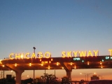
), then past an interchange with the Chicago SkywayChicago SkywayThe Chicago Skyway, also known as Chicago Skyway Toll Bridge System, is a toll road in Chicago, Illinois, United States, carrying Interstate 90 from the Indiana Toll Road to the Dan Ryan Expressway on Chicago's South Side leading into the Chicago Loop....
near 66th Street, to its southern terminus in south Chicago, where it interchanges with the Bishop Ford FreewayBishop Ford FreewayThe Bishop Ford Freeway, formerly known as the Calumet Expressway, is a portion of Interstate 94 in northeastern Illinois, south of downtown Chicago. It runs from Interstate 57 south to the intersection with Interstate 80, Interstate 294 and Illinois Route 394...
and continues southwest through south Chicago and the southern suburbs toward Champaign-Urbana. The Dan RyanDan Ryan ExpresswayThe Dan Ryan is an expressway in the city of Chicago that runs from the Circle Interchange with I-290 near downtown Chicago through the South Side of the city. It is designated as both Interstate 94 and Interstate 90 south to 66th Street, a distance of...
is signed as Interstate 94Interstate 94Interstate 94 is the northernmost east–west Interstate Highway, connecting the Great Lakes and Intermountain regions of the United States. I-94's western terminus is in Billings, Montana at a junction with Interstate 90; its eastern terminus is the U.S...
until it interchanges with the Bishop Ford FreewayBishop Ford FreewayThe Bishop Ford Freeway, formerly known as the Calumet Expressway, is a portion of Interstate 94 in northeastern Illinois, south of downtown Chicago. It runs from Interstate 57 south to the intersection with Interstate 80, Interstate 294 and Illinois Route 394...
and Interstate 57Interstate 57Interstate 57 is an Interstate Highway in Missouri and Illinois that parallels the old Illinois Central rail line for much of its route. It goes from Miner, Missouri, at Interstate 55 to Chicago, Illinois, at Interstate 94. I-57 essentially serves as a shortcut route for travelers headed between...
; the Dan Ryan is then signed as the latter (although for the purposes of local traffic reports and conversation, the Dan Ryan is usually considered to end at the Interstate 57Interstate 57Interstate 57 is an Interstate Highway in Missouri and Illinois that parallels the old Illinois Central rail line for much of its route. It goes from Miner, Missouri, at Interstate 55 to Chicago, Illinois, at Interstate 94. I-57 essentially serves as a shortcut route for travelers headed between...
interchange). The portion between the Circle Interchange and the junction with the Chicago Skyway is overlaid with Interstate 90Interstate 90Interstate 90 is the longest Interstate Highway in the United States at . It is the northernmost coast-to-coast interstate, and parallels US 20 for the most part. Its western terminus is in Seattle, at Edgar Martinez Drive S. near Safeco Field and CenturyLink Field, and its eastern terminus is in...
. There are express and local lanes running through downtown Chicago on the south side of the city which were under construction until their completion in November 2007.
- The Eisenhower Expressway (Interstate 290Interstate 290 (Illinois)Interstate 290 is a main Interstate freeway that runs westwards from the Chicago Loop. A portion of I-290 is officially called the Dwight D. Eisenhower Expressway. In short form, it is known as "the Ike" or the Eisenhower...
, and then separately Illinois Route 53Illinois Route 53Illinois Route 53 is an arterial north–south state highway in northeast Illinois. Route 53 runs south from Long Grove at Illinois Route 83 to Gardner at Interstate 55 west of old U.S. Highway 66, a distance of...
; formerly "Congress Expressway") runs from the Circle InterchangeCircle InterchangeThe Circle Interchange is an expressway interchange near downtown Chicago, Illinois. It is the junction between the Dan Ryan, Eisenhower and Kennedy expressways...
near the Loop almost due west to Chicago's western suburbs, interchanging with the Tri-State Tollway and the eastern terminus of the Ronald Reagan Memorial Tollway (Interstate 88Interstate 88 (west)Interstate 88 is an intrastate Interstate Highway in the state of Illinois. It runs from an interchange with Interstate 80 near Silvis and Moline to an interchange with Interstates 290 and 294 in Hillside, near Chicago...
) near Hillside, IllinoisHillside, IllinoisHillside is a village in Cook County, Illinois, United States. The population was 8,155 at the 2000 census.One notable landmark in Hillside is the Mount Carmel Cemetery. On the grounds of the cemetery are the graves of a number of organized crime figures, such as Al Capone and Dion O'Bannion...
, after which it turns northwest (as the "Eisenhower extension"). At the interchange with Interstate 90Interstate 90Interstate 90 is the longest Interstate Highway in the United States at . It is the northernmost coast-to-coast interstate, and parallels US 20 for the most part. Its western terminus is in Seattle, at Edgar Martinez Drive S. near Safeco Field and CenturyLink Field, and its eastern terminus is in...
, it continues as Illinois Route 53Illinois Route 53Illinois Route 53 is an arterial north–south state highway in northeast Illinois. Route 53 runs south from Long Grove at Illinois Route 83 to Gardner at Interstate 55 west of old U.S. Highway 66, a distance of...
until eventually terminating at Lake Cook Road. SchaumburgSchaumburg, IllinoisSchaumburg is a city located in Cook County in northeastern Illinois. A common misspelling of the city name is Schaumberg, a spelling which persists on some modern maps. Schaumburg is located just under northwest of downtown Chicago and approximately northwest of O'Hare International Airport. As...
. The name "Congress Parkway" persists for the short section east of the Circle Interchange, which connects the three major expressways to Lake Shore DriveLake Shore DriveLake Shore Drive is a mostly freeway-standard expressway running parallel with and alongside the shoreline of Lake Michigan through Chicago, Illinois, USA. Except for the portion north of Foster Avenue , Lake Shore Drive is designated as part of U.S...
(U.S. 41).
- The Stevenson ExpresswayStevenson ExpresswayThe Stevenson Expressway is the major Interstate highway leading southwest out of the city of Chicago in Illinois. It is signed as Interstate 55 for the entire length....
(Interstate 55Interstate 55 in IllinoisIn the U.S. state of Illinois, Interstate 55 is a major north–south Interstate Highway that connects the St. Louis, Missouri and Chicago metropolitan areas. It runs from the Poplar Street Bridge in East St. Louis to U.S. Route 41 near downtown Chicago...
) has its northern terminus at Lake Shore Drive near the McCormick PlaceMcCormick PlaceMcCormick Place is the largest convention center in the United States. It is made up of four interconnected buildings sited on and near the shore of Lake Michigan, about 4 km south of downtown Chicago, Illinois, USA. McCormick Place hosts numerous trade shows, including the Chicago Auto Show,...
convention center. From the junction with Lake Shore Drive, the Stevenson runs southwest where it interchanges with the Dan Ryan before heading to the south and southwestern neighborhoods of Chicago. The Stevenson then continues past Chicago Midway International Airport and out of Chicago. After leaving Chicago it intersects with the Tri-State TollwayTri-State TollwayThe Tri-State Tollway is a U.S. toll road maintained by the Illinois State Toll Highway Authority in northeastern Illinois which is considered one of the most heavily traveled highways in the country...
and the Veterans Memorial Tollway, and then heads southwest out of the Chicago area toward JolietJoliet, IllinoisJoliet is a city in Will and Kendall Counties in the U.S. state of Illinois, located southwest of Chicago. It is the county seat of Will County. As of the 2010 census, the city was the fourth-most populated in Illinois, with a population of 147,433. It continues to be Illinois' fastest growing...
(where it intersects Interstate 80Interstate 80Interstate 80 is the second-longest Interstate Highway in the United States, following Interstate 90. It is a transcontinental artery running from downtown San Francisco, California to Teaneck, New Jersey in the New York City Metropolitan Area...
) and on into central Illinois.
- The Veterans Memorial Tollway (Interstate 355Interstate 355Interstate 355 , also known as the Veterans Memorial Tollway, is an Interstate Highway and tollway in the western and southwest suburbs of Chicago, Illinois, U.S. Like most other toll roads in the northeastern portion of the state, I-355 is maintained by a State Highway Authority...
) (formerly the North-South Tollway) runs from an interchange with Interstate 290Interstate 290 (Illinois)Interstate 290 is a main Interstate freeway that runs westwards from the Chicago Loop. A portion of I-290 is officially called the Dwight D. Eisenhower Expressway. In short form, it is known as "the Ike" or the Eisenhower...
through the western suburbs to a complex interchange with Interstate 88Interstate 88 (west)Interstate 88 is an intrastate Interstate Highway in the state of Illinois. It runs from an interchange with Interstate 80 near Silvis and Moline to an interchange with Interstates 290 and 294 in Hillside, near Chicago...
before continuing south to the redone interchange with Interstate 55Interstate 55Interstate 55 is an Interstate Highway in the central United States. Its odd number indicates that it is a north–south Interstate Highway. I-55 goes from LaPlace, Louisiana at Interstate 10 to Chicago at U.S. Route 41 , at McCormick Place. A common nickname for the highway is "double...
, its former southern terminus. Then it continues on 11 miles of new tollway to its southern terminus at Interstate 80Interstate 80Interstate 80 is the second-longest Interstate Highway in the United States, following Interstate 90. It is a transcontinental artery running from downtown San Francisco, California to Teaneck, New Jersey in the New York City Metropolitan Area...
.
- The Ronald Reagan Memorial Tollway (Interstate 88Interstate 88 (west)Interstate 88 is an intrastate Interstate Highway in the state of Illinois. It runs from an interchange with Interstate 80 near Silvis and Moline to an interchange with Interstates 290 and 294 in Hillside, near Chicago...
; formerly the East-West Tollway) runs from a complex interchange with the Eisenhower Expressway and the Tri-State TollwayTri-State TollwayThe Tri-State Tollway is a U.S. toll road maintained by the Illinois State Toll Highway Authority in northeastern Illinois which is considered one of the most heavily traveled highways in the country...
west to another complex interchange with Interstate 355Interstate 355Interstate 355 , also known as the Veterans Memorial Tollway, is an Interstate Highway and tollway in the western and southwest suburbs of Chicago, Illinois, U.S. Like most other toll roads in the northeastern portion of the state, I-355 is maintained by a State Highway Authority...
. Then it heads through the western suburbs into north-central Illinois.
- Interstate 57Interstate 57Interstate 57 is an Interstate Highway in Missouri and Illinois that parallels the old Illinois Central rail line for much of its route. It goes from Miner, Missouri, at Interstate 55 to Chicago, Illinois, at Interstate 94. I-57 essentially serves as a shortcut route for travelers headed between...
runs from the junction of the Dan Ryan ExpresswayDan Ryan ExpresswayThe Dan Ryan is an expressway in the city of Chicago that runs from the Circle Interchange with I-290 near downtown Chicago through the South Side of the city. It is designated as both Interstate 94 and Interstate 90 south to 66th Street, a distance of...
and Bishop Ford FreewayBishop Ford FreewayThe Bishop Ford Freeway, formerly known as the Calumet Expressway, is a portion of Interstate 94 in northeastern Illinois, south of downtown Chicago. It runs from Interstate 57 south to the intersection with Interstate 80, Interstate 294 and Illinois Route 394...
south-southwest to the southern suburbs. Known originally as the "Dan Ryan West Leg", the name has since dropped from common usage. As such, it is the only expressway within the city of Chicago lacking a formal name.
- The Bishop Ford FreewayBishop Ford FreewayThe Bishop Ford Freeway, formerly known as the Calumet Expressway, is a portion of Interstate 94 in northeastern Illinois, south of downtown Chicago. It runs from Interstate 57 south to the intersection with Interstate 80, Interstate 294 and Illinois Route 394...
(Interstate 94Interstate 94 in IllinoisIn the U.S. state of Illinois, Interstate 94 generally runs north–south through the northeastern portion of the state, in Lake and Cook Counties. It is marked east–west in Illinois in accordance with its general alignment across the country, although some entrances on the Tri-State...
, and then separately Illinois Route 394Illinois Route 394Illinois Route 394 is a four-lane state freeway that travels south from Thornton at the Interstate 294/Interstate 94/Interstate 80 interchange to Illinois Route 1 south of Steger and Crete. Before taking the Illinois 394 route, it was known as Illinois 1...
; originally named the Calumet Expressway, and still referred to as such in some local traffic reports) starts at the southern terminus of the Dan Ryan Expressway and heads first southeast and then south through southern Chicago and into Chicago's southern suburbs, where it intersects with the western end of the Kingery ExpresswayKingery ExpresswayThe Robert Kingery Expressway, formerly called the Tri-State Highway, is a three-mile-long , eight-lane expressway in northeastern Illinois...
and the eastern end of the Tri-State TollwayTri-State TollwayThe Tri-State Tollway is a U.S. toll road maintained by the Illinois State Toll Highway Authority in northeastern Illinois which is considered one of the most heavily traveled highways in the country...
, then continues on further into the south suburbs before downgrading to a surface highway and eventually terminating into Dixie HighwayDixie HighwayThe Dixie Highway was a United States automobile highway, first planned in 1914 to connect the US Midwest with the Southern United States. It was part of the National Auto Trail system, and grew out of an earlier Miami to Montreal highway. The final result is better understood as a small network of...
(Illinois Route 1) south of Crete, IllinoisCrete, IllinoisCrete is a village in Will County, Illinois, United States. The population was 7,346 at the 2000 census. Originally named Wood's Corner, it was founded in 1836 by Vermonters Dyantha and Willard Wood.-Geography:Crete is located at ....
. The portion of the Bishop Ford Freeway north of the interchange with the Kingery ExpresswayKingery ExpresswayThe Robert Kingery Expressway, formerly called the Tri-State Highway, is a three-mile-long , eight-lane expressway in northeastern Illinois...
is signed as Interstate 94Interstate 94Interstate 94 is the northernmost east–west Interstate Highway, connecting the Great Lakes and Intermountain regions of the United States. I-94's western terminus is in Billings, Montana at a junction with Interstate 90; its eastern terminus is the U.S...
; south of that point it is signed as Illinois Route 394.
- The Chicago SkywayChicago SkywayThe Chicago Skyway, also known as Chicago Skyway Toll Bridge System, is a toll road in Chicago, Illinois, United States, carrying Interstate 90 from the Indiana Toll Road to the Dan Ryan Expressway on Chicago's South Side leading into the Chicago Loop....
(Interstate 90Interstate 90 in IllinoisIn the U.S. state of Illinois, Interstate 90 runs roughly northwest through the northern end of the state, from the Indiana border to Wisconsin. I-90 traverses a variety of settings, from farmland west of the Fox River Valley to medium-density suburban west of O'Hare International Airport, to the...
) angles off from the Dan Ryan Expressway near 66th Street and heads southeast toward IndianaIndianaIndiana is a US state, admitted to the United States as the 19th on December 11, 1816. It is located in the Midwestern United States and Great Lakes Region. With 6,483,802 residents, the state is ranked 15th in population and 16th in population density. Indiana is ranked 38th in land area and is...
. Whether or not the Skyway is part of Interstate 90 is a matter of some debate. The eastern end of the Skyway ends with toll bridge over the Little Calumet River and (incidentally) the Indiana state line; on the other side of the state line the Skyway ends at the western terminus of the Indiana Toll RoadIndiana Toll RoadThe Indiana Toll Road, officially the Indiana East–West Toll Road, is a toll road that runs for east–west across northern Indiana from the Illinois state line to the Ohio state line...
.
- The Tri-State TollwayTri-State TollwayThe Tri-State Tollway is a U.S. toll road maintained by the Illinois State Toll Highway Authority in northeastern Illinois which is considered one of the most heavily traveled highways in the country...
(Interstate 294Interstate 294Interstate 294 is a tolled Interstate Highway in northeastern Illinois, U.S.A.. It forms the southern portion of the Tri-State Tollway in Illinois. I-294 runs from South Holland at Interstates 80 and 94, and Illinois Route 394 to Northbrook at I-94. Interstate 294 is long; are shared with I-80....
, and then separately Interstate 94Interstate 94 in IllinoisIn the U.S. state of Illinois, Interstate 94 generally runs north–south through the northeastern portion of the state, in Lake and Cook Counties. It is marked east–west in Illinois in accordance with its general alignment across the country, although some entrances on the Tri-State...
) only enters Chicago at one point: its interchange with the Kennedy Expressway and North-West Tollway on the far northwest side. Otherwise, the Tri-State circumvents the city of Chicago entirely, running entirely through the suburbs from its northern terminus near the WisconsinWisconsinWisconsin is a U.S. state located in the north-central United States and is part of the Midwest. It is bordered by Minnesota to the west, Iowa to the southwest, Illinois to the south, Lake Michigan to the east, Michigan to the northeast, and Lake Superior to the north. Wisconsin's capital is...
border to its southern terminus at the interchange with the Bishop Ford Freeway and the western end of the Kingery ExpresswayKingery ExpresswayThe Robert Kingery Expressway, formerly called the Tri-State Highway, is a three-mile-long , eight-lane expressway in northeastern Illinois...
. North of the junction with the Edens Spur the Tri-State is signed as Interstate 94Interstate 94Interstate 94 is the northernmost east–west Interstate Highway, connecting the Great Lakes and Intermountain regions of the United States. I-94's western terminus is in Billings, Montana at a junction with Interstate 90; its eastern terminus is the U.S...
; south of this it is signed as Interstate 294, and the southern part of that is overlaid by Interstate 80Interstate 80Interstate 80 is the second-longest Interstate Highway in the United States, following Interstate 90. It is a transcontinental artery running from downtown San Francisco, California to Teaneck, New Jersey in the New York City Metropolitan Area...
(which continues east past the eastern terminus of Interstate 294 as the Kingery Expressway and on into Indiana).
- The Kingery ExpresswayKingery ExpresswayThe Robert Kingery Expressway, formerly called the Tri-State Highway, is a three-mile-long , eight-lane expressway in northeastern Illinois...
(Interstate 80Interstate 80 in IllinoisIn the U.S. state of Illinois, Interstate 80 is an Interstate Highway that runs from the Quad Cities east to south of Chicago. It is a main east–west route for trafficcoming and going through Illinois, especially for cross-country truckers....
, Interstate 94Interstate 94 in IllinoisIn the U.S. state of Illinois, Interstate 94 generally runs north–south through the northeastern portion of the state, in Lake and Cook Counties. It is marked east–west in Illinois in accordance with its general alignment across the country, although some entrances on the Tri-State...
and U.S. Route 6U.S. Route 6 in IllinoisIn the state of Illinois, U.S. Route 6 is an east–west arterial surface road that runs from the city of Moline in the Quad Cities area to Lansing at the Indiana state line. This is a distance of approximately .-Quad Cities to LaSalle–Peru:...
) entirely in Lansing, IllinoisLansing, IllinoisLansing is a village in Cook County, Illinois, USA. Lansing is a southern suburb of Chicago. The population was 28,332 at the 2000 census.-Geography:...
, is a three mile long expressway from the interchange with the Bishop Ford FreewayBishop Ford FreewayThe Bishop Ford Freeway, formerly known as the Calumet Expressway, is a portion of Interstate 94 in northeastern Illinois, south of downtown Chicago. It runs from Interstate 57 south to the intersection with Interstate 80, Interstate 294 and Illinois Route 394...
and the Tri-State TollwayTri-State TollwayThe Tri-State Tollway is a U.S. toll road maintained by the Illinois State Toll Highway Authority in northeastern Illinois which is considered one of the most heavily traveled highways in the country...
to the IllinoisIllinoisIllinois is the fifth-most populous state of the United States of America, and is often noted for being a microcosm of the entire country. With Chicago in the northeast, small industrial cities and great agricultural productivity in central and northern Illinois, and natural resources like coal,...
/IndianaIndianaIndiana is a US state, admitted to the United States as the 19th on December 11, 1816. It is located in the Midwestern United States and Great Lakes Region. With 6,483,802 residents, the state is ranked 15th in population and 16th in population density. Indiana is ranked 38th in land area and is...
border.
- Lake Shore DriveLake Shore DriveLake Shore Drive is a mostly freeway-standard expressway running parallel with and alongside the shoreline of Lake Michigan through Chicago, Illinois, USA. Except for the portion north of Foster Avenue , Lake Shore Drive is designated as part of U.S...
(U.S. Route 41U.S. Route 41 in IllinoisIn the U.S. state of Illinois, U.S. Route 41 runs north from the Indiana border beneath the Chicago Skyway on Indianapolis Boulevard to the Wisconsin border north of the northern terminus of the Tri-State Tollway with Interstate 94. It is the only north–south U.S...
) is a major highway running along the Lake Michigan shoreline from Hayes Drive (63rd Street) in southern Chicago to the intersection of Hollywood Avenue and Sheridan Road in Chicago's Edgewater neighborhood. For most of its length, Lake Shore Drive is signed as U.S. Route 41. Parts of Lake Shore Drive are constructed at or near expressway grade, but there are a number of at-grade intersections, especially near downtown. Nonetheless, "LSD" (as it is often referred to) is a major arterial with a great deal of cultural as well as transportation significance to Chicagoans.
- The Elgin BypassElgin BypassThe Elgin Bypass is the common name for a four-lane freeway that carries U.S. Highway 20 around the city of Elgin in northeast Illinois. The highway forms a southern border to the Elgin street grid. The state-ownership of the land on the south edge of town for hospital and highway maintenance...
(U.S. Route 20U.S. Route 20 in IllinoisIn the U.S. state of Illinois, U.S. Route 20 is a major arterial highway that runs from the Iowa state line at East Dubuque at the northwestern tip of Illinois, to the Indiana state line at Chicago south of the Chicago Skyway. A distance of .For its entire length, US 20 is designated as the...
) is a five-mile freeway along U.S. Route 20U.S. Route 20U.S. Route 20 is an east–west United States highway. As the "0" in its route number implies, US 20 is a coast-to-coast route. Spanning , it is the longest road in the United States, and the route sparsely parallels Interstate 90...
, bypassing Elgin, IllinoisElgin, IllinoisElgin is a city in northern Illinois located roughly northwest of Chicago on the Fox River. Most of Elgin lies within Kane County, Illinois, with a portion in Cook County, Illinois...
. It goes west from the Villa Street interchange across the Fox RiverFox River (Illinois River tributary)The Fox River is a tributary of the Illinois River in the states of Wisconsin and Illinois in the United States. There are two other "Fox Rivers" in southern Illinois: the Fox River and a smaller "Fox River" that joins the Wabash River near New Harmony, Indiana.-Wisconsin:The Fox River rises near...
with exits at State Street, McLean Boulevard, and Randall Road before continuing as an at-grade road.
- The Kingery Highway (Illinois Route 83Illinois Route 83Illinois Route 83 is a major north–south state road in northeast Illinois. It stretches from U.S. Highway 30 by Lynwood and Dyer, Indiana north to the Wisconsin border by Antioch at Highway 83. Incidentally, this alignment is concentric with Interstate 294...
) is a freeway from 55th Street in Clarendon HillsClarendon Hills, IllinoisClarendon Hills is an affluent village in DuPage County, Illinois, United States. The population was 7,610 at the 2000 census.-Geography:Clarendon Hills is located at...
to Roosevelt Road in Oakbrook TerraceOakbrook Terrace, IllinoisOakbrook Terrace is a city in DuPage County, Illinois, a suburb of Chicago. The population was 2,300 at the 2000 census. A 2003 recount gave the city a population of 2,293. Its current mayor is Tony "Red Panda" Ragucci.-Points of interest:...
. South of 55th Street it is a 4-lane surface road. North of Roosevelt Road, it is a 6-lane divided highway.
- The Amstutz Expressway (Illinois Route 137Illinois Route 137Illinois Route 137 is a state highway in northeast Illinois. It runs from the Wisconsin Border north of Winthrop Harbor south to North Chicago, west to Libertyville, and then back northwest to Grayslake, terminating at Illinois Route 83 just south of Illinois Route 120...
) is a two-mile freeway located entirely in Waukegan, IllinoisWaukegan, IllinoisWaukegan is a city and county seat of Lake County, Illinois. As of the 2000 census, the city had a total population of 87,901. The 2010 population was 89,078. It is the ninth-largest city in Illinois by population...
. It has only one exit at Grand Avenue.
- The Elgin-O'Hare ExpresswayElgin-O'Hare ExpresswayThe Elgin-O'Hare Expressway is an Interstate-standard freeway in northeast Illinois, United States. Contrary to its given name, the expressway does not enter either Elgin or O'Hare International Airport, giving it a somewhat infamous reputation as a "road to nowhere"...
is an unsigned expressway that was originally planned to connect to Interstate 190Interstate 190 (Illinois)Interstate 190 is an intrastate Interstate Highway in the U.S. state of Illinois. I-190 runs west from I-90 to O'Hare International Airport. This is a distance of . Interstate 190 is the westernmost leg of the Kennedy Expressway...
and the Elgin BypassElgin BypassThe Elgin Bypass is the common name for a four-lane freeway that carries U.S. Highway 20 around the city of Elgin in northeast Illinois. The highway forms a southern border to the Elgin street grid. The state-ownership of the land on the south edge of town for hospital and highway maintenance...
, hence the name. It heads west from Rohlwing Road in ItascaItasca, IllinoisItasca is a village in DuPage County, Illinois, United States. The population was 8,302 at the 2000 census.In 2009, BusinessWeek rated Itasca as the 'Best Affordable Suburb' in the state of Illinois...
through RoselleRoselle, IllinoisRoselle is a city located in DuPage County and a small portion in Cook County Illinois in northeastern Illinois. It was first incorporated in 1922 and can correctly be relegated to a bedroom community — that is, a community that largely consists of residential zoning in both income streams...
and SchaumburgSchaumburg, IllinoisSchaumburg is a city located in Cook County in northeastern Illinois. A common misspelling of the city name is Schaumberg, a spelling which persists on some modern maps. Schaumburg is located just under northwest of downtown Chicago and approximately northwest of O'Hare International Airport. As...
until terminating at an interchange with U.S. Route 20U.S. Route 20 in IllinoisIn the U.S. state of Illinois, U.S. Route 20 is a major arterial highway that runs from the Iowa state line at East Dubuque at the northwestern tip of Illinois, to the Indiana state line at Chicago south of the Chicago Skyway. A distance of .For its entire length, US 20 is designated as the...
.
- U.S. Route 41U.S. Route 41U.S. Route 41 is a north–south United States Highway that runs from Miami, Florida to the Upper Peninsula of Michigan. Until 1949, the part in southern Florida, from Naples to Miami, was U.S...
enters through the southeastern part of the city from IndianaIndianaIndiana is a US state, admitted to the United States as the 19th on December 11, 1816. It is located in the Midwestern United States and Great Lakes Region. With 6,483,802 residents, the state is ranked 15th in population and 16th in population density. Indiana is ranked 38th in land area and is...
as a part of U.S. Route 12U.S. Route 12U.S. Route 12 or US 12 is an east–west United States highway, running from Grays Harbor on the Pacific Ocean, in the state of Washington, to downtown Detroit, for almost . As a thoroughfare, it has mostly been supplanted by I-90 and I-94, but remains an important road for local travel.The...
and U.S. Route 20U.S. Route 20U.S. Route 20 is an east–west United States highway. As the "0" in its route number implies, US 20 is a coast-to-coast route. Spanning , it is the longest road in the United States, and the route sparsely parallels Interstate 90...
, underneath the bridge linking the Chicago SkywayChicago SkywayThe Chicago Skyway, also known as Chicago Skyway Toll Bridge System, is a toll road in Chicago, Illinois, United States, carrying Interstate 90 from the Indiana Toll Road to the Dan Ryan Expressway on Chicago's South Side leading into the Chicago Loop....
and the Indiana Toll RoadIndiana Toll RoadThe Indiana Toll Road, officially the Indiana East–West Toll Road, is a toll road that runs for east–west across northern Indiana from the Illinois state line to the Ohio state line...
. It traverses the southeast side of the city until it becomes South Shore Drive, and eventually Lake Shore DriveLake Shore DriveLake Shore Drive is a mostly freeway-standard expressway running parallel with and alongside the shoreline of Lake Michigan through Chicago, Illinois, USA. Except for the portion north of Foster Avenue , Lake Shore Drive is designated as part of U.S...
. U.S. 41 then departs from Lake Shore Drive at Foster Avenue. From Foster Avenue, U.S. 41 continues northwest on Lincoln AvenueLincoln Avenue (Chicago)Lincoln Avenue is a major diagonal thoroughfare of the north side of city of Chicago. It runs from Clark Street on the western border of Lincoln Park largely to the northwest, ending in Morton Grove, Illinois...
, finally exiting Chicago at Devon AvenueDevon Avenue (Chicago)Devon Avenue is a major east-west thoroughfare in the Chicago metropolitan area. It begins at Chicago's Sheridan Road, which borders Lake Michigan, and it runs west until merging with Higgins Road near O'Hare International Airport. Devon continues on the opposite side of the airport and runs...
into the suburb of Lincolnwood. - U.S. Route 14U.S. Route 14U.S. Route 14 , an east–west route, is one of the original United States highways of 1926. It currently has a length of 1,398 miles , but it had a peak length of 1,429 miles . For much of its length, it runs roughly parallel to Interstate 90.As of 2004, the highway's eastern terminus is in...
splits off from U.S. Route 41U.S. Route 41U.S. Route 41 is a north–south United States Highway that runs from Miami, Florida to the Upper Peninsula of Michigan. Until 1949, the part in southern Florida, from Naples to Miami, was U.S...
at Bryn Mawr Avenue by Lake MichiganLake MichiganLake Michigan is one of the five Great Lakes of North America and the only one located entirely within the United States. It is the second largest of the Great Lakes by volume and the third largest by surface area, after Lake Superior and Lake Huron...
on the north side of the city. U.S. 14 then recrosses U.S. 41 and eventually exits the city as Caldwell Avenue. - U.S. Route 12U.S. Route 12U.S. Route 12 or US 12 is an east–west United States highway, running from Grays Harbor on the Pacific Ocean, in the state of Washington, to downtown Detroit, for almost . As a thoroughfare, it has mostly been supplanted by I-90 and I-94, but remains an important road for local travel.The...
and U.S. Route 20U.S. Route 20U.S. Route 20 is an east–west United States highway. As the "0" in its route number implies, US 20 is a coast-to-coast route. Spanning , it is the longest road in the United States, and the route sparsely parallels Interstate 90...
enter the city proper on the far south side on 95th Street at Western Avenue. They stay together until they join U.S. Route 41U.S. Route 41U.S. Route 41 is a north–south United States Highway that runs from Miami, Florida to the Upper Peninsula of Michigan. Until 1949, the part in southern Florida, from Naples to Miami, was U.S...
in the south side, and exit together into Indiana. U.S. 12 crosses back into Chicago by O'Hare Airport concurrentConcurrency (road)A concurrency, overlap, or coincidence in a road network is an instance of one physical road bearing two or more different highway, motorway, or other route numbers...
with U.S. Route 45U.S. Route 45U.S. Route 45 is a north–south United States highway. US 45 is a border-to-border route, from Lake Superior to the Gulf of Mexico. A sign at the highway's northern terminus notes the total distance as ....
. - U.S. Route 45U.S. Route 45 in IllinoisIn the U.S. state of Illinois, U.S. Route 45 is a major north–south highway that runs from the Irvin S. Cobb Bridge over the Ohio River at Brookport north through rural sections of eastern Illinois and then through the suburbs of Chicago to the Wisconsin border east of Antioch. This is a...
remains mostly outside of Chicago, crossing Interstate 190Interstate 190 (Illinois)Interstate 190 is an intrastate Interstate Highway in the U.S. state of Illinois. I-190 runs west from I-90 to O'Hare International Airport. This is a distance of . Interstate 190 is the westernmost leg of the Kennedy Expressway...
as a part of U.S. Route 12U.S. Route 12U.S. Route 12 or US 12 is an east–west United States highway, running from Grays Harbor on the Pacific Ocean, in the state of Washington, to downtown Detroit, for almost . As a thoroughfare, it has mostly been supplanted by I-90 and I-94, but remains an important road for local travel.The...
and U.S. Route 20U.S. Route 20U.S. Route 20 is an east–west United States highway. As the "0" in its route number implies, US 20 is a coast-to-coast route. Spanning , it is the longest road in the United States, and the route sparsely parallels Interstate 90...
. It follows the Des Plaines RiverDes Plaines RiverThe Des Plaines River is a river that flows southward for through southern Wisconsin and northern Illinois in the U.S. Midwest, eventually meeting the Kankakee River west of Channahon to form the Illinois River, a tributary of the Mississippi River....
as the Des Plaines River Road or Mannheim Road.
See also
- Multilevel streets in ChicagoMultilevel streets in ChicagoDowntown Chicago, Illinois has some double-decked and a few triple-decked streets immediately north and south of the Main Branch and immediately east of the South Branch of the Chicago River. The most famous and longest of these is Wacker Drive, which replaced the South Water Street Market upon its...
(including Wacker DriveWacker DriveWacker Drive is a major street in Chicago, Illinois, United States, running along the south side of the main branch and the east side of the south branch of the Chicago River...
) - U.S. Route 66 in IllinoisU.S. Route 66 in IllinoisU.S. Route 66 connected St. Louis, Missouri and Chicago, Illinois. The highway had previously been Illinois Route 4 and the road has now been largely replaced with Interstate 55 . Parts of the road still carry traffic and sixseparate portions of the roadbed have been listed on the U.S...
- Chicago PedwayChicago PedwayThe Chicago Pedway is a network of tunnels, ground-level concourses and overhead bridges connecting skyscrapers, retail stores, hotels and train stations throughout the central business district of Chicago, Illinois. Having a length of more than 40 downtown blocks, it contains shops, restaurants...
- Chicago Tunnel CompanyChicago Tunnel CompanyThe Chicago Tunnel Company built a narrow gauge railway freight tunnel network under the downtown of the city of Chicago. This was regulated by the Interstate Commerce Commission as an interurban despite the fact that it operated entirely under central Chicago, did not carry passengers, and was...
- Cycling in Chicago
- LaSalle Street TunnelLaSalle Street TunnelThe LaSalle Street Tunnel was Chicago's second tunnel under the Chicago River. It was started November 3, 1869, and completed July 4, 1871. It was designed by William Bryson who was the resident engineer for the Washington Street Tunnel...
- Van Buren Street TunnelVan Buren Street TunnelThe Van Buren Street Tunnel was Chicago's third tunnel under the Chicago River. Built in 1891–92 just north of Van Buren Street, it was 1,514 feet long and was used for cable car service until 1906....
- Washington Street TunnelWashington Street Tunnel (Chicago)The Washington Street Tunnel was the first traffic tunnel under the Chicago River. J.L. Lake was awarded the contract to construct the tunnel in July 1867 and its construction was completed January 1, 1869.This tunnel was 1605 feet long and cost $517,000....
- Philo CarpenterPhilo CarpenterPhilo Carpenter was Chicago, Illinois' first pharmacist, and an outspoken abolitionist.Born in Savoy, Massachusetts, February 27, 1805, young Philo learned medicine and the pharmaceutical trade in Troy, New York in the drugstore of Amatus Robins, eventually gaining a half interest in the business...
- Matthew LaflinMatthew LaflinMatthew Laflin was an American manufacturer of gunpowder, businessman, philanthropist, and an early pioneer of Chicago, Illinois.-Early life and ancestors:...
- Horatio G. LoomisHoratio G. LoomisLoomis was a native of Vermont who came to Chicago as a pioneer settler in 1834. A grocer by trade, Loomis also was an entrepreneur who became involved in many business fields, including commodities trading....
- Philip MaxwellPhilip MaxwellBorn in Vermont in 1799, Maxwell moved to New York State where he became a doctor and politician, and was elected to the New York Legislature. He also was a physician for the United States Army, where he served with General Zachary Taylor. A military transfer brought him to Chicago, Illinois, which...