
.gif)
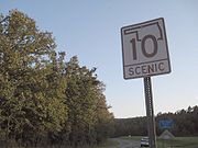
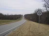
State Highway 10 (Oklahoma)
Encyclopedia
State Highway 10 is a state highway
in northeastern Oklahoma
. It makes a 235.5 mile (379 km) crescent through the northeast corner of the state, running from State Highway 99
in Osage County
to Interstate 40 near Gore
. It has two lettered spur routes.
SH-10 first appeared as part of the original highway system designated in 1924. The route originally served eastern Oklahoma as a border-to-border route, connecting the Red River near Hugo
to the Missouri
state line near Joplin, Missouri
. Much of the southern half of the route was dropped in 1941, while western extensions throughout the 1940s brought the highway towards the routing we know today.
 Highway 10 begins at State Highway 99 northwest of the unincorporated town of Bigheart. The highway runs northeast of this point through sparsely-populated Osage County. The route runs across the dam forming Lake Hulah and runs through its eponymous unincorporated community. East of this, it crosses into Washington County
, where it skirts Copan Lake. The route then proceeds to the town of Copan
, where it intersects US-75. SH-10 progresses east to Nowata County
, entering the county near Wann
, before meeting US-169 around Elliot. It forms a concurrency
with US-169 through the town of Lenapah, and splits off and heads due east from there. It does not intersect any highways or pass through any sizeable towns until Welch
, where it meets US-59/SH-2
. It then continues east to Miami, Oklahoma
where it overlaps
with US-59/69 and meets State Highway 125
. After passing through Miami and passing the northern terminus of State Highway 137
, SH-10 reaches its northeasternmost point at the western terminus of SH-10C (see below). After this point, all of SH-10 is north–south.
SH-10 has a brief concurrency with U.S. Highway 60 near Wyandotte
. At Wyandotte, the route turns to the south once more for 16 miles (25.7 km) to its junction with SH-25
. From this junction, the route turns to the west for the three-mile (4.8 km) stretch to Grove
. Until recently, SH-25 and SH-10 were concurrent along this stretch, but SH-25 now ends at the aforementioned junction. In downtown Grove, SH-10 again joins US-59, and is signed with that highway for 30 miles (48 km) through mostly rural parts of Delaware County
, including the county seat, Jay
, where State Highway 20
joins with SH-10 and US-59 for approximately two miles.
South of Jay, the route continues south for 17 miles (27.4 km) to an intersection with SH-116. SH-10 continues south for 3 miles (4.8 km), coming to an interchange with U.S. Highway 412, the Cherokee Turnpike
, at the town of Kansas
. (US-59 departs just south of the interchange and follows US-412 east toward the Arkansas
state line at West Siloam Springs
.) SH-10 then begins paralleling the Illinois River
, a popular recreation area primarily accessed through SH-10. It then heads eastbound again at US-62/State Highway 51
. SH-10 forms a concurrency with these two highways to Tahlequah
, where SH-51 splits off. US-62 and SH-10 remain concurrent until south of Ft. Gibson
.
After leaving US-62, SH-10 runs mostly parallel to the Arkansas River
, passing through the towns of Braggs, Oklahoma
and Gore
. It has a brief concurrency with U.S. Highway 64 to cross the Arkansas River, and splits off to the south in Webbers Falls
. Just after this it ends at Interstate 40.
state line south of Hugo
and followed present-day US-271 northward to Spiro, Oklahoma
, where it turned west along present-day State Highway 9
. The highway then resumed a northbound course along present-day SH-2 to Warner
. In Warner, it turned east to follow what is now US-64 to Webbers Falls
and Gore. From Gore, it followed its current route to what is now the present-day western terminus of SH-10C. From that intersection, rather than turning west towards Miami, SH-10 continued northeast to end southwest of Joplin, Missouri
, approximately where Interstate 44 crosses the state line now. By 1927, however, the northern terminus had been relocated to Miami.
The Miami terminus lasted until January 30, 1930, when the highway was truncated to the US-60 junction near Wyandotte. However, this change would be reverted seven years later; SH-10 once again ended in Miami beginning February 3, 1937. SH-10 was extended to the west for the first time in 1941. The route's western terminus was moved to SH-2 at Welch on April 14, 1941. However, the other terminus was moved north at the end of that year, resulting in SH-10 being truncated to Gore after November 12, 1941. SH-10 was then extended farther west, to US-169 at Lenapah, on April 3, 1944.
A new section of highway, running from SH-99 to Copan, was added to the state highway system on August 21, 1954. This road was also assigned the SH-10 designation, creating a gap in the highway between Copan and Lenapah. This gap would persist until August 3, 1981, when SH-10 was extended east from Copan to US-169, filling the gap.
Interstate 40 was built through Sequoyah County in the late 1960s. SH-10 was extended from Gore along US-64 to Exit 291 on June 1, 1970. This brought SH-10 to its present-day southern terminus.
The section of Highway 10 between Gore and I-40 was pressed into service as an emergency detour for the interstate when its bridge collapsed in the Webbers Falls bridge disaster.
State highway
State highway, state road or state route can refer to one of three related concepts, two of them related to a state or provincial government in a country that is divided into states or provinces :#A...
in northeastern Oklahoma
Oklahoma
Oklahoma is a state located in the South Central region of the United States of America. With an estimated 3,751,351 residents as of the 2010 census and a land area of 68,667 square miles , Oklahoma is the 28th most populous and 20th-largest state...
. It makes a 235.5 mile (379 km) crescent through the northeast corner of the state, running from State Highway 99
State Highway 99 (Oklahoma)
State Highway 99, also referred to as SH-99 or OK-99, is a north–south state highway through central Oklahoma. It runs from the Texas border at Lake Texoma to the Kansas border near Lake Hulah. It is long. The highway overlaps US-377 for over half its length.SH-99 links up with K-99 after...
in Osage County
Osage County, Oklahoma
Osage County is a county in the northern part of the U.S. state of Oklahoma. Coterminous with the Osage Indian Reservation, it is the home of the federally recognized Osage Nation. As of the 2010 census, the population was 47,472 a 6.8 percent increase from 2000, when the population was 44,437...
to Interstate 40 near Gore
Gore, Oklahoma
Gore is a town in Sequoyah County, Oklahoma, United States. It is part of the Fort Smith, Arkansas-Oklahoma Metropolitan Statistical Area. The population was 850 at the 2000 census...
. It has two lettered spur routes.
SH-10 first appeared as part of the original highway system designated in 1924. The route originally served eastern Oklahoma as a border-to-border route, connecting the Red River near Hugo
Hugo, Oklahoma
Hugo is a city in the southeastern part of the U.S. state of Oklahoma, bordering Texas. Hugo is the county seat for Choctaw County and has a population of 5,395 as of 2009 estimates. The city serves as winter quarters for some circus performers...
to the Missouri
Missouri
Missouri is a US state located in the Midwestern United States, bordered by Iowa, Illinois, Kentucky, Tennessee, Arkansas, Oklahoma, Kansas and Nebraska. With a 2010 population of 5,988,927, Missouri is the 18th most populous state in the nation and the fifth most populous in the Midwest. It...
state line near Joplin, Missouri
Joplin, Missouri
Joplin is a city in southern Jasper County and northern Newton County in the southwestern corner of the US state of Missouri. Joplin is the largest city in Jasper County, though it is not the county seat. As of the 2010 census, the city population was 50,150...
. Much of the southern half of the route was dropped in 1941, while western extensions throughout the 1940s brought the highway towards the routing we know today.
Route description
Washington County, Oklahoma
Washington County is a county located in the U.S. state of Oklahoma. It is, in total area, the smallest county in Oklahoma, adjacent to the largest county in Oklahoma, Osage County. It is the second smallest county, by land only size, i.e., not including water. As of 2000, the population was...
, where it skirts Copan Lake. The route then proceeds to the town of Copan
Copan, Oklahoma
Copan is a town in Washington County, Oklahoma, United States. The population was 796 at the 2000 census.-Geography:Copan is located at .According to the United States Census Bureau, the town has a total area of , all of it land....
, where it intersects US-75. SH-10 progresses east to Nowata County
Nowata County, Oklahoma
Nowata County is a county located in the U.S. state of Oklahoma. As of the 2010 census, the population was 10,573, a decline of 0.3 percent from 2000, when the population was 10,569...
, entering the county near Wann
Wann, Oklahoma
Wann is a town in Nowata County, Oklahoma, United States. The population was 125 at the 2010 census, a decrease of 5.3 percent from 132 at the 2000 census. Wann is famous for the 'Six Flag Poles Over Wann America'.-History:...
, before meeting US-169 around Elliot. It forms a concurrency
Concurrency (road)
A concurrency, overlap, or coincidence in a road network is an instance of one physical road bearing two or more different highway, motorway, or other route numbers...
with US-169 through the town of Lenapah, and splits off and heads due east from there. It does not intersect any highways or pass through any sizeable towns until Welch
Welch, Oklahoma
Welch is a town in Craig County, Oklahoma, United States. The population was 597 at the 2000 census.-Geography:Welch is located at .According to the United States Census Bureau, the town has a total area of , all of it land....
, where it meets US-59/SH-2
State Highway 2 (Oklahoma)
State Highway 2, abbreviated SH-2 or OK-2, is a designation for two distinct highways maintained by the U.S. state of Oklahoma. Though they were once connected, the middle section of highway was concurrent with three different U.S. highways, so the middle section was decommissioned for reasons of...
. It then continues east to Miami, Oklahoma
Miami, Oklahoma
Miami is a city in Ottawa County, Oklahoma, United States. As of 2009, the population estimate was 12,910. It is the county seat of Ottawa County. The city is named after the Miami tribe...
where it overlaps
Concurrency (road)
A concurrency, overlap, or coincidence in a road network is an instance of one physical road bearing two or more different highway, motorway, or other route numbers...
with US-59/69 and meets State Highway 125
State Highway 125 (Oklahoma)
State Highway 125 is a state highway in northeastern Oklahoma that is 26.3 mi long. It begins in the south at Grand Lake O' the Cherokees, running northward to meet State Highway 85A six miles later. It then crosses U.S. Highway 59 four miles later and US-60 near Fairland before ending in...
. After passing through Miami and passing the northern terminus of State Highway 137
State Highway 137 (Oklahoma)
State Highway 137 is a highway in Ottawa County. It is a two-lane highway beginning at State Highway 10 east of Miami and ends at U.S. Highway 60 in Twin Bridges State Park on the north side of the Grand Lake o' the Cherokees....
, SH-10 reaches its northeasternmost point at the western terminus of SH-10C (see below). After this point, all of SH-10 is north–south.
SH-10 has a brief concurrency with U.S. Highway 60 near Wyandotte
Wyandotte, Oklahoma
Wyandotte is a town in Ottawa County, Oklahoma, United States. The population was 363 at the 2000 census.The town is the tribal headquarters of the Wyandotte Nation of Oklahoma.-Geography:Wyandotte is located at ....
. At Wyandotte, the route turns to the south once more for 16 miles (25.7 km) to its junction with SH-25
State Highway 25 (Oklahoma)
State Highway 25 is a state highway in northeastern Oklahoma with two nonconnecting sections. The northern section runs between the communities of Pyramid Corners and Narcissa, and the southern section runs from east of Grove to the Missouri state line.-Western section:The western section of SH-25...
. From this junction, the route turns to the west for the three-mile (4.8 km) stretch to Grove
Grove, Oklahoma
Grove is a city in Delaware County, Oklahoma, United States. The population was 5,131 at the 2000 census, but the 2009 estimate was 6,377.-Geography:Grove is located at ....
. Until recently, SH-25 and SH-10 were concurrent along this stretch, but SH-25 now ends at the aforementioned junction. In downtown Grove, SH-10 again joins US-59, and is signed with that highway for 30 miles (48 km) through mostly rural parts of Delaware County
Delaware County, Oklahoma
Delaware County is a county located in the U.S. state of Oklahoma. As of 2000, the population was 37,077 and the newest population estimate is 45,000. Its county seat is Jay. The county was named for the Delaware Indians resettled in what was then Indian Territory in the 1830s. .Delaware County...
, including the county seat, Jay
Jay, Oklahoma
Jay is a city in Delaware County, Oklahoma, United States. The population was 2,448 at the 2010 census, compared to 2,482 at the 2000 census, a decrease of 1.4 percent. Almost 40% of Jay residents are Native American...
, where State Highway 20
State Highway 20 (Oklahoma)
State Highway 20 is a highway in northeastern Oklahoma. Its eastern terminus is at the corner of Oklahoma, Arkansas, and Missouri near Southwest City, Missouri; its western terminus is at State Highway 18 near Ralston...
joins with SH-10 and US-59 for approximately two miles.
South of Jay, the route continues south for 17 miles (27.4 km) to an intersection with SH-116. SH-10 continues south for 3 miles (4.8 km), coming to an interchange with U.S. Highway 412, the Cherokee Turnpike
Cherokee Turnpike
The Cherokee Turnpike is a toll road in eastern Oklahoma. Opened in 1991, the route is a four-lane tollway carrying US-412 from east of Kansas, Oklahoma to east of Chouteau, and has a total length of and a speed limit of...
, at the town of Kansas
Kansas, Oklahoma
Kansas is a town in Delaware County, Oklahoma, United States. The population was 685 at the 2000 census.-Geography:Kansas is located at .According to the United States Census Bureau, the town has a total area of , all of it land....
. (US-59 departs just south of the interchange and follows US-412 east toward the Arkansas
Arkansas
Arkansas is a state located in the southern region of the United States. Its name is an Algonquian name of the Quapaw Indians. Arkansas shares borders with six states , and its eastern border is largely defined by the Mississippi River...
state line at West Siloam Springs
West Siloam Springs, Oklahoma
West Siloam Springs is a town in Delaware County, Oklahoma, United States. The population was 877 at the 2000 census.-Geography:West Siloam Springs is located at...
.) SH-10 then begins paralleling the Illinois River
Illinois River (Oklahoma)
The Illinois River is a tributary of the Arkansas River in the U.S. states of Arkansas and Oklahoma.It rises in the Ozark Mountains in the northwest corner of Arkansas, in Washington County southwest of Fayetteville, near the town of Hogeye. It flows west into northeast Oklahoma, then southwest...
, a popular recreation area primarily accessed through SH-10. It then heads eastbound again at US-62/State Highway 51
State Highway 51 (Oklahoma)
State Highway 51, abbreviated to SH-51 or OK-51, is a major state highway in Oklahoma. It runs for 333 miles east–west across the state, running from the Texas state line to Arkansas. It is the third-longest state highway in the system.-Texas to I-35:SH-51 begins at the Texas line concurrent...
. SH-10 forms a concurrency with these two highways to Tahlequah
Tahlequah, Oklahoma
Tahlequah is a city in Cherokee County, Oklahoma, United States located at the foothills of the Ozark Mountains. It was founded as a capital of the original Cherokee Nation in 1838 to welcome those Cherokee forced west on the Trail of Tears. The city's population was 15,753 at the 2010 census. It...
, where SH-51 splits off. US-62 and SH-10 remain concurrent until south of Ft. Gibson
Fort Gibson, Oklahoma
Fort Gibson is a town in Cherokee and Muskogee counties in the U.S. state of Oklahoma. The population was 4,054 at the 2000 census. It is the location of Fort Gibson National Cemetery and is located near at the end of the Cherokees' Trail of Tears at Tahlequah, Oklahoma.Colonel Matthew Arbuckle of...
.
After leaving US-62, SH-10 runs mostly parallel to the Arkansas River
Arkansas River
The Arkansas River is a major tributary of the Mississippi River. The Arkansas generally flows to the east and southeast as it traverses the U.S. states of Colorado, Kansas, Oklahoma, and Arkansas. The river's initial basin starts in the Western United States in Colorado, specifically the Arkansas...
, passing through the towns of Braggs, Oklahoma
Braggs, Oklahoma
Braggs is a town in Muskogee County, Oklahoma, United States. The population was 301 at the 2000 census.-Geography:According to the United States Census Bureau, Braggs has a total area of , all of it land.-Demographics:...
and Gore
Gore, Oklahoma
Gore is a town in Sequoyah County, Oklahoma, United States. It is part of the Fort Smith, Arkansas-Oklahoma Metropolitan Statistical Area. The population was 850 at the 2000 census...
. It has a brief concurrency with U.S. Highway 64 to cross the Arkansas River, and splits off to the south in Webbers Falls
Webbers Falls, Oklahoma
Webbers Falls is a town in Muskogee County, Oklahoma, United States. The population was 726 at the 2000 census. The name comes from a 7 foot falls in the Arkansas River, itself named in honor of Walter Webber, a Cherokee leader who lived there in the early 19th Century.-The I-40 Bridge Disaster:The...
. Just after this it ends at Interstate 40.
History
SH-10 was first added to the state highway system on August 24, 1924. The original route of the highway began at the TexasTexas
Texas is the second largest U.S. state by both area and population, and the largest state by area in the contiguous United States.The name, based on the Caddo word "Tejas" meaning "friends" or "allies", was applied by the Spanish to the Caddo themselves and to the region of their settlement in...
state line south of Hugo
Hugo, Oklahoma
Hugo is a city in the southeastern part of the U.S. state of Oklahoma, bordering Texas. Hugo is the county seat for Choctaw County and has a population of 5,395 as of 2009 estimates. The city serves as winter quarters for some circus performers...
and followed present-day US-271 northward to Spiro, Oklahoma
Spiro, Oklahoma
Spiro is a town in Le Flore County, Oklahoma, United States. It is part of the Fort Smith, Arkansas-Oklahoma Metropolitan Statistical Area. The population was 2,227 at the 2000 census.-Geography:Spiro is located at ....
, where it turned west along present-day State Highway 9
State Highway 9 (Oklahoma)
State Highway 9, abbreviated as SH-9, OK-9, or simply Highway 9, is a major east–west highway in the U.S. state of Oklahoma. Spanning across the central part of the state, SH-9 begins at the Texas state line near Madge, Oklahoma, and ends at the Arkansas state line near Fort Smith, Arkansas. State...
. The highway then resumed a northbound course along present-day SH-2 to Warner
Warner, Oklahoma
Warner is a town in Muskogee County, Oklahoma, United States. The population was 1,430 at the 2000 census. The town is also home to part of the Connors State College campus.-Geography:Warner is located at ....
. In Warner, it turned east to follow what is now US-64 to Webbers Falls
Webbers Falls, Oklahoma
Webbers Falls is a town in Muskogee County, Oklahoma, United States. The population was 726 at the 2000 census. The name comes from a 7 foot falls in the Arkansas River, itself named in honor of Walter Webber, a Cherokee leader who lived there in the early 19th Century.-The I-40 Bridge Disaster:The...
and Gore. From Gore, it followed its current route to what is now the present-day western terminus of SH-10C. From that intersection, rather than turning west towards Miami, SH-10 continued northeast to end southwest of Joplin, Missouri
Joplin, Missouri
Joplin is a city in southern Jasper County and northern Newton County in the southwestern corner of the US state of Missouri. Joplin is the largest city in Jasper County, though it is not the county seat. As of the 2010 census, the city population was 50,150...
, approximately where Interstate 44 crosses the state line now. By 1927, however, the northern terminus had been relocated to Miami.
The Miami terminus lasted until January 30, 1930, when the highway was truncated to the US-60 junction near Wyandotte. However, this change would be reverted seven years later; SH-10 once again ended in Miami beginning February 3, 1937. SH-10 was extended to the west for the first time in 1941. The route's western terminus was moved to SH-2 at Welch on April 14, 1941. However, the other terminus was moved north at the end of that year, resulting in SH-10 being truncated to Gore after November 12, 1941. SH-10 was then extended farther west, to US-169 at Lenapah, on April 3, 1944.
A new section of highway, running from SH-99 to Copan, was added to the state highway system on August 21, 1954. This road was also assigned the SH-10 designation, creating a gap in the highway between Copan and Lenapah. This gap would persist until August 3, 1981, when SH-10 was extended east from Copan to US-169, filling the gap.
Interstate 40 was built through Sequoyah County in the late 1960s. SH-10 was extended from Gore along US-64 to Exit 291 on June 1, 1970. This brought SH-10 to its present-day southern terminus.
The section of Highway 10 between Gore and I-40 was pressed into service as an emergency detour for the interstate when its bridge collapsed in the Webbers Falls bridge disaster.
Spurs
- SH-10A (6.3 mi) runs from SH-10 north of Gore to SH-100 near Lake Tenkiller.
- SH-10C (4.4 mi) is a short branch of SH-10 in Ottawa CountyOttawa County, OklahomaOttawa County is a county located in the U.S. state of Oklahoma. As of 2000, the population was 33,194. Its county seat is Miami. It was named for the Ottawa Tribe of Oklahoma.Ottawa County was established in 1907.-Geography:...
. Its western terminus is at SH-10, and its eastern terminus is at the MissouriMissouriMissouri is a US state located in the Midwestern United States, bordered by Iowa, Illinois, Kentucky, Tennessee, Arkansas, Oklahoma, Kansas and Nebraska. With a 2010 population of 5,988,927, Missouri is the 18th most populous state in the nation and the fifth most populous in the Midwest. It...
state line, north of Seneca, MissouriSeneca, MissouriSeneca is a city in Newton County, Missouri, United States. The population was 2,336 at the 2010 census. It is part of the Joplin, Missouri Metropolitan Statistical Area.-2008 tornado:...
. It continues as Missouri Supplemental RouteMissouri Supplemental RouteA supplemental route is a state secondary road in the U.S. state of Missouri, designated with letters. Supplemental routes were various roads within the state which the Missouri Department of Transportation was given in 1952 to maintain in addition to the regular routes...
U which runs less than a mile before it ends at Route 43 north of Seneca, MissouriSeneca, MissouriSeneca is a city in Newton County, Missouri, United States. The population was 2,336 at the 2010 census. It is part of the Joplin, Missouri Metropolitan Statistical Area.-2008 tornado:...
. The highway is relatively straight, though hilly, and no communities are located on the highway.