
.gif)
State Highway 2 (Oklahoma)
Encyclopedia
State Highway 2, abbreviated SH-2 or OK-2, is a designation for two distinct highways maintained by the U.S.
state of Oklahoma
. Though they were once connected, the middle section of highway was concurrent
with three different U.S. highways, so the middle section was decommissioned for reasons of redundancy.
The southern section of highway runs from Antlers, Oklahoma
to U.S. Highway 64 near Warner
, covering 117 miles (188 km) through the southeastern part of the state. The northern SH-2 runs for 17 miles (27.4 km) through Craig Co.
in northeastern Oklahoma.
 The southern section of SH-2 begins at SH-3
in Antlers. It travels north-northwest from here, roughly parallelling the Kiamichi River
, until reaching Clayton
and US-271. North of Clayton, Highway 2 and US-271 overlap
for 3 miles (5 km). Immediately after this, SH-2 meets SH-43
's eastern terminus southeast of Sardis Lake
. SH-2 then crosses over the lake and meets SH-1
/SH-63, and the three form a six-mile (10 km) concurrency. This area is mountainous and has some tight hairpin curves. After the concurrency Highway 2 continues northward, meeting US-270 at Wilburton
.
SH-2 then passes Robbers Cave State Park and the eastern edge of the Sansbois Mountains before reaching SH-31
east of Quinton
, and the two form a six-mile (10 km) concurrency until Kinta
. Ten miles (16 km) north of here, Highway 2 meets SH-9
. Three miles (4.9 km) later, the highway passes the eastern terminus of SH-71
, south of the town of Porum, Oklahoma
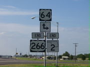
. 10 miles (16.1 km) later, SH-2 meets US-266, which it will overlap until its end. After having an interchange at I-40 milemarker 278, both SH-2 and US-266 end at US-64 near Warner
.
Until the early 1980s a portion of SH-2 was one of the last unpaved state highways in the Oklahoma road network. The section between the communities of Kosoma, Oklahoma
and Stanley, Oklahoma
in the Kiamichi River
Valley, remained gravel. Its builders during the 1930s and 1940s, in order to save the expense of building two bridges across the Kiamichi River, routed the highway mid-way up the flank of Bull Creek Mountain. The highway traversed the mountain at its midway point, with no shoulders or guard rails. During the 1980s a new route was opened in the floor of the valley, featuring modern bridges across Pine Creek and the Kiamichi River. The old route on Bull Creek Mountain was decommissioned and is no longer in use.
. It then heads due north, meeting SH-25
four miles (6.5 km) west of Bluejacket
. Six miles north of here, it ends at SH-10
in Welch, Oklahoma
.
The mainline road becomes U.S. Highway 59, and the official state maps show SH-2 as overlapping US-59 until the Kansas
border nine miles (14.4 km) later. However, the signage all shows that SH-2 ends in Welch http://roads.tulok.net/t-2n.html.
United States
The United States of America is a federal constitutional republic comprising fifty states and a federal district...
state of Oklahoma
Oklahoma
Oklahoma is a state located in the South Central region of the United States of America. With an estimated 3,751,351 residents as of the 2010 census and a land area of 68,667 square miles , Oklahoma is the 28th most populous and 20th-largest state...
. Though they were once connected, the middle section of highway was concurrent
Concurrency (road)
A concurrency, overlap, or coincidence in a road network is an instance of one physical road bearing two or more different highway, motorway, or other route numbers...
with three different U.S. highways, so the middle section was decommissioned for reasons of redundancy.
The southern section of highway runs from Antlers, Oklahoma
Antlers, Oklahoma
Antlers is a city in Pushmataha County, Oklahoma. The population was 2,552 at the 2000 census. It is the county seat of Pushmataha County.-Geography:Antlers is located at...
to U.S. Highway 64 near Warner
Warner, Oklahoma
Warner is a town in Muskogee County, Oklahoma, United States. The population was 1,430 at the 2000 census. The town is also home to part of the Connors State College campus.-Geography:Warner is located at ....
, covering 117 miles (188 km) through the southeastern part of the state. The northern SH-2 runs for 17 miles (27.4 km) through Craig Co.
Craig County, Oklahoma
Craig County is a county located in the U.S. state of Oklahoma. As of 2010, the population was 15,029, a gain of 0.5 percent from 14,950 in 2000. Its county seat is Vinita.Craig County was organized in 1907.-History:...
in northeastern Oklahoma.
Southern section
State Highway 3 (Oklahoma)
State Highway 3, also abbreviated as SH-3 or OK-3, is a highway maintained by the U.S. state of Oklahoma. Traveling diagonally through Oklahoma, from the Panhandle to the far southeastern corner of the state, SH-3 is the longest state highway in the Oklahoma road system, at a total length of...
in Antlers. It travels north-northwest from here, roughly parallelling the Kiamichi River
Kiamichi River
The Kiamichi River is a river in southeastern Oklahoma. A tributary of the Red River, its headwaters rise on Pine Mountain in the Ouachita Mountains near the Arkansas border...
, until reaching Clayton
Clayton, Oklahoma
Clayton is a town in Pushmataha County, Oklahoma, United States. The population was 719 at the 2000 census.- History :Clayton was formerly known as Dexter. A United States Post Office was established at Dexter, Indian Territory on March 31, 1894...
and US-271. North of Clayton, Highway 2 and US-271 overlap
Concurrency (road)
A concurrency, overlap, or coincidence in a road network is an instance of one physical road bearing two or more different highway, motorway, or other route numbers...
for 3 miles (5 km). Immediately after this, SH-2 meets SH-43
State Highway 43 (Oklahoma)
State Highway 43 is a state highway in Oklahoma, USA. It runs 65.3 miles west-to-east through Coal, Atoka, Pushmataha and Pittsburg counties.-Route description:...
's eastern terminus southeast of Sardis Lake
Sardis Lake (Oklahoma)
Sardis Lake is a reservoir in Pushmataha County and Latimer County in Oklahoma, USA. The dam impounding the lake is located approximately north of Clayton. The lake covers with of shoreline. The lake is an impoundment of Jackfork Creek, a tributary of the Kiamichi River.The lake's normal pool...
. SH-2 then crosses over the lake and meets SH-1
State Highway 1 (Oklahoma)
State Highway 1, sometimes abbreviated as SH-1 or OK-1, is a highway maintained by the U.S. state of Oklahoma. It travels through the southeastern part of the state, nicknamed Little Dixie. Because Oklahoma uses odd numbers for east and west highways State Highway 1, sometimes abbreviated as SH-1...
/SH-63, and the three form a six-mile (10 km) concurrency. This area is mountainous and has some tight hairpin curves. After the concurrency Highway 2 continues northward, meeting US-270 at Wilburton
Wilburton, Oklahoma
Wilburton is a city in Latimer County, Oklahoma, United States. The city has a population of 2,972 at the 2000 census. It is the county seat of Latimer County.-Geography:Wilburton is located at ....
.
SH-2 then passes Robbers Cave State Park and the eastern edge of the Sansbois Mountains before reaching SH-31
State Highway 31 (Oklahoma)
State Highway 31 is a state highway in Oklahoma. It runs 132.6 miles in an irregular west-to-east pattern in the southeastern part of the state.There are two spur highways branching from SH-31, SH-31A and SH-31B....
east of Quinton
Quinton, Oklahoma
Quinton is a town in Pittsburg County, Oklahoma, United States. The population was 1,071 at the 2000 census. The town was named for Elizabeth Quinton who lived to be 116 years old. Her family still resides in and around the town of Quinton.-Geography:...
, and the two form a six-mile (10 km) concurrency until Kinta
Kinta, Oklahoma
Kinta is a town in Haskell County, Oklahoma, United States. The population was 243 at the 2000 census.-Geography:Kinta is located at .According to the United States Census Bureau, the town has a total area of , all of it land....
. Ten miles (16 km) north of here, Highway 2 meets SH-9
State Highway 9 (Oklahoma)
State Highway 9, abbreviated as SH-9, OK-9, or simply Highway 9, is a major east–west highway in the U.S. state of Oklahoma. Spanning across the central part of the state, SH-9 begins at the Texas state line near Madge, Oklahoma, and ends at the Arkansas state line near Fort Smith, Arkansas. State...
. Three miles (4.9 km) later, the highway passes the eastern terminus of SH-71
State Highway 71 (Oklahoma)
State Highway 71 is a state highway in eastern Oklahoma. It runs from State Highway 31 in Quinton north to intersect State Highway 9 near Enterprise. It then continues north to Lake Eufaula Dam, and then turns east to end at State Highway 2...
, south of the town of Porum, Oklahoma
Porum, Oklahoma
Porum is a town in Muskogee County, Oklahoma, United States. The population was 725 at the 2000 census.-Geography:Porum is located at ....
. 10 miles (16.1 km) later, SH-2 meets US-266, which it will overlap until its end. After having an interchange at I-40 milemarker 278, both SH-2 and US-266 end at US-64 near Warner
Warner, Oklahoma
Warner is a town in Muskogee County, Oklahoma, United States. The population was 1,430 at the 2000 census. The town is also home to part of the Connors State College campus.-Geography:Warner is located at ....
.
Until the early 1980s a portion of SH-2 was one of the last unpaved state highways in the Oklahoma road network. The section between the communities of Kosoma, Oklahoma
Kosoma, Oklahoma
Kosoma is a settlement and former railroad station in Pushmataha County, Oklahoma, United States. It is located just off Oklahoma State Highway 2, about north of Antlers.-Geography:...
and Stanley, Oklahoma
Stanley, Oklahoma
Stanley is a community in northern Pushmataha County, Oklahoma, eight miles southwest of Clayton, Oklahoma.A United States Post Office was established at Stanley, Indian Territory on August 20, 1906. It was named for William Eugene Stanley , Governor of Kansas, 1899–1903, and member of the Dawes...
in the Kiamichi River
Kiamichi River
The Kiamichi River is a river in southeastern Oklahoma. A tributary of the Red River, its headwaters rise on Pine Mountain in the Ouachita Mountains near the Arkansas border...
Valley, remained gravel. Its builders during the 1930s and 1940s, in order to save the expense of building two bridges across the Kiamichi River, routed the highway mid-way up the flank of Bull Creek Mountain. The highway traversed the mountain at its midway point, with no shoulders or guard rails. During the 1980s a new route was opened in the floor of the valley, featuring modern bridges across Pine Creek and the Kiamichi River. The old route on Bull Creek Mountain was decommissioned and is no longer in use.
Northern section
The northern SH-2 begins at US-60/US-69 in VinitaVinita, Oklahoma
Vinita is a city in south-central Craig County, Oklahoma. As of 2009, the population estimate was 6,057. It is the county seat of Craig County.-Geography:...
. It then heads due north, meeting SH-25
State Highway 25 (Oklahoma)
State Highway 25 is a state highway in northeastern Oklahoma with two nonconnecting sections. The northern section runs between the communities of Pyramid Corners and Narcissa, and the southern section runs from east of Grove to the Missouri state line.-Western section:The western section of SH-25...
four miles (6.5 km) west of Bluejacket
Bluejacket, Oklahoma
Bluejacket is a town in Craig County, Oklahoma, United States. The population was 274 at the 2000 census. Bluejacket was named for its first postmaster, the Rev...
. Six miles north of here, it ends at SH-10
State Highway 10 (Oklahoma)
State Highway 10 is a state highway in northeastern Oklahoma. It makes a 235.5 mile crescent through the northeast corner of the state, running from State Highway 99 in Osage County to Interstate 40 near Gore. It has two lettered spur routes.SH-10 first appeared as part of the original highway...
in Welch, Oklahoma
Welch, Oklahoma
Welch is a town in Craig County, Oklahoma, United States. The population was 597 at the 2000 census.-Geography:Welch is located at .According to the United States Census Bureau, the town has a total area of , all of it land....
.
The mainline road becomes U.S. Highway 59, and the official state maps show SH-2 as overlapping US-59 until the Kansas
Kansas
Kansas is a US state located in the Midwestern United States. It is named after the Kansas River which flows through it, which in turn was named after the Kansa Native American tribe, which inhabited the area. The tribe's name is often said to mean "people of the wind" or "people of the south...
border nine miles (14.4 km) later. However, the signage all shows that SH-2 ends in Welch http://roads.tulok.net/t-2n.html.