

Salton Sea
Encyclopedia
The Salton Sea is a shallow, saline
, endorheic rift lake
located directly on the San Andreas Fault
, predominantly in California's Imperial Valley. The lake occupies the lowest elevations of the Salton Sink
in the Colorado Desert
of Imperial
and Riverside
counties in Southern California
. Like Death Valley
, it is below sea level
. Currently, its surface is 226 ft (68.9 m) below sea level. The deepest area of the sea is 5 ft (1.5 m) higher than the lowest point of Death Valley. The sea is fed by the New
, Whitewater
, and Alamo
rivers, as well as agricultural runoff
drainage systems and creeks
.
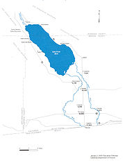
While it varies in dimensions and area with fluctuations in agricultural runoff and rainfall, the Salton Sea averages 15 mi (24.1 km) by 35 mi (56.3 km). With an average area of roughly 525 sq mi (1,359.7 km²), the Salton Sea is the largest lake in California. Average annual inflow is 1360000 acre.ft, which is enough to maintain a maximum depth of 52 ft (15.8 m) and a total volume of about 7500000 acre.ft.
The lake's salinity
, about 44 g/L, is greater than that of the waters of the Pacific Ocean
(35 g/L), but less than that of the Great Salt Lake
(which ranges from 50 to 270 g/L); the concentration is increasing by about 1 percent annually.
glacial age, the Colorado River
worked to build its delta in the southern region of the Imperial Valley
. Eventually, the delta had reached the western shore of the Gulf of California
(the Sea of Cortez/Cortés), creating a massive dam that excluded the Salton Sea from the northern reaches of the Gulf. Were it not for this dam, the entire Salton Sink along with the Imperial Valley, including most of the area occupied by Anza-Borrego State park, would all be submerged, as the Gulf would extend as far north as Indio.
As a result, the Salton Sink or Salton Basin has long been alternately a fresh water lake and a dry desert basin, depending on random river flows and the balance between inflow and evaporative loss. A lake would exist only when it was replenished by the river and rainfall, a cycle that repeated itself countless times over hundreds of thousands of years – most recently when the lake was recreated in 1905.
There is evidence that the basin was occupied periodically by multiple lakes. Wave-cut shorelines at various elevations are still preserved on the hillsides of the east and west margins of the present lake, the Salton Sea, showing that the basin was occupied intermittently as recently as a few hundred years ago. The last of the Pleistocene lakes to occupy the basin was Lake Cahuilla
, also periodically identified on older maps as Lake LeConte, and the Blake Sea, after American
professor and geologist William Phipps Blake
.
Once part of a vast inland sea that covered a large area of Southern California, the endorheic
Salton Sink was the site of a major salt mining operation. Throughout the Spanish period of California's history the area was referred to as the "Colorado Desert
" after the Rio Colorado (Colorado River
). In the 1853/55 railroad survey, it was called "The Valley of the Ancient Lake". On several old maps from the Library of Congress
, it has been found labeled "Cahuilla Valley" (after the local Indian tribe) and "Cabazon Valley" (after a local Indian chief – Chief Cabazon). "Salt Creek
" first appeared on a map in 1867 and "Salton Station" is on a railroad map from 1900, although this place had been there as a rail stop since the late 1870s.
. The resulting flood poured down the canal and breached an Imperial Valley dike, eroding two watercourses, the New River
in the west, and the Alamo River
in the east, each about 60 miles (96.6 km) long. Over a period of approximately two years these two newly created rivers sporadically carried the entire volume of the Colorado River into the Salton Sink.
The Southern Pacific Railroad
attempted to stop the flooding by dumping earth into the canal's headgates area, but the effort was not fast enough, and as the river eroded deeper and deeper into the dry desert sand of the Imperial Valley, a massive waterfall was created that started to cut rapidly upstream along the path of the Alamo Canal that now was occupied by the Colorado. This waterfall was initially 15 feet (4.6 m) high but grew to a height of 80 feet (24.4 m) before the flow through the breach was finally stopped. It was originally feared that the waterfall would recede upstream to the true main path of the Colorado, attaining a height of up to 100 to 300 ft (30.5 to 91.4 m), from where it would be practically impossible to fix the problem. As the basin filled, the town of Salton
, a Southern Pacific Railroad siding, and Torres-Martinez
Indian land were submerged. The sudden influx of water and the lack of any drainage from the basin resulted in the formation of the Salton Sea.
The continuing intermittent flooding of the Imperial Valley from the Colorado River led to the idea of the need for a dam on the Colorado River for flood control. Eventually, the federal government sponsored survey parties in 1922 that explored the Colorado River for a dam site, ultimately leading to the construction of Hoover Dam
in Black Canyon
, which was constructed beginning in 1929 and completed in 1935. The dam effectively put an end to the flooding episodes in the Imperial Valley.
 In the 1920s, the Salton Sea developed into a tourist attraction, because of its water recreation, and waterfowl attracted to the area.
The Salton Sea has had some success as a resort area, with Salton City, Salton Sea Beach
, and Desert Shores
on the western shore and Desert Beach, North Shore
, and Bombay Beach
built on the eastern shore in the 1950s. The town of Niland
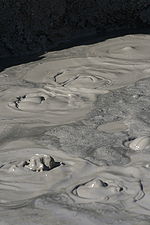
is located 2 miles (3 km) southeast of the Sea as well. The evidence of geothermal activity is also visible. There are mud pots and mud volcano
es on the eastern side of the Salton Sea.
. The Salton Sea is also a major resting stop on the Pacific Flyway
. On 18 November 2006, a Ross's gull
, a high Arctic bird, was sighted and photographed there.
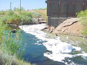 The lack of an outflow means that the Salton Sea is a system of accelerated change. Variations in agricultural runoff cause fluctuations in water level (and flooding of surrounding communities in the 1950s and 1960s), and the relatively high salinity of the inflow feeding the Sea has resulted in ever increasing salinity. By the 1960s it was apparent that the salinity of the Salton Sea was rising, jeopardizing some of the species in it. The Salton Sea currently has a salinity exceeding 4.0% w/v (saltier than seawater) and many species of fish are no longer able to survive. It is believed that once the salinity surpasses 4.4% w/v, only the tilapia
will survive. Fertilizer runoffs combined with the increasing salinity have resulted in large algal blooms and elevated bacteria levels.
or Pacific Ocean
and export higher salinity Salton Sea water; evaporation ponds that would serve as a salt sink, and large dam structures that would partition the sea into a marine lake portion and a brine salt sink portion. Others advocate building a sea-level canal to the Salton Sea from the Gulf of California. Given that the Sea is over 200 feet (60m) below sea level, a sea level canal would allow thousands of tons of lower-salinity sea water to flow into the Sea without costly pumping or pipelines. Such a canal could be built large enough for recreational use and ocean-going vessels. A sea-level canal would promote dual purposes, as both an inland port for Southern California and a recreational/environmental asset along its course for humans and wildlife in Mexico
and the U.S. A sea-level canal would also likely provide a way to regulate the shoreline of the Sea in a predictable manner. However, without a means to export salt, even this approach would eventually leave the sea with ever-increasing salinity levels.
Much of the current interest in the sea was sparked in the 1990s by the late Congressman Sonny Bono
. His widow, Mary Bono Mack, was elected to fill his seat and has continued interest in the Salton Sea, as has Representative Jerry Lewis
of Redlands
. In 1998, the Sonny Bono Salton Sea Restoration Project was named for the politician.
In the late 1990s, the Salton Sea Authority
, a local joint powers agency, and the U.S. Bureau of Reclamation began efforts to evaluate and develop an alternative to save the Salton Sea. A draft Environmental Impact Report/Environmental Impact Statement
, which did not specify a preferred alternative, was released for public review in 2000.
Since that time, the Salton Sea Authority has developed a preferred concept that involves the construction of a large dam
that would impound water to create a marine sea in the northern and southern parts of the sea and along the western edge. The plan has been subject to some criticism for failing to address ecosystem needs, and for engineering practicality concerns such as local faulting, potentially devastating to such a plan.
Criticisms of the preferred plan issued by the Salton Sea Authority include:
Many other concepts have been proposed, including piping water from the Sea to a wetland in Mexico, Laguna Salada, as a means of salt export, and one by Aqua Genesis Ltd to bring in sea water from the Gulf of California, desalinate it at the Sea using available geothermal heat, and selling the water to pay for the plan. This concept would involve the construction of over 20 miles (30 km) of pipes and tunneling, and, with the increasing demand for water at the coastline, would provide an additional 1000000 acre.ft of water to Southern California coastal cities each year.
 The California State Legislature
, by legislation enacted in 2003 and 2004, directed the Secretary of the California Resources Agency
to prepare a restoration plan for the Salton Sea ecosystem
, and an accompanying Environmental Impact Report. As part of this effort the Secretary for Resources has established an Advisory Committee to provide recommendations to assist in the preparation of the Ecosystem Restoration Plan, including consultation throughout all stages of the alternative selection process. The California Department of Water Resources
and California Department of Fish and Game
are leading the effort to develop a preferred alternative for the restoration of the Salton Sea ecosystem and the protection of wildlife dependent on that ecosystem.
On January 24, 2008, the California Legislative Analyst's Office released a report entitled "Restoring the Salton Sea." The preferred alternative outlined within this draft plan calls for spending a total of almost $9 billion over 25 years and proposes a smaller but more manageable Salton Sea. The amount of water available for use by humans and wildlife would be reduced by 60 percent from 365 square miles (945 square kilometers) to about 147 square miles (381 square kilometers). Fifty-two miles (84 km) of barrier and perimeter dikes – constructed most likely out of boulders, gravel, and stone columns – would be erected along with earthen berms to corral the water into a horseshoe shape along northern shoreline of the sea from San Felipe Creek on the west shore to Bombay Beach on the east shore. The central portion of the sea would be allowed to almost completely evaporate and would serve as a brine sink, while the southern portion of the sea would be constructed into a saline habitat complex. If approved, construction on this project is slated to begin in 2011 and would be completed by 2035.
, narrated by John Waters
, covers the first 100 years of the Salton Sea along with the environmental issues and offbeat residents of the region.
A 6-minute short film, The Accidental Sea, filmed and narrated by Ransom Riggs, briefly discusses the history and depicts the desolation since the area's abandonment.
The episode "Future Conditional" (#302) from the series Journey to Planet Earth (narrated by Matt Damon
) talks about the plight of the sea, and, if nothing is done, a repeat of the fate of the Aral Sea
will occur.
The episode "Holiday Hell" (#206) from the series Life After People
uses the Salton Sea as an example of how a resort town like Palm Springs would decay if no humans were there to maintain it.
On March 24, 2009, a Los Angeles Times
article reported a series of earthquake
s in the Salton Sea. The article also quoted prominent geophysicists and seismologists who discuss the potential for these small quakes to spawn a massive earthquake on the San Andreas Fault
.
, San Jacinto Fault, Imperial Fault Zone
, and a "stepover fault" shear zone
system. American researchers determined that previous flooding episodes from the Colorado River
have been linked to earthquakes along the San Andreas Fault. Sonar
and other instruments were used to map the Salton Sea's underwater faults during the study. During the period when the basin was filled by Lake Cahuilla
, a much larger inland sea, earthquakes higher than magnitude 7 occurred roughly every 180 years, the last one occurring within decades of the year 1700. Computer models suggest that the normal faults in the area are most vulnerable to deviatoric stress loading by the in-filling of water. Currently, a risk still exists for an earthquake of magnitude 7 or 8. Simulations also showed that in the Los Angeles
area, shaking and thus damage would be more severe for a San Andreas earthquake that propagated along the fault from the south, rather than from the north. Such an earthquake also raises the risk for soil liquefaction
in the Imperial Valley
region.
The effective drainage divide that separates the Salton Sea from the Gulf of California
is approximately 9 m (29.5 ft) in elevation and is located near Delta, northeastern Baja California
State, Mexico, south-southeast of Mexicali
. Past sea level rise may partially be responsible for the salinity
of the lake, while potential future changes
in sea levels could occur. However, other factors such as hydrothermal vent
s, diffusion
of salt from minerals and sediment, including concentrated brine
and evaporite
s are another contributor to salinity, as is the recent lowering of lake levels raising the salinity, though sedimentary records show that the lake surface elevation reached levels 10–12 metres above sea level in the 1500s.
Salt lake
A salt lake or saline lake is a landlocked body of water which has a concentration of salts and other dissolved minerals significantly higher than most lakes . In some cases, salt lakes have a higher concentration of salt than sea water, but such lakes would also be termed hypersaline lakes...
, endorheic rift lake
Rift lake
A rift lake is a lake formed as a result of subsidence related to movement on faults within a rift zone, an area of extensional tectonics in the continental crust. They are often found within rift valleys and may be very deep...
located directly on the San Andreas Fault
San Andreas Fault
The San Andreas Fault is a continental strike-slip fault that runs a length of roughly through California in the United States. The fault's motion is right-lateral strike-slip...
, predominantly in California's Imperial Valley. The lake occupies the lowest elevations of the Salton Sink
Salton Sink
The Salton Sink is a geographic sink in the Coachella and Imperial valleys of southeastern California. It is in the Colorado Desert subregion of the Sonoran Desert ecoregion...
in the Colorado Desert
Colorado Desert
California's Colorado Desert is a part of the larger Sonoran Desert, which extends across southwest North America. The Colorado Desert region encompasses approximately , reaching from the Mexican border in the south to the higher-elevation Mojave Desert in the north and from the Colorado River in...
of Imperial
Imperial County, California
Imperial County is a county located in the Imperial Valley, in the far southeast of the U.S. state of California, bordering both Arizona and Mexico. It is part of the El Centro Metropolitan Area, which encompasses all of Imperial County. The population as of 2000 was 142,361. The county seat is the...
and Riverside
Riverside County, California
Riverside County is a county in the U.S. state of California. One of 58 California counties, it covers in the southern part of the state, and stretches from Orange County to the Colorado River, which forms the state border with Arizona. The county derives its name from the city of Riverside,...
counties in Southern California
Southern California
Southern California is a megaregion, or megapolitan area, in the southern area of the U.S. state of California. Large urban areas include Greater Los Angeles and Greater San Diego. The urban area stretches along the coast from Ventura through the Southland and Inland Empire to San Diego...
. Like Death Valley
Death Valley
Death Valley is a desert valley located in Eastern California. Situated within the Mojave Desert, it features the lowest, driest, and hottest locations in North America. Badwater, a basin located in Death Valley, is the specific location of the lowest elevation in North America at 282 feet below...
, it is below sea level
Sea level
Mean sea level is a measure of the average height of the ocean's surface ; used as a standard in reckoning land elevation...
. Currently, its surface is 226 ft (68.9 m) below sea level. The deepest area of the sea is 5 ft (1.5 m) higher than the lowest point of Death Valley. The sea is fed by the New
New River (Mexico – United States)
The New River flows north from near Cerro Prieto, through the city of Mexicali, Baja California, Mexico, into the United States through the city of Calexico, California towards the Salton Sea...
, Whitewater
Whitewater River (California)
The Whitewater River is a small permanent stream in western Riverside County, California, except for a small upstream portion in southwestern San Bernardino County. Its headwaters are in the San Bernardino Mountains and 'mouth'—terminus in the Colorado Desert...
, and Alamo
Alamo River
The Alamo River is a river flowing west and north from the Mexicali Valley across the Imperial Valley . The river drains into the Salton Sea....
rivers, as well as agricultural runoff
Surface runoff
Surface runoff is the water flow that occurs when soil is infiltrated to full capacity and excess water from rain, meltwater, or other sources flows over the land. This is a major component of the water cycle. Runoff that occurs on surfaces before reaching a channel is also called a nonpoint source...
drainage systems and creeks
Stream
A stream is a body of water with a current, confined within a bed and stream banks. Depending on its locale or certain characteristics, a stream may be referred to as a branch, brook, beck, burn, creek, "crick", gill , kill, lick, rill, river, syke, bayou, rivulet, streamage, wash, run or...
.
While it varies in dimensions and area with fluctuations in agricultural runoff and rainfall, the Salton Sea averages 15 mi (24.1 km) by 35 mi (56.3 km). With an average area of roughly 525 sq mi (1,359.7 km²), the Salton Sea is the largest lake in California. Average annual inflow is 1360000 acre.ft, which is enough to maintain a maximum depth of 52 ft (15.8 m) and a total volume of about 7500000 acre.ft.
The lake's salinity
Salinity
Salinity is the saltiness or dissolved salt content of a body of water. It is a general term used to describe the levels of different salts such as sodium chloride, magnesium and calcium sulfates, and bicarbonates...
, about 44 g/L, is greater than that of the waters of the Pacific Ocean
Pacific Ocean
The Pacific Ocean is the largest of the Earth's oceanic divisions. It extends from the Arctic in the north to the Southern Ocean in the south, bounded by Asia and Australia in the west, and the Americas in the east.At 165.2 million square kilometres in area, this largest division of the World...
(35 g/L), but less than that of the Great Salt Lake
Great Salt Lake
The Great Salt Lake, located in the northern part of the U.S. state of Utah, is the largest salt water lake in the western hemisphere, the fourth-largest terminal lake in the world. In an average year the lake covers an area of around , but the lake's size fluctuates substantially due to its...
(which ranges from 50 to 270 g/L); the concentration is increasing by about 1 percent annually.
History
It is estimated that for 3 million years, at least through all the years of the PleistocenePleistocene
The Pleistocene is the epoch from 2,588,000 to 11,700 years BP that spans the world's recent period of repeated glaciations. The name pleistocene is derived from the Greek and ....
glacial age, the Colorado River
Colorado River
The Colorado River , is a river in the Southwestern United States and northwestern Mexico, approximately long, draining a part of the arid regions on the western slope of the Rocky Mountains. The watershed of the Colorado River covers in parts of seven U.S. states and two Mexican states...
worked to build its delta in the southern region of the Imperial Valley
Imperial Valley
The Imperial Valley is an agricultural area of Southern California's Imperial County. It is located in southeastern Southern California, centered around the city of El Centro. Locally, the terms "Imperial Valley" and "Imperial County" are used synonymously. The Valley is bordered between the...
. Eventually, the delta had reached the western shore of the Gulf of California
Gulf of California
The Gulf of California is a body of water that separates the Baja California Peninsula from the Mexican mainland...
(the Sea of Cortez/Cortés), creating a massive dam that excluded the Salton Sea from the northern reaches of the Gulf. Were it not for this dam, the entire Salton Sink along with the Imperial Valley, including most of the area occupied by Anza-Borrego State park, would all be submerged, as the Gulf would extend as far north as Indio.
As a result, the Salton Sink or Salton Basin has long been alternately a fresh water lake and a dry desert basin, depending on random river flows and the balance between inflow and evaporative loss. A lake would exist only when it was replenished by the river and rainfall, a cycle that repeated itself countless times over hundreds of thousands of years – most recently when the lake was recreated in 1905.
There is evidence that the basin was occupied periodically by multiple lakes. Wave-cut shorelines at various elevations are still preserved on the hillsides of the east and west margins of the present lake, the Salton Sea, showing that the basin was occupied intermittently as recently as a few hundred years ago. The last of the Pleistocene lakes to occupy the basin was Lake Cahuilla
Lake Cahuilla
Prehistoric Lake Cahuilla was an extensive freshwater lake that filled the Coachella, Imperial, and Mexicali valleys of southeastern California and northeastern Baja California during the centuries prior to Spanish entry into the region...
, also periodically identified on older maps as Lake LeConte, and the Blake Sea, after American
United States
The United States of America is a federal constitutional republic comprising fifty states and a federal district...
professor and geologist William Phipps Blake
William Phipps Blake
William Phipps Blake was an American mineralogist and geologist. He was born in New York City, graduated from the Sheffield Scientific School at Yale in 1852, one of seven to get the newly created Ph.B. degree. He was mineralogist and geologist of the Pacific Railroad Exploring Expedition of 1853,...
.
Once part of a vast inland sea that covered a large area of Southern California, the endorheic
Endorheic
An endorheic basin is a closed drainage basin that retains water and allows no outflow to other bodies of water such as rivers or oceans...
Salton Sink was the site of a major salt mining operation. Throughout the Spanish period of California's history the area was referred to as the "Colorado Desert
Colorado Desert
California's Colorado Desert is a part of the larger Sonoran Desert, which extends across southwest North America. The Colorado Desert region encompasses approximately , reaching from the Mexican border in the south to the higher-elevation Mojave Desert in the north and from the Colorado River in...
" after the Rio Colorado (Colorado River
Colorado River
The Colorado River , is a river in the Southwestern United States and northwestern Mexico, approximately long, draining a part of the arid regions on the western slope of the Rocky Mountains. The watershed of the Colorado River covers in parts of seven U.S. states and two Mexican states...
). In the 1853/55 railroad survey, it was called "The Valley of the Ancient Lake". On several old maps from the Library of Congress
Library of Congress
The Library of Congress is the research library of the United States Congress, de facto national library of the United States, and the oldest federal cultural institution in the United States. Located in three buildings in Washington, D.C., it is the largest library in the world by shelf space and...
, it has been found labeled "Cahuilla Valley" (after the local Indian tribe) and "Cabazon Valley" (after a local Indian chief – Chief Cabazon). "Salt Creek
Salt Creek (Salton Sea)
Salt Creek is a intermittent stream in Riverside County, California, flowing into the Salton Sea at Salt Creek Beach on the northern shore. It is an important habitat of desert pupfish, containing a population of 159 fish....
" first appeared on a map in 1867 and "Salton Station" is on a railroad map from 1900, although this place had been there as a rail stop since the late 1870s.
Creation of the current Salton Sea
The creation of the Salton Sea of today started in 1905, when heavy rainfall and snowmelt caused the Colorado River to swell, overrunning a set of headgates for the Alamo CanalAlamo Canal
The Alamo Canal was a long waterway that connected the Colorado River to the head of the Alamo River. The canal was constructed to provide irrigation to the Imperial Valley. A small portion of the canal was located in the United States but the majority of the canal was located in Mexico...
. The resulting flood poured down the canal and breached an Imperial Valley dike, eroding two watercourses, the New River
New River (Mexico – United States)
The New River flows north from near Cerro Prieto, through the city of Mexicali, Baja California, Mexico, into the United States through the city of Calexico, California towards the Salton Sea...
in the west, and the Alamo River
Alamo River
The Alamo River is a river flowing west and north from the Mexicali Valley across the Imperial Valley . The river drains into the Salton Sea....
in the east, each about 60 miles (96.6 km) long. Over a period of approximately two years these two newly created rivers sporadically carried the entire volume of the Colorado River into the Salton Sink.
The Southern Pacific Railroad
Southern Pacific Railroad
The Southern Pacific Transportation Company , earlier Southern Pacific Railroad and Southern Pacific Company, and usually simply called the Southern Pacific or Espee, was an American railroad....
attempted to stop the flooding by dumping earth into the canal's headgates area, but the effort was not fast enough, and as the river eroded deeper and deeper into the dry desert sand of the Imperial Valley, a massive waterfall was created that started to cut rapidly upstream along the path of the Alamo Canal that now was occupied by the Colorado. This waterfall was initially 15 feet (4.6 m) high but grew to a height of 80 feet (24.4 m) before the flow through the breach was finally stopped. It was originally feared that the waterfall would recede upstream to the true main path of the Colorado, attaining a height of up to 100 to 300 ft (30.5 to 91.4 m), from where it would be practically impossible to fix the problem. As the basin filled, the town of Salton
Salton City, California
Salton City is a census-designated place in Imperial County, California. The population was 3,763 at the 2010 census, up from 978 at the 2000 census. It is the largest Imperial County development on the Salton coast. It is part of the El Centro, California Metropolitan Statistical Area...
, a Southern Pacific Railroad siding, and Torres-Martinez
Torres-Martinez Desert Cahuilla Indians
The Torres-Martinez Desert Cahuilla Indians is a federally recognized tribe of Cahuilla and Chemehuevi Indians, located in Imperial and Riverside counties in California...
Indian land were submerged. The sudden influx of water and the lack of any drainage from the basin resulted in the formation of the Salton Sea.
The continuing intermittent flooding of the Imperial Valley from the Colorado River led to the idea of the need for a dam on the Colorado River for flood control. Eventually, the federal government sponsored survey parties in 1922 that explored the Colorado River for a dam site, ultimately leading to the construction of Hoover Dam
Hoover Dam
Hoover Dam, once known as Boulder Dam, is a concrete arch-gravity dam in the Black Canyon of the Colorado River, on the border between the US states of Arizona and Nevada. It was constructed between 1931 and 1936 during the Great Depression and was dedicated on September 30, 1935, by President...
in Black Canyon
Black Canyon of the Colorado
The Black Canyon of the Colorado is the canyon on the Colorado River where Hoover Dam was built. The canyon is located on the Colorado River at the state line between Nevada and Arizona. The western wall of the gorge is in the El Dorado Mountains, and the eastern wall is in the Black Mountains of...
, which was constructed beginning in 1929 and completed in 1935. The dam effectively put an end to the flooding episodes in the Imperial Valley.
Subsequent evolution of the Sea
The Salton Sea has had some success as a resort area, with Salton City, Salton Sea Beach
Salton Sea Beach, California
Salton Sea Beach is a census-designated place in Imperial County, California. Salton Sea Beach is located southeast of Desert Shores, The population was 422 at the 2010 census, up from 392 at the 2000 census. It is part of the El Centro, California Metropolitan Statistical Area.-Geography:The...
, and Desert Shores
Desert Shores, California
Desert Shores is a census-designated place in Imperial County, California. It is located on Salton Sea west-northwest of Calipatria. It is part of the El Centro, California Metropolitan Statistical Area. The population was 1,104 at the 2010 census, up from 792 at the 2000...
on the western shore and Desert Beach, North Shore
North Shore, California
North Shore is a census-designated place in southeastern Riverside County, so named because of its location along the northeast shore of the Salton Sea. It was once a popular vacation destination spot before ever-increasing salinity and pollution of the Salton Sea shut the tourist trade down...
, and Bombay Beach
Bombay Beach, California
Bombay Beach is a census-designated place in Imperial County, California. It is located on the Salton Sea west-southwest of Frink. The population was 295 at the 2010 census, down from 366 at the 2000 census. It is part of the El Centro, California Metropolitan Statistical Area.-2010:The 2010...
built on the eastern shore in the 1950s. The town of Niland
Niland, California
Niland is a census-designated place in Imperial County, California. The town is located north of Calipatria, southeast of Salton Sea. The population was 1,006 at the 2010 census, down from 1,143 at the 2000 census...
is located 2 miles (3 km) southeast of the Sea as well. The evidence of geothermal activity is also visible. There are mud pots and mud volcano
Mud volcano
The term mud volcano or mud dome are used to refer to formations created by geo-excreted liquids and gases, although there are several different processes which may cause such activity. Hot water mixes with mud and surface deposits. Mud volcanoes are associated with subduction zones and about 700...
es on the eastern side of the Salton Sea.
Avian population
The Salton Sea has been termed a "crown jewel of avian biodiversity" (Dr. Milt Friend, Salton Sea Science Office). Over 400 species have been documented at the Salton Sea. The Salton Sea supports 30% of the remaining population of the American white pelicanAmerican White Pelican
The American White Pelican is a large aquatic bird from the order Pelecaniformes. It breeds in interior North America, moving south and to the coasts, as far as Central America, in winter....
. The Salton Sea is also a major resting stop on the Pacific Flyway
Pacific Flyway
The Pacific Flyway is a major north-south route of travel for migratory birds in America, extending from Alaska to Patagonia. Every year, migratory birds travel some or all of this distance both in spring and in fall, following food sources, heading to breeding grounds, or travelling to...
. On 18 November 2006, a Ross's gull
Ross's Gull
The Ross's Gull is a small gull, the only species in its genus, although it has been suggested it should be moved to the genus Hydrocoloeus, which otherwise only includes the Little Gull....
, a high Arctic bird, was sighted and photographed there.
Environmental decline
Tilapia
Tilapia , is the common name for nearly a hundred species of cichlid fish from the tilapiine cichlid tribe. Tilapia inhabit a variety of fresh water habitats, including shallow streams, ponds, rivers and lakes. Historically, they have been of major importance in artisan fishing in Africa and the...
will survive. Fertilizer runoffs combined with the increasing salinity have resulted in large algal blooms and elevated bacteria levels.
Past efforts and proposals for a sea level canal
Alternatives for "saving" the Salton Sea have been evaluated since 1955. Early concepts included costly "pipe in/pipe out" options, which would import lower salinity seawater from the Gulf of CaliforniaGulf of California
The Gulf of California is a body of water that separates the Baja California Peninsula from the Mexican mainland...
or Pacific Ocean
Pacific Ocean
The Pacific Ocean is the largest of the Earth's oceanic divisions. It extends from the Arctic in the north to the Southern Ocean in the south, bounded by Asia and Australia in the west, and the Americas in the east.At 165.2 million square kilometres in area, this largest division of the World...
and export higher salinity Salton Sea water; evaporation ponds that would serve as a salt sink, and large dam structures that would partition the sea into a marine lake portion and a brine salt sink portion. Others advocate building a sea-level canal to the Salton Sea from the Gulf of California. Given that the Sea is over 200 feet (60m) below sea level, a sea level canal would allow thousands of tons of lower-salinity sea water to flow into the Sea without costly pumping or pipelines. Such a canal could be built large enough for recreational use and ocean-going vessels. A sea-level canal would promote dual purposes, as both an inland port for Southern California and a recreational/environmental asset along its course for humans and wildlife in Mexico
Mexico
The United Mexican States , commonly known as Mexico , is a federal constitutional republic in North America. It is bordered on the north by the United States; on the south and west by the Pacific Ocean; on the southeast by Guatemala, Belize, and the Caribbean Sea; and on the east by the Gulf of...
and the U.S. A sea-level canal would also likely provide a way to regulate the shoreline of the Sea in a predictable manner. However, without a means to export salt, even this approach would eventually leave the sea with ever-increasing salinity levels.
Much of the current interest in the sea was sparked in the 1990s by the late Congressman Sonny Bono
Sonny Bono
Salvatore Phillip "Sonny" Bono was an American recording artist, record producer, actor, and politician whose career spanned over three decades.-Early life:...
. His widow, Mary Bono Mack, was elected to fill his seat and has continued interest in the Salton Sea, as has Representative Jerry Lewis
Jerry Lewis (politician)
Charles Jeremy Lewis is the U.S. Representative for , and previously the 40th, 35th and 37th, serving since 2003. He is a member of the Republican Party. He is a former chairman of the House Appropriations Committee, serving in the role during the 109th Congress.-Early life, education, and...
of Redlands
Redlands, California
Redlands is a city in San Bernardino County, California, United States. As of the 2010 census, the city had a population of 68,747, up from 63,591 at the 2000 census. The city is located east of downtown San Bernardino.- History :...
. In 1998, the Sonny Bono Salton Sea Restoration Project was named for the politician.
In the late 1990s, the Salton Sea Authority
Salton Sea Authority
The Salton Sea Authority is a Joint Powers Authority whose goal is the revitalization of the Salton Sea in California. It was created on June 2, 1993 by the state of California "for the purpose of ensuring the beneficial uses of the Salton Sea." It has representatives from the Coachella Valley...
, a local joint powers agency, and the U.S. Bureau of Reclamation began efforts to evaluate and develop an alternative to save the Salton Sea. A draft Environmental Impact Report/Environmental Impact Statement
Environmental impact statement
An environmental impact statement , under United States environmental law, is a document required by the National Environmental Policy Act for certain actions "significantly affecting the quality of the human environment". An EIS is a tool for decision making...
, which did not specify a preferred alternative, was released for public review in 2000.
Since that time, the Salton Sea Authority has developed a preferred concept that involves the construction of a large dam
Dam
A dam is a barrier that impounds water or underground streams. Dams generally serve the primary purpose of retaining water, while other structures such as floodgates or levees are used to manage or prevent water flow into specific land regions. Hydropower and pumped-storage hydroelectricity are...
that would impound water to create a marine sea in the northern and southern parts of the sea and along the western edge. The plan has been subject to some criticism for failing to address ecosystem needs, and for engineering practicality concerns such as local faulting, potentially devastating to such a plan.
Criticisms of the preferred plan issued by the Salton Sea Authority include:
- Massive alkali storms blowing across the area destroying crops from the south basin.
Many other concepts have been proposed, including piping water from the Sea to a wetland in Mexico, Laguna Salada, as a means of salt export, and one by Aqua Genesis Ltd to bring in sea water from the Gulf of California, desalinate it at the Sea using available geothermal heat, and selling the water to pay for the plan. This concept would involve the construction of over 20 miles (30 km) of pipes and tunneling, and, with the increasing demand for water at the coastline, would provide an additional 1000000 acre.ft of water to Southern California coastal cities each year.
Current state restoration process
California State Legislature
The California State Legislature is the state legislature of the U.S. state of California. It is a bicameral body consisting of the lower house, the California State Assembly, with 80 members, and the upper house, the California State Senate, with 40 members...
, by legislation enacted in 2003 and 2004, directed the Secretary of the California Resources Agency
California Resources Agency
The California Natural Resources Agency is a state cabinet-level agency in the government of California. The institution and jurisdiction of the Natural Resources Agency is provided for in California Government Code sections 12800 and 12805, et seq...
to prepare a restoration plan for the Salton Sea ecosystem
Ecosystem
An ecosystem is a biological environment consisting of all the organisms living in a particular area, as well as all the nonliving , physical components of the environment with which the organisms interact, such as air, soil, water and sunlight....
, and an accompanying Environmental Impact Report. As part of this effort the Secretary for Resources has established an Advisory Committee to provide recommendations to assist in the preparation of the Ecosystem Restoration Plan, including consultation throughout all stages of the alternative selection process. The California Department of Water Resources
California Department of Water Resources
The California Department of Water Resources , is a department within the California Natural Resources Agency. The Department of Water Resources is responsible for the State of California's management and regulation of water usage...
and California Department of Fish and Game
California Department of Fish and Game
The California Department of Fish and Game is a department within the government of California, falling under its parent California Natural Resources Agency. The Department of Fish and Game manages and protects the state's diverse fish, wildlife, plant resources, and native habitats...
are leading the effort to develop a preferred alternative for the restoration of the Salton Sea ecosystem and the protection of wildlife dependent on that ecosystem.
On January 24, 2008, the California Legislative Analyst's Office released a report entitled "Restoring the Salton Sea." The preferred alternative outlined within this draft plan calls for spending a total of almost $9 billion over 25 years and proposes a smaller but more manageable Salton Sea. The amount of water available for use by humans and wildlife would be reduced by 60 percent from 365 square miles (945 square kilometers) to about 147 square miles (381 square kilometers). Fifty-two miles (84 km) of barrier and perimeter dikes – constructed most likely out of boulders, gravel, and stone columns – would be erected along with earthen berms to corral the water into a horseshoe shape along northern shoreline of the sea from San Felipe Creek on the west shore to Bombay Beach on the east shore. The central portion of the sea would be allowed to almost completely evaporate and would serve as a brine sink, while the southern portion of the sea would be constructed into a saline habitat complex. If approved, construction on this project is slated to begin in 2011 and would be completed by 2035.
Media attention
The documentary, Plagues & Pleasures on the Salton SeaPlagues & Pleasures on the Salton Sea
Plagues & Pleasures on the Salton Sea is a documentary by filmmakers Chris Metzler and Jeff Springer, with narration by John Waters and music by Friends of Dean Martinez....
, narrated by John Waters
John Waters (filmmaker)
John Samuel Waters, Jr. is an American filmmaker, actor, stand-up comedian, writer, journalist, visual artist, and art collector, who rose to fame in the early 1970s for his transgressive cult films...
, covers the first 100 years of the Salton Sea along with the environmental issues and offbeat residents of the region.
A 6-minute short film, The Accidental Sea, filmed and narrated by Ransom Riggs, briefly discusses the history and depicts the desolation since the area's abandonment.
The episode "Future Conditional" (#302) from the series Journey to Planet Earth (narrated by Matt Damon
Matt Damon
Matthew Paige "Matt" Damon is an American actor, screenwriter, and philanthropist whose career was launched following the success of the film Good Will Hunting , from a screenplay he co-wrote with friend Ben Affleck...
) talks about the plight of the sea, and, if nothing is done, a repeat of the fate of the Aral Sea
Aral Sea
The Aral Sea was a lake that lay between Kazakhstan in the north and Karakalpakstan, an autonomous region of Uzbekistan, in the south...
will occur.
The episode "Holiday Hell" (#206) from the series Life After People
Life After People
Life After People is a television documentary series where scientists and other experts speculate about what the Earth might be like if humanity no longer existed, as well as the impact humanity's disappearance might have on the environment and the artificial aspects of civilization...
uses the Salton Sea as an example of how a resort town like Palm Springs would decay if no humans were there to maintain it.
On March 24, 2009, a Los Angeles Times
Los Angeles Times
The Los Angeles Times is a daily newspaper published in Los Angeles, California, since 1881. It was the second-largest metropolitan newspaper in circulation in the United States in 2008 and the fourth most widely distributed newspaper in the country....
article reported a series of earthquake
Earthquake
An earthquake is the result of a sudden release of energy in the Earth's crust that creates seismic waves. The seismicity, seismism or seismic activity of an area refers to the frequency, type and size of earthquakes experienced over a period of time...
s in the Salton Sea. The article also quoted prominent geophysicists and seismologists who discuss the potential for these small quakes to spawn a massive earthquake on the San Andreas Fault
San Andreas Fault
The San Andreas Fault is a continental strike-slip fault that runs a length of roughly through California in the United States. The fault's motion is right-lateral strike-slip...
.
Earthquake geology
The Salton Sea and surrounding basin sits over the San Andreas FaultSan Andreas Fault
The San Andreas Fault is a continental strike-slip fault that runs a length of roughly through California in the United States. The fault's motion is right-lateral strike-slip...
, San Jacinto Fault, Imperial Fault Zone
Imperial Fault Zone
The Imperial Fault Zone is a system of geological faults located in Imperial County in the Southern California region, along the border of the United States and Mexico.-Geology:...
, and a "stepover fault" shear zone
Shear zone
A shear zone is a very important structural discontinuity surface in the Earth's crust and upper mantle. It forms as a response to inhomogeneous deformation partitioning strain into planar or curviplanar high-strain zones. Intervening blocks stay relatively unaffected by the deformation...
system. American researchers determined that previous flooding episodes from the Colorado River
Colorado River
The Colorado River , is a river in the Southwestern United States and northwestern Mexico, approximately long, draining a part of the arid regions on the western slope of the Rocky Mountains. The watershed of the Colorado River covers in parts of seven U.S. states and two Mexican states...
have been linked to earthquakes along the San Andreas Fault. Sonar
Sonar
Sonar is a technique that uses sound propagation to navigate, communicate with or detect other vessels...
and other instruments were used to map the Salton Sea's underwater faults during the study. During the period when the basin was filled by Lake Cahuilla
Lake Cahuilla
Prehistoric Lake Cahuilla was an extensive freshwater lake that filled the Coachella, Imperial, and Mexicali valleys of southeastern California and northeastern Baja California during the centuries prior to Spanish entry into the region...
, a much larger inland sea, earthquakes higher than magnitude 7 occurred roughly every 180 years, the last one occurring within decades of the year 1700. Computer models suggest that the normal faults in the area are most vulnerable to deviatoric stress loading by the in-filling of water. Currently, a risk still exists for an earthquake of magnitude 7 or 8. Simulations also showed that in the Los Angeles
Los Ángeles
Los Ángeles is the capital of the province of Biobío, in the commune of the same name, in Region VIII , in the center-south of Chile. It is located between the Laja and Biobío rivers. The population is 123,445 inhabitants...
area, shaking and thus damage would be more severe for a San Andreas earthquake that propagated along the fault from the south, rather than from the north. Such an earthquake also raises the risk for soil liquefaction
Soil liquefaction
Soil liquefaction describes a phenomenon whereby a saturated soil substantially loses strength and stiffness in response to an applied stress, usually earthquake shaking or other sudden change in stress condition, causing it to behave like a liquid....
in the Imperial Valley
Imperial Valley
The Imperial Valley is an agricultural area of Southern California's Imperial County. It is located in southeastern Southern California, centered around the city of El Centro. Locally, the terms "Imperial Valley" and "Imperial County" are used synonymously. The Valley is bordered between the...
region.
The effective drainage divide that separates the Salton Sea from the Gulf of California
Gulf of California
The Gulf of California is a body of water that separates the Baja California Peninsula from the Mexican mainland...
is approximately 9 m (29.5 ft) in elevation and is located near Delta, northeastern Baja California
Baja California
Baja California officially Estado Libre y Soberano de Baja California is one of the 31 states which, with the Federal District, comprise the 32 Federal Entities of Mexico. It is both the northernmost and westernmost state of Mexico. Before becoming a state in 1953, the area was known as the North...
State, Mexico, south-southeast of Mexicali
Mexicali
Mexicali is the capital of the State of Baja California, seat of the Municipality of Mexicali, and 2nd largest city in Baja California. The City of Mexicali has a population of 689,775, according to the 2010 census, while the population of the entire metropolitan area reaches 936,826.The city...
. Past sea level rise may partially be responsible for the salinity
Salinity
Salinity is the saltiness or dissolved salt content of a body of water. It is a general term used to describe the levels of different salts such as sodium chloride, magnesium and calcium sulfates, and bicarbonates...
of the lake, while potential future changes
Future sea level
The rate of global mean sea-level rise has accelerated compared to the mean of the 20th century , but the rate of rise is locally variable. Factors contributing to SLR include decreased global ice volume and warming of the ocean. On Greenland, the deficiency between annual ice gained and lost...
in sea levels could occur. However, other factors such as hydrothermal vent
Hydrothermal vent
A hydrothermal vent is a fissure in a planet's surface from which geothermally heated water issues. Hydrothermal vents are commonly found near volcanically active places, areas where tectonic plates are moving apart, ocean basins, and hotspots. Hydrothermal vents exist because the earth is both...
s, diffusion
Diffusion
Molecular diffusion, often called simply diffusion, is the thermal motion of all particles at temperatures above absolute zero. The rate of this movement is a function of temperature, viscosity of the fluid and the size of the particles...
of salt from minerals and sediment, including concentrated brine
Brine
Brine is water, saturated or nearly saturated with salt .Brine is used to preserve vegetables, fruit, fish, and meat, in a process known as brining . Brine is also commonly used to age Halloumi and Feta cheeses, or for pickling foodstuffs, as a means of preserving them...
and evaporite
Evaporite
Evaporite is a name for a water-soluble mineral sediment that result from concentration and crystallization by evaporation from an aqueous solution. There are two types of evaporate deposits, marine which can also be described as ocean deposits, and non-marine which are found in standing bodies of...
s are another contributor to salinity, as is the recent lowering of lake levels raising the salinity, though sedimentary records show that the lake surface elevation reached levels 10–12 metres above sea level in the 1500s.
See also
- Aral SeaAral SeaThe Aral Sea was a lake that lay between Kazakhstan in the north and Karakalpakstan, an autonomous region of Uzbekistan, in the south...
- California Development CompanyCalifornia Development CompanyThe California Development Company was formed in 1896 as a replacement for the defunct Colorado River Irrigation Company, which had been started a few years earlier for the purpose of planning an irrigation system for the lower Colorado Desert in California...
- Dead SeaDead SeaThe Dead Sea , also called the Salt Sea, is a salt lake bordering Jordan to the east and Israel and the West Bank to the west. Its surface and shores are below sea level, the lowest elevation on the Earth's surface. The Dead Sea is deep, the deepest hypersaline lake in the world...
- Endorheic basin
- San Andreas Fault Observatory at DepthSan Andreas Fault Observatory at DepthThe San Andreas Fault Observatory at Depth is one of three components of the Earthscope Project, funded by the National Science Foundation in conjunction with the USGS and NASA. The SAFOD site is located just north of the town of Parkfield, California...
Further reading
- Setmire, James G., et al. (1993). Detailed study of water quality, bottom sediment, and biota associated with irrigation drainage in the Salton Sea area, California, 1988–90 [Water-Resources Investigations Report 93-4014]. Sacramento, Calif.: U.S. Department of the Interior, U.S. Geological Survey.
- Setmire, James G., Wolfe, John C., and Stroud, Richard K. (1990). Reconnaissance investigation of water quality, bottom sediment, and biota associated with irrigation drainage in the Salton Sea area, California, 1986–87 [Water-Resources Investigations Report 89-4102]. Sacramento, Calif.: U.S. Department of the Interior, U.S. Geological Survey.
External links
- "Plagues & Pleasures on the Salton Sea" a documentary on the Salton Sea
- Salton Sea Authority
- Salton Basin overview
- Salton Sea data and other resources
- From the Colorado River to the Salton Sea: The story of Imperial Valley's Water (slideshow)
- US Bureau of Reclamation's Salton Sea Restoration Project Office
- The Salton Sea – A Photo Essay by Scott London
- National Geographic photos of the Salton Sea
- Calexico New River Committee, New River Tributary
- The Salton Sea: an account of Harriman's fight with the Colorado River
- The Accidental Sea