

Sahara pump theory
Encyclopedia
Floristic province
A phytochorion, in phytogeography, is a geographic area with a relatively uniform composition of plant species. Adjacent phytochoria do not usually have a sharp boundary, but rather a soft one, a transitional area in which many species from both regions overlap...
and fauna
Fauna
Fauna or faunæ is all of the animal life of any particular region or time. The corresponding term for plants is flora.Zoologists and paleontologists use fauna to refer to a typical collection of animals found in a specific time or place, e.g. the "Sonoran Desert fauna" or the "Burgess shale fauna"...
migrated between Eurasia
Eurasia
Eurasia is a continent or supercontinent comprising the traditional continents of Europe and Asia ; covering about 52,990,000 km2 or about 10.6% of the Earth's surface located primarily in the eastern and northern hemispheres...
and Africa
Africa
Africa is the world's second largest and second most populous continent, after Asia. At about 30.2 million km² including adjacent islands, it covers 6% of the Earth's total surface area and 20.4% of the total land area...
via a Levant
Levant
The Levant or ) is the geographic region and culture zone of the "eastern Mediterranean littoral between Anatolia and Egypt" . The Levant includes most of modern Lebanon, Syria, Jordan, Israel, the Palestinian territories, and sometimes parts of Turkey and Iraq, and corresponds roughly to the...
ine land bridge. The theory observes that extended periods of abundant rainfall lasting many thousands of years (pluvial
Pluvial
In geology and climatology, a pluvial was an extended period of abundant rainfall lasting many thousands of years. Pluvial is also applied to the sediments of these periods . The term is especially applied to such periods during the Pleistocene Epoch...
periods) in Africa are associated with a "wet Sahara
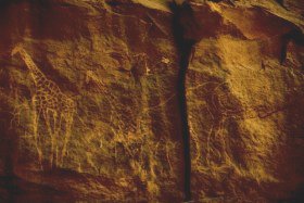
Sahara
The Sahara is the world's second largest desert, after Antarctica. At over , it covers most of Northern Africa, making it almost as large as Europe or the United States. The Sahara stretches from the Red Sea, including parts of the Mediterranean coasts, to the outskirts of the Atlantic Ocean...
" phase, during which larger lakes and more rivers exist. This causes changes in the type of animals found in the area. Regardless of the aridity of the greater Sahara, migration along the river corridor was halted when, during a desert phase 1.8-0.8 million years ago (mya), the Nile
Nile
The Nile is a major north-flowing river in North Africa, generally regarded as the longest river in the world. It is long. It runs through the ten countries of Sudan, South Sudan, Burundi, Rwanda, Democratic Republic of the Congo, Tanzania, Kenya, Ethiopia, Uganda and Egypt.The Nile has two major...
ceased to flow completely and possibly flowed only temporarily in other periods due to the geologic uplift (Nubian Swell
Nubian Swell
The Nubian Swell is a geologic structural uplift in northern Africa that trends east-west and separates the lower Nile of Egypt from the Sudan basin. The Nubian Swell has been geologically active since early Mesozoic times, and portions are still active...
) of the Nile River region.
Mechanism
During periods of a wet or "Green Sahara", the Sahara and ArabiaArabian Peninsula
The Arabian Peninsula is a land mass situated north-east of Africa. Also known as Arabia or the Arabian subcontinent, it is the world's largest peninsula and covers 3,237,500 km2...
become a savanna
Savanna
A savanna, or savannah, is a grassland ecosystem characterized by the trees being sufficiently small or widely spaced so that the canopy does not close. The open canopy allows sufficient light to reach the ground to support an unbroken herbaceous layer consisting primarily of C4 grasses.Some...
grassland and African flora and fauna become common. Following inter-pluvial arid periods, the Sahara area then reverts to desert conditions, usually as a result of the retreat of the West African Monsoon southwards. Evaporation exceeds precipitation, the level of water in lakes like Lake Chad
Lake Chad
Lake Chad is a historically large, shallow, endorheic lake in Africa, whose size has varied over the centuries. According to the Global Resource Information Database of the United Nations Environment Programme, it shrank as much as 95% from about 1963 to 1998; yet it also states that "the 2007 ...
falls, and rivers become dry wadi
Wadi
Wadi is the Arabic term traditionally referring to a valley. In some cases, it may refer to a dry riverbed that contains water only during times of heavy rain or simply an intermittent stream.-Variant names:...
s. Flora and fauna previously widespread as a result retreat northwards to the Atlas Mountains
Atlas Mountains
The Atlas Mountains is a mountain range across a northern stretch of Africa extending about through Morocco, Algeria, and Tunisia. The highest peak is Toubkal, with an elevation of in southwestern Morocco. The Atlas ranges separate the Mediterranean and Atlantic coastlines from the Sahara Desert...
, southwards into West Africa
West Africa
West Africa or Western Africa is the westernmost region of the African continent. Geopolitically, the UN definition of Western Africa includes the following 16 countries and an area of approximately 5 million square km:-Flags of West Africa:...
, or eastwards into the Nile Valley and thence either south-east to the Ethiopian Highlands
Ethiopian Highlands
The Ethiopian Highlands are a rugged mass of mountains in Ethiopia, Eritrea , and northern Somalia in the Horn of Africa...
and Kenya
Kenya
Kenya , officially known as the Republic of Kenya, is a country in East Africa that lies on the equator, with the Indian Ocean to its south-east...
or north-east across the Sinai into Asia
Asia
Asia is the world's largest and most populous continent, located primarily in the eastern and northern hemispheres. It covers 8.7% of the Earth's total surface area and with approximately 3.879 billion people, it hosts 60% of the world's current human population...
. This separates population
Population
A population is all the organisms that both belong to the same group or species and live in the same geographical area. The area that is used to define a sexual population is such that inter-breeding is possible between any pair within the area and more probable than cross-breeding with individuals...
s of some of the species in areas with different climate
Climate
Climate encompasses the statistics of temperature, humidity, atmospheric pressure, wind, rainfall, atmospheric particle count and other meteorological elemental measurements in a given region over long periods...
s, forcing them to adapt
Adaptation
An adaptation in biology is a trait with a current functional role in the life history of an organism that is maintained and evolved by means of natural selection. An adaptation refers to both the current state of being adapted and to the dynamic evolutionary process that leads to the adaptation....
, possibly giving rise to allopatric speciation
Allopatric speciation
Allopatric speciation or geographic speciation is speciation that occurs when biological populations of the same species become isolated due to geographical changes such as mountain building or social changes such as emigration...
.
Plio-Pleistocene
The Plio-PleistocenePlio-Pleistocene
The term Plio-Pleistocene refers to the geological period more recent than circa 5 million years ago, incorporating both the formally defined epochs of the Pliocene and the Pleistocene...
migrations to Africa included the Caprinae in two waves at 3.2 Ma and 2.7-2.5 Ma; Nyctereutes
Nyctereutes
Nyctereutes is an east Asian genus of the family Canidae, consisting of just one living species, the Raccoon Dog. Nyctereutes appeared about 9.0 Ma, with all but one species becoming extinct before the Pleistocene.-Taxonomy:...
at 2.5 Ma, and Equus
Equus (genus)
Equus is a genus of animals in the family Equidae that includes horses, donkeys, and zebras. Within Equidae, Equus is the only extant genus. Like Equidae more broadly, Equus has numerous extinct species known only from fossils. This article deals primarily with the extant species.The term equine...
at 2.3 Ma. Hippotragus
Hippotragus
Hippotragus is a genus of antelope which includes three species. The species are:* Roan Antelope, Hippotragus equinus* Bluebuck, Hippotragus leucophaeus †* Sable Antelope, Hippotragus niger...
migrated at 2.6 Ma from Africa to the Siwaliks. Asian bovid
Bovid
A bovid is any of almost 140 species of cloven-hoofed ruminant mammal at least the males of which bear characteristic unbranching horns covered in a permanent sheath of keratin....
s moved to Europe and to and from Africa. The primate Theropithecus experienced contraction and its fossils are found only in Europe and Asia, while Homo
Homo (genus)
Homo is the genus that includes modern humans and species closely related to them. The genus is estimated to be about 2.3 to 2.4 million years old, evolving from australopithecine ancestors with the appearance of Homo habilis....
and Macaca
Macaque
The macaques constitute a genus of Old World monkeys of the subfamily Cercopithecinae. - Description :Aside from humans , the macaques are the most widespread primate genus, ranging from Japan to Afghanistan and, in the case of the barbary macaque, to North Africa...
settled wide ranges.
185,000–20,000 years ago
Between about 133 and 122 thousand years ago (kya), the southern parts of the Saharan-Arabian Desert experienced the start of the Abbassia PluvialAbbassia Pluvial
The Abbassia Pluvial was an extended wet and rainy period in the climate history of North Africa. It began c. 120,000 years before the present , lasted approximately 30,000 years, and ended c. 90,000 ybp...
, a wet period with increased monsoonal precipitation, around 200–100 mm/year. This allowed Eurasian biota to travel to Africa and vice versa. The growth of speleothems (which requires rainwater) was detected in Hol-Zakh, Ashalim, Even-Sid, Ma'ale-ha-Meyshar, Ktora Cracks, Nagev Tzavoa Cave. In Qafzeh and Es Skuhl caves, where at that time precipitation was 600–1000 mm/year, the remains of Qafzeh-Skhul type anatomically modern humans
Anatomically modern humans
The term anatomically modern humans in paleoanthropology refers to early individuals of Homo sapiens with an appearance consistent with the range of phenotypes in modern humans....
are dated from this period, but human occupation seems to end in the later arid period.
The Red Sea coastal route was extremely arid before 140 and after 115 kya. Slightly wetter conditions appear at 90–87 kya, but it still was just one tenth the rainfall around 125 kya. Speleothem
Speleothem
A speleothem , commonly known as a cave formation, is a secondary mineral deposit formed in a cave. Speleothems are typically formed in limestone or dolostone solutional caves.-Origin and composition:...
s are detected only in Even-Sid-2.
In the southern Negev Desert speleothems did not grow between 185–140 kya (MIS
Marine isotope stage
Marine isotope stages , marine oxygen-isotope stages, or oxygen isotope stages , are alternating warm and cool periods in the Earth's paleoclimate, deduced from oxygen isotope data reflecting changes in temperature derived from data from deep sea core samples...
6), 110-90 (MIS 5.4-5.2), nor after 85 kya nor during most of the interglacial period (MIS 5.1), the glacial period and Holocene. This suggests that the southern Negev was arid to hyper-arid in these periods.
The coastal route around the western Mediterranean
Mediterranean Sea
The Mediterranean Sea is a sea connected to the Atlantic Ocean surrounded by the Mediterranean region and almost completely enclosed by land: on the north by Anatolia and Europe, on the south by North Africa, and on the east by the Levant...
may have been open at times during the last glacial; speleothems grew in Hol-Zakh and in Nagev Tzavoa Caves. Comparison of speleothem formation with calcite horizons suggests that the wet periods were limited to only tens or hundreds of years.
From 60–30 kya there were extremely dry conditions in many parts of Africa.
Last Glacial Maximum
An example of the Saharan pump has occurred after the Last Glacial MaximumLast Glacial Maximum
The Last Glacial Maximum refers to a period in the Earth's climate history when ice sheets were at their maximum extension, between 26,500 and 19,000–20,000 years ago, marking the peak of the last glacial period. During this time, vast ice sheets covered much of North America, northern Europe and...
(LGM). During the Last Glacial Maximum the Sahara desert was more extensive than it is now with the extent of the tropical forests being greatly reduced. During this period, the lower temperatures reduced the strength of the Hadley Cell
Hadley cell
The Hadley cell, named after George Hadley, is a circulation pattern that dominates the tropical atmosphere, with rising motion near the equator, poleward flow 10–15 kilometers above the surface, descending motion in the subtropics, and equatorward flow near the surface...
whereby rising tropical air of the Inter-Tropical Convergence Zone (ITCZ) brings rain to the tropics, while dry descending air, at about 20 degrees north
20th parallel north
The 20th parallel north is a circle of latitude that is 20 degrees north of the Earth's equatorial plane. It crosses Africa, Asia, the Indian Ocean, the Pacific Ocean, North America, the Caribbean and the Atlantic Ocean....
, flows back to the equator and brings desert conditions to this region. This phase is associated with high rates of wind-blown mineral dust, found in marine cores that come from the north tropical Atlantic.
Around 12,500 BC, the amount of dust in the cores in the Bølling
Bølling Oscillation
The Bølling oscillation was a warm interstadial period between the Oldest Dryas and Older Dryas stadials, at the end of the last glacial period. It is named after a peat sequence discovered at Bølling lake, central Jutland...
/Allerød
Allerød Oscillation
The Allerød period was a warm and moist global interstadial that occurred at the end of the last glacial period. The Allerød oscillation raised temperatures , before they declined again in the succeeding Younger Dryas period, which was followed by the present interglacial period.In some regions,...
phase suddenly plummets and shows a period of much wetter conditions in the Sahara, indicating a Dansgaard-Oeschger
Dansgaard-Oeschger event
Dansgaard–Oeschger events are rapid climate fluctuations that occurred 25 times during the last glacial period. Some scientists claim that the events occur quasi-periodically with a recurrence time being a multiple of 1,470 years, but this is debated...
(DO) event (a sudden warming followed by a slower cooling of the climate). The moister Saharan conditions had begun about 12,500 BC, with the extension of the ITCZ northward in the northern hemisphere summer, bringing moist wet conditions and a savanna climate to the Sahara, which (apart from a short dry spell associated with the Younger Dryas
Younger Dryas
The Younger Dryas stadial, also referred to as the Big Freeze, was a geologically brief period of cold climatic conditions and drought between approximately 12.8 and 11.5 ka BP, or 12,800 and 11,500 years before present...
) peaked during the Holocene thermal maximum climatic phase at 4000 BC when mid-latitude temperatures seem to have been between 2 and 3 degrees warmer than in the recent past. Analysis of Nile River deposited sediments in the delta also shows this period had a higher proportion of sediments coming from the Blue Nile, suggesting higher rainfall also in the Ethiopian Highlands
Ethiopian Highlands
The Ethiopian Highlands are a rugged mass of mountains in Ethiopia, Eritrea , and northern Somalia in the Horn of Africa...
. This was caused principally by a stronger monsoon
Monsoon
Monsoon is traditionally defined as a seasonal reversing wind accompanied by corresponding changes in precipitation, but is now used to describe seasonal changes in atmospheric circulation and precipitation associated with the asymmetric heating of land and sea...
al circulation throughout the sub-tropical regions, affecting India, Arabia and the Sahara. Lake Victoria only recently became the source of the White Nile and dried out almost completely around 15 kya
The sudden subsequent movement of the ITCZ southwards with a Heinrich event
Heinrich event
Heinrich events, first described by marine geologist Hartmut Heinrich, occurred during the last glacial period, or "ice age". During such events, armadas of icebergs broke off from glaciers and traversed the North Atlantic. The icebergs contained rock mass eroded by the glaciers, and as they...
(a sudden cooling followed by a slower warming), linked to changes with the El Niño-Southern Oscillation
El Niño-Southern Oscillation
El Niño/La Niña-Southern Oscillation, or ENSO, is a quasiperiodic climate pattern that occurs across the tropical Pacific Ocean roughly every five years...
cycle, led to a rapid drying out of the Saharan and Arabian regions, which quickly became desert. This is linked to a marked decline in the scale of the Nile floods between 2700 and 2100 BC.
Human migration
The Saharan pump has been used to date four waves of human migration from Africa, namely:- Homo erectusHomo erectusHomo erectus is an extinct species of hominid that lived from the end of the Pliocene epoch to the later Pleistocene, about . The species originated in Africa and spread as far as India, China and Java. There is still disagreement on the subject of the classification, ancestry, and progeny of H...
(ssp. ergaster) into Southeast and East Asia - Homo heidelbergensisHomo heidelbergensisHomo heidelbergensis is an extinct species of the genus Homo which may be the direct ancestor of both Homo neanderthalensis in Europe and Homo sapiens. The best evidence found for these hominins date between 600,000 and 400,000 years ago. H...
into the Middle East and Western Europe - Homo sapiens sapiens "Out of Africa theoryRecent African origin of modern humansIn paleoanthropology, the recent African origin of modern humans is the most widely accepted model describing the origin and early dispersal of anatomically modern humans...
" - The spread of Afro-Asiatic languagesAfro-Asiatic languagesThe Afroasiatic languages , also known as Hamito-Semitic, constitute one of the world's largest language families, with about 375 living languages...
(BerberBerber languagesThe Berber languages are a family of languages indigenous to North Africa, spoken from Siwa Oasis in Egypt to Morocco , and south to the countries of the Sahara Desert...
and EgyptianEgyptian languageEgyptian is the oldest known indigenous language of Egypt and a branch of the Afroasiatic language family. Written records of the Egyptian language have been dated from about 3400 BC, making it one of the oldest recorded languages known. Egyptian was spoken until the late 17th century AD in the...
to North Africa and SemiticSemitic languagesThe Semitic languages are a group of related languages whose living representatives are spoken by more than 270 million people across much of the Middle East, North Africa and the Horn of Africa...
to the Arabian Peninsula and Middle East).
The formation of the modern Sahara, as a result of the 5.9 kiloyear event
5.9 kiloyear event
The 5.9 kiloyear event was one of the most intense aridification events during the Holocene. It occurred around 3900 BC, ending the Neolithic Subpluvial and probably initiated the most recent desiccation of the Sahara desert. Thus, it also triggered worldwide migration to river valleys, e.g...
is also considered to be a part of the same mechanism in operation.
See also
- Abbassia PluvialAbbassia PluvialThe Abbassia Pluvial was an extended wet and rainy period in the climate history of North Africa. It began c. 120,000 years before the present , lasted approximately 30,000 years, and ended c. 90,000 ybp...
- Mousterian PluvialMousterian PluvialThe Mousterian Pluvial was an extended wet and rainy period in the climate history of North Africa. It occurred during the Upper Paleolithic era, beginning around 50,000 years before the present , lasting 20,000 years, and ending around 30,000 ybp .During the Mousterian Pluvial, the now-desiccated...
- Neolithic SubpluvialNeolithic SubpluvialThe Neolithic Subpluvial — sometimes called the Holocene Wet Phase — was an extended period of wet and rainy conditions in the climate history of northern Africa...
- North African climate cyclesNorth African climate cyclesNorth African Climate Cycles have a unique history that can be traced back millions of years. The cyclic climate pattern of the Sahara is characterized by significant shifts in the strength of the North African Monsoon...