

R113 road
Encyclopedia
The R113 road is a regional road
in Ireland
. Located in the east of Ireland
at Dublin, it forms a semi-orbital route around the south of the city. As of 2007, clockwise, it starts at the N31 at Temple Hill in Blackrock and ends at a junction with the N4 at Palmerstown
.
The road is one of the busiest Regional Roads in Ireland. The Liffey Valley Shopping Centre
, and The Square, Tallaght
, two of the busiest shopping centres in Ireland, are both located just off the route. Both the Fonthill Road (in Lucan/Clondalkin
) and Belgard Road (in Tallaght) sections also have a number of large retail outlets. The Belgard Road section, running between the N7 at Newlands and the N81
at Tallaght, is a standard dual carriageway and the main thoroughfare in the Tallaght area.
 As of January 2008 based the latest Ordnance Survey map of Dublin (Sixth Edition, updated Sept 2005) and the 2006 legislation defining the route changes the former R113 route to:
Note: As of 2008 the former R113 route via Ticknock, Tibradden, Rockbrock and Mount Venus
is still partially signposted 'R113' and the new R113 is still partially signed as a variety of other regional routes.
Regional road
A regional road in Ireland is a class of road not forming a major route , but nevertheless forming a link in the national route network. There are over 11,600 kilometres of regional roads. Regional roads are numbered with three digit route numbers, prefixed by "R" A regional road in Ireland is a...
in Ireland
Republic of Ireland
Ireland , described as the Republic of Ireland , is a sovereign state in Europe occupying approximately five-sixths of the island of the same name. Its capital is Dublin. Ireland, which had a population of 4.58 million in 2011, is a constitutional republic governed as a parliamentary democracy,...
. Located in the east of Ireland
Ireland
Ireland is an island to the northwest of continental Europe. It is the third-largest island in Europe and the twentieth-largest island on Earth...
at Dublin, it forms a semi-orbital route around the south of the city. As of 2007, clockwise, it starts at the N31 at Temple Hill in Blackrock and ends at a junction with the N4 at Palmerstown
Palmerstown
Palmerstown , occasionally referred to as Palmerston, is a suburb of Dublin,Ireland. It is located about 8km west of the city centre, in the administrative county of South Dublin. The area is bordered to the north by the River Liffey, to the west by Lucan, to the south by Ballyfermot and to theeast...
.
The road is one of the busiest Regional Roads in Ireland. The Liffey Valley Shopping Centre
Liffey Valley Shopping Centre
Liffey Valley Shopping Centre is a shopping centre, that is located in Clondalkin in Dublin 22. The centre opened in 1998 and is located at the junction of the M50 motorway and N4 road...
, and The Square, Tallaght
Tallaght
Tallaght is the largest town, and county town, of South Dublin County, Ireland. The village area, dating from at least the 17th century, held one of the earliest settlements known in the southern part of the island, and one of medieval Ireland's more important monastic centres.Up to the 1960s...
, two of the busiest shopping centres in Ireland, are both located just off the route. Both the Fonthill Road (in Lucan/Clondalkin
Clondalkin
-Today:Modern Clondalkin is a busy satellite town of Dublin, with a population of 43,929 in 2006. Retail facilities include Tesco Ireland- and Dunnes Stores-led shopping centres, and Aldi and Lidl stores on the Fonthill Road and New Nangor Road respectively, and the village centre is a base for...
) and Belgard Road (in Tallaght) sections also have a number of large retail outlets. The Belgard Road section, running between the N7 at Newlands and the N81
N81 road
The N81 road is a national secondary road in Ireland, connecting the gates of Trinity College, Dublin to Tullow, County Carlow, north to south. The N81 continues past Tullow for another 8 km to terminate at the village of Closh, County Carlow, where it intersects the N80. The N81 is long...
at Tallaght, is a standard dual carriageway and the main thoroughfare in the Tallaght area.
Route
The official description of the R113 from the Roads Act 1993 (Classification of Regional Roads) Order 2006 reads:- R113: Fonthill - Blackrock, County Dublin
- Between its junction with N4 at Fonthill and its junction with N7 at Newland's Cross via Fonthill Road North, Nangor Road and Fonthill Road South all in the county of South Dublin
-
-
- and
-
- between its junction with N7 at Newland's Cross and its junction with N81 at Tallaght Bypass via Belgard Road and Belgard Road Extension all in the county of South Dublin
-
-
- and
-
- between its junction with N81 at Tallaght Bypass in the county of South Dublin and its junction with N31 at Leopardstown Road in the county of DunLaoghaire - Rathdown via Old Bawn Road, Killininney Road, Saint Colmcille's Way, Scholarstown Road, Ballyboden Way, Taylor's Lane and Grange Road in the county of South Dublin: Grange Road, Brohenfield Road, Motorway Service Roads and Murphystown in the county of Dun Laoghaire - Rathdown
-
-
- and
-
- between its junction with N31 at Brewery Road and its junction with N31 at Temple Road Blackrock via Leopardstown Road, Newtownpark Avenue, Stradbrook Road and Temple Hill all in the county of Dun Laoghaire - Rathdown.
- Start at Temple Hill in Blackrock at its junction with the N31.
- Top of Temple Hill fork to Stradbrook Road.
- Turn right up into Newtownpark Avenue.
- Up Newtownpark Avenue
- Cross the N11 at White's Cross and proceed along Leopardstown Road to the roundabout at Brewery Road (N31)/SandyfordSandyfordSandyford is a suburb of Dublin, located in Dún Laoghaire-Rathdown County, Ireland. A major part of Sandyford today is composed of the Sandyford Industrial Estate and related developments.- Location and access :...
Industrial Estate junction. - Follow dual-carriageway (on the N31/Leopardstown Road) to J14 of the M50M50 motorway (Ireland)The M50 motorway is a motorway in Ireland running in a C-shaped ring around the north-eastern, northern, western and southern sides of the capital city, Dublin. The northern end of the route is located at the entrance to the Dublin Port Tunnel. Anti-clockwise it heads northwest through the tunnel...
. - Cross the M50 and follow the western end of the Leopardstown Road to a new junction at Hillcrest/Kilgobbin Rd.
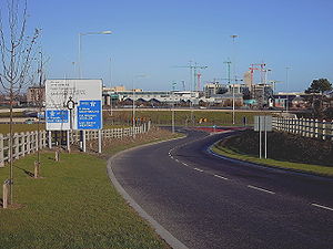
- Goes sharp right at Hillcrest down the new Kilgobbin Road Extension (in the thumbnail), to a rotary junction over the M50 (J13 East).
- Follows two parallel roads either side of the M50 (two-lane one-way roads, in effect a dual carriageway with the M50 in the median) to a dumbbell junction under the M50 (J13 West).
- From here it goes west along Brehon Fields Road (part of the Green Route) and then follows Grange Road past Marlay ParkMarlay ParkMarlay Park is a suburban public park located in Rathfarnham in the administrative area of Dún Laoghaire-Rathdown, in Co. Dublin, Ireland. Lying about nine kilometres from Dublin city centre. The parkland comprises woodlands, ponds and walks...
; on to Taylor's Lane as far as BallybodenBallybodenBallyboden is a locality within the suburb of Rathfarnham in South Dublin, at the foot of the Dublin mountains between Whitechurch, Ballyroan and Knocklyon....
roundabout, where it intersects the R115R115 roadThe R115 road is a regional road in counties Dublin and Wicklow in Ireland. It follows the Military Road for its entire length. The R115 is long; the full length of the Military Road is... - Continues west along Ballyboden Way; Templeroan; Scholarstown Road to cross the M50 again at Junction 12 (KnocklyonKnocklyonKnocklyon is a suburb of Dublin in Ireland, situated south west of Dublin city, and north of the Dublin Mountains.There is currently a debate among locals whether the correct name is cnoc linn, or cnoc liamhna....
). - Continues west along St. Collumkilles Rd; Scholarstown Link Rd to a junction with the R114 (FirhouseFirhouseFirhouse is a small outer suburb of Dublin, in South Dublin County, Ireland, developed from what was historically a rural village. It is located just south of the River Dodder, and is in the postal district of Dublin 24...
/Bohernabreena Roads). - Veers north along the Old Bawn Road and joins the N81 in TallaghtTallaghtTallaght is the largest town, and county town, of South Dublin County, Ireland. The village area, dating from at least the 17th century, held one of the earliest settlements known in the southern part of the island, and one of medieval Ireland's more important monastic centres.Up to the 1960s...
Town centre. - After following the N81 west for 0.5 km it branches north along the Belgard Road dual-carriageway as far as Newlands CrossNewlands CrossNewlands Cross is a well-known crossroads in SW Dublin in the county of South Dublin.It is the point where the N7 National Route to the South West and Mid West crosses an orbital local route, the R113. Traditionally Newlands Cross was regarded as the place where Dublin City ended and the "country"...
. - It crosses the N7 through a set of traffic lights. at grade, and follows the Fonthill Rd north west bypassing central ClondalkinClondalkin-Today:Modern Clondalkin is a busy satellite town of Dublin, with a population of 43,929 in 2006. Retail facilities include Tesco Ireland- and Dunnes Stores-led shopping centres, and Aldi and Lidl stores on the Fonthill Road and New Nangor Road respectively, and the village centre is a base for...
. Clondalkin/Fonthill railway station is located on R113 at this point. - It crosses the R134 at a double roundabout junction and follows the Fonthill Road North for 5 km (3.1 mi) before terminating at a grade separated junction (junction 2) with the N4 at Quarryvale/Liffey Valley Shopping CentreLiffey Valley Shopping CentreLiffey Valley Shopping Centre is a shopping centre, that is located in Clondalkin in Dublin 22. The centre opened in 1998 and is located at the junction of the M50 motorway and N4 road...
. - Plans to carry the road north, across the River LiffeyRiver LiffeyThe Liffey is a river in Ireland, which flows through the centre of Dublin. Its major tributaries include the River Dodder, the River Poddle and the River Camac. The river supplies much of Dublin's water, and a range of recreational opportunities.-Name:The river was previously named An Ruirthech,...
, seem to have been abandoned. Possibly due to concerns that a "free" crossing just one kilometer upstream from the West-Link on the M50 would cause massive re-routing of traffic (and, of course, loss of West-LinkWest-LinkThe West-Link is a toll bridge on the M50 motorway to the west of Dublin, Ireland, operated by BetEire Flow Limited for the National Roads Authority.- Structure :...
revenue).
Note: As of 2008 the former R113 route via Ticknock, Tibradden, Rockbrock and Mount Venus
Mount Venus
Mount Venus is a sacred megalithic site in Edmondstown, County Dublin, Ireland on the Mount Venus Road. It is a national heritage site....
is still partially signposted 'R113' and the new R113 is still partially signed as a variety of other regional routes.
See also
- Roads in IrelandRoads in IrelandThe island of Ireland, comprising Northern Ireland and the Republic of Ireland, has an extensive network of tens of thousands of kilometres of public roads, usually surfaced. These roads have been developed and modernised over centuries, from trackways suitable only for walkers and horses, to...
- National primary roadNational primary roadA national primary road is a road classification in the Republic of Ireland. National primary roads form the major routes between the major urban centres. There are over 2,700km of national primary roads. This category of road has the prefix "N" followed by one or two digits...
- National secondary roadNational secondary roadA national secondary road is a category of road in Ireland. These roads form an important part of the national route network, but are secondary to the main arterial routes which are classified as national primary roads. National secondary roads are designated with route numbers higher than those...
- Regional roadRegional roadA regional road in Ireland is a class of road not forming a major route , but nevertheless forming a link in the national route network. There are over 11,600 kilometres of regional roads. Regional roads are numbered with three digit route numbers, prefixed by "R" A regional road in Ireland is a...