
Parks and open spaces in Oslo
Encyclopedia
Oslo
Oslo is a municipality, as well as the capital and most populous city in Norway. As a municipality , it was established on 1 January 1838. Founded around 1048 by King Harald III of Norway, the city was largely destroyed by fire in 1624. The city was moved under the reign of Denmark–Norway's King...
, the capital and largest city of Norway
Norway
Norway , officially the Kingdom of Norway, is a Nordic unitary constitutional monarchy whose territory comprises the western portion of the Scandinavian Peninsula, Jan Mayen, and the Arctic archipelago of Svalbard and Bouvet Island. Norway has a total area of and a population of about 4.9 million...
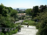
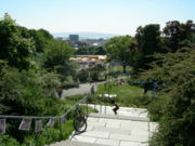
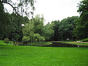
. The various parks and open spaces are interconnected by paths so that the city's inhabitants can walk between them.
As the city expanded in the middle of the 19th century, areas were appropriated for parks and recreational purposes. The eastern part of the city (Østkanten) was prioritized due to congestion and industrialization. The residential and more affluent western parts of the city (Majorstuen, Frogner) have comparably fewer parks and open spaces. 95% of the city's inhabitants have a park or an open green space within 300 meters of their home.
Some of the many parks have a special place in the life and history of Oslo:
- Frogner ParkFrogner ParkFrogner Park is a public park located in the borough of Frogner in Oslo, Norway. The park contains the world famous Vigeland Sculpture Park designed by Gustav Vigeland....
with the Vigeland Sculpture Park, Norway's most visited tourist attraction. - Eidsvolls plassEidsvolls plassEidsvolls plass is a square and park in Oslo, Norway, located west of the Parliament of Norway Building, south of Karl Johans gate and east of Studenterlunden and the National Theatre...
and StudenterlundenStudenterlundenStudenterlunden is a park in the city center of Oslo, Norway. It is surrounded by Karl Johans gate, Stortingsgata, Universitetsgata and Frederiks gate. Within the park lays the National Theatre. It also contains one of the entrances to Nationaltheatret Station of the Oslo Metro and Nationaltheatret...
along the main street Karl Johans gateKarl Johans gateKarl Johans gate is the main street of the city of Oslo, Norway. The street was named in honor of King Karl Johan, who was King of Sweden and of Norway....
. - SlottsparkenPalace ParkThe Palace Park is a public park in the center of Oslo, Norway, surrounding the Royal Palace. It is . It was built during the 1840s and was designed by Hans Ditlev Franciscus Linstow, who was the main architect of the palace...
, which surrounds the Royal PalaceRoyal Palace, OsloThe Royal Palace in Oslo was built in the first half of the 19th century as the Norwegian residence of Norwegian and Swedish king Charles III and is the official residence of the present Norwegian Monarch. The crown prince couple resides at Skaugum in Asker west of Oslo...
. - St. HanshaugenSt. Hanshaugen ParkSt. Hanshaugen Park is the first large public park outside the city center of Oslo, Norway. St. Hanshaugen Park is a classic city park located within the Oslo borough of St. Hanshaugen, named for the park which lies within its center. Years ago the park location was regarded as worthless and was...
, the first large public park outside the city center. - BirkelundenBirkelundenBirkelunden is a park placed centrally in the Grünerløkka borough of Oslo, Norway. It is formed as a rectangle, more or less like a city block.-History:...
and Olaf Ryes plass in GrünerløkkaGrünerløkkaGrünerløkka is a borough of the city of Oslo, Norway. Grünerløkka became part of the city of Oslo in 1858.Grünerløkka was named after Friedrich Grüner who bought a mill in the area from king Christian V of Denmark in 1672 . During the 19th century, Grünerløkka became a working class area...
. - AkerselvaAkerselvaAkerselva, or Akerselven, is a river which flows through Oslo. It starts at Maridalsvannet in Oslomarka, and follows the urban areas Nordre Aker, Sagene, Grünerløkka, Oslo centre and Grønland, whereby it finally ends at Paulsenkaien and Oset in Bjørvika. The river is considered to be a part of the...
environment park, with walks around structures from early stages of Norwegian industrial development. - BygdøyBygdøyBygdøy or Bygdø is a peninsula on the western side of Oslo, Norway. Administratively, Bygdøy belongs to the borough of Frogner.Bygdøy has several museums, like the Kon-Tiki Museum, which shows all year long the legendary expeditions of Thor Heyerdahl; the Norwegian Museum of Cultural History ; the...
and EkebergslettaEkebergslettaEkebergsletta is a field in Ekeberg, Oslo, Norway.For most people, Ekebergsletta is known as the place where the Norway Cup started in 1972 and which is still one of many places around Oslo where the game is held....
, large natural parks.
Landscape and parks
The central part of Oslo is situated between hills; HolmenkollenHolmenkollen
Holmenkollen is a neighborhood in the Vestre Aker borough of Oslo, Norway. In addition to being a residential area, the area has been a ski recreation area since the late 19th century, with its famous, eponymous, ski jump arena hosting competitions since 1892...
, Voksenkollen, Vettakollen
Vettakollen
Vettakollen is a hill and neighbourhood in the borough of Vestre Aker in Oslo, Norway.The hill lies west of Sognsvann and southeast of Voksenåsen and Holmenkollen, and measures 419 metres above mean sea level. The built-up residential area south of the hill is served by the Oslo Metro station...
and Grefsenåsen
Grefsenåsen
Grefsenåsen is a hill in Lillomarka in Oslo, Norway. The height is 377 meter.The view from the top is magnificent, and the hill has for a long time been a popular resort for day-trippers living in Oslo...
north of the city and Haukåsen to the east, all of them with a height of 350–500 metres. The Ekeberg hill is located to the southeast, with a height of 150 metres. On the slopes from the hills north of the city Holmenkollåsen, Grefsenkollen and Korsvollparken are the areas that provide the best view of the city.

Akerselva and its surroundings have in the last hundred years been landscaped in a matter that preserves both the river and its industrial history. The task of developing the other rivers within the city as parks has started. The work with the river Alna has been concluded with an environment park while Lysakerelva, Frognerelva, Hovinbekken and Ljanselva are still under development.
Oslo has a long shoreline that has been used by shipyards and ports for the last 150 years. In the west, on the border to Bærum, the Vækerøparken is situated along the shoreside. Beaches with parks are Huk on Bygdøy
Bygdøy
Bygdøy or Bygdø is a peninsula on the western side of Oslo, Norway. Administratively, Bygdøy belongs to the borough of Frogner.Bygdøy has several museums, like the Kon-Tiki Museum, which shows all year long the legendary expeditions of Thor Heyerdahl; the Norwegian Museum of Cultural History ; the...
, Katten and Hvervenbukta and areas on Malmøya and Ulvøya. The "Fjordby" plan allocates more access to the shoreline for the city's population.
Among the islands within the city border Hovedøya
Hovedøya
Hovedøya or Hovedøen is one of several small islands off the coast of Oslo, Norway in the Oslofjord. The island is quite small, no more than 800 metres across in any direction, the total area is 0,4 square kilometre. It is well known for its lush and green nature, with a wide variety of trees,...
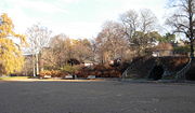
, Gressholmen and Langøyene are easily accessible by ferries, and have extensive parks and beaches. In Gamlebyen, the water level in Middelalderparken gives a view of the shoreline in medieval ages.
Early parks in Oslo
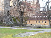
Akershus Fortress
Akershus Fortress or Akershus Castle is a medieval castle that was built to protect Oslo, the capital of Norway. It has also been used as a prison.- Construction :...
is the earliest depicted garden in Norway, possibly created around 1560. The garden had neatly arranged beds, a pavilion and a fish pond called Munkedammen after the feudal overlord Christen Munk. The garden was cleared by the end of the 17th century, and the pond was filled in around 1860s, though it was reopened in 1965. In the 1770s, the Kanonparken was created by the commandant. It was open and constructed in public, though it was not primarily intended for use by the civil population.
Paléhaven became the first publicly available park when the owner Christian Ancher opened it in 1760s. It was Norway's only city park in Baroque style and was situated by the shoreline. The only thing left of it today is an alley of linden trees on Christian Frederiks plass ("Plata"). Many enclosures around the early city had gardens, mostly for growing vegetables, from the 18th century also as parks. Ponds were created for fish. The only one of these enclosures unsullied is the closure Rolighed at Professor Dahls gate 32.

The garden around Munkedammen in Pipervika was around 1750 one of the first semi-public gardens where the upper class of Christiania went for walks, but it decayed after 1790. The pond was about 50 meters wide and 100 meters long and was a continuation of two earlier, separate ponds one assumed that the monks from the Hovedøya monastery had created. In the pond there was a small island with a pavilion and a herb garden.
North of Stortorget and Grensen several parks were created around 1700, among them James Collet's Grensehaven between Akersgata and Grubbegata, in Renaissance style. The garden at Oslo Ladegård had hedges, paths in a square system, a long pond and alleys down to the fjord, in Renaissance style. A small part of Ladegårdshagen was recreated in 1999.
Grünerhagen, created by the Grüner family on Nedre Foss was around 1700 a grandiose garden with terraces, alleys, a pond with a garden pavilion on piles and a zoo with various animals. The garden was destroyed by the end of the 19th century.

Bygdøy
Bygdøy or Bygdø is a peninsula on the western side of Oslo, Norway. Administratively, Bygdøy belongs to the borough of Frogner.Bygdøy has several museums, like the Kon-Tiki Museum, which shows all year long the legendary expeditions of Thor Heyerdahl; the Norwegian Museum of Cultural History ; the...
was the summer residence for the viceregent and had a renaissance garden from around 1680. The peninsula became an excursion spot by the end of the 18th century. Around 1830 a new garden in landscape style was created at Kongsgården and walks in the nearby woods were cleared.
Several of the estates around the city had grand linden alleys in the 18th century: Stubljan, Linderud, Søndre Bjølsen (currently Bjølsenparken) and Nordre Skøyen hovedgård. Linderud gård had a large garden with a 70-meter-long canal and a 120 alley of hazel trees. In the city center there are still linden alleys in Paléhagen, Regjeringsparken and Dronningparken.
The park surrounding Bogstad mansion from 1780 was the first in Norway in landscape style. Peder Anker
Peder Anker
Peder Anker was a Norwegian businessman and politician. He served as Prime Minister of Norway from 1814 until 1822.-Biography:...
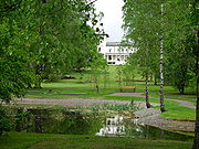
engaged a gardener from Germany who utilized the slope from the main house down to the Bogstadvannet lake, with curved paths and artificial creeks. A similar style was applied when John Collett created the park around Ullevål gård, known for its rich variety of sentiments and as a center for the city's social life. Vækerø also had quite a large garden in a similar style and it is preserved today as Vækerøparken.
The wealthy Bernt Anker created a baroque park at Frogner hovedgård
Frogner Manor
Frogner Manor is located on a former estate in an area that became part of today's borough of Frogner in Oslo, Norway. The estate is now the site of Frognerparken...
at the end of the 18th century. When Benjamin Wegner bought the estate in the early 19th century, a romantic landscape style park was created. That park included parts of what today is the Frogner Park
Frogner Park
Frogner Park is a public park located in the borough of Frogner in Oslo, Norway. The park contains the world famous Vigeland Sculpture Park designed by Gustav Vigeland....
. Around 1800 there was a total of 96 persons in the city that offered gardening services.
1812–1865: The first public parks
When tiny Christiania with around 10,000 inhabitants became capital of Norway in 1814, the foundations for creating parks were not favourable compared with other larges cities in Europe:- There were no castles with gardens, that could become a public park, as the Tuileries PalaceTuileries PalaceThe Tuileries Palace was a royal palace in Paris which stood on the right bank of the River Seine until 1871, when it was destroyed in the upheaval during the suppression of the Paris Commune...
. - There were no continuous ramparts that could be demolished to make way for a park, as in CopenhagenCopenhagenCopenhagen is the capital and largest city of Denmark, with an urban population of 1,199,224 and a metropolitan population of 1,930,260 . With the completion of the transnational Øresund Bridge in 2000, Copenhagen has become the centre of the increasingly integrating Øresund Region...
(Tivoli Gardens, botanical gardenUniversity of Copenhagen Botanical GardenThe University of Copenhagen Botanical Garden , usually referred to simply as Copenhagen Botanical Garden, is a botanical garden located in the centre of Copenhagen, Denmark...
, Ørsted park and Østre anlegg). - There were no large areas in the center of the city that could be converted to parks, as the Royal Parks of LondonRoyal Parks of LondonThe Royal Parks of London are lands originally owned by the monarchy of the United Kingdom for the recreation of the royal family...
.
Before 1870 there was no consensus as to whether the city should engage in constructing parks. When the city's park administration was founded in 1875 and the rapid expansion of the city started, there were all the same several nice parks. Various private persons and organisations had provided for this:
- Citizens in the organisation Selskabet for Christiania Byes VelSelskabet for Oslo Byes VelSelskabet for Oslo Byes Vel , often known as Oslo Byes Vel, is a non-profit heritage association for the benefit of Oslo, Norway's capital city. It was established in 1811 by Niels Wulfsberg.-History:...
had constructed several parks. - State authorities engaged in creating a capital; the area at Tøyen to be used by the new university, the Botsfengselet jail with its surrounding park, areas in vicinity to the Akershus castle, the garden Universitetshagen behind the university.
- Landlords that did not want neighbours created Eidsvolls plass
- A Frenchman with grand ideas (Charles XIV John of Sweden and NorwayCharles XIV John of SwedenCharles XIV & III John, also Carl John, Swedish and Norwegian: Karl Johan was King of Sweden and King of Norway from 1818 until his death...
) created SlottsparkenPalace ParkThe Palace Park is a public park in the center of Oslo, Norway, surrounding the Royal Palace. It is . It was built during the 1840s and was designed by Hans Ditlev Franciscus Linstow, who was the main architect of the palace...
and laid the foundation for the park areas on BygdøyBygdøyBygdøy or Bygdø is a peninsula on the western side of Oslo, Norway. Administratively, Bygdøy belongs to the borough of Frogner.Bygdøy has several museums, like the Kon-Tiki Museum, which shows all year long the legendary expeditions of Thor Heyerdahl; the Norwegian Museum of Cultural History ; the...
. - A businessman with varied interests, Fritz Heinrich Frølich, created the St. Hanshaugen park.
Oslo Stock Exchange
The Oslo Stock Exchange serves as the main market for trading in the shares of Norwegian companies. It opens at 9:00am and closes 5:30pm local time...
opened in 1826.
The organisation Selskapet for Christiania Byes Vel concentrated on creation of public parks as one of its main priorities during its first fifty years of existence. At the bridge Nybrua crossing Akerselva the organisation erected the city's first outdoor monument in 1833, with a surrounding park. Bankplassen
Bankplassen
Bankplassen is a square in the neighborhood Kvadraturen in Oslo, bounded by Kongens gate, Myntgata and Kirkegata. Before 1953 Agnes Thorsens plass was also part of Bankplassen. The square takes its name after the building of the Christiania Department's Norges Bank, Bankplassen 3, built in 1830 as...
was laid out with the city's first bed of flowers in a public park (around 1860). Trees were planted around Oslo Cathedral
Oslo Cathedral
Oslo Cathedral — formerly Our Savior's Church — is the main church for the Oslo bishopric of the Church of Norway, as well as the parish church for downtown Oslo. The present building dates from 1694-1697....
and Trefoldighetskirken, and the organisation managed to stop construction at Kontraskjæret. Selskapet for Christiania Byes Vel did also organize planting of trees along various streets, among them Grønlandsleiret, the road from Nybrua to Tøyen, Drammensveien and Rådhusgata. Some of the trees are still standing across Kontraskjæret.
Royal Palace, Oslo
The Royal Palace in Oslo was built in the first half of the 19th century as the Norwegian residence of Norwegian and Swedish king Charles III and is the official residence of the present Norwegian Monarch. The crown prince couple resides at Skaugum in Asker west of Oslo...
, was laid out from 1838 to 1844, in landscape style with large trees, paths, ponds and lawns in the curved terrain. Within Slottsparken the Dronningparken face Drammensveien and is a romantic, intimate park, constructed some years after the main park and in general closed for the public, except for a limited time during the summer. To the east, facing Karl Johans Street
Streets in Oslo
-Aasta Hansteens vei:Aasta Hansteens vei lies in Stovner, Oslo. The road is a cul-de-sac from Fossumveien to Stovner police station. The street was named in 1977 after the women's rights pioneer and artist Aasta Hansteen .-Abbediengen terrasse:Abbediengen terrasse is a cul-de-sac in the suburb of...
are the heights Abelhaugen and Nisseberget. The 225-decare large park has a number of well-known statues and sculptures.
King Charles' original plan for the park was for it to continue to the Uranienborg woods, where the Uranienborg church is today, and be part of a chain of parks from the Royal Castle to the Bygdøy peninsula. The king's monumental plans were not realized in full, but the Slottsparken is Oslo's major central city park and the landscape of the Bygdøy peninsula with its woods, beaches and paths has made a major imprint on the city. King Charles took possession of the mansion at Bygdøy and proclaimed the area as a public park in 1837. He bought enclosures along Frognerkilen and constructed Lindehagen, today's Dronningberget, north on Bygdøy. The wood that belongs to the Royal Mansion was designated as a protected area in 1940. King Oscar II constructed pathways west and north on the peninsula, as of 1882 there were about 10 kilometers of paths available for the public.
Eidsvolls plass, with the area today called "Spikersuppa" was purchased from the landlord's across Karl Johan's street in 1846. The large trees in the park are probably from around 1850. The area was then still swampy and the Bislett creek that traverses the park was still open, and not dug over before 1860. The state bought the area area in 1858. It took some years before the park was finished. The statue of Henrik Wergeland
Henrik Wergeland
Henrik Arnold Thaulow Wergeland was a Norwegian writer, most celebrated for his poetry but also a prolific playwright, polemicist, historian, and linguist...
was unveiled in 1881.
The park at the university was laid out around 1850, as an enclosed area between the university buildings at Karl Johan's street.

St. Hanshaugen Park
St. Hanshaugen Park is the first large public park outside the city center of Oslo, Norway. St. Hanshaugen Park is a classic city park located within the Oslo borough of St. Hanshaugen, named for the park which lies within its center. Years ago the park location was regarded as worthless and was...
was a scrap heap and viewed as a useless area until the celebration of summer solstice
Solstice
A solstice is an astronomical event that happens twice each year when the Sun's apparent position in the sky, as viewed from Earth, reaches its northernmost or southernmost extremes...
(St. Hans in Norwegian) was moved there some time before 1820. The businessman Fritz Heinrich Frølich initiated a park there around 1850, got his will after much initial resistance and paid for the first works. In the middle of the 1860s Christiania Byes Vel was involved with the new park, planted 1275 trees and helped create the first major park outside the city center. From 1867 the city took responsibility for the park and the last major works were carried out in the years 1876–1890. The final part of the park was added with purchases of land in 1909. St. Hanshaugen had its heyday as an attraction from 1890 to the First World War. It is a classic city park where terrain, vegetation and water is used. The mixture of intimate and romantic areas in the south with more plain areas in the northern part, fabulous views, entertainment, a good restaurant (Hasselbakken), animals (birds and bears in a cage) all added to making the park popular.
The area around Tøyen
Tøyen
Tøyen is a residential area in the central parts of Oslo, Norway, part of the borough of Gamle Oslo.-Location:It is noted for its high concentration of immigrants. The multicultural atmosphere makes Tøyen very trendy and popular with continually rising cost of housing.There are two different...
was designated for the city's first university, from when the state bought the mansion Tøyen hovedgård and until around 1820, when it was decided that the university should be in the center of the city. In the years 1814–18 the botanical garden was laid out, and from around 1830 several enclosures were given to professors at the new university, the one remaining being Bellevue in Tøyenparken. The state ownership of the area helped preserve large areas for the future park.
Around the prison Botsfengselet (opened 1851) there was established a park, today known as Grønlands park and Klosterenga.
The city was not particularly late in creating public parks; Bremen
Bremen
The City Municipality of Bremen is a Hanseatic city in northwestern Germany. A commercial and industrial city with a major port on the river Weser, Bremen is part of the Bremen-Oldenburg metropolitan area . Bremen is the second most populous city in North Germany and tenth in Germany.Bremen is...
established its first park in 1804, Stockholm
Stockholm
Stockholm is the capital and the largest city of Sweden and constitutes the most populated urban area in Scandinavia. Stockholm is the most populous city in Sweden, with a population of 851,155 in the municipality , 1.37 million in the urban area , and around 2.1 million in the metropolitan area...
had its first public park Strömparterren in 1832 while New York
New York
New York is a state in the Northeastern region of the United States. It is the nation's third most populous state. New York is bordered by New Jersey and Pennsylvania to the south, and by Connecticut, Massachusetts and Vermont to the east...
got its Central Park
Central Park
Central Park is a public park in the center of Manhattan in New York City, United States. The park initially opened in 1857, on of city-owned land. In 1858, Frederick Law Olmsted and Calvert Vaux won a design competition to improve and expand the park with a plan they entitled the Greensward Plan...
by the end of the 1850s.
1865–1916: Refuge from the city
- It would soften the harmful influence from the city, noise, soot, smoke and dirt from the expanding industry and straitened circumstances.
- It would give the city residents an aesthetic impact that was educative and curative.
Christiania grew faster than most European cities around 1870–1890. Property developers built houses and villas while the city provided roads, water and sanitation. Owing to fire regulations the building material was brick, and this is largely the area that today is inside Ring 2
Ring 2 (Oslo)
Ring 2, sometimes called Kirkeveiringen and until 2010 officially known as National Road 161 , and now also officially County road 161 , , is an important ring road and surface street through densely populated parts of Oslo, Norway....
(the bypass road 2). Several new parks were created, most of them in the eastern part of the city. The argument giving priority to the eastern part was that it was the most crowded part of the city and was thus most in need of parks.
The city's expansion and the creation of a tram network contributed to increased commuting. Combined with steadily reduced working hours, this created a need to fill the available leisure time with activities. Some of the parks, like Kampen park, were used extensively from the time they were ready. The city's park organisation from 1875, Christiania beplantningsvesen, was a new authority for creating and maintaining parks.
In 1897, the Paléhaven (currently named Christian Frederiks plass) in the city center was ready as a public park. Børshagen was upgraded when Kristiania Stock Exchange expanded in 1911. The city took responsibility for Studenterlunden and Eidsvolls plass in 1888 and 1889. Grev Wedels plass by the quarter called Kvadraturen was laid out as a 14-decare park in 1869, initiated by Christiania Byes Vel. The park was created on an area previously used by the armed forces.

- By the Oslo Cathedral, 3 decare, in 1870
- By Trefoldighetskirken
- By Old Aker ChurchOld Aker ChurchOld Aker Church is a medieval church located in Oslo. An active parish, the church is the oldest existing building in Oslo.-History:Old Aker Church was built as a three-naved Roman-style basilica and constructed from limestone. The church has a baroque pulpit and baptismal font from 1715. The...
- By Grønland kirke
- Halfdan Kjerulfs plass
- Bankplassen
- Nordraaks plass
- Solli plass
Around 1865 the architect Georg Andreas Bull
Georg Andreas Bull
Georg Andreas Bull was a Norwegian architect and chief building inspector in Christiania for forty years. He was among the leading architects in the country, and left his mark on Norwegian building history both as a creative architect, and through his measurement studies and archeological...
sketched a general plan for Grünerløkka
Grünerløkka
Grünerløkka is a borough of the city of Oslo, Norway. Grünerløkka became part of the city of Oslo in 1858.Grünerløkka was named after Friedrich Grüner who bought a mill in the area from king Christian V of Denmark in 1672 . During the 19th century, Grünerløkka became a working class area...
. One owner and one architect for the whole area turned out as a good solution concerning parks. Three spacious parks were planned in the otherwise densely populated area. Whole blocks assigned to parks were inspired by the renovation of Paris
Haussmann's renovation of Paris
Haussmann's Renovation of Paris, or the Haussmann Plan, was a modernization program of Paris commissioned by Napoléon III and led by the Seine prefect, Baron Georges-Eugène Haussmann, between 1853 and 1870...
. Birkelunden
Birkelunden
Birkelunden is a park placed centrally in the Grünerløkka borough of Oslo, Norway. It is formed as a rectangle, more or less like a city block.-History:...
and Olaf Ryes plass, laid out in 1882 and 1890, became two very popular parks, favourably viewed also today. Schous plass at the southern perimeter of the area was ready in 1916. This gave together with the 1915 construction of parks along the river Akerselva the inhabitants of Grünerløkka good access to green areas.
Bjølsenparken was laid out in 1900 on a part of the garden belonging to Søndre Bjølsen mansion, known for its linden alley along the ridge of the park. A large area west of the park has been assigned allotment gardening from 1912. Grønland park, surrounding the main prison Botsfengselet, sometimes called Botsparken, was opened in 1913.
Stensparken was the only major new park on the western part of the city in this period, and was constructed on a hill that had been used to dump garbage. The height Korpehaugen (Blåsen) is an untouched part of nature within the park. The park was constructed in landscape style from 1890 and was finished during the Second World War. The Fagerborg church is in the southern part of the park.
Aside from the two above mentioned parks, no major parks were laid out on the western part of the city; the reason for this being that there was no single major developer in the area. Hence, there is a striking lack of green spaces from Majorstuen to the city center, which is also true of the Frogner area.
To the west of this densely inhabited part of the city, the first stage of the Frogner Park
Frogner Park
Frogner Park is a public park located in the borough of Frogner in Oslo, Norway. The park contains the world famous Vigeland Sculpture Park designed by Gustav Vigeland....
was opened in 1904, the previous Baroque garden between Frogner Manor
Frogner Manor
Frogner Manor is located on a former estate in an area that became part of today's borough of Frogner in Oslo, Norway. The estate is now the site of Frognerparken...
and the street Kirkeveien. For the Jubilee exhibition in 1914 paths were laid out west of the manor and bridges were built over the ponds.
Some of the mansions in the area laid out private parks in the period, which later became public parks, as Skøyenparken (Søndre Skøyen mansion, Ullern
Ullern
Ullern is an affluent borough of the city of Oslo, Norway.- History :The borough has its name from an old farm, Norse Ullarin. The first element is the genitive case of the name of the Norse god Ullr. The last element is vin, meaning pasture or meadow. In Medieval times, the farm belonged to the...
borough), a large park in landscape style constructed around 1860.
Part of the slope on the western side of Ekeberg
Ekeberg
Ekeberg is a neighborhood in the city of Oslo, Norway. The Norway Cup soccer tournament takes place at Ekebergsletta every summer. "Sletta" means plateau. The painting "the Scream" by Edvard Munch is painted from Utsikten a part of Ekeberg.In the area are a number of old Iron Age grave mounds and...
was bought by the city in 1889 to secure the area for the public and prevent developers from destroying the well known landscape.
Park concerts organised by the city started in 1907, which were widely popular for many years. Many of them are still in existence as of 2007. In 1901, park libraries were constructed in three parks, though the libraries in two of them were closed the same year as they opened. Nonetheless there was a park library in St. Hanshaugen until 1907.
1916–1940: An active public park policy
The years 1916–17 were important for the parks and the green city. The city park organisation (Parkvesenet) was established as an independent body, with Marius Røhne as the city gardener. He had established the country's first garden architect firm and became a decisive leader for the organisation. The city established a park committee, with the well-known politician Fernanda Nissen from the Norwegian Labour PartyNorwegian Labour Party
The Labour Party is a social-democratic political party in Norway. It is the senior partner in the current Norwegian government as part of the Red-Green Coalition, and its leader, Jens Stoltenberg, is the current Prime Minister of Norway....
as its first leader. The committee managed to get development of parks into public debate.
The city's options for enforcing its policy were strengthened by the new role the city obtained from 1911 in developing housing projects. In many projects there were large areas covered by the plans, under the well known city planning officer Harald Hals.
The class struggle and industrial actions during and after the First World War also reached Norway, and just after the war the eight-hour day was introduced. A huge part of the population in Oslo was workers, and they now got markedly more spare time. The workers parties laid pressure on the city so it would support this extra free time with added options for activities.
Until the start of the Second World War a number of initiatives were taken, as part of a coordinated city policy for parks and green spaces. The city park policy was part of a new city welfare policy that made Oslo known abroad.
The first years green areas in residential areas got priority, ahead of the parks in the city center. The city park organisation maintained that by constructing robust and neat parks and removing fences the public would engage in keeping them tidy, which worked. By the end of the period the budgets were pressed and the many new parks stretched the resources. The parks had to be made simpler and flowerbeds removed.
Pathways, street trees, playgrounds and green housing areas
"Parks and parklike walkways shall create parkveins through the city", a plan for park development from 1916–17 stated. Parks and the green corridors were integrated with the city plan, especially during development of the large areas outside the city center that the commune had bought around the turn of the century. The park corridors should connect the various parks and thus enhance the value of each individual park, and in concert they should connect the city to MarkaMarka, Oslo
Marka is the name of the forested and hilly areas surrounding Oslo, Norway. It includes areas within the municipality of Oslo, but also large areas in Hole, Ringerike, Jevnaker, Lunner, Nittedal, Bærum, Asker, and other municipalities in Oppland and Akershus counties.The name is actually just the...
, the forested and hilly areas surrounding Oslo. The park corridors planned was:
- The riverbanks of Akerselva, developed from 1917 from Nybrua and north
- From Akerselva through Birkelunden, Dælenenga playing field, the Torshov valley to Grefsenkollen; this corridor were developed up to north of Sinsenkrysset but not to Grefsenkollen
- From the Botanical Garden on Tøyen through Tøyenparken, Kampen park, Ensjø and Valle Hovin and from there in branches to Etterstad, ØstmarkaØstmarkaØstmarka is a forested area to the east of Oslo and part of the congregation of woodland areas known as Oslomarka. The area is situated within the municipalities Oslo, Lørenskog, Rælingen, Ski and Enebakk...
, Østensjø, Linderud, Alnabru, Grorud and Ekeberg - Rådhusplassen – Bygdøy – Frognerparken – Gaustad – Sognsvann
- Alexander Kiellands plass – Geitmyra – Gråbeinsletta – Voldsløkka – Bjølsenparken – Korsvoll – Maridalen
- Frognerparken – Smestad – Huseby – Holmenkollen
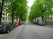
The length of streets with trees was expanded from 6,000 meter to about 20,000 between 1916 and 1947. The major street Kirkeveien got trees from Majorstuen to Vestre Aker church, and from 1930 parts of Colletts gate, Uelands gate and Christian Michelsens gate were widened and flanked by trees.
A total of 33 playgrounds with communal employed guards were systematically expanded until 1940, many of these were partly covered with ice in the winter, for skating while concerts and theater plays in the parks sponsored by the city continued.
New parks and Akerselva as park
BirkelundenBirkelunden
Birkelunden is a park placed centrally in the Grünerløkka borough of Oslo, Norway. It is formed as a rectangle, more or less like a city block.-History:...
was the first park that was maintained by the new communal park organisation; the renovation was finished in 1917 and people were surprised by the difference a park built by professionals made. Pathways were not slippery in rain or dusty during drought, plants and trees were cared for, and the area was illuminated. Acts of vandalism receded and Birkelunden became a meetingground in the interwar years, very much used for political meetings, concerts and such.
Torshovparken was the first park laid out by Parkvesenet after a united plan for an area, Torshovbyen that was built by the municipality from 1917–1924. The park is on a hill with a good view of the city and the Oslo fjord, with a music pavilion at the peak. The park opened in 1931, and is a mixture of the formal parkstyle with axis, symmetry and a pavilion in the center and functionalism
Functionalism (architecture)
Functionalism, in architecture, is the principle that architects should design a building based on the purpose of that building. This statement is less self-evident than it first appears, and is a matter of confusion and controversy within the profession, particularly in regard to modern...
with soft use of the terrain and large, continuous plains.
Alexander Kiellands plass was completed in 1927 as a park in formal style, nevertheless it became a textbook example of how lack of continuous maintenance would degrade a park. Already before 1940 it was worn and little used. It was renovated around 1980 but again let to rot. In 2001 it was once again renovated, with fountains and ponds which made it was once again an impressive small park. However, 6 years later, it was once more run down, owing to lack of maintenance.
On the eastern part of the city numerous other parks were laid out:
- Grønlands park on the green parts surrounding the city prison Botsfengslet (1917)
- Gråbeinsletta west of Sagene church (1922)
- Rudolf Nilsens space (previously Vahls space) (1927)
- Kuba by Akerselva on Grünerløkka (1928)
- Bülow Hanssens space by Carl Berners space (1939)
Evald Ryghs space on Ila gives a view of the park policy for the city's districts. It was laid out as a communal housing project (Ilakomplekset) in 1930 and combines a traditional park with a playground. On the western part of the city the following parks were laid out:
- Ankerhagen at Ruseløkka (1921)
- Amaldus Nielsens space (Vestkanttorget), a not very successful trading space, converted to park (1930)
- Idioten on Valleløkken by Adamstuen (1930)
- Langgaardsløkken, an old enclosure on Briskeby (1930)
- Arno Bergs space on Briskeby (1932)
- Skarpsnoparken by Frognerkilen (1934)
Starting in 1915 the river banks of Akerselva
Akerselva
Akerselva, or Akerselven, is a river which flows through Oslo. It starts at Maridalsvannet in Oslomarka, and follows the urban areas Nordre Aker, Sagene, Grünerløkka, Oslo centre and Grønland, whereby it finally ends at Paulsenkaien and Oset in Bjørvika. The river is considered to be a part of the...
were landscaped, starting with Theodor Kittelsens plass and the area around Nybrua and Ankerbrua, which were finished around 1920. The area from Nybrua to Østre Elvebakke was readied in 1937. A section by Brekkedammen where the river starts was landscaped around 1930. The large area on the hill Ekeberg was landscaped in the interwar years and was readied in 1948 as a large area for recreation and sports.
The Frognerpark with the Vigeland Sculpture Park
The Frogner ParkFrogner Park
Frogner Park is a public park located in the borough of Frogner in Oslo, Norway. The park contains the world famous Vigeland Sculpture Park designed by Gustav Vigeland....
is composed of the farm land of the old Frogner Manor
Frogner Manor
Frogner Manor is located on a former estate in an area that became part of today's borough of Frogner in Oslo, Norway. The estate is now the site of Frognerparken...
; the buildings of the manor is situated in the southern part of the park. During World War I
World War I
World War I , which was predominantly called the World War or the Great War from its occurrence until 1939, and the First World War or World War I thereafter, was a major war centred in Europe that began on 28 July 1914 and lasted until 11 November 1918...
the park was used for cultivating food, the potato harvest in particular were large. By the start of the interwar years much of the area was landscaped. The fountains were the first part of the Vigeland Sculpture Park, the work started after a resolution in 1924. Until around 1950 the work was concentrated on the 850 metres (2,788.7 ft) long monumental sculpture park in Baroque style. In the years before the work started there were heated discussions regarding the layout of the park, whether the main axis should be east-west or north-south. The famous Monolith was erected as a single granite block in 1928; three stone cutters worked on the 200 tonnes (196.8 LT) and 17 metres (55.8 ft) tall sculpture until 1942 when it finally was unveiled.
1940–1945
Norway was invaded by GermanyGermany
Germany , officially the Federal Republic of Germany , is a federal parliamentary republic in Europe. The country consists of 16 states while the capital and largest city is Berlin. Germany covers an area of 357,021 km2 and has a largely temperate seasonal climate...
on 9 April 1940, and already on April 16 the park administration initiated the use of all suitable areas the city owned for growing potatoes and turnip. Within short time voluntary communal work was organized to cultivate food production in parks, playgrounds and gardens, 35 different areas by the summer of 1940.
Many parks were also used by the German Wehrmacht for baracks, parking equipment and workshops and so damaged the parks. When the second world war ended the park administration had a huge job restoring the parks back to their original state. At the playground on Sophus Bugges plass there were concrete strongholds until 1953 and between the creek and Madserud allé in Frognerparken there were baracks used by the SS.
List of parks
Below is a list of major parks and open spaces in Oslo. The tables are split between the various areas of Oslo. The tables give the name of the park, size, the year established and the coordinates.Sentrum
Parks and open spaces in Central Oslo include| Park | Size | Year | Coordinates | |
|---|---|---|---|---|
| decare Hectare The hectare is a metric unit of area defined as 10,000 square metres , and primarily used in the measurement of land. In 1795, when the metric system was introduced, the are was defined as being 100 square metres and the hectare was thus 100 ares or 1/100 km2... s |
acre Acre The acre is a unit of area in a number of different systems, including the imperial and U.S. customary systems. The most commonly used acres today are the international acre and, in the United States, the survey acre. The most common use of the acre is to measure tracts of land.The acre is related... s |
|||
| Slottsparken Palace Park The Palace Park is a public park in the center of Oslo, Norway, surrounding the Royal Palace. It is . It was built during the 1840s and was designed by Hans Ditlev Franciscus Linstow, who was the main architect of the palace... (The Palace Park) |
225 daa | 1850 | 59.917634°N 10.72780°W | |
| Kontraskjæret | 18 daa | 1970 | 59.909997°N 10.736496°W | |
| Eidsvolls plass Eidsvolls plass Eidsvolls plass is a square and park in Oslo, Norway, located west of the Parliament of Norway Building, south of Karl Johans gate and east of Studenterlunden and the National Theatre... |
16 daa | Around 1861 | 59.913644°N 10.73729°W | |
| Grev Wedels plass | 14 daa | 1869 / 1984 | 59.90734°N 10.742376°W | |
| Studenterlunden Studenterlunden Studenterlunden is a park in the city center of Oslo, Norway. It is surrounded by Karl Johans gate, Stortingsgata, Universitetsgata and Frederiks gate. Within the park lays the National Theatre. It also contains one of the entrances to Nationaltheatret Station of the Oslo Metro and Nationaltheatret... |
11 daa | Before 1845 | 59.914547°N 10.734619°W | |
| Universitetshagen (The University Garden) | 9 daa | 1850s / 1932 | 59.915951°N 10.734791°W | |
| Vaterlandsparken | 9 daa | 1994 | 59.913036°N 10.757096°W | |
| Rådhushagen (The City Hall Garden) | 4 daa | 1947 | 59.912181°N 10.732656°W | |
| Christian Frederiks plass (Paléhaven) | 3 daa | 1750s / 1897 | 59.910083°N 10.750272°W | |
| Halfdan Kjerulfs plass | 0.5 daa | 1861 | 59.917656°N 10.735273°W | |
| Regjeringsparken | — | — | Around 1990 | 59.915195°N 10.745004°W |
Børshagen, the city's first publicly created park (4 decare, 1819, 59.915435°N 10.745463°W), is no longer open for the public.
Inner city
The table shows parks in the inner city of Oslo , excluding the city center. Parks without proper info regarding size are arranged after estimated size. The minor parks are described under the table.| Park | Size, decare Hectare The hectare is a metric unit of area defined as 10,000 square metres , and primarily used in the measurement of land. In 1795, when the metric system was introduced, the are was defined as being 100 square metres and the hectare was thus 100 ares or 1/100 km2... |
Year | Area | District | Coordinates |
|---|---|---|---|---|---|
| Frognerparken Frogner Park Frogner Park is a public park located in the borough of Frogner in Oslo, Norway. The park contains the world famous Vigeland Sculpture Park designed by Gustav Vigeland.... (a section of the park belongs to the outer city) |
467 | 1904 / 1936 | Frogner Frogner Frogner is a borough of the city of Oslo, Norway. In addition to traditional Frogner, the borough incorporates Bygdøy, Uranienborg and Majorstuen.... |
Frogner Frogner Frogner is a borough of the city of Oslo, Norway. In addition to traditional Frogner, the borough incorporates Bygdøy, Uranienborg and Majorstuen.... og Ullern Ullern Ullern is an affluent borough of the city of Oslo, Norway.- History :The borough has its name from an old farm, Norse Ullarin. The first element is the genitive case of the name of the Norse god Ullr. The last element is vin, meaning pasture or meadow. In Medieval times, the farm belonged to the... |
59.909132°N 10.748236°W |
| Botanisk hage | 140 | 1818 | Tøyen Tøyen Tøyen is a residential area in the central parts of Oslo, Norway, part of the borough of Gamle Oslo.-Location:It is noted for its high concentration of immigrants. The multicultural atmosphere makes Tøyen very trendy and popular with continually rising cost of housing.There are two different... |
Grünerløkka Grünerløkka Grünerløkka is a borough of the city of Oslo, Norway. Grünerløkka became part of the city of Oslo in 1858.Grünerløkka was named after Friedrich Grüner who bought a mill in the area from king Christian V of Denmark in 1672 . During the 19th century, Grünerløkka became a working class area... |
59.925900°N 10.704813°W |
| Torshovdalen | 136 | 1939 / 1948 | Torshov Torshov Torshov is an area in the borough Sagene in Oslo, Norway.Vogts gate serves as the neighborhood's main street. In the street there are trams between the city centre and Kjelsås. Along Vogts gate are several coffee shops, restaurants and cafes.... , Rosenhoff Rosenhoff Rosenhoff is a neighbourhood of Grünerløkka, Oslo. It lies north of Carl Berners plass and Rodeløkka, south and east of the park area of Torshovdalen, and west of Sinsenbyen. The neighborhood is built on the site of the former Rosenhoff locks, is triangular, and borders Mailundveien to the... |
Sagene Sagene Sagene is a borough of the city of Oslo, Norway. The area became part of the city of Oslo in 1859.The name Sagene itself is the plural of the Norwegian word for "saw", reflecting all the old industrial mechanical saws powered by the river Akerselvain this area in the 19th and early 20th... |
59.917191°N 10.770604°W |
| Tøyenparken Tøyen Park Tøyen Park is a park in Oslo, Norway. It is located behind the Munch Museum and includes the University of Oslo Botanical Gardens. The botanical Gardens is home to both the Geological and Zoological museums.-Tøyen Manor:... |
93 | 1950s | Tøyen Tøyen Tøyen is a residential area in the central parts of Oslo, Norway, part of the borough of Gamle Oslo.-Location:It is noted for its high concentration of immigrants. The multicultural atmosphere makes Tøyen very trendy and popular with continually rising cost of housing.There are two different... |
Grünerløkka Grünerløkka Grünerløkka is a borough of the city of Oslo, Norway. Grünerløkka became part of the city of Oslo in 1858.Grünerløkka was named after Friedrich Grüner who bought a mill in the area from king Christian V of Denmark in 1672 . During the 19th century, Grünerløkka became a working class area... |
59.917870°N 10.778131°W |
| St. Hanshaugen St. Hanshaugen Park St. Hanshaugen Park is the first large public park outside the city center of Oslo, Norway. St. Hanshaugen Park is a classic city park located within the Oslo borough of St. Hanshaugen, named for the park which lies within its center. Years ago the park location was regarded as worthless and was... |
89 | 1865 | St. Hanshaugen St. Hanshaugen St. Hanshaugen is a borough of the city of Oslo, Norway.-Area:It has a triangular shape, with its northern border just north of the buildings of the Norwegian Broadcasting Corporation and Ullevål University Hospital, and south of the University of Oslo campus at Blindern... |
St. Hanshaugen St. Hanshaugen St. Hanshaugen is a borough of the city of Oslo, Norway.-Area:It has a triangular shape, with its northern border just north of the buildings of the Norwegian Broadcasting Corporation and Ullevål University Hospital, and south of the University of Oslo campus at Blindern... |
59.933539°N 10.776813°W |
| Sofienbergparken | 74 | 1961 | Sofienberg Grünerløkka Grünerløkka is a borough of the city of Oslo, Norway. Grünerløkka became part of the city of Oslo in 1858.Grünerløkka was named after Friedrich Grüner who bought a mill in the area from king Christian V of Denmark in 1672 . During the 19th century, Grünerløkka became a working class area... , Grünerløkka Grünerløkka Grünerløkka is a borough of the city of Oslo, Norway. Grünerløkka became part of the city of Oslo in 1858.Grünerløkka was named after Friedrich Grüner who bought a mill in the area from king Christian V of Denmark in 1672 . During the 19th century, Grünerløkka became a working class area... |
Grünerløkka Grünerløkka Grünerløkka is a borough of the city of Oslo, Norway. Grünerløkka became part of the city of Oslo in 1858.Grünerløkka was named after Friedrich Grüner who bought a mill in the area from king Christian V of Denmark in 1672 . During the 19th century, Grünerløkka became a working class area... |
59.926923°N 10.741251°W |
| Stensparken with Blåsen | 49 | 1890 / 1943 | Fagerborg Fagerborg Fagerborg is a neighbourhood in the St. Hanshaugen borough in Oslo, Norway. Located at the northwestern end of the borough, it is bounded by Majorstua in Frogner in the west, by Marienlyst in the north, by Adamstuen and Bolteløkka in the east, and by Bislett in the south.-Architechture:The... |
St. Hanshaugen | 59.922849°N 10.764282°W |
| Marienlystparken | 45 | * | Marienlyst Marienlyst Marienlyst is an area in the borough of St. Hanshaugen in Oslo. It is best known as the site of the national headquarters of the Norwegian Broadcasting Corporation , and "Marienlyst" is often used synonymously with NRK.... |
St. Hanshaugen | 59.928904°N 10.730752°W |
| Torshovparken | 41 | 1931 | Torshov Torshov Torshov is an area in the borough Sagene in Oslo, Norway.Vogts gate serves as the neighborhood's main street. In the street there are trams between the city centre and Kjelsås. Along Vogts gate are several coffee shops, restaurants and cafes.... |
Sagene | 59.933374°N 10.722390°W |
| Myraløkka | around 40 | around 1960 | Sagene Sagene Sagene is a borough of the city of Oslo, Norway. The area became part of the city of Oslo in 1859.The name Sagene itself is the plural of the Norwegian word for "saw", reflecting all the old industrial mechanical saws powered by the river Akerselvain this area in the 19th and early 20th... |
Sagene | 59.916315°N 10.765641°W |
| Kampen park | 39 | 1888 | Kampen | Gamle Oslo | 59.935130°N 10.770613°W |
| Bjølsenparken | 33 | before 1900 | Bjølsen Bjølsen Bjølsen is a neighbourhood in the Sagene borough in central-northern Oslo, Norway. Originally a farm in the former Aker municipality, it was incorporated into Christiania in 1878.-References:... |
Sagene | 59.915271°N 10.780529°W |
| Vålerenga park | 32 | 1903 | Vålerenga Vålerenga Vålerenga is a neighbourhood in the city of Oslo, Norway, belonging to the borough of Gamle Oslo. Vålerenga is located between the neighbourhoods of Gamlebyen, Jordal, Ensjø, Etterstad and Lodalen. Vålerenga is in particular known for its traditional, small wooden houses, and for its football and... |
Gamle Oslo | 59.940399°N 10.755939°W |
| Middelalderparken | 30 | 2000 | Gamlebyen | Gamle Oslo | 59.907041°N 10.787043°W |
| Klosterenga | 30 | * | Galgeberg Roermond Roermond is a city, a municipality, and a diocese in the southeastern part of the Netherlands.The city of Roermond is a historically important town, on the lower Roer at the east bank of the Meuse river. It received city rights in 1231... |
Gamle Oslo | 59.903263°N 10.762374°W |
| Iladalen park | 26 | 1948 | Ila | Sagene | 59.931773°N 10.752176°W |
| Uranienborgparken | 17 | 1904 | Uranienborg Uranienborg, Norway Uranienborg is a neighborhood in the borough of Frogner in Oslo, Norway.-History:Originally a rural area in the former municipality Aker, it was incorporated into Christiania city in 1859. The property used to have a wonderful view, and it was therefore named after the famous observatory... |
Frogner | 59.921319°N 10.721064°W |
| Birkelunden Birkelunden Birkelunden is a park placed centrally in the Grünerløkka borough of Oslo, Norway. It is formed as a rectangle, more or less like a city block.-History:... |
17 | 1882 / 1916 | Grünerløkka Grünerløkka Grünerløkka is a borough of the city of Oslo, Norway. Grünerløkka became part of the city of Oslo in 1858.Grünerløkka was named after Friedrich Grüner who bought a mill in the area from king Christian V of Denmark in 1672 . During the 19th century, Grünerløkka became a working class area... |
Grünerløkka | 59.921319°N 10.721064°W |
| Grønlands park and Botsparken | 15 | 1917 / 1924 | Grønland Grønland Grønland is a neighbourhood in central Oslo, Norway. It is served by several tram and bus lines, as well as the Oslo Metro at the Grønland Station.... |
Gamle Oslo | 59.926005°N 10.760296°W |
| Hasleparken | 14 | * | Hasle Hasle, Oslo Hasle is a neighborhood in the borough of Grünerløkka in Oslo, Norway.It is served by the station Hasle on the Oslo Metro. Facilities include a church and the national tennis centre of Norway.-References:... |
Grünerløkka | 59.920978°N 10.783164°W |
| Ruinparken (previously called Minneparken) | 14 | 1872 / 1932 | Gamlebyen | Gamle Oslo | 59.920978°N 10.783164°W |
| Hallénparken | 13 | * | Dælenenga Dælenenga idrettspark Dælenenga idrettspark is a park located in the Grünerløkka borough of Oslo, Norway. For the 1952 Winter Olympics, it hosted eight of the 37 ice hockey matches that took place there.-1952 Winter Olympics:... / Torshov Torshov Torshov is an area in the borough Sagene in Oslo, Norway.Vogts gate serves as the neighborhood's main street. In the street there are trams between the city centre and Kjelsås. Along Vogts gate are several coffee shops, restaurants and cafes.... |
Grünerløkka | 59.906206°N 10.768855°W |
| Grünerhagen | 12 | 1700-t. / 1950 | Grünerløkka Grünerløkka Grünerløkka is a borough of the city of Oslo, Norway. Grünerløkka became part of the city of Oslo in 1858.Grünerløkka was named after Friedrich Grüner who bought a mill in the area from king Christian V of Denmark in 1672 . During the 19th century, Grünerløkka became a working class area... |
Grünerløkka | 59.930832°N 10.763249°W |
| Idioten | 12 | 1930 | Valleløkken, Adamstuen Adamstuen Adamstuen is a neighborhood in the borough of St. Hanshaugen in Oslo, Norway. It is located south of Ullevål University Hospital. It is served by Adamstuen Station of the Oslo Tramway... |
St. Hanshaugen | 59.921964°N 10.755076°W |
| Olaf Ryes plass Olaf Ryes plass Olaf Ryes plass is a square and park placed centrally in the Grünerløkka borough of Oslo, Norway. It is more or less quadratic in shape.-History:... |
10 | 1888 / 1928 | Grünerløkka Grünerløkka Grünerløkka is a borough of the city of Oslo, Norway. Grünerløkka became part of the city of Oslo in 1858.Grünerløkka was named after Friedrich Grüner who bought a mill in the area from king Christian V of Denmark in 1672 . During the 19th century, Grünerløkka became a working class area... |
Grünerløkka | 59.930993°N 10.737096°W |
| Rudolf Nilsens plass | 9 | 1927 / 1999 | Tøyen Tøyen Tøyen is a residential area in the central parts of Oslo, Norway, part of the borough of Gamle Oslo.-Location:It is noted for its high concentration of immigrants. The multicultural atmosphere makes Tøyen very trendy and popular with continually rising cost of housing.There are two different... |
Gamle Oslo | 59.922818°N 10.758460°W |
| Framneshaven (Tinker'n) | 8 | 1993 | Skillebekk Skillebekk Skillebekk is a neighbourhood of Oslo, Norway. It is located near Solli plass in the West End of Oslo, and is served by the station Skillebekk on the Skøyen Line. The name origins from Skillebekken, a brook between Bymarken and Frogner Hovedgård.... |
Frogner | 59.936506°N 10.757574°W |
| Gråbeinsletta (with the park around Sagene kirke 11 decare) | 7 | 1922 | Sagene Sagene Sagene is a borough of the city of Oslo, Norway. The area became part of the city of Oslo in 1859.The name Sagene itself is the plural of the Norwegian word for "saw", reflecting all the old industrial mechanical saws powered by the river Akerselvain this area in the 19th and early 20th... |
Sagene | 59.937786°N 10.751809°W |
| Skarpsnoparken | 7 | 1934 | Skarpsno | Frogner | 59.937786°N 10.751809°W |
| Alexander Kiellands plass | 7 | 1927 / 2001 | Ila | Grünerløkka | 59.914929°N 10.700262°W |
| Kristparken | 7 | 1964 | St. Hanshaugen St. Hanshaugen St. Hanshaugen is a borough of the city of Oslo, Norway.-Area:It has a triangular shape, with its northern border just north of the buildings of the Norwegian Broadcasting Corporation and Ullevål University Hospital, and south of the University of Oslo campus at Blindern... |
St. Hanshaugen | 59.927400°N 10.750551°W |
| Schous plass Schous plass Schous plass is a square placed in the south of the borough Grünerløkka in Oslo, Norway.-History:The area belonged to Aker municipality until 1858, when it was incorporated into Christiania . It was laid out in 1873, and got its name in 1874. Its namesake was brewery owner Christian Schou, who... |
6 | 1916 | Grünerløkka Grünerløkka Grünerløkka is a borough of the city of Oslo, Norway. Grünerløkka became part of the city of Oslo in 1858.Grünerløkka was named after Friedrich Grüner who bought a mill in the area from king Christian V of Denmark in 1672 . During the 19th century, Grünerløkka became a working class area... |
Grünerløkka | 59.917460°N 10.748616°W |
| Langgaardsløkken | 6 | 1930 | Briskeby Briskeby Briskeby is an electro-pop band from Norway. Bjørn Bergene, Claus Heiberg Larsen and Bård Helgeland are from Larvik, while Lise Karlsnes is from Tønsberg.-Band name:The band's name is derived from the neighbourhood where their rehearsal room was located.... |
Frogner | 59.920492°N 10.760262°W |
| Hydroparken | 5 | 1960 | Frogner Frogner Frogner is a borough of the city of Oslo, Norway. In addition to traditional Frogner, the borough incorporates Bygdøy, Uranienborg and Majorstuen.... |
Frogner | 59.922871°N 10.715319°W |
| Amaldus Nielsens plass (Vestkanttorget) | 5 | 1930 | Frogner Frogner Frogner is a borough of the city of Oslo, Norway. In addition to traditional Frogner, the borough incorporates Bygdøy, Uranienborg and Majorstuen.... |
Frogner | 59.914553°N 10.715935°W |
| Sommerfrydhagen | 4 | 1995 | Tøyen Tøyen Tøyen is a residential area in the central parts of Oslo, Norway, part of the borough of Gamle Oslo.-Location:It is noted for its high concentration of immigrants. The multicultural atmosphere makes Tøyen very trendy and popular with continually rising cost of housing.There are two different... |
Gamle Oslo | 59.924057°N 10.713881°W |
| Svartdalsparken | * | 1930s | Svartdalen | Gamle Oslo | 59.911738°N 10.776487°W |
| Evald Ryghs plass | 4 | 1931 | Ila | St. Hanshaugen | 59.904479°N 10.792130°W |
| Bülow Hanssens plass | 4 | 1939 | Carl Berner Carl Berner Carl Christian Berner was a Norwegian politician for the Liberal Party. He was member of the Council of State Division in Stockholm 1891–92, and Norwegian Minister of Education and Church Affairs 1891–93.... |
Grünerløkka | 59.929289°N 10.747371°W |
| Frøyas have | * | 1994 | Skarpsno | Frogner | 59.926808°N 10.775930°W |
| Akersveien / Akersbakken in front of Gamle Aker kirke | 2 | 1869 | Gamle Aker | St. Hanshaugen | 59.916051°N 10.695710°W |
| Ankerhagen | 2 | 1921 / 1985 | Ruseløkka | Frogner | 59.913066°N 10.721056°W |
| Hygeaparken | 1 | * | Homansbyen Homansbyen Homansbyen is a neighborhood in Frogner borough in Oslo, Norway. The area is named for the lawyer brothers Jacob and Henrik Homan .-Area:... |
Frogner | 59.913066°N 10.721056°W |
- = reliable information lacking.
I addition is the river Akerselva
Akerselva
Akerselva, or Akerselven, is a river which flows through Oslo. It starts at Maridalsvannet in Oslomarka, and follows the urban areas Nordre Aker, Sagene, Grünerløkka, Oslo centre and Grønland, whereby it finally ends at Paulsenkaien and Oset in Bjørvika. The river is considered to be a part of the...
with several smaller parks, among them Theodor Kittelsens plass (1917, 59.923288°N 10.726490°W) between Ankerbrua and Nybrua
Nybrua
Nybrua is a bridge over the Akerselva in Oslo. The bridge lies in the area of Grünerløkka and links the streets Storgata with Trondheimsveien and Thorvald Meyers gate....
, Kuba (59.918337°N 10.758605°W) on Grünerløkka, Våghalsen (59.923883°N 10.753034°W), Heftyeløkka on Bjølsen
Bjølsen
Bjølsen is a neighbourhood in the Sagene borough in central-northern Oslo, Norway. Originally a farm in the former Aker municipality, it was incorporated into Christiania in 1878.-References:...
.
In the inner city there are a few smaller parks, among them Arno Bergs plass (0,1 acres, 1932, 59.942258°N 10.766067°W), Dronning Astrids park (after 1995, 59.925813°N 10.723365°W), sentralparken and Gjenbruksparken in Pilestredet park
Pilestredet Park
Pilestredet Park is a neighborhood in the borough St. Hanshaugen in Oslo, Norway, about one kilometer north of the city center.It is named after the street Pilestredet. From 1893, it was the location of Rikshospitalet. The area underwent an urban renewal after 2000, when the hospital moved to Gaustad...
(around 2000), Riddervolds plass (0,8 mål, established 1885, 59.912586°N 10.711082°W), Skillebekkparken (1869, 59.912586°N 10.711082°W), Sommerroparken (1870s, 59.914959°N 10.718937°W), Valkyrie plass
Valkyrie plass
Valkyrie plass is a square in Oslo, Norway, located one block southeast of Majorstuen.The square is triangular in shape, and boundaried by the streets Valkyriegata, Bogstadveien and Jacob Aall's gate...
(0.2 acres, 1929, 59.928389°N 10.717624°W).
Ladegårdshagen
Oslo Ladegård
Oslo Ladegård, also known as Ladegården, is a building in Gamlebyen in Oslo, Norway.The name is because this area was used for unloading ships with supplies for Akershus fortress after the founding of Christiania. The word "lade" means to load in this context, so "Ladegård" means loading yard or...
is a small garden designed symmetrically with ornate hedges in renaissance and baroque style. Freiaparken is a private, enclosed garden near the chocolate factory, in strictly regular forms, noted for the wealth of its flora and many sculptures.
Of the 25 parks in the inner city that are 2.5 acres (10,117.2 m²) or more, 19 are in the eastern section and 6 in the western sector (in the Frogner and St. Hanshaugen sections).
Outer City
The major parks and green areas in the outer city are:| Park | Decare Hectare The hectare is a metric unit of area defined as 10,000 square metres , and primarily used in the measurement of land. In 1795, when the metric system was introduced, the are was defined as being 100 square metres and the hectare was thus 100 ares or 1/100 km2... |
Year | Area | District |
|---|---|---|---|---|
| Ekeberg with Brannfjell, green fields and woods | 1695 | Ekeberg Ekeberg Ekeberg is a neighborhood in the city of Oslo, Norway. The Norway Cup soccer tournament takes place at Ekebergsletta every summer. "Sletta" means plateau. The painting "the Scream" by Edvard Munch is painted from Utsikten a part of Ekeberg.In the area are a number of old Iron Age grave mounds and... |
Nordstrand Nordstrand, Norway Nordstrand is a borough of the city of Oslo, Norway.The borough is located in the southern part of the city and is the second most populated district of Oslo with over 40,000 inhabitants... |
|
| Alnaparken (Alnabru Alnabru Alnabru is a neighbourhood of Oslo. It is located in the middle of the southern part of Groruddalen. The name Alnabru comes from the area around Alnaelva and the old Alna Gård. This has also given its name to the suburb of Alna where the neighbourhood of Alnabru is located.The neighbourhood is an... ) |
200 | 2006 | Alna | |
| Nordre Skøyen Hovedgård | 135 | * | * | Østensjø |
| Korsvollparken | 87 | 1930 | Korsvoll Korsvoll Korsvoll is an area in the borough Nordre Aker in Oslo, Norway.The area is located between the areas Brekke and Nordberg, northwest of the old industrial area Nydalen. The area borders on the forest area Nordmarka, and is a popular residential area for families.The local sports club is Korsvoll IL.... |
Nordre Aker |
| Østensjø Østensjø Østensjø is a borough of the city of Oslo, Norway.The borough is in the southeastern part of Oslo. It is well known for its proximity to the forested area of Østmarka, a popular resort and hiking area for the citizens of Oslo and Lørenskog. Østensjø consists of the suburbs of Bøler, Oppsal and... området |
86 | 1930 | * | Østensjø |
| Svartdalsparken (nature park) | 83 | * | * | Gamle Oslo, Østensjø, Nordstrand Nordstrand, Norway Nordstrand is a borough of the city of Oslo, Norway.The borough is located in the southern part of the city and is the second most populated district of Oslo with over 40,000 inhabitants... |
| Holmendammen | 64 | * | * | Vestre Aker |
| Smestadparken | 49 | * | Smestad Smestad, Oslo Smestad is an area in the borough Vestre Aker in Oslo, Norway. It is named after Smestad mansion, which was parcelled out for residences after the tram line was built in 1912. It is served by Smestad station.... |
Ullern |
Other parks in the outer city termed in the city's plan Grøntplan for Oslo, arranged after district (area, year constructed and size in brackets where known):
- Bydel Alna: Furusetparken (FurusetFurusetFuruset was a borough of the city of Oslo, Norway up to January 1, 2004, when it became part of the new borough of Alna....
) - Bydel Bjerke: Sverre Refstads plass (Risløkka), Veitvetparken (Veitvet), Økernparken (Økern, refurbished 2007), Årvollparken (ÅrvollÅrvollÅrvoll is a residential community located in the Bjerke district of Oslo, Norway. The community is named for the historic Årvoll Gård , which still stands in the center of the community. This is also where anti-Nazi activists Viggo Hansteen and Rolf Wickstrøm were executed by the Germans on...
) - Bydel Frogner: BygdøyBygdøyBygdøy or Bygdø is a peninsula on the western side of Oslo, Norway. Administratively, Bygdøy belongs to the borough of Frogner.Bygdøy has several museums, like the Kon-Tiki Museum, which shows all year long the legendary expeditions of Thor Heyerdahl; the Norwegian Museum of Cultural History ; the...
- Bydel Grorud: Grorudparken (GrorudGrorudGrorud is a borough of the city of Oslo, Norway.The borough contains the Ammerud, Grorud, Kalbakken, Rødtvet, Nordtvet and Romsås areas. Traditionally a borough inhabited by the working class, Grorud has in the last few decades had a great influx of immigrants. 40% of the population are first or...
), Romsåsparken (RomsåsRomsåsRomsås was a borough of the city of Oslo, Norway, until January 1, 2004, when it became part of the Grorud district. By 1850 Romsås was one of the biggest farms in Østre Aker and the name Romsås came from the farm....
) - Bydel Nordre Aker: Harald Hals' park (Ullevål hagebyUllevål HagebyUllevål Hageby is a residential area and garden city in borough Nordre Aker of Oslo, Norway. All housing in the area is part of the housing cooperative Oslo Havebyselskap...
, 11 decare), Kjelsåsparken (KjelsåsKjelsåsKjelsås is a one of the northern suburbs of Oslo situated in Nordre Aker, the northern borough of Oslo, Norway.- History :Together with Grefsen, Kjelsås was part of the borough Grefsen-Kjelsås until January 1 2004, when they both became part of the new borough of Nordre Aker...
) - Bydel NordstrandNordstrand, NorwayNordstrand is a borough of the city of Oslo, Norway.The borough is located in the southern part of the city and is the second most populated district of Oslo with over 40,000 inhabitants...
: Nordseterparken - Bydel Stovner: Stovnerparken (StovnerStovnerStovner is a borough located to the far north east of the city of Oslo, Norway. Historically, Stovner was the name of a farm in the municipal borough "Østre Aker". Østre Aker merged with Oslo in 1948, both instigated and followed by a massive expansion of the city settlement...
) - Bydel Søndre Nordstrand: Hallagerjordet, Holmliaparken (HolmliaHolmliaHolmlia is a part of Oslo, Norway located in the southeastern borough of Søndre Nordstrand.It is served by Holmlia station.Holmlia is a highly ethnically diverse part of the city of Oslo, where ethnic minorities outnumber ethnic Norwegians....
), Lofsrudparken, Stensrudparken - Bydel Ullern: Vækerøparken
- Bydel Vestre Aker: Gaustadparken (GaustadGaustadGaustad is a neighborhood in Nordre Aker borough of Oslo, Norway. It is located between Vinderen and Kringsjå. At Gaustad are Rikshospitalet and Gaustad Hospital, as well as residential areas that border to Nordmarka....
), Hovseterparken (HovseterHovseterHovseter is a neighborhood in the borough of Vestre Aker in Oslo, Norway.It was mainly built up in the 1970s. It is served by the station Hovseter on the Oslo Metro, and the Norwegian National Road 168 passes near.-References:...
) Makrellbekken / Hoffselva - Bydel Østensjø: Trasopparken.
Some of the old manor houses have gardens and parks that are open for public use: Søndre skøyen manor (1860s, private part, also called Den engelske park), Linderud manor, Bogstad
Bogstad
Bogstad is a former estate and now neighborhood in the borough of Vestre Aker in Oslo, Norway.It has its origin in a farm by the same name, near the lake Bogstadvannet. The farm was owned by several notable people...
, Frogner.
Further reading
- Knut Are Tvedt (red., 2000) Oslo byleksikon – Kunnskapsforlaget, Oslo. ISBN 82-573-0815-3
- Oslo bys historie. Oslo, Cappelen 1991–1994, 5 volumes
- Marius Røhne, Oslo kommunale parker og grønnanlegg 1810–1948. Oslo, Myhres papirindustri, 1967
- Ida Fossum Tønnessen og Dagfinn Tveito (red.): Den grønne by. Oslo park- og idrettsvesen gjennom 75 år 1916–1991. Oslo, Grøndahl & Søn, Park- og idrettsvesenet og Det Norske Hageselskap, 1991
- Magne Bruun: Norske hager gjennom tusen år. Oslo, Andresen & Butenschøn, 2007