

Streets in Oslo
Encyclopedia
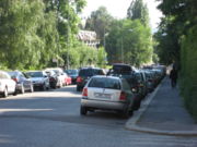
Aasta Hansteens vei
Aasta Hansteens vei (1A-3, 2-10) lies in StovnerStovner
Stovner is a borough located to the far north east of the city of Oslo, Norway. Historically, Stovner was the name of a farm in the municipal borough "Østre Aker". Østre Aker merged with Oslo in 1948, both instigated and followed by a massive expansion of the city settlement...
, Oslo
Oslo
Oslo is a municipality, as well as the capital and most populous city in Norway. As a municipality , it was established on 1 January 1838. Founded around 1048 by King Harald III of Norway, the city was largely destroyed by fire in 1624. The city was moved under the reign of Denmark–Norway's King...
. The road is a cul-de-sac
Cul-de-sac
A cul-de-sac is a word of French origin referring to a dead end, close, no through road or court meaning dead-end street with only one inlet/outlet...
from Fossumveien to Stovner police station. The street was named in 1977 after the women's rights pioneer and artist Aasta Hansteen
Aasta Hansteen
Aasta Hansteen, , was a Norwegian painter, writer, and early feminist.-Background:Aasta Hansteen was born in Christiania, modern day Oslo, the daughter of Christopher Hansteen, a noted professor of astronomy, geophysics and applied mathematics at the University of Oslo...
(born 10 September 1824, died 1908).
Abbediengen terrasse
Abbediengen terrasse (1A-3,2-4) is a cul-de-sac in the suburb of UllernUllern
Ullern is an affluent borough of the city of Oslo, Norway.- History :The borough has its name from an old farm, Norse Ullarin. The first element is the genitive case of the name of the Norse god Ullr. The last element is vin, meaning pasture or meadow. In Medieval times, the farm belonged to the...
, Oslo
Oslo
Oslo is a municipality, as well as the capital and most populous city in Norway. As a municipality , it was established on 1 January 1838. Founded around 1048 by King Harald III of Norway, the city was largely destroyed by fire in 1624. The city was moved under the reign of Denmark–Norway's King...
. The street runs northwards from the crossroads of Harbitzalléen/Abbedikollen. The street got its name in 1935 after the farm of Abbediengen.
Abbediengveien
Abbediengveien (1-21, 2-8) is a street in the suburb of UllernUllern
Ullern is an affluent borough of the city of Oslo, Norway.- History :The borough has its name from an old farm, Norse Ullarin. The first element is the genitive case of the name of the Norse god Ullr. The last element is vin, meaning pasture or meadow. In Medieval times, the farm belonged to the...
, Oslo
Oslo
Oslo is a municipality, as well as the capital and most populous city in Norway. As a municipality , it was established on 1 January 1838. Founded around 1048 by King Harald III of Norway, the city was largely destroyed by fire in 1624. The city was moved under the reign of Denmark–Norway's King...
. The street runs from St. Edmunds vei to Harbitzalléen. The streets took its name in 1917 after the farm Abbediengen.
Aasmund Vinjes vei
Aasmund Vinjes vei (25-43, 26-40) is a road in VinderenVinderen
Vinderen is a neighbourhood in the Vestre Aker borough of Oslo, Norway. It was a separate borough until 1 January 2004, when it was incorporated into the newly established borough of Vestre Aker....
, Oslo
Oslo
Oslo is a municipality, as well as the capital and most populous city in Norway. As a municipality , it was established on 1 January 1838. Founded around 1048 by King Harald III of Norway, the city was largely destroyed by fire in 1624. The city was moved under the reign of Denmark–Norway's King...
. The road is a villa road which runs from Rasmus Winderens vei to Slemdalsveien and Gaustad station
Gaustad (station)
Gaustad is a Oslo Metro station on Holmenkollen Line between Vinderen and Ris, at an altitude of . The outer highway ring of Oslo crosses the railway at Gaustad. Gaustad is the subway station closest to Rikshospitalet, although the tram system has a stop even closer...
. At the bottom of the road is a trail
Trail
A trail is a path with a rough beaten or dirt/stone surface used for travel. Trails may be for use only by walkers and in some places are the main access route to remote settlements...
. The road was named after the author Aasmund Olavsson Vinje
Aasmund Olavsson Vinje
Aasmund Olavsson Vinje was a famous Norwegian poet and journalist who is remembered for poetry, travel writing, and his pioneering use of Landsmål .-Background:...
(born 1818, died 1870) in 1917.
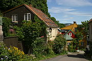
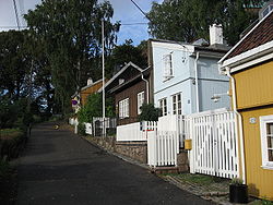
Damstredet
Oslo
Oslo is a municipality, as well as the capital and most populous city in Norway. As a municipality , it was established on 1 January 1838. Founded around 1048 by King Harald III of Norway, the city was largely destroyed by fire in 1624. The city was moved under the reign of Denmark–Norway's King...
, in the borough of St. Hanshaugen
St. Hanshaugen
St. Hanshaugen is a borough of the city of Oslo, Norway.-Area:It has a triangular shape, with its northern border just north of the buildings of the Norwegian Broadcasting Corporation and Ullevål University Hospital, and south of the University of Oslo campus at Blindern...
. Damstredet has managed to survive intact as a charming part of town, with well-preserved and inhabited wood
Wood
Wood is a hard, fibrous tissue found in many trees. It has been used for hundreds of thousands of years for both fuel and as a construction material. It is an organic material, a natural composite of cellulose fibers embedded in a matrix of lignin which resists compression...
en houses, now one of the few streets that retains the then small town character of Oslo in a genuine manner.
Damstredet was mostly built from 1810 to 1860, as part of the expansion of Oslo that begun at this time. The first house, Solberg, was erected in 1756 by sculptor Ole Meyer. His nephew, sculptor Andreas Hansen Meyer, took over in 1767, while his son Ole, also sculptor, erected another building in 1838. His friend, author and poet Henrik Wergeland
Henrik Wergeland
Henrik Arnold Thaulow Wergeland was a Norwegian writer, most celebrated for his poetry but also a prolific playwright, polemicist, historian, and linguist...
, then newly wed, moved in and spent two of his most productive years here, until moving to Grotten
Grotten
Grotten , is an honorary residence owned by the Norwegian state. It is located on the premises of the Royal Palace in the city centre of Oslo, and given as a permanent residence to a person specifically bestowed this honour by the King of Norway. The most recent occupant was the Norwegian composer...
in 1841. Solberg was later home of architect Heinrich Ernst Schirmer
Heinrich Ernst Schirmer
Heinrich Ernst Schirmer was German-born architect most noted for his work in Norway.Schirmer worked in Norway from 1838 to 1883 and put his mark on a number of public buildings...
, and General and Minister of Defence
Norwegian Ministry of Defence
The Royal Norwegian Ministry of Defence is a Norwegian government ministry in charge of the formation and implementation of national security and defence policy, and for the overall management and control of the activities of subordinate agencies. The ministry is located at Glacisgata 1, Oslo,...
(1868–1872) Nils Christian Irgens
Nils Christian Irgens
Nils Christian Irgens was a Norwegian military officer and politician.He was born in Sogndal as the son of Lars Johannes Irgens, founding father of the Norwegian Constitution. Nils Christian Irgens became a military officer in 1830, and advanced in the ranks, becoming Colonel in 1861. In 1863 he...
.
External links
59°55′11.77"N 10°44′50.16"E
Geitmyrsveien
Oslo
Oslo is a municipality, as well as the capital and most populous city in Norway. As a municipality , it was established on 1 January 1838. Founded around 1048 by King Harald III of Norway, the city was largely destroyed by fire in 1624. The city was moved under the reign of Denmark–Norway's King...
situated in the borough of St. Hanshaugen
St. Hanshaugen
St. Hanshaugen is a borough of the city of Oslo, Norway.-Area:It has a triangular shape, with its northern border just north of the buildings of the Norwegian Broadcasting Corporation and Ullevål University Hospital, and south of the University of Oslo campus at Blindern...
.
The street is c. 1.6 km long. It runs from Ullevålsveien along St. Hanshaugen park (1-33), and north of the park it separates the neighbourhoods of Lovisenberg and Valleløkken (34-54/63A), and later between Lindern
Lindern, Oslo
Lindern is an area in the borough St. Hanshaugen in Oslo, Norway.Originally farmland in the former municipality Aker, the southern part was incorporated into Christiania city in 1858 and the northern part in 1948. The Norwegian School of Veterinary Science is located at Lindern.-References:...
and Lovisenberg until it meets Kirkeveien/Griffenfeldts gate (Oslo Ring Road 2) where it ends.
Swiss chalet style
Swiss chalet style is an architectural style inspired by the chalets of Switzerland. The style originated in Germany in the early 19th century and was popular in parts of Europe and North America, notably in the architecture of Norway, the country house architecture of Sweden, Cincinnati, Ohio,...
built in 1836 with a surviving yard and buildings. Number 44-48 belong to "Frølichbyen". In number 69-71 resides the Odontological Faculty of the University of Oslo
University of Oslo
The University of Oslo , formerly The Royal Frederick University , is the oldest and largest university in Norway, situated in the Norwegian capital of Oslo. The university was founded in 1811 and was modelled after the recently established University of Berlin...
, and in number 75 the National Public Health Institute.
From 1879 the street has had its name from Gjetemyren farm in Tåsenveien 2. Today the area with allotment garden
Allotment (gardening)
An allotment garden, often called simply an allotment, is a plot of land made available for individual, non-professional gardening. Such plots are formed by subdividing a piece of land into a few or up to several hundreds of land parcels that are assigned to individuals or families...
s between Griffenfeldts gate (as it crosses Geitmyrsveien), Uelands gate and Kierschows gate is called "Geitmyra".
Bus line 37 (Helsfyr – Nydalen) goes along Geitmyrsveien between Colletts gate and Kirkeveien. From 1899 there was also a tram line (from Sagene
Sagene
Sagene is a borough of the city of Oslo, Norway. The area became part of the city of Oslo in 1859.The name Sagene itself is the plural of the Norwegian word for "saw", reflecting all the old industrial mechanical saws powered by the river Akerselvain this area in the 19th and early 20th...
to Akersgata, later Sagene Ring
Sagene ring
Sagene ring is a former tramway in Oslo, Norway. The route was operated as line 0 of the Oslo Tramway between 1916 and 1954. The line went from the depot behind Sagene Church along Nordre Gravlund, Geitmyrsveien, Colletts gate, Ullevålsveien, Akersgaten, Karl Johans gate, via Stortorvet, Storgata,...
) in Geitmyrsveien between Colletts gate and Kirkeveien. The tram line was closed in 1961.
External links
- Shops, restaurants, photos and architecture from the areas Geitmyrsveien passes through.
- Map of the street and area.
Heierstuveien
Heierstuveien (1-27, 2(A)-42) is a street in the Norwegian capital Oslo Heierstuveien is located in the borough of Nordre Aker, more specifically on the outskirts of the residential area KorsvollKorsvoll
Korsvoll is an area in the borough Nordre Aker in Oslo, Norway.The area is located between the areas Brekke and Nordberg, northwest of the old industrial area Nydalen. The area borders on the forest area Nordmarka, and is a popular residential area for families.The local sports club is Korsvoll IL....
.
Heierstuveien is approximately 285 metres long, and runs from the street Taasenveien to the street Carl Kjeldsens vei.
External links
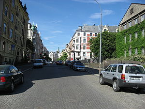
Map of the street and its surroundingsKarl Johans gate
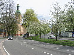
Karl Johans gate (Karl Johan Street), named after King Karl JohanCharles XIV John of Sweden
Charles XIV & III John, also Carl John, Swedish and Norwegian: Karl Johan was King of Sweden and King of Norway from 1818 until his death...
, is the main street of the city of Oslo
Oslo
Oslo is a municipality, as well as the capital and most populous city in Norway. As a municipality , it was established on 1 January 1838. Founded around 1048 by King Harald III of Norway, the city was largely destroyed by fire in 1624. The city was moved under the reign of Denmark–Norway's King...
. In its current route, it connects the main railroad station in Oslo and the Royal Palace
Royal Palace, Oslo
The Royal Palace in Oslo was built in the first half of the 19th century as the Norwegian residence of Norwegian and Swedish king Charles III and is the official residence of the present Norwegian Monarch. The crown prince couple resides at Skaugum in Asker west of Oslo...
, changing slightly its direction and width halfway between them, at Egertorget.
Niels Juels Gate
Street
A street is a paved public thoroughfare in a built environment. It is a public parcel of land adjoining buildings in an urban context, on which people may freely assemble, interact, and move about. A street can be as simple as a level patch of dirt, but is more often paved with a hard, durable...
in the Frogner
Frogner
Frogner is a borough of the city of Oslo, Norway. In addition to traditional Frogner, the borough incorporates Bygdøy, Uranienborg and Majorstuen....
district of Oslo
Oslo
Oslo is a municipality, as well as the capital and most populous city in Norway. As a municipality , it was established on 1 January 1838. Founded around 1048 by King Harald III of Norway, the city was largely destroyed by fire in 1624. The city was moved under the reign of Denmark–Norway's King...
in Norway
Norway
Norway , officially the Kingdom of Norway, is a Nordic unitary constitutional monarchy whose territory comprises the western portion of the Scandinavian Peninsula, Jan Mayen, and the Arctic archipelago of Svalbard and Bouvet Island. Norway has a total area of and a population of about 4.9 million...
.
The street was built in 1879 and was named after the admiral Niels Juel
Niels Juel
Niels Juel was a Dano–Norwegian admiral. He was the brother of the diplomat Jens Juel.-Biography:Niels Juel was born the son of Erik Juel and Sophie Clausdatter Sehested, both were descendant of Danish nobility, who lived in Jutland where the father had a career as a local functionary and judge...
(1629–97).
Streets in the vicinity include Svoldergata, Drammensveien, Bygdøy allé, Colbjørnsens gate, Gyldenløves gate and Briskebyveien
In 1932 the Indian embassy was built on the street and was designed by Gudolf Blakstad
Gudolf Blakstad
Gudolf Blakstad was a Norwegian architect.Born in Gjerpen, Blakstad was educated at the Norwegian Institute of Technology, worked with Arnstein Arneberg and Herman Munthe-Kaas...
and Herman Munthe-Kaas
Herman Munthe-Kaas
Herman Munthe-Kaas was a Norwegian architect. Herman Munthe-Kaas was primarily known for his Functionalist building designs.-Biography:...
.
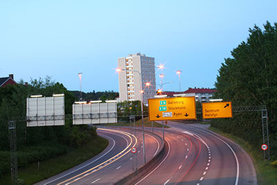
Norwegian National Road 161
Ring road
A ring road, orbital motorway, beltway, circumferential highway, or loop highway is a road that encircles a town or city...
and surface street
Street
A street is a paved public thoroughfare in a built environment. It is a public parcel of land adjoining buildings in an urban context, on which people may freely assemble, interact, and move about. A street can be as simple as a level patch of dirt, but is more often paved with a hard, durable...
through densely populated parts of Oslo
Oslo
Oslo is a municipality, as well as the capital and most populous city in Norway. As a municipality , it was established on 1 January 1838. Founded around 1048 by King Harald III of Norway, the city was largely destroyed by fire in 1624. The city was moved under the reign of Denmark–Norway's King...
, Norway
Norway
Norway , officially the Kingdom of Norway, is a Nordic unitary constitutional monarchy whose territory comprises the western portion of the Scandinavian Peninsula, Jan Mayen, and the Arctic archipelago of Svalbard and Bouvet Island. Norway has a total area of and a population of about 4.9 million...
. The entire route is signposted as Ring 2, not National Road 161.
It stretches from Skøyen
Skøyen
Skøyen is a neighborhood of Oslo, Norway. It is located in the western part of the city, in the borough of Ullern.The name "Skøyen" comes from Old Norse Skǫðin, of unknown etymology....
to Lodalen, a length of 9.7 km. The most important locations along the route are Skøyen
Skøyen
Skøyen is a neighborhood of Oslo, Norway. It is located in the western part of the city, in the borough of Ullern.The name "Skøyen" comes from Old Norse Skǫðin, of unknown etymology....
, Frogner
Frogner
Frogner is a borough of the city of Oslo, Norway. In addition to traditional Frogner, the borough incorporates Bygdøy, Uranienborg and Majorstuen....
, Majorstuen
Majorstuen
Majorstuen is a neighbourhood in the Frogner borough in the western part of Oslo, Norway.Majorstuen is known for its vibrant downtown, especially its shopping area. The area has several elegant townhouses circa 1880-1890. The area is also an important public transport junction in Oslo, where all...
, Lindern
Lindern
Lindern is a municipality in the district of Cloppenburg, in Lower Saxony, Germany. It is situated approx. 20 km west of Cloppenburg....
, Sagene
Sagene
Sagene is a borough of the city of Oslo, Norway. The area became part of the city of Oslo in 1859.The name Sagene itself is the plural of the Norwegian word for "saw", reflecting all the old industrial mechanical saws powered by the river Akerselvain this area in the 19th and early 20th...
, Carl Berners Plass
Carl Berners plass
Carl Berners plass is a square in Oslo, Norway. It is located in the borough Grünerløkka, south of Sinsen. The Sinsen Line of the Oslo Tramway runs over the square. The colloquial expression for the square is just "Carl Berner". Around the square is a large number of shops as well as inexpensive...
, Tøyen
Tøyen
Tøyen is a residential area in the central parts of Oslo, Norway, part of the borough of Gamle Oslo.-Location:It is noted for its high concentration of immigrants. The multicultural atmosphere makes Tøyen very trendy and popular with continually rising cost of housing.There are two different...
and Galgeberg
Galgeberg
Galgeberg is a neighbourhood in the borough of Gamle Oslo in Oslo, Norway.The neighbourhood lies near Vålerenga, Kampen and Gamlebyen. The name stems from the gallows present at the location in earlier times.-References:...
. Important institutions like the Frogner Park
Frogner Park
Frogner Park is a public park located in the borough of Frogner in Oslo, Norway. The park contains the world famous Vigeland Sculpture Park designed by Gustav Vigeland....
, the Norwegian Broadcasting Corporation, Ullevål University Hospital
Ullevål University Hospital
Ullevaal, Oslo University Hospital was opened in 1887. From January 1, 2009, the hospital is part of the Oslo University Hospital.Ullevål has more than 8,600 employees. 940 of them are doctors and 2,400 nurses. With a total of 1,200 beds Ullevål, admits some 45,000 patients per year and its...
and the University of Oslo
University of Oslo
The University of Oslo , formerly The Royal Frederick University , is the oldest and largest university in Norway, situated in the Norwegian capital of Oslo. The university was founded in 1811 and was modelled after the recently established University of Berlin...
are situated along or near the road. The name of streets are Drammensveien—Halvdan Svartes gate—Kirkeveien—Griffenfeldts gate—Marcus Thranes gate—Christian Michelsens gate—Finnmarkgaten—Kjølberggaten—Åkebergveien—St. Halvards gate—Kværnerveien.
Traffic
Ring 2 is used by both cars and public transportPublic transport
Public transport is a shared passenger transportation service which is available for use by the general public, as distinct from modes such as taxicab, car pooling or hired buses which are not shared by strangers without private arrangement.Public transport modes include buses, trolleybuses, trams...
ation. The traffic on the route is separated only with traffic light
Traffic light
Traffic lights, which may also be known as stoplights, traffic lamps, traffic signals, signal lights, robots or semaphore, are signalling devices positioned at road intersections, pedestrian crossings and other locations to control competing flows of traffic...
s and roundabout
Roundabout
A roundabout is the name for a road junction in which traffic moves in one direction around a central island. The word dates from the early 20th century. Roundabouts are common in many countries around the world...
s. The road is connected to major highway
Highway
A highway is any public road. In American English, the term is common and almost always designates major roads. In British English, the term designates any road open to the public. Any interconnected set of highways can be variously referred to as a "highway system", a "highway network", or a...
s such as European route E18
European route E18
European route E18 runs from Craigavon in the United Kingdom to Saint Petersburg in Russia, passing through Norway, Sweden, and Finland. It is about 1,890 km in length.-United Kingdom:...
, National Road 4
Norwegian national road
Norwegian national road , are roads thus categorized by the Norwegian Public Roads Administration which also maintains them...
and National Road 190
Norwegian national road
Norwegian national road , are roads thus categorized by the Norwegian Public Roads Administration which also maintains them...
. Major parts of Ring 2 are heavily congested during peak hours
Rush hour
A rush hour or peak hour is a part of the day during which traffic congestion on roads and crowding on public transport is at its highest. Normally, this happens twice a day—once in the morning and once in the evening, the times during when the most people commute...
, because of low capacity and many large intersections. The route was originally planned to have 4 lanes, but several parts have only 2 lanes. The entire route is a priority road and the speed limit is 50 km/h.
There are some parking garage
Multi-storey car park
A multi-storey car-park is a building designed specifically to be for car parking and where there are a number of floors or levels on which parking takes place...
s situated on the western parts of the route. The gas stations
Filling station
A filling station, also known as a fueling station, garage, gasbar , gas station , petrol bunk , petrol pump , petrol garage, petrol kiosk , petrol station "'servo"' in Australia or service station, is a facility which sells fuel and lubricants...
along the road are situated on Skøyen, Marienlyst, Fagerborg, Lindern, Carl Berners Plass and Tøyen.
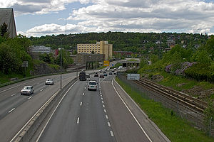
Ring 3 (Oslo)
Norwegian national road
Norwegian national road , are roads thus categorized by the Norwegian Public Roads Administration which also maintains them...
150 (formerly known as Store Ringvei) is a major highway
Highway
A highway is any public road. In American English, the term is common and almost always designates major roads. In British English, the term designates any road open to the public. Any interconnected set of highways can be variously referred to as a "highway system", a "highway network", or a...
in Oslo
Oslo
Oslo is a municipality, as well as the capital and most populous city in Norway. As a municipality , it was established on 1 January 1838. Founded around 1048 by King Harald III of Norway, the city was largely destroyed by fire in 1624. The city was moved under the reign of Denmark–Norway's King...
, Norway
Norway
Norway , officially the Kingdom of Norway, is a Nordic unitary constitutional monarchy whose territory comprises the western portion of the Scandinavian Peninsula, Jan Mayen, and the Arctic archipelago of Svalbard and Bouvet Island. Norway has a total area of and a population of about 4.9 million...
. The numerous pre-existing roads orbiting the most densely populated areas of Oslo now have become a beltway
Ring road
A ring road, orbital motorway, beltway, circumferential highway, or loop highway is a road that encircles a town or city...
limited-access road
Limited-access road
A limited-access road known by various terms worldwide, including limited-access highway, dual-carriageway and expressway, is a highway or arterial road for high-speed traffic which has many or most characteristics of a controlled-access highway , including limited or no access to adjacent...
from its starting point at Ryen
Ryen
Ryen is a neighborhood in the borough Østensjø in Oslo, Norway. It is located north of the border to the borough Nordstrand.The area is served by the station Ryen of the Oslo T-bane. The eastern depot of the rapid transit system is located at Ryen. Until 1967, it was also served by Simensbråten of...
, through the Sinsen Interchange
Sinsen Interchange
The Sinsen Interchange is a heavily trafficked, multilevel road junction in Oslo, Norway. It connects the highways Norwegian National Road 150 and Trondheimsveien. The junction has existed since the 19th century, and has grown considerably in size since then. It was enhanced with a roundabout in...
, and to Lysaker
Lysaker
Lysaker is a section of and a postal code area of the Norwegian municipality of Bærum, just west of Oslo.Geographically, it is bordered by Lysakerelven on the east, which also forms the border to Oslo; Fornebu to the south; Stabekk to the west; and Jar to the north...
in Bærum
Bærum
is a municipality in Akershus county, Norway. The administrative centre of the municipality is the town of Sandvika. Bærum was established as a municipality on 1 January 1838. A suburb of Oslo, Bærum is located on the west coast of the city....
.
The Sinsen interchange, where Ring 3 meets Trondheimsveien was opened in 1962. The increase in traffic was greater than the capacity of the junction, and thus a bridge was constructed that redirected Trondheimsveien above the roundabout.
Further restructuring was done in 1992, when a local tramway line was redirected outside of the interchange, and in 1994, when Riksvei 150 was directed below the roundabout. The Norwegian Public Roads Administration
Norwegian Public Roads Administration
The Norwegian Public Roads Administration is a Norwegian government agency responsible for the state and county public roads in the country. This includes planning, construction and operation of the state and county road networks, driver training and licensing, vehicle inspection and subsidies to...
plans to connect the Løren tunnel, a planned tunnel over Riksvei 150, with the Sinsen interchange in late 2008.
The highway is subdivided into parts with separate names (from Ryen to Lysaker):
- Adolf Hedins vei
- Hjalmar Brantings vei
- Dag Hammarskjølds vei
- Storoveien
- Rolf Wickstrøms vei
- Tåsen Tunnel
- Kaj Munks vei
- Torgny Segerstedts vei
- Viggo Hansteens vei
- Ullernchausséen
- Granfoss TunnelGranfoss TunnelThe Granfoss Tunnel are two tunnels on Ring 3 in Oslo, Norway. The tunnels are 2.1 km long and they are part of the Granfoss Line, a 2.9 km stretch of motorway which was opened in 1992 connecting Ring 3 with the European route E18. The name comes from the Granfossen waterfall on the Lysakerelva...
(Snarøyveien).
External links
Telthusbakken
Oslo
Oslo is a municipality, as well as the capital and most populous city in Norway. As a municipality , it was established on 1 January 1838. Founded around 1048 by King Harald III of Norway, the city was largely destroyed by fire in 1624. The city was moved under the reign of Denmark–Norway's King...
, in the borough of St. Hanshaugen
St. Hanshaugen
St. Hanshaugen is a borough of the city of Oslo, Norway.-Area:It has a triangular shape, with its northern border just north of the buildings of the Norwegian Broadcasting Corporation and Ullevål University Hospital, and south of the University of Oslo campus at Blindern...
. Almost all buildings along the street are old and traditional wooden houses, many from the period around 1815 when deed
Deed
A deed is any legal instrument in writing which passes, or affirms or confirms something which passes, an interest, right, or property and that is signed, attested, delivered, and in some jurisdictions sealed...
s were issued for the properties.
During the 16th century, the street which is now Telthusbakken was part of the main road passing the Old Aker Church
Old Aker Church
Old Aker Church is a medieval church located in Oslo. An active parish, the church is the oldest existing building in Oslo.-History:Old Aker Church was built as a three-naved Roman-style basilica and constructed from limestone. The church has a baroque pulpit and baptismal font from 1715. The...
, from east to west of Oslo
Oslo
Oslo is a municipality, as well as the capital and most populous city in Norway. As a municipality , it was established on 1 January 1838. Founded around 1048 by King Harald III of Norway, the city was largely destroyed by fire in 1624. The city was moved under the reign of Denmark–Norway's King...
and further across to the west coast. Sitting on top of the Telthusbakken hill, Old Aker Church was built around 1080 and is the oldest building still in use in Oslo. The name Telthusbakken is from a large canvas
Canvas
Canvas is an extremely heavy-duty plain-woven fabric used for making sails, tents, marquees, backpacks, and other items for which sturdiness is required. It is also popularly used by artists as a painting surface, typically stretched across a wooden frame...
house that existed around 1700.
The street is mentioned in the song "Glemte minner" on the album Neste sommer
Neste sommer
Neste sommer is the sixth studio album by Norwegian rock band deLillos.-Track listing:#"Langfredag i Aarhus "#"Kokken Tor"#"Glemte minner"#"Fornøyd"#"Uendelig trist"#"Søvn"#"Postmann"#"Album"#"Neste sommer"#"Ved porten der jeg bor"...
by the Norwegian band deLillos
DeLillos
deLillos is a Norwegian rock band formed in Oslo in 1984. They are regarded as one the "Four Greats" in modern Norwegian pop music, i.e. one of the four 1980s groups that founded a new tradition for rock music with lyrics in Norwegian...
.
External links
- Description on VisitNorway.com
- Description on Yahoo!Yahoo!Yahoo! Inc. is an American multinational internet corporation headquartered in Sunnyvale, California, United States. The company is perhaps best known for its web portal, search engine , Yahoo! Directory, Yahoo! Mail, Yahoo! News, Yahoo! Groups, Yahoo! Answers, advertising, online mapping ,...
Travel Guide
59°55′24.68"N 10°44′57.16"E
Aagots vei
Aagots vei (1A-19, 2A-20B) lies in OppsalOppsal
Oppsal is a suburb in the borough of Østensjø in Oslo, Norway.The modern history of Oppsal starts with villas and summer homes built during the Interwar period. The Oslo Tramway was extended to Oppsal in 1926....
in the suburb of Østensjø
Østensjø
Østensjø is a borough of the city of Oslo, Norway.The borough is in the southeastern part of Oslo. It is well known for its proximity to the forested area of Østmarka, a popular resort and hiking area for the citizens of Oslo and Lørenskog. Østensjø consists of the suburbs of Bøler, Oppsal and...
in Oslo
Oslo
Oslo is a municipality, as well as the capital and most populous city in Norway. As a municipality , it was established on 1 January 1838. Founded around 1048 by King Harald III of Norway, the city was largely destroyed by fire in 1624. The city was moved under the reign of Denmark–Norway's King...
. The road is a crescent off Oppsalveien without crossing any other streets. The road is named after Aagot Tveter (1883–1972), who was the daughter of the former mayor of Aker
Aker, Norway
Aker is a former municipality in Akershus, which lends its name to a municipality and a county in Norway. The name originally belonged to a farm which was located near the current Old Aker Church...
, Haakon Tveter. From 1936, she was one of the owners of Østensjø gård. The street was named on 25 September 1975.
Literature
- Svensgam, Arild: De er døde – men lever fortsatt i Oslo. Galehuset forlag, 1999.