

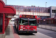
OC Transpo Route 95
Encyclopedia
Ottawa
Ottawa is the capital of Canada, the second largest city in the Province of Ontario, and the fourth largest city in the country. The city is located on the south bank of the Ottawa River in the eastern portion of Southern Ontario...
transit network's busiest route, running on the Transitway
Ottawa Rapid Transit
In Ottawa, Ontario, Canada, the public transit service operated by OC Transpo has two rapid transit systems: the Transitway, a bus rapid transit network, and the O-Train, a diesel-powered light rail transit service operated on one line.-Major routes:...
across the city. The termination points are located at Marketplace
Marketplace Station (OC Transpo)
Barrhaven Centre Station is a Southwest Transitway station in the Barrhaven neighbourhood of Ottawa, Ontario, Canada. The station is new southerly terminus of the transitway, south from Marketplace Station, another new transitway station. The new transitway is now partly open with the link between...
, at Fallowfield Station
Fallowfield Station (OC Transpo)
Fallowfield is a bus station on Ottawa's transitway system. Operated by OC Transpo, it is located at Woodroffe Avenue and Fallowfield Road in the community of Barrhaven, next to the Fallowfield railway station....
and in Orléans
Orléans, Ontario
Orleans , also written Orléans, is a suburban area within the city of Ottawa, Ontario, Canada. It is located in the eastern part of the city along the Ottawa River, about from downtown Ottawa. The Canada 2006 Census gave Orleans a population of 95,491. It became a ward of the City of Ottawa in 2001...
, at Place d'Orleans. Weekday trips may be extended to Trim Station
Trim Station (OC Transpo)
Trim Station is a Ottawa, Canada, transitway station in the east end of the city located near Trim Road and Regional Road 174 . A Natrel factory is located near this station...
, a few minutes east of Place d'Orleans. In addition, some trips also start or end at Baseline
Baseline Station (OC Transpo)
Baseline Transitway Station is directly across from the main campus of Algonquin College in Ottawa's west end, off of Woodroffe Avenue and Baseline Road. Many Algonquin students and Centrepointe residents use this terminal to get to various points in the city, and of course, to get to the College...
in the west end. During rush hour
Rush hour
A rush hour or peak hour is a part of the day during which traffic congestion on roads and crowding on public transport is at its highest. Normally, this happens twice a day—once in the morning and once in the evening, the times during when the most people commute...
, a few trips start or end at Tunney's Pasture
Tunney's Pasture Station (OC Transpo)
Tunney's Pasture Station is a stop on the transitway in Ottawa, Ontario. It is located at the Tunney's Pasture government office complex, on Scott Street at Holland Avenue.The transitway in the area is in a below-grade 'trench' parallel to Scott Street...
. Originally, the route served only the city core, but since the 1990s, the route has been expanded significantly to serve suburban areas, starting with Orleans in the early 1990s and Barrhaven in 2000. Since January 2007, some trips have been extended to Barrhaven Centre near Riocan Marketplace via Greenbank Road
Greenbank Road (Ottawa)
Greenbank Road is a major north-south road in Ottawa, Ontario, Canada that serves central Nepean and Barrhaven. From its northern terminus at the Queensway until its intersection with Jockvale Road, it is designated Ottawa Road #13....
and the new Strandherd Station
Strandherd Station (OC Transpo)
Strandherd Station is a transit station in Ottawa, Ontario. It opened on January 2, 2007 and contains a park and ride facility with over 300 parking spaces available. It is located northeast of the intersection of Strandherd Drive and the access to the Riocan Marketplace shopping area in which...
and Park and Ride
Park and ride
Park and ride facilities are car parks with connections to public transport that allow commuters and other people wishing to travel into city centres to leave their vehicles and transfer to a bus, rail system , or carpool for the rest of their trip...
.
History
During the 1970s and 1980s, the Regional Municipality of Ottawa-CarletonRegional Municipality of Ottawa-Carleton
The Regional Municipality of Ottawa–Carleton was a regional government area and census division in Ontario, Canada which existed from 1969 until 2001...
approved the construction of a new transit corridor called the Transitway. The purpose of this busway was to increase the speed of city-bound services from east and west. The first sections were built in 1983: in the southwest between Lincoln Fields
Lincoln Fields Station (OC Transpo)
Lincoln Fields Station is a station on Ottawa's transitway located at Carling Avenue and the Ottawa River Parkway. It is adjacent but not connected to nearby Lincoln Heights Galleria Shopping Centre. It is the main western hub of the transitway system and has a ticket sales and information office...
and Baseline, and in the east between Lees
Lees Station (OC Transpo)
Lees Transitway Station is a station on Ottawa's transitway. It is located south of the Queensway just to the west of the Rideau River. It serves the Lees Avenue region and the Sandy Hill Heights community....
and Hurdman
Hurdman Station (OC Transpo)
Hurdman Transitway Station is a station on Ottawa's transitway. Hurdman is one of the busier stations, perhaps the busiest, as it is the main hub of the transitway network east of downtown. Hurdman is where the main transitway route from downtown to west branches off in two directions: one to the...
. Gradually, those two sections were extended through the addition of a central Transitway in the Westboro and Mechanicsville
Mechanicsville (Ottawa)
Mechanicsville is a neighbourhood of Ottawa, Ontario, Canada. It is located to the west of downtown and bordered by the Ottawa River to the north, the transitway railway to the east, Scott Street to the south, and Parkdale Avenue to the west...
areas, as well as in the downtown
Downtown
Downtown is a term primarily used in North America by English speakers to refer to a city's core or central business district ....
core along Albert
Albert Street (Ottawa)
Albert Street is one of the main east-west roads in downtown Ottawa, Canada. Albert is one way going west. It carries the westbound portion of the transitway through downtown, with Slater Street just to the south carrying the eastbound portion...
and Slater streets, with the addition of designated bus lanes. There was also an eastern extension towards the St. Laurent
St. Laurent Station (OC Transpo)
St. Laurent Station is a station on Ottawa's transitway located at St. Laurent Boulevard and the Queensway. This station is the most integrated to its surroundings with direct indoor pedestrian access to the St. Laurent Shopping Centre...
and Cyrville
Cyrville Station (OC Transpo)
Cyrville Station is a station on Ottawa's transitway located at Cyrville Road and the Queensway...
areas, built during the late 1980s.
Route 95 became very important when the Transitway route was further developed. Priority measures were introduced on Woodroffe Avenue
Woodroffe Avenue (Ottawa)
Woodroffe Avenue is the major north-south arterial road in Ottawa, Ontario, Canada's west end. It runs south from the Ottawa River Parkway through Baseline Road to Prince of Wales Drive towards the communities of Manotick and Barrhaven. The road runs through the heart of Nepean in Ottawa's west end...
and on Regional Route 174 towards Orléans
Orléans, Ontario
Orleans , also written Orléans, is a suburban area within the city of Ottawa, Ontario, Canada. It is located in the eastern part of the city along the Ottawa River, about from downtown Ottawa. The Canada 2006 Census gave Orleans a population of 95,491. It became a ward of the City of Ottawa in 2001...
. The route rapidly became the city's busiest, requiring a very frequent service on weekdays and weekends. In the early 1990s, it ran from Baseline Station towards St. Laurent and then to Blair. As the suburbs grew in the 1990s and early 2000s, its coverage extended towards Barrhaven in the southwest and Orléans in the east. The Barrhaven extension was made after the construction of Fallowfield Station at the corner of Woodroffe and Fallowfield road in 2000, while the expansion to Orléans was possible subsequent to the opening of Place d'Orléans Station. Prior to the expansion of Route 95 toward the suburbs, the local service in Barrhaven served Baseline and/or Bayshore Stations
Bayshore Station (OC Transpo)
Bayshore Transitway Station is a transit station on Ottawa, Ontario, Canada's transitway served by OC Transpo buses. It is located in the western transitway section at the Bayshore Shopping Centre...
, while the local Orléans service ended at Blair Station. The route will further change in future years with the continuation of major developments in those two suburbs.
Recent Changes
In 2003, OC Transpo opened a new Park-and-Ride facility at the corner of Trim Road and Regional Road 174, which became Trim Station. Initially, they added rush hour trips from LebretonLebreton Station (OC Transpo)
Lebreton Station is a stop on the transitway in Ottawa. It is located in the Lebreton Flats area, near the intersection of Wellington Street and Booth Street...
to Trim. Due to increasing demand, additional trips were added and frequent service is now provided on weekdays and weekends between 6 a.m. and 3 AM.
OC Transpo built a new extension of the southwest transitway in 2005. The new roadway was built parallel to Woodroffe Avenue from the Nepean Sportsplex
Nepean Sportsplex
Nepean Sportsplex is a sports facility in Ottawa, Ontario. It is located on Woodroffe Avenue north of the Ottawa Greenbelt, near the former Confederation High School along OC Transpo route 95. Unfortunately, the sportsplex does not have a website that adequately provides information.- History...
south of Hunt Club Road
Hunt Club Road (Ottawa)
Hunt Club Road also known as Ottawa Road #32, is a major east-west route in Ottawa, Ontario, Canada. Hunt Club originally ran from Albion Road to Riverside Drive, but was extended east to Hawthorne Road in the late 1980s. The section between Bank Street and Riverside Drive, originally only one lane...
towards Fallowfield Station, which opened in 2000. The 95 and express buses from Barrhaven travel along that stretch. Service on Woodroffe, previously provided by the 95, was replaced by Route 157, which is a rush hour-only route. The frequency of the 95 did not improve, due to which there were public complaints, as Woodroffe Avenue was widened to four lanes at the same time. In addition, the Via railroad track that crosses Woodroffe and the transitway is by a level crossing
Level crossing
A level crossing occurs where a railway line is intersected by a road or path onone level, without recourse to a bridge or tunnel. It is a type of at-grade intersection. The term also applies when a light rail line with separate right-of-way or reserved track crosses a road in the same fashion...
- a singularity on the exclusive busway network.
Following the 2006 TransPlan public consultations, OC Transpo extended the 95 south of Fallowfield Station to a new Park and Ride facility located at the corner of Greenbank and Strandherd
Strandherd Drive (Ottawa)
Strandherd Drive is a major road serving the community of Barrhaven in southwest Ottawa.Up until the mid-1990s, Strandherd Drive was an east-west coursing road extending from Moodie Drive to Woodroffe Avenue...
, near a bustling and expanding shopping district and neighbouring residential developments. In the future, a new transitway extension will be built to connect the southern sections of Barrhaven, and will be completed with the creation of Strandherd and Marketplace Stations
Marketplace Station (OC Transpo)
Barrhaven Centre Station is a Southwest Transitway station in the Barrhaven neighbourhood of Ottawa, Ontario, Canada. The station is new southerly terminus of the transitway, south from Marketplace Station, another new transitway station. The new transitway is now partly open with the link between...
. Before its cancellation on December 14, 2006, the north-south light-rail extension project between downtown Ottawa to South Barrhaven would have connected with the 95 near Chapman Hills. Those who opposed the light-rail project believed it would faster to take the 95 rather than the O-Train
In 2009, 24-hour service was introduced on the 95 between Fallowfield and Place d'Orléans. Service during the newly-operated hours is every 30 minutes. http://ottawa.ca/calendar/ottawa/citycouncil/tc/2009/05-20/ACS2009-ICS-TRA-0006.htm
Future Changes
The City of Ottawa has also conducted public consultations over the Greenbank Road extension and realignment. There are plans to add designated bus lanes along Greenbank from south of Strandherd to Cambrian Road (and possibly further south) in conjunction with future development growth. It is possible that the 95 and other bus services will use the corridor towards those new communities.TransPlan 2011 is proposing to modify route 95 within Nepean
Nepean, Ontario
- Recent quantity of snow :- History :Nepean Township, originally known as Township D, was established in 1792 and originally included what is now the central area of Ottawa west of the Rideau River. Jehiel Collins, from Vermont, is believed to have been the first person to settle in Nepean...
South (Barrhaven) by adding a dedicated Transitway between Fallowfield Station
Fallowfield Station (OC Transpo)
Fallowfield is a bus station on Ottawa's transitway system. Operated by OC Transpo, it is located at Woodroffe Avenue and Fallowfield Road in the community of Barrhaven, next to the Fallowfield railway station....
and Barrhaven Centre Station. A new station (Longfields Station) would be added, along with moving the current Barrhaven Centre Station South (new location would be located at the corner of Jockvale/Chapman Mills, once Chapman Mills is extended to Jockvale). Buses would no longer use Greenbank Road due to these changes. A lot of other changes to other Barrhaven routes would also take place, including heavy modifications to existing routes such as rapid-transit route 94, peak route 186, express routes 70, 71, 73 and 76, cross-town route 176, and local routes 170, 171 and 177. New local route 175 and peak route 180 would be added; local route 173 and peak route 195 were to be be removed (route 173 is remaining in service as a result of public consultations).
Starting in mid-April 2011, route 95, along with almost all other Barrhaven bus routes, is going to be modified to improve service to, from, and within Barrhaven. The new leg of the Transitway (between Fallowfield Station
Fallowfield Station (OC Transpo)
Fallowfield is a bus station on Ottawa's transitway system. Operated by OC Transpo, it is located at Woodroffe Avenue and Fallowfield Road in the community of Barrhaven, next to the Fallowfield railway station....
and Barrhaven Centre Station) is set to be open by that time, prompting OC Transpo
OC Transpo
OC Transpo is the urban transit service of the City of Ottawa, Ontario, Canada. An integrated hub-and-spoke system of services is available consisting of: regular buses travelling on fixed routes in mixed traffic, typical of most urban transit systems; a bus rapid transit system — a high...
to provide modifications. Route 95 will serve Barrhaven Centre Station 24/7. Frequencies on route 95 will also be increased at all times of all days. Route 94, which currently starts/ends at Tunney's Pasture Station
Tunney's Pasture Station (OC Transpo)
Tunney's Pasture Station is a stop on the transitway in Ottawa, Ontario. It is located at the Tunney's Pasture government office complex, on Scott Street at Holland Avenue.The transitway in the area is in a below-grade 'trench' parallel to Scott Street...
will be extended to/from Barrhaven via Woodroffe and the Transitway to supplement route 95. Several other modifications will also take place at this time, including all Barrhaven express routes (70, 71, 73, 76, and 77), Barrhaven local service (existing routes 170, 171, 173, and 177, and a new route, 175), and cross-town route 176. Route 186 to/from Manotick is also undergoing changes.
Buses
During the early years, GM articulated buses were used for the 95. During the late 1980s and 1990s, the route was served by OrionOrion Bus Industries
Orion International, previously Orion Bus Industries and Ontario Bus Industries in Canada and Bus Industries of America in the United States, is a bus manufacturer based in Mississauga, Ontario, Canada and established by the Government of Ontario in 1975...
III Ikarus articulated buses that were built during the second half of the decade. Some of those buses were purchased from the Toronto Transit Commission
Toronto Transit Commission
-Island Ferry:The ferry service to the Toronto Islands was operated by the TTC from 1927 until 1962, when it was transferred to the Metro Parks and Culture department. Since 1998, the ferry service is run by Toronto Parks and Recreation.-Gray Coach:...
in the mid 1990s. There were problems over the bodywork and rust on these vehicles. These buses were also not air-conditioned and the doors would sometimes get people's ankles caught in the door rail. With the arrival of new articulated buses built by New Flyer Industries
New Flyer Industries
New Flyer Industries Inc. is a bus manufacturer in North America, headquartered in Winnipeg, Manitoba, Canada. It also has factories in Crookston and St. Cloud, Minnesota, USA.-History:...
, OC Transpo gradually shifted to the New Flyer's D60LF model, a change completed in 2003. Between late 2010 and early 2011, the New Flyer D60LFs will be gradually replaced by New Flyer's D60LFRs.
Purpose
The very frequent service of the 95 (compared to the 96 and 97) is unsurprising, as it is the only transit route that serves more than one major suburban area (Barrhaven and Orléans). The 95 serves five major Park and Ride facilities, including Fallowfield, Strandherd, Baseline, Place d'Orléans and Trim. There are smaller facilities near Blair and Jeanne d'Arc StationsJeanne d'Arc Station (OC Transpo)
Jeanne d'Arc Station is a bus stop on Ottawa's Rapid Transit Network. It is located at the interchange of Regional Road 174 and Jeanne d'Arc Boulevard in Orleans in the east end of the city of Ottawa....
. It also serves both of the city's Via Rail
VIA Rail
Via Rail Canada is an independent crown corporation offering intercity passenger rail services in Canada. It is headquartered near Montreal Central Station at 3 Place Ville-Marie in Montreal, Quebec....
train stations
Ottawa Train Station
Ottawa Station in Ottawa, Ontario, Canada, located at 200 Tremblay Road, is served by Via Rail inter-city trains connecting it to Toronto and Montreal. OC Transpo’s Train rapid transit station carries railway passengers into the city centre or into the eastern suburbs.The station was designed by...
. Several major tourist attractions are served by the 95, including Parliament Hill
Parliament Hill
Parliament Hill , colloquially known as The Hill, is an area of Crown land on the southern banks of the Ottawa River in downtown Ottawa, Ontario. Its Gothic revival suite of buildingsthe parliament buildings serves as the home of the Parliament of Canada and contains a number of architectural...
, the Rideau Canal
Rideau Canal
The Rideau Canal , also known as the Rideau Waterway, connects the city of Ottawa, Ontario, Canada on the Ottawa River to the city of Kingston, Ontario on Lake Ontario. The canal was opened in 1832 as a precaution in case of war with the United States and is still in use today, with most of its...
, the Byward Market
Byward Market
ByWard Market is a district in Lower Town located east of the government & business district, surrounding the market buildings and open-air market on George, York, ByWard and William Streets.The district is bordered on the west by Sussex Drive, on the...
and the Canadian War Museum
Canadian War Museum
The Canadian War Museum is Canada’s national museum of military history. Located in Ottawa, Ontario, the museum covers all facets of Canada’s military past, from the first recorded instances of death by armed violence in Canadian history several thousand years ago to the country’s most recent...
north of Lebreton Station.
It is also a major route for shoppers. In addition to new commercial district coverage with additional service to the Greenbank/Strandherd area, the 95 also serves College Square located at Baseline Road
Baseline Road (Ottawa)
Baseline Road is a road in Ottawa, Ontario, Canada.Baseline runs from Richmond Road east in a straight line until it ends at the Heron Road Bridge over the Rideau River and Rideau Canal when it becomes Heron Road. Before the 2001 City of Ottawa amalgamation, Baseline formed the border of the city...
and Woodroffe, Lincoln Fields Shopping Centre on Carling, St. Laurent Shopping Centre
St. Laurent Shopping Centre
St. Laurent Shopping Centre is a major shopping centre located in Ottawa, Ontario, Canada owned and operated by Morguard REIT. The shopping mall is located just north of Highway 417 at the corner of St. Laurent Boulevard and Coventry Road. It opened its doors in 1967.St...
, Place d'Orléans, the Rideau Centre
Rideau Centre
Rideau Centre is a three-level shopping centre on Rideau Street in Downtown Ottawa, Ontario, Canada. It borders on Rideau Street , the Rideau Canal, the Mackenzie King Bridge, and Nicholas Street....
, the Sparks Street Mall, the Bank Street
Bank Street (Ottawa)
Bank Street is the major north-south road in Ottawa, Ontario, Canada. It runs south from Wellington Street in downtown Ottawa, south through the neighbourhoods of Centretown, The Glebe, Old Ottawa South, Alta Vista, Hunt Club, and then through the villages of Blossom Park, Leitrim, South...
Promenade and Shopper's City East near Blair Station.
Educational institutes along this route include Woodroffe High School
Woodroffe High School (Ottawa)
Woodroffe High School is a secondary school situated in the west end of Ottawa, Ontario. Woodroffe High School an extensive variety of 20 school clubs, organizations and inter-school and intramural athletics are offered. Woodroffe High School is a secondary school with high academic standards, a...
(near Lincoln Fields), Algonquin College
Algonquin College
Algonquin College of Applied Arts and Technology is a publicly funded English-language college and member of Polytechnics Canada located in Ottawa, Ontario, Canada. The college serves the National Capital Region and the outlying areas of Eastern Ontario and Western Quebec...
(near Baseline Station), the University of Ottawa
University of Ottawa
The University of Ottawa is a bilingual, research-intensive, non-denominational, international university in Ottawa, Ontario. It is one of the oldest universities in Canada. It was originally established as the College of Bytown in 1848 by the Missionary Oblates of Mary Immaculate...
, Lisgar Collegiate Institute
Lisgar Collegiate Institute
Lisgar Collegiate Institute is an Ottawa-Carleton District School Board secondary school in Ottawa, Ontario, Canada.Lisgar Collegiate Institute, one of the country's best regarded public schools, is located in downtown Ottawa by the Rideau Canal and is only a few blocks from Canada's Parliament Hill...
(both near downtown), and Gloucester High School
Gloucester High School (Ottawa)
Gloucester High School is a high school in the Beacon Hill, Ottawa, Canada neighborhood of Gloucester, in the city of Ottawa. Their mascot is the Gator, and the school can harbor approximately 2000 students...
.
Additional bus rapid transit routes
After the 2006 TransPlan public meetings, whose purpose was to discuss the improvement of transit services across the city, three rapid-transit routes were created and extended to Orléans. The main purpose of these changes was to offer east-end residents alternatives to Route 95 during the planned construction of the O-Train in the downtown core and to improve local service in growing communities in the east end. These three routes provide frequent service in addition to Route 95 on the eastern transitway corridor. It also followed plans by the Transportation Committee to improve travel times between the east and west ends of the city. Service to the 95 in Orléans was not modified.OC Transpo Route 94
Route 94 is a new rapid transit route that travels from the community of Avalon to Tunney's PastureTunney's Pasture Station (OC Transpo)
Tunney's Pasture Station is a stop on the transitway in Ottawa, Ontario. It is located at the Tunney's Pasture government office complex, on Scott Street at Holland Avenue.The transitway in the area is in a below-grade 'trench' parallel to Scott Street...
. While its service was originally limited to rush hour, OC Transpo plans on improving the frequency due to new developments south of Innes Road
Innes Road (Ottawa)
Innes Road is one of the most important streets in the east end of the City of Ottawa, Ontario, Canada, running through the former cities of Gloucester and Cumberland. It is the main route serving Blackburn Hamlet and south Orleans, as well as several industrial and commercial areas in east Ottawa...
between Navan Road and Trim Road
Trim Road (Ottawa)
Trim Road is an arterial road in the eastern end of Orléans, Ontario . It serves as the only road access to Petrie Island and its public beach in the Ottawa River. From Petrie Island, Trim runs south through the eastern suburban areas of Orleans and then south into rural former Cumberland Township...
as well as the increase of new big-box and department stores that are located along Innes. It is unclear whether Route 94 will use a future transitway road that will link South Orléans to Blair Station and Hurdman Station.
Midday service was added in September 2007 as it ran westbound from 6 a.m. to 8 p.m. and eastbound from 9 a.m. to 8 p.m. with 30-minute service during midday hours in both directions and westbound during afternoon rush hour. Midday service was increased to every 15 minutes during the spring of 2008 with earlier and later eastbound service added as well. 30-minute weekend service from 9 a.m. to 7 p.m. was be added in September 2008 as well as more evening service in both directions up to 10 PM and later until midnight in 2009 with frequencies increased to every 15 minutes on weekends. http://www.octranspo.com/mapscheds/Service_Changes/2009/2009_SeptChange_menuE.htm
TransPlan 2011 calls for route 94 to be extended from its current Western termination point at Tunney's Pasture Station
Tunney's Pasture Station (OC Transpo)
Tunney's Pasture Station is a stop on the transitway in Ottawa, Ontario. It is located at the Tunney's Pasture government office complex, on Scott Street at Holland Avenue.The transitway in the area is in a below-grade 'trench' parallel to Scott Street...
to Barrhaven as part of Barrhaven's bus route changes. Route 94 would follow the South-West Transitway to Fallowfield Station
Fallowfield Station (OC Transpo)
Fallowfield is a bus station on Ottawa's transitway system. Operated by OC Transpo, it is located at Woodroffe Avenue and Fallowfield Road in the community of Barrhaven, next to the Fallowfield railway station....
, where buses would then use Woodroffe Avenue to end at the intersection of Strandherd/Woodroffe. Rush hour route 94 trips would be diverted along Crestway, Leikin, Bill Leathem and Longfields back to Woodroffe, replacing route 195's service to the RCMP headquarters. When the Strandherd-Armstrong Bridge is completed (connecting Barrhaven to Riverside South), route 94 would terminate at Riverview Station
Riverview Station (OC Transpo)
Riverview Station is an OC Transpo transit station located in the Riverside South community in Ottawa, Ontario. The station is located at the corner of Earl Armstrong Road and River Road....
. All of these TransPlan recommendations have been approved and will be implemented in mid-April 2011.
OC Transpo Route 101
Route 99, previously running from Blair Station to Bayshore Station (and rush hour trips to Kanata North Business Park) for over 25 years, was renumbered to Route 101 and extended to Orléans to allow residents to travel to the west end of the city (such as Bayshore) without travelling through downtown. However, most morning rush hour trips to and from KanataKanata, Ontario
Situated in the Ottawa Valley, Kanata is located about west-southwest of Downtown Ottawa along Highway 417 at a latitude of 45°18' North and a longitude of 75°55' West, with an area of . Its northern end is just to the west of the Ottawa River....
do not serve Orléans (where service is provided by peak Route 102 that travels to Tunney's Pasture). Since April 15, 2007, four AM rush hour trips travel from Orléans to Kanata, while all PM peak trips do the opposite.
The route runs every 30 minutes and 6 days a week with frequencies of 10 minutes during rush hour to (AM) and from (PM) Kanata. 10-15 minute service is provided during rush hour in the other direction. Service outside rush hour has been improved with buses running every 20 minutes until 9-10 PM. During its first years of operation, Route 99 ran on Sundays and late on Saturday evenings, before service cuts were made. There are no immediate plans to re-introduce Sunday service despite being designated as a rapid transit bus route. It also previously served areas of Industrial, Innes, Star Top and Blair Roads
Blair Road (Ottawa)
Blair Road is a road in the eastern part of Ottawa, Ontario, Canada. It begins just south of the Rockcliffe Parkway, but does not connect to the parkway, except for a small bike-path connection to the Ottawa River Pathway - one of the city's main bike trails that runs along the Ottawa...
before ending at Blair Station. Some trips ended at Hurdman Station before it was revised to remain on the Eastern Transitway. Those portions of the route were replaced by Routes 125 and 126. In its early years, the 99 did not travel via Carling Avenue and Booth Street.
Both Route 101 and 102 use the Queensway
Queensway (Ottawa)
The Queensway is a major controlled-access freeway running through Ottawa, Ontario, Canada, from Kanata in the west to Orleans in the east. It is the primary east-west transportation artery in the Ottawa-Gatineau area....
in addition to the transitway. While Route 101 is generally much faster than crosstown Route 2 that links Blair to Bayshore, it is more susceptible to lengthy delays due to accidents, traffic tie-ups and construction on Highway 417
Highway 417 (Ontario)
King's Highway 417, also known as Highway 417 and the Queensway through Ottawa is a 400-series highways in the Canadian province of Ontario which connects Montreal with Ottawa. It is the backbone of the transportation system in the Ottawa region, where it forms part of the Queensway along with...
. Future transitway extensions in the west end from Queensway Station
Queensway Station (OC Transpo)
Queensway Transitway Station is located around and under the Queensway along the southwest transitway leg. The upper platforms provide access to the crosstown Route 101 while the lower platforms are for transitway routes such as the 95 and eastbound trips of Route 96.Despite its seemingly isolated...
to Bayshore Station will minimize the risk of delays on the 101.
In September 2007, the 101 expanded its service hours to include Sunday service between Kanata and Queensway Station for employees working at Kanata North Business Park, but this service was later discontinued in September 2009. Some Orléans trips on Saturdays were also extended to Kanata during the morning westbound and in the afternoon and evening eastbound
In September 2011, the 101 was once again reduced, now, the buses travel between St. Laurent Station
St. Laurent Station (OC Transpo)
St. Laurent Station is a station on Ottawa's transitway located at St. Laurent Boulevard and the Queensway. This station is the most integrated to its surroundings with direct indoor pedestrian access to the St. Laurent Shopping Centre...
in the East End, and Bayshore Station
Bayshore Station (OC Transpo)
Bayshore Transitway Station is a transit station on Ottawa, Ontario, Canada's transitway served by OC Transpo buses. It is located in the western transitway section at the Bayshore Shopping Centre...
in the westend. Supplemental Service to Kanata North, will be provided by new rapid transit route 93.
OC Transpo Route 102
Route 102 offers similar service during rush hour towards Tunney's Pasture. It follows most of Route 101 until the Ottawa Civic Hospital on Carling Avenue. The City of Ottawa, in collaboration with the local newspaper, L'Express d'Orléans, have offered coupons for free rides for one day to those who were travelling or trying the route from Orléans to Tunney's Pasture. Its service has replaced the supplementary trips of Route 99 from Blair to Carling but extended to Tunney's Pasture via Holland Avenue. It also replaces Route 101 for rush hour service to (PM) and from (AM) Orléans with 10-12 minute frequencies.Frequencies
Société de transport de l'Outaouais
Société de transport de l'Outaouais is the transit service of the Outaouais region of Quebec. It operates public transit routes in Gatineau, Quebec, including the Hull, Aylmer, Gatineau, Buckingham and Masson-Angers sectors, plus limited service to suburban communities such as Chelsea and...
service. It also travels through the heart of the touristic area and the biggest employment area, and three of the biggest shopping centres across the city—St. Laurent, Place d'Orleans and the Rideau Centre—are all served by the 95. The heavily commercial area of Barrhaven was also added on the 95's route. In addition, Route 101 serves the Pinecrest and Bayshore Shopping Centre
Bayshore Shopping Centre
Bayshore Shopping Centre is a major shopping mall located in Ottawa, Ontario, Canada, more specifically in the former city of Nepean, Ontario. The mall is one of the busiest in the National Capital Region as it attracts about 7 million visitors per year from across the city and the surrounding...
s in the west end.
The 95 is the route that is the most used every day as it runs every 3–4 minutes between Orleans and Baseline (7-8 from Fallowfield, 14 from Barrhaven Cenntre, and 11-12 from Trim) on weekday
Weekday
Weekday may either refer to only a day of the week which is part of the workweek thus not part of the weekend or to any of the days of the week.-Weekday as a day of the workweek:In most countries the days of the workweek are:# Monday# Tuesday# Wednesday...
s and only every 2–4 minutes during rush hour. Trips to Trim are provided until 2 AM on weekdays. During Saturdays, the frequencies are as short as 6 minutes (12 from Fallowfield) and on Sundays as short as 7–8 minutes (13-15 from Fallowfield). It runs every 15 minutes until midnight on most days and starts even before 4:00 a.m. on weekdays and ends at 2:30-3:00 AM each day. Since September 2008, 30 minute service was be added on weekends between Fallowfield and Marketplace from 9 a.m. to 12 a.m. on Saturdays and from 10 a.m. to 10 p.m. on Sundays.
Eastbound trips
Eastbound trip signs include:- 95 ORLEANS - All weekendWorkweekThe workweek and weekend are those complementary parts of the week devoted to labour and rest respectively. The legal working week , or workweek , is the part of the seven-day week devoted to labor. In most Western countries it is Monday to Friday. The weekend comprises the two traditionally...
trips and more than half of weekday trips end at Place d'Orleans. All trips that are detoured on St. Joseph Boulevard during the overnight hours, those that are detoured on Belfast and St. Laurent during the early morning hours and those that travels on Rideau Street after 1 a.m. are also signed 95 ORLEANS. - 95 TRIMTrim Station (OC Transpo)Trim Station is a Ottawa, Canada, transitway station in the east end of the city located near Trim Road and Regional Road 174 . A Natrel factory is located near this station...
/ORLEANS - Some trips are extended to Trim Station & Park and Ride between 6 AM and midnight on weekdays. As the main ridership at this station comes from Park and Ride users travelling downtown to work and workers at the nearby Taylor Creek Industrial Park, there are no weekend trips there. Some trips come from either Fallowfield or Baseline during most days, with some from Tunney's Pasture during the afternoon rush hour. - 95X HURDMANHurdman Station (OC Transpo)Hurdman Transitway Station is a station on Ottawa's transitway. Hurdman is one of the busier stations, perhaps the busiest, as it is the main hub of the transitway network east of downtown. Hurdman is where the main transitway route from downtown to west branches off in two directions: one to the...
- Used as extra trips during rush hour (usually as the extensions of some trips of routes 156, 172 and 178 that were removed from downtown). Otherwise it is mostly used on the weekends. This trip is used as an Extra Route, such as special events such as Remembrance Day, Canada DayCanada DayCanada Day , formerly Dominion Day , is the national day of Canada, a federal statutory holiday celebrating the anniversary of the July 1, 1867, enactment of the British North America Act , which united three British colonies into a single country, called Canada, within the British Empire...
, and on the days when there has been a bus breakdown. - 95X BASELINEBaseline Station (OC Transpo)Baseline Transitway Station is directly across from the main campus of Algonquin College in Ottawa's west end, off of Woodroffe Avenue and Baseline Road. Many Algonquin students and Centrepointe residents use this terminal to get to various points in the city, and of course, to get to the College...
- This route is on Saturday and Sunday mornings, using a 40 feet (12.2 m) bus instead of a 60 feet (18.3 m) articulated model on the route. This runs from Barrhaven Center/Fallowfield to Baseline station, where the passengers can transfer to a 60-foot bus.
Westbound Trips
Westbound trip signs includes :- 95 FALLOWFIELDFallowfield Station (OC Transpo)Fallowfield is a bus station on Ottawa's transitway system. Operated by OC Transpo, it is located at Woodroffe Avenue and Fallowfield Road in the community of Barrhaven, next to the Fallowfield railway station....
/BASELINE - On average during the day, every 1 out of 3 trips goes to Barrhaven. All early morning and late evening trips end there. - 95 BARRHAVEN CENTRE - All trips that have been extended to Marketplace StationMarketplace Station (OC Transpo)Barrhaven Centre Station is a Southwest Transitway station in the Barrhaven neighbourhood of Ottawa, Ontario, Canada. The station is new southerly terminus of the transitway, south from Marketplace Station, another new transitway station. The new transitway is now partly open with the link between...
. - 95X BASELINEBaseline Station (OC Transpo)Baseline Transitway Station is directly across from the main campus of Algonquin College in Ottawa's west end, off of Woodroffe Avenue and Baseline Road. Many Algonquin students and Centrepointe residents use this terminal to get to various points in the city, and of course, to get to the College...
- 1/2 to 2/3 of midday trips end there. - 95X DOWNTOWN/TUNNEY'S PASTURETunney's Pasture Station (OC Transpo)Tunney's Pasture Station is a stop on the transitway in Ottawa, Ontario. It is located at the Tunney's Pasture government office complex, on Scott Street at Holland Avenue.The transitway in the area is in a below-grade 'trench' parallel to Scott Street...
(AM rush hour only) - These are generally rush hours trips that depart from Trim StationTrim Station (OC Transpo)Trim Station is a Ottawa, Canada, transitway station in the east end of the city located near Trim Road and Regional Road 174 . A Natrel factory is located near this station...
and end at Tunney's Pasture. These trips do not serve Place d'Orleans StationPlace d'Orleans Station (OC Transpo)Place d'Orléans is a transitway station in the Orléans community of the city of Ottawa, Ontario. It is located just off Regional Road 174 and Champlain Street right next to Place d'Orléans Shopping Centre....
, but its Park and Ride facility only.
Communities Served
- Barrhaven
- Merivale Gardens (although service only provided by Route 157)
- Tanglewood
- CentrepointeCentrepointeCentrepointe is a neighbourhood in Ottawa, Canada and part of the former city of Nepean. The population of Centrepointe is between 4,000 and 4,500 people...
(at Baseline StationBaseline Station (OC Transpo)Baseline Transitway Station is directly across from the main campus of Algonquin College in Ottawa's west end, off of Woodroffe Avenue and Baseline Road. Many Algonquin students and Centrepointe residents use this terminal to get to various points in the city, and of course, to get to the College...
) - Knoxdale/Craig Henry/Manordale
- Iris
- Lincoln HeightsLincoln Heights (Ottawa)Lincoln Heights is a neighbourhood in western Ottawa, bounded to the south by Carling Avenue, to the north by the Ottawa River, to the west by Pinecrest Avenue, and to the east by Woodroffe Avenue....
- Westboro
- MechanicsvilleMechanicsville (Ottawa)Mechanicsville is a neighbourhood of Ottawa, Ontario, Canada. It is located to the west of downtown and bordered by the Ottawa River to the north, the transitway railway to the east, Scott Street to the south, and Parkdale Avenue to the west...
- Lebreton FlatsLebreton FlatsLeBreton Flats is a neighbourhood in Ottawa, Canada. It lies to the west of Centretown neighbourhood, and to the north of Centretown West with "Nanny Goat Hill" as the dividing line...
(future community development) - Sandy Hill (at Campus StationCampus Station (OC Transpo)Campus Transitway Station is a station on Ottawa's transitway. The stop number is 3021, located just east of the Rideau Canal at the western terminus of Somerset Street East, the station services the University of Ottawa's southern section and the Sandy Hill neighbourhood...
) - Cyrville
- OrleansOrléans-Prehistory and Roman:Cenabum was a Gallic stronghold, one of the principal towns of the Carnutes tribe where the Druids held their annual assembly. It was conquered and destroyed by Julius Caesar in 52 BC, then rebuilt under the Roman Empire...
Major Attractions and Locations along the route
- Via RailVIA RailVia Rail Canada is an independent crown corporation offering intercity passenger rail services in Canada. It is headquartered near Montreal Central Station at 3 Place Ville-Marie in Montreal, Quebec....
Station at Fallowfield StationFallowfield Station (OC Transpo)Fallowfield is a bus station on Ottawa's transitway system. Operated by OC Transpo, it is located at Woodroffe Avenue and Fallowfield Road in the community of Barrhaven, next to the Fallowfield railway station.... - Nepean SportsplexNepean SportsplexNepean Sportsplex is a sports facility in Ottawa, Ontario. It is located on Woodroffe Avenue north of the Ottawa Greenbelt, near the former Confederation High School along OC Transpo route 95. Unfortunately, the sportsplex does not have a website that adequately provides information.- History...
at the corner of Woodroffe Avenue and Hunt Club Road - Ben Franklin PlaceBen Franklin PlaceBen Franklin Place is a building complex in the Centrepointe area of Ottawa which houses the Centrepointe Branch of the Ottawa Public Library, the Centrepointe Theatre, and a satellite office for the city of Ottawa. It also includes an outdoor skating rink...
and Centrepointe TheatreCentrepointe TheatreCentrepointe Theatre is a 966-seat publicly owned performance hall located in Ottawa, Ontario, Canada. It opened on May 3, 1988.-Location:... - Algonquin CollegeAlgonquin CollegeAlgonquin College of Applied Arts and Technology is a publicly funded English-language college and member of Polytechnics Canada located in Ottawa, Ontario, Canada. The college serves the National Capital Region and the outlying areas of Eastern Ontario and Western Quebec...
across from Baseline StationBaseline Station (OC Transpo)Baseline Transitway Station is directly across from the main campus of Algonquin College in Ottawa's west end, off of Woodroffe Avenue and Baseline Road. Many Algonquin students and Centrepointe residents use this terminal to get to various points in the city, and of course, to get to the College... - Lincoln Fields Shopping Centre
- Ottawa RiverOttawa RiverThe Ottawa River is a river in the Canadian provinces of Ontario and Quebec. For most of its length, it now defines the border between these two provinces.-Geography:...
, Deschenes Rapids, and Westboro Beach - Westboro Village
- Tunney's PastureTunney's PastureTunney's Pasture is an area within the City of Ottawa, Ontario, that is exclusively developed for Canada's federal government buildings. It is bordered by Scott Street to the south, Parkdale Avenue to the east, the Ottawa River Parkway to the north and Northwestern Avenue to the west...
government complex - Canadian War MuseumCanadian War MuseumThe Canadian War Museum is Canada’s national museum of military history. Located in Ottawa, Ontario, the museum covers all facets of Canada’s military past, from the first recorded instances of death by armed violence in Canadian history several thousand years ago to the country’s most recent...
(north of Lebreton StationLebreton Station (OC Transpo)Lebreton Station is a stop on the transitway in Ottawa. It is located in the Lebreton Flats area, near the intersection of Wellington Street and Booth Street...
) - Library and Archives CanadaLibrary and Archives CanadaLibrary and Archives Canada is a national memory institution dedicated to providing the best possible account of Canadian life through acquiring, preserving and making Canada's documentary heritage accessible for use in the 21st century and beyond...
- Bank Street Promenade
- Sparks Street Mall
- World Exchange PlazaWorld Exchange PlazaThe World Exchange Plaza is a building in downtown Ottawa, Ontario, Canada. The first phase of the project was completed in 1991. It covers an entire city block between Metcalfe and O'Connor south of Queen Street. The twenty-storey building was unusual in Ottawa for its visual flair. The eastern...
- Parliament HillParliament HillParliament Hill , colloquially known as The Hill, is an area of Crown land on the southern banks of the Ottawa River in downtown Ottawa, Ontario. Its Gothic revival suite of buildingsthe parliament buildings serves as the home of the Parliament of Canada and contains a number of architectural...
(north of Metcalfe StationMetcalfe Station (OC Transpo)Metcalfe Station is a bus station on OC Transpo's Central Transitway. There are two parts of the station, as the Transitway runs on two parallel streets. The north station serves westbound traffic, and is found on Albert Street, and the south station serves eastbound traffic, and is found on...
) - Chateau LaurierChâteau LaurierThe Fairmont Château Laurier is a landmark hotel in Downtown Ottawa, Ontario located near the intersection of Rideau Street and Sussex Drive designed in the Châteauesque style.-History:...
- National Arts CentreNational Arts CentreThe National Arts Centre is a centre for the performing arts located in Ottawa, Ontario, between Elgin Street and the Rideau Canal...
- Major's Hill ParkMajor's Hill ParkMajor's Hill Park is one of the most notable parks in downtown Ottawa. The park stands above the Rideau Canal at the point where it enters the Ottawa River. Across the canal to the west are the parliament buildings, to the north of the park is the National Gallery of Canada, and to the east are...
- United States Embassy
- National Gallery of CanadaNational Gallery of CanadaThe National Gallery of Canada , located in the capital city Ottawa, Ontario, is one of Canada's premier art galleries.The Gallery is now housed in a glass and granite building on Sussex Drive with a notable view of the Canadian Parliament buildings on Parliament Hill. The acclaimed structure was...
- Rideau CentreRideau CentreRideau Centre is a three-level shopping centre on Rideau Street in Downtown Ottawa, Ontario, Canada. It borders on Rideau Street , the Rideau Canal, the Mackenzie King Bridge, and Nicholas Street....
and the Byward MarketByward MarketByWard Market is a district in Lower Town located east of the government & business district, surrounding the market buildings and open-air market on George, York, ByWard and William Streets.The district is bordered on the west by Sussex Drive, on the... - Rideau CanalRideau CanalThe Rideau Canal , also known as the Rideau Waterway, connects the city of Ottawa, Ontario, Canada on the Ottawa River to the city of Kingston, Ontario on Lake Ontario. The canal was opened in 1832 as a precaution in case of war with the United States and is still in use today, with most of its...
and Locks - University of OttawaUniversity of OttawaThe University of Ottawa is a bilingual, research-intensive, non-denominational, international university in Ottawa, Ontario. It is one of the oldest universities in Canada. It was originally established as the College of Bytown in 1848 by the Missionary Oblates of Mary Immaculate...
- Via Rail Central StationTrain Station (OC Transpo)Train Station is a station on Ottawa's transitway. Despite its name, it is a bus stop on the transitway system, not a train station. However, it is connected to Ottawa's main railway station....
- St. Laurent Shopping CentreSt. Laurent Shopping CentreSt. Laurent Shopping Centre is a major shopping centre located in Ottawa, Ontario, Canada owned and operated by Morguard REIT. The shopping mall is located just north of Highway 417 at the corner of St. Laurent Boulevard and Coventry Road. It opened its doors in 1967.St...
- GloucesterGloucester, OntarioGloucester is a suburb of and within the City of Ottawa. Gloucester Township was established in 1792 and originally included lands east of the Rideau River from the Ottawa River south to Manotick. It was incorporated as a township in 1850 and became a city in 1981...
Centre - Place d'OrleansOrléans-Prehistory and Roman:Cenabum was a Gallic stronghold, one of the principal towns of the Carnutes tribe where the Druids held their annual assembly. It was conquered and destroyed by Julius Caesar in 52 BC, then rebuilt under the Roman Empire...
Shopping Centre