
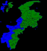
North Waziristan
Encyclopedia
North Waziristan is the northern part of Waziristan
, a mountainous region of northwest Pakistan
, bordering Afghanistan
and covering 11585 square kilometres (4,473 sq mi). Waziristan comprises the area west and south-west of Peshawar
between the Tochi river to the north and the Gomal river
to the south, forming part of Pakistan's Federally Administered Tribal Areas
(FATA). Miranshah
is capital of North Waziristan. Khyber Pakhtunkhwa lies immediately to the east. The region was an independent tribal territory from 1893, remaining outside of the British empire and Afghanistan
. Tribal raiding into British territory was a constant problem for the British, requiring frequent punitive expeditions between 1860 and 1945. The region became part of Pakistan on independence in 1947.
Waziristan is divided into two "agencies", North Waziristan and South Waziristan
, with estimated populations (as of 1998) of 361,246 and 429,841 respectively. The two parts have quite distinct characteristics, though both tribes are subgroups of the Waziris and speak a common Waziri language. They have a formidable reputation as warriors and are known for their frequent blood feuds. Traditionally, feuding local Waziri religious leaders have enlisted outsiders in the Pakistani government, and U.S. forces hunting al-Qaeda
fugitives, in attempts at score-settling. The tribes are divided into sub-tribes governed by male village elders who meet in a tribal jirga
. Socially and religiously Waziristan is an extremely conservative area. Women are carefully guarded, and every household must be headed by a male figure. Tribal cohesiveness is so strong through so-called Collective Responsibility Acts in the Frontier Crimes Regulation.
In 1910 North Waziristan Agency was constituted as a full fledged agency with its headquarters at Miranshah
. It is inhabited by the Pashtun
Wazirs
and Daurs
tribes. The agency lies from 32.35 degrees to 33.22 degrees latitudes and 69.22 degrees to 70.38 degrees longitudes. It is bounded on the north by Afghanistan
, Kurram Agency and Hangu District
, on the east by Tribal Areas Adjoining Bannu District and Tribal Area Adjoining Karak and Bannu Districts. On the south by South Waziristan
Agency and on the west also by Afghanistan. The total area of the agency is 4707 square kilometres (1,817 sq mi).
is a single unit. However, for administrative convenience it has been split into two agencies, i.e. North and South Waziristan. The area has been described as a land of high and difficult hills with deep and rugged defile
s. The mountains of North Waziristan are geographically apart from the larger mountain system of the Koh-e-Sufaid in the north and the Sulaiman
in the south. The Waziristan hills were subject to igneous activity during the late Cretaceous period. The highly mineralized zone of Razmak
is connected with it. The mountains and hills form a rampart between Pakistan and Afghanistan. The average height of the Waziristan hills is 1,500 to 2,500 metres (4,900–6,600 ft) above sea level. The important ranges in the Waziristan hills are Derwesta, Laran, Vezda, Ingame, Shoidar, Shawal, Eblunkai, Alexandra, Muzdak and Zakha.
The Tochi River flowing through the agency has formed the Tochi Pass named after the river, through which armies, people and cultures have moved in and out of this region. The Tochi Pass connects Ghazni
in Afghanistan with Bannu
in Pakistan. The Tochi River has carved a large and important valley which is bounded by hills and mountains on all sides except the eastern side. It is about 100 kilometres (62.1 mi) in length and opens up into the Indus Valley
near Bannu. The Tochi valley is fertile and cultivable. Ketu and Kurram are the two minor rivers which flow in the northern part of the agency.
There are five notable rivers: Tochi, Kaitu, Kurram, Khaisor and Shaktue. There are some streams: Khoni Aigad, Chashma Aigad, Saidgi Algad, Kanungo Aigad, Sagga Aigad, Tauda China Algad, Damoma Algad, Tarkhobi Algad, Suedar Aigad.
Copper
associated with volcanics at Boya, Manzarkhel Spinkamar (east of Shora-Algad). Manganese
associated with cherts. Chromite
associated with serpentinites. There are only two mining sites of chromite at Mohammad Khel and Saidgi. In some hills, ordinary stones are mined for construction of buildings, etc.
rule, Waziristan was a part of the Mughal Empire, and once Bahadur Shah, son of Aurangzeb
personally visited this place and received the tribute from the Wazirs and Daurs. After the fall of Mughal Empire, the emerging Sikh Empire and their Khalsa Army could not extend their sway up to Waziristan. Their short rule in this area was confined to sporadic forages. Both tribes, Wazirs and Daurs, accepted the influence of the Mughal and Durrani
Kings who counted on them as a solid army always in readiness to help them in emergencies.
located Buddhist sites from the area:
Wazir
s and Dawar
s. There are also small tribes like the Gurbaz, Kharsins, Saidgis and Malakshis Mahsud
s. These tribes, except Saidgis, are Pakhtuns. According to the tribal annals they are descendants of Karlan
, who in turn is descended from Qais Abdur Rashid
. Regarding their ethnic origin, some historians believe that they are Semites. The traditions of the tribesmen however indicate that they are descendants of Karlan
, and are, therefore, generally accepted as being a tribe of Karlanri Pakhtuns. The Saidgis are the descendants of a Syed
who accompanied the founder of the Wazir tribe.
The Wazirs dominate the hilly tracts; Khaisora. Sherathala Plain, spinwam mirali,shewa, Kaitu valley, Lower stretches of the Kurram River and upper parts of Tochi valley beyond Kharakamar. They are divided into three main sections, namely, Ibrahim Khel, Wali Khel and mohmit Khel. These sections are further divided into several sub-sections.
The Dawars are divided into two main sections viz: Tur gun and spin gund. The inhabitants of village Tappi, village Miramshah, Issuri Haidar khel are Tur gund and the remaining are spin gund. In the time of Ahmad shah Abdali the total number of Dawars was 12,000 and Wazirs were 60000. The Tur gund of dawars are 3,000 and the spingund are 9,000. The traditional jarga of spingund are still called as "lazariza" (the meeting of all the 9,000 spingund). Those living in the administration control of Miranshah tehsil are known as Upper Dawars and living in the administration control of Mir Ali tehsil are known as Lower Dawars. The area settled by them is also known as Upper Dawar and Lower Dawar. They have settled in the fertile Tochi valley, mostly on the left bank of Tochi river from Khajuri
to Kharkamar. They are well educated and well mannered as compared to Wazirs, because most of the educational institutions fall in the area of Dawars. Their lands are very fertile.
The Kharsins are affiliated with Bora Khel and Madda Khel Wazirs. They live near the Durand Line to the northwest of the agency flanked by Madda Khel Wazirs and Saidgis. Mahsuds are the cousins of Wazirs; both have common ancestor, viz. Wazirs. A section of Mahsuds called Bahlol Zai Malakshai occupy a small portion of Razmak
surrounded by Bora Khel and Tori Khel Wazirs. The Saidgis occupy Zoi valley, Shawal. Dawegar and Dande plain near the Durand Line. The Kabulkhel contains Miami,Malakshahis,Pipali'Saifali are located in Shewa tehsil.Kabulkhel has two regions in Waziristan namely Shawal and Shawa.They migrate to Shawal in summer.
and Chappal. The Wazir woman wears a sleeved blouse or petti-coat and a long heavy shirt with trousers. She covers her head and body with a sheet of cloth. A married woman wears coloured trousers while unmarried wears simple trousers. On festivals and marriages, Wazir women put on colorful and ornamented blouses and multi-coloured frocks some times made of 40 metres (131.2 ft) cloths. To further adorn themselves, the women put on rectangular pieces of silver and gold that hang on their forehead and side-ways down to ear.
While the dress of Dawar people is somewhat the same as the Wazir's, there are some differences due to regional, and climate variations. Dawar wear almost all kind of dresses usually use through out Pakistan. There are many cultural and regional differences among the Dawar and Wazir.
Wazirs people mostly live near mountains areas and they have generally different livingstyle while Dawar tribes live near river and on plains.
Waziri tribes generally run businesses, while Dawars tribes are more heavily employed through government services.
Emigres from Waziristan tend to prefer medical education, when available to them.
is the headquarters of North Waziristan Agency, It is connected with Bannu
and other important places in the agency by metalled roads. This town houses the offices of all government departments in the agency and also serves as a market centre for people of the area.
Razmak valley is a summer resort. Ghulam Khan (on the Pakistan-Afghan border) and Keitu valley (which is also along the Pakistan-Afghanistan border) are some of the other places of interest in the agency.and also another one place which called manosallai.
sub-division comprises the Miranshah
, Ghulam Khan, and Datta Khel tehsils. The Mir Ali sub-division contains the Mir Ali, Spinwam, and Shewa tehsils. The Razmak
sub-division consists of the Razmak
, Dossali, and Garyum tehsils. Each of the sub-division is headed by an Assistant Political Officer/Assistant Political Agent. The Political Agent is assisted by three Assistant Political Agents in criminal cases and other official work including matters maintaining law and order in the agency. Assistant Political Agents assist the Political Agent in tackling problems of the agency. They perform their duties like a Liaison Officer between the Political Agent and the tribes. They also decide cases of minor criminal nature and civil suits.
Political Tehsildars and Political Naib- Tehsildars are in charge of Tehsils and their main duty is to control the tribes and maintain law and order within their own areas. They are answerable to the Political Agent through the Assistant Political Agent. They deal with all cases occurring in the protected area of their respective Tehsils. Land revenue administration in some parts of the agency is carried on exactly on the same lines as in the settled districts of Pakistan. The Frontier Crimes Regulation is applicable in this area. Cases occurring in the unprotected area are decided by the tribes themselves through their elders who are known as Maliks and Motabars. The Maliki system introduced by British government was the same in North Waziristan Agency as functioning in other FATA. Maliks use to work like a medium between administration and the Qaum or tribe. A Maliki is hereditary and devolves on the son and his son so on and so both for which regular benefits and subsidies are sanctioned from time to time. Lungi
system known as Sufaid Resh is slightly lower form of Maliki. In North Waziristan Agency there are 1620 Maliks and Lungi holders.
The government decided to take a number of actions to stop the "Talibanization" and crush the armed militancy in the Tribal regions and Khyber Pakhtunkhwa.
The NSC of Pakistan has decided the following actions will be taken to achieve the goals:
The ministry of interior has played a large part in the information gathering for the operations against militants and their institutions. The Ministry of Interior has prepared a list of militant commanders operating in the region and they have also prepared a list of seminaries for monitoring.
The government is also trying to strengthen the law enforcement in the area by providing the Khyber Pakhtunkhwa Police with weapons, bullet-proof jackets and night-vision devices. The paramilitary Frontier Corps will be provided with artillery and APC's. The state agencies are also working on studying ways to block FM frequencies of illegal FM radio channels.
Waziristan
Waziristan is a mountainous region near the Northwest of Pakistan, bordering Afghanistan and covering some 11,585 km² . The area is entirely populated by ethnic Pashtuns . The language spoken in the valley is Pashto/Pakhto...
, a mountainous region of northwest Pakistan
Pakistan
Pakistan , officially the Islamic Republic of Pakistan is a sovereign state in South Asia. It has a coastline along the Arabian Sea and the Gulf of Oman in the south and is bordered by Afghanistan and Iran in the west, India in the east and China in the far northeast. In the north, Tajikistan...
, bordering Afghanistan
Afghanistan
Afghanistan , officially the Islamic Republic of Afghanistan, is a landlocked country located in the centre of Asia, forming South Asia, Central Asia and the Middle East. With a population of about 29 million, it has an area of , making it the 42nd most populous and 41st largest nation in the world...
and covering 11585 square kilometres (4,473 sq mi). Waziristan comprises the area west and south-west of Peshawar
Peshawar
Peshawar is the capital of Khyber-Pakhtunkhwa and the administrative center and central economic hub for the Federally Administered Tribal Areas of Pakistan....
between the Tochi river to the north and the Gomal river
Gomal River
Gomal River is a river in the historical region of Pashtunistan, consisting of areas in Afghanistan and Pakistan, inhabited by the Pashtuns...
to the south, forming part of Pakistan's Federally Administered Tribal Areas
Federally Administered Tribal Areas
The Federally Administered Tribal Areas are a semi-autonomous tribal region in the northwest of Pakistan, lying between the province of Khyber Pakhtunkhwa, Balochistan, and the neighboring country of Afghanistan. The FATA comprise seven Agencies and six FRs...
(FATA). Miranshah
Miranshah
Miranshah is the capital or headquarters of North Waziristan in Pakistan. It is the site of a town, which has s small airfield that was built by the British for World War II. The area in which Miranshah sits is extremely dangerous mainly due to Taliban activities and U.S. Drone...
is capital of North Waziristan. Khyber Pakhtunkhwa lies immediately to the east. The region was an independent tribal territory from 1893, remaining outside of the British empire and Afghanistan
Afghanistan
Afghanistan , officially the Islamic Republic of Afghanistan, is a landlocked country located in the centre of Asia, forming South Asia, Central Asia and the Middle East. With a population of about 29 million, it has an area of , making it the 42nd most populous and 41st largest nation in the world...
. Tribal raiding into British territory was a constant problem for the British, requiring frequent punitive expeditions between 1860 and 1945. The region became part of Pakistan on independence in 1947.
Waziristan is divided into two "agencies", North Waziristan and South Waziristan
South Waziristan
South Waziristan is the southern part of Waziristan, a mountainous region of northwest Pakistan, bordering Afghanistan and covering some 11,585 km² . Waziristan comprises the area west and southwest of Peshawar between the Tochi River to the north and the Gomal River to the south, forming...
, with estimated populations (as of 1998) of 361,246 and 429,841 respectively. The two parts have quite distinct characteristics, though both tribes are subgroups of the Waziris and speak a common Waziri language. They have a formidable reputation as warriors and are known for their frequent blood feuds. Traditionally, feuding local Waziri religious leaders have enlisted outsiders in the Pakistani government, and U.S. forces hunting al-Qaeda
Al-Qaeda
Al-Qaeda is a global broad-based militant Islamist terrorist organization founded by Osama bin Laden sometime between August 1988 and late 1989. It operates as a network comprising both a multinational, stateless army and a radical Sunni Muslim movement calling for global Jihad...
fugitives, in attempts at score-settling. The tribes are divided into sub-tribes governed by male village elders who meet in a tribal jirga
Jirga
A jirga is a tribal assembly of elders which takes decisions by consensus, particularly among the Pashtun people but also in other ethnic groups near them; they are most common in Afghanistan and among the Pashtuns in Pakistan near its border with Afghanistan...
. Socially and religiously Waziristan is an extremely conservative area. Women are carefully guarded, and every household must be headed by a male figure. Tribal cohesiveness is so strong through so-called Collective Responsibility Acts in the Frontier Crimes Regulation.
In 1910 North Waziristan Agency was constituted as a full fledged agency with its headquarters at Miranshah
Miranshah
Miranshah is the capital or headquarters of North Waziristan in Pakistan. It is the site of a town, which has s small airfield that was built by the British for World War II. The area in which Miranshah sits is extremely dangerous mainly due to Taliban activities and U.S. Drone...
. It is inhabited by the Pashtun
Pashtun people
Pashtuns or Pathans , also known as ethnic Afghans , are an Eastern Iranic ethnic group with populations primarily between the Hindu Kush mountains in Afghanistan and the Indus River in Pakistan...
Wazirs
Wazir (tribe)
Wazirs or Waziris are a Pashtun tribe settled in the North Waziristan and South Waziristan agencies of Pakistan as well in the urban cities of Tank, F.R Bannu,i.e Domel and adjacent villages, Karachi and Lahore. Across the border, they can also be found in Paktia, Khost and Paktika provinces of...
and Daurs
Dawari
The Dawari, or Dauri are a Pashtun tribe in the Waziristan area of Pakistan. The Dawaris inhabit the Tochi Valley, otherwise known as Dawar or Daur, and are a homogeneous tribe of considerable size.-History:...
tribes. The agency lies from 32.35 degrees to 33.22 degrees latitudes and 69.22 degrees to 70.38 degrees longitudes. It is bounded on the north by Afghanistan
Afghanistan
Afghanistan , officially the Islamic Republic of Afghanistan, is a landlocked country located in the centre of Asia, forming South Asia, Central Asia and the Middle East. With a population of about 29 million, it has an area of , making it the 42nd most populous and 41st largest nation in the world...
, Kurram Agency and Hangu District
Hangu District (Pakistan)
Hangu is a district in Khyber Pakhtunkhwa province of Pakistan. The district takes its name from the town of Hangu. The name Hangu may also sometimes be applied to the Miranzai Valley which is partly within the district, bordering the Samana Range....
, on the east by Tribal Areas Adjoining Bannu District and Tribal Area Adjoining Karak and Bannu Districts. On the south by South Waziristan
South Waziristan
South Waziristan is the southern part of Waziristan, a mountainous region of northwest Pakistan, bordering Afghanistan and covering some 11,585 km² . Waziristan comprises the area west and southwest of Peshawar between the Tochi River to the north and the Gomal River to the south, forming...
Agency and on the west also by Afghanistan. The total area of the agency is 4707 square kilometres (1,817 sq mi).
Geography
Geographically, the whole of WaziristanWaziristan
Waziristan is a mountainous region near the Northwest of Pakistan, bordering Afghanistan and covering some 11,585 km² . The area is entirely populated by ethnic Pashtuns . The language spoken in the valley is Pashto/Pakhto...
is a single unit. However, for administrative convenience it has been split into two agencies, i.e. North and South Waziristan. The area has been described as a land of high and difficult hills with deep and rugged defile
Defile (geography)
Defile is a geographic term for a narrow pass or gorge between mountains or hills. It has its origins as a military description of a pass through which troops can march only in a narrow column or with a narrow front...
s. The mountains of North Waziristan are geographically apart from the larger mountain system of the Koh-e-Sufaid in the north and the Sulaiman
Sulaiman Mountains
The Sulaiman Mountains are a major geological feature of southeastern Afghanistan and northern Balochistan province of Pakistan. In Pakistan, it forms the eastern edge of the Iranian plateau where the Indus River separates it from the Asian Subcontient...
in the south. The Waziristan hills were subject to igneous activity during the late Cretaceous period. The highly mineralized zone of Razmak
Razmak
Razmak is one of the three sub-divisions of North Waziristan Agency in Pakistan, the other two being Miranshah and Mirali. Inhabitants are Uthmanzai Wazirs. Razmak is further sub-divided in three Tehsils. Tehsil being the lowest administrative unit in the Federally Administered Tribal Areas of...
is connected with it. The mountains and hills form a rampart between Pakistan and Afghanistan. The average height of the Waziristan hills is 1,500 to 2,500 metres (4,900–6,600 ft) above sea level. The important ranges in the Waziristan hills are Derwesta, Laran, Vezda, Ingame, Shoidar, Shawal, Eblunkai, Alexandra, Muzdak and Zakha.
The Tochi River flowing through the agency has formed the Tochi Pass named after the river, through which armies, people and cultures have moved in and out of this region. The Tochi Pass connects Ghazni
Ghazni
For the Province of Ghazni see Ghazni ProvinceGhazni is a city in central-east Afghanistan with a population of about 141,000 people...
in Afghanistan with Bannu
Bannu
Bannu is the principal city of the Bannu District in the Khyber Pakhtunkhwa Province of Pakistan. It is an important road junction and market city. Bannu is a very old city, founded in ancient times; however, the present location of the downtown Bannu was founded by Sir Herbert Edwardes in 1848,...
in Pakistan. The Tochi River has carved a large and important valley which is bounded by hills and mountains on all sides except the eastern side. It is about 100 kilometres (62.1 mi) in length and opens up into the Indus Valley
Indus River
The Indus River is a major river which flows through Pakistan. It also has courses through China and India.Originating in the Tibetan plateau of western China in the vicinity of Lake Mansarovar in Tibet Autonomous Region, the river runs a course through the Ladakh district of Jammu and Kashmir and...
near Bannu. The Tochi valley is fertile and cultivable. Ketu and Kurram are the two minor rivers which flow in the northern part of the agency.
There are five notable rivers: Tochi, Kaitu, Kurram, Khaisor and Shaktue. There are some streams: Khoni Aigad, Chashma Aigad, Saidgi Algad, Kanungo Aigad, Sagga Aigad, Tauda China Algad, Damoma Algad, Tarkhobi Algad, Suedar Aigad.
Mining
Following minerals have been found in the area:Copper
Copper
Copper is a chemical element with the symbol Cu and atomic number 29. It is a ductile metal with very high thermal and electrical conductivity. Pure copper is soft and malleable; an exposed surface has a reddish-orange tarnish...
associated with volcanics at Boya, Manzarkhel Spinkamar (east of Shora-Algad). Manganese
Manganese
Manganese is a chemical element, designated by the symbol Mn. It has the atomic number 25. It is found as a free element in nature , and in many minerals...
associated with cherts. Chromite
Chromite
Chromite is an iron chromium oxide: FeCr2O4. It is an oxide mineral belonging to the spinel group. Magnesium can substitute for iron in variable amounts as it forms a solid solution with magnesiochromite ; substitution of aluminium occurs leading to hercynite .-Occurrence:Chromite is found in...
associated with serpentinites. There are only two mining sites of chromite at Mohammad Khel and Saidgi. In some hills, ordinary stones are mined for construction of buildings, etc.
Climate
The climate of the area is cold in winter and warm in summer. Summer season starts from May and continues till September. June is generally the warmest month. The mean maximum and minimum temperatures during the month of June are 31 and 18 degree Celsius respectively. The winter starts in October and continues till April. December. January and February are the cold months. The mean maximum and minimum temperatures during the month of January are 10 and minus 2 degree Celsius respectively. Rainfall is scanty except in the Razmak area where the rainfall is slightly higher.History
During MughalMughal Empire
The Mughal Empire , or Mogul Empire in traditional English usage, was an imperial power from the Indian Subcontinent. The Mughal emperors were descendants of the Timurids...
rule, Waziristan was a part of the Mughal Empire, and once Bahadur Shah, son of Aurangzeb
Aurangzeb
Abul Muzaffar Muhy-ud-Din Muhammad Aurangzeb Alamgir , more commonly known as Aurangzeb or by his chosen imperial title Alamgir , was the sixth Mughal Emperor of India, whose reign lasted from 1658 until his death in 1707.Badshah Aurangzeb, having ruled most of the Indian subcontinent for nearly...
personally visited this place and received the tribute from the Wazirs and Daurs. After the fall of Mughal Empire, the emerging Sikh Empire and their Khalsa Army could not extend their sway up to Waziristan. Their short rule in this area was confined to sporadic forages. Both tribes, Wazirs and Daurs, accepted the influence of the Mughal and Durrani
Durrani
Durrani or Abdali is the name of a chief Pashtun tribal confederation in Afghanistan and Pakistan. Originally known by their ancient name Abdali later as Durrani they have been called Durrani since the beginning of the Durrani Empire in 1747. The number of Durranis are estimated to be roughly 16%...
Kings who counted on them as a solid army always in readiness to help them in emergencies.
Archeological Finds
In 1966 Ahmad Hasan DaniAhmad Hasan Dani
Professor Ahmad Hasan Dani FRAS, SI, HI , was a Pakistani intellectual, archaeologist, historian, and linguist. He was among the foremost authorities on Central Asian and South Asian archaeology and history. He introduced archaeology as a discipline in higher education in Pakistan and Bangladesh...
located Buddhist sites from the area:
Coins of the Parthian and Kusana rulers have been found previously in the Shertala plain. Some archeological finds were reported by Sir Aurel Stein . In fact we also located during our visit a Buddhist StupaStupaA stupa is a mound-like structure containing Buddhist relics, typically the remains of Buddha, used by Buddhists as a place of worship....
site not far from Spinwam. But nothing definitely is known about the early history of this region.
The Tochi ValleyTochi ValleyTochi Valley, , is one of the main routes into Afghanistan from the Khyber-Pakhtunkhwa of Pakistan.The Tochi Valley leads from Bannu District through tribal areas, and is inhabited by the Dawari tribe. The valley is divided into two parts, known as Upper and Lower Dawar, by a narrow pass called the...
inscriptions for the first time attest to the presence of the ShahiShahiThe Shahi , Sahi, also called Shahiya dynasties ruled one of the Middle kingdoms of India which included portions of the Kabulistan and the old province of Gandhara , from the decline of the Kushan Empire in the 3rd century to the early 9th century...
rulers here ...
British era
When the British took over the administration of the settled district of Bannu in 1849, the tribes of North Waziristan were under the sovereignty of the Kabul government. The British, therefore, entered North Waziristan in 1894 and made agreement with the tribes. The British introduced a regular system of land record and revenue administration for the most fertile part of the Tochi valley. It was later in the year 1910 when North Waziristan was made a full fledged agency. In 1935-36, a Hindu-Muslim clash occurred over a Hindu girl of Bannu, who had married a Muslim which led to disturbance in Waziristan. The tribesmen rallied round one Mirzali Khan, Tori Khel Wazir, who was later on given the title of the Faqir of Ipi. Jehad was declared against the British and the Faqir of Ipi with his huge Lashkar (force) remained at war with the British till the latter evacuated the area in 1947. The Faqir of Ipi died in 1960. In spite of his opposition to the Islamic Republic of Pakistan the Jirgas in Waziristan decided in favour of joining Pakistan.Ethnic groups and tribes
The chief tribes in North Waziristan are the UtmanzaiUtmanzai
Utmanzai is a town in Charsadda District in the North-West Frontier Province of Pakistan. It is located at 34°22'24N 71°45'33E with an altitude of 390 metres and lies to the north of Charsadda city. Utmanzai is famous for being the birth place of Khan Abdul Ghaffar Khan....
Wazir
Wazir (tribe)
Wazirs or Waziris are a Pashtun tribe settled in the North Waziristan and South Waziristan agencies of Pakistan as well in the urban cities of Tank, F.R Bannu,i.e Domel and adjacent villages, Karachi and Lahore. Across the border, they can also be found in Paktia, Khost and Paktika provinces of...
s and Dawar
Dawari
The Dawari, or Dauri are a Pashtun tribe in the Waziristan area of Pakistan. The Dawaris inhabit the Tochi Valley, otherwise known as Dawar or Daur, and are a homogeneous tribe of considerable size.-History:...
s. There are also small tribes like the Gurbaz, Kharsins, Saidgis and Malakshis Mahsud
Mahsud
Mahsud is a Pashtun tribe in South Waziristan, a tribal region in Pakistan. Mahsud are considered to be one of the bravest and toughest Pashtun Tribes. The Mahsud tribe lives in the centre of South Waziristan valley, surrounded on three sides by the Darwesh Waziris, and being shut off by the...
s. These tribes, except Saidgis, are Pakhtuns. According to the tribal annals they are descendants of Karlan
Karlan
Karlan or Kalanai is said to have been a direct descendant of Ghurghusht the second son of the legendary Qais Abdur Rashid, the folklorish ancestor of the Pashtun people. He was the son of Burhan himself the son of Ghurghusht. Because of the numerous tribes associated with his name, he is sometimes...
, who in turn is descended from Qais Abdur Rashid
Qais Abdur Rashid
Qais Abdur Rashid Khan , also known as Kesh, Kish, Qesh and Imraul Qais is a legendary ancestor of the Pashtun race, claimed to be the first ethnic Pashtun who travelled to Mecca and Medina in Saudi Arabia during the early days of Islam.) He is believed to be the 37th descendent of King Saul .He...
. Regarding their ethnic origin, some historians believe that they are Semites. The traditions of the tribesmen however indicate that they are descendants of Karlan
Karlan
Karlan or Kalanai is said to have been a direct descendant of Ghurghusht the second son of the legendary Qais Abdur Rashid, the folklorish ancestor of the Pashtun people. He was the son of Burhan himself the son of Ghurghusht. Because of the numerous tribes associated with his name, he is sometimes...
, and are, therefore, generally accepted as being a tribe of Karlanri Pakhtuns. The Saidgis are the descendants of a Syed
Syed
Syed is a masculine given name derived from the title Sayyid, it is not to be confused with the similar looking name Sayid...
who accompanied the founder of the Wazir tribe.
The Wazirs dominate the hilly tracts; Khaisora. Sherathala Plain, spinwam mirali,shewa, Kaitu valley, Lower stretches of the Kurram River and upper parts of Tochi valley beyond Kharakamar. They are divided into three main sections, namely, Ibrahim Khel, Wali Khel and mohmit Khel. These sections are further divided into several sub-sections.
The Dawars are divided into two main sections viz: Tur gun and spin gund. The inhabitants of village Tappi, village Miramshah, Issuri Haidar khel are Tur gund and the remaining are spin gund. In the time of Ahmad shah Abdali the total number of Dawars was 12,000 and Wazirs were 60000. The Tur gund of dawars are 3,000 and the spingund are 9,000. The traditional jarga of spingund are still called as "lazariza" (the meeting of all the 9,000 spingund). Those living in the administration control of Miranshah tehsil are known as Upper Dawars and living in the administration control of Mir Ali tehsil are known as Lower Dawars. The area settled by them is also known as Upper Dawar and Lower Dawar. They have settled in the fertile Tochi valley, mostly on the left bank of Tochi river from Khajuri
Khajuri
Khajuri is a village in the southern state of Karnataka, India. It is located in the Aland taluk of Gulbarga district in Karnataka.-Demographics:As of 2001 India census, Khajuri had a population of 6273 with 3162 males and 3111 females....
to Kharkamar. They are well educated and well mannered as compared to Wazirs, because most of the educational institutions fall in the area of Dawars. Their lands are very fertile.
The Kharsins are affiliated with Bora Khel and Madda Khel Wazirs. They live near the Durand Line to the northwest of the agency flanked by Madda Khel Wazirs and Saidgis. Mahsuds are the cousins of Wazirs; both have common ancestor, viz. Wazirs. A section of Mahsuds called Bahlol Zai Malakshai occupy a small portion of Razmak
Razmak
Razmak is one of the three sub-divisions of North Waziristan Agency in Pakistan, the other two being Miranshah and Mirali. Inhabitants are Uthmanzai Wazirs. Razmak is further sub-divided in three Tehsils. Tehsil being the lowest administrative unit in the Federally Administered Tribal Areas of...
surrounded by Bora Khel and Tori Khel Wazirs. The Saidgis occupy Zoi valley, Shawal. Dawegar and Dande plain near the Durand Line. The Kabulkhel contains Miami,Malakshahis,Pipali'Saifali are located in Shewa tehsil.Kabulkhel has two regions in Waziristan namely Shawal and Shawa.They migrate to Shawal in summer.
Dress and ornaments
The common dress of tribesmen consists of shirt, trousers, Waist-coat, sheet of cloth, turbanTurban
In English, Turban refers to several types of headwear popularly worn in the Middle East, North Africa, Punjab, Jamaica and Southwest Asia. A commonly used synonym is Pagri, the Indian word for turban.-Styles:...
and Chappal. The Wazir woman wears a sleeved blouse or petti-coat and a long heavy shirt with trousers. She covers her head and body with a sheet of cloth. A married woman wears coloured trousers while unmarried wears simple trousers. On festivals and marriages, Wazir women put on colorful and ornamented blouses and multi-coloured frocks some times made of 40 metres (131.2 ft) cloths. To further adorn themselves, the women put on rectangular pieces of silver and gold that hang on their forehead and side-ways down to ear.
While the dress of Dawar people is somewhat the same as the Wazir's, there are some differences due to regional, and climate variations. Dawar wear almost all kind of dresses usually use through out Pakistan. There are many cultural and regional differences among the Dawar and Wazir.
Food
The staple food of the tribesman is wheat or maize bread. Milk is taken in its various forms. Roasted meat larmin is much relished. The people of Waziristan generally like a fried goat dish called palawoo, served in hilly areas.Dwelling
The Dawars live in houses close together in a compact area. In case of Wazirs a large joint family lives either in one and the same house called ket or kot or in houses adjacent to one another, but separated from the houses of the other families. A walled enclosure of mud or mud and stones three to five metres (16.4 ft) high is called kot. Most of the kots have a fort-like structure with a tower in the centre of every Kot which is used as a strategic point for fighting with the enemy when hostilities break out. Every section in a village has a Masjid and a common sitting place. One or several households have a private guest house hujra attached to the house. In a house there may be one or several rooms.Wazirs people mostly live near mountains areas and they have generally different livingstyle while Dawar tribes live near river and on plains.
Occupation
Due to the rugged nature of the terrain and their lack of education, many inhabitants believe they must depend upon government services. Many emigrate abroad to earn livelihoods as laborers. Local people have also invested in transportation-related businesses.Waziri tribes generally run businesses, while Dawars tribes are more heavily employed through government services.
Emigres from Waziristan tend to prefer medical education, when available to them.
Places of interest
MiranshahMiranshah
Miranshah is the capital or headquarters of North Waziristan in Pakistan. It is the site of a town, which has s small airfield that was built by the British for World War II. The area in which Miranshah sits is extremely dangerous mainly due to Taliban activities and U.S. Drone...
is the headquarters of North Waziristan Agency, It is connected with Bannu
Bannu
Bannu is the principal city of the Bannu District in the Khyber Pakhtunkhwa Province of Pakistan. It is an important road junction and market city. Bannu is a very old city, founded in ancient times; however, the present location of the downtown Bannu was founded by Sir Herbert Edwardes in 1848,...
and other important places in the agency by metalled roads. This town houses the offices of all government departments in the agency and also serves as a market centre for people of the area.
Razmak valley is a summer resort. Ghulam Khan (on the Pakistan-Afghan border) and Keitu valley (which is also along the Pakistan-Afghanistan border) are some of the other places of interest in the agency.and also another one place which called manosallai.
Administrative setup
The agency is under the general charge of a Political Agent who administers civil, criminal and revenue cases in accordance with Frontier Crimes Regulation and Customary Law. The North Waziristan Agency consists of three sub-divisions and nine Tehsils. The MiranshahMiranshah
Miranshah is the capital or headquarters of North Waziristan in Pakistan. It is the site of a town, which has s small airfield that was built by the British for World War II. The area in which Miranshah sits is extremely dangerous mainly due to Taliban activities and U.S. Drone...
sub-division comprises the Miranshah
Miranshah
Miranshah is the capital or headquarters of North Waziristan in Pakistan. It is the site of a town, which has s small airfield that was built by the British for World War II. The area in which Miranshah sits is extremely dangerous mainly due to Taliban activities and U.S. Drone...
, Ghulam Khan, and Datta Khel tehsils. The Mir Ali sub-division contains the Mir Ali, Spinwam, and Shewa tehsils. The Razmak
Razmak
Razmak is one of the three sub-divisions of North Waziristan Agency in Pakistan, the other two being Miranshah and Mirali. Inhabitants are Uthmanzai Wazirs. Razmak is further sub-divided in three Tehsils. Tehsil being the lowest administrative unit in the Federally Administered Tribal Areas of...
sub-division consists of the Razmak
Razmak
Razmak is one of the three sub-divisions of North Waziristan Agency in Pakistan, the other two being Miranshah and Mirali. Inhabitants are Uthmanzai Wazirs. Razmak is further sub-divided in three Tehsils. Tehsil being the lowest administrative unit in the Federally Administered Tribal Areas of...
, Dossali, and Garyum tehsils. Each of the sub-division is headed by an Assistant Political Officer/Assistant Political Agent. The Political Agent is assisted by three Assistant Political Agents in criminal cases and other official work including matters maintaining law and order in the agency. Assistant Political Agents assist the Political Agent in tackling problems of the agency. They perform their duties like a Liaison Officer between the Political Agent and the tribes. They also decide cases of minor criminal nature and civil suits.
Political Tehsildars and Political Naib- Tehsildars are in charge of Tehsils and their main duty is to control the tribes and maintain law and order within their own areas. They are answerable to the Political Agent through the Assistant Political Agent. They deal with all cases occurring in the protected area of their respective Tehsils. Land revenue administration in some parts of the agency is carried on exactly on the same lines as in the settled districts of Pakistan. The Frontier Crimes Regulation is applicable in this area. Cases occurring in the unprotected area are decided by the tribes themselves through their elders who are known as Maliks and Motabars. The Maliki system introduced by British government was the same in North Waziristan Agency as functioning in other FATA. Maliks use to work like a medium between administration and the Qaum or tribe. A Maliki is hereditary and devolves on the son and his son so on and so both for which regular benefits and subsidies are sanctioned from time to time. Lungi
Lungi
The Lungi , also known as a sarong , is a traditional garment worn around the waist in India, Pakistan, Bangladesh, Sri Lanka, Burma, Brunei, Indonesia, Malaysia, Singapore, the Horn of Africa and the southern Arabian Peninsula...
system known as Sufaid Resh is slightly lower form of Maliki. In North Waziristan Agency there are 1620 Maliks and Lungi holders.
Pakistan's new Waziristan strategy
On June 4, 2007, the National Security Council of Pakistan met to decide the fate of Waziristan and take up a number of political and administrative decisions to control "Talibanization" of the area. The meeting was chaired by President Pervez Musharraf and it was attended by the Chief Ministers and Governors of all four provinces. They discussed the deteriorating law and order situation and the threat posed to state security.The government decided to take a number of actions to stop the "Talibanization" and crush the armed militancy in the Tribal regions and Khyber Pakhtunkhwa.
The NSC of Pakistan has decided the following actions will be taken to achieve the goals:
- Deployment of unmanned reconnaissance planes
- Strengthening law-enforcement agencies with advanced equipment
- Deployment of more troops to the region
- Operations against militants on fast-track basis
- Focused operations against militant commanders
- Action against madrassah's preaching militancy
- Appointment of regional coordinators
- Fresh Recruitments of police officers in Khyber Pakhtunkhwa
The ministry of interior has played a large part in the information gathering for the operations against militants and their institutions. The Ministry of Interior has prepared a list of militant commanders operating in the region and they have also prepared a list of seminaries for monitoring.
The government is also trying to strengthen the law enforcement in the area by providing the Khyber Pakhtunkhwa Police with weapons, bullet-proof jackets and night-vision devices. The paramilitary Frontier Corps will be provided with artillery and APC's. The state agencies are also working on studying ways to block FM frequencies of illegal FM radio channels.
See also
- WaziristanWaziristanWaziristan is a mountainous region near the Northwest of Pakistan, bordering Afghanistan and covering some 11,585 km² . The area is entirely populated by ethnic Pashtuns . The language spoken in the valley is Pashto/Pakhto...
- South WaziristanSouth WaziristanSouth Waziristan is the southern part of Waziristan, a mountainous region of northwest Pakistan, bordering Afghanistan and covering some 11,585 km² . Waziristan comprises the area west and southwest of Peshawar between the Tochi River to the north and the Gomal River to the south, forming...
- Islamic Emirate of WaziristanIslamic Emirate of WaziristanThe Islamic Emirate of Waziristan is a rebel organization, in Waziristan, Pakistan that some commentators claim gained de facto recognition from the Government of Pakistan when it was named as party to the Waziristan Accord, the agreement reached between Islamabad and local tribesmen to end the...
- Federally Administered Tribal AreasFederally Administered Tribal AreasThe Federally Administered Tribal Areas are a semi-autonomous tribal region in the northwest of Pakistan, lying between the province of Khyber Pakhtunkhwa, Balochistan, and the neighboring country of Afghanistan. The FATA comprise seven Agencies and six FRs...
- Drone attacks in PakistanDrone attacks in PakistanThe United States government, led by the Central Intelligence Agency's Special Activities Division, has made a series of attacks on targets in northwest Pakistan since 2004 using drones . These attacks are part of the US' War on Terrorism campaign, seeking to defeat Taliban and Al-Qaeda militants...
- Targeted killingTargeted killingTargeted killing is the deliberate, specific targeting and killing, by a government or its agents, of a supposed terrorist or of a supposed "unlawful combatant" who is not in that government's custody...