
Mineral County, West Virginia
Encyclopedia
Mineral County is a county located in the U.S. state
of West Virginia
. It is part of the Cumberland, MD-WV Metropolitan Statistical Area. As of 2010, the population was 28,212. Its county seat
is Keyser
.
lived throughout the highlands along rivers in this area for thousands of years. Archeologists have identified artifacts of the Adena culture
, dating from 1000 BC to 200 BC. They were among the several early Native American cultures who built major earthwork mounds
for ceremonial and burial use. Remnants of their culture have been found throughout West Virginia. They were followed by other indigenous peoples.
With the growth of fur trading to the north after European encounter in the coastal areas, the nations of the Haudenosaunee (or Iroquois Confederacy), based in present-day New York, moved into the Ohio Valley in search of new hunting grounds. By the 17th century they had conquered other tribes, pushed them out to the west, and preserved the area for hunting.
, a German physician and explorer employed by Sir William Berkeley, colonial governor of Virginia, is believed to be the first European to set foot in present-day Mineral County. He explored the area in 1669.
The first recorded grants of land in West Virginia were made to Isaac and John Van Meter in 1730. This was in the Frankfort district of Mineral County. In 1749 English colonists built the first frontier fort, Fort Ohio
, at Ridgeley
. They constructed Fort Ashby
in 1755, which is the last standing unit in the chain of forts built under the orders of George Washington
. Fort Sellers
was built near present day Short Gap
, and Fort Cocke
near Headsville
. In 1750 a frontier blockhouse, New Creek Blockhouse
, was built about 1 miles (1.6 km) west of New Creek
to protect local settlers.
Prior to 1738, the Orange County, Virginia
, today located on the east side of the Blue Ridge Mountains
, included all of Virginia west of the Blue Ridge. In that year, the Virginia Assembly passed an act dividing this territory into two counties: Frederick and Augusta. Hampshire County was formed from those two counties in 1753.
(although, technically, coal is not a true mineral).

The County Clerk shall have the custody of all deeds and other papers presented for record in their counties and they shall be preserved therein. They shall have jurisdiction in all matters of probate, the appointment and qualification of personal representatives, guardians, committees, curators and the settlement of their accounts. The Clerk shall have custody of all election records, payroll and budgetary accounting, and accounts payable.
County Clerk: Lauren Ellifritz, Republican, term ending 2011
House of Delegates
Senate
, featuring rail access, and near Fort Ashby
, with fiber optics and sitewide wireless Internet.
on the site of Civil War
Fort Fuller.
Eastern West Virginia Community & Technical College
holds classes at Mineral Counties Vocational and Technical School.
located near Short Gap
and Keyser High School
located south of Keyser
.
, the county has a total area of 329 square miles (852 km²), of which 328 square miles (849 km²) is land and 1 square mile (4 km²) (0.43%) is water.
in West Virginia lies in Mineral County, and contains the highest point in the county. Known as the Pinnacle it is 3104 feet (946.1 m) above sea level. From the abandoned fire tower you can see four states on a clear day, Pennsylvania
, Maryland
, West Virginia
, and Virginia
. The Allegheny Front is the largest mountain in the county; on the north end it is also known as Green Mountain. On top of the Allegheny Plateau
is located the town of Elk Garden, West Virginia
in the southwestern portion of the county. The Potomac River Valley lies to west and north of the mountain, and the New Creek
Valley lies to the east.
Knobly Mountain
lies between the New Creek and Patterson Creek valleys. It is the longest mountain in Mineral County stretching from the Grant County line in the south to the Potomac River in the north at Ridgeley, West Virginia
.
To the east of the Patterson Creek Valley lie a series of low hills which form the eastern border of the county with Hampshire County
.
deposits. No coal is found east of the Allegheny Front
, and coal mining is only found on top of the Allegheny Plateau
.
Natural gas
is found east of the Allegheny Front as well as iron ore deposits. The county no longer produces iron
, but several abandoned iron furnaces
from the 19th century still exist.
of 2010, there were 28,212 people, 10,784 households, and 7,710 families residing in the county. The population density
was 83 people per square mile (32/km²). There were 12,094 housing units at an average density of 37 per square mile (14/km²). The racial makeup of the county was 96.16% White
, 2.55% Black
or African American
, 0.11% Native American
, 0.20% Asian
, 0.01% Pacific Islander
, 0.21% from other races
, and 0.76% from two or more races. 0.58% of the population were Hispanic
or Latino
of any race.
There were 10,784 households out of which 30.40% had children under the age of 18 living with them, 57.90% were married couples
living together, 9.70% had a female householder with no husband present, and 28.50% were non-families. 25.00% of all households were made up of individuals and 11.50% had someone living alone who was 65 years of age or older. The average household size was 2.46 and the average family size was 2.93.
In the county, the population was spread out with 23.40% under the age of 18, 8.60% from 18 to 24, 27.10% from 25 to 44, 25.90% from 45 to 64, and 15.10% who were 65 years of age or older. The median age was 39 years. For every 100 females there were 95.80 males. For every 100 females age 18 and over, there were 93.00 males.
The median income for a household in the county was $31,149, and the median income for a family was $37,866. Males had a median income of $32,337 versus $20,090 for females. The per capita income
for the county was $15,384. About 11.50% of families and 14.70% of the population were below the poverty line, including 21.10% of those under age 18 and 11.60% of those age 65 or over.
of 600. One Little League field and one softball field. Fishing Areas; two flood control dams stocked by WVDNR, 5 acres (20,234.3 m²) and 2.5 acres (10,117.2 m²). All 365 acres (1.5 km²) are open to public hunting by permit. Approximately 5 miles of trails. An arboretum is under construction at Larenim to include a Shale Barrens Conservancy. Larenim Park is also home to the local theater group, McNeill's Rangers.
below Jennings Randolph Lake, along the old Western Maryland Railway
right-of-way. It is one of the best trout streams in West Virginia and also provides seven miles (11 km) of whitewater rafting and canoeing for the entire family to enjoy. Public hunting permitted on surrounding state lands.
, named for Senator Jennings Randolph
, near Elk Garden offers extensive recreational opportunity with its 952 acres (3.9 km²) and more than 13 miles (20.9 km) of shoreline. Howell Run Picnic Area overlooks the lake and contains 40 picnic sites, two pavilions, a playground and vault toilets. The Howell Run Boat Launch consists of a two lane concrete ramp. the Robert W. Craig Campground is situated on a high ridge overlooking the dam site and features 87 campsites, potable water, hot showers, vault toilets and a playground. A 3/4 mile long interpretive trail has been developed in the area. The West Virginia Overlook area contains a two tier Visitor Center. Waffle Rock, a unique natural rock formation, can also be viewed from the Overlook.
Mill Creek – Privately owned, nine holes, Club House
City of Piedmont – One pool open to public
U.S. state
A U.S. state is any one of the 50 federated states of the United States of America that share sovereignty with the federal government. Because of this shared sovereignty, an American is a citizen both of the federal entity and of his or her state of domicile. Four states use the official title of...
of West Virginia
West Virginia
West Virginia is a state in the Appalachian and Southeastern regions of the United States, bordered by Virginia to the southeast, Kentucky to the southwest, Ohio to the northwest, Pennsylvania to the northeast and Maryland to the east...
. It is part of the Cumberland, MD-WV Metropolitan Statistical Area. As of 2010, the population was 28,212. Its county seat
County seat
A county seat is an administrative center, or seat of government, for a county or civil parish. The term is primarily used in the United States....
is Keyser
Keyser, West Virginia
Keyser is a city in and the county seat of Mineral County, West Virginia, United States. It is part of the Cumberland, MD-WV Metropolitan Statistical Area. The population was 5,303 at the 2000 census.- History :...
.
Ancient history
Indigenous peoplesIndigenous peoples
Indigenous peoples are ethnic groups that are defined as indigenous according to one of the various definitions of the term, there is no universally accepted definition but most of which carry connotations of being the "original inhabitants" of a territory....
lived throughout the highlands along rivers in this area for thousands of years. Archeologists have identified artifacts of the Adena culture
Adena culture
The Adena culture was a Pre-Columbian Native American culture that existed from 1000 to 200 BC, in a time known as the early Woodland Period. The Adena culture refers to what were probably a number of related Native American societies sharing a burial complex and ceremonial system...
, dating from 1000 BC to 200 BC. They were among the several early Native American cultures who built major earthwork mounds
Earthworks (archaeology)
In archaeology, earthwork is a general term to describe artificial changes in land level. Earthworks are often known colloquially as 'lumps and bumps'. Earthworks can themselves be archaeological features or they can show features beneath the surface...
for ceremonial and burial use. Remnants of their culture have been found throughout West Virginia. They were followed by other indigenous peoples.
With the growth of fur trading to the north after European encounter in the coastal areas, the nations of the Haudenosaunee (or Iroquois Confederacy), based in present-day New York, moved into the Ohio Valley in search of new hunting grounds. By the 17th century they had conquered other tribes, pushed them out to the west, and preserved the area for hunting.
Colonial Virginia history
John LedererJohn Lederer
John Lederer was a 17th-century German physician and an explorer of the Appalachian Mountains. He and the members of his party became the first Europeans to crest the Blue Ridge Mountains and the first to see the Shenandoah Valley and the Allegheny Mountains beyond...
, a German physician and explorer employed by Sir William Berkeley, colonial governor of Virginia, is believed to be the first European to set foot in present-day Mineral County. He explored the area in 1669.
The first recorded grants of land in West Virginia were made to Isaac and John Van Meter in 1730. This was in the Frankfort district of Mineral County. In 1749 English colonists built the first frontier fort, Fort Ohio
Fort Ohio
Fort Ohio Fort Ohio Fort Ohio (also known as the "New Store" was a stockade fort erected by Job Pearsall in 1749 on the present site of Ridgeley, West Virginia. The building was of log construction, long and wide, with two stories...
, at Ridgeley
Ridgeley, West Virginia
Ridgeley is a town in Mineral County, West Virginia, United States, and part of the Cumberland Metropolitan Statistical Area. The population was 762 at the 2000 census but has fallen to 575 with the 2010 census....
. They constructed Fort Ashby
Fort Ashby
Fort Ashby is a historic stockade fort located in Fort Ashby, West Virginia. A military installation constructed during the French and Indian War, it is listed on the National Register of Historic Places....
in 1755, which is the last standing unit in the chain of forts built under the orders of George Washington
George Washington
George Washington was the dominant military and political leader of the new United States of America from 1775 to 1799. He led the American victory over Great Britain in the American Revolutionary War as commander-in-chief of the Continental Army from 1775 to 1783, and presided over the writing of...
. Fort Sellers
Fort Sellers
Fort Sellers was a small stockade on the east side of Pattersons Creek at the conflunce with the Potomac River, in Franklin District, in present day Mineral County, West Virginia. Thisfort was erected by Colonel Washington....
was built near present day Short Gap
Short Gap, West Virginia
Short Gap is an unincorporated community in Mineral County, West Virginia located at the intersection of West Virginia Route 956 and West Virginia Route 28. The community is home to Frankfort High School, as well as Frankfort Middle School, which serve the northern part of Mineral County including...
, and Fort Cocke
Fort Cocke
Fort Cocke was a stockade, made of wooden palisades up stream from Fort Ashby. It was a square ninety feet on a side and enclosed about 1/5 acre. Blockhouses were built at each of the four corners. A barracks to house fifty men was constructed within the stockade.It was built by Captain William...
near Headsville
Headsville, West Virginia
Headsville is an unincorporated community in Mineral County, West Virginia, USA. It is part of the Cumberland, MD-WV Metropolitan Statistical Area. It lies between U.S. Route 50 and West Virginia Route 46 alongside Pattersons Creek....
. In 1750 a frontier blockhouse, New Creek Blockhouse
New Creek Blockhouse
New Creek Blockhouse, was built about 1 mile west of New Creek to protect local settlers in 1750. The fortification consisted of a log blockhouse but without a stockade around it....
, was built about 1 miles (1.6 km) west of New Creek
New Creek
New Creek is an stream in eastern West Virginia in the United States. It is the third major West Virginia tributary to the North Branch Potomac River. Via the Potomac, it is part of the watershed of Chesapeake Bay.-Course:...
to protect local settlers.
Prior to 1738, the Orange County, Virginia
Orange County, Virginia
As of the census of 2000, there were 25,881 people, 10,150 households, and 7,470 families residing in the county. The population density was 76 people per square mile . There were 11,354 housing units at an average density of 33 per square mile...
, today located on the east side of the Blue Ridge Mountains
Blue Ridge Mountains
The Blue Ridge Mountains are a physiographic province of the larger Appalachian Mountains range. This province consists of northern and southern physiographic regions, which divide near the Roanoke River gap. The mountain range is located in the eastern United States, starting at its southern-most...
, included all of Virginia west of the Blue Ridge. In that year, the Virginia Assembly passed an act dividing this territory into two counties: Frederick and Augusta. Hampshire County was formed from those two counties in 1753.
Virginia state history 1776 to 1863
Ultimately Hardy County in 1785 and part of Morgan County in 1820 were formed from Hampshire County.West Virginia history 1863 to present
It was not until after West Virginia became a state in 1863 that present-day Mineral County was organized. It was created in 1866 by an Act of the West Virginia Legislature from the existing Hampshire County. The name was selected due to its reserves of minerals, especially coalCoal
Coal is a combustible black or brownish-black sedimentary rock usually occurring in rock strata in layers or veins called coal beds or coal seams. The harder forms, such as anthracite coal, can be regarded as metamorphic rock because of later exposure to elevated temperature and pressure...
(although, technically, coal is not a true mineral).
Historical sites
|
New Creek Blockhouse New Creek Blockhouse, was built about 1 mile west of New Creek to protect local settlers in 1750. The fortification consisted of a log blockhouse but without a stockade around it.... Northwestern Turnpike The Northwestern Turnpike is a historic road in West Virginia , important for being historically one of the major roads crossing the Appalachians, financed by the Virginia Board of Public Works in the 1830s. In modern times, west of Winchester, Virginia, U.S... Patterson Creek Manor Patterson Creek Manor was a 9,000 acre land grant held by Lord Fairfax near present day Burlington, West Virginia. Starting in 1738 about 30 farms were established here.-External links:*... Saddle Mountain (Mineral County, West Virginia) Saddle Mountain is a section of New Creek Mountain in the Ridge and Valley physiographic province of the Appalachian Mountains in Mineral County, West Virginia. The mountain is so named for its shape. It is best viewed from Skyline which is located to the west along US 50 at the intersection with... Wind Lea Wind Lea was built in 1815 by Edward McCarty and his sons and is the oldest building in Keyser. The structure played an important role during the Civil War when it served both as a prison and a hospital. The home is now divided into private residences.... |
Notable people from Mineral County
- Colonel James Allen
- John AshbyJohn Ashby (militiaman)John Ashby was a Colonel in the Virginia Militia.During the French and Indian war there was a siege at present day Fort Ashby, West Virginia. In 1756 Colonel John Ashby was out of the fort at that location and was attacked by Indians and made a remarkable escape to the fort. The fort was named for...
- Woodrow Wilson BarrWoodrow Wilson BarrWoodrow Wilson Barr was a United States Marine with the 1st Marine Raider Battalion. He was killed in action at Tulagi, Solomon Islands, August 7, 1942 — and was posthumously awarded the Silver Star medal for his "conspicuous gallantry and intrepedity in action" during the action at...
- Thomas CarskadonThomas CarskadonThomas Carskadon from Keyser, West Virginia, USA was the Prohibition candiditate for Governor of West Virginia in 1884 and again in 1888.Thomas R. Carskadon was an influential Mineral County farmer and political leader....
- Henry G. DavisHenry G. DavisHenry Gassaway Davis was a self-made millionaire and U.S. Senator from West Virginia. He was the Democratic Party's nominee for Vice President of the United States in 1904. His brother was U.S...
- Thomas Beall DavisThomas Beall DavisThomas Beall Davis , of Keyser, West Virginia, was an American politician.-Biography:Davis was born in Baltimore, Maryland, the brother of Henry Gassaway Davis....
- Lynndie EnglandLynndie EnglandLynndie Rana England is a former United States Army reservist who served in the 372nd Military Police Company. She was one of eleven military personnel convicted in 2005 by Army courts-martial in connection with the torture and prisoner abuse at Abu Ghraib prison in Baghdad during the occupation...
- Henry Louis Gates
- Nancy HanksNancy HanksNancy Hanks Lincoln was the mother of Abraham Lincoln and of Sarah Lincoln after her marriage to Thomas Lincoln. After the family moved from Kentucky to Spencer County, Indiana, Nancy Lincoln died of milk sickness at the Little Pigeon Creek settlement...
- Jonah Edward KelleyJonah Edward Kelley-External links: *Dictionary of American Naval Fighting Ships entry for...
- John KrukJohn KrukJohn Martin Kruk is a former Major League Baseball player and current baseball analyst for ESPN.-Early life and career:...
- Leo MazzoneLeo MazzoneLeo David Mazzone is a former pitcher in minor league baseball and coach in Major League Baseball. He began working with the Atlanta Braves' organization in 1979.-Early life:...
- Catherine MarshallCatherine MarshallCatherine Wood Marshall was an American author of nonfiction, inspirational, and fiction works. She was the wife of well-known minister Peter Marshall.-Biography:...
- Walter E. "Jack" Rollins
- Harley Orrin Staggers, Sr.Harley Orrin StaggersHarley Orrin Staggers, Sr. was a Democratic U.S. politician.-Education:Staggers graduated from Emory and Henry College in 1931 and did graduate work at Duke University.-Career:...
- Harley "Buckey" Staggers, Jr.Harley O. Staggers, Jr.Harley O. "Buckey" Staggers, Jr. is a Democratic U.S. politician. He graduated from Harvard University and the West Virginia University College of Law, served as an assistant West Virginia Attorney General, served one term in the West Virginia Senate, and served five terms in the United States...
County Commission
Mineral County is governed by a three member commission, one member to be elected every two years to a six year term of office. The County Commission, as the governing body, is responsible for the fiscal affairs and general administration of county government. The County Commission does not possess inherent rights of self government but are creations of the State with the authority to carry out those functions specified by the WV Constitution or by legislative enactment.Commissioners
- Cynthia L. Pyles, DemocratDemocratic Party (United States)The Democratic Party is one of two major contemporary political parties in the United States, along with the Republican Party. The party's socially liberal and progressive platform is largely considered center-left in the U.S. political spectrum. The party has the lengthiest record of continuous...
Commission President: term ending 2013 - Janice LaRue, RepublicanRepublican Party (United States)The Republican Party is one of the two major contemporary political parties in the United States, along with the Democratic Party. Founded by anti-slavery expansion activists in 1854, it is often called the GOP . The party's platform generally reflects American conservatism in the U.S...
: term ending 2015 - Richard Lechliter, Republican: term ending 2017
Appointed commissions
- Planning CommissionMineral County, West Virginia Planning CommissionThe Mineral County Planning Commission is charged with administering Mineral County's land use ordinaces. It operates under section §8A-2-1 of the West Virginia state code* Subdivisions* Industrial Park Construction* Storm Water Management...
- Administers ordinances involved with land use and construction. - Development Authority - Administers Industrial Parks and seeks news business to the county.
Office of Assessor
- AssessorAssessor (property)An assessor is a specialist who calculates the value of property. The value calculated by the assessor is then used as the basis for determining the amounts to be paid or assessed for tax or insurance purposes....
: Rose Anne Hanna-Maine, Republican: term ending 2009
County Clerk
The Clerk is elected to a six year term with the right to succeed himself/herself. The primary duties and responsibilities of the Clerk of the County Commission may be identified as two basic functions:- to act as clerk (fiscal officer, secretary) of the County Commission, and
- to act as the receiver of fees charged for the instruments to be filed and recorded within the county. The official books and papers of the Office of the Clerk of the County Commission are considered permanent public records.
The County Clerk shall have the custody of all deeds and other papers presented for record in their counties and they shall be preserved therein. They shall have jurisdiction in all matters of probate, the appointment and qualification of personal representatives, guardians, committees, curators and the settlement of their accounts. The Clerk shall have custody of all election records, payroll and budgetary accounting, and accounts payable.
County Clerk: Lauren Ellifritz, Republican, term ending 2011
House of DelegatesWest Virginia House of DelegatesThe West Virginia House of Delegates is the lower house of the West Virginia Legislature. Only three states—Maryland, Virginia, and West Virginia—refer to their lower house as the House of Delegates.-Historical:-Current:-District organization:...
| District | Representative | Party | County of Residence |
|---|---|---|---|
| 48 | Allen V. Evans Allen V. Evans Allen V. Evans is an American politician. Evans is the West Virginia House of Delegates Member from the 48th District which represents Mineral County and Grant County. He also serves as the Minority Chair of the Agriculture committee.-External links:**... |
Rep | Grant Grant County, West Virginia As of the census of 2000, there were 11,299 people, 4,591 households, and 3,273 families residing in the county. The population density was 24 people per square mile . There were 6,105 housing units at an average density of 13 per square mile... |
| 49 | Gary G. Howell Gary Howell Gary Howell is an American politician and businessman from West Virginia. He is currently a member of the West Virginia House of Delegates for the 49th district and chairman of the Mineral County Republican Executive Committee.-Biography:Howell has lived his entire life in Keyser, West Virginia... |
Rep | Mineral Mineral County, West Virginia Mineral County is a county located in the U.S. state of West Virginia. It is part of the Cumberland, MD-WV Metropolitan Statistical Area. As of 2010, the population was 28,212. Its county seat is Keyser.-Ancient history:... |
| 50 | Ruth Rowan Ruth Rowan Ruth Rowan is an American politician from the U.S. state of West Virginia. She is a member of the Republican Party and is currently the West Virginia House of Delegates member from the 50th District, which represents Mineral County and Hampshire County in West Virginia's Eastern Panhandle... |
Rep | Hampshire Hampshire County, West Virginia Hampshire County is a county located in the U.S. state of West Virginia. As of 2010, the population was 23,964. Its county seat is Romney, West Virginia's oldest town . Hampshire County was created by the Virginia General Assembly on December 13, 1753, from parts of Frederick and Augusta counties ... |
SenateWest Virginia SenateThe West Virginia Senate is the upper house of the West Virginia Legislature.There are 17 senatorial districts. Each district has two senators who serve staggered four-year terms....
| District | Senator | Party | County/Counties |
|---|---|---|---|
| 14 | David Sypolt David Sypolt David Sypolt is a Republican West Virginia state senator from the 14th District representing part or all of the following counties: Barbour County, Grant County, Mineral County, Monongalia County, Preston County, Taylor County, and Tucker County... |
Republican | Barbour Barbour County, West Virginia As of the census of 2000, there are 15,557 people, 6,123 households, and 4,365 families residing in the county. The population density is 46 people per square mile . There are 7,348 housing units at an average density of 22 per square mile... , Grant Grant County, West Virginia As of the census of 2000, there were 11,299 people, 4,591 households, and 3,273 families residing in the county. The population density was 24 people per square mile . There were 6,105 housing units at an average density of 13 per square mile... (part), Mineral Mineral County, West Virginia Mineral County is a county located in the U.S. state of West Virginia. It is part of the Cumberland, MD-WV Metropolitan Statistical Area. As of 2010, the population was 28,212. Its county seat is Keyser.-Ancient history:... , Monongalia Monongalia County, West Virginia As of the census of 2000, there were 81,866 people, 33,446 households, and 18,495 families residing in the county. The population density was 227 people per square mile . There were 36,695 housing units at an average density of 102 per square mile... (part), Preston Preston County, West Virginia As of the census of 2000, there were 29,334 people, 11,544 households, and 8,357 families residing in the county. The population density was 45 people per square mile . There were 13,444 housing units at an average density of 21 per square mile... , Taylor Taylor County, West Virginia As of the census of 2000, there were 16,089 people, 6,320 households, and 4,487 families residing in the county. The population density was 93 people per square mile . There were 7,125 housing units at an average density of 41 per square mile... , Tucker Tucker County, West Virginia As of the census of 2000, there were 7,321 people, 3,052 households, and 2,121 families residing in the county. The population density was 18 people per square mile . There were 4,634 housing units at an average density of 11 per square mile... |
| Bob Williams | Democratic | ||
Industrial parks
The Mineral County Economic Development Authority operates industrial parks near KeyserKeyser, West Virginia
Keyser is a city in and the county seat of Mineral County, West Virginia, United States. It is part of the Cumberland, MD-WV Metropolitan Statistical Area. The population was 5,303 at the 2000 census.- History :...
, featuring rail access, and near Fort Ashby
Fort Ashby, West Virginia
Fort Ashby is an census-designated place in Mineral County, West Virginia along Patterson Creek. It is part of the 'Cumberland, MD-WV Metropolitan Statistical Area'. The population was 1,380 at the 2010 census...
, with fiber optics and sitewide wireless Internet.
Colleges
Potomac State College, a two year school, is located in the county seat of Keyser, West VirginiaKeyser, West Virginia
Keyser is a city in and the county seat of Mineral County, West Virginia, United States. It is part of the Cumberland, MD-WV Metropolitan Statistical Area. The population was 5,303 at the 2000 census.- History :...
on the site of Civil War
American Civil War
The American Civil War was a civil war fought in the United States of America. In response to the election of Abraham Lincoln as President of the United States, 11 southern slave states declared their secession from the United States and formed the Confederate States of America ; the other 25...
Fort Fuller.
Eastern West Virginia Community & Technical College
Eastern West Virginia Community & Technical College
Eastern West Virginia Community & Technical College is a two-year college with its main campus located at Moorefield in Hardy County, West Virginia, United States.-External links:*...
holds classes at Mineral Counties Vocational and Technical School.
High schools
Mineral County Schools includes two high schools: Frankfort High SchoolFrankfort High School (West Virginia)
Frankfort High School is a high school in Short Gap, West Virginia that houses over 600 students from Ridgeley, Short Gap, Ft. Ashby, Wiley Ford, and Carpendale...
located near Short Gap
Short Gap, West Virginia
Short Gap is an unincorporated community in Mineral County, West Virginia located at the intersection of West Virginia Route 956 and West Virginia Route 28. The community is home to Frankfort High School, as well as Frankfort Middle School, which serve the northern part of Mineral County including...
and Keyser High School
Keyser High School
Keyser High School is a high school located south of Keyser, West Virginia with an enrollment of more than 800 students from southern Mineral County, WV. The school's fight song is sung to the tune of Anchors Aweigh.-History:...
located south of Keyser
Keyser, West Virginia
Keyser is a city in and the county seat of Mineral County, West Virginia, United States. It is part of the Cumberland, MD-WV Metropolitan Statistical Area. The population was 5,303 at the 2000 census.- History :...
.
Geography
According to the U.S. Census BureauUnited States Census Bureau
The United States Census Bureau is the government agency that is responsible for the United States Census. It also gathers other national demographic and economic data...
, the county has a total area of 329 square miles (852 km²), of which 328 square miles (849 km²) is land and 1 square mile (4 km²) (0.43%) is water.
Major highways
 U.S. Highway 50
 U.S. Highway 220
 West Virginia Route 28
 West Virginia Route 42
 West Virginia Route 46
 West Virginia Route 93
 West Virginia Route 956
Mountains
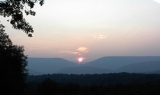
The northern terminus of the Allegheny FrontAllegheny Front
The Allegheny Front is the major southeast- or east-facing escarpment in the Allegheny Mountains in southern Pennsylvania, western Maryland, and eastern West Virginia, USA. The Allegheny Front delineates the Ridge-and-Valley Appalachians to its east from the Appalachian Plateau to its west...
in West Virginia lies in Mineral County, and contains the highest point in the county. Known as the Pinnacle it is 3104 feet (946.1 m) above sea level. From the abandoned fire tower you can see four states on a clear day, Pennsylvania
Pennsylvania
The Commonwealth of Pennsylvania is a U.S. state that is located in the Northeastern and Mid-Atlantic regions of the United States. The state borders Delaware and Maryland to the south, West Virginia to the southwest, Ohio to the west, New York and Ontario, Canada, to the north, and New Jersey to...
, Maryland
Maryland
Maryland is a U.S. state located in the Mid Atlantic region of the United States, bordering Virginia, West Virginia, and the District of Columbia to its south and west; Pennsylvania to its north; and Delaware to its east...
, West Virginia
West Virginia
West Virginia is a state in the Appalachian and Southeastern regions of the United States, bordered by Virginia to the southeast, Kentucky to the southwest, Ohio to the northwest, Pennsylvania to the northeast and Maryland to the east...
, and Virginia
Virginia
The Commonwealth of Virginia , is a U.S. state on the Atlantic Coast of the Southern United States. Virginia is nicknamed the "Old Dominion" and sometimes the "Mother of Presidents" after the eight U.S. presidents born there...
. The Allegheny Front is the largest mountain in the county; on the north end it is also known as Green Mountain. On top of the Allegheny Plateau
Allegheny Plateau
The Allegheny Plateau is a large dissected plateau area in western and central New York, northern and western Pennsylvania, northern and western West Virginia, and eastern Ohio...
is located the town of Elk Garden, West Virginia
Elk Garden, West Virginia
Elk Garden is a town in Mineral County, West Virginia, United States. It is part of the 'Cumberland, MD-WV Metropolitan Statistical Area'. The population was 217 at the 2000 census. Elk Garden was incorporated in 1890 by the Mineral County Circuit Court...
in the southwestern portion of the county. The Potomac River Valley lies to west and north of the mountain, and the New Creek
New Creek
New Creek is an stream in eastern West Virginia in the United States. It is the third major West Virginia tributary to the North Branch Potomac River. Via the Potomac, it is part of the watershed of Chesapeake Bay.-Course:...
Valley lies to the east.
Knobly Mountain
Knobly Mountain
Knobly Mountain is a part of the Ridge-and-Valley Appalachians, located east of New Creek Mountain in Mineral and Grant counties, West Virginia, in the United States....
lies between the New Creek and Patterson Creek valleys. It is the longest mountain in Mineral County stretching from the Grant County line in the south to the Potomac River in the north at Ridgeley, West Virginia
Ridgeley, West Virginia
Ridgeley is a town in Mineral County, West Virginia, United States, and part of the Cumberland Metropolitan Statistical Area. The population was 762 at the 2000 census but has fallen to 575 with the 2010 census....
.
To the east of the Patterson Creek Valley lie a series of low hills which form the eastern border of the county with Hampshire County
Hampshire County, West Virginia
Hampshire County is a county located in the U.S. state of West Virginia. As of 2010, the population was 23,964. Its county seat is Romney, West Virginia's oldest town . Hampshire County was created by the Virginia General Assembly on December 13, 1753, from parts of Frederick and Augusta counties ...
.
Rivers
- North Branch Potomac River is the largest river, though not actually in the county. It forms the northern border of the county and the state border with actual border being the low water mark on the south side. Jennings Randolph LakeJennings Randolph LakeJennings Randolph Lake is a reservoir of located on the North Branch Potomac River in Garrett County, Maryland and Mineral County, West Virginia. It is approximately eight miles upstream of Bloomington, Maryland, and approximately five miles north of Elk Garden, West Virginia.-Construction and...
is located on this stream.
- New CreekNew CreekNew Creek is an stream in eastern West Virginia in the United States. It is the third major West Virginia tributary to the North Branch Potomac River. Via the Potomac, it is part of the watershed of Chesapeake Bay.-Course:...
enters the North Branch Potomac River at KeyserKeyser, West VirginiaKeyser is a city in and the county seat of Mineral County, West Virginia, United States. It is part of the Cumberland, MD-WV Metropolitan Statistical Area. The population was 5,303 at the 2000 census.- History :...
with the headwaters starting at Dam Site 14 in Grant County, West VirginiaGrant County, West VirginiaAs of the census of 2000, there were 11,299 people, 4,591 households, and 3,273 families residing in the county. The population density was 24 people per square mile . There were 6,105 housing units at an average density of 13 per square mile...
. It is the water supply for the city of Keyser.
- Patterson CreekPatterson CreekPatterson Creek is a tributary of the North Branch Potomac River in West Virginia's Eastern Panhandle, in the United States. It enters the North Branch east of Cumberland, Maryland, with its headwaters located in Grant County, West Virginia...
enters the Potomac River east of Cumberland, MarylandCumberland, MarylandCumberland is a city in the far western, Appalachian portion of Maryland, United States. It is the county seat of Allegany County, and the primary city of the Cumberland, MD-WV Metropolitan Statistical Area. At the 2010 census, the city had a population of 20,859, and the metropolitan area had a...
with headwaters being in Grant County, West VirginiaGrant County, West VirginiaAs of the census of 2000, there were 11,299 people, 4,591 households, and 3,273 families residing in the county. The population density was 24 people per square mile . There were 6,105 housing units at an average density of 13 per square mile...
. The Patterson Creek watershed contains two-thirds of Mineral County.
Minerals
Mineral County is the easternmost West Virginia county with coalCoal
Coal is a combustible black or brownish-black sedimentary rock usually occurring in rock strata in layers or veins called coal beds or coal seams. The harder forms, such as anthracite coal, can be regarded as metamorphic rock because of later exposure to elevated temperature and pressure...
deposits. No coal is found east of the Allegheny Front
Allegheny Front
The Allegheny Front is the major southeast- or east-facing escarpment in the Allegheny Mountains in southern Pennsylvania, western Maryland, and eastern West Virginia, USA. The Allegheny Front delineates the Ridge-and-Valley Appalachians to its east from the Appalachian Plateau to its west...
, and coal mining is only found on top of the Allegheny Plateau
Allegheny Plateau
The Allegheny Plateau is a large dissected plateau area in western and central New York, northern and western Pennsylvania, northern and western West Virginia, and eastern Ohio...
.
Natural gas
Natural gas
Natural gas is a naturally occurring gas mixture consisting primarily of methane, typically with 0–20% higher hydrocarbons . It is found associated with other hydrocarbon fuel, in coal beds, as methane clathrates, and is an important fuel source and a major feedstock for fertilizers.Most natural...
is found east of the Allegheny Front as well as iron ore deposits. The county no longer produces iron
Iron
Iron is a chemical element with the symbol Fe and atomic number 26. It is a metal in the first transition series. It is the most common element forming the planet Earth as a whole, forming much of Earth's outer and inner core. It is the fourth most common element in the Earth's crust...
, but several abandoned iron furnaces
Bloomery
A bloomery is a type of furnace once widely used for smelting iron from its oxides. The bloomery was the earliest form of smelter capable of smelting iron. A bloomery's product is a porous mass of iron and slag called a bloom. This mix of slag and iron in the bloom is termed sponge iron, which...
from the 19th century still exist.
Demographics
As of the censusCensus
A census is the procedure of systematically acquiring and recording information about the members of a given population. It is a regularly occurring and official count of a particular population. The term is used mostly in connection with national population and housing censuses; other common...
of 2010, there were 28,212 people, 10,784 households, and 7,710 families residing in the county. The population density
Population density
Population density is a measurement of population per unit area or unit volume. It is frequently applied to living organisms, and particularly to humans...
was 83 people per square mile (32/km²). There were 12,094 housing units at an average density of 37 per square mile (14/km²). The racial makeup of the county was 96.16% White
Race (United States Census)
Race and ethnicity in the United States Census, as defined by the Federal Office of Management and Budget and the United States Census Bureau, are self-identification data items in which residents choose the race or races with which they most closely identify, and indicate whether or not they are...
, 2.55% Black
Race (United States Census)
Race and ethnicity in the United States Census, as defined by the Federal Office of Management and Budget and the United States Census Bureau, are self-identification data items in which residents choose the race or races with which they most closely identify, and indicate whether or not they are...
or African American
Race (United States Census)
Race and ethnicity in the United States Census, as defined by the Federal Office of Management and Budget and the United States Census Bureau, are self-identification data items in which residents choose the race or races with which they most closely identify, and indicate whether or not they are...
, 0.11% Native American
Race (United States Census)
Race and ethnicity in the United States Census, as defined by the Federal Office of Management and Budget and the United States Census Bureau, are self-identification data items in which residents choose the race or races with which they most closely identify, and indicate whether or not they are...
, 0.20% Asian
Race (United States Census)
Race and ethnicity in the United States Census, as defined by the Federal Office of Management and Budget and the United States Census Bureau, are self-identification data items in which residents choose the race or races with which they most closely identify, and indicate whether or not they are...
, 0.01% Pacific Islander
Race (United States Census)
Race and ethnicity in the United States Census, as defined by the Federal Office of Management and Budget and the United States Census Bureau, are self-identification data items in which residents choose the race or races with which they most closely identify, and indicate whether or not they are...
, 0.21% from other races
Race (United States Census)
Race and ethnicity in the United States Census, as defined by the Federal Office of Management and Budget and the United States Census Bureau, are self-identification data items in which residents choose the race or races with which they most closely identify, and indicate whether or not they are...
, and 0.76% from two or more races. 0.58% of the population were Hispanic
Race (United States Census)
Race and ethnicity in the United States Census, as defined by the Federal Office of Management and Budget and the United States Census Bureau, are self-identification data items in which residents choose the race or races with which they most closely identify, and indicate whether or not they are...
or Latino
Race (United States Census)
Race and ethnicity in the United States Census, as defined by the Federal Office of Management and Budget and the United States Census Bureau, are self-identification data items in which residents choose the race or races with which they most closely identify, and indicate whether or not they are...
of any race.
There were 10,784 households out of which 30.40% had children under the age of 18 living with them, 57.90% were married couples
Marriage
Marriage is a social union or legal contract between people that creates kinship. It is an institution in which interpersonal relationships, usually intimate and sexual, are acknowledged in a variety of ways, depending on the culture or subculture in which it is found...
living together, 9.70% had a female householder with no husband present, and 28.50% were non-families. 25.00% of all households were made up of individuals and 11.50% had someone living alone who was 65 years of age or older. The average household size was 2.46 and the average family size was 2.93.
In the county, the population was spread out with 23.40% under the age of 18, 8.60% from 18 to 24, 27.10% from 25 to 44, 25.90% from 45 to 64, and 15.10% who were 65 years of age or older. The median age was 39 years. For every 100 females there were 95.80 males. For every 100 females age 18 and over, there were 93.00 males.
The median income for a household in the county was $31,149, and the median income for a family was $37,866. Males had a median income of $32,337 versus $20,090 for females. The per capita income
Per capita income
Per capita income or income per person is a measure of mean income within an economic aggregate, such as a country or city. It is calculated by taking a measure of all sources of income in the aggregate and dividing it by the total population...
for the county was $15,384. About 11.50% of families and 14.70% of the population were below the poverty line, including 21.10% of those under age 18 and 11.60% of those age 65 or over.
Incorporated
|
Ridgeley, West Virginia Ridgeley is a town in Mineral County, West Virginia, United States, and part of the Cumberland Metropolitan Statistical Area. The population was 762 at the 2000 census but has fallen to 575 with the 2010 census.... Carpendale, West Virginia Carpendale is a town in Mineral County, West Virginia, United States, and part of the 'Cumberland, MD-WV Metropolitan Statistical Area'. The population was 954 at the 2000 census. Carpendale was incorporated on January 2, 1990 by the Circuit Court. The town is a combination of three subdivisions... |
Elk Garden, West Virginia Elk Garden is a town in Mineral County, West Virginia, United States. It is part of the 'Cumberland, MD-WV Metropolitan Statistical Area'. The population was 217 at the 2000 census. Elk Garden was incorporated in 1890 by the Mineral County Circuit Court... |
Unincorporated
|
Claysville, West Virginia Claysville is an unincorporated community in Mineral County, West Virginia located at the intersection of West Virginia Route 93 and U.S. Route 50. It is part of the Cumberland, MD-WV Metropolitan Statistical Area.-Historic sites:*Claysville Church... Cross, West Virginia Cross is an unincorporated community atop the Allegheny Plateau in the western part of Mineral County, West Virginia, United States. It is part of the Cumberland, MD-WV Metropolitan Statistical Area. Cross is located just east of Jennings Randolph Lake on West Virginia Route 46.... Dans Run, West Virginia Dans Run is an unincorporated community in Mineral County, West Virginia. It is part of the Cumberland, MD-WV Metropolitan Statistical Area. Dans Run is located along the former Baltimore and Ohio Railroad at the confluence of Dans Run and the North Branch Potomac River.... Emoryville, West Virginia Emoryville is an unincorporated community in Mineral County, West Virginia, USA. It is part of the Cumberland, MD-WV Metropolitan Statistical Area. According to the Geographic Names Information System, Emoryville has also been known throughout its history as Emery, Emory, Switch Back, and Switch... Foote Station, West Virginia Foote Station was a community in Mineral County, West Virginia, United States, located on Horseshoe Run Road about one mile from Georges Run Road. The farm house owned by Hampshire County, Virginia Delegate James Allen still stands at Foote Station. Before modern transportation was available,... Forge Hill, West Virginia Forge Hill is an unincorporated community in Mineral County, West Virginia, USA. It is part of the Cumberland, MD-WV Metropolitan Statistical Area. Forge Hill lies to the northeast of the City of Keyser on a hill of the same name overlooking the North Branch Potomac River.... Fort Ashby, West Virginia Fort Ashby is an census-designated place in Mineral County, West Virginia along Patterson Creek. It is part of the 'Cumberland, MD-WV Metropolitan Statistical Area'. The population was 1,380 at the 2010 census... Fountain, West Virginia Fountain is an unincorporated community in Mineral County, West Virginia, United States, located at the intersection of West Virginia Route 46 and Knobley Road.- References :... |
Hampshire, West Virginia Hampshire is an unincorporated town on the North Branch Potomac River in Mineral County, West Virginia. It is part of the Cumberland, MD-WV Metropolitan Statistical Area. It is located to the south of Bloomington and to the west of Beryl.... Hartmansville, West Virginia Hartmansville is an unincorporated community in Mineral County, West Virginia, USA. It is part of the Cumberland, MD-WV Metropolitan Statistical Area. Hartmansville lies along the Northwestern Turnpike near the Grant County line.... Headsville, West Virginia Headsville is an unincorporated community in Mineral County, West Virginia, USA. It is part of the Cumberland, MD-WV Metropolitan Statistical Area. It lies between U.S. Route 50 and West Virginia Route 46 alongside Pattersons Creek.... Keymont, West Virginia Keymont is an unincorporated community in Mineral County, West Virginia, United States, located between Keyser and Piedmont on State Route 46.- References :... Laurel Dale, West Virginia Laurel Dale is an unincorporated community on New Creek in Mineral County, West Virginia, United States. Laurel Dale was established in 1878. The community is located along West Virginia Route 93.... Limestone, West Virginia Limestone is an unincorporated community in Marshall County, West Virginia, USA.... Markwood, West Virginia Markwood is an unincorporated community located along U.S. Route 50/U.S. Route 220 in the Mill Creek Valley west of Burlington in Mineral County, West Virginia. The ZIP code for Markwood is 26710.- Historic sites :... |
Nethkin, West Virginia Nethkin is an unincorporated community in Mineral County, West Virginia, USA. Nethkin lies to the east of Elk Garden.... New Creek, West Virginia The town of New Creek is an unincorporated community in Mineral County, West Virginia. It lies near the intersection of New Creek and U.S. Route 50, and is south of Keyser. The ZIP code for New Creek is 26743.... Oakmont, West Virginia Oakmont is an unincorporated community in Mineral County, West Virginia, USA. Oakmont is located on Abram Creek.... Patterson Creek, West Virginia Patterson Creek is an unincorporated community in Mineral County, West Virginia, USA. It lies at the northeastern end of the county, and is named for Patterson Creek which empties into the North Branch Potomac River here.... Reeses Mill, West Virginia Reeses Mill is an unincorporated community on Patterson Creek in Mineral County, West Virginia, USA. Reeses Mill is home to Camp Minco.... Ridgeley, West Virginia Ridgeley is a town in Mineral County, West Virginia, United States, and part of the Cumberland Metropolitan Statistical Area. The population was 762 at the 2000 census but has fallen to 575 with the 2010 census.... Ridgeville, West Virginia Ridgeville is an unincorporated community in Mineral County, West Virginia, United States. It lies along U.S. Routes 50 and 220 in the Mill Creek Valley, west of Markwood.The zip code for Ridgeville is 26710... |
Rocket Center, West Virginia Rocket Center, West Virginia is the site of a government installation known as Allegany Ballistics Laboratory, part of the Naval Sea Systems Command which is currently operated by Alliant Techsystems. Rocket Center shares a ZIP Code with Keyser but is located north along the North Branch Potomac... Russelldale, West Virginia Russelldale is an unincorporated community in Mineral County, West Virginia, USA. Russelldale is located on Patterson Creek Mountain to the east of Patterson Creek.... Short Gap, West Virginia Short Gap is an unincorporated community in Mineral County, West Virginia located at the intersection of West Virginia Route 956 and West Virginia Route 28. The community is home to Frankfort High School, as well as Frankfort Middle School, which serve the northern part of Mineral County including... Skyline, West Virginia Skyline is an unincorporated community in Mineral County, West Virginia, located at the intersection of U.S. Route 50 and West Virginia Route 42 atop the Allegheny Front. Skyline is best known for its view of Saddle Mountain.... Sulphur City, West Virginia Sulphur City is an unincorporated community in Mineral County, West Virginia, USA. Sulphur City is located along West Virginia Route 42.... Wagoner, West Virginia Wagoner is an unincorporated community in Mineral County, West Virginia. Wagoner lies along the North Branch Potomac River at Round Bottom Hollow between the communities of Dans Run and Green Spring. Wagoner is located at the northern terminus of West Virginia Secondary Route 15/2.... Wiley Ford, West Virginia Wiley Ford is a census-designated place in Mineral County, West Virginia, United States and part of the 'Cumberland, MD-WV Metropolitan Statistical Area'... |
Districts
|
|
|
Transportation
- Greater Cumberland Regional AirportGreater Cumberland Regional AirportGreater Cumberland Regional Airport is a public airport located in the town of Wiley Ford in Mineral County, West Virginia. It is two miles south of the larger city of Cumberland in Allegany County, Maryland...
- Rail Transportation
- CSX lines run along the Potomac RiverPotomac RiverThe Potomac River flows into the Chesapeake Bay, located along the mid-Atlantic coast of the United States. The river is approximately long, with a drainage area of about 14,700 square miles...
on the northern border of the county. - AmtrakAmtrakThe National Railroad Passenger Corporation, doing business as Amtrak , is a government-owned corporation that was organized on May 1, 1971, to provide intercity passenger train service in the United States. "Amtrak" is a portmanteau of the words "America" and "track". It is headquartered at Union...
service is available in Cumberland, MarylandCumberland, MarylandCumberland is a city in the far western, Appalachian portion of Maryland, United States. It is the county seat of Allegany County, and the primary city of the Cumberland, MD-WV Metropolitan Statistical Area. At the 2010 census, the city had a population of 20,859, and the metropolitan area had a...
, just across from Ridgeley, West VirginiaRidgeley, West VirginiaRidgeley is a town in Mineral County, West Virginia, United States, and part of the Cumberland Metropolitan Statistical Area. The population was 762 at the 2000 census but has fallen to 575 with the 2010 census....
. KeyserKeyser, West VirginiaKeyser is a city in and the county seat of Mineral County, West Virginia, United States. It is part of the Cumberland, MD-WV Metropolitan Statistical Area. The population was 5,303 at the 2000 census.- History :...
's railroad station closed in the 1980s.
- CSX lines run along the Potomac River
Larenim Park
Owned by Mineral County, the park size is 365 acres (1.5 km²). Includes two pavilions with 10 tables, an amphitheater with seating capacitySeating capacity
Seating capacity refers to the number of people who can be seated in a specific space, both in terms of the physical space available, and in terms of limitations set by law. Seating capacity can be used in the description of anything ranging from an automobile that seats two to a stadium that seats...
of 600. One Little League field and one softball field. Fishing Areas; two flood control dams stocked by WVDNR, 5 acres (20,234.3 m²) and 2.5 acres (10,117.2 m²). All 365 acres (1.5 km²) are open to public hunting by permit. Approximately 5 miles of trails. An arboretum is under construction at Larenim to include a Shale Barrens Conservancy. Larenim Park is also home to the local theater group, McNeill's Rangers.
Barnum Whitewater Area
Owned by Mineral County with size of approximately 40 acres (161,874.4 m²). Includes four miles (6 km) of rail/trail. This area has approximately 1 miles (1.6 km) of river frontage on the North Branch of the Potomac RiverPotomac River
The Potomac River flows into the Chesapeake Bay, located along the mid-Atlantic coast of the United States. The river is approximately long, with a drainage area of about 14,700 square miles...
below Jennings Randolph Lake, along the old Western Maryland Railway
Western Maryland Railway
The Western Maryland Railway was an American Class I railroad which operated in Maryland, West Virginia, and Pennsylvania. It was primarily a coal hauling and freight railroad, with a small passenger train operation. The WM became part of the Chessie System in 1973 and ceased operating its lines...
right-of-way. It is one of the best trout streams in West Virginia and also provides seven miles (11 km) of whitewater rafting and canoeing for the entire family to enjoy. Public hunting permitted on surrounding state lands.
MINCO Park
Owned by the Mineral County Board of Education, MINCO Park's size is 13.5 acres (54,632.6 m²). Its facilities include two pavilions with 50 picnic tables, nine cabins, a dining field, a chapel, meeting room, and bath/shower facilities.Van Myra Campground
Owned by the State of West Virginia and leased by Mineral County, the campground area is 10 acres (40,468.6 m²). Three picnic tables, four mini-pavilions, and picnic area only comprise this facility.Dam Site #21
Owned by Mineral County, 178 acre (0.72034108 km²), with no facilities. Fishing 10 acres (40,468.6 m²) flood control dam.Jennings Randolph Lake
Jennings Randolph LakeJennings Randolph Lake
Jennings Randolph Lake is a reservoir of located on the North Branch Potomac River in Garrett County, Maryland and Mineral County, West Virginia. It is approximately eight miles upstream of Bloomington, Maryland, and approximately five miles north of Elk Garden, West Virginia.-Construction and...
, named for Senator Jennings Randolph
Jennings Randolph
Jennings Randolph was an American politician from West Virginia. He was a member of the Democratic Party and was the last surviving member of the United States Congress to have served during the first 100 days of Franklin D. Roosevelt's administration.-Early life and career:Randolph was born in...
, near Elk Garden offers extensive recreational opportunity with its 952 acres (3.9 km²) and more than 13 miles (20.9 km) of shoreline. Howell Run Picnic Area overlooks the lake and contains 40 picnic sites, two pavilions, a playground and vault toilets. The Howell Run Boat Launch consists of a two lane concrete ramp. the Robert W. Craig Campground is situated on a high ridge overlooking the dam site and features 87 campsites, potable water, hot showers, vault toilets and a playground. A 3/4 mile long interpretive trail has been developed in the area. The West Virginia Overlook area contains a two tier Visitor Center. Waffle Rock, a unique natural rock formation, can also be viewed from the Overlook.
Golf courses – public
Polish Pines – Privately owned, nine holes, Club HouseMill Creek – Privately owned, nine holes, Club House
Swimming pools – public
City of Keyser – One pool open to publicCity of Piedmont – One pool open to public
See also
- Allegheny Wildlife Management AreaAllegheny Wildlife Management AreaThe Allegheny Wildlife Management Area is located on on two separate tracts of mixed oak-hickory woodlands in western Mineral County along the Allegheny Front. The large land tract of is accessible via Pinnacle Road and Pine Swamp Road four miles southwest of Keyser...
- National Register of Historic Places listings in Mineral County, West VirginiaNational Register of Historic Places listings in Mineral County, West VirginiaThis is a list of the National Register of Historic Places listings in Mineral County, West Virginia.This is intended to be a complete list of the properties and districts on the National Register of Historic Places in Mineral County, West Virginia, United States...