

Matagorda Bay
Encyclopedia
Matagorda Bay is a large estuary
bay on the Texas
coast, lying in Calhoun
and Matagorda counties and located approximately 80 miles (128.7 km) northeast of Corpus Christi
, 143 miles (230.1 km) southeast of San Antonio
, 108 miles (173.8 km) southwest of Houston
, and 167 miles (268.8 km) southeast of Austin
. It is separated from the Gulf of Mexico
by Matagorda Peninsula
and serves as the mouth of numerous streams, most notably the Lavaca
and Colorado River
s. The major Texas seaport of Port Lavaca
is located on the system's northwestern extension of Lavaca Bay
. The city of Palacios
is found on northeastern extension of Tres Palacios Bay
, and Port O'Connor
is located on the southwestern tip of the main bay's shore. The ghost town
of Indianola
, which was a major port before it was destroyed by two hurricanes in the late 19th Century, is also found on the bay.
The bay's shore, especially near the Colorado River delta, provides a habitat for a wide variety of wildlife. The wildlife serves as a basis for the birding and fishing tourism, and is an essential component of the production of seafood, specifically shrimp
and blue crab, which are the specialties of the area. The fertile land near the bay is ideal for farming, especially for the propagation of rice.
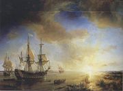
's map from the late 1510s appears to be the first documentation of the bay. In 1685, French explorer René-Robert Cavelier, Sieur de La Salle
established the colony of Fort St. Louis along the bay's shore after missing the entrance to the Mississippi River
. Half of the colonists were killed by disease, and the other half, save for five children, were killed by Karankawa Indians. The Indians kept the children until they were rescued by the Spanish during the Alonso De León
and Domingo Terán de los Ríos
expeditions near the bay. A fort, Presidio La Bahia
, and Mission Nuestra Señora del Espíritu Santo de Zúñiga
was built by the Spanish on the site of Fort Saint Louis in 1722.
 The port of Linnville was established on Matagorda Bay in 1831, and served as a main port for the Republic of Texas
. The Great Comanche Raid of 1840
destroyed the town and forced the inhabitants to flee to the nearby Labbacca, which would later become known as Port Lavaca. Lavaca or la vaca, Spanish for cow, was founded in the wake of the Comanche Raid in 1841. It replaced Linnville as the main port on Matagorda Bay. However, the sandbar-heavy Lavaca Bay caused some navigational problems for ships. As a result, Lavaca was surpassed by Indianola as the main port on Matagorda Bay in the 1850s, even though the sandbars were dredged later in the decade. Indianola had been founded in 1846 as a landing place for German immigrants. It rapidly developed into a major seaport, and became the second largest in the state (after Galveston
) by the 1860s. The two ports, and strategic control of Matagorda Bay in particular, became important during the American Civil War
. Control of the bay shifted between the Union
and Confederate
forces several times. The Union presence in the area ended in June 1864. After the war, Indianola continued its growth, and had a population of 5,000 in the 1870s. A hurricane in 1875 caused massive damage to the city. It was rebuilt on a smaller scale shortly thereafter, but a second and more intense hurricane made landfall in 1886 (the fifth most intense in U.S. history), causing even greater destruction. The following year, Indianola was completely abandoned. Although Lavaca was also significantly affected by the hurricanes, it survived as a port, and again became the largest on the bay. It continues to hold this distinction today. It was renamed Port Lavaca in the late 19th Century. Palacios was established around 1901, and Port O'Connor was founded on the bay in 1909.
Before 1900, East Matagorda Bay
was a free flowing extension, which formed the eastern segment of Matagorda Bay. Flooding and drainage issues caused by the Colorado River
, which at the time emptied into the bay, precipitated a massive dredging campaign in the 1920s. Flooding was not remedied by the dredging, as sediment deposited in the bay and formed a tidal marsh
that grew at 500 acres (2 km²) a year. As a result, local citizens decided to change the course of the Colorado River in 1934 to bypass Matagorda Bay into the Gulf of Mexico
, the dredging from this project causing the split and forming the isolated East Matagorda Bay. In 1992, the river was diverted back to the bay.
s and tidal marshes. Extended coastal prairie
s supporting native grasses, can be found throughout the area.
On average, the Matagorda Bay system is 2 metres (6.6 ft) deep, and covers approximately 1093 km2. It is the third largest estuarine system in Texas behind Galveston Bay
and Laguna Madre
. The main extensions include: Lavaca Bay
, which extends westward to the mouth of the Lavaca River
; Tres Palacios Bay
, which extends northeast to the mouth of the Tres Palacios River and East Matagorda Bay
, which is nearly isolated from the system by the Colorado River
delta. Other inlets include Turtle Bay, Carancahua Bay, Keller Bay, and Cox Bay.
Every second, approximately 150 cubic metre of water flows into the bay. The exchange with the Gulf of Mexico occurs at Pass Cavallo
, Matagorda Ship Channel, Greens Bayou, the Colorado River Delta Complex and Brown Cedar Cut. As a result of the seawater exchange, the bay's salinity is 19 parts per thousand (ppt), which is lower than the seawater average of 35 ppt. This difference is caused by the large number of creeks and rivers that flow into the system, largely from the drainage basins of the Colorado and Lavaca Rivers.
's Annual Christmas bird count from 2000 to 2002. Other fauna located along the bay include Bobcat
s, White-tailed deer
, River otters, Texas horned lizard
s, Reddish egret
, White-tailed Hawk
, Peregrine Falcon
, the piping plover
and alligator
s.
According to Texas Parks and Wildlife, the following fish have been caught in the bay: Striped Bass
, Gafftopsail catfish
, Atlantic croaker, Black drum
, Red drum
, Southern flounder
, Barred grunt
, Hake
, Skipjack herring, Crevalle jack
, Ladyfish, Gulf menhaden
, Pigfish
, Smooth puffer
, Sand seatrout, Spotted seatrout
, Blacktip shark
, Gray snapper, Southern stingray
, Gulf toadfish
, Tripletail
. The bay serves as a nursery for finfish, shrimp and crabs.
 The Matagorda Bay system is a renowned fishing location in the region, due to its status as a nutrient-rich estuary. The mainstays of the settlements on the bay include seafood processing, manufacturing, agriculture and tourism. Commercial fishermen specialize in oyster, blue crab, and shrimp. Port Lavaca is the national leader in the processing of shrimp, and passed four million tons of seafood through its port in 1985 alone. Palacios houses the largest blue crab processing plant in the United States, and is home to the only individually quick frozen shrimp plant in Texas. Recreational fishing
also contributes to the local economies, via tourism. Tourists often flock to the Port Lavaca State Fishing Pier, which is a major point of interest for fishermen. Other activities for visitors include hunting, oyster roasts, beach combing and birding.
Several manufacturing complexes have been erected along the bay, which employ local residents. The Aluminum Company of America, Union Carbide
, Du Pont, and Formosa Plastics
all established plants in Point Comfort
. The South Texas Nuclear Generating Station
is found in nearby Bay City
. Petroleum
and Natural Gas
were discovered in the bay in the 1930s. Maize
, cotton, soybeans, turf, and most notably rice grow well around the bay, especially in the fertile delta region.
Estuary
An estuary is a partly enclosed coastal body of water with one or more rivers or streams flowing into it, and with a free connection to the open sea....
bay on the Texas
Texas
Texas is the second largest U.S. state by both area and population, and the largest state by area in the contiguous United States.The name, based on the Caddo word "Tejas" meaning "friends" or "allies", was applied by the Spanish to the Caddo themselves and to the region of their settlement in...
coast, lying in Calhoun
Calhoun County, Texas
Calhoun County is a county located in the U.S. state of Texas. In 2000, the population was 20,647. Its county seat is Port Lavaca. It is a part of the Victoria Metropolitan Statistical Area...
and Matagorda counties and located approximately 80 miles (128.7 km) northeast of Corpus Christi
Corpus Christi, Texas
Corpus Christi is a coastal city in the South Texas region of the U.S. state of Texas. The county seat of Nueces County, it also extends into Aransas, Kleberg, and San Patricio counties. The MSA population in 2008 was 416,376. The population was 305,215 at the 2010 census making it the...
, 143 miles (230.1 km) southeast of San Antonio
San Antonio, Texas
San Antonio is the seventh-largest city in the United States of America and the second-largest city within the state of Texas, with a population of 1.33 million. Located in the American Southwest and the south–central part of Texas, the city serves as the seat of Bexar County. In 2011,...
, 108 miles (173.8 km) southwest of Houston
Houston, Texas
Houston is the fourth-largest city in the United States, and the largest city in the state of Texas. According to the 2010 U.S. Census, the city had a population of 2.1 million people within an area of . Houston is the seat of Harris County and the economic center of , which is the ...
, and 167 miles (268.8 km) southeast of Austin
Austin, Texas
Austin is the capital city of the U.S. state of :Texas and the seat of Travis County. Located in Central Texas on the eastern edge of the American Southwest, it is the fourth-largest city in Texas and the 14th most populous city in the United States. It was the third-fastest-growing large city in...
. It is separated from the Gulf of Mexico
Gulf of Mexico
The Gulf of Mexico is a partially landlocked ocean basin largely surrounded by the North American continent and the island of Cuba. It is bounded on the northeast, north and northwest by the Gulf Coast of the United States, on the southwest and south by Mexico, and on the southeast by Cuba. In...
by Matagorda Peninsula
Matagorda Peninsula
The Matagorda Peninsula is a narrow spit of land on the southeastern coast of Texas in the United States.The peninsula is in Matagorda County, Texas. It lies between Matagorda Bay, an estuary, and the Gulf of Mexico, and water is exchanged between the two through five main tidal...
and serves as the mouth of numerous streams, most notably the Lavaca
Lavaca River
The Lavaca River is a river in the U.S. state of Texas. It begins in the northeastern part of Gonzales County, and travels generally southeast for 115 miles until it empties into Lavaca Bay, which is a component of Matagorda Bay.-History:...
and Colorado River
Colorado River (Texas)
The Colorado River is a river that runs through the U.S. state of Texas; it should not be confused with the much longer Colorado River which flows from Colorado into the Gulf of California....
s. The major Texas seaport of Port Lavaca
Port of Port Lavaca – Point Comfort
The Port of Port Lavaca - Point Comfort, or simply the Port of Port Lavaca, is a seaport along the shores of Matagorda Bay, Texas . It includes terminals at both Port Lavaca and Point Comfort, Texas. These terminals are connected to the Gulf of Mexico through the Matagorda Ship Channel, a conduit...
is located on the system's northwestern extension of Lavaca Bay
Lavaca Bay
Lavaca Bay is a northwestern extension of the Matagorda Bay system found mostly in Calhoun County, Texas, United States. The ports of Port Lavaca and Point Comfort have been established on the bay, and are the main areas of human habitation...
. The city of Palacios
Palacios, Texas
-Demographics:As of the census of 2000, there were 5,153 people, 1,661 households, and 1,244 families residing in the city. The population density was 1,021.4 people per square mile . There were 1,976 housing units at an average density of 391.7 per square mile...
is found on northeastern extension of Tres Palacios Bay
Tres Palacios Bay
Tres Palacios Bay is a northeastern extension of Matagorda Bay on the Texas coast in Matagorda County. It is fed by the Tres Palacios River. The city of Palacios is located on its shores...
, and Port O'Connor
Port O'Connor, Texas
Port O'Connor is an unincorporated village in Calhoun County, Texas, United States, on the coastline between Galveston and Corpus Christi. The ZIP Code Tabulation Area including Port O'Connor had a population of 1,078 at the 2000 census...
is located on the southwestern tip of the main bay's shore. The ghost town
Ghost town
A ghost town is an abandoned town or city. A town often becomes a ghost town because the economic activity that supported it has failed, or due to natural or human-caused disasters such as floods, government actions, uncontrolled lawlessness, war, or nuclear disasters...
of Indianola
Indianola, Texas
Indianola is a ghost town located on Matagorda Bay in Calhoun County, Texas, United States. The community, once the county seat of Calhoun County, is a part of the Victoria, Texas, Metropolitan Statistical Area. In 1875, the city had a population of 5,000, but on September 15 of that year, a...
, which was a major port before it was destroyed by two hurricanes in the late 19th Century, is also found on the bay.
The bay's shore, especially near the Colorado River delta, provides a habitat for a wide variety of wildlife. The wildlife serves as a basis for the birding and fishing tourism, and is an essential component of the production of seafood, specifically shrimp
Shrimp
Shrimp are swimming, decapod crustaceans classified in the infraorder Caridea, found widely around the world in both fresh and salt water. Adult shrimp are filter feeding benthic animals living close to the bottom. They can live in schools and can swim rapidly backwards. Shrimp are an important...
and blue crab, which are the specialties of the area. The fertile land near the bay is ideal for farming, especially for the propagation of rice.
History
Early European records suggest that the bay and the surrounding area went by the names Espíritu Santo and Costa y Bahía de San Bernardo. Spanish explorer Alonso Álvarez de PinedaAlonso Álvarez de Pineda
Alonso Álvarez de Pineda was a Spanish explorer and cartographer. His map marks the first document in Texas history.-Expedition:The Spanish thought there must be a sea lane from the Gulf of Mexico to Asia...
's map from the late 1510s appears to be the first documentation of the bay. In 1685, French explorer René-Robert Cavelier, Sieur de La Salle
René-Robert Cavelier, Sieur de La Salle
René-Robert Cavelier, Sieur de La Salle, or Robert de LaSalle was a French explorer. He explored the Great Lakes region of the United States and Canada, the Mississippi River, and the Gulf of Mexico...
established the colony of Fort St. Louis along the bay's shore after missing the entrance to the Mississippi River
Mississippi River
The Mississippi River is the largest river system in North America. Flowing entirely in the United States, this river rises in western Minnesota and meanders slowly southwards for to the Mississippi River Delta at the Gulf of Mexico. With its many tributaries, the Mississippi's watershed drains...
. Half of the colonists were killed by disease, and the other half, save for five children, were killed by Karankawa Indians. The Indians kept the children until they were rescued by the Spanish during the Alonso De León
Alonso De León
Alonso de León wasexplorer and governor, who led several expeditions into the area that is now northeastern Mexico and southern Texas.-Early life:...
and Domingo Terán de los Ríos
Domingo Terán de los Ríos
Domingo Terán de los Ríos served as the first governor of Spanish Texas from 1691 to 1692.-Previous service:Terán served the Spanish crown in Peru for two decades. He came to Mexico in 1681, and was governor of the province of Sonora y Sinaloa for approximately five years...
expeditions near the bay. A fort, Presidio La Bahia
Presidio La Bahía
The Presidio Nuestra Señora de Loreto de la Bahía, known more commonly as Presidio La Bahia, or simply La Bahia is a fort constructed by the Spanish Army that became the nucleus of the city of Goliad, Texas, United States. Originally founded in 1721 on the ruins of the failed French Fort Saint...
, and Mission Nuestra Señora del Espíritu Santo de Zúñiga
Mission Nuestra Señora del Espíritu Santo de Zúñiga
Mission Nuestra Señora del Espíritu Santo de Zúñigaalso known as Aranama Mission orMission La Bahiawas a Roman Catholic mission established by Spain in Victoria County, Texas in northern New Spain in 1722 to convert local Native Karankawa Indians to Christianity...
was built by the Spanish on the site of Fort Saint Louis in 1722.
Republic of Texas
The Republic of Texas was an independent nation in North America, bordering the United States and Mexico, that existed from 1836 to 1846.Formed as a break-away republic from Mexico by the Texas Revolution, the state claimed borders that encompassed an area that included all of the present U.S...
. The Great Comanche Raid of 1840
Great Raid of 1840
The Great Raid of 1840 was the largest raid ever mounted by Native Americans on white cities in what is now the United States. It followed the Council House Fight, in which Republic of Texas officials attempted to capture and take prisoner 33 Comanche chiefs who had come to negotiate a peace...
destroyed the town and forced the inhabitants to flee to the nearby Labbacca, which would later become known as Port Lavaca. Lavaca or la vaca, Spanish for cow, was founded in the wake of the Comanche Raid in 1841. It replaced Linnville as the main port on Matagorda Bay. However, the sandbar-heavy Lavaca Bay caused some navigational problems for ships. As a result, Lavaca was surpassed by Indianola as the main port on Matagorda Bay in the 1850s, even though the sandbars were dredged later in the decade. Indianola had been founded in 1846 as a landing place for German immigrants. It rapidly developed into a major seaport, and became the second largest in the state (after Galveston
Galveston, Texas
Galveston is a coastal city located on Galveston Island in the U.S. state of Texas. , the city had a total population of 47,743 within an area of...
) by the 1860s. The two ports, and strategic control of Matagorda Bay in particular, became important during the American Civil War
American Civil War
The American Civil War was a civil war fought in the United States of America. In response to the election of Abraham Lincoln as President of the United States, 11 southern slave states declared their secession from the United States and formed the Confederate States of America ; the other 25...
. Control of the bay shifted between the Union
Union Army
The Union Army was the land force that fought for the Union during the American Civil War. It was also known as the Federal Army, the U.S. Army, the Northern Army and the National Army...
and Confederate
Confederate States of America
The Confederate States of America was a government set up from 1861 to 1865 by 11 Southern slave states of the United States of America that had declared their secession from the U.S...
forces several times. The Union presence in the area ended in June 1864. After the war, Indianola continued its growth, and had a population of 5,000 in the 1870s. A hurricane in 1875 caused massive damage to the city. It was rebuilt on a smaller scale shortly thereafter, but a second and more intense hurricane made landfall in 1886 (the fifth most intense in U.S. history), causing even greater destruction. The following year, Indianola was completely abandoned. Although Lavaca was also significantly affected by the hurricanes, it survived as a port, and again became the largest on the bay. It continues to hold this distinction today. It was renamed Port Lavaca in the late 19th Century. Palacios was established around 1901, and Port O'Connor was founded on the bay in 1909.
Before 1900, East Matagorda Bay
East Matagorda Bay
East Matagorda Bay, off Matagorda County on the Texas coast , is enclosed by the Matagorda Peninsula and the tidal flats at the mouth of the Colorado River. Its only true opening to the Gulf of Mexico is through Brown Cedar Cut, near the north end of the peninsula.It is part of the Matagorda Bay...
was a free flowing extension, which formed the eastern segment of Matagorda Bay. Flooding and drainage issues caused by the Colorado River
Colorado River (Texas)
The Colorado River is a river that runs through the U.S. state of Texas; it should not be confused with the much longer Colorado River which flows from Colorado into the Gulf of California....
, which at the time emptied into the bay, precipitated a massive dredging campaign in the 1920s. Flooding was not remedied by the dredging, as sediment deposited in the bay and formed a tidal marsh
Tidal marsh
A tidal marsh is a type of marsh that is found along coasts and estuaries of which the flooding characteristics are determined by the tidal movement of the adjacent estuary, sea or ocean . According to the salinity of the flooding water, freshwater, brackish and saline tidal marshes are...
that grew at 500 acres (2 km²) a year. As a result, local citizens decided to change the course of the Colorado River in 1934 to bypass Matagorda Bay into the Gulf of Mexico
Gulf of Mexico
The Gulf of Mexico is a partially landlocked ocean basin largely surrounded by the North American continent and the island of Cuba. It is bounded on the northeast, north and northwest by the Gulf Coast of the United States, on the southwest and south by Mexico, and on the southeast by Cuba. In...
, the dredging from this project causing the split and forming the isolated East Matagorda Bay. In 1992, the river was diverted back to the bay.
Features
The shoreline of the bay is included in the Texas Coastal Plain. At the eastern end, near the Colorado River delta, there is a swampy terrain, with an abundance of wetlandWetland
A wetland is an area of land whose soil is saturated with water either permanently or seasonally. Wetlands are categorised by their characteristic vegetation, which is adapted to these unique soil conditions....
s and tidal marshes. Extended coastal prairie
Prairie
Prairies are considered part of the temperate grasslands, savannas, and shrublands biome by ecologists, based on similar temperate climates, moderate rainfall, and grasses, herbs, and shrubs, rather than trees, as the dominant vegetation type...
s supporting native grasses, can be found throughout the area.
On average, the Matagorda Bay system is 2 metres (6.6 ft) deep, and covers approximately 1093 km2. It is the third largest estuarine system in Texas behind Galveston Bay
Galveston Bay
Galveston Bay is a large estuary located along the upper coast of Texas in the United States. It is connected to the Gulf of Mexico and is surrounded by sub-tropic marshes and prairies on the mainland. The water in the Bay is a complex mixture of sea water and fresh water which supports a wide...
and Laguna Madre
Laguna Madre
The Laguna Madre extends well into Mexico, to the mouth of the Río Soto la Marina in the state of Tamaulipas. It is separated from the Gulf of Mexico on the east by a number of barrier islands, including Barra Los Americanos, Barra Jesús María, and Barra Soto la Marina, and is bounded on the west...
. The main extensions include: Lavaca Bay
Lavaca Bay
Lavaca Bay is a northwestern extension of the Matagorda Bay system found mostly in Calhoun County, Texas, United States. The ports of Port Lavaca and Point Comfort have been established on the bay, and are the main areas of human habitation...
, which extends westward to the mouth of the Lavaca River
Lavaca River
The Lavaca River is a river in the U.S. state of Texas. It begins in the northeastern part of Gonzales County, and travels generally southeast for 115 miles until it empties into Lavaca Bay, which is a component of Matagorda Bay.-History:...
; Tres Palacios Bay
Tres Palacios Bay
Tres Palacios Bay is a northeastern extension of Matagorda Bay on the Texas coast in Matagorda County. It is fed by the Tres Palacios River. The city of Palacios is located on its shores...
, which extends northeast to the mouth of the Tres Palacios River and East Matagorda Bay
East Matagorda Bay
East Matagorda Bay, off Matagorda County on the Texas coast , is enclosed by the Matagorda Peninsula and the tidal flats at the mouth of the Colorado River. Its only true opening to the Gulf of Mexico is through Brown Cedar Cut, near the north end of the peninsula.It is part of the Matagorda Bay...
, which is nearly isolated from the system by the Colorado River
Colorado River (Texas)
The Colorado River is a river that runs through the U.S. state of Texas; it should not be confused with the much longer Colorado River which flows from Colorado into the Gulf of California....
delta. Other inlets include Turtle Bay, Carancahua Bay, Keller Bay, and Cox Bay.
Every second, approximately 150 cubic metre of water flows into the bay. The exchange with the Gulf of Mexico occurs at Pass Cavallo
Pass Cavallo (Texas)
Pass Cavallo, alternately known as Cavallo Pass, is one of five natural water inlets which separate the Gulf of Mexico and Matagorda Bay, in the U.S. state of Texas. René-Robert Cavelier, Sieur de La Salle came ashore in Texas at this point. Matagorda Island Lighthouse was originally built on...
, Matagorda Ship Channel, Greens Bayou, the Colorado River Delta Complex and Brown Cedar Cut. As a result of the seawater exchange, the bay's salinity is 19 parts per thousand (ppt), which is lower than the seawater average of 35 ppt. This difference is caused by the large number of creeks and rivers that flow into the system, largely from the drainage basins of the Colorado and Lavaca Rivers.
Ecosystem
A wide variety of wildlife can be found in and around Matagorda Bay. The Mad Island-Oyster Lake conservation area, located on the eastern shore of Matagorda Bay, is a habitat for over 300 species of birds including songbirds, shorebirds and waterfowl. More species of birds were found in the area than any other in the nation during the National Audubon SocietyNational Audubon Society
The National Audubon Society is an American non-profit environmental organization dedicated to conservation. Incorporated in 1905, Audubon is one of the oldest of such organizations in the world and uses science, education and grassroots advocacy to advance its conservation mission...
's Annual Christmas bird count from 2000 to 2002. Other fauna located along the bay include Bobcat
Bobcat
The bobcat is a North American mammal of the cat family Felidae, appearing during the Irvingtonian stage of around 1.8 million years ago . With twelve recognized subspecies, it ranges from southern Canada to northern Mexico, including most of the continental United States...
s, White-tailed deer
White-tailed Deer
The white-tailed deer , also known as the Virginia deer or simply as the whitetail, is a medium-sized deer native to the United States , Canada, Mexico, Central America, and South America as far south as Peru...
, River otters, Texas horned lizard
Texas horned lizard
The Texas horned lizard is one of about 14 North American species of spikey-bodied reptiles called horned lizards. P. cornutum ranges from Colorado and Kansas to northern Mexico , and from southeastern Arizona to Texas. There are also isolated, introduced populations in the Carolinas, Georgia, and...
s, Reddish egret
Reddish Egret
The Reddish Egret is a small heron. It is a resident breeder in Central America, The Bahamas, the Caribbean, the Gulf Coast of the United States, and Mexico. There is post-breeding dispersal to well north of the nesting range...
, White-tailed Hawk
White-tailed Hawk
The White-tailed Hawk is a large bird of prey species found in tropical or subtropical environments across the Americas.-Description:...
, Peregrine Falcon
Peregrine Falcon
The Peregrine Falcon , also known as the Peregrine, and historically as the Duck Hawk in North America, is a widespread bird of prey in the family Falconidae. A large, crow-sized falcon, it has a blue-gray back, barred white underparts, and a black head and "moustache"...
, the piping plover
Piping Plover
The Piping Plover is a small sand-colored, sparrow-sized shorebird that nests and feeds along coastal sand and gravel beaches in North America. The adult has yellow-orange legs, a black band across the forehead from eye to eye, and a black ring around the neck...
and alligator
Alligator
An alligator is a crocodilian in the genus Alligator of the family Alligatoridae. There are two extant alligator species: the American alligator and the Chinese alligator ....
s.
According to Texas Parks and Wildlife, the following fish have been caught in the bay: Striped Bass
Striped bass
The striped bass is the state fish of Maryland, Rhode Island, South Carolina, and the state saltwater fish of New York, Virginia, and New Hampshire...
, Gafftopsail catfish
Gafftopsail catfish
The gafftopsail catfish, Bagre marinus, is found in the waters of the western central Atlantic Ocean, as well as the Gulf of Mexico and the Caribbean Sea. It has long venomous spines which can cause painful wounds. It feeds on crustaceans and other fish. The male of the species fertilizes the eggs...
, Atlantic croaker, Black drum
Black drum
The Black Drum is a saltwater fish similar to its cousin, the Red Drum. It is the only species in the genus Pogonias. Though most specimens are generally found in the 5-30 lb range, the black drum is well known as the largest of all the drum family with some specimens reaching excesses of...
, Red drum
Red Drum
The Red Drum , also known as Channel Bass, Redfish, Spottail Bass or simply Reds, is a game fish that is found in the Atlantic Ocean from Massachusetts to Florida and in the Gulf of Mexico from Florida to Northern Mexico. It is the only species in the genus Sciaenops...
, Southern flounder
Southern flounder
The southern flounders are a small family of flounders found in Antarctic and sub-Antarctic waters. There are six species of southern flounders in four genera....
, Barred grunt
Haemulidae
The grunts are a family, Haemulidae, of fishes in the order Perciformes. They are numerous and widespread, with about 150 species in 19 genera, found in tropical fresh, brackish and salt waters around the world...
, Hake
Hake
The term hake refers to fish in either of:* family Phycidae of the northern oceans* family Merlucciidae of the southern oceans-Hake fish:...
, Skipjack herring, Crevalle jack
Crevalle jack
The crevalle jack, Caranx hippos is a common species of large marine fish classified within the jack family, Carangidae...
, Ladyfish, Gulf menhaden
Gulf menhaden
The Gulf menhaden is a small marine filter feeding fish belonging to the family Clupeidae. The range of Gulf menhaden encompasses the entirety of the Gulf of Mexico nearshore waters, with the exception of the extreme eastern Yucatan and western Cuba...
, Pigfish
Congiopodidae
Congiopodidae is a family of scorpaeniform fishes native to the southern hemisphere, commonly known as pigfishes, horsefishes and racehorses.Congiopids live on the bottom of shallow temperate and sub-Antarctic seas, at depths of up to...
, Smooth puffer
Lagocephalus
Lagocephalus is a genus in the pufferfish family .- Species :* Lagocephalus gloveri Abe & Tabeta, 1983* Diamondback puffer, Lagocephalus guentheri Miranda-Ribeiro, 1915...
, Sand seatrout, Spotted seatrout
Spotted Seatrout
The spotted seatrout also known as speckled trout,or spotted weakfish is a common estuary fish found in the southern United States...
, Blacktip shark
Blacktip shark
The blacktip shark is a species of requiem shark, family Carcharhinidae. It is common to coastal tropical and subtropical waters around the world, including brackish habitats. Genetic analyses have revealed substantial variation within this species, with populations from the western Atlantic Ocean...
, Gray snapper, Southern stingray
Southern stingray
The southern stingray, Dasyatis americana, is a stingray of the family Dasyatidae found in tropical and subtropical waters of the Western Atlantic Ocean from New Jersey to Brazil. It has a flat, diamond-shaped disc, with a mud brown, olive, and grey dorsal surface and white underbelly...
, Gulf toadfish
Toadfish
Batrachoididae is the only family in the ray-finned fish order Batrachoidiformes. Fish in this family are usually called toadfish: both the English common name and scientific name refer to their toad-like appearance .Toadfish are benthic ambush predators that favor sandy or muddy substrates where...
, Tripletail
Tripletail
Tripletails are perciform fishes in the genus Lobotes, the only genus in the family Lobotidae.-Species:* Pacific tripletail, Lobotes pacificus Gilbert, 1898.* Atlantic tripletail, Lobotes surinamensis ....
. The bay serves as a nursery for finfish, shrimp and crabs.
Industry
Recreational fishing
Recreational fishing, also called sport fishing, is fishing for pleasure or competition. It can be contrasted with commercial fishing, which is fishing for profit, or subsistence fishing, which is fishing for survival....
also contributes to the local economies, via tourism. Tourists often flock to the Port Lavaca State Fishing Pier, which is a major point of interest for fishermen. Other activities for visitors include hunting, oyster roasts, beach combing and birding.
Several manufacturing complexes have been erected along the bay, which employ local residents. The Aluminum Company of America, Union Carbide
Union Carbide
Union Carbide Corporation is a wholly owned subsidiary of The Dow Chemical Company. It currently employs more than 2,400 people. Union Carbide primarily produces chemicals and polymers that undergo one or more further conversions by customers before reaching consumers. Some are high-volume...
, Du Pont, and Formosa Plastics
Formosa Plastics
Formosa Plastics Corporation is a Taiwanese company based in Taiwan that primarily produces polyvinyl chloride resins and other intermediate plastic products. It is the corporation around which influential businessman Wang Yung-ching formed the Formosa Plastics Group, and it remains central to...
all established plants in Point Comfort
Point Comfort, Texas
Point Comfort is a city in Calhoun County, Texas, United States. It is a part of the Victoria, Texas Metropolitan Statistical Area. The population was 781 at the 2000 census.-Geography:Point Comfort is located at...
. The South Texas Nuclear Generating Station
South Texas Nuclear Generating Station
The South Texas Project Electric Generating Station , is a nuclear power station southwest of Bay City, Texas, United States. The STP occupies a 12,200 acre site on the Colorado River about 90 miles southwest of Houston...
is found in nearby Bay City
Bay City, Texas
Bay City is a city in Matagorda County, Texas, United States. The population was 18,667 at the 2000 census. It is the county seat of Matagorda County. The current mayor is Mark Bricker.-Geography:Bay City is located at...
. Petroleum
Petroleum
Petroleum or crude oil is a naturally occurring, flammable liquid consisting of a complex mixture of hydrocarbons of various molecular weights and other liquid organic compounds, that are found in geologic formations beneath the Earth's surface. Petroleum is recovered mostly through oil drilling...
and Natural Gas
Natural gas
Natural gas is a naturally occurring gas mixture consisting primarily of methane, typically with 0–20% higher hydrocarbons . It is found associated with other hydrocarbon fuel, in coal beds, as methane clathrates, and is an important fuel source and a major feedstock for fertilizers.Most natural...
were discovered in the bay in the 1930s. Maize
Maize
Maize known in many English-speaking countries as corn or mielie/mealie, is a grain domesticated by indigenous peoples in Mesoamerica in prehistoric times. The leafy stalk produces ears which contain seeds called kernels. Though technically a grain, maize kernels are used in cooking as a vegetable...
, cotton, soybeans, turf, and most notably rice grow well around the bay, especially in the fertile delta region.