
Mackenzie Basin
Encyclopedia

Intermontane
Intermontane is a physiographic adjective formed from the prefix "inter-" and the adjective "montane" Usage includes intermontane basin such as New Zealand's Mackenzie Basin and intermontane...
basin, located in the Mackenzie
Mackenzie District
Mackenzie District is a political district in New Zealand's South Island. It is part of the larger Canterbury Region.-Principal settlements:*Fairlie*Twizel*Cave*Mount Cook Village*Albury*TekapoAlso*Burkes Pass-Geography:See Mackenzie Basin,...
and Waitaki District
Waitaki District
The Waitaki district, in the Canterbury and Otago regions of New Zealand, straddles the traditional border between the two regions, the Waitaki River. It has a land area of 7,151.94 km² , divided 59.28% to Canterbury Region and 40.72% to Otago Region. It is the only district on the South...
s, near the centre of the South Island
South Island
The South Island is the larger of the two major islands of New Zealand, the other being the more populous North Island. It is bordered to the north by Cook Strait, to the west by the Tasman Sea, to the south and east by the Pacific Ocean...
of New Zealand
New Zealand
New Zealand is an island country in the south-western Pacific Ocean comprising two main landmasses and numerous smaller islands. The country is situated some east of Australia across the Tasman Sea, and roughly south of the Pacific island nations of New Caledonia, Fiji, and Tonga...
. It is the largest such basin in New Zealand. Historically famous mainly for sheep farming, the sparsely populated area is now also a popular tourism destination.
The basin was named in the 1850s by and after James Mckenzie (or in his native ), a shepherd and sheep thief
Cattle raiding
Cattle raiding is the act of stealing cattle.In Australia, such stealing is often referred to as duffing, and the person as a duffer...
of Scottish origin, who herded his stolen flocks in what was then an area almost totally empty of any human habitation, though Māori previously lived there intermittently. After his capture, the area was soon divided up amongst new sheep pasture stations in 1857.
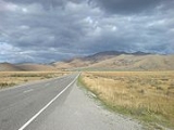
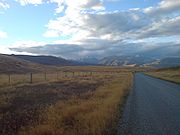
Geography

Southern Alps
The Southern Alps is a mountain range extending along much of the length of New Zealand's South Island, reaching its greatest elevations near the island's western side...
constitute its western edge. The majority of the Mackenzie Basin is within Canterbury
Canterbury, New Zealand
The New Zealand region of Canterbury is mainly composed of the Canterbury Plains and the surrounding mountains. Its main city, Christchurch, hosts the main office of the Christchurch City Council, the Canterbury Regional Council - called Environment Canterbury - and the University of Canterbury.-...
, although the area to the south of the Waitaki River
Waitaki River
The Waitaki River is a large river in the South Island of New Zealand, some 110 km long. It is the major river of the Mackenzie Basin.It is a braided river which flows through Lake Benmore, Lake Aviemore and Lake Waitaki. These are ultimately fed by three large glacial lakes, Pukaki, Tekapo,...
is in Otago
Otago
Otago is a region of New Zealand in the south of the South Island. The region covers an area of approximately making it the country's second largest region. The population of Otago is...
.
Using State Highway 8, it can be accessed via Burkes Pass (elevation 709m / 2,326 ft) from the north and the Lindis Pass
Lindis Pass
Lindis Pass is located in the South Island of New Zealand.It lies between the towns of Cromwell in Central Otago and Omarama in North Otago, on the main inland route to the Mackenzie Basin in Canterbury....
(elevation 965m / 3,166 ft) from the south, or via State Highway 83
New Zealand State Highway 83
State Highway 83 is a South Island State Highway in New Zealand running up the Waitaki Valley between the settlements of Pukeuri and Omarama. It forms part of the southernmost of the east-west roads crossing the South Island .-Route:...
through the Waitaki Valley
Waitaki River
The Waitaki River is a large river in the South Island of New Zealand, some 110 km long. It is the major river of the Mackenzie Basin.It is a braided river which flows through Lake Benmore, Lake Aviemore and Lake Waitaki. These are ultimately fed by three large glacial lakes, Pukaki, Tekapo,...
from the east. Aside from these passes, the terrain is generally highest at the northern end and gradually descends in a southward direction.
Prominent rivers crossing the Mackenzie Basin include the Waitaki
Waitaki River
The Waitaki River is a large river in the South Island of New Zealand, some 110 km long. It is the major river of the Mackenzie Basin.It is a braided river which flows through Lake Benmore, Lake Aviemore and Lake Waitaki. These are ultimately fed by three large glacial lakes, Pukaki, Tekapo,...
, the Ahuriri
Ahuriri River
The Ahuriri River is a river in the Otago region of the South Island of New Zealand.The headwaters are on the eastern flanks of the Southern Alps. The river flows for 70 kilometres through the southernmost part of the Mackenzie Basin before reaching the Ahuriri Arm of Lake Benmore, one of the...
, the Hakataramea
Hakataramea River
The Hakataramea River flows generally south through the Hakataramea Valley, which is separated from the more inland Mackenzie Basin by the Kirkliston Range in Canterbury, New Zealand....
and the Tekapo
Tekapo River
The Tekapo River flows occasionally through the Mackenzie Basin, Canterbury, in New Zealand's South Island, although the riverbed is now often dry in the upper reaches it maintains a constant flow below the confluence of several tributaries notably the Merryburn, Forks, and Greys streams...
Rivers. Lakes Ohau
Lake Ohau
Lake Ohau is a glacial lake in the Mackenzie Basin of New Zealand's South Island. It is fed by the Hopkins and Dobson rivers, which have their headwaters in the Southern Alps, and has its outflow in the Ohau River, which itself feeds into the Waitaki River hydroelectric project.Ohau is the smallest...
, Pukaki
Lake Pukaki
Lake Pukaki is the largest of three roughly parallel alpine lakes running north-south along the northern edge of the Mackenzie Basin on New Zealand's South Island. The others are Lakes Tekapo and Ohau...
, Alexandrina and Tekapo
Lake Tekapo
Lake Tekapo is the second-largest of three roughly parallel lakes running north–south along the northern edge of the Mackenzie Basin in the South Island of New Zealand...
lie within the Mackenzie Basin, as do the artificial hydroelectric lakes of Ruataniwha
Lake Ruataniwha
Lake Ruataniwha is located in the Mackenzie Basin in New Zealand's South Island. An artificial lake, it was formed as part of the Waitaki hydroelectric project....
, Benmore
Lake Benmore
Lake Benmore is a lake located in the South Island of New Zealand. It was artificially created in the 1960s by construction of Benmore Dam. The lake covers an area of approximately 75 km²...
and Aviemore
Lake Aviemore
Lake Aviemore or Mahi Tikumu is a man-made lake in New Zealand's South Island, part of the Waitaki hydroelectric scheme. Immediately upstream is Lake Benmore and downstream Lake Waitaki...
.
Settlement and activities
Sparsely populated, and with only five settlements (Lake TekapoLake Tekapo (town)
TekapoUrban AreaPopulation:Extent:Territorial AuthorityName:Mackenzie District CouncilPopulation:Mayor:Website:Extent:Regional councilName:Environment Canterbury...
, population <500; Mount Cook Village
Mount Cook Village
Mount Cook VillageUrban AreaPopulation:Extent:Territorial AuthorityName:Mackenzie District CouncilPopulation:Mayor:Website:Extent:Regional councilName:Environment Canterbury...
, population <150; Twizel
Twizel
TwizelUrban AreaPopulation:1,000Extent:Territorial AuthorityName:Mackenzie District CouncilPopulation:Mayor:Website:Extent:Regional councilName:Environment Canterbury...
, population <1,000; Omarama
Omarama
Omarama is a small township at the junction of State Highways 8 and 83, near the southern end of the Mackenzie Basin, in the South Island of New Zealand. Omarama is in the Waitaki District, in the historic Province of Otago...
, population <400 and Fairlie, population <800), the Mackenzie Country comprises an area of huge glacial lakes and snow-capped mountains, particularly favoured by tourists and skiers.
The Ohau skifield near Omarama, and Roundhill and Mount Dobson Ski Areas at Lake Tekapo, are small commercial skifields popular amongst many living in Canterbury and Otago. Roundhill and Ohau have invested in (or are considering investing in) snowmaking
Snowmaking
Snowmaking is the production of snow by forcing water and pressurized air through a "snow gun" or "snow cannon", on ski slopes. Snowmaking is mainly used at ski resorts to supplement natural snow. This allows ski resorts to improve the reliability of their snow cover and to extend their ski...
equipment to ensure fields can always open during the seasons. The fields had 14,000 (Roundhill) and 12,083 (Ohau) skier days in 2004, with Roundhill also noting that 85% of its guests came from NZ. The smaller skifields of the area are less crowded than those in the Queenstown
Queenstown, New Zealand
Queenstown is a resort town in Otago in the south-west of New Zealand's South Island. It is built around an inlet called Queenstown Bay on Lake Wakatipu, a long thin Z-shaped lake formed by glacial processes, and has spectacular views of nearby mountains....
area, with an official report also noting that part of the attraction of the fields lies in the "alternative and relaxed experience [compared] to those offered by larger fields closer to Christchurch and Queenstown".
The Mackenzie Country is frequently utilised as the principal and second-unit location for television commercials, documentaries, and motion pictures, including much of Peter Jackson's
Peter Jackson
Sir Peter Robert Jackson, KNZM is a New Zealand film director, producer, actor, and screenwriter, known for his The Lord of the Rings film trilogy , adapted from the novel by J. R. R...
epic Lord of the Rings film trilogy
The Lord of the Rings film trilogy
The Lord of the Rings is an epic film trilogy consisting of three fantasy adventure films based on the three-volume book of the same name by English author J. R. R. Tolkien. The films are The Fellowship of the Ring , The Two Towers and The Return of the King .The films were directed by Peter...
.
Gliding
Gliding
Gliding is a recreational activity and competitive air sport in which pilots fly unpowered aircraft known as gliders or sailplanes using naturally occurring currents of rising air in the atmosphere to remain airborne. The word soaring is also used for the sport.Gliding as a sport began in the 1920s...
is another common activity within the Mackenzie Basin, and the area was host to a Gliding World Cup event in 1995, as well as being the home of several gliding clubs, airfields, and numerous private glider pilots, of both amateur and professional status.
Due to its clean, dry and dark sky, the Mackenzie Basin serves as an important area for New Zealand-based astronomy
Astronomy
Astronomy is a natural science that deals with the study of celestial objects and phenomena that originate outside the atmosphere of Earth...
, with a number of related facilities located there, including the nation's premier astronomical observatory, the University of Canterbury
University of Canterbury
The University of Canterbury , New Zealand's second-oldest university, operates its main campus in the suburb of Ilam in the city of Christchurch, New Zealand...
's Mount John University Observatory
Mount John University Observatory
Mount John University Observatory , is New Zealand's premier astronomical research observatory. It is situated at ASL atop Mount John at the northern end of the Mackenzie Basin in the South Island, and was established in 1965...
, and several amateur observatories. Astronomy-related tourism is an increasing contributor to the area's economy, with more astro-tourism ventures in development near Lake Tekapo, Mount Cook village (planetarium) and Omarama.
Plans are currently well-progressed to have the Mackenzie Basin designated as a Dark Sky Reserve, possibly the World's first, that will probably result in strengthening local ordinances to prevent light pollution
Light pollution
Light pollution, also known as photopollution or luminous pollution, is excessive or obtrusive artificial light.The International Dark-Sky Association defines light pollution as:...
. A recent World Heritage Committee meeting in Seville in 2009 was positive about the proposed project.
Environmental issues
The original vegetation cover prior to human settlement has been completely transformed in the basin and indeed most of the surrounding Canterbury-Otago tussock grasslandsCanterbury-Otago tussock grasslands
The Canterbury-Otago tussock grasslands are an ecoregion of South Island, New Zealand.-Location and description:This ecoregion is a large area of dry grassy plains between the east coast and the Southern Alps that form the spine of South Island, in the regions of Canterbury and Otago...
ecoregion, initially due fires lit by Maori and European settlers, and in more recent times by farming activity and by pests. A relatively weakly settled area, in recent times (late 2000s), numerous proposals for new farming operations have locals fearing that the agriculture will be transformed from often family-held farms to large agribusiness
Agribusiness
In agriculture, agribusiness is a generic term for the various businesses involved in food production, including farming and contract farming, seed supply, agrichemicals, farm machinery, wholesale and distribution, processing, marketing, and retail sales....
operations causing increased local ecologic damage and siphoning off capital overseas. The effluent from proposed factory farming
Factory farming
Factory farming is a term referring to the process of raising livestock in confinement at high stocking density, where a farm operates as a factory — a practice typical in industrial farming by agribusinesses. The main products of this industry are meat, milk and eggs for human consumption...
schemes, one proposed set of which would release sewage the equivalent of the city of Christchurch, is also feared to put further pressure on the ecosystems of local lakes and rivers. Over 5,000 submissions have been received in opposition to the dairy farming proposals, including from tourism associations, which fear that the industrial agriculture
Industrial agriculture
Industrial farming is a form of modern farming that refers to the industrialized production of livestock, poultry, fish, and crops. The methods of industrial agriculture are technoscientific, economic, and political...
will damage the reputation of the area as well as its ecosystems.
The extensive network of canals for hydroelectric schemes posed a threat to the Black Stilt
Black Stilt
The Black Stilt or Kakī , Himantopus novaezelandiae, is a large wader in the avocet and stilt family Recurvirostridae. The species is endemic to New Zealand. Adults are 40 cm long. They have very long red legs, a long thin black bill and black plumage...
(or kaki), an endangered river wading bird. A captive breeding programme was set up and it is administered by the Department of Conservation.
The MacKenzie Basin is one of the areas where wilding conifer
Wilding conifer
Wilding conifers, also known as wilding pines, are invasive tree species in the high country of New Zealand. Millions of dollars is spent on controlling their spread....
s proliferate. These weed trees cover large areas sometimes to a very high density and therefore excluding native vegetation and reducing the amount of available pasture. Some areas have control measures in place to prevent the trees from spreading.
Rabbits are a common invasive species
Invasive species
"Invasive species", or invasive exotics, is a nomenclature term and categorization phrase used for flora and fauna, and for specific restoration-preservation processes in native habitats, with several definitions....
in the area affect both agricultural production and biodiversity
Biodiversity
Biodiversity is the degree of variation of life forms within a given ecosystem, biome, or an entire planet. Biodiversity is a measure of the health of ecosystems. Biodiversity is in part a function of climate. In terrestrial habitats, tropical regions are typically rich whereas polar regions...
. Rabbit numbers dropped after the introduction of rabbit haemorrhagic disease virus (RCD) but are now increasing. The Department of Conservation has plans to drop sodium fluoroacetate (1080) laced poison bait to control the rabbit numbers. This is seen as necessary due to the disproportionally high number of threatened plant species in the Mackenzie Basin. The plan attracted opposition at submission hearings.
There is currently a high demand for water to irrigate the MacKenzie Basin, with 126 resource consent
Resource consent
A resource consent is the authorisation given to certain activities or uses of natural and physical resources required under the New Zealand Resource Management Act . Some activities may either be specifically authorised by the RMA or be permitted activities authorised by rules in plans...
s from 36 applicants before Environment Canterbury as of mid 2009. The water would be used to irrigate an area of 27125 hectares (67,027.3 acre), but the schemes are opposed by many locals and the Department of Conservation for the potential ecological effects, and since it may clash with a proposed MacKenzie Basin Drylands Park. Forest and Bird
Royal Forest and Bird Protection Society of New Zealand
The Royal Forest and Bird Protection Society of New Zealand Inc. is an environmental organisation specialising in conservation of indigenous plant and animal life in and around New Zealand....
are also opposed to the irrigation for a variety of conservation reasons.
External links
- Aoraki Mt Cook Mackenzie District Council
- Twizel Te Manahuna area at the Department of ConservationNew Zealand Department of ConservationThe Department of Conservation , commonly known by its acronym, "DOC", is the state sector organisation which deals with the conservation of New Zealand’s natural and historic heritage...
- Omarama Gliding Club
- List of local and national ski areas
- Observatories
- Mackenzie Guardians - a lobby group advocating for protection of the Mackenzie Basin
- Mackenzie Basin campaign at Forest and Bird
- Ecological threats to The MacKenzie country - Nicola Vallance, Forest and Bird advocate, explains