

Waitaki District
Encyclopedia

New Zealand
New Zealand is an island country in the south-western Pacific Ocean comprising two main landmasses and numerous smaller islands. The country is situated some east of Australia across the Tasman Sea, and roughly south of the Pacific island nations of New Caledonia, Fiji, and Tonga...
, straddles the traditional border between the two regions, the Waitaki River
Waitaki River
The Waitaki River is a large river in the South Island of New Zealand, some 110 km long. It is the major river of the Mackenzie Basin.It is a braided river which flows through Lake Benmore, Lake Aviemore and Lake Waitaki. These are ultimately fed by three large glacial lakes, Pukaki, Tekapo,...
. It has a land area of 7,151.94 km² (2,761.38 sq mi), divided 59.28% to Canterbury Region and 40.72% to Otago Region. It is the only district on the South Island
South Island
The South Island is the larger of the two major islands of New Zealand, the other being the more populous North Island. It is bordered to the north by Cook Strait, to the west by the Tasman Sea, to the south and east by the Pacific Ocean...
that is divided between two regions. A major reason for this split was the governance of the Waitaki River which forms a political boundary between Canterbury and Otago. With major hydro schemes on this river it was decided to place the entire catchment in one administrative region, thus forming the split. Some people who fall into the Canterbury Region of Waitaki District still regard themselves as part of Otago, and attempts have been made in the past to change the boundary. The district, which is agricultural by nature, comprises the wide alluvial fan
Alluvial fan
An alluvial fan is a fan-shaped deposit formed where a fast flowing stream flattens, slows, and spreads typically at the exit of a canyon onto a flatter plain. A convergence of neighboring alluvial fans into a single apron of deposits against a slope is called a bajada, or compound alluvial...
of the river, and runs inland along the banks of the river, this forming a roughly triangular region. The population is Oamaru
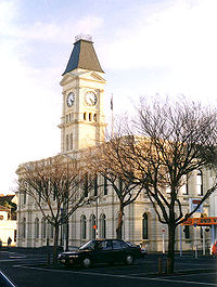
Oamaru
Oamaru , the largest town in North Otago, in the South Island of New Zealand, is the main town in the Waitaki District. It is 80 kilometres south of Timaru and 120 kilometres north of Dunedin, on the Pacific coast, and State Highway 1 and the railway Main South Line connects it to both...
(in Otago
Otago
Otago is a region of New Zealand in the south of the South Island. The region covers an area of approximately making it the country's second largest region. The population of Otago is...
) is the largest town in the district.
The Waitaki District is made up of the former Waitaki County, Waihemo County and Oamaru Borough, which were merged in 1989. It is governed by the Waitaki District Council.
A relatively weakly settled area, the District does have a wide number of farms. However, in recent times (late 2000s), numerous proposals for new farming operations have locals fearing that the agriculture will be transformed from often family-held farms to large agribusiness
Agribusiness
In agriculture, agribusiness is a generic term for the various businesses involved in food production, including farming and contract farming, seed supply, agrichemicals, farm machinery, wholesale and distribution, processing, marketing, and retail sales....
operations causing increased local ecologic damage and siphoning off capital overseas.