

Lake Benmore
Encyclopedia
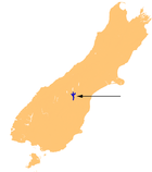
Lake Benmore is a lake
located in the South Island
of New Zealand
. It was artificially created in the 1960s by construction of Benmore Dam
. The lake covers an area of approximately 75 km². Parts of it lie in the Mackenzie
, Waimate
, and Waitaki
districts
within the southern portion of the Canterbury Region
.
The major river
s with which it is fed are the Ohau
, Pukaki
and the Tekapo River
s. Immediately downstream is Lake Aviemore
. The lake has New Zealand's largest earth dam as part of the Waitaki hydroelectricity
power scheme.
After the lake was created the incidence of seismic shocks increased by a factor of three to six times.
Lake
A lake is a body of relatively still fresh or salt water of considerable size, localized in a basin, that is surrounded by land. Lakes are inland and not part of the ocean and therefore are distinct from lagoons, and are larger and deeper than ponds. Lakes can be contrasted with rivers or streams,...
located in the South Island
South Island
The South Island is the larger of the two major islands of New Zealand, the other being the more populous North Island. It is bordered to the north by Cook Strait, to the west by the Tasman Sea, to the south and east by the Pacific Ocean...
of New Zealand
New Zealand
New Zealand is an island country in the south-western Pacific Ocean comprising two main landmasses and numerous smaller islands. The country is situated some east of Australia across the Tasman Sea, and roughly south of the Pacific island nations of New Caledonia, Fiji, and Tonga...
. It was artificially created in the 1960s by construction of Benmore Dam
Benmore Dam
Benmore Dam is the largest dam within the Waitaki power scheme, located in the Canterbury Region of New Zealand's South Island. There are eight other power stations in the valley....
. The lake covers an area of approximately 75 km². Parts of it lie in the Mackenzie
Mackenzie District
Mackenzie District is a political district in New Zealand's South Island. It is part of the larger Canterbury Region.-Principal settlements:*Fairlie*Twizel*Cave*Mount Cook Village*Albury*TekapoAlso*Burkes Pass-Geography:See Mackenzie Basin,...
, Waimate
Waimate
WaimateUrban AreaPopulation:2,835 Extent:Territorial AuthorityName:Waimate District CouncilPopulation:7,206 Land area:3,582.19 km² Mayor:John ColesWebsite:...
, and Waitaki
Waitaki District
The Waitaki district, in the Canterbury and Otago regions of New Zealand, straddles the traditional border between the two regions, the Waitaki River. It has a land area of 7,151.94 km² , divided 59.28% to Canterbury Region and 40.72% to Otago Region. It is the only district on the South...
districts
Territorial authorities of New Zealand
Territorial authorities are the second tier of local government in New Zealand, below regional councils. There are 67 territorial authorities: 13 city councils, 53 district councils, and the Chatham Islands Council...
within the southern portion of the Canterbury Region
Canterbury, New Zealand
The New Zealand region of Canterbury is mainly composed of the Canterbury Plains and the surrounding mountains. Its main city, Christchurch, hosts the main office of the Christchurch City Council, the Canterbury Regional Council - called Environment Canterbury - and the University of Canterbury.-...
.
The major river
River
A river is a natural watercourse, usually freshwater, flowing towards an ocean, a lake, a sea, or another river. In a few cases, a river simply flows into the ground or dries up completely before reaching another body of water. Small rivers may also be called by several other names, including...
s with which it is fed are the Ohau
Ohau River
Ohau River may refer to two watercourses in New Zealand:*Ohau River, Canterbury*Ohau River, Wellington...
, Pukaki
Pukaki River
The Pukaki River flows through the Mackenzie Basin, Canterbury, in New Zealand's South Island.Originally, the river flowed southwest for 15 kilometres from the southern end of Lake Pukaki before joining with the Tekapo River and flowing into the northern end of Lake Benmore...
and the Tekapo River
Tekapo River
The Tekapo River flows occasionally through the Mackenzie Basin, Canterbury, in New Zealand's South Island, although the riverbed is now often dry in the upper reaches it maintains a constant flow below the confluence of several tributaries notably the Merryburn, Forks, and Greys streams...
s. Immediately downstream is Lake Aviemore
Lake Aviemore
Lake Aviemore or Mahi Tikumu is a man-made lake in New Zealand's South Island, part of the Waitaki hydroelectric scheme. Immediately upstream is Lake Benmore and downstream Lake Waitaki...
. The lake has New Zealand's largest earth dam as part of the Waitaki hydroelectricity
Hydroelectricity
Hydroelectricity is the term referring to electricity generated by hydropower; the production of electrical power through the use of the gravitational force of falling or flowing water. It is the most widely used form of renewable energy...
power scheme.
After the lake was created the incidence of seismic shocks increased by a factor of three to six times.
See also
- Electricity sector in New ZealandElectricity sector in New ZealandThe electricity sector in New Zealand uses mainly renewable energy sources such as hydropower, geothermal power and increasingly wind energy. The 70% share of renewable energy sources makes New Zealand one of the lowest carbon dioxide emitting countries in terms of electricity generation....
- Lakes of New ZealandLakes of New ZealandThere are 3,820 lakes in New Zealand with a surface area larger than one hectare. The lakes are of varying types and origins. Many of the lakes in the central North Island area are volcanic crater lakes, while the majority of the lakes near the Southern Alps were carved by glaciers...
- List of lakes in New Zealand