
M2 motorway
Encyclopedia
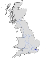
The M2 is a motorway in Kent
, England. It is 25.7 miles (41.4 km) long and acts as a bypass of the section of the A2 road
which runs through the Medway Towns, Sittingbourne
and Faversham
.
at Three Crutches, diverging southeastwards from the A2 road that heads eastwards from London. It begins at junction 1 with four lanes. It then descends towards the Medway Valley to the south of Rochester. Running parallel to High Speed 1, it crosses the River Medway
on the Medway Viaduct
. On the west bank, Junction 2, the A228
, is a complex junction where the exit roundabouts have to be built round the raillink track and still maintain, by footbridge and tunnel, a public footpath. On the east bank is the village of Borstal.The M2 then diverges from the Channel Tunnel Rail Link, climbs up north side Nashenden Valley to Blue Bell Hill
and on to the North Downs
on a split-level carriageway and meets junction 3 at Walderslade, south of Chatham
. Here the road narrows to three lanes, and runs northeast across Crossington Fields, Westfield Sole, Lidsing
, and Bredhurst towards junction 4, where it becomes two lanes. Continuing east, passing Medway Service Station, it crosses the A249
over the Stockbury Viaduct at junction 5. It then continues along the rural North Downs, with a connection to the old A2 at Faversham
. Shortly after this, it terminates at junction 7, allowing traffic to continue on either the A299
towards Thanet
which joins a dual carriage way or the A2
towards Canterbury
and Dover
which again is virtually all a dual cariageway except where it approaches Dover
.
It was planned to extend the road to London and Dover, making the M2 the main route between London and the channel
port
s, but this extension never materialised. The M2 was originally to be designated as the A2(M), but due to the Daily Telegraph reporting it as the M2, the Ministry of Transport
later decided upon the M20
as the main London-Channel Ports link. http://www.cbrd.co.uk/motorway/m2/
was completed from London to Folkestone
in 1991, and the M2 merely remains a bypass for the Medway Towns. Junction 1 was altered when the A289 Wainscott Northern bypass was built in the late 1990s.
, Skanska
and Mowlem
(CSM) created the company that would undertake the project. The project required the redesign of Junction 2 and Junction 3, and a second Medway Bridge. The existing bridge was converted to a 4-lane, eastbound carriageway (including a hard shoulder). The new bridge formed the westbound carriageway. The entire stretch was lit with streetlights
(the old section was not lit). The old Medway Bridge was physically narrowed by removing part of the footpath. High-pressure water cutting equipment was used to cut the concrete into manageable sections for disposal. There is only one path open to the public now.
Spoil from the North Downs Tunnel
was used to form the new embankment for the London bound traffic between J2 and the Nashenden Valley.
The widening was completed in July 2003.
is between junction 4 and 5. It operates under the Moto brand with a "Travelodge" hotel. It long went under the local name "Farthing Corner Services". The signs have been altered to reflect the new description.
are used to provide 'distance (in kilometres) and carriageway identifier information. Where junctions often extend over several hundred metres and the data is available values are given for the start and end points of the junction.
Kent
Kent is a county in southeast England, and is one of the home counties. It borders East Sussex, Surrey and Greater London and has a defined boundary with Essex in the middle of the Thames Estuary. The ceremonial county boundaries of Kent include the shire county of Kent and the unitary borough of...
, England. It is 25.7 miles (41.4 km) long and acts as a bypass of the section of the A2 road
A2 road (Great Britain)
The A2 is a major road in southern England, connecting London with the English Channel port of Dover in Kent. This route has always been of importance as a connection between the British capital of London and sea trade routes to Continental Europe...
which runs through the Medway Towns, Sittingbourne
Sittingbourne
Sittingbourne is an industrial town about eight miles east of Gillingham in England, beside the Roman Watling Street off a creek in the Swale, a channel separating the Isle of Sheppey from mainland Kent...
and Faversham
Faversham
Faversham is a market town and civil parish in the Swale borough of Kent, England. The parish of Faversham grew up around an ancient sea port on Faversham Creek and was the birthplace of the explosives industry in England.-History:...
.
Route
The M2 starts to the west of StroodStrood
Strood is a town in the unitary authority of Medway in South East England. It is part of the ceremonial county of Kent. It lies on the north west bank of the River Medway at its lowest bridging point, and is part of the Rochester post town....
at Three Crutches, diverging southeastwards from the A2 road that heads eastwards from London. It begins at junction 1 with four lanes. It then descends towards the Medway Valley to the south of Rochester. Running parallel to High Speed 1, it crosses the River Medway
River Medway
The River Medway, which is almost entirely in Kent, England, flows for from just inside the West Sussex border to the point where it enters the Thames Estuary....
on the Medway Viaduct
Medway Viaduct
There are three Medway Viaducts, two of which carry the two carriageways of the M2 motorway. The other viaduct carries High Speed 1 across the River Medway near Rochester in north Kent, England.-M2 Motorway viaduct :...
. On the west bank, Junction 2, the A228
A228 road
The A228 road is an important transport artery in Kent, England. It begins at the Isle of Grain and runs in a south-westerly direction to connect eventually with the A21 trunk road at Pembury. It serves existing communities and new and proposed housing developments and commercial enterprises...
, is a complex junction where the exit roundabouts have to be built round the raillink track and still maintain, by footbridge and tunnel, a public footpath. On the east bank is the village of Borstal.The M2 then diverges from the Channel Tunnel Rail Link, climbs up north side Nashenden Valley to Blue Bell Hill
Blue Bell Hill
Blue Bell Hill is a chalk hill between Maidstone and Rochester in the English county of Kent. It overlooks the River Medway and is part of the North Downs. Settlements on the hill include Walderslade; and Blue Bell Hill and Kit's Coty villages...
and on to the North Downs
North Downs
The North Downs are a ridge of chalk hills in south east England that stretch from Farnham in Surrey to the White Cliffs of Dover in Kent. The North Downs lie within two Areas of Outstanding Natural Beauty , the Surrey Hills and the Kent Downs...
on a split-level carriageway and meets junction 3 at Walderslade, south of Chatham
Chatham, Medway
Chatham is one of the Medway towns located within the Medway unitary authority, in North Kent, in South East England.Although the dockyard has long been closed and is now being redeveloped into a business and residential community as well as a museum featuring the famous submarine, HMS Ocelot,...
. Here the road narrows to three lanes, and runs northeast across Crossington Fields, Westfield Sole, Lidsing
Lidsing
Lidsing is a hamlet near the M2 motorway, in the Maidstone District, in the English county of Kent. It is south of the town of Gillingham.- References :Philip's Navigator Britain...
, and Bredhurst towards junction 4, where it becomes two lanes. Continuing east, passing Medway Service Station, it crosses the A249
A249 road
The A249 is a road in Kent, England, running from Maidstone to Sheerness on the Isle of Sheppey. It mainly functions as a link between the M2 and M20 motorways, and for goods vehicle traffic to the port at Sheerness....
over the Stockbury Viaduct at junction 5. It then continues along the rural North Downs, with a connection to the old A2 at Faversham
Faversham
Faversham is a market town and civil parish in the Swale borough of Kent, England. The parish of Faversham grew up around an ancient sea port on Faversham Creek and was the birthplace of the explosives industry in England.-History:...
. Shortly after this, it terminates at junction 7, allowing traffic to continue on either the A299
A299 road
The A299, better known as the Thanet Way, is a major road in the county of Kent, England, and runs from Brenley Corner near Faversham to Ramsgate via Whitstable and Herne Bay. It is predominantly used for freight traffic to Ramsgate Harbour and local traffic to Thanet.Most of the A299 was...
towards Thanet
Thanet
Thanet is a local government district of Kent, England which was formed under the Local Government Act 1972, and came into being on 1 April 1974...
which joins a dual carriage way or the A2
A2 road (Great Britain)
The A2 is a major road in southern England, connecting London with the English Channel port of Dover in Kent. This route has always been of importance as a connection between the British capital of London and sea trade routes to Continental Europe...
towards Canterbury
Canterbury
Canterbury is a historic English cathedral city, which lies at the heart of the City of Canterbury, a district of Kent in South East England. It lies on the River Stour....
and Dover
Dover
Dover is a town and major ferry port in the home county of Kent, in South East England. It faces France across the narrowest part of the English Channel, and lies south-east of Canterbury; east of Kent's administrative capital Maidstone; and north-east along the coastline from Dungeness and Hastings...
which again is virtually all a dual cariageway except where it approaches Dover
Dover
Dover is a town and major ferry port in the home county of Kent, in South East England. It faces France across the narrowest part of the English Channel, and lies south-east of Canterbury; east of Kent's administrative capital Maidstone; and north-east along the coastline from Dungeness and Hastings...
.
Original construction
The M2 was constructed in the 1960s, with the Medway bypass being constructed in 1963 and the rest in 1965. It was opened in 3 stages:- Junction 1 to 2 in 1965
- Junction 2 to 5 in 1963
- Junction 5 to 7 in 1965
It was planned to extend the road to London and Dover, making the M2 the main route between London and the channel
English Channel
The English Channel , often referred to simply as the Channel, is an arm of the Atlantic Ocean that separates southern England from northern France, and joins the North Sea to the Atlantic. It is about long and varies in width from at its widest to in the Strait of Dover...
port
Port
A port is a location on a coast or shore containing one or more harbors where ships can dock and transfer people or cargo to or from land....
s, but this extension never materialised. The M2 was originally to be designated as the A2(M), but due to the Daily Telegraph reporting it as the M2, the Ministry of Transport
Department for Transport
In the United Kingdom, the Department for Transport is the government department responsible for the English transport network and a limited number of transport matters in Scotland, Wales and Northern Ireland which are not devolved...
later decided upon the M20
M20 motorway
The M20 is a motorway in Kent, England. It runs from the M25 motorway to Folkestone, providing a link to the Channel Tunnel and the ports at Dover. It is long...
as the main London-Channel Ports link. http://www.cbrd.co.uk/motorway/m2/
Junction amendments
The M2 stayed much the same until the 1990s. Traffic using it decreased when the M20M20 motorway
The M20 is a motorway in Kent, England. It runs from the M25 motorway to Folkestone, providing a link to the Channel Tunnel and the ports at Dover. It is long...
was completed from London to Folkestone
Folkestone
Folkestone is the principal town in the Shepway District of Kent, England. Its original site was in a valley in the sea cliffs and it developed through fishing and its closeness to the Continent as a landing place and trading port. The coming of the railways, the building of a ferry port, and its...
in 1991, and the M2 merely remains a bypass for the Medway Towns. Junction 1 was altered when the A289 Wainscott Northern bypass was built in the late 1990s.
Widening
The M2 was still busy between Junctions 1 and 4 though, and in 2000 work began on upgrading the 2-lane M2 to 4-lanes. A joint venture between CostainCostain Group
Costain Group plc is a British construction and civil engineering company headquartered in Maidenhead. It was part of the original Channel Tunnel consortium and is involved in Private Finance Initiative projects.-History:...
, Skanska
Skanska
Skanska AB, is a multinational construction and development company based in Sweden, where it also is the largest construction company. The company's head office is in Solna, north of Stockholm.-History:...
and Mowlem
Mowlem
Mowlem was one of the largest construction and civil engineering companies in the United Kingdom. Carillion bought the firm in 2006.-History:Founded by John Mowlem in 1822, the company was awarded a Royal Warrant in 1902 and went public on the London Stock Exchange in 1924. It acquired SGB Group in...
(CSM) created the company that would undertake the project. The project required the redesign of Junction 2 and Junction 3, and a second Medway Bridge. The existing bridge was converted to a 4-lane, eastbound carriageway (including a hard shoulder). The new bridge formed the westbound carriageway. The entire stretch was lit with streetlights
Street light
A street light, lamppost, street lamp, light standard, or lamp standard is a raised source of light on the edge of a road or walkway, which is turned on or lit at a certain time every night. Modern lamps may also have light-sensitive photocells to turn them on at dusk, off at dawn, or activate...
(the old section was not lit). The old Medway Bridge was physically narrowed by removing part of the footpath. High-pressure water cutting equipment was used to cut the concrete into manageable sections for disposal. There is only one path open to the public now.
Spoil from the North Downs Tunnel
North Downs Tunnel
The North Downs Tunnel is a railway tunnel that carries High Speed 1 through the North Downs, at Blue Bell Hill near Maidstone in Kent, south-east England....
was used to form the new embankment for the London bound traffic between J2 and the Nashenden Valley.
The widening was completed in July 2003.
Service areas
Medway servicesMedway services
Medway is a service area on the M2 motorway south of Medway, near Junction 4 in Kent, southeast England. It is managed by Moto and was previously called Farthing Corner, which is the name of the nearby settlement.-Facilities:...
is between junction 4 and 5. It operates under the Moto brand with a "Travelodge" hotel. It long went under the local name "Farthing Corner Services". The signs have been altered to reflect the new description.
Junctions
Data from driver location signsDriver location signs
Driver location signs are English highway route markers, first introduced in 2003, that complement distance marker posts. Both types of marker post display the distances from a nominal start point in kilometres...
are used to provide 'distance (in kilometres) and carriageway identifier information. Where junctions often extend over several hundred metres and the data is available values are given for the start and end points of the junction.
| M2 Motorway Junctions | ||||
| mile (km) | Westbound exits (B Carriageway) | Junction | Eastbound exits (A Carriageway) | Coordinates |
| 43.4 (27 mi) 44.3 (27.5 mi) |
Road continues as A2 to London | J1 | Rochester A2 Gillingham, Grain Isle of Grain The Isle of Grain, in the north of Kent, England, is the easternmost point of the Hoo Peninsula. No longer an island, the Isle is almost all marshland and the Grain Marshes are an important habitat for birdlife... A289 Non-motorway traffic |
51.39953°N 0.44332°E |
| Grain, Rochester A289 | Start of motorway | |||
| 46.3 (28.8 mi) 46.6 (29 mi) |
Rochester, West Malling West Malling West Malling is a historic market town in the Tonbridge and Malling district of Kent, England. It has a population of about 3000-5000.-Landmarks:... A228 A228 road The A228 road is an important transport artery in Kent, England. It begins at the Isle of Grain and runs in a south-westerly direction to connect eventually with the A21 trunk road at Pembury. It serves existing communities and new and proposed housing developments and commercial enterprises... |
J2 | Rochester, West Malling A228 | 51.38383°N 0.46799°E |
| 52.4 (32.6 mi) 52.8 (32.8 mi) |
Maidstone Maidstone Maidstone is the county town of Kent, England, south-east of London. The River Medway runs through the centre of the town linking Maidstone to Rochester and the Thames Estuary. Historically, the river was a source and route for much of the town's trade. Maidstone was the centre of the agricultural... , Chatham Chatham, Medway Chatham is one of the Medway towns located within the Medway unitary authority, in North Kent, in South East England.Although the dockyard has long been closed and is now being redeveloped into a business and residential community as well as a museum featuring the famous submarine, HMS Ocelot,... , Rochester A229 A229 road The A229 is a major road running north-south through Kent.The road begins in the Medway town of Rochester at the foot of Star Hill forming a junction with the A2 road. It then climbs up through the built-up area of Chatham, passing Troy Town and Rochester Airport before descending the slope of the... |
J3 | Maidstone, Chatham A229 Channel Tunnel (M20) |
51.33729°N 0.50790°E |
| 58.5 (36.4 mi) 58.8 (36.5 mi) |
Gillingham A278 | J4 | Gillingham A278 | 51.33616°N 0.58438°E |
| Medway Services Medway services Medway is a service area on the M2 motorway south of Medway, near Junction 4 in Kent, southeast England. It is managed by Moto and was previously called Farthing Corner, which is the name of the nearby settlement.-Facilities:... |
Services | Medway Services | 51.34120°N 0.60781°E | |
| 64.4 (40 mi) 64.9 (40.3 mi) |
Maidstone, Sheerness Sheerness Sheerness is a town located beside the mouth of the River Medway on the northwest corner of the Isle of Sheppey in north Kent, England. With a population of 12,000 it is the largest town on the island.... A249 The WEST (M20, Gatwick Airport) |
J5 | Maidstone, Sittingbourne, Sheerness A249 | 51.32986°N 0.66231°E |
| 81.5 (50.6 mi) 81.8 (50.8 mi) |
Faversham, Ashford Ashford, Kent Ashford is a town in the borough of Ashford in Kent, England. In 2005 it was voted the fourth best place to live in the United Kingdom. It lies on the Great Stour river, the M20 motorway, and the South Eastern Main Line and High Speed 1 railways. Its agricultural market is one of the most... A251 |
J6 | Faversham, Ashford A251 | 51.30060°N 0.88843°E |
| 84.2 (52.3 mi) 84.7 (52.6 mi) |
Start of motorway | J7 | Canterbury, Dover, Channel Tunnel A2 | 51.30151°N 0.92543°E |
| Canterbury, Channel Tunnel, Dover, Faversham A2 Non-motorway traffic |
Road continues as A299 A299 road The A299, better known as the Thanet Way, is a major road in the county of Kent, England, and runs from Brenley Corner near Faversham to Ramsgate via Whitstable and Herne Bay. It is predominantly used for freight traffic to Ramsgate Harbour and local traffic to Thanet.Most of the A299 was... (Thanet Way) to Ramsgate Ramsgate Ramsgate is a seaside town in the district of Thanet in east Kent, England. It was one of the great English seaside towns of the 19th century and is a member of the ancient confederation of Cinque Ports. It has a population of around 40,000. Ramsgate's main attraction is its coastline and its main... |
|||