
A228 road
Encyclopedia
Kent
Kent is a county in southeast England, and is one of the home counties. It borders East Sussex, Surrey and Greater London and has a defined boundary with Essex in the middle of the Thames Estuary. The ceremonial county boundaries of Kent include the shire county of Kent and the unitary borough of...
, England
England
England is a country that is part of the United Kingdom. It shares land borders with Scotland to the north and Wales to the west; the Irish Sea is to the north west, the Celtic Sea to the south west, with the North Sea to the east and the English Channel to the south separating it from continental...
. It begins at the Isle of Grain
Isle of Grain
The Isle of Grain, in the north of Kent, England, is the easternmost point of the Hoo Peninsula. No longer an island, the Isle is almost all marshland and the Grain Marshes are an important habitat for birdlife...
and runs in a south-westerly direction to connect eventually with the A21 trunk road at Pembury
Pembury
Pembury is a large village in Kent, in the south east of England, with a population of around 6,000. It lies just to the north-east of Tunbridge Wells.The village centre, including the village green and High Street area is a conservation area.-History:...
. It serves existing communities and new and proposed housing developments and commercial enterprises. The most influential force on the recent upgrading of the road has been the development of Kings Hill
Kings Hill
Kings Hill is a civil parish in the Borough of Tonbridge and Malling in Kent, England. It is one of several new villages built in Kent since the 1950s . Development started in 1989 near West Malling, on land previously occupied by RAF West Malling. The plan was for a multi-purpose site of both...
near West Malling
West Malling
West Malling is a historic market town in the Tonbridge and Malling district of Kent, England. It has a population of about 3000-5000.-Landmarks:...
.
Route
The A228 commences at Lower Stoke on the Isle of GrainIsle of Grain
The Isle of Grain, in the north of Kent, England, is the easternmost point of the Hoo Peninsula. No longer an island, the Isle is almost all marshland and the Grain Marshes are an important habitat for birdlife...
. It begins as Grain Road, becoming Malmaynes Hall Road after it passes through Stoke
Stoke, Kent
Stoke is a civil parish on the Hoo Peninsula in Kent, England, to the south of Allhallows, on the north of the Medway Estuary. According to the 2001 census it had a population of 1,063....
running west. Passing High Halstow
High Halstow
High Halstow is a village and civil parish on the Hoo Peninsula in the borough of Medway in northern Kent, England. The parish had a population of 1,781 according to the 2001 census....
and turning south, it follows Shamal Street which then becomes the Ratcliffe Highway, which bypasses Hoo St Werburgh
Hoo St Werburgh
Hoo St Werburgh is one of several villages on the Hoo Peninsula in Kent, England, to bear the name Hoo. It constitutes a civil parish in the borough of Medway, with a population of 7,356 at the 2001 census.- History :...
and skirts the Deangate Ridge Golf Club. After reaching Chattenden
Chattenden
Chattenden is a small village in Hoo Parish, in Medway in Kent, UK. It lies to the north of the A228 and the village of Wainscott, at the top of Four Elms Hill.Chattenden means 'Forest Settlement' from the elements ceto and ham dun...
it turns into Four Elms Hill before switching onto the new Wainscott Eastern Bypass. Entering Frindsbury
Frindsbury
Frindsbury is part of the Medway Towns conurbation in Kent, southern England. It lies on the opposite side of the River Medway to Rochester, and at various times in its history has been considered fully or partially part of the City of Rochester. Frindsbury refers to both a parish and a manor....
, where the A289 Medway Towns northern bypass starts, it follows Frindsbury Hill and then Frindsbury Road before reaching Strood
Strood
Strood is a town in the unitary authority of Medway in South East England. It is part of the ceremonial county of Kent. It lies on the north west bank of the River Medway at its lowest bridging point, and is part of the Rochester post town....
. The southern part of this Hoo Peninsula
Hoo Peninsula
The Hoo Peninsula is a peninsula in England separating the estuaries of the rivers Thames and Medway. It is dominated by a line of sand and clay hills, surrounded by an extensive area of marshland composed of alluvial silt. The name Hoo is the Old English word for spur of land.-History:The Romans...
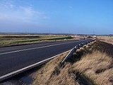
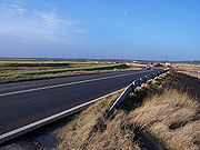
section was widened in 2005 as part of the Thames Gateway
Thames Gateway
The Thames Gateway is an area of land stretching east from inner east London on both sides of the River Thames and the Thames Estuary. The area, which includes much brownfield land, has been designated a national priority for urban regeneration, taking advantage of the development opportunities...
development programme. It is intended to dual the northern section to Grain at a later date (provisionally 2016).
In Strood the southbound and northbound routes split due to Strood's one way system. The southbound route goes along North Road and then Knight Road before joining the Cuxton Road whilst the northbound route follows Gun Lane from Cuxton Road to Frindsbury Road. In Strood it also crosses the A2
A2 road (Great Britain)
The A2 is a major road in southern England, connecting London with the English Channel port of Dover in Kent. This route has always been of importance as a connection between the British capital of London and sea trade routes to Continental Europe...
. Continuing south, the road passes over the M2 and High Speed 1 on Sundridge Hill where those two routes reach land again after crossing their respective Medway
Medway
Medway is a conurbation and unitary authority in South East England. The Unitary Authority was formed in 1998 when the City of Rochester-upon-Medway amalgamated with Gillingham Borough Council and part of Kent County Council to form Medway Council, a unitary authority independent of Kent County...
bridges.
Proceeding down Sundridge Hill, the road descends from the Downs
North Downs
The North Downs are a ridge of chalk hills in south east England that stretch from Farnham in Surrey to the White Cliffs of Dover in Kent. The North Downs lie within two Areas of Outstanding Natural Beauty , the Surrey Hills and the Kent Downs...
and enters the Medway Gap
Medway Gap
The Medway Gap is a topographic feature in the English county of Kent near Rochester.It was created when the prehistoric River Medway cut through line of chalk hills now known as the North Downs; other rivers such as the Darent and the Stour have similar features.Its past significance as a means of...
at Cuxton
Cuxton
Cuxton is a village in the unitary authority of Medway. It lies on left bank of the River Medway in the North Downs. It is served by the A228, and Cuxton railway station on the Medway Valley Line between Strood and Maidstone...
, where it then becomes the Rochester Road and later Formby Road as it makes it way to Halling
Halling
Halling may refer to:*Halling , a mainly Norwegian dance; also a name used for a person from Hallingdal, Norway* Halling , Thoroughbred racehorsePlaces:*Halling, Kent, a village in England*Halling, Moselle, a village in France...
. At Halling, the A228 departs from the old route that took it through the village and proceeds along the Halling Bypass which then links up with the Snodland
Snodland
Snodland is a small town in the county of Kent, England, located on the River Medway between Rochester and Maidstone. It has a population of about 12,000 people....
Bypass near Holborough.
As the Snodland Bypass ends the road rejoins its historic route (albeit on very recent much enlarged roads) for a short stretch on Malling Road which becomes Castle
Leybourne Castle
Leybourne Castle is a 13th century castle in the parish of Leybourne, Kent. It is situated between West Malling and Larkfield. The two semi circular bastions of the twin towered gatehouse built in 1275 remain and are incorporated into a Tudor farmhouse the was extensively rebuilt around 1930. Some...
Way as it approaches Leybourne
Leybourne
Leybourne is a small village in Kent, England situated off Junction 4 of the M20 Motorway. Leybourne is adjacent to Larkfield and West Malling....
. At this point, where the route crosses the M20
M20 motorway
The M20 is a motorway in Kent, England. It runs from the M25 motorway to Folkestone, providing a link to the Channel Tunnel and the ports at Dover. It is long...
, the route again diverts onto a new bypass, this time the Leybourne Bypass, opened November 2006, which then passes under the A20 (a road that it used to junction) and then joins the West Malling
West Malling
West Malling is a historic market town in the Tonbridge and Malling district of Kent, England. It has a population of about 3000-5000.-Landmarks:...
Bypass.
Passing Manor Park Country Park
Manor Park Country Park
.Manor Park Country Park is a country park in West Malling, Kent, England. The park, formerly the private gardens of the nearby Douces Manor was purchased from the manor's owners by Kent County Council in 1973 to be converted into a public open space....
to the west and the roundabout at the northern entrance to Kings Hill
Kings Hill
Kings Hill is a civil parish in the Borough of Tonbridge and Malling in Kent, England. It is one of several new villages built in Kent since the 1950s . Development started in 1989 near West Malling, on land previously occupied by RAF West Malling. The plan was for a multi-purpose site of both...
, the road becomes Ashton Way before meeting the Malling Road at the southern tip of West Malling and proceeding through Mereworth
Mereworth
Mereworth is a village near the town of Maidstone in Kent, England. The Wateringbury Stream flows through the village and powered a watermill, the site of which now lies within the grounds of Mereworth Castle.-History:...
. South of Mereworth, the route is shared by that of the A26
A26 road
For the road in Northern Ireland see A26 road The A26 road is one of the three cross-country two-digit numbered roads in the southeast of England, the others being the A25 road and A27 road. It carries traffic from Maidstone in Kent in a generally south-westerly direction to Tunbridge Wells and...
for a short period before the routes diverge upon meeting Seven Mile Lane onto which the A228 turns south while the A26 proceeds southwest to Tonbridge
Tonbridge
Tonbridge is a market town in the English county of Kent, with a population of 30,340 in 2007. It is located on the River Medway, approximately 4 miles north of Tunbridge Wells, 12 miles south west of Maidstone and 29 miles south east of London...
.
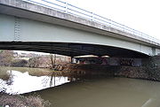
As it passes East Peckham
East Peckham
East Peckham is a village in Kent, England, made up of nine hamlets and situated about east of Tonbridge on the River Medway. It was the centre for the hop growing industry in Kent and is still home to the Hop Farm which has the world's largest collection of Oast Houses.-History:The Domesday entry...
and the hamlet of Hale Street, the road becomes Hale Street before crossing the River Medway and joining Bainbridges Road, passing Beltring
Beltring
Beltring is a village in the local government district of Tonbridge and Malling in Kent, England.Beltring is known for the annual War and peace show which takes place at The Hop Farm Country Park...
and The Hop Farm Country Park
The Hop Farm Country Park
The Hop Farm Family Park is a Country Park in Beltring, near East Peckham in Kent, England, is over 450 years old, and has the largest collection of oast houses in the world.-History:...
. Here the road splits with the B2160 branching off south towards Paddock Wood
Paddock Wood
Paddock Wood is a small town and civil parish in the Borough of Tunbridge Wells and county of Kent in England, about southwest of Maidstone. At the time of the 2001 census it had a population of 8,263, and is the centre for hop growing in Kent.-History:...
and the A228 turning southwest along the Whetsted Road towards Whetsted, where it becomes the Maidstone
Maidstone
Maidstone is the county town of Kent, England, south-east of London. The River Medway runs through the centre of the town linking Maidstone to Rochester and the Thames Estuary. Historically, the river was a source and route for much of the town's trade. Maidstone was the centre of the agricultural...
Road for its final stretch before reaching Pembury.
This last section is under consideration for another bypass for Colts Hill as this section of road is a relatively small single carriageway which is a notorious accident blackspot
Accident blackspot
An accident blackspot is a term used in road safety management to denote a place where road traffic accidents have historically been concentrated...
and a key link between Maidstone Hospital
Maidstone Hospital
Maidstone Hospital is a hospital in Barming, Maidstone, England. It is managed by the Maidstone and Tunbridge Wells NHS Trust.-History:...
and the newly redeveloped Pembury Hospital.
The classification A228 was not applied originally to the route south of Mereworth. Following improvements in the 1990s (including a bypass around East Peckham), the B2016 between Mereworth and Hale Street and the B2015 between Hale Street and Pembury were reclassified as A228.
As it passes through Pembury, the Maidstone Road becomes the Pembury Road towards Tunbridge Wells, and the A228 shares the route of the A264
A264 road
The A264 is an east-west road in southern England that runs from Pembury in west Kent to Five Oaks in West Sussex.There have been a number of notable changes in this important east-west route which follows the north Sussex border with Kent and Surrey....
for its last few yards as it crosses the A21 before finally terminating on a roundabout at the end of the slip roads for the northern bound carriageway of the A21.