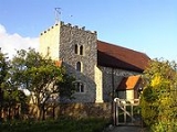
Isle of Grain
Overview
Kent
Kent is a county in southeast England, and is one of the home counties. It borders East Sussex, Surrey and Greater London and has a defined boundary with Essex in the middle of the Thames Estuary. The ceremonial county boundaries of Kent include the shire county of Kent and the unitary borough of...
, England, is the easternmost point of the Hoo Peninsula
Hoo Peninsula
The Hoo Peninsula is a peninsula in England separating the estuaries of the rivers Thames and Medway. It is dominated by a line of sand and clay hills, surrounded by an extensive area of marshland composed of alluvial silt. The name Hoo is the Old English word for spur of land.-History:The Romans...
. No longer an island, the Isle is almost all marshland and the Grain Marshes are an important habitat for birdlife. The Isle constitutes a civil parish, which at the 2001 census had a population of 1,731.
The following extract is taken from the Topographical Dictionary of Great Britain and Ireland by John Gorton
John Gorton (writer)
John Gorton was an English writer, known as a compiler of reference works.His works include:* a translation of Voltaire's Dictionnaire Philosophique, 1824;...
, 1833:
Graine, Isle of
A parish in the Hundred of Hoo, lathe of Aylesford, opposite to Sheppey at the mouth of the Thames; it is about 3.5 miles (5.6 km) long and 2.5 miles (4 km) broad and is formed by Yantlet Creek running from the Medway to the Thames.

