
List of Idaho State Highways
Encyclopedia
The Idaho Transportation Department
is responsible for the establishment and classification of a state highway network which includes the interstate highways, U.S. highways, and state routes. These routes are listed below.
The following trails were marked:
Idaho Transportation Department
The Idaho Transportation Department is the State of Idaho governmental organization responsible for the current transportation infrastructure. This includes ongoing operations and maintenance; as well as planning for future needs of the state and its citizens...
is responsible for the establishment and classification of a state highway network which includes the interstate highways, U.S. highways, and state routes. These routes are listed below.
History
Instead of numbering its highways, Idaho had a system of lettered Sampson Trails in the 1920s. They were marked by Charles B. Sampson of Boise at no expense to the state. By the mid-1930s, the state had adopted a more standard system of numbered state highways.The following trails were marked:
- A, Boise to WyomingWyomingWyoming is a state in the mountain region of the Western United States. The western two thirds of the state is covered mostly with the mountain ranges and rangelands in the foothills of the Eastern Rocky Mountains, while the eastern third of the state is high elevation prairie known as the High...
via Twin Falls and Pocatello; became US-30 and US-30N - B, Boise to CanadaCanadaCanada is a North American country consisting of ten provinces and three territories. Located in the northern part of the continent, it extends from the Atlantic Ocean in the east to the Pacific Ocean in the west, and northward into the Arctic Ocean...
via Lewiston and Coeur d'Alene; became US-30, US-30N, US-95, and SH-1 - C, Pocatello to MontanaMontanaMontana is a state in the Western United States. The western third of Montana contains numerous mountain ranges. Smaller, "island ranges" are found in the central third of the state, for a total of 77 named ranges of the Rocky Mountains. This geographical fact is reflected in the state's name,...
via Idaho Falls; became US-91 and US-191 - D, Boise to New Meadows via BanksBanks, IdahoBanks is an unincorporated census-designated place in Boise County, Idaho, United States. Banks is located on Idaho State Highway 55 north-northeast of Horseshoe Bend. Banks has a post office with ZIP code 83602. As of the 2010 census, its population was 17....
; became SH-15 - E, not on the 1926 map
- F, Boise to Blackfoot via Stanley; became SH-21, SH-17, US-93, and SH-27
- G, Mountain Home to Picabo via Fairfield; became SR-22
- H, Bliss to Trude via Arco; became SH-24, SH-23, SH-22, SH-29, and an unnumbered road
- I, Pioneer to Idaho Falls; became an unnumbered road
- J, NevadaNevadaNevada is a state in the western, mountain west, and southwestern regions of the United States. With an area of and a population of about 2.7 million, it is the 7th-largest and 35th-most populous state. Over two-thirds of Nevada's people live in the Las Vegas metropolitan area, which contains its...
to Shoshone via Twin Falls; became US-93 - K, UtahUtahUtah is a state in the Western United States. It was the 45th state to join the Union, on January 4, 1896. Approximately 80% of Utah's 2,763,885 people live along the Wasatch Front, centering on Salt Lake City. This leaves vast expanses of the state nearly uninhabited, making the population the...
to McCammon via Preston; became US-91 - L, not on the 1926 map
- M, Washington to MontanaMontanaMontana is a state in the Western United States. The western third of Montana contains numerous mountain ranges. Smaller, "island ranges" are found in the central third of the state, for a total of 77 named ranges of the Rocky Mountains. This geographical fact is reflected in the state's name,...
via Coeur d'Alene; became US-10 - N, Bonners Ferry to MontanaMontanaMontana is a state in the Western United States. The western third of Montana contains numerous mountain ranges. Smaller, "island ranges" are found in the central third of the state, for a total of 77 named ranges of the Rocky Mountains. This geographical fact is reflected in the state's name,...
; became US-2 - O, OregonOregonOregon is a state in the Pacific Northwest region of the United States. It is located on the Pacific coast, with Washington to the north, California to the south, Nevada on the southeast and Idaho to the east. The Columbia and Snake rivers delineate much of Oregon's northern and eastern...
to Caldwell; became SH-49 and SH-18 - P, UtahUtahUtah is a state in the Western United States. It was the 45th state to join the Union, on January 4, 1896. Approximately 80% of Utah's 2,763,885 people live along the Wasatch Front, centering on Salt Lake City. This leaves vast expanses of the state nearly uninhabited, making the population the...
to Downey; became SH-36 - Q, Declo to Fairfield; became SH-25 and SH-46
- R, not on the 1926 map
- S, OregonOregonOregon is a state in the Pacific Northwest region of the United States. It is located on the Pacific coast, with Washington to the north, California to the south, Nevada on the southeast and Idaho to the east. The Columbia and Snake rivers delineate much of Oregon's northern and eastern...
to Nampa; became unnumbered road and SH-45 - T, Star to Grimes Pass; became SH-16, unnumbered road, and SH-17
- U, UtahUtahUtah is a state in the Western United States. It was the 45th state to join the Union, on January 4, 1896. Approximately 80% of Utah's 2,763,885 people live along the Wasatch Front, centering on Salt Lake City. This leaves vast expanses of the state nearly uninhabited, making the population the...
to Montpelier; became SH-35 - V, Hailey to Stanley; became US-93
- W, not on the 1926 map
- X, not on the 1926 map
- Y, Bonners Ferry to CanadaCanadaCanada is a North American country consisting of ten provinces and three territories. Located in the northern part of the continent, it extends from the Atlantic Ocean in the east to the Pacific Ocean in the west, and northward into the Arctic Ocean...
; became US-95
Interstates
 |
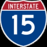
Interstate 15 | At 200 miles (321.9 km) in length, it traverses through Pocatello Pocatello, Idaho Pocatello is the county seat and largest city of Bannock County, with a small portion on the Fort Hall Indian Reservation in neighboring Power County, in the southeastern part of the U.S. state of Idaho. It is the principal city of the Pocatello metropolitan area, which encompasses all of Bannock... , Blackfoot Blackfoot, Idaho Blackfoot is a city in Bingham County, Idaho, United States. The population was 10,419 at the 2000 census. The city is the county seat of Bingham County. Blackfoot is self-designated the "Potato Capital of the World", because it claims to have the largest potato industry in the world... , and Idaho Falls Idaho Falls, Idaho Idaho Falls is a city in and the county seat of Bonneville County, Idaho, United States, and the largest city in Eastern Idaho. As of the 2010 census, the population of Idaho Falls was 56,813, with a metro population of 130,374.... . |
_map.svg.png) |
 |
Interstate 84 Interstate 84 in Idaho In the U.S. state of Idaho, Interstate 84 heads southeast from the Oregon state line, it spurs to Interstate 184 in Boise. Eventually I-84 spurs Interstate 86 and mainline I-84 heads southeast towards Utah and I-86 is continues due east and heads to Pocatello, meeting with Interstate 15.-Future:... |
Crossing through the "heel" of the Idaho "boot", this interstate passes through Boise Boise, Idaho Boise is the capital and most populous city of the U.S. state of Idaho, as well as the county seat of Ada County. Located on the Boise River, it anchors the Boise City-Nampa metropolitan area and is the largest city between Salt Lake City, Utah and Portland, Oregon.As of the 2010 Census Bureau,... , near Twin Falls Twin Falls, Idaho Twin Falls is the county seat and largest city of Twin Falls County, Idaho, United States. The population was 44,125 at the 2010 censusTwin Falls is the largest city of Idaho's Magic Valley region... , and other smaller towns. |
|
 |
Interstate 86 Interstate 86 (west) Interstate 86 is an intrastate Interstate Highway, located entirely within the state of Idaho. It runs 63 miles from an intersection with Interstate 84 located approximately 7 miles east of Declo in rural Cassia County, to an intersection with Interstate 15 at Pocatello... |
Located entirely within Idaho, it stretches from Interstate 84 in Heyburn Heyburn, Idaho Heyburn is a city in Minidoka County, Idaho, United States. The population was 2,899 at the 2000 census. It is part of the Burley, Idaho Micropolitan Statistical Area.The city was named after Weldon Heyburn, a U.S. Senator from Idaho from 1903-12.... to Interstate 15 at Pocatello Pocatello, Idaho Pocatello is the county seat and largest city of Bannock County, with a small portion on the Fort Hall Indian Reservation in neighboring Power County, in the southeastern part of the U.S. state of Idaho. It is the principal city of the Pocatello metropolitan area, which encompasses all of Bannock... . |
|
 |
Interstate 90 Interstate 90 in Idaho In the U.S. state of Idaho, Interstate 90 has a small routing in the panhandle, just under 74 miles . Traveling east from Spokane, Washington, I-90 passes through Post Falls and Coeur d'Alene, over Fourth of July Summit, and through the Silver Valley before entering Montana at Lookout Pass.I-90 is... |
The 73 miles (117.5 km) segment of interstate highway boasted one of the last traffic lights on the interstate highway system at Wallace Wallace, Idaho Wallace is a historic city in the Panhandle region of the U.S. state of Idaho and the county seat of Shoshone County in the Silver Valley mining district... . |
_map.svg.png) |
 |
Interstate 184 | This spur connects Interstate 84 travelers to downtown Boise Boise, Idaho Boise is the capital and most populous city of the U.S. state of Idaho, as well as the county seat of Ada County. Located on the Boise River, it anchors the Boise City-Nampa metropolitan area and is the largest city between Salt Lake City, Utah and Portland, Oregon.As of the 2010 Census Bureau,... . |
U.S. Highways
 |
US-2 | |
 |
US-10 | Replaced by Interstate 90. Interstate 90 Business Interstate 90 Business Interstate 90 Business may refer to several business routes of the Interstate Highway System that connects Interstate 90 with the central business district of various cities bypassed by I-90. Each business route can be either a business loop or a business spur, depending on whether both ends... in Coeur d'Alene Coeur d'Alene, Idaho Coeur d'Alene is the largest city and county seat of Kootenai County, Idaho, United States. It is the principal city of the Coeur d'Alene Metropolitan Statistical Area. Coeur d'Alene has the second largest metropolitan area in the state of Idaho. As of the 2010 census the population of Coeur... , Osburn Osburn, Idaho Osburn is a city in Shoshone County, Idaho, United States. The population was 1,555 at the 2010 census.-Geography:Osburn is located at .According to the United States Census Bureau, the city has a total area of , all land.... /Silverton Silverton, Idaho Silverton is an unincorporated community in Shoshone County, Idaho, United States, located one mile west of Wallace.... , Post Falls Post Falls, Idaho Post Falls is a city in Kootenai County, Idaho, United States near the Idaho state line between Spokane, Washington, and Coeur d'Alene, Idaho. The population was 17,247 at the 2000 census, and grew to 27,574 people by the 2010 census, making it Idaho's tenth largest city.-History:Post Falls is... , and Wallace Wallace, Idaho Wallace is a historic city in the Panhandle region of the U.S. state of Idaho and the county seat of Shoshone County in the Silver Valley mining district... are segments of US-10. |
 |
US-12 | |
 |
US-20 | Theres a freeway like section in eastern Idaho from Idaho Falls to Chester Idaho. |
 |
US-26 | |
 |
US-30 | mostly Concurrent with Interstate 84 and Interstate 86 |
 |
US-30N | Renumbered U.S. Route 95 Spur |
 |
US-30S | |
 |
US-89 | |
 |
US-91 | |
 |
US-93 U.S. Route 93 in Idaho U.S. Route 93 is a north–south U.S. Highway in the U.S. state of Idaho.-Route description:US 93 enters Idaho from a point immediately north of the border casino town of Jackpot, Nevada.... |
Runs from Jackpot, Nevada Jackpot, Nevada Jackpot is an unincorporated community in Elko County, Nevada, United States. The Zip Code Tabulation Area for its ZIP code, 89825, had a population of 1,189 as of the 2010 census. Located less than 1 mile from the Idaho border on U.S... to Lost Trail Pass Lost Trail Pass Lost Trail Pass is a mountain pass in the Rocky Mountains of the United States, on the border of Idaho and Montana in the Bitterroot Mountains. The pass is at an elevation of 7014 feet above sea level and is traversed by U.S. Highway 93... in Montana. Concurrency with US 26 from Shoshone to Arco. |
 |
US-95 | Currently being upgraded to a freeway like highway for safety and for a faster and easier way to connect the 2 most populous Metro areas in Idaho. |
 |
US-95E | |
 |
US-95W | |
 |
US-191 | |
 |
US-195 | |
 |
US-287 | Section in Idaho renamed Idaho Highway 87 |
| US-410 | Renumbered U.S. Route 12 U.S. Route 12 in Idaho US Route 12 is a state highway in north central Idaho. It extends from the Washington state line in Lewiston east to the Montana state line at Lolo Pass, generally along the route of the Lewis and Clark expedition, and is known as the Northwest Passage Scenic Byway -Route description:US 12 enters... |
|
 |
US-630 | Renumbered as U.S. Route 95 Spur in Weiser Weiser, Idaho Weiser is a city in the rural western part of the U.S. state of Idaho and the county seat of Washington County. With its mild climate, the city supports farm, orchard, and livestock endeavors in the vicinity. The city sits at the confluence of the Weiser River with the great Snake River, which... |
State highways
 |
SH-1 Idaho State Highway 1 State Highway 1 is a state highway in Boundary County, in the U.S. state of Idaho. It extends from U.S. Route 95 east of Copeland, north to British Columbia Highway 21 in Porthill. The route serves as a connector between Bonners Ferry, via US-95 south, Porthill, and Creston, BC. The highway is... |
Connects US-95 to the Canadian border at Porthill. |
 |
SH-3 Idaho State Highway 3 Idaho State Highway 3 is a state highway in northern Idaho connecting US 12 near Spalding with I-90 near Rose Lake. It is long and runs north–south.-Route description:... |
Runs from Nez Perce County north to I-90 in Kootenai County. |
 |
SH-4 Idaho State Highway 4 State Highway 4 is a state highway in Shoshone County, in the U.S. state of Idaho. It runs from Interstate 90 in Wallace, east to the ghost town of Burke.-Route description:... |
A six-mile (10 km) road from Wallace to the ghost towns of Gem and Burke. |
 |
SH-5 Idaho State Highway 5 State Highway 5 is a state highway in Benewah County, in the U.S. state of Idaho. It runs from U.S. Route 95 in Plummer, east to SH-3 in Saint Maries.-Route description:... |
A short road from Plummer to St. Maries. |
 |
SH-6 Idaho State Highway 6 Idaho State Highway 6 is a state highway in northern Idaho running from the Washington state line near Potlatch to Santa. It is long and runs north-south.-Route description:... |
Connects State Highway 3 to the Washington border near Potlatch. |
 |
SH-7 Idaho State Highway 7 Idaho State Highway 7 is a state highway in Clearwater County, Idaho running from the Lewis County line through Orofino. It is long and runs north-south.-Route description:... |
Serves the communities of Orofino and Ahsahka. |
 |
SH-8 Idaho State Highway 8 State Highway 8 is an Idaho state highway in Latah and Clearwater counties, running from the Washington state line in Moscow to Elk River. It is in length, and runs primarily east–west.-Route description:... |
Runs from the Washington border at Moscow to Elk River. |
 |
SH-9 Idaho State Highway 9 State Highway 9 is a state highway in Latah County, in the U.S. state of Idaho. It runs from SH-8 near Deary, north to SH-6 near Harvard.-Route description:... |
Connects State Highway 6 at Princeton to State Highway 8 at Deary. |
 |
SH-11 Idaho State Highway 11 State Highway 11 is a state highway in northern Idaho. It runs from U.S. Route 12 near Greer, north to Headquarters.-Route description:... |
A road through Weippe and Pierce in Clearwater County. |
 |
SH-13 Idaho State Highway 13 Idaho State Highway 13 is a state highway located entirely within in Idaho County, Idaho. SH 13 is and runs from its southern terminus at U.S. Route 95 in Grangeville to its northern terminus at U.S. Route 12 in Kooskia. In addition to those cities, SH 13 also serves the city of Stites and the... |
Runs from Kooskia to downtown Grangeville. |
 |
SH-14 Idaho State Highway 14 Idaho State Highway 14 is a state highway located entirely within Idaho County, Idaho. It runs from its western terminus at Idaho State Highway 13 near Grangeville to its eastern terminus at Sweeney Hill Road in unincorporated Elk City. SH 14 passes through two communities, Golden and Elk City... |
Entirely in Idaho County, it connects Grangeville to Elk City. |
 |
SH-16 Idaho State Highway 16 State Highway 16 is a 14 mile route connecting State Highway 44 and Star with Emmett.-Route description:Also known as the Emmett Highway, Highway 16 begins at the junction of State Highway 44 near Star and Eagle. The highway continues north through Jackass Gulch and descends over 500 vertical feet... |
A short route from Star to Emmett. A freeway like corridor is planned to extend SH-16 to I-84 West. |
 |
SH-19 | A valley road from Caldwell to the Oregon border near Homedale. |
 |
SH-21 Idaho State Highway 21 Idaho State Highway 21 is the Ponderosa Pine Scenic Byway, primarily a two-lane highway from Boise to Stanley. With two-thirds of its length in Boise County, it passes by historic Idaho City and the village of Lowman to the western edge of the Sawtooth Mountains, then along their northern... |
Runs from the east end of Boise to Stanley. |
 |
SH-22 | A route from Dubois to Butte County, where it joins State Highway 33. |
 |
SH-24 Idaho State Highway 24 Idaho State Highway 24 is a long state highway in Idaho that runs east west from Shoshone, Idaho on the far west to Minidoka and Acequia on the far east. It passes Dietrich, Owinza, and Kimima and runs approximately north of Paul and Burley and 15 north of Rupert. U.S. Highway 93 borders the... |
In south-central Idaho from Burley to Shoshone. |
 |
SH-25 Idaho State Highway 25 Idaho State Highway 25 is a 58.05 mi state highway in Idaho that runs east-west from Jerome, Idaho in the west to Interstate 84 north of Declo in the east. Idaho State Highway 25 also passes through Eden, Hazleton, Paul and Rupert.... |
Runs near Interstate 84 from Jerome to the Declo area. |
 |
SH-27 | Connects the town of Oakley to Burley and Paul. |
 |
SH-28 Idaho State Highway 28 Idaho State Highway 28 is a long state highway in Idaho which runs from Salmon, Idaho to Interstate 15 near the Continental Divide.It runs through Tendoy, Idaho in Lemhi County, Idaho.... |
Runs from Salmon to Interstate 15 near the Continental Divide. |
 |
SH-29 | A route from Leadore to the nearby Montana border. |
 |
SH-31 Idaho State Highway 31 Idaho State Highway 31 is a north-south state highway in the eastern part of the U.S. state of Idaho. SH-31 runs from U.S. Route 26 in Swan Valley north to Idaho State Highway 33 in Victor. The highway is maintained by the Idaho Transportation Department.... |
In eastern Idaho from Swan Valley to Victor. |
 |
SH-32 | An eastern Idaho road from Ashton to Tetonia. |
 |
SH-33 | Runs from Butte County to the Wyoming border. |
 |
SH-34 | Diverges from State Highway 36 near Preston, and runs to the Wyoming border. |
 |
SH-36 | An east-west road from Ovid through Preston to Interstate 15. |
 |
SH-37 | Runs from the Oneida/Power county line north to Interstate 86 at American Falls. |
 |
SH-38 Idaho State Highway 38 Idaho State Highway 38 is a east-west state highway located entirely within Oneida County in the southeast part of the U.S. state of Idaho. SH-38 runs from Holbrook east to Interstate 15 in Malad City. The highway is maintained by the Idaho Transportation Department.-Route description:SH-38 begins... |
Runs east from Holbrook to Malad City and Interstate 15. |
 |
SH-39 Idaho State Highway 39 Idaho State Highway 39 is a state highway located in Power and Bingham counties in Idaho. SH 39 is long and runs from its southern terminus at Interstate 86 in American Falls to its northern terminus at U.S. Route 26 in Blackfoot. Between the two cities, it passes through the city of Aberdeen and... |
A route from Blackfoot to American Falls. |
 |
SH-40 Idaho State Highway 40 Idaho State Highway 40 is a state highway located in Bannock County, Idaho. SH-40 is long and runs from its western terminus at Interstate 15 west of Downey to its eastern terminus at U.S. Route 91 in Downey... |
A very short connector from Downey to Interstate 15. |
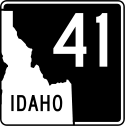 |
SH-41 Idaho State Highway 41 State Highway 41, abbreviated SH-41, is a state highway mostly in the U.S. state of Idaho. It runs from Interstate 90 in Post Falls to U.S. Route 2 on the Washington state line. The northernmost of SH-41 run along State Street along the state line, with the southbound lane in the town of... |
Runs north from Post Falls to the Washington border (near Newport, Washington). |
 |
SH-43 Idaho State Highway 43 Idaho State Highway 43 is a state highway located in Bonneville County, Idaho. SH-43 is long and runs from its southern terminus at U.S. Route 26 in Beachs Corner to its northern terminus at U.S. Route 20 in Ucon. The highway is maintained by the Idaho Transportation Department.-Route... |
A short route from US Highway 26 north to Ucon. |
 |
SH-44 Idaho State Highway 44 State Highway 44 is a road that travels through the Treasure Valley from Interstate 84 to Garden City, Idaho.-Route description:State Highway 44 starts at the junction of Interstate 84 north of Caldwell at Exit 25. The highway heads eastward staying mostly to the north of the Boise River. The... |
Cuts across the Treasure Valley from Interstate 84 to Garden City. |
 |
SH-45 | Connects State Highway 78 to downtown Nampa. |
 |
SH-46 | Runs south from Camas County to Wendell. |
 |
SH-47 | A short highway in Fremont County that ends in Ashton. |
 |
SH-48 | A route in eastern Idaho from Roberts to Ririe Ririe, Idaho Ririe is a city in Bonneville and Jefferson counties in the eastern part of the U.S. state of Idaho. It is part of the Idaho Falls, Idaho Metropolitan Statistical Area. The population was 656 at the 2010 census.- History :... . |
 |
SH-50 | Connects US Highway 30 near Kimberly to State Highway 25. |
 |
SH-51 Idaho State Highway 51 State Highway 51 is a 92 mile road in southwestern Idaho from Mountain Home south to the Nevada border, where it continues as State Route 225 to Elko. At its northern terminus in Mountain Home, SH-51 connects at the junction of U.S. Highway 20 and Interstate 84... |
A rural road from Mountain Home south to the Nevada border. |
 |
SH-52 Idaho State Highway 52 State Highway 52 is a state highway in the U.S. State of Idaho that travels along the Payette River from the Oregon State Line and Snake River to Horseshoe Bend.-Route description:... |
Runs from Horseshoe Bend to the Oregon border at Payette. |
 |
SH-53 Idaho State Highway 53 State Highway 53 is a long state highway serving Kootenai County in the U.S. state of Idaho. SH-53 travels northeast from Washington State Route 290 at the Washington state border near Hauser to a short concurrency with SH-41 in Rathdrum. From Rathdrum, the highway continues east to end at U.S.... |
Runs west from Rathdrum to the Washington border. |
 |
SH-54 | In northern Idaho between Spirit Lake and Bayview. |
 |
SH-55 Idaho State Highway 55 State Highway 55 is an Idaho highway from Marsing to New Meadows, connecting with US-95 at both ends.From Marsing it travels east to Nampa, Meridian, and Eagle, then north to Horseshoe Bend. SH-55 then climbs the Payette River to Banks, then its north fork to the Long Valley, through the towns of... |
Begins at Marsing, runs east to Meridian, and turns north to New Meadows. |
 |
SH-57 Idaho State Highway 57 Idaho State Highway 57 is a state highway located entirely within Bonner County in the Idaho Panhandle region of the U.S. state of Idaho. SH-57 runs from U.S. Route 2 in Priest River north to the end of state maintenance in Nordman. The highway is maintained by the Idaho Transportation... |
A route from Priest River to Nordman. |
 |
SH-58 | A short continuation of WA 278 to fully connect US Highway 95 to Rockford, Washington. |
 |
SH-60 | Runs from US Highway 95 near Plummer to the Washington border. |
 |
SH-61 Idaho State Highway 61 Idaho State Highway 61 is a short north-south State Highway located in extreme eastern Bear Lake County.-Route description:Idaho State Highway 61 begins at the Wyoming State Line as a continuation of Wyoming Highway 89. Highway 61 only travels north just under eight-tenths of a mile to end at U.S.... |
A one-mile (1.6 km) continuation of WY 89 near Geneva. |
 |
SH-62 | A route from Craigmont to Nezperce in north-central Idaho. |
 |
SH-64 | Runs east from Nezperce to Kamiah and US Highway 12. |
 |
SH-66 | A one-mile (1.6 km) road from US Highway 95, near Viola, that continues into Washington. |
 |
SH-67 | A road between Mountain Home and Mountain Home Air Force Base. |
 |
SH-69 Idaho State Highway 69 Idaho State Highway 69 is a short highway from Kuna to Interstate 84, in Meridian.-Route description:State Highway 69 starts at its southern junction and terminus in Kuna... |
A short highway from Kuna to Interstate 84 in Meridian. |
 |
SH-71 | Connects Cambridge to the Oregon border near Brownlee Dam. |
 |
SH-72 | Connects New Plymouth to nearby State Highway 52. |
 |
SH-74 Idaho State Highway 74 State Highway 74 is a short state highway that affords access between U.S. Route 93 and downtown Twin Falls. The road is located entirely in Twin Falls County.-Route description:... |
Starts just south of Twin Falls and ends in the downtown area. |
 |
SH-75 Idaho State Highway 75 State Highway 75 is a two-lane highway that travels through the Sawtooth Range of central Idaho from Shoshone to Challis. The road is designated as one of Idaho's scenic byways and provides access to Sawtooth National Recreation Area... |
Runs from Shoshone through the Sun Valley area to Challis. |
 |
SH-77 | Connects US Highway 30 to Malta. |
 |
SH-78 | A rural highway from Marsing to Hammett. |
 |
SH-79 | A road from US Highway 93 in Twin Falls north to Jerome. |
 |
SH-81 | Runs from Malta to Burley. |
 |
SH-87 | Runs from US Highway 20 near Henrys Lake to the Montana border. |
 |
SH-97 | A route from Harrison to Interstate 90. |
 |
SH-99 | A short highway from Troy to Kendrick. |
 |
SH-128 | A road in north Lewiston that runs to the Washington border. |
 |
SH-162 | A route from Nezperce to Kamiah. |
| SH-167 | A road between Grand View and Mountain Home Air Force Base. | |
 |
SH-200 Idaho State Highway 200 State Highway 200 is a two-lane highway from Ponderay, Idaho eastward to the Montana border. The highway has been dedicated as a national scenic byway and given the name Pend Oreille Scenic Byway.-Route description:... |
Pend Oreille Scenic Byway runs east from Ponderay, ID to the Montana border. |