
List of GIS software
Encyclopedia
GIS software
encompasses a broad range of applications, all of which involve the use of some combination of digital maps and georeferenced data. GIS software can be sorted into different categories. Below is a list of notable GIS software applications. Please update the listing of software below with respect to the different categories.

other:
and .
WebMap Server
Spatial Database Management Systems
Software Development Frameworks and Libraries (non-web)
Software Development Frameworks and Libraries (for web applications)
Cataloging application for spatially referenced resources
Spatial ETL
GIS software
The umbrella term GIS software refers to a geographic information system application, which is software used to create, manage, analyze and display geospatial data on digital maps...
encompasses a broad range of applications, all of which involve the use of some combination of digital maps and georeferenced data. GIS software can be sorted into different categories. Below is a list of notable GIS software applications. Please update the listing of software below with respect to the different categories.
Open source software
The development of open source GIS software has - in terms of software history - a long tradition with the appearance of a first system in 1978. Numerous systems are nowadays available which cover all sectors of geospatial data handling.Desktop GIS
The following open source desktop GIS projects are reviewed in Steiniger and Bocher (2008/9):- GRASS GISGRASS GISGRASS GIS is a free, open source geographical information system capable of handling raster, topological vector, image processing, and graphic data....
– Originally developed by the U.S. Army Corps of Engineers, open source: a complete GIS - SAGA GISSAGA GISSAGA GIS is a free and open source geographic information system used for editing spatial data. It was originally developed by a small team at the Department of Physical Geography, University of Göttingen, Germany, and is now being maintained and extended by an international developer...
– System for Automated Geoscientific Analysis- a hybrid GIS software. SAGA has a unique Application Programming InterfaceApplication programming interfaceAn application programming interface is a source code based specification intended to be used as an interface by software components to communicate with each other...
(API) and a fast growing set of geoscientific methods, bundled in exchangeable Module Libraries. - Quantum GISQuantum GISQuantum GIS is a free software desktop Geographic Information Systems application that provides data viewing, editing, and analysis capabilities.-Development:...
– QGIS is an Open Source GIS that runs on Linux, Unix, Mac OS X, and Windows. - MapWindow GISMapWindow GISMapWindow GIS is an open source GIS application and set of programmable mapping components. It has been adopted by the United States Environmental Protection Agency as the primary GIS platform for its BASINS watershed analysis and modeling software.-Technical details:MapWindow GIS is distributed...
– Free, open source GIS desktop application and programming component. - ILWISILWISILWIS is a GIS / Remote sensing software for both vector and raster processing. ILWIS features include digitizing, editing, analysis and display of data as well as production of quality maps...
– ILWIS (Integrated Land and Water Information System) integrates image, vector and thematic data. - uDigUDiguDig is a GIS software program produced by a community led by Canadian-based consulting company Refractions Research. It is based on the Eclipse platform and features full layered Open Source GIS...
– Open source GIS desktop application (API and source code (Java) available). - gvSIGGvSIGgvSIG is a geographic information system , that is, a desktop application designed for capturing, storing, handling, analyzing and deploying any kind of referenced geographic information in order to solve complex management and planning problems. gvSIG is known for having a user-friendly interface,...
– Open source GIS written in Java. - JUMP GISJUMP GISJUMP is a Java based vector GIS and programming framework. Current development continues under the OpenJUMP name.-Features:* platform independent * reads and writes ESRI Shapefile, GML files, DXF and PostGIS...
/ OpenJUMP – (Open) Java Unified Mapping Platform (the desktop GIS OpenJUMP, SkyJUMP, deeJUMP and KosmoKosmoKosmo is a desktop geographic information system with advanced functions. It is the first of a series of developments that are being made available to the community....
emerged from JUMP; see )
other:
- Whitebox GATWhitebox Geospatial Analysis ToolsWhitebox Geospatial Analysis Tools is an open-source Geographic information system and remote sensing software package that is distributed under the GNU General Public License. It has been developed by the members of the University of Guelph and is intended for advanced geospatial analysis and...
– Open source and transparent GIS software - Kalypso (software)Kalypso (software)Kalypso is an open source modelling software. It focuses on numerical simulations in water management and ecology such as the generation of inundation and flood risk maps by hydrologic and hydrodynamic models and GIS functionality....
– Kalypso is an Open Source GIS (Java, GML3) and focuses mainly on numerical simulations in water management. - TerraViewTerraViewTerraView is an GIS application built on the TerraLib GIS library. TerraView handles vector data and raster data , both of them stored in a relational or geo-relational database, including ACCESS, PostgreSQL, MySQL and Oracle Spatial...
– GIS desktop that handles vector and raster data stored in a relational or geo-relational database, i.e. a frontend for TerraLibTerraLibTerraLib is an open source GIS software library that extends object-relational DBMS technology to handle spatiotemporal data types. The library supports different DBMS, including MySQL, PostgreSQL, and Oracle. Its vector data model is upwards compliant with OGC) standards...
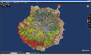
. - CapawareCapawareCapaware is a 3D general purpose virtual worlds viewer. This is a free software project and began in 2007. This project has been released for the purpose of promoting the development of free software in the Canary Islands by its Government. Capaware allows interaction with 3D virtual terrain...
– Capaware is also an Open Source GIS, an incredible fast C++ 3D GIS Framework with a multiple plugin architecture for geographic graphical analysis and visualization. - FalconViewFalconViewFalconView is a mapping system created by the Georgia Tech Research Institute for the Windows family of operating systems. It displays various types of maps and geographically referenced overlays. Many types of maps are supported, but the primary ones of interest to most users are aeronautical...
– FalconView is a mapping system created by the Georgia Tech Research Institute for the Windows family of operating systems. A free, open source version is available.
Other GIS tools - classified
Note, for different categories of GIS tools see GIS softwareGIS software
The umbrella term GIS software refers to a geographic information system application, which is software used to create, manage, analyze and display geospatial data on digital maps...
and .
WebMap Server
- MapnikMapnikMapnik is an open source mapping toolkit, written in C++ and useful for both desktop- and server-based map rendering. One of its many users is the OpenStreetMap project which uses it in combination with an Apache Web Server module to render tiles that make up the OSM 'Slippy Map' Layer...
- C++/Python library for rendering - used by OpenStreetMapOpenStreetMapOpenStreetMap is a collaborative project to create a free editable map of the world. Two major driving forces behind the establishment and growth of OSM have been restrictions on use or availability of map information across much of the world and the advent of inexpensive portable GPS devices.The... - GeoServerGeoServerIn computing, GeoServer - an open-source server written in Java - allows users to share and edit geospatial data. Designed for interoperability, it publishes data from any major spatial data source using open standards...
- MapGuide Open SourceMapGuide Open SourceMapGuide Open Source is a web-based map-making platform that enables users to quickly develop and deploy web mapping applications and geospatial web services...
– Web-based mapping server. - MapServerMapServerMapServer is an open source development environment for building spatially-enabled internet applications. It can run as a CGI program or via MapScript which supports several programming languages . MapServer was developed by the University of Minnesota — so, it is often and more specifically...
– Web-based mapping server, developed by the University of MinnesotaUniversity of MinnesotaThe University of Minnesota, Twin Cities is a public research university located in Minneapolis and St. Paul, Minnesota, United States. It is the oldest and largest part of the University of Minnesota system and has the fourth-largest main campus student body in the United States, with 52,557...
.
Spatial Database Management Systems
- PostGISPostGISPostGIS is an open source software program that adds support for geographic objects to the PostgreSQL object-relational database. PostGIS follows the Simple Features for SQL specification from the Open Geospatial Consortium .-Features:...
– Spatial extensions for the open source PostgreSQLPostgreSQLPostgreSQL, often simply Postgres, is an object-relational database management system available for many platforms including Linux, FreeBSD, Solaris, MS Windows and Mac OS X. It is released under the PostgreSQL License, which is an MIT-style license, and is thus free and open source software...
database, allowing geospatial queries. - TerraLibTerraLibTerraLib is an open source GIS software library that extends object-relational DBMS technology to handle spatiotemporal data types. The library supports different DBMS, including MySQL, PostgreSQL, and Oracle. Its vector data model is upwards compliant with OGC) standards...
is a spatial DBMS and also provides advanced functions for GIS analysis. - SpatiaLiteSpatialiteSpatiaLite is a spatial extension to SQLite, providing vector geodatabase functionality. It is similar to PostGIS, Oracle Spatial, and SQL Server with spatial extensions, although SQLite/SpatiaLite aren't based on client-server architecture: they adopt a simpler personal architecture. i.e...
– Spatial extensions for the open source SQLiteSQLiteSQLite is an ACID-compliant embedded relational database management system contained in a relatively small C programming library. The source code for SQLite is in the public domain and implements most of the SQL standard...
database, allowing geospatial queries.
Software Development Frameworks and Libraries (non-web)
- GeoToolsGeoToolsGeoTools is a free software GIS toolkit for developing standards compliant solutions.It provides an implementation of Open Geospatial Consortium specifications as they are developed...
– Open source GIS toolkit written in JavaJava (programming language)Java is a programming language originally developed by James Gosling at Sun Microsystems and released in 1995 as a core component of Sun Microsystems' Java platform. The language derives much of its syntax from C and C++ but has a simpler object model and fewer low-level facilities...
, using Open Geospatial ConsortiumOpen Geospatial ConsortiumThe Open Geospatial Consortium , an international voluntary consensus standards organization, originated in 1994. In the OGC, more than 400 commercial, governmental, nonprofit and research organizations worldwide collaborate in a consensus process encouraging development and implementation of open...
specifications. - GDALGDALGDAL is a library for reading and writing raster geospatial data formats, and is released under the permissive X/MIT style free software license by the Open Source Geospatial Foundation. As a library, it presents a single abstract data model to the calling application for all supported formats...
/ OGR - Orfeo toolboxOrfeo toolboxOrfeo Toolbox is a library for remote sensing image processing. The project had been initiated by the French space agency in 2006 and is under heavy developments and the participation from the open source community is currently growing. The goal is to provide potential users of satellite images...
Software Development Frameworks and Libraries (for web applications)
- OpenLayersOpenLayersOpenLayers is an open source JavaScript library for displaying map data in web browsers. It provides an API for building rich web-based geographic applications similar to Google Maps and Bing Maps...
– open source AJAXAjax- Mythology :* Ajax , son of Telamon, ruler of Salamis and a hero in the Trojan War, also known as "Ajax the Great"* Ajax the Lesser, son of Oileus, ruler of Locris and the leader of the Locrian contingent during the Trojan War.- People :...
library for accessing geographic data layers of all kinds, originally developed and sponsored by MetaCartaMetaCartaMetaCarta is aprivate company providing geographic solutions since 2001. Their headquarters are in Cambridge, MA with additional offices located in Washington DC; Houston, TX; San Francisco, CA; Seattle, WA; and New York, NY.-History:...
. - MapFishMapFishMapFish is an open source web mapping development framework that extends the Pylons development framework and provides support for spatial data. In order to create rich UIs, MapFish aggregates the power of OpenLayers, ExtJS and GeoExt....
- GeoBase (Telogis GIS software) - GeospatialGeospatialGeospatial analysis is an approach to applying statistical analysis and other informational techniques to geographically based data. Such analysis employs spatial software and analytical methods with terrestrial or geographic datasets, including geographic information systems and...
mapping software available as a Software development kitSoftware development kitA software development kit is typically a set of software development tools that allows for the creation of applications for a certain software package, software framework, hardware platform, computer system, video game console, operating system, or similar platform.It may be something as simple...
, which performs various functions including address lookup, mapping, routing, reverse geocoding, and navigation. Suited for high transaction enterprise environments. - GeomajasGeomajasGeomajas is an open source GIS framework for the web. It allows aggregation and transformation of GIS data sources and has components for Web mapping. It was written in Java building on the Spring Framework, JTS Topology Suite, GeoTools, Hibernate spatial, GWT...
, open source development software for web-based and cloud based GIS applications
Cataloging application for spatially referenced resources
- GeoNetwork opensourceGeoNetwork opensourceThe GeoNetwork opensource project is a free and open source cataloging application for spatially referenced resources. It is a catalog of location-oriented information.-Outline:...
– A catalog application to manage spatially referenced resources
Other GIS tools - unclassified
- ST-Links – Connection tool for working with ArcMap and spatial databases PostGres/PostGIS, SQL Server spatial.
- ChameleonChameleon (GIS)Chameleon is an open source, distributed, highly configurable, environment for developing Web Mapping applications. It is built on MapServer as the core mapping engine and works with all MapServer supported data formats...
– Environments for building applications with MapServer. - MapPoint, a technology ("MapPoint Web Service," previously known as MapPoint .NET) and a specific software program created by Microsoft that allows users to view, edit and integrate maps.
Desktop GIS provider
Note: Almost all of the below companies offer Desktop GIS and WebMap Server products. Some offer Spatial DBMS products as well.Companies with High Market Share
- AutodeskAutodeskAutodesk, Inc. is an American multinational corporation that focuses on 3D design software for use in the architecture, engineering, construction, manufacturing, media and entertainment industries. The company was founded in 1982 by John Walker, a coauthor of the first versions of the company's...
– Products include Map 3D, Topobase, MapGuide and other products that interface with its flagship AutoCADAutoCADAutoCAD is a software application for computer-aided design and drafting in both 2D and 3D. It is developed and sold by Autodesk, Inc. First released in December 1982, AutoCAD was one of the first CAD programs to run on personal computers, notably the IBM PC...
software package. - Bentley SystemsBentley SystemsBentley Systems, Incorporated is a software company that produces solutions for the design, construction and operation of infrastructure. The company’s software serves the building, plant, civil, and geospatial vertical markets in the areas of architecture, engineering, construction and operations...
– Products include Bentley Map, Bentley Map View and other products that interface with its flagship MicroStationMicrostationMicroStation is a CAD software product for 2- and 3-dimensional design and drafting, developed and sold by Bentley Systems. The latest versions of the software are released solely for Microsoft Windows operating systems, but historically MicroStation was available for Macintosh platforms and a...
software package. - ERDAS IMAGINEERDAS IMAGINEERDAS IMAGINE is a remote sensing application with raster graphics editor capabilities designed by ERDAS for geospatial applications. The latest version is 2010, version 10.1. ERDAS IMAGINE is aimed primarily at geospatial raster data processing and allows the user to prepare, display and enhance...
by ERDAS Inc; products include Leica Photogrammetry SuiteLeica Photogrammetry SuiteLeica Photogrammetry Suite is a software application for performing photogrammetric operations on imagery and extracting information from imagery...
, ERDAS ER Mapper, and ERDAS ECW JPEG2000 SDK (ECW (file format)ECW (file format)ECW is a proprietary wavelet compression image format optimized for aerial and satellite imagery. It was developed by Earth Resource Mapping, and is now owned by ERDAS, which is owned by Intergraph...
)are used throughout the entire mapping community (GIS, Remote Sensing, Photogrammetry, and image compression). - EsriESRIEsri is a software development and services company providing Geographic Information System software and geodatabase management applications. The headquarters of Esri is in Redlands, California....
– Products include ArcView 3.x, ArcGISArcGISArcGIS is a suite consisting of a group of geographic information system software products produced by Esri.ArcGIS is a system for working with maps and geographic information...
, ArcSDEArcSDEArcSDE is a server-software sub-system that aims to enable the usage of Relational Database Management Systems for spatial data...
, ArcIMSArcIMSArcIMS is a Web Map Server produced by Esri. It is a GIS that is designed to serve maps across the Internet. Sometimes these maps are just static images allowing simple panning and zooming, while others are more complex pages...
, ArcWeb services and ArcGIS ServerArcGIS ServerArcGIS Server is the core server geographic information system software made by Esri. ArcGIS Server is used for creating and managing GIS Web services, applications, and data...
. - IntergraphIntergraphIntergraph Corporation is an American software development and services company. It provides enterprise engineering and geospatially powered software to businesses, governments, and organizations around the world. Intergraph operates through two divisions: Process, Power & Marine and Security,...
– Products include G/Technology, GeoMediaGeoMediaGeoMedia is the technology, suite of software components in Intergraph Corporation's geographic information system and family of software products that include: GeoMedia Objects, GeoMedia Viewer , GeoMedia, GeoMedia Professional, GeoMedia WebMap, GeoMedia WebMap Professional and others...
, GeoMedia Professional, GeoMedia WebMap, and add-on products for industry sectors, as well as photogrammetryPhotogrammetryPhotogrammetry is the practice of determining the geometric properties of objects from photographic images. Photogrammetry is as old as modern photography and can be dated to the mid-nineteenth century....
. - MapInfoMapInfoMapInfo Corporation, initially incorporated as Navigational Technologies Incorporated, was a leading Location Intelligence and GIS company, headquartered in North Greenbush, New York. It was acquired on April 19, 2007 by Pitney Bowes, and on January 28, 2009, the name of division of Pitney Bowes it...
by Pitney Bowes – Products include MapInfo ProfessionalMapInfo ProfessionalMapInfo Professional is a mapping software product produced by MapInfo Corporation.MapInfo Professional has the ability to combine and display, on a single map, data from a variety of sources that are in different formats and projections...
and MapXtreme. - SmallworldSmallworldSmallworld was a GIS company founded in Cambridge, England, in 1989 by Dick Newell and others. It grew to become the global market leader for GIS in utilities and communications, according to Daratech. In September 2000, it was acquired by GE Energy, a division of General Electric...
– developed in Cambridge, England (Smallworld, Inc.) and purchased by General ElectricGeneral ElectricGeneral Electric Company , or GE, is an American multinational conglomerate corporation incorporated in Schenectady, New York and headquartered in Fairfield, Connecticut, United States...
and used primarily by public utilitiesPublic utilityA public utility is an organization that maintains the infrastructure for a public service . Public utilities are subject to forms of public control and regulation ranging from local community-based groups to state-wide government monopolies...
.
Companies with Minor but Notable Market Share
- Aquaveo - Developers of GMS, WMS, SMS, which are modular hydrology programs with 3D mapping features.
- CadcorpCadcorpComputer Aided Development Corporation Ltd. is a British owned and run company established in 1991. Cadcorp has its headquarters in Stevenage, Hertfordshire, U.K. and a development office in London...
– Products include Cadcorp SIS, GeognoSIS, mSIS and developer kits - CaliperCaliper CorporationCaliper Corporation was founded in 1983 as a developer of mapping software and is headquartered in Newton, Massachusetts.Caliper develops geographic information systems and transportation software...
– Products include MaptitudeMaptitudeMaptitude is a mapping software program created by Caliper Corporation that allows users to view, edit and integrate maps. The software and technology are designed to facilitate the geographical visualization and analysis of either included data or custom external data.Maptitude is intended for...
, TransModelerTransModelerTransModeler is the name of a traffic simulation product for doing wide-area traffic planning, traffic management, and emergency evacuation studies...
and TransCAD - Dragon/ipsDragon (remote sensing)Dragon refers to any of several remote sensing image processingsoftware packages. This software provides capabilities for displaying,analyzing, and interpreting digital imagesfrom earth satellites and raster data files...
– Remote sensing software with some GIS capabilities. - ENVI - Utilized for image analysis, exploitation, and hyperspectral analysis.
- Field-MapField-mapField-Map is an integrated tool designed for computer aided field data collection. It is used mainly for mapping of forest ecosystems and for data collection during field examinations. This application is able to work with multi-level relational database and also provides smooth communication with...
: GIS tool designed for computer aided field data collection, used mainly for mapping of forest ecosystems. - IDRISIIDRISIIDRISI is an integrated geographic information system and remote sensing software developed by Clark Labs at Clark University for the analysis and display of digital geospatial information...
– GIS and Image Processing product developed by Clark Labs at Clark UniversityClark UniversityClark University is a private research university and liberal arts college in Worcester, Massachusetts.Founded in 1887, it is the oldest educational institution founded as an all-graduate university. Clark now also educates undergraduates...
. Affordable and robust, it is used for both operations and education. - Manifold SystemManifold SystemManifold System is a geographic information system software package developed by manifold.net that runs only on Microsoft Windows. Manifold System handles both vector and raster data, includes spatial SQL, a built-in Internet Map Server , and other general GIS features...
– GIS software package. - NetcadNetcadNETCAD is the name of a group of Computer Aided Design - Geographic Information Systems software product lines produced by ULUSAL CAD ve GIS Cozumleri A.S.....
– Desktop and web based GIS products developed by Ulusal CAD ve GIS Çözümleri A.Ş. - RegioGraphRegioGraphRegioGraph is the flagship business mapping software of GfK GeoMarketing, a Germany-based company that provides integrated Geo solutions, including software, digital maps, market data and consultancy services....
by GfK GeoMarketingGfK GeoMarketingGfK GeoMarketing is a German-based company that provides Geo solutions, including GIS software, digital maps, market data and consultancy services.-Company history:...
; GIS software for business planning and analyses; company also provides compatible maps and market data.
Spatial DBMS
- VMDSVMDSVMDS abbreviates the relational database technology called Version Managed Data Store provided by GE Energy as part of its Smallworld technology platform and was designed from the outset to store and analyse the highly complex spatial and topological networks typically used by enterprise utilities...
version managed data store from smallworld - Boeing's Spatial Query ServerSpatial Query ServerThe Boeing Company's Spatial Query Server is a commercially available product which enables a Sybase database to contain spatial features.-Geometric Types:*Circle*Ellipse*Point - a point in 2D space. plane.*Voxel - a point in 3D space...
spatially enables Sybase ASE. - DB2IBM DB2The IBM DB2 Enterprise Server Edition is a relational model database server developed by IBM. It primarily runs on Unix , Linux, IBM i , z/OS and Windows servers. DB2 also powers the different IBM InfoSphere Warehouse editions...
– Allows spatial querying and storing of most spatial data types. - InformixInformixIBM Informix is a family of relational database management system developed by IBM. It is positioned as IBM's flagship data server for online transaction processing as well as integrated solutions...
– Allows spatial querying and storing of most spatial data types. - Microsoft SQL Server 2008 – The latest player in the market of storing and querying spatial data. At this stage only some GIS products such as MapInfo and Cadcorp SIS can read and edit this data while ESRI and others are expected to be able to read and edit this data within the next few months
- Oracle SpatialOracle SpatialOracle Spatial forms a separately-licensed option component of the Oracle Database. Oracle Spatial aids users in managing geographic and location-data in a native type within an Oracle database, potentially supporting a wide range of applications — from automated mapping/facilities-management and...
– Product allows users to perform complex geographic operations and store common spatial data types in a native Oracle environment. Most commercial GIS packages can read and edit spatial data stored in this way. - PostGISPostGISPostGIS is an open source software program that adds support for geographic objects to the PostgreSQL object-relational database. PostGIS follows the Simple Features for SQL specification from the Open Geospatial Consortium .-Features:...
– a spatial database based on the free PostgreSQL database
Spatial ETLSpatial ETLSpatial ETL tools provide the data processing functionality of traditional Extract, Transform, Load software, but with a primary focus on the ability to manage spatial data ....
Tools
- Safe SoftwareSafe SoftwareSafe Software Inc. provides software and consulting services focused on managing the exchange of both spatial and non-spatial data between GIS applications and/or relational databases with differing file formats and structures....
– Spatial ETL products including FME DesktopFeature Manipulation EngineFME is an integrated collection of Spatial ETL tools for spatial data transformation and data translation produced by Safe Software Inc. of Surrey, British Columbia, Canada...
, FME Server and the ArcGISArcGISArcGIS is a suite consisting of a group of geographic information system software products produced by Esri.ArcGIS is a system for working with maps and geographic information...
Data Interoperability Extension.
- ST-Links PgMap for converting spatial data between databases and feature classes. It is and connection tool for ArcMap to view/edit/convert spatial data in databases systems.
See also
- Open Source Geospatial FoundationOpen Source Geospatial FoundationThe Open Source Geospatial Foundation , is a non-profit non-governmental organization whose mission is to support and promote the collaborative development of open geospatial technologies and data. The foundation was formed in February 2006 to provide financial, organizational and legal support to...
(OSGeo) - Comparison of geographic information systems software
- GIS Live DVDGIS Live DVDGIS Live DVD is a type of the thematic Live CDs containing GIS/RS applications and related tutorials, and sample data sets. The general sense of a GIS Live DVD is to demonstrate the power of FLOSS GIS and encourage users to start on FLOSS GIS. However a disc can be used GIS data processing and...