
ArcIMS
Encyclopedia
ArcIMS is a Web Map Server produced by Esri
. It is a GIS
that is designed to serve maps across the Internet
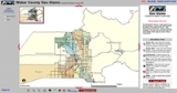
. Sometimes these maps are just static images allowing simple panning and zooming, while others are more complex pages. Examples of interactive maps served with ArcIMS include maps with layers that can be turned on and off, or with features containing attributes that can be queried. A visitor to a site driven by ArcIMS needs nothing more than a web browser: the GIS and database are maintained on the server side.
desktop application like ArcMap, ArcExplorer, or ArcPad.
ArcIMS uses Esri's ArcXML
to receive and respond to requests from the client.
The data behind ArcIMS is usually stored in Shapefile
format (an open specification) or an ArcSDE
RDBMS database.
The Data Delivery Extension (DDE) is an extension to the ArcIMS product that delivers data to users in a data format and coordinate system of their own choosing, in order to have access to data in a format compatible with their local GIS applications.
ESRI
Esri is a software development and services company providing Geographic Information System software and geodatabase management applications. The headquarters of Esri is in Redlands, California....
. It is a GIS
Geographic Information System
A geographic information system, geographical information science, or geospatial information studies is a system designed to capture, store, manipulate, analyze, manage, and present all types of geographically referenced data...
that is designed to serve maps across the Internet
Internet
The Internet is a global system of interconnected computer networks that use the standard Internet protocol suite to serve billions of users worldwide...
. Sometimes these maps are just static images allowing simple panning and zooming, while others are more complex pages. Examples of interactive maps served with ArcIMS include maps with layers that can be turned on and off, or with features containing attributes that can be queried. A visitor to a site driven by ArcIMS needs nothing more than a web browser: the GIS and database are maintained on the server side.
Implementation
The core of ArcIMS is a spatial server where most of the map related services are processed. On the server side, ArcIMS connector sits on top of web server and ArcIMS component and Application server works behind the scene. On the client side, the viewers can be thin client, custom clients or EsriESRI
Esri is a software development and services company providing Geographic Information System software and geodatabase management applications. The headquarters of Esri is in Redlands, California....
desktop application like ArcMap, ArcExplorer, or ArcPad.
ArcIMS uses Esri's ArcXML
ArcXML
ArcXML is a proprietary XML standard created by ESRI to be used in ArcIMS, a web mapping server that is part of the ArcGIS suite of applications. Static files are often saved with a ".axl" extension and are therefore called axl files by those that use them....
to receive and respond to requests from the client.
The data behind ArcIMS is usually stored in Shapefile
Shapefile
The Esri Shapefile or simply a shapefile is a popular geospatial vector data format for geographic information systems software. It is developed and regulated by Esri as a open specification for data interoperability among Esri and other software products.Shapefiles spatially describe geometries:...
format (an open specification) or an ArcSDE
ArcSDE
ArcSDE is a server-software sub-system that aims to enable the usage of Relational Database Management Systems for spatial data...
RDBMS database.
The Data Delivery Extension (DDE) is an extension to the ArcIMS product that delivers data to users in a data format and coordinate system of their own choosing, in order to have access to data in a format compatible with their local GIS applications.
Version history
- 2000 June - ArcIMS 3.0 released
- 2002 April - ArcIMS 4.0 released