
Kosmo
Encyclopedia
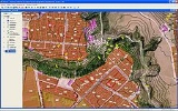
Kosmo is a desktop geographic information system
(GIS) with advanced functions. It is the first of a series of developments that are being made available to the community.
Kosmo was implemented using the Java
programming language and is being developed from the JUMP GIS
platform and a series of free code libraries, all of which are well acknowledged and widely used in different free software projects (for example, Geotools
and JTS
). It is available for Windows and Linux operating systems.
It is a tool for visualizing and processing spatial data, characterized by its friendly user interface and access to multiple data formats, both vectorial (in a file, such as Shapefile
, GML
, KML
, DWG
and DXF, or a database, such as PostgreSQL
, MySQL
, or Oracle
) and raster (TIFF, ECW
, MrSID
, or other georeferenced image files, such as BMP, GIF
, JPEG
, or PNG). It can also edit and offer a variety of utilities to the GIS user, like support for [www.sextantegis.com/ Sextante] libraries for raster and vector analysis
One of its main characteristics is the possibility of increasing functionality, based on extensions.
Kosmo was developed by a company called SAIG S.L. (in Spanish Sistemas Abiertos de Información Geográfica - Open Geographical Information Systems), and is distributed under the GNU General Public License
.
Other way, how to get better raster data processing possibilities (gridding, interpolation, geostatistics) is to use Kosmo together with other gis software like SAGA GIS
.
Geographic Information System
A geographic information system, geographical information science, or geospatial information studies is a system designed to capture, store, manipulate, analyze, manage, and present all types of geographically referenced data...
(GIS) with advanced functions. It is the first of a series of developments that are being made available to the community.
Kosmo was implemented using the Java
Java (programming language)
Java is a programming language originally developed by James Gosling at Sun Microsystems and released in 1995 as a core component of Sun Microsystems' Java platform. The language derives much of its syntax from C and C++ but has a simpler object model and fewer low-level facilities...
programming language and is being developed from the JUMP GIS
JUMP GIS
JUMP is a Java based vector GIS and programming framework. Current development continues under the OpenJUMP name.-Features:* platform independent * reads and writes ESRI Shapefile, GML files, DXF and PostGIS...
platform and a series of free code libraries, all of which are well acknowledged and widely used in different free software projects (for example, Geotools
GeoTools
GeoTools is a free software GIS toolkit for developing standards compliant solutions.It provides an implementation of Open Geospatial Consortium specifications as they are developed...
and JTS
JTS Topology Suite
The JTS Topology Suite is an open source Java software library that provides an object model for Euclidean planar linear geometry together with a set of fundamental geometric functions. JTS is primarily intended to be used as a core component of vector-based geomatics software such as...
). It is available for Windows and Linux operating systems.
It is a tool for visualizing and processing spatial data, characterized by its friendly user interface and access to multiple data formats, both vectorial (in a file, such as Shapefile
Shapefile
The Esri Shapefile or simply a shapefile is a popular geospatial vector data format for geographic information systems software. It is developed and regulated by Esri as a open specification for data interoperability among Esri and other software products.Shapefiles spatially describe geometries:...
, GML
GML
GML may refer to:* Middle Low German , a language used around the North Sea and the Baltic Sea from 1100 to 1600* Gostomel Airport , an international cargo airport, near Kiev, Ukraine* Gradient Multi-Layer nano-film...
, KML
KML
KML or kml may refer to:* Kamileroi Airport , Queensland, Australia* Keyhole Markup Language, an XML geospatial data file format...
, DWG
.dwg
DWG is a binary file format used for storing two and three dimensional design data and metadata. It is the native format for several CAD packages including AutoCAD, IntelliCAD and Caddie. In addition, DWG is supported non-natively by many other CAD applications...
and DXF, or a database, such as PostgreSQL
PostgreSQL
PostgreSQL, often simply Postgres, is an object-relational database management system available for many platforms including Linux, FreeBSD, Solaris, MS Windows and Mac OS X. It is released under the PostgreSQL License, which is an MIT-style license, and is thus free and open source software...
, MySQL
MySQL
MySQL officially, but also commonly "My Sequel") is a relational database management system that runs as a server providing multi-user access to a number of databases. It is named after developer Michael Widenius' daughter, My...
, or Oracle
Oracle database
The Oracle Database is an object-relational database management system produced and marketed by Oracle Corporation....
) and raster (TIFF, ECW
ECW
ECW may refer to:Professional wrestling* Extreme Championship Wrestling, a professional wrestling promotion that operated from 1992 to 2001...
, MrSID
MrSID
-External links:* from LizardTech's website...
, or other georeferenced image files, such as BMP, GIF
GIF
The Graphics Interchange Format is a bitmap image format that was introduced by CompuServe in 1987 and has since come into widespread usage on the World Wide Web due to its wide support and portability....
, JPEG
JPEG
In computing, JPEG . The degree of compression can be adjusted, allowing a selectable tradeoff between storage size and image quality. JPEG typically achieves 10:1 compression with little perceptible loss in image quality....
, or PNG). It can also edit and offer a variety of utilities to the GIS user, like support for [www.sextantegis.com/ Sextante] libraries for raster and vector analysis
One of its main characteristics is the possibility of increasing functionality, based on extensions.
Kosmo was developed by a company called SAIG S.L. (in Spanish Sistemas Abiertos de Información Geográfica - Open Geographical Information Systems), and is distributed under the GNU General Public License
GNU General Public License
The GNU General Public License is the most widely used free software license, originally written by Richard Stallman for the GNU Project....
.
Other way, how to get better raster data processing possibilities (gridding, interpolation, geostatistics) is to use Kosmo together with other gis software like SAGA GIS
SAGA GIS
SAGA GIS is a free and open source geographic information system used for editing spatial data. It was originally developed by a small team at the Department of Physical Geography, University of Göttingen, Germany, and is now being maintained and extended by an international developer...
.