
ArcGIS
Overview
Software suite
A software suite or application suite is a collection of computer programs, usually application software and programming software of related functionality, often sharing a more-or-less common user interface and some ability to smoothly exchange data with each other.Sometimes software makers...
consisting of a group of geographic information system
Geographic Information System
A geographic information system, geographical information science, or geospatial information studies is a system designed to capture, store, manipulate, analyze, manage, and present all types of geographically referenced data...
(GIS) software products produced by Esri
ESRI
Esri is a software development and services company providing Geographic Information System software and geodatabase management applications. The headquarters of Esri is in Redlands, California....
.
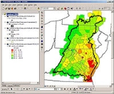
ArcGIS is a system for working with maps and geographic information. It is used for: creating and using maps; compiling geographic data; analyzing mapped information; sharing and discovering geographic information; using maps and geographic information in a range of applications; and managing geographic information in a database.
The system provides an infrastructure for making maps and geographic information available throughout an organization, across a community, and openly on the Web.
ArcGIS includes the following Windows desktop software:
- ArcReaderArcReaderArcReader is a basic data viewer for maps and GIS data published in the proprietary ESRI format using ArcPublisher. The software also provides some basic tools for map viewing, printing and querying of spatial data...
, which allows one to view and query maps created with the other ArcGIS products; - ArcGIS Desktop, is licensed under three functionality levels:
- ArcViewArcViewArcView 3.x was a geographic information system software product produced by ESRI.-History:ArcView started as a graphical program for spatial data and maps made using ESRI's other software products. Over time more and more functionality was added to ArcView and it became a real GIS program capable...
, which allows one to view spatial data, create layered mapMapA map is a visual representation of an area—a symbolic depiction highlighting relationships between elements of that space such as objects, regions, and themes....
s, and perform basic spatial analysisSpatial analysisSpatial analysis or spatial statistics includes any of the formal techniques which study entities using their topological, geometric, or geographic properties...
; - ArcEditorArcEditorArcEditor is the midlevel software suite designed for advanced editing of spatial data published in the proprietary Esri format. It is part of the ArcGIS product. It provides tools for the creation of map and spatial data used in Geospatial Information Systems...
which, in addition to the functionality of ArcView, includes more advanced tools for manipulation of shapefileShapefileThe Esri Shapefile or simply a shapefile is a popular geospatial vector data format for geographic information systems software. It is developed and regulated by Esri as a open specification for data interoperability among Esri and other software products.Shapefiles spatially describe geometries:...
s and geodatabaseGeodatabaseA geodatabase is a spatial database designed to store, query, and manipulate geographic information and spatial data of low dimensionality. It is a specialized type of spatial database often with optimizations for 2 and 3 dimensions, raster data and Euclidean distance.Within a spatial database,...
s; or - ArcInfoArcInfoArcInfo is a full-featured geographic information system produced by Esri, and is the highest level of licensing in the ArcGIS Desktop product line. It was originally a command-line based system...
which includes capabilities for data manipulation, editing, and analysis.
- ArcView
There are also server-based ArcGIS products, as well as ArcGIS products for PDAs
Personal digital assistant
A personal digital assistant , also known as a palmtop computer, or personal data assistant, is a mobile device that functions as a personal information manager. Current PDAs often have the ability to connect to the Internet...
.
Unanswered Questions
Discussions