
MapWindow GIS
Encyclopedia
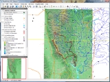
MapWindow GIS is an open source
GIS (mapping) application and set of programmable mapping components. It has been adopted by the United States Environmental Protection Agency
as the primary GIS platform for its BASINS (Better Assessment Science Integrating Point and Nonpoint Sources) watershed analysis and modeling software.
distribution license, MapWindow GIS can be reprogrammed to perform different or more specialized tasks. There are also plug-ins available to expand compatibility and functionality.
The application is built upon Microsoft .NET technology.
Updates for MapWindow GIS are regularly released by a group of student and volunteer developers.
Open source
The term open source describes practices in production and development that promote access to the end product's source materials. Some consider open source a philosophy, others consider it a pragmatic methodology...
GIS (mapping) application and set of programmable mapping components. It has been adopted by the United States Environmental Protection Agency
United States Environmental Protection Agency
The U.S. Environmental Protection Agency is an agency of the federal government of the United States charged with protecting human health and the environment, by writing and enforcing regulations based on laws passed by Congress...
as the primary GIS platform for its BASINS (Better Assessment Science Integrating Point and Nonpoint Sources) watershed analysis and modeling software.
Technical details
MapWindow GIS is distributed as an open source application under the Mozilla Public LicenseMozilla Public License
The Mozilla Public License is a free and open source software license. Version 1.0 was developed by Mitchell Baker when she worked as a lawyer at Netscape Communications Corporation and version 1.1 at the Mozilla Foundation...
distribution license, MapWindow GIS can be reprogrammed to perform different or more specialized tasks. There are also plug-ins available to expand compatibility and functionality.
The application is built upon Microsoft .NET technology.
Updates for MapWindow GIS are regularly released by a group of student and volunteer developers.
See also
- List of GIS software
- Comparison of geographic information systems software
External links
- MapWindow GIS Home page
- The Soil Company, The Netherlands The Soil Company supplies spatial soil maps and soil related knowledge for land owners and users and uses MapWindow for their main tasks.
- U.S. EPA BASINS watershed analysis system
- WaterBase (United Nations University project supporting Integrated Water Resources Management in developing countries)