

List of Bay Area Rapid Transit stations
Encyclopedia
Bay Area Rapid Transit
(BART) is a heavy-rail public rapid-transit
system that serves the San Francisco Bay Area
. The system is operated by the San Francisco Bay Area Rapid Transit District (SF BART district), a special government agency in California
consisting of three counties
: Alameda County
, Contra Costa County
, and the City and County of San Francisco. Serving over 350,000 passengers a day, BART is the fifth largest rapid transit system in the United States in terms of ridership.
Out of the five lines currently in service, the Richmond – Fremont line is the oldest, having opened south of MacArthur in September 1972. The Pittsburg/Bay Point – SFO/Millbrae line (originally Concord
– Daly City
) opened MacArthur to Concord a year later. The Richmond – Millbrae line (originally Richmond
– Daly City
) and the Fremont – Daly City line were added to the system in 1980 and 1985 respectively. The first major expansions were in 1995 through 1997, beginning services to Northern Concord
/ Martinez
(1995), Pittsburg
(1996), Colma
(1996), and Pleasanton
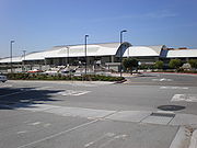
(1997), the last of which is served by BART's newest line — the Dublin/Pleasanton – Daly City line. In mid-2003, extensions to San Francisco International Airport
and Millbrae
were completed, bringing BART further south into San Mateo County
. In addition, BART connects its Coliseum/Oakland Airport station
to the Oakland International Airport
with AirBART
, a shuttle bus
service.
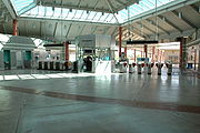
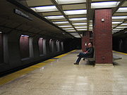
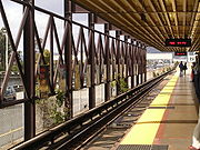
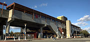
The system has 44 stations: 15 on the surface, 15 underground and 14 elevated. Nineteen stations are in Alameda County, more than any other county. Eleven stations are in Contra Costa County, and eight are in City and County of San Francisco. Six stations are in San Mateo County, although it is not part of the SF BART district. Fremont
is the southernmost station of the system, while Pittsburg/Bay Point
is the northernmost station. In terms of daily ridership, Embarcadero
is the most heavily used station, while North Concord/Martinez
is the least.
 The following table lists all 44 stations currently in service. The ones with mileposts are measured from the Oakland wye: M line from zero at the north end of the wye, A line from zero at the west end of the wye, and C and R lines from zero at the east end of the wye. Each leg of the wye is about 0.25 mile, so (for instance) Concord is 36.17 miles from Daly City, give or take a hundredth or two.
or }
|Transfer stations and terminals
|-
|}Station
Bay Area Rapid Transit
Bay Area Rapid Transit is a rapid transit system serving the San Francisco Bay Area. The heavy-rail public transit and subway system connects San Francisco with cities in the East Bay and suburbs in northern San Mateo County. BART operates five lines on of track with 44 stations in four counties...
(BART) is a heavy-rail public rapid-transit
Rapid transit
A rapid transit, underground, subway, elevated railway, metro or metropolitan railway system is an electric passenger railway in an urban area with a high capacity and frequency, and grade separation from other traffic. Rapid transit systems are typically located either in underground tunnels or on...
system that serves the San Francisco Bay Area
San Francisco Bay Area
The San Francisco Bay Area, commonly known as the Bay Area, is a populated region that surrounds the San Francisco and San Pablo estuaries in Northern California. The region encompasses metropolitan areas of San Francisco, Oakland, and San Jose, along with smaller urban and rural areas...
. The system is operated by the San Francisco Bay Area Rapid Transit District (SF BART district), a special government agency in California
California
California is a state located on the West Coast of the United States. It is by far the most populous U.S. state, and the third-largest by land area...
consisting of three counties
County (United States)
In the United States, a county is a geographic subdivision of a state , usually assigned some governmental authority. The term "county" is used in 48 of the 50 states; Louisiana is divided into parishes and Alaska into boroughs. Parishes and boroughs are called "county-equivalents" by the U.S...
: Alameda County
Alameda County, California
Alameda County is a county in the U.S. state of California. It occupies most of the East Bay region of the San Francisco Bay Area. As of the 2010 census it had a population of 1,510,271, making it the 7th most populous county in the state...
, Contra Costa County
Contra Costa County, California
Contra Costa County is a primarily suburban county in the San Francisco Bay Area of the U.S. state of California. As of the 2010 census, it had a population of 1,049,025...
, and the City and County of San Francisco. Serving over 350,000 passengers a day, BART is the fifth largest rapid transit system in the United States in terms of ridership.
Out of the five lines currently in service, the Richmond – Fremont line is the oldest, having opened south of MacArthur in September 1972. The Pittsburg/Bay Point – SFO/Millbrae line (originally Concord
Concord (BART station)
Concord is a Bay Area Rapid Transit station that serves Concord, California. The station consists of an elevated island platform.The Concord station operated as a terminal station from the time when BART opened until 1995 when the line was extended to North Concord/Martinez. Pittsburg/Bay Point is...
– Daly City
Daly City (BART station)
Daly City Station is a Bay Area Rapid Transit station located in extreme northern San Mateo County, California, in suburban Daly City, less than one block outside the San Francisco city and county limits. Interstate 280 and California Route 1 run along the immediate west side of the station...
) opened MacArthur to Concord a year later. The Richmond – Millbrae line (originally Richmond
Richmond Station (California)
Richmond Station is an at-grade Bay Area Rapid Transit and Amtrak station located in Richmond, California. Each system is served by an island platform. The Capitol Corridor, San Joaquins, California Zephyr, and Coast Starlight stop here and connect to BART. The station is currently being rebuilt...
– Daly City
Daly City (BART station)
Daly City Station is a Bay Area Rapid Transit station located in extreme northern San Mateo County, California, in suburban Daly City, less than one block outside the San Francisco city and county limits. Interstate 280 and California Route 1 run along the immediate west side of the station...
) and the Fremont – Daly City line were added to the system in 1980 and 1985 respectively. The first major expansions were in 1995 through 1997, beginning services to Northern Concord
Concord, California
Concord is the largest city in Contra Costa County, California, USA. At the 2010 census, the city had a population of 122,067. Originally founded in 1869 as the community of Todos Santos by Salvio Pacheco, the name was changed to Concord within months...
/ Martinez
Martinez, California
Martinez is a city and the county seat of Contra Costa County, California, United States. The population was 35,824 at the 2010 census. The downtown is notable for its large number of preserved old buildings...
(1995), Pittsburg
Pittsburg, California
Pittsburg is a city located in eastern Contra Costa County, California, the outer portion of the East Bay region of the San Francisco Bay Area. The population was 63,264 at the 2010 census....
(1996), Colma
Colma, California
Colma is a small incorporated town in San Mateo County, California, at the northern end of the San Francisco Peninsula in the San Francisco Bay Area. The population was 1,792 at the 2010 census. The town was founded as a necropolis in 1924....
(1996), and Pleasanton
Pleasanton, California
Pleasanton is a city in Alameda County, California, incorporated in 1894. It is a suburb in the San Francisco Bay Area located about east of Oakland, and west of Livermore. The population was 70,285 at the 2010 census. In 2005 and 2007, Pleasanton was ranked the wealthiest middle-sized city in...
(1997), the last of which is served by BART's newest line — the Dublin/Pleasanton – Daly City line. In mid-2003, extensions to San Francisco International Airport
San Francisco International Airport
San Francisco International Airport is a major international airport located south of downtown San Francisco, California, United States, near the cities of Millbrae and San Bruno in unincorporated San Mateo County. It is often referred to as SFO...
and Millbrae
Millbrae, California
Millbrae is a city in San Mateo County, California, United States, just west of San Francisco Bay, with San Bruno on the north and Burlingame on the south. The population was 21,532 at the 2010 census.-History:...
were completed, bringing BART further south into San Mateo County
San Mateo County, California
San Mateo County is a county located in the San Francisco Bay Area of the U.S. state of California. It covers most of the San Francisco Peninsula just south of San Francisco, and north of Santa Clara County. San Francisco International Airport is located at the northern end of the county, and...
. In addition, BART connects its Coliseum/Oakland Airport station
Oakland Coliseum Amtrak/BART Station
The Oakland Coliseum Station is a complex of two stations of two public transit providers that are within of each other: Amtrak Capitol Corridors Oakland Coliseum station and Bay Area Rapid Transit 's Coliseum/Oakland Airport station...
to the Oakland International Airport
Oakland International Airport
Oakland International Airport , also known as Metropolitan Oakland International Airport, is a public airport located south of the central business district of Oakland, a city in Alameda County, California, United States...
with AirBART
AirBART
AirBART is a privately-run shuttle bus service that connects the Bay Area Rapid Transit's Coliseum/Oakland Airport station with Oakland International Airport . Buses stop at street level just outside the BART station and serve both airport terminals with one stop at the airport along the third curb...
, a shuttle bus
Bus
A bus is a road vehicle designed to carry passengers. Buses can have a capacity as high as 300 passengers. The most common type of bus is the single-decker bus, with larger loads carried by double-decker buses and articulated buses, and smaller loads carried by midibuses and minibuses; coaches are...
service.
The system has 44 stations: 15 on the surface, 15 underground and 14 elevated. Nineteen stations are in Alameda County, more than any other county. Eleven stations are in Contra Costa County, and eight are in City and County of San Francisco. Six stations are in San Mateo County, although it is not part of the SF BART district. Fremont
Fremont (BART station)
Fremont is a Bay Area Rapid Transit station that serves Fremont, California. The elevated island platform serves as the southernmost terminal station of BART's Fremont line, which is served by trains on the Fremont - Daly City Line, which runs daytimes Monday-Saturday, and the Richmond - Fremont...
is the southernmost station of the system, while Pittsburg/Bay Point
Pittsburg/Bay Point (BART station)
Pittsburg/Bay Point is a Bay Area Rapid Transit station in the town of Bay Point, California. As the terminal station of the Pittsburg/Bay Point - SFO Line, it serves all of northern and eastern Contra Costa County, including the cities of Pittsburg, Antioch, Oakley and Brentwood, as well as the...
is the northernmost station. In terms of daily ridership, Embarcadero
Embarcadero Station
Embarcadero is a BART and Muni Metro station in the Financial District of San Francisco. The easternmost stop on the Market Street Subway, Embarcadero acts as a major hub for passenger movement throughout the San Francisco Bay Area...
is the most heavily used station, while North Concord/Martinez
North Concord/Martinez (BART station)
North Concord/Martinez is a Bay Area Rapid Transit station that serves the cities of Concord and Martinez, California. The station itself is in the northern part of Concord...
is the least.
Stations
| * | Transfer station Interchange station An interchange station or a transfer station is a train station for more than one railway route in a public transport system, and allows passengers to change from one route to another. Transfer may occur within the same mode, or between rail modes, or to buses... s within the BART system |
| ** | Transfer stations with other systems |
| Termini of lines | |
|Transfer stations and terminals
|-
|}
| Line(s) | Location | Year opened | Ridership Patronage (transportation) In public transportation, patronage or ridership is a type of forecasting or statistic for studying the average quantity of passengers carried per certain time in a mode of public transit system. The concept should not be confused with the maximum loading capacity of one particular vehicle or the... |
|
|---|---|---|---|---|
| 16th Street Mission 16th Street Mission (BART station) 16th Street Mission Station is a Bay Area Rapid Transit station in the Mission District of San Francisco, California. It is used by the Richmond-Millbrae line, the Pittsburg/Bay Point-SFO line, the Fremont-Daly City line, and the Dublin/Pleasanton-Daly City line... |
San Francisco Mile 9.76 M | 10,234 | ||
| 19th Street/Oakland* | Oakland Oakland, California Oakland is a major West Coast port city on San Francisco Bay in the U.S. state of California. It is the eighth-largest city in the state with a 2010 population of 390,724... Mile 0.70 C |
9,856 | ||
| 24th Street Mission 24th Street Mission (BART station) 24th Street Mission Station is a Bay Area Rapid Transit station in the Mission District of San Francisco, California. It is an underground station with an island platform located below the intersection of Mission Street and 24th Street.... |
San Francisco Mile 10.64 M | 11,359 | ||
| Ashby Ashby (BART station) Ashby Station is a BART station, located beneath and parallel to Adeline Street, extending from Woolsey Street to Ashby Avenue in the southern part of Berkeley, California. It consists of an underground island platform... |
Berkeley Berkeley, California Berkeley is a city on the east shore of the San Francisco Bay in Northern California, United States. Its neighbors to the south are the cities of Oakland and Emeryville. To the north is the city of Albany and the unincorporated community of Kensington... Mile 3.96 R |
4,142 | ||
| Balboa Park* | San Francisco Mile 13.44 M | 11,149 | ||
| Bay Fair Bay Fair (BART station) Bay Fair is a Bay Area Rapid Transit station located near the Bayfair Center in San Leandro, California. The station is in BART District 3 and is represented by Bob Franklin.- Service :... * |
San Leandro San Leandro, California San Leandro is a city in Alameda County, California, United States. It is considered a suburb of Oakland and San Francisco. The population was 84,950 as of 2010 census. The climate of the city is mild throughout the year.-Geography and water resources:... Mile 10.94 A |
5,086 | ||
| Castro Valley Castro Valley (BART station) Castro Valley is a Bay Area Rapid Transit station serving Castro Valley, California.The station consists of an island platform located in the center median of Interstate 580, with the concourse mezzanine located underneath the freeway's westbound lanes... |
Castro Valley Castro Valley, California Castro Valley is a census-designated place in Alameda County, California, United States. As of the 2000 census, it is the fifth most populous unincorporated area in California, and the twenty-third in the United States... |
2,355 | ||
| Civic Center Civic Center Station (San Francisco) Civic Center/UN Plaza Station is a Muni Metro and Bay Area Rapid Transit station near the Civic Center in downtown San Francisco, California. It is along the Market Street Subway below Market Street between Seventh Street and Eighth Street... ** |
San Francisco Mile 8.64 M | 17,434 | ||
| Coliseum/Oakland Airport Oakland Coliseum Amtrak/BART Station The Oakland Coliseum Station is a complex of two stations of two public transit providers that are within of each other: Amtrak Capitol Corridors Oakland Coliseum station and Bay Area Rapid Transit 's Coliseum/Oakland Airport station... ** |
Oakland Oakland, California Oakland is a major West Coast port city on San Francisco Bay in the U.S. state of California. It is the eighth-largest city in the state with a 2010 population of 390,724... Mile 5.43 A |
6,040 | ||
| Colma Colma (BART station) Colma Station is a Bay Area Rapid Transit station located in unincorporated Colma, California, in northern San Mateo County, adjacent to incorporated Colma and Daly City. Situated in a small valley immediately adjacent to a BART rail yard, the station consists of three main tracks with a shared... |
Colma Colma, California Colma is a small incorporated town in San Mateo County, California, at the northern end of the San Francisco Peninsula in the San Francisco Bay Area. The population was 1,792 at the 2010 census. The town was founded as a necropolis in 1924.... |
3,567 | ||
| Concord Concord (BART station) Concord is a Bay Area Rapid Transit station that serves Concord, California. The station consists of an elevated island platform.The Concord station operated as a terminal station from the time when BART opened until 1995 when the line was extended to North Concord/Martinez. Pittsburg/Bay Point is... |
Concord Concord, California Concord is the largest city in Contra Costa County, California, USA. At the 2010 census, the city had a population of 122,067. Originally founded in 1869 as the community of Todos Santos by Salvio Pacheco, the name was changed to Concord within months... Mile 21.18 C |
5,090 | ||
| Daly City Daly City (BART station) Daly City Station is a Bay Area Rapid Transit station located in extreme northern San Mateo County, California, in suburban Daly City, less than one block outside the San Francisco city and county limits. Interstate 280 and California Route 1 run along the immediate west side of the station... |
Daly City Daly City, California Daly City is the largest city in San Mateo County, California, United States, with a 2010 population of 101,123. Located immediately south of San Francisco, it is named in honor of businessman and landowner John Daly.-History:... Mile 15.24 M |
7,400 | ||
| Downtown Berkeley Downtown Berkeley (BART station) Downtown Berkeley is a Bay Area Rapid Transit station located on Shattuck Avenue, between Allston Way and Addison Street in Downtown Berkeley, California. Signs in the station itself read simply Berkeley, per se the original name of the station... |
Berkeley Berkeley, California Berkeley is a city on the east shore of the San Francisco Bay in Northern California, United States. Its neighbors to the south are the cities of Oakland and Emeryville. To the north is the city of Albany and the unincorporated community of Kensington... Mile 5.16 R |
10,913 | ||
| Dublin/Pleasanton | Pleasanton Pleasanton, California Pleasanton is a city in Alameda County, California, incorporated in 1894. It is a suburb in the San Francisco Bay Area located about east of Oakland, and west of Livermore. The population was 70,285 at the 2010 census. In 2005 and 2007, Pleasanton was ranked the wealthiest middle-sized city in... |
7,523 | ||
| El Cerrito del Norte El Cerrito del Norte (BART station) El Cerrito del Norte, frequenly shorterned to del Norte, is one of two BART stations in El Cerrito, California, just east of the Cutting Boulevard interchange of Interstate 80 parallel to San Pablo Avenue and the Ohlone Greenway straddling the Richmond border. Del Norte opened to revenue service on... |
El Cerrito El Cerrito, Contra Costa County, California -Transportation:The city's primary transportation infrastructure consists of the El Cerrito Plaza and El Cerrito del Norte BART stations along with several local bus lines, operated by AC Transit, providing access to the surrounding area and the nearby cities of Albany, Berkeley and Richmond... Mile 10.26 R |
7,364 | ||
| El Cerrito Plaza El Cerrito Plaza (BART station) El Cerrito Plaza is one of two elevated BART stations located in El Cerrito, California. It primarily serves southern El Cerrito, northern Albany, and Kensington, along with nearby areas of Berkeley and Richmond... |
El Cerrito El Cerrito, Contra Costa County, California -Transportation:The city's primary transportation infrastructure consists of the El Cerrito Plaza and El Cerrito del Norte BART stations along with several local bus lines, operated by AC Transit, providing access to the surrounding area and the nearby cities of Albany, Berkeley and Richmond... Mile 8.42 R |
4,219 | ||
| Embarcadero Embarcadero Station Embarcadero is a BART and Muni Metro station in the Financial District of San Francisco. The easternmost stop on the Market Street Subway, Embarcadero acts as a major hub for passenger movement throughout the San Francisco Bay Area... ** |
San Francisco Mile 7.33 M | 34,234 | ||
| Fremont Fremont (BART station) Fremont is a Bay Area Rapid Transit station that serves Fremont, California. The elevated island platform serves as the southernmost terminal station of BART's Fremont line, which is served by trains on the Fremont - Daly City Line, which runs daytimes Monday-Saturday, and the Richmond - Fremont... |
Fremont Fremont, California Fremont is a city in Alameda County, California. It was incorporated on January 23, 1956, from the merger of five smaller communities: Centerville, Niles, Irvington, Mission San Jose, and Warm Springs... Mile 23.71 A |
7,080 | ||
| Fruitvale Fruitvale (BART station) Fruitvale is a Bay Area Rapid Transit station located in the Fruitvale District of Oakland. The station consists of two elevated side platforms with the concourse mezzanine at ground level. The redevelopment of the immediate station area from a parking lot to a mixed-use "transit village" has... |
Oakland Oakland, California Oakland is a major West Coast port city on San Francisco Bay in the U.S. state of California. It is the eighth-largest city in the state with a 2010 population of 390,724... Mile 3.32 A |
7,069 | ||
| Glen Park | San Francisco Mile 12.29 M | 6,765 | ||
| Hayward Hayward (BART station) The Hayward station is a Bay Area Rapid Transit station that serves the Downtown Hayward area of Hayward, California. It is directly across the street from the rear of Hayward City Hall. The station consists of two train platforms and a free five-level parking garage.-History:Service at the... |
Hayward Hayward, California Hayward is a city located in the East Bay in Alameda County, California. With a population of 144,186, Hayward is the sixth largest city in the San Francisco Bay Area and the third largest in Alameda County. Hayward was ranked as the 37th most populous municipality in California. It is included in... Mile 13.80 A |
4,549 | ||
| Lafayette Lafayette (BART station) Lafayette is a Bay Area Rapid Transit station in Lafayette, California. The station has of an island platform in the center median of State Route 24.Service at this station began on May 21, 1973... |
Lafayette Lafayette, California Lafayette is a city in Contra Costa County, California, United States. As of the 2010 census, the city's population was 23,893. It was named after the Marquis de Lafayette, a French military hero of the American Revolutionary War... Mile 11.94 C |
3,364 | ||
| Lake Merritt Lake Merritt (BART station) The Lake Merritt Bay Area Rapid Transit station is located in Downtown Oakland on Oak Street near Lake Merritt, Chinatown, Laney College and the Oakland Museum. This station consists of an underground island platform.... |
Oakland Oakland, California Oakland is a major West Coast port city on San Francisco Bay in the U.S. state of California. It is the eighth-largest city in the state with a 2010 population of 390,724... Mile 0.57 A |
5,324 | ||
| MacArthur MacArthur (BART station) MacArthur is a rapid transit station on three lines of the Bay Area Rapid Transit system in Oakland, California. It is the largest station in the BART system, being the only one with four platform tracks in regular use.-Location:... * |
Oakland Oakland, California Oakland is a major West Coast port city on San Francisco Bay in the U.S. state of California. It is the eighth-largest city in the state with a 2010 population of 390,724... Mile 2.22 C |
7,937 | ||
| Millbrae Millbrae Station Millbrae Station is an at-grade Bay Area Rapid Transit and Caltrain station located in suburban Millbrae, California, in northern San Mateo County.-Description:... } |
Millbrae Millbrae, California Millbrae is a city in San Mateo County, California, United States, just west of San Francisco Bay, with San Bruno on the north and Burlingame on the south. The population was 21,532 at the 2010 census.-History:... |
4,867 | ||
| Montgomery Street Montgomery Street Station Montgomery Street Station is a Muni Metro and Bay Area Rapid Transit station in the Financial District of San Francisco, California. It is located on the Market Street Subway beneath Market Street, between Montgomery Street and Sansome Street... ** |
San Francisco Mile 7.69 M | 33,260 | ||
| North Berkeley North Berkeley (BART station) North Berkeley is an underground Bay Area Rapid Transit station located on Sacramento Street in Berkeley, California. The station is bounded by Virginia, Sacramento, Delaware, and Acton Streets to the north, east, south, and west, respectively.-Station:... |
Berkeley Berkeley, California Berkeley is a city on the east shore of the San Francisco Bay in Northern California, United States. Its neighbors to the south are the cities of Oakland and Emeryville. To the north is the city of Albany and the unincorporated community of Kensington... Mile 6.22 R |
3,885 | ||
| North Concord/Martinez | Concord Concord, California Concord is the largest city in Contra Costa County, California, USA. At the 2010 census, the city had a population of 122,067. Originally founded in 1869 as the community of Todos Santos by Salvio Pacheco, the name was changed to Concord within months... |
1,969 | ||
| Oakland City Center/12th Street | Oakland Oakland, California Oakland is a major West Coast port city on San Francisco Bay in the U.S. state of California. It is the eighth-largest city in the state with a 2010 population of 390,724... Mile 0.35 C |
12,319 | ||
| Orinda Orinda (BART station) Orinda a Bay Area Rapid Transit station in Orinda, California. The station has of an island platform in the center median of State Route 24. The station is east of the Caldecott TunnelService at this station began on May 21, 1973.... |
Orinda Orinda, California -2010:The 2010 United States Census reported that Orinda had a population of 17,643. The population density was 1,389.5 people per square mile . The racial makeup of Orinda was 14,533 White, 149 African American, 22 Native American, 2,016 Asian, 24 Pacific Islander, 122 from other races, and... Mile 8.18 C |
2,721 | ||
| Pittsburg/Bay Point | Pittsburg Pittsburg, California Pittsburg is a city located in eastern Contra Costa County, California, the outer portion of the East Bay region of the San Francisco Bay Area. The population was 63,264 at the 2010 census.... |
4,884 | ||
| Pleasant Hill Pleasant Hill (BART station) Pleasant Hill/Contra Costa Centre is a Bay Area Rapid Transit station serving the Contra Costa Centre Transit Village in Contra Costa Centre, California, just north of Walnut Creek and just east of Pleasant Hill.-Overview:... |
Walnut Creek Walnut Creek, California Walnut Creek is an incorporated city located east of the city of Oakland. It lies in the East Bay region of the San Francisco Bay Area. While not as large as neighboring Concord, Walnut Creek serves as the business and entertainment hub for the neighboring cities within central Contra Costa... Mile 17.11 C |
5,889 | ||
| Powell Street Powell Street Station Powell Street Station is a Muni Metro and Bay Area Rapid Transit station near the intersection of Market Street and Powell Street in downtown San Francisco, California. The station is located along the Market Street Subway and extends underground from Fourth Street to Fifth Street. Hallidie Plaza... ** |
San Francisco Mile 8.13 M | 23,311 | ||
| Richmond Richmond Station (California) Richmond Station is an at-grade Bay Area Rapid Transit and Amtrak station located in Richmond, California. Each system is served by an island platform. The Capitol Corridor, San Joaquins, California Zephyr, and Coast Starlight stop here and connect to BART. The station is currently being rebuilt... } |
Richmond Richmond, California Richmond is a city in western Contra Costa County, California, United States. The city was incorporated on August 7, 1905. It is located in the East Bay, part of the San Francisco Bay Area. It is a residential inner suburb of San Francisco, as well as the site of heavy industry, which has been... Mile 12.57 R |
3,347 | ||
| Rockridge Rockridge (BART station) Rockridge is a Bay Area Rapid Transit station located in the Rockridge District of Oakland, California.The station has an island platform in the center median of State Route 24 at College Avenue west of the Caldecott Tunnel... |
Oakland Oakland, California Oakland is a major West Coast port city on San Francisco Bay in the U.S. state of California. It is the eighth-largest city in the state with a 2010 population of 390,724... Mile 3.80 C |
5,197 | ||
| San Bruno San Bruno (BART station) San Bruno Station is a Bay Area Rapid Transit station located adjacent to the Tanforan shopping center in suburban San Bruno, California, in northern San Mateo County... * |
San Bruno San Bruno, California San Bruno is a city in San Mateo County, California, United States. The population was 41,114 at the 2010 census.The city is adjacent to San Francisco International Airport and Golden Gate National Cemetery.-Geography:San Bruno is located at... |
2,771 | ||
| San Francisco International Airport San Francisco International Airport (BART station) San Francisco International Airport BART station also known as SFIA is a Bay Area Rapid Transit station on the Pittsburg/Bay Point–SFO/Millbrae line located inside San Francisco International Airport.... |
San Mateo County San Mateo County, California San Mateo County is a county located in the San Francisco Bay Area of the U.S. state of California. It covers most of the San Francisco Peninsula just south of San Francisco, and north of Santa Clara County. San Francisco International Airport is located at the northern end of the county, and... |
4,325 | ||
| San Leandro San Leandro (BART station) San Leandro is a Bay Area Rapid Transit station located near the downtown area of San Leandro, California. It is the busiest station in the city and is also one of the busiest in the East Bay.... |
San Leandro San Leandro, California San Leandro is a city in Alameda County, California, United States. It is considered a suburb of Oakland and San Francisco. The population was 84,950 as of 2010 census. The climate of the city is mild throughout the year.-Geography and water resources:... Mile 8.38 A |
4,972 | ||
| South Hayward South Hayward (BART station) South Hayward is a Bay Area Rapid Transit station located near Tennyson Road in the southern part of Hayward. The station consists of two side platforms. The station serves the less ritzy industrial part of hayward... |
Hayward Hayward, California Hayward is a city located in the East Bay in Alameda County, California. With a population of 144,186, Hayward is the sixth largest city in the San Francisco Bay Area and the third largest in Alameda County. Hayward was ranked as the 37th most populous municipality in California. It is included in... Mile 16.75 A |
2,918 | ||
| South San Francisco South San Francisco (BART station) South San Francisco Station is a Bay Area Rapid Transit station located in suburban South San Francisco, California in northern San Mateo County... |
South San Francisco South San Francisco, California South San Francisco is a city in San Mateo County, California, United States, located on the San Francisco Peninsula in the San Francisco Bay Area... |
2,778 | ||
| Union City Union City (BART station) Union City is a Bay Area Rapid Transit station located near the Decoto district of Union City. Service at this station began on September 11, 1972. The station sits near Decoto Road east of Alvarado-Niles Road, directly behind James Logan High School's campus... |
Union City Union City, California Union City is a city in Alameda County, California, United States. It was incorporated in 1959, combining the communities of Alvarado and Decoto. Alvarado was the original county seat of Alameda County, and the site of the first county courthouse is a California Historical Landmark . The city... Mile 20.50 A |
3,782 | ||
| Walnut Creek Walnut Creek (BART station) Walnut Creek is an elevated subway station in Walnut Creek, California, on the Pittsburg/Bay Point – SFO/Millbrae line of the Bay Area Rapid Transit system.-Location:... |
Walnut Creek Walnut Creek, California Walnut Creek is an incorporated city located east of the city of Oakland. It lies in the East Bay region of the San Francisco Bay Area. While not as large as neighboring Concord, Walnut Creek serves as the business and entertainment hub for the neighboring cities within central Contra Costa... Mile 15.44 C |
5,864 | ||
| West Dublin/Pleasanton | Pleasanton Pleasanton, California Pleasanton is a city in Alameda County, California, incorporated in 1894. It is a suburb in the San Francisco Bay Area located about east of Oakland, and west of Livermore. The population was 70,285 at the 2010 census. In 2005 and 2007, Pleasanton was ranked the wealthiest middle-sized city in... |
|||
| West Oakland West Oakland (BART station) West Oakland is a Bay Area Rapid Transit station located in the neighborhood of West Oakland in Oakland. It has two elevated side platforms, and is located near the eastern end of the Transbay Tube... |
Oakland Oakland, California Oakland is a major West Coast port city on San Francisco Bay in the U.S. state of California. It is the eighth-largest city in the state with a 2010 population of 390,724... Mile 1.48 M |
4,934 | ||
Stations planned or under construction
| Station | Line(s) | City | Planned to open |
|---|---|---|---|
| Warm Springs Warm Springs (BART station) Warm Springs will be an at-grade BART station in Fremont. Construction on the station began in fall 2010; it is scheduled to open in late 2015.... |
Fremont Fremont, California Fremont is a city in Alameda County, California. It was incorporated on January 23, 1956, from the merger of five smaller communities: Centerville, Niles, Irvington, Mission San Jose, and Warm Springs... |
||
| Irvington Irvington (BART station) Irvington BART station is a planned Bay Area Rapid Transit station in southern Fremont, California part of the Warm Springs BART extension.-History:... |
San José extension | Fremont Fremont, California Fremont is a city in Alameda County, California. It was incorporated on January 23, 1956, from the merger of five smaller communities: Centerville, Niles, Irvington, Mission San Jose, and Warm Springs... |
|
| Berryessa Berryessa (BART station) Berryessa BART station is a future Bay Area Rapid Transit station scheduled to begin construction in the summer of 2012 and open in 2018 in San José, California as part of the Silicon Valley BART extension... |
San José extension | San Jose San Jose, California San Jose is the third-largest city in California, the tenth-largest in the U.S., and the county seat of Santa Clara County which is located at the southern end of San Francisco Bay... |
|
| Milpitas Milpitas (BART station) Milpitas BART station also known as Montague station is a future Bay Area Rapid Transit station scheduled to begin construction in the summer of 2012 and open in 2018 in the city of Milpitas, California as part of the Silicon Valley BART extension. It will be both the first BART station in Santa... |
San José extension | Milpitas Milpitas, California Milpitas is a city in Santa Clara County, California. It is a suburb of the major city of San Jose, California. It is located with San Jose to its south and Fremont to its north, at the eastern end of State Route 237 and generally between Interstates 680 and 880 which run roughly north/south... |
|
| Calaveras Calaveras (BART station) Calaveras BART station is a planned at-grade Bay Area Rapid Transit station in downtown Milpitas, California, part of the Silicon Valley BART extension. It is the first station site in Santa Clara County but will not be the first station built due to funding... |
San José extension | Milpitas Milpitas, California Milpitas is a city in Santa Clara County, California. It is a suburb of the major city of San Jose, California. It is located with San Jose to its south and Fremont to its north, at the eastern end of State Route 237 and generally between Interstates 680 and 880 which run roughly north/south... |
|
| Alum Rock Alum Rock (BART station) Alum Rock BART station is a planned underground Bay Area Rapid Transit station in eastern San Jose, California. It will be the first station of the Phase II portion of the Silicon Valley BART extension. It will be located near Highway 101 and Santa Clara Street... |
San José extension | San Jose San Jose, California San Jose is the third-largest city in California, the tenth-largest in the U.S., and the county seat of Santa Clara County which is located at the southern end of San Francisco Bay... |
|
| Downtown San Jose Downtown San José (BART station) Downtown San Jose BART station is a planned underground Bay Area Rapid Transit station in southern San Jose, California, part of the Silicon Valley BART extension... |
San José extension | San Jose San Jose, California San Jose is the third-largest city in California, the tenth-largest in the U.S., and the county seat of Santa Clara County which is located at the southern end of San Francisco Bay... |
|
| Diridon/Arena | San José extension | San Jose San Jose, California San Jose is the third-largest city in California, the tenth-largest in the U.S., and the county seat of Santa Clara County which is located at the southern end of San Francisco Bay... |
|
| Santa Clara | San José extension | Santa Clara Santa Clara, California Santa Clara , founded in 1777 and incorporated in 1852, is a city in Santa Clara County, in the U.S. state of California. The city is the site of the eighth of 21 California missions, Mission Santa Clara de Asís, and was named after the mission. The Mission and Mission Gardens are located on the... |
|
| Antioch Antioch (eBART station) Antioch is a BART station under construction east of Pittsburg/Bay Point, the current terminus of the Pittsburg/Bay Point–SFO/Millbrae line... |
eBART | Antioch Antioch, California Antioch is a city in Contra Costa County, California. Located in the East Bay region of the San Francisco Bay Area along the San Joaquin-Sacramento River Delta, it is a suburb of San Francisco and Oakland. The city's population was 102,372 at the U.S... |
|
| Pittsburg Pittsburg (eBART station) Pittsburg eBART station also referred to as Railroad Avenue is a Bay Area Rapid Transit station under construction east of the current system terminus at Pittsburg/Bay Point to be located at Highway 4 and Railroad Avenue in Pittsburg, California it will open in 2015.-History:It will be BART's first... |
eBART | Pittsburg Pittsburg, California Pittsburg is a city located in eastern Contra Costa County, California, the outer portion of the East Bay region of the San Francisco Bay Area. The population was 63,264 at the 2010 census.... |
|
| Oakland International Airport | Oakland Airport Connector | Oakland Oakland, California Oakland is a major West Coast port city on San Francisco Bay in the U.S. state of California. It is the eighth-largest city in the state with a 2010 population of 390,724... |
|
| Doolittle Drive | Oakland Airport Connector | Oakland Oakland, California Oakland is a major West Coast port city on San Francisco Bay in the U.S. state of California. It is the eighth-largest city in the state with a 2010 population of 390,724... |
|
| Livermore | Livermore Extension | Livermore Livermore, California Livermore is a city in Alameda County. The population as of 2010 was 80,968. Livermore is located on the eastern edge of California's San Francisco Bay Area.... |
|
| Vasco | Livermore Extension | Livermore Livermore, California Livermore is a city in Alameda County. The population as of 2010 was 80,968. Livermore is located on the eastern edge of California's San Francisco Bay Area.... |
|