

Land of the Cross-Tipped Churches
Encyclopedia
The Land of the Cross-Tipped Churches is a rural
region in the western part of the U.S. state
of Ohio
, centered near Maria Stein
in Mercer County
. Its name is derived from the dense concentration of large Catholic churches that dominate the area's architecture. These and other buildings were constructed by the Society of the Most Precious Blood
under the oversight of the missionary priest Francis de Sales Brunner
. Under his leadership, the Society founded many churches and schools in the region, as well as several seminaries.
The earliest buildings from the mid-19th century were mostly small wooden or simple brick structures. Most of these were replaced in later construction periods; only two from this generation are still in use as churches.
Many of the massive Gothic revival
churches that remain today were built in the late 19th century and early 20th century. The churches of the region have changed little since the early 20th century, and only one new parish has been established since 1925.
, along with a small number of church-related buildings. These buildings are detailed in the chart below; each is listed under the name by which it appears on the Register.
Rural
Rural areas or the country or countryside are areas that are not urbanized, though when large areas are described, country towns and smaller cities will be included. They have a low population density, and typically much of the land is devoted to agriculture...
region in the western part of the U.S. state
U.S. state
A U.S. state is any one of the 50 federated states of the United States of America that share sovereignty with the federal government. Because of this shared sovereignty, an American is a citizen both of the federal entity and of his or her state of domicile. Four states use the official title of...
of Ohio
Ohio
Ohio is a Midwestern state in the United States. The 34th largest state by area in the U.S.,it is the 7th‑most populous with over 11.5 million residents, containing several major American cities and seven metropolitan areas with populations of 500,000 or more.The state's capital is Columbus...
, centered near Maria Stein
Maria Stein, Ohio
Maria Stein is an unincorporated community in central Marion Township, Mercer County, Ohio, United States. The community and the Maria Stein Convent lie at the center of the area known as the Land of the Cross-Tipped Churches, where a missionary priest, Father Francis de Sales Brunner,...
in Mercer County
Mercer County, Ohio
Mercer County is a county located in the state of Ohio, United States. Its county seat is Celina and is named for Hugh Mercer, an officer in the American Revolutionary War.The Celina Micropolitan Statistical Area includes all of Mercer County.-Geography:...
. Its name is derived from the dense concentration of large Catholic churches that dominate the area's architecture. These and other buildings were constructed by the Society of the Most Precious Blood
Missionaries of the Precious Blood
The Missionaries of the Precious Blood form a community of priests and brothers within the Latin Church, one of the 23 sui iuris churches which make up the universal Catholic Church. The Society was founded by Saint Gaspar del Bufalo in 1815...
under the oversight of the missionary priest Francis de Sales Brunner
Francis de Sales Brunner
Francis de Sales Brunner was the founder of the Swiss American congregation of the Benedictines.-References:...
. Under his leadership, the Society founded many churches and schools in the region, as well as several seminaries.
The earliest buildings from the mid-19th century were mostly small wooden or simple brick structures. Most of these were replaced in later construction periods; only two from this generation are still in use as churches.
Many of the massive Gothic revival
Gothic Revival architecture
The Gothic Revival is an architectural movement that began in the 1740s in England...
churches that remain today were built in the late 19th century and early 20th century. The churches of the region have changed little since the early 20th century, and only one new parish has been established since 1925.
Historic buildings
In 1976, many churches in the Land of the Cross-Tipped Churches were added to the National Register of Historic PlacesNational Register of Historic Places
The National Register of Historic Places is the United States government's official list of districts, sites, buildings, structures, and objects deemed worthy of preservation...
, along with a small number of church-related buildings. These buildings are detailed in the chart below; each is listed under the name by which it appears on the Register.
| Name | Patron | Date | Location | County | Photograph | |
|---|---|---|---|---|---|---|
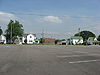
| 1 | Botkins Elementary School | N/A | 1921 | Botkins Botkins, Ohio Botkins is a village in Shelby County, Ohio, United States. The population was 1,205 at the 2000 census. The village's welcome sign reads "Where the waters divide and the people unite."-Geography:Botkins is located at .... : Main St. 40°28′8.8"N 84°10′57.5"W |
Shelby Shelby County, Ohio As of the census of 2000, there were 47,910 people, 17,636 households, and 13,085 families residing in the county. The population density was 117 people per square mile . There were 18,682 housing units at an average density of 46 per square mile... |
 |
| 2 | Cassella Catholic Church and Rectory Nativity of the Blessed Virgin Mary Catholic Church The Nativity of the Blessed Virgin Mary Catholic Church is a historic Catholic church in Cassella, an unincorporated community in Mercer County, Ohio, United States... |
Nativity of the Blessed Virgin Mary Nativity of Mary The Nativity of Mary, or Birth of the Virgin and various permutations, is celebrated as a liturgical feast in the Roman Catholic calendar of saints and in most Anglican liturgical calendars on 8 September, nine months after the solemnity of her Immaculate Conception, celebrated on 8 December... |
1858 | Marion Township Marion Township, Mercer County, Ohio Marion Township is one of the fourteen townships of Mercer County, Ohio, United States. The 2000 census found 2,969 people in the township, 2,605 of whom lived in the unincorporated portions of the township.-Geography:... : State Route 119 Ohio State Route 119 State Route 119 is an east–west highway serving rural sections of west-central Ohio. It begins just west of Fort Recovery at the eastern terminus of Indiana State Road 26 and intersects with State Route 49 in the virtual center of Fort Recovery. A "TO Indiana 26" shield can be seen... in Cassella Cassella, Ohio Cassella is an unincorporated community in Marion Township, Mercer County, Ohio, United States. Located at , it lies at an elevation of 955 feet... 40°24′24"N 84°33′3"W |
Mercer Mercer County, Ohio Mercer County is a county located in the state of Ohio, United States. Its county seat is Celina and is named for Hugh Mercer, an officer in the American Revolutionary War.The Celina Micropolitan Statistical Area includes all of Mercer County.-Geography:... |
|
| 3 | Chickasaw School and Rectory Precious Blood Catholic Church (Chickasaw, Ohio) Precious Blood Catholic Church is a Roman Catholic parish in Chickasaw, Ohio, United States. Erected in 1903 and still an active parish, the church historically owned two buildings constructed in its early years that have been designated as historic sites.... |
N/A | 1904 | Chickasaw Chickasaw, Ohio Chickasaw is a village in Mercer County, Ohio, United States. The population was 364 at the 2000 census.-Geography:Chickasaw is located at .... : Maple St. 40°26′10"N 84°29′35"W |
Mercer Mercer County, Ohio Mercer County is a county located in the state of Ohio, United States. Its county seat is Celina and is named for Hugh Mercer, an officer in the American Revolutionary War.The Celina Micropolitan Statistical Area includes all of Mercer County.-Geography:... |
|
| 4 | Coldwater Catholic Church Complex | Holy Trinity Trinity The Christian doctrine of the Trinity defines God as three divine persons : the Father, the Son , and the Holy Spirit. The three persons are distinct yet coexist in unity, and are co-equal, co-eternal and consubstantial . Put another way, the three persons of the Trinity are of one being... |
1899 | Coldwater Coldwater, Ohio Coldwater is a village in Mercer County, Ohio, United States. The population was 4,482 at the 2000 census.-Geography:Coldwater is located at .... : E. Main and 2nd Sts. 40°28′49"N 84°37′42"W |
Mercer Mercer County, Ohio Mercer County is a county located in the state of Ohio, United States. Its county seat is Celina and is named for Hugh Mercer, an officer in the American Revolutionary War.The Celina Micropolitan Statistical Area includes all of Mercer County.-Geography:... |
|
| 5 | Egypt Catholic Church and Rectory St. Joseph's Catholic Church (Egypt, Ohio) St. Joseph's Catholic Church is a historic Roman Catholic church in Egypt, Ohio, United States. Built in 1887, this church is home to a small Catholic parish, and it has been declared a historic site because of its well-preserved Gothic Revival architecture.... |
St. Joseph Saint Joseph Saint Joseph is a figure in the Gospels, the husband of the Virgin Mary and the earthly father of Jesus Christ .... |
1887 | Jackson Township Jackson Township, Auglaize County, Ohio Jackson Township is one of the fourteen townships of Auglaize County, Ohio, United States. The 2000 census found 3,577 people in the township, 776 of whom lived in the unincorporated portions of the township.-Geography:... : junction of Minster-Egypt Rd. and State Route 364 Ohio State Route 364 -Route description:SR 364 travels through portions of Allen, Shelby and Auglaize Counties. There are no segments of SR 364 that are included within the National Highway System . The NHS is a network of highways identified as being most important for the economy, mobility and defense of... at Egypt Egypt, Ohio Egypt is an unincorporated community in western Jackson Township, Auglaize County, Ohio, United States. Located at , the community sits at an elevation of 971 feet , approximately west of the village of Minster.... 40°23′5"N 84°26′4"W |
Auglaize Auglaize County, Ohio As of the census of 2000, there were 46,611 people, 17,376 households, and 12,771 families residing in the county. The population density was 116 people per square mile . There were 18,470 housing units at an average density of 46 per square mile... |
|
| 6 | Glynnwood Catholic Church St. Patrick's Catholic Church (Glynwood, Ohio) St. Patrick's Church is a historic Roman Catholic church in Glynwood, an unincorporated community in Moulton Township, Auglaize County, Ohio, United States. Located north of U.S. Route 33 between St. Marys and Wapakoneta, the church was built in 1883 in the Gothic Revival style... |
St. Patrick Saint Patrick Saint Patrick was a Romano-Briton and Christian missionary, who is the most generally recognized patron saint of Ireland or the Apostle of Ireland, although Brigid of Kildare and Colmcille are also formally patron saints.... |
1883 | Moulton Township Moulton Township, Auglaize County, Ohio Moulton Township is one of the fourteen townships of Auglaize County, Ohio, United States. The 2000 census found 1,704 people in the township, 1,682 of whom lived in the unincorporated portions of the township.-Geography:... : 6 miles northeast of St. Marys on Glynnwood Rd. in Glynnwood Glynwood, Ohio Glynwood is an unincorporated community located in southwestern Moulton Township, in Auglaize County, Ohio, United States.It is located between Wapakoneta and Saint Marys. The community is served by the Saint Marys City School District and the Saint Marys post office.A community landmark is St... 40°34′59"N 84°19′5"W |
Auglaize Auglaize County, Ohio As of the census of 2000, there were 46,611 people, 17,376 households, and 12,771 families residing in the county. The population density was 116 people per square mile . There were 18,470 housing units at an average density of 46 per square mile... |
|
| 7 | Gruenwald Convent Gruenwald Convent The Gruenwald Convent is a historic former Roman Catholic convent in the far western part of the U.S. state of Ohio. Located approximately south of the small community of Cassella in Mercer County, the convent was built in 1854... |
N/A | 1854 | Marion Township Marion Township, Mercer County, Ohio Marion Township is one of the fourteen townships of Mercer County, Ohio, United States. The 2000 census found 2,969 people in the township, 2,605 of whom lived in the unincorporated portions of the township.-Geography:... : 0.5 miles south of Cassella Cassella, Ohio Cassella is an unincorporated community in Marion Township, Mercer County, Ohio, United States. Located at , it lies at an elevation of 955 feet... 40°24′1"N 84°33′3"W |
Mercer Mercer County, Ohio Mercer County is a county located in the state of Ohio, United States. Its county seat is Celina and is named for Hugh Mercer, an officer in the American Revolutionary War.The Celina Micropolitan Statistical Area includes all of Mercer County.-Geography:... |
|
| 8 | Holy Family Catholic Church Holy Family Catholic Church (Frenchtown, Ohio) Holy Family Catholic Church is a historic Roman Catholic church in Wayne Township, Darke County, Ohio, United States. Located in the unincorporated community of Frenchtown, it houses an active congregation, and it has been accorded historic site status because of its well-preserved Gothic Revival... |
Holy Family Holy Family The Holy Family consists of the Child Jesus, the Virgin Mary, and Saint Joseph.The Feast of the Holy Family is a liturgical celebration in the Roman Catholic Church in honor of Jesus of Nazareth, his mother, the Blessed Virgin Mary, and his foster father, Saint Joseph, as a family... |
1866 | Wayne Township Wayne Township, Darke County, Ohio Wayne Township is one of the twenty townships of Darke County, Ohio, United States. The 2000 census found 4,349 people in the township, 1,760 of whom lived in the unincorporated portions of the township.-Geography:... : State Route 185 Ohio State Route 185 State Route 185 is a long east–west state highway in the western part of the U.S. state of Ohio. The western terminus of SR 185 is at U.S. Route 127 approximately south of North Star. Its eastern terminus is in Piqua... at Frenchtown Frenchtown, Ohio Frenchtown is an unincorporated community in Wayne Township, Darke County, Ohio, United States. The community lies at the intersection of State Route 185 with Burns and Mangen Roads, approximately northwest of the village of Versailles... 40°14′46"N 84°31′25"W |
Darke Darke County, Ohio As of the census of 2000, there were 53,309 people, 20,419 households, and 14,905 families residing in the county. The population density was 89 people per square mile . There were 21,583 housing units at an average density of 36 per square mile... |
|
| 9 | Holy Rosary Catholic Church Holy Rosary Catholic Church (St. Marys, Ohio) Holy Rosary Catholic Church is a Roman Catholic parish on the east side of St. Marys, Ohio, United States. Established in 1852, the church has been recognized for its historic 1860s church building, which was demolished amid a period of growth in the 1970s and replaced with a modern... |
Holy Rosary Rosary The rosary or "garland of roses" is a traditional Catholic devotion. The term denotes the prayer beads used to count the series of prayers that make up the rosary... |
1867 | St. Marys St. Marys, Ohio St. Marys is a city in Auglaize County, Ohio, United States. The population was 8,342 at the 2000 census. It is included in the Wapakoneta, Ohio, Micropolitan Statistical Area.-History:... : junction of E. Spring and S. Pine Sts. 40°32′42"N 84°22′58"W |
Auglaize Auglaize County, Ohio As of the census of 2000, there were 46,611 people, 17,376 households, and 12,771 families residing in the county. The population density was 116 people per square mile . There were 18,470 housing units at an average density of 46 per square mile... |
 |
| 10 | Immaculate Conception Catholic Church Complex Immaculate Conception Catholic Church (Celina, Ohio) Immaculate Conception Catholic Church is a parish of the Roman Catholic Church in Celina, Ohio, United States. Founded later than many other Catholic parishes in the heavily Catholic region of western Ohio, it owns a complex of buildings constructed in the early 20th century that have been... |
Immaculate Conception Immaculate Conception The Immaculate Conception of Mary is a dogma of the Roman Catholic Church, according to which the Virgin Mary was conceived without any stain of original sin. It is one of the four dogmata in Roman Catholic Mariology... |
1903 | Celina Celina, Ohio Celina is a city in and the county seat of Mercer County, Ohio, United States. The population was 10,303 at the 2000 census. Celina is situated on the western shores of Grand Lake St. Marys.-History:... : Anthony and Walnut Sts. 40°33′7"N 84°34′22"W |
Mercer Mercer County, Ohio Mercer County is a county located in the state of Ohio, United States. Its county seat is Celina and is named for Hugh Mercer, an officer in the American Revolutionary War.The Celina Micropolitan Statistical Area includes all of Mercer County.-Geography:... |
|
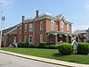
| 11 | Immaculate Conception Rectory at Botkins | Immaculate Conception Immaculate Conception The Immaculate Conception of Mary is a dogma of the Roman Catholic Church, according to which the Virgin Mary was conceived without any stain of original sin. It is one of the four dogmata in Roman Catholic Mariology... |
1887 | Botkins Botkins, Ohio Botkins is a village in Shelby County, Ohio, United States. The population was 1,205 at the 2000 census. The village's welcome sign reads "Where the waters divide and the people unite."-Geography:Botkins is located at .... : 116 N. Mill St. 40°28′9.6"N 84°10′57.8"W |
Shelby Shelby County, Ohio As of the census of 2000, there were 47,910 people, 17,636 households, and 13,085 families residing in the county. The population density was 117 people per square mile . There were 18,682 housing units at an average density of 46 per square mile... |
 |
| 12 | Maria Stein Catholic Church and Rectory St. John the Baptist Catholic Church (Maria Stein, Ohio) St. John the Baptist Catholic Church is a historic Roman Catholic church in Marion Township, Mercer County, Ohio, United States. Located in the unincorporated community of Maria Stein, it is the home of an active congregation and has been recognized as a historic site because of its well-preserved... |
St. John the Baptist John the Baptist John the Baptist was an itinerant preacher and a major religious figure mentioned in the Canonical gospels. He is described in the Gospel of Luke as a relative of Jesus, who led a movement of baptism at the Jordan River... |
1889 | Marion Township Marion Township, Mercer County, Ohio Marion Township is one of the fourteen townships of Mercer County, Ohio, United States. The 2000 census found 2,969 people in the township, 2,605 of whom lived in the unincorporated portions of the township.-Geography:... : St. John's Rd. and State Route 119 Ohio State Route 119 State Route 119 is an east–west highway serving rural sections of west-central Ohio. It begins just west of Fort Recovery at the eastern terminus of Indiana State Road 26 and intersects with State Route 49 in the virtual center of Fort Recovery. A "TO Indiana 26" shield can be seen... in Maria Stein Maria Stein, Ohio Maria Stein is an unincorporated community in central Marion Township, Mercer County, Ohio, United States. The community and the Maria Stein Convent lie at the center of the area known as the Land of the Cross-Tipped Churches, where a missionary priest, Father Francis de Sales Brunner,... 40°24′29"N 84°28′22"W |
Mercer Mercer County, Ohio Mercer County is a county located in the state of Ohio, United States. Its county seat is Celina and is named for Hugh Mercer, an officer in the American Revolutionary War.The Celina Micropolitan Statistical Area includes all of Mercer County.-Geography:... |
|
| 13 | Maria Stein Convent Shrine of the Holy Relics The Shrine of the Holy Relics in Maria Stein, Ohio is the second largest collection of relics in the United States. It is a part of the historic Maria Stein Convent.-History:... |
N/A | 1846 | Marion Township Marion Township, Mercer County, Ohio Marion Township is one of the fourteen townships of Mercer County, Ohio, United States. The 2000 census found 2,969 people in the township, 2,605 of whom lived in the unincorporated portions of the township.-Geography:... : St. John's and Rolfes Rd. in Maria Stein Maria Stein, Ohio Maria Stein is an unincorporated community in central Marion Township, Mercer County, Ohio, United States. The community and the Maria Stein Convent lie at the center of the area known as the Land of the Cross-Tipped Churches, where a missionary priest, Father Francis de Sales Brunner,... 40°24′57"N 84°28′34"W |
Mercer Mercer County, Ohio Mercer County is a county located in the state of Ohio, United States. Its county seat is Celina and is named for Hugh Mercer, an officer in the American Revolutionary War.The Celina Micropolitan Statistical Area includes all of Mercer County.-Geography:... |
|
| 14 | Minster Elementary School Minster Elementary School The Minster Elementary School is a historic Catholic school building in Minster, Ohio, United States. Built in the early twentieth century, it has been recognized as a historic site.-Architecture:... |
N/A | 1904 | Minster Minster, Ohio Minster is a village in Auglaize County, Ohio, United States. The population was 2,794 at the 2000 census. It is included in the Wapakoneta, Ohio Micropolitan Statistical Area... : Lincoln St. 40°23′42"N 84°22′44"W |
Auglaize Auglaize County, Ohio As of the census of 2000, there were 46,611 people, 17,376 households, and 12,771 families residing in the county. The population density was 116 people per square mile . There were 18,470 housing units at an average density of 46 per square mile... |
|
| 15 | Philothea Catholic Church and Priest House | St. Mary Blessed Virgin Mary (Roman Catholic) Roman Catholic veneration of the Blessed Virgin Mary is based on Holy Scripture: In the fullness of time, God sent his son, born of a virgin. The mystery of the incarnation of the Son of God through Mary thus signifies her honour as Mother of God... |
1871 | Butler Township Butler Township, Mercer County, Ohio Butler Township is one of the fourteen townships of Mercer County, Ohio, United States. The 2000 census found 6,459 people in the township, 1,977 of whom lived in the unincorporated portions of the township.-Geography:... : Philothea Rd. in Philothea, between St. Henry and Coldwater 40°27′3"N 84°39′18"W |
Mercer Mercer County, Ohio Mercer County is a county located in the state of Ohio, United States. Its county seat is Celina and is named for Hugh Mercer, an officer in the American Revolutionary War.The Celina Micropolitan Statistical Area includes all of Mercer County.-Geography:... |
|
| 16 | Sacred Heart of Jesus Rectory Sacred Heart Catholic Church (McCartyville, Ohio) Sacred Heart of Jesus Catholic Church is a parish of the Roman Catholic Church in McCartyville, Ohio, United States. Founded in the late nineteenth century, it remains an active parish to the present day... |
Sacred Heart of Jesus Sacred Heart The Sacred Heart is one of the most famous religious devotions to Jesus' physical heart as the representation of His divine love for Humanity.... |
1911 | Van Buren Township Van Buren Township, Shelby County, Ohio Van Buren Township is one of the fourteen townships of Shelby County, Ohio, United States. The 2000 census found 1,599 people in the township, 1,424 of whom lived in the unincorporated portions of the township.-Geography:... : State Routes 29 and 119 Ohio State Route 119 State Route 119 is an east–west highway serving rural sections of west-central Ohio. It begins just west of Fort Recovery at the eastern terminus of Indiana State Road 26 and intersects with State Route 49 in the virtual center of Fort Recovery. A "TO Indiana 26" shield can be seen... at McCartyville McCartyville, Ohio McCartyville is an unincorporated community in Shelby County, Ohio, United States. Located at the junction of State Routes 29 and 119, it lies in southern Van Buren Township, south of central Kettlersville and approximately northwest of the city of Sidney, the county seat of Shelby County... 40°23′42.4"N 84°15′16.6"W |
Shelby Shelby County, Ohio As of the census of 2000, there were 47,910 people, 17,636 households, and 13,085 families residing in the county. The population density was 117 people per square mile . There were 18,682 housing units at an average density of 46 per square mile... |
|
| 17 | St. Aloysius Catholic Church St. Aloysius' Catholic Church (Carthagena, Ohio) St. Aloysius' Catholic Church is a historic Roman Catholic church in Carthagena, an unincorporated community in Marion Township, Mercer County, Ohio, United States... |
St. Aloysius Aloysius Gonzaga - Early life :Aloysius Gonzaga was born at his family's castle in Castiglione delle Stiviere, between Brescia and Mantova in northern Italy in what was then part of the Papal States. He was a member of the illustrious House of Gonzaga... |
1875 | Marion Township Marion Township, Mercer County, Ohio Marion Township is one of the fourteen townships of Mercer County, Ohio, United States. The 2000 census found 2,969 people in the township, 2,605 of whom lived in the unincorporated portions of the township.-Geography:... : U.S. Route 127 U.S. Route 127 U.S. Route 127 is a long north–south United States highway in the eastern half of the United States. The southern terminus of the route is at U.S. Route 27 in Chattanooga, Tennessee. The northern terminus is at Interstate 75 near Grayling, Michigan... and State Route 274 Ohio State Route 274 State Route 274 is a two-lane east–west state highway located in the western portion of the U.S. state of Ohio. The western terminus of State Route 274 is at a T-intersection with U.S. Route 127 approximately west of Chickasaw... , west of Carthagena Carthagena, Ohio Carthagena is an unincorporated community in Mercer County, Ohio, United States. It has an elevation of and is located at .The Saint Charles Center, originally Saint Charles Seminary, operated by the Missionaries of the Precious Blood is located in Carthagena.Carthagena is named after Cartagena,... 40°26′11"N 84°34′12"W |
Mercer Mercer County, Ohio Mercer County is a county located in the state of Ohio, United States. Its county seat is Celina and is named for Hugh Mercer, an officer in the American Revolutionary War.The Celina Micropolitan Statistical Area includes all of Mercer County.-Geography:... |
|
| 18 | St. Anthony Catholic Church, Padua St. Anthony's Catholic Church (Padua, Ohio) St. Anthony's Catholic Church is a historic Roman Catholic church in Padua, an unincorporated community in Washington Township, Mercer County, Ohio, United States... |
St. Anthony Anthony of Padua Anthony of Padua or Anthony of Lisbon, O.F.M., was a Portuguese Catholic priest and friar of the Franciscan Order. Though he died in Padua, Italy, he was born to a wealthy family in Lisbon, Portugal, which is where he was raised... |
1869 | Washington Township Washington Township, Mercer County, Ohio Washington Township is one of the fourteen townships of Mercer County, Ohio, United States. The 2000 census found 1,218 people in the township.-Geography:Located in the western part of the county, it borders the following townships:*Liberty Township - north... : State Route 49 Ohio State Route 49 State Route 49 or SR 49 is a state highway in the western part of the U.S. state of Ohio. It begins at Drexel with US 35 and runs northwesterly to Greenville, and then runs roughly along near the western edge of the state near the Indiana state line to the Michigan state line where it meets with... and St. Anthony Rd. in Padua Padua, Ohio Padua is an unincorporated community in western Washington Township, Mercer County, Ohio, United States. It lies at the intersection of State Route 49 and St. Anthony Road, west of the city of Celina, the county seat of Mercer County... 40°30′32"N 84°47′7"W |
Mercer Mercer County, Ohio Mercer County is a county located in the state of Ohio, United States. Its county seat is Celina and is named for Hugh Mercer, an officer in the American Revolutionary War.The Celina Micropolitan Statistical Area includes all of Mercer County.-Geography:... |
|
| 19 | St. Augustine Catholic Church | St. Augustine Augustine of Hippo Augustine of Hippo , also known as Augustine, St. Augustine, St. Austin, St. Augoustinos, Blessed Augustine, or St. Augustine the Blessed, was Bishop of Hippo Regius . He was a Latin-speaking philosopher and theologian who lived in the Roman Africa Province... |
1848 | Minster Minster, Ohio Minster is a village in Auglaize County, Ohio, United States. The population was 2,794 at the 2000 census. It is included in the Wapakoneta, Ohio Micropolitan Statistical Area... : N. Hanover St. 40°23′40"N 84°22′47"W |
Auglaize Auglaize County, Ohio As of the census of 2000, there were 46,611 people, 17,376 households, and 12,771 families residing in the county. The population density was 116 people per square mile . There were 18,470 housing units at an average density of 46 per square mile... |
|
| 20 | St. Bernard Catholic Church and Rectory | St. Bernard Bernard of Clairvaux Bernard of Clairvaux, O.Cist was a French abbot and the primary builder of the reforming Cistercian order.After the death of his mother, Bernard sought admission into the Cistercian order. Three years later, he was sent to found a new abbey at an isolated clearing in a glen known as the Val... |
1906 | Burkettsville Burkettsville, Ohio Burkettsville is a village in Darke and Mercer counties in the U.S. state of Ohio. The population was 254 at the 2000 census.-History:Burkettsville was founded after the construction of a railroad line through northern Darke County in 1883... : Main St. 40°21′8"N 84°38′45"W |
Mercer Mercer County, Ohio Mercer County is a county located in the state of Ohio, United States. Its county seat is Celina and is named for Hugh Mercer, an officer in the American Revolutionary War.The Celina Micropolitan Statistical Area includes all of Mercer County.-Geography:... |
|
| 21 | St. Charles Seminary and Chapel | St. Charles Charles Borromeo Charles Borromeo was the cardinal archbishop of the Catholic Archdiocese of Milan from 1564 to 1584. He was a leading figure during the Counter-Reformation and was responsible for significant reforms in the Catholic Church, including the founding of seminaries for the education of priests... |
1906 | Marion Township Marion Township, Mercer County, Ohio Marion Township is one of the fourteen townships of Mercer County, Ohio, United States. The 2000 census found 2,969 people in the township, 2,605 of whom lived in the unincorporated portions of the township.-Geography:... : 0.5 miles south of Carthagena Carthagena, Ohio Carthagena is an unincorporated community in Mercer County, Ohio, United States. It has an elevation of and is located at .The Saint Charles Center, originally Saint Charles Seminary, operated by the Missionaries of the Precious Blood is located in Carthagena.Carthagena is named after Cartagena,... , off U.S. Route 127 U.S. Route 127 U.S. Route 127 is a long north–south United States highway in the eastern half of the United States. The southern terminus of the route is at U.S. Route 27 in Chattanooga, Tennessee. The northern terminus is at Interstate 75 near Grayling, Michigan... 40°25′57"N 84°33′48"W |
Mercer Mercer County, Ohio Mercer County is a county located in the state of Ohio, United States. Its county seat is Celina and is named for Hugh Mercer, an officer in the American Revolutionary War.The Celina Micropolitan Statistical Area includes all of Mercer County.-Geography:... |
|
| 22 | St. Francis Catholic Church and Rectory | St. Francis Francis of Assisi Saint Francis of Assisi was an Italian Catholic friar and preacher. He founded the men's Franciscan Order, the women’s Order of St. Clare, and the lay Third Order of Saint Francis. St... |
1906 | Granville Township Granville Township, Mercer County, Ohio Granville Township is one of the fourteen townships of Mercer County, Ohio, United States. The 2000 census found 3,885 people in the township, 1,434 of whom lived in the unincorporated portions of the township.-Geography:... : Cranberry and Ft. Recovery-Minster Rd. in Cranberry Prairie 40°23′34"N 84°34′55"W |
Mercer Mercer County, Ohio Mercer County is a county located in the state of Ohio, United States. Its county seat is Celina and is named for Hugh Mercer, an officer in the American Revolutionary War.The Celina Micropolitan Statistical Area includes all of Mercer County.-Geography:... |
|
| 23 | St. Henry Catholic Church St. Henry's Catholic Church (St. Henry, Ohio) St. Henry's Catholic Church is a historic Roman Catholic church in St. Henry, Ohio, United States. Built in the late nineteenth century, it remains the home of a functioning congregation, and it has been recognized as a historically significant building because of its architecture.-Early... |
St. Henry Henry II, Holy Roman Emperor Henry II , also referred to as Saint Henry, Obl.S.B., was the fifth and last Holy Roman Emperor of the Ottonian dynasty, from his coronation in Rome in 1014 until his death a decade later. He was crowned King of the Germans in 1002 and King of Italy in 1004... |
1897 | St. Henry St. Henry, Ohio St. Henry is a village in Mercer County, Ohio, United States. The population was 2,271 at the 2000 census.-History:Located at the center of the village is St. Henry's Catholic Church. Completed in 1897, it is listed on the National Register of Historic Places.-Geography:St. Henry is located at... : Main St. 40°25′3"N 84°38′19"W |
Mercer Mercer County, Ohio Mercer County is a county located in the state of Ohio, United States. Its county seat is Celina and is named for Hugh Mercer, an officer in the American Revolutionary War.The Celina Micropolitan Statistical Area includes all of Mercer County.-Geography:... |
|
| 24 | St. John Catholic Church and Parish Hall | St. John John the Evangelist Saint John the Evangelist is the conventional name for the author of the Gospel of John... |
1850 | Pusheta Township Pusheta Township, Auglaize County, Ohio Pusheta Township is one of the fourteen townships of Auglaize County, Ohio, United States. The 2000 census found 1,346 people in the township, 1,295 of whom lived in the unincorporated portions of the township.-Geography:... : southwestern corner of Schlemel and Van Buren Sts. in Fryburg 40°30′57.5"N 84°8′54.6"W |
Auglaize Auglaize County, Ohio As of the census of 2000, there were 46,611 people, 17,376 households, and 12,771 families residing in the county. The population density was 116 people per square mile . There were 18,470 housing units at an average density of 46 per square mile... |
 |
| 25 | St. Joseph Catholic Church and Rectory | St. Joseph Saint Joseph Saint Joseph is a figure in the Gospels, the husband of the Virgin Mary and the earthly father of Jesus Christ .... |
1866 | Recovery Township Recovery Township, Mercer County, Ohio Recovery Township is one of the fourteen townships of Mercer County, Ohio, United States. The 2000 census found 1,550 people in the township, 1,149 of whom lived in the unincorporated portions of the township.-Geography:... : Sawmill and St. Joe Rds. in St. Joe 40°25′41"N 84°44′19"W |
Mercer Mercer County, Ohio Mercer County is a county located in the state of Ohio, United States. Its county seat is Celina and is named for Hugh Mercer, an officer in the American Revolutionary War.The Celina Micropolitan Statistical Area includes all of Mercer County.-Geography:... |
|
| 26 | St. Joseph Catholic Church and School St. Joseph's Catholic Church (Wapakoneta, Ohio) St. Joseph's Catholic Church is a historic Roman Catholic church in Wapakoneta, Ohio, United States. Built in 1910, this church is home to an active Catholic parish, and it has been declared a historic site because of its well-preserved Romanesque Revival architecture.-Early parish history:One of... |
St. Joseph Saint Joseph Saint Joseph is a figure in the Gospels, the husband of the Virgin Mary and the earthly father of Jesus Christ .... |
1899 | Wapakoneta Wapakoneta, Ohio Wapakoneta is a city in and the county seat of Auglaize County, Ohio, United States with a population of 9,474 as of the 2000 U.S. census. It is the principal city of and is included in the Wapakoneta, Ohio Micropolitan S A, which is included in the Lima-Van Wert-Wapakoneta, Ohio CSA... : 309 S. Perry St. 40°34′4"N 84°11′43"W |
Auglaize Auglaize County, Ohio As of the census of 2000, there were 46,611 people, 17,376 households, and 12,771 families residing in the county. The population density was 116 people per square mile . There were 18,470 housing units at an average density of 46 per square mile... |
|
| 27 | St. Louis Catholic Church and Rectory St. Louis' Catholic Church (North Star, Ohio) St. Louis' Catholic Church is a historic Roman Catholic church in North Star, Ohio, United States. Constructed in the early twentieth century, it is one of the newest churches in a heavily Catholic region of far western Ohio, but it has been recognized as a historic site because of its unique... |
St. Louis Louis IX of France Louis IX , commonly Saint Louis, was King of France from 1226 until his death. He was also styled Louis II, Count of Artois from 1226 to 1237. Born at Poissy, near Paris, he was an eighth-generation descendant of Hugh Capet, and thus a member of the House of Capet, and the son of Louis VIII and... |
1914 | North Star North Star, Ohio North Star is a village in Darke County, Ohio, United States. The population was 209 at the 2000 census.-History:North Star was platted in 1852 along the road between Greenville and Celina, approximately midway between the two cities... : east of U.S. Route 127 U.S. Route 127 U.S. Route 127 is a long north–south United States highway in the eastern half of the United States. The southern terminus of the route is at U.S. Route 27 in Chattanooga, Tennessee. The northern terminus is at Interstate 75 near Grayling, Michigan... 40°19′29"N 84°34′13"W |
Darke Darke County, Ohio As of the census of 2000, there were 53,309 people, 20,419 households, and 14,905 families residing in the county. The population density was 89 people per square mile . There were 21,583 housing units at an average density of 36 per square mile... |
|
| 28 | St. Michael Catholic Church Complex | St. Michael Michael (archangel) Michael , Micha'el or Mîkhā'ēl; , Mikhaḗl; or Míchaël; , Mīkhā'īl) is an archangel in Jewish, Christian, and Islamic teachings. Roman Catholics, Anglicans, and Lutherans refer to him as Saint Michael the Archangel and also simply as Saint Michael... |
1849 | Fort Loramie Fort Loramie, Ohio Fort Loramie is a village in Shelby County, Ohio, United States, along Loramie Creek. The population was 3,045 at the 2010 census. The village was founded in 1837.-History:... : State Route 705 Ohio State Route 705 State Route 705 is a state highway in western Ohio, a U.S. state. The highway's western terminus is in rural northwestern Darke County at State Route 49 approximately southeast of Fort Recovery, and just a mile south of the Darke-Mercer County Line... east of State Route 66 40°21′5"N 84°22′19"W |
Shelby Shelby County, Ohio As of the census of 2000, there were 47,910 people, 17,636 households, and 13,085 families residing in the county. The population density was 117 people per square mile . There were 18,682 housing units at an average density of 46 per square mile... |
|
| 29 | St. Nicholas Catholic Church and Rectory St. Nicholas' Catholic Church (Osgood, Ohio) St. Nicholas' Catholic Church is a historic Roman Catholic church in Osgood, Ohio, United States. Built in the first years of the 20th century, it houses one of the newest parishes in a heavily Catholic region of far western Ohio, but it has been recognized as a historic site for its... |
St. Nicholas Saint Nicholas Saint Nicholas , also called Nikolaos of Myra, was a historic 4th-century saint and Greek Bishop of Myra . Because of the many miracles attributed to his intercession, he is also known as Nikolaos the Wonderworker... |
1907 | Osgood Osgood, Ohio Osgood is a village in Darke County, Ohio, United States. The population was 255 at the 2000 census.-History:Osgood was founded in the 1880s. While its earliest settlers were primarily Protestants, a Roman Catholic parish was erected in the village in 1906. Today, St... : State Route 705 Ohio State Route 705 State Route 705 is a state highway in western Ohio, a U.S. state. The highway's western terminus is in rural northwestern Darke County at State Route 49 approximately southeast of Fort Recovery, and just a mile south of the Darke-Mercer County Line... and Washington St. 40°20′26"N 84°29′33"W |
Darke Darke County, Ohio As of the census of 2000, there were 53,309 people, 20,419 households, and 14,905 families residing in the county. The population density was 89 people per square mile . There were 21,583 housing units at an average density of 36 per square mile... |
|
| 30 | St. Patrick Catholic Church and Rectory St. Patrick's Catholic Church (St. Patrick, Ohio) St. Patrick's Catholic Church was a Roman Catholic church in northwestern Shelby County, Ohio, United States. Located in the southwestern corner of Van Buren Township, the church sat at the intersection of Hoying and Wright-Puthoff Roads in the unincorporated community of St. Patrick.-Parish... |
St. Patrick Saint Patrick Saint Patrick was a Romano-Briton and Christian missionary, who is the most generally recognized patron saint of Ireland or the Apostle of Ireland, although Brigid of Kildare and Colmcille are also formally patron saints.... |
1915 | Van Buren Township Van Buren Township, Shelby County, Ohio Van Buren Township is one of the fourteen townships of Shelby County, Ohio, United States. The 2000 census found 1,599 people in the township, 1,424 of whom lived in the unincorporated portions of the township.-Geography:... : Hoying and Wright-Puthoff Rds. in St. Patrick St. Patrick, Ohio St. Patrick is an unincorporated community in southwestern Van Buren Township, Shelby County, Ohio, United States. It lies at the intersection of Hoying and Wright-Puthoff Roads, northwest of the city of Sidney, the county seat of Shelby County. Its elevation is 971 feet , and it is located... 40°22′13.1"N 84°17′19"W |
Shelby Shelby County, Ohio As of the census of 2000, there were 47,910 people, 17,636 households, and 13,085 families residing in the county. The population density was 117 people per square mile . There were 18,682 housing units at an average density of 46 per square mile... |
|
| 31 | St. Paul's Catholic Church and Rectory | St. Paul Paul of Tarsus Paul the Apostle , also known as Saul of Tarsus, is described in the Christian New Testament as one of the most influential early Christian missionaries, with the writings ascribed to him by the church forming a considerable portion of the New Testament... |
1889 | Gibson Township Gibson Township, Mercer County, Ohio Gibson Township is one of the fourteen townships of Mercer County, Ohio, United States. The 2000 census found 1,869 people in the township, 997 of whom lived in the unincorporated portions of the township.-Geography:... : junction of Sharpsburg and Meiring Rds. in Sharpsburg 40°22′2"N 84°42′41"W |
Mercer Mercer County, Ohio Mercer County is a county located in the state of Ohio, United States. Its county seat is Celina and is named for Hugh Mercer, an officer in the American Revolutionary War.The Celina Micropolitan Statistical Area includes all of Mercer County.-Geography:... |
|
| 32 | St. Peter Catholic Church and Rectory | St. Peter Saint Peter Saint Peter or Simon Peter was an early Christian leader, who is featured prominently in the New Testament Gospels and the Acts of the Apostles. The son of John or of Jonah and from the village of Bethsaida in the province of Galilee, his brother Andrew was also an apostle... |
1904 | Recovery Township Recovery Township, Mercer County, Ohio Recovery Township is one of the fourteen townships of Mercer County, Ohio, United States. The 2000 census found 1,550 people in the township, 1,149 of whom lived in the unincorporated portions of the township.-Geography:... : St. Peter and Philothea Rds. in St. Peter 40°27′3"N 84°44′48"W |
Mercer Mercer County, Ohio Mercer County is a county located in the state of Ohio, United States. Its county seat is Celina and is named for Hugh Mercer, an officer in the American Revolutionary War.The Celina Micropolitan Statistical Area includes all of Mercer County.-Geography:... |
|
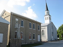
| 33 | St. Remy Catholic Church St. Remy's Catholic Church St. Remy's Catholic Church is a historic Roman Catholic church in Russia, Ohio, United States. Built in 1890, it continues to house an active parish, and it has been recognized as a historic site because of its architecture.-Parish history:... |
St. Remy Saint Remigius Saint Remigius, Remy or Remi, , was Bishop of Reims and Apostle of the Franks, . On 24 December 496 he baptised Clovis I, King of the Franks... |
1890 | Russia Russia, Ohio Russia is a village in Loramie Township, Shelby County, Ohio, United States. The population was 551 at the 2000 census.-History:Russia was founded by Lewis Phillips, who purchased and platted the land where the village now sits. Phillips' house, built in 1853, was the first house in Russia; other... : Main St. and Russia-Versailles Rd. 40°14′0.68"N 84°24′53.25"W |
Shelby Shelby County, Ohio As of the census of 2000, there were 47,910 people, 17,636 households, and 13,085 families residing in the county. The population density was 117 people per square mile . There were 18,682 housing units at an average density of 46 per square mile... |
|
| 34 | St. Rose Catholic Church Complex St. Rose's Catholic Church (St. Rose, Ohio) St. Rose's Catholic Church is a historic Catholic church in St. Rose, an unincorporated community in Marion Township, Mercer County, Ohio, United States.-Parish history:Catholics near the community of St... |
St. Rose Rose of Lima Rose of Lima, , the first Catholic saint of the Americas, was born in Lima, Peru.-Biography:Saint Rose of Lima was born in the city of that name, the daughter of Gaspar Flores, a harquebusier from San German, Puerto Rico, and his wife, Maria de Oliva, who was a native of Lima. She was part of a... |
1892 | Marion Township Marion Township, Mercer County, Ohio Marion Township is one of the fourteen townships of Mercer County, Ohio, United States. The 2000 census found 2,969 people in the township, 2,605 of whom lived in the unincorporated portions of the township.-Geography:... : Main St. in St. Rose 40°24′26"N 84°30′53"W |
Mercer Mercer County, Ohio Mercer County is a county located in the state of Ohio, United States. Its county seat is Celina and is named for Hugh Mercer, an officer in the American Revolutionary War.The Celina Micropolitan Statistical Area includes all of Mercer County.-Geography:... |
|
| 35 | St. Sebastian Catholic Church and Rectory St. Sebastian's Catholic Church (Sebastian, Ohio) St. Sebastian's Catholic Church is a historic Roman Catholic church in Marion Township, Mercer County, Ohio, United States. Located in the unincorporated community of Sebastian, it is the home of an active congregation and has been declared a historic site because of its well-preserved early... |
St. Sebastian | 1904 | Marion Township Marion Township, Mercer County, Ohio Marion Township is one of the fourteen townships of Mercer County, Ohio, United States. The 2000 census found 2,969 people in the township, 2,605 of whom lived in the unincorporated portions of the township.-Geography:... : Sebastian Rd. and State Route 716A Ohio State Route 716 State Route 716 is a state highway in the western part of the U.S. state of Ohio. Its southern terminus is at State Route 705 in the village of Osgood in northeastern Darke County. The northern terminus of State Route 716 is at State Route 274 in the village of Chickasaw in southeastern Mercer... in Sebastian Sebastian, Ohio Sebastian is an unincorporated community in northern Marion Township, Mercer County, Ohio, United States. Its elevation is 932 feet , and it is located at... 40°26′41.65"N 84°31′1.13"W |
Mercer Mercer County, Ohio Mercer County is a county located in the state of Ohio, United States. Its county seat is Celina and is named for Hugh Mercer, an officer in the American Revolutionary War.The Celina Micropolitan Statistical Area includes all of Mercer County.-Geography:... |
|
| 36 | St. Wendelin Catholic Church, School, and Rectory | St. Wendelin Wendelin of Trier Saint Wendelin or Wendelin of Trier was a hermit and abbot.-Life:There is very little definite information about this saint. His earliest biographies , did not appear until after 1417. The story as told there is that Wendelin was the son of a Scottish king... |
1870 | Recovery Township Recovery Township, Mercer County, Ohio Recovery Township is one of the fourteen townships of Mercer County, Ohio, United States. The 2000 census found 1,550 people in the township, 1,149 of whom lived in the unincorporated portions of the township.-Geography:... : Ft. Recovery-Minster Rd. and Township Line in Wendelin 40°24′0"N 84°41′27"W |
Mercer Mercer County, Ohio Mercer County is a county located in the state of Ohio, United States. Its county seat is Celina and is named for Hugh Mercer, an officer in the American Revolutionary War.The Celina Micropolitan Statistical Area includes all of Mercer County.-Geography:... |