
Ohio State Route 716
Encyclopedia
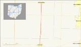
State Route 716 is a state highway
in the western part of the U.S. state
of Ohio
. Its southern terminus is at State Route 705
in the village of Osgood
in northeastern Darke County
. The northern terminus of State Route 716 is at State Route 274
in the village of Chickasaw
in southeastern Mercer County
. For its entire length, State Route 716 runs parallel to, and approximately 4 miles (6.4 km) to the east of, U.S. Route 127.
The highway was assigned in 1937 on a routing from State Route 705 in Osgood to an unnumbered highway in Franklin Township. The route was truncated to its current northern terminus in 1973. State Route 716 has remained intact ever since.
in the Darke County
village of Osgood. The highway heads northward through downtown Osgood and then into the rural regions, which includes spontaneous residential homes and fields. Not far after Osgood, State Route 716 intersects with Township Road 7 (Darke-Mercer County Line Road), which as stated, runs along the county line. The highway crosses the line into Mercer County
and continues northward through rural areas. There is an intersection with a local road, Indian Trail Road, soon after.
State Route 716 remains mainly unchanged for a little while until it nears the Marion Township village of Maria Stein. It then passes Marion Local High School. In Maria Stein, it intersects with State Route 119
. In Maria Stein, the highway is more urbanized, with more homes and commercial buildings surrounding the highway. However, this is only for a short time, as State Route 716 leaves Maria Stein after the intersection with State Route 119. The route continues northward for a short distance into Chickasaw
, where it terminates at State Route 274
.
, and a currently unnumbered road from Marion Township to 1 miles (1.6 km) east of Montezuma in Franklin Township
.
In 1973, State Route 716 was scaled back on the north end to its current northern terminus at State Route 274 in Chickasaw. The road went westward at the intersection with State Route 274, and went on a short concurrency before turning off for the north. It continued to its then northern terminus. The former stretch of State Route 716 from Chickasaw to Marion Township was re-numbered as State Route 274, and the stretch from Marion Township to Franklin Township was decommissioned.
State highway
State highway, state road or state route can refer to one of three related concepts, two of them related to a state or provincial government in a country that is divided into states or provinces :#A...
in the western part of the U.S. state
U.S. state
A U.S. state is any one of the 50 federated states of the United States of America that share sovereignty with the federal government. Because of this shared sovereignty, an American is a citizen both of the federal entity and of his or her state of domicile. Four states use the official title of...
of Ohio
Ohio
Ohio is a Midwestern state in the United States. The 34th largest state by area in the U.S.,it is the 7th‑most populous with over 11.5 million residents, containing several major American cities and seven metropolitan areas with populations of 500,000 or more.The state's capital is Columbus...
. Its southern terminus is at State Route 705
Ohio State Route 705
State Route 705 is a state highway in western Ohio, a U.S. state. The highway's western terminus is in rural northwestern Darke County at State Route 49 approximately southeast of Fort Recovery, and just a mile south of the Darke-Mercer County Line...
in the village of Osgood
Osgood, Ohio
Osgood is a village in Darke County, Ohio, United States. The population was 255 at the 2000 census.-History:Osgood was founded in the 1880s. While its earliest settlers were primarily Protestants, a Roman Catholic parish was erected in the village in 1906. Today, St...
in northeastern Darke County
Darke County, Ohio
As of the census of 2000, there were 53,309 people, 20,419 households, and 14,905 families residing in the county. The population density was 89 people per square mile . There were 21,583 housing units at an average density of 36 per square mile...
. The northern terminus of State Route 716 is at State Route 274
Ohio State Route 274
State Route 274 is a two-lane east–west state highway located in the western portion of the U.S. state of Ohio. The western terminus of State Route 274 is at a T-intersection with U.S. Route 127 approximately west of Chickasaw...
in the village of Chickasaw
Chickasaw, Ohio
Chickasaw is a village in Mercer County, Ohio, United States. The population was 364 at the 2000 census.-Geography:Chickasaw is located at ....
in southeastern Mercer County
Mercer County, Ohio
Mercer County is a county located in the state of Ohio, United States. Its county seat is Celina and is named for Hugh Mercer, an officer in the American Revolutionary War.The Celina Micropolitan Statistical Area includes all of Mercer County.-Geography:...
. For its entire length, State Route 716 runs parallel to, and approximately 4 miles (6.4 km) to the east of, U.S. Route 127.
The highway was assigned in 1937 on a routing from State Route 705 in Osgood to an unnumbered highway in Franklin Township. The route was truncated to its current northern terminus in 1973. State Route 716 has remained intact ever since.
Route description
State Route 716 begins at an intersection with State Route 705Ohio State Route 705
State Route 705 is a state highway in western Ohio, a U.S. state. The highway's western terminus is in rural northwestern Darke County at State Route 49 approximately southeast of Fort Recovery, and just a mile south of the Darke-Mercer County Line...
in the Darke County
Darke County, Ohio
As of the census of 2000, there were 53,309 people, 20,419 households, and 14,905 families residing in the county. The population density was 89 people per square mile . There were 21,583 housing units at an average density of 36 per square mile...
village of Osgood. The highway heads northward through downtown Osgood and then into the rural regions, which includes spontaneous residential homes and fields. Not far after Osgood, State Route 716 intersects with Township Road 7 (Darke-Mercer County Line Road), which as stated, runs along the county line. The highway crosses the line into Mercer County
Mercer County, Ohio
Mercer County is a county located in the state of Ohio, United States. Its county seat is Celina and is named for Hugh Mercer, an officer in the American Revolutionary War.The Celina Micropolitan Statistical Area includes all of Mercer County.-Geography:...
and continues northward through rural areas. There is an intersection with a local road, Indian Trail Road, soon after.
State Route 716 remains mainly unchanged for a little while until it nears the Marion Township village of Maria Stein. It then passes Marion Local High School. In Maria Stein, it intersects with State Route 119
Ohio State Route 119
State Route 119 is an east–west highway serving rural sections of west-central Ohio. It begins just west of Fort Recovery at the eastern terminus of Indiana State Road 26 and intersects with State Route 49 in the virtual center of Fort Recovery. A "TO Indiana 26" shield can be seen...
. In Maria Stein, the highway is more urbanized, with more homes and commercial buildings surrounding the highway. However, this is only for a short time, as State Route 716 leaves Maria Stein after the intersection with State Route 119. The route continues northward for a short distance into Chickasaw
Chickasaw, Ohio
Chickasaw is a village in Mercer County, Ohio, United States. The population was 364 at the 2000 census.-Geography:Chickasaw is located at ....
, where it terminates at State Route 274
Ohio State Route 274
State Route 274 is a two-lane east–west state highway located in the western portion of the U.S. state of Ohio. The western terminus of State Route 274 is at a T-intersection with U.S. Route 127 approximately west of Chickasaw...
.
History
State Route 716 was established in 1937. Its original path consisted of its entire current routing, State Route 274 between Chickasaw and 1 miles (1.6 km) west of Chickasaw in Marion TownshipMarion Township, Mercer County, Ohio
Marion Township is one of the fourteen townships of Mercer County, Ohio, United States. The 2000 census found 2,969 people in the township, 2,605 of whom lived in the unincorporated portions of the township.-Geography:...
, and a currently unnumbered road from Marion Township to 1 miles (1.6 km) east of Montezuma in Franklin Township
Franklin Township, Mercer County, Ohio
Franklin Township is one of the fourteen townships of Mercer County, Ohio, United States. The 2000 census found 2,303 people in the township, 2,112 of whom lived in the unincorporated portions of the township.-Geography:...
.
In 1973, State Route 716 was scaled back on the north end to its current northern terminus at State Route 274 in Chickasaw. The road went westward at the intersection with State Route 274, and went on a short concurrency before turning off for the north. It continued to its then northern terminus. The former stretch of State Route 716 from Chickasaw to Marion Township was re-numbered as State Route 274, and the stretch from Marion Township to Franklin Township was decommissioned.