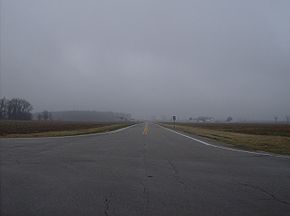
Ohio State Route 49
Encyclopedia

State highway
State highway, state road or state route can refer to one of three related concepts, two of them related to a state or provincial government in a country that is divided into states or provinces :#A...
in the western part of the U.S. state
U.S. state
A U.S. state is any one of the 50 federated states of the United States of America that share sovereignty with the federal government. Because of this shared sovereignty, an American is a citizen both of the federal entity and of his or her state of domicile. Four states use the official title of...
of Ohio
Ohio
Ohio is a Midwestern state in the United States. The 34th largest state by area in the U.S.,it is the 7th‑most populous with over 11.5 million residents, containing several major American cities and seven metropolitan areas with populations of 500,000 or more.The state's capital is Columbus...
. It begins at Drexel
Drexel, Ohio
Drexel is a census-designated place in Montgomery County, Ohio, United States. The population was 2,076 at the 2010 census, an increase from 2,057 in 2000.Drexel is part of the Dayton Metropolitan Statistical Area.-Geography:...
with US 35 and runs northwesterly to Greenville
Greenville, Ohio
Greenville is a city in Darke County, Ohio, United States. The population was 13,227 at the 2010 census. It is the county seat of Darke County.-History:Greenville is the historic location of Fort Greene Ville,Greenville is a city in Darke County, Ohio, United States. The population was 13,227 at...
, and then runs roughly along near the western edge of the state near the Indiana
Indiana
Indiana is a US state, admitted to the United States as the 19th on December 11, 1816. It is located in the Midwestern United States and Great Lakes Region. With 6,483,802 residents, the state is ranked 15th in population and 16th in population density. Indiana is ranked 38th in land area and is...
state line to the Michigan
Michigan
Michigan is a U.S. state located in the Great Lakes Region of the United States of America. The name Michigan is the French form of the Ojibwa word mishigamaa, meaning "large water" or "large lake"....
state line where it meets with Michigan's M-49
M-49 (Michigan highway)
M-49 is a north–south state trunkline highway in the south-central portion of the US state of Michigan. It runs from the Ohio state line north to Litchfield through rural Hillsdale County. M-49 is the only Michigan highway in which the road crossing into another state has the same state highway...
.
Route 49's southern terminus is west of Dayton
Dayton, Ohio
Dayton is the 6th largest city in the U.S. state of Ohio and the county seat of Montgomery County, the fifth most populous county in the state. The population was 141,527 at the 2010 census. The Dayton Metropolitan Statistical Area had a population of 841,502 in the 2010 census...
, at the intersection of Williamson Street and 3rd Street. US 35 continues southward from this intersection as a limited-access expressway into downtown Dayton
Dayton, Ohio
Dayton is the 6th largest city in the U.S. state of Ohio and the county seat of Montgomery County, the fifth most populous county in the state. The population was 141,527 at the 2010 census. The Dayton Metropolitan Statistical Area had a population of 841,502 in the 2010 census...
. Prior to 2000, State Route 49 followed Salem Street to a southern terminus in downtown Dayton
Dayton, Ohio
Dayton is the 6th largest city in the U.S. state of Ohio and the county seat of Montgomery County, the fifth most populous county in the state. The population was 141,527 at the 2010 census. The Dayton Metropolitan Statistical Area had a population of 841,502 in the 2010 census...
.
Route 49 is concurrent with Interstate 70 for 1.5 miles between Dayton
Dayton, Ohio
Dayton is the 6th largest city in the U.S. state of Ohio and the county seat of Montgomery County, the fifth most populous county in the state. The population was 141,527 at the 2010 census. The Dayton Metropolitan Statistical Area had a population of 841,502 in the 2010 census...
and Greenville
Greenville, Ohio
Greenville is a city in Darke County, Ohio, United States. The population was 13,227 at the 2010 census. It is the county seat of Darke County.-History:Greenville is the historic location of Fort Greene Ville,Greenville is a city in Darke County, Ohio, United States. The population was 13,227 at...
.

