
Ohio State Route 119
Encyclopedia
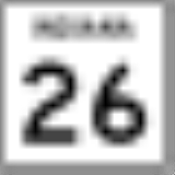
State Route 119 is an east–west highway serving rural sections of west-central Ohio. It begins just west of Fort Recovery
at the eastern terminus of Indiana State Road 26
and intersects with State Route 49
in the virtual center of Fort Recovery. A "TO Indiana 26" shield can be seen westbound at the intersection with State Route 49. Heading east from Fort Recovery, State Route 119 intersects with State Route 118
near the eastern border of Saint Henry
. Shortly thereafter, State Route 119 meets U.S. Route 127
, the only U.S. highway it has an intersection with. Near the border between Mercer and Auglaize counties, it crosses State Route 716
at Maria Stein
. After crossing into Auglaize County, State Route 119 intersects with State Route 364
, which runs north to Grand Lake Saint Marys State Park. Next, State Route 119 meets up with State Route 66 at the northern edge of Minster
. The two roads overlap for about a mile into the town, before 119 turns left onto Fourth St. Just outside of Minster, State Route 363
heads south from 119 toward Lake Loramie State Park
. 119 then crosses into Shelby County and intersects with State Route 29 in McCartyville
, which was 119's original eastern terminus (see below). This is also the only east–west highway that State Route 119 crosses. The road then continues east to Anna
, the last town State Route 119 enters in that direction. Near the eastern outskirts of Anna, 119 has an interchange with Interstate 75
. Approximately 7 miles (11.3 km) later, State Route 65 marks the eastern terminus of State Route 119.
Fort Recovery, Ohio
Fort Recovery is a village in Mercer County, Ohio, United States. The population was 1,273 at the 2000 census. The village is near the location of Fort Recovery, first established in 1793 under orders from General Anthony Wayne....
at the eastern terminus of Indiana State Road 26
Indiana State Road 26
State Road 26 is an east–west road in central Indiana in the United States that crosses the entire state from east to west, covering a distance of about .-Route description:...
and intersects with State Route 49
Ohio State Route 49
State Route 49 or SR 49 is a state highway in the western part of the U.S. state of Ohio. It begins at Drexel with US 35 and runs northwesterly to Greenville, and then runs roughly along near the western edge of the state near the Indiana state line to the Michigan state line where it meets with...
in the virtual center of Fort Recovery. A "TO Indiana 26" shield can be seen westbound at the intersection with State Route 49. Heading east from Fort Recovery, State Route 119 intersects with State Route 118
Ohio State Route 118
Ohio State Route 118 is a state route in western Ohio. It is an indirect connection to the cities of Van Wert and Greenville. State Route 118 travels through some of the flattest land in the state. There are a few cities of considerable size along the route, including Van Wert, Coldwater, and...
near the eastern border of Saint Henry
St. Henry, Ohio
St. Henry is a village in Mercer County, Ohio, United States. The population was 2,271 at the 2000 census.-History:Located at the center of the village is St. Henry's Catholic Church. Completed in 1897, it is listed on the National Register of Historic Places.-Geography:St. Henry is located at...
. Shortly thereafter, State Route 119 meets U.S. Route 127
U.S. Route 127
U.S. Route 127 is a long north–south United States highway in the eastern half of the United States. The southern terminus of the route is at U.S. Route 27 in Chattanooga, Tennessee. The northern terminus is at Interstate 75 near Grayling, Michigan...
, the only U.S. highway it has an intersection with. Near the border between Mercer and Auglaize counties, it crosses State Route 716
Ohio State Route 716
State Route 716 is a state highway in the western part of the U.S. state of Ohio. Its southern terminus is at State Route 705 in the village of Osgood in northeastern Darke County. The northern terminus of State Route 716 is at State Route 274 in the village of Chickasaw in southeastern Mercer...
at Maria Stein
Maria Stein, Ohio
Maria Stein is an unincorporated community in central Marion Township, Mercer County, Ohio, United States. The community and the Maria Stein Convent lie at the center of the area known as the Land of the Cross-Tipped Churches, where a missionary priest, Father Francis de Sales Brunner,...
. After crossing into Auglaize County, State Route 119 intersects with State Route 364
Ohio State Route 364
-Route description:SR 364 travels through portions of Allen, Shelby and Auglaize Counties. There are no segments of SR 364 that are included within the National Highway System . The NHS is a network of highways identified as being most important for the economy, mobility and defense of...
, which runs north to Grand Lake Saint Marys State Park. Next, State Route 119 meets up with State Route 66 at the northern edge of Minster
Minster, Ohio
Minster is a village in Auglaize County, Ohio, United States. The population was 2,794 at the 2000 census. It is included in the Wapakoneta, Ohio Micropolitan Statistical Area...
. The two roads overlap for about a mile into the town, before 119 turns left onto Fourth St. Just outside of Minster, State Route 363
Ohio State Route 363
State Route 363 ' is a short north–south state highway located in west-central Ohio. The southern terminus of this spur route is along the shores of Lake Loramie approximately southeast of Minster, where the roadway becomes known as Lotus Road. The northern terminus of State Route 363 is...
heads south from 119 toward Lake Loramie State Park
Lake Loramie State Park
Lake Loramie State Park is a 407-acre Ohio State Park in Minster, Ohio. It is located around 1,655-acre Lake Loramie and is operated by the Ohio Department of Natural Resources.-History:...
. 119 then crosses into Shelby County and intersects with State Route 29 in McCartyville
McCartyville, Ohio
McCartyville is an unincorporated community in Shelby County, Ohio, United States. Located at the junction of State Routes 29 and 119, it lies in southern Van Buren Township, south of central Kettlersville and approximately northwest of the city of Sidney, the county seat of Shelby County...
, which was 119's original eastern terminus (see below). This is also the only east–west highway that State Route 119 crosses. The road then continues east to Anna
Anna, Ohio
Anna is a village in Shelby County, Ohio, United States. The population was 1,319 at the 2000 census.Anna is the location of a Honda Motor Co., Ltd plant that builds the GM L66 engine and Honda J engine....
, the last town State Route 119 enters in that direction. Near the eastern outskirts of Anna, 119 has an interchange with Interstate 75
Interstate 75
Interstate 75 is a major north–south Interstate Highway in the Great Lakes and Southeastern regions of the United States. It travels from State Road 826 and State Road 924 in Hialeah, Florida to Sault Ste. Marie, Michigan, at the Ontario, Canada, border...
. Approximately 7 miles (11.3 km) later, State Route 65 marks the eastern terminus of State Route 119.