
Murray County, Oklahoma
Encyclopedia
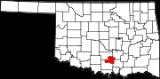
Murray County is a county located in the U.S. state
of Oklahoma
. As of 2000, the population was 12,623. Its county seat
is Sulphur
.
, the county has a total area of 1,101 km² (425 mi²). 1,083 km² (418 mi²) of it is land and 17 km² (7 mi²) of it (1.57%) is water.
of 2000, there were 12,623 people, 5,003 households, and 3,587 families residing in the county. The population density
was 12/km² (30/mi²). There were 6,479 housing units at an average density of 6/km² (16/mi²). The racial makeup of the county was 80.76% White
, 1.90% Black
or African American
, 11.57% Native American
, 0.32% Asian
, 0.03% Pacific Islander
, 1.16% from other races
, and 4.26% from two or more races. 3.15% of the population were Hispanic
or Latino
of any race.
There were 5,003 households out of which 30.90% had children under the age of 18 living with them, 57.70% were married couples
living together, 10.20% had a female householder with no husband present, and 28.30% were non-families. 25.20% of all households were made up of individuals and 12.70% had someone living alone who was 65 years of age or older. The average household size was 2.45 and the average family size was 2.92.
In the county, the population was spread out with 24.20% under the age of 18, 8.00% from 18 to 24, 25.10% from 25 to 44, 24.30% from 45 to 64, and 18.50% who were 65 years of age or older. The median age was 40 years. For every 100 females there were 97.40 males. For every 100 females age 18 and over, there were 92.80 males.
The median income for a household in the county was $30,294, and the median income for a family was $37,303. Males had a median income of $28,381 versus $19,727 for females. The per capita income
for the county was $16,084. About 11.10% of families and 14.10% of the population were below the poverty line, including 16.90% of those under age 18 and 15.10% of those age 65 or over.
U.S. state
A U.S. state is any one of the 50 federated states of the United States of America that share sovereignty with the federal government. Because of this shared sovereignty, an American is a citizen both of the federal entity and of his or her state of domicile. Four states use the official title of...
of Oklahoma
Oklahoma
Oklahoma is a state located in the South Central region of the United States of America. With an estimated 3,751,351 residents as of the 2010 census and a land area of 68,667 square miles , Oklahoma is the 28th most populous and 20th-largest state...
. As of 2000, the population was 12,623. Its county seat
County seat
A county seat is an administrative center, or seat of government, for a county or civil parish. The term is primarily used in the United States....
is Sulphur
Sulphur, Oklahoma
Sulphur is a city in Murray County, Oklahoma, United States. The population was 4,794 at the 2000 census. It is the county seat of Murray County.-Geography:Sulphur is located at ....
.
Geography
According to the U.S. Census BureauUnited States Census Bureau
The United States Census Bureau is the government agency that is responsible for the United States Census. It also gathers other national demographic and economic data...
, the county has a total area of 1,101 km² (425 mi²). 1,083 km² (418 mi²) of it is land and 17 km² (7 mi²) of it (1.57%) is water.
Major highways
 Interstate 35
 U.S. Highway 77
 U.S. Highway 177
 State Highway 1State Highway 1 (Oklahoma)State Highway 1, sometimes abbreviated as SH-1 or OK-1, is a highway maintained by the U.S. state of Oklahoma. It travels through the southeastern part of the state, nicknamed Little Dixie. Because Oklahoma uses odd numbers for east and west highways State Highway 1, sometimes abbreviated as SH-1...
 State Highway 7State Highway 7 (Oklahoma)State Highway 7, often abbreviated as SH-7 or OK-7, is a 150-mile highway in southern Oklahoma. This lengthy highway connects many towns in Oklahoma's "Little Dixie" area. It runs from Interstate 44 in Lawton to U.S...
Adjacent counties
- Pontotoc CountyPontotoc County, OklahomaPontotoc County is a county located in the U.S. state of Oklahoma. As of 2000, the population was 35,143. Its county seat is Ada.-Geography:According to the U.S. Census Bureau, the county has a total area of 1,879 km²...
(northeast) - Johnston CountyJohnston County, OklahomaJohnston County is a county located in the U.S. state of Oklahoma. As of 2000, the population was 10,513. Its county seat is Tishomingo.-Geography:...
(southeast) - Carter CountyCarter County, OklahomaCarter County is a county located in the U.S. state of Oklahoma. As of 2010, the population was 47,557. Its county seat is Ardmore.Carter County is part of the Ardmore, Oklahoma, Micropolitan Statistical Area.-Geography:According to the U.S...
(southwest) - Garvin CountyGarvin County, OklahomaGarvin County is a county located in the U.S. state of Oklahoma. As of 2000, the population was 27,210. Its county seat is Pauls Valley.-History:...
(northwest)
Demographics
As of the censusCensus
A census is the procedure of systematically acquiring and recording information about the members of a given population. It is a regularly occurring and official count of a particular population. The term is used mostly in connection with national population and housing censuses; other common...
of 2000, there were 12,623 people, 5,003 households, and 3,587 families residing in the county. The population density
Population density
Population density is a measurement of population per unit area or unit volume. It is frequently applied to living organisms, and particularly to humans...
was 12/km² (30/mi²). There were 6,479 housing units at an average density of 6/km² (16/mi²). The racial makeup of the county was 80.76% White
Race (United States Census)
Race and ethnicity in the United States Census, as defined by the Federal Office of Management and Budget and the United States Census Bureau, are self-identification data items in which residents choose the race or races with which they most closely identify, and indicate whether or not they are...
, 1.90% Black
Race (United States Census)
Race and ethnicity in the United States Census, as defined by the Federal Office of Management and Budget and the United States Census Bureau, are self-identification data items in which residents choose the race or races with which they most closely identify, and indicate whether or not they are...
or African American
Race (United States Census)
Race and ethnicity in the United States Census, as defined by the Federal Office of Management and Budget and the United States Census Bureau, are self-identification data items in which residents choose the race or races with which they most closely identify, and indicate whether or not they are...
, 11.57% Native American
Race (United States Census)
Race and ethnicity in the United States Census, as defined by the Federal Office of Management and Budget and the United States Census Bureau, are self-identification data items in which residents choose the race or races with which they most closely identify, and indicate whether or not they are...
, 0.32% Asian
Race (United States Census)
Race and ethnicity in the United States Census, as defined by the Federal Office of Management and Budget and the United States Census Bureau, are self-identification data items in which residents choose the race or races with which they most closely identify, and indicate whether or not they are...
, 0.03% Pacific Islander
Race (United States Census)
Race and ethnicity in the United States Census, as defined by the Federal Office of Management and Budget and the United States Census Bureau, are self-identification data items in which residents choose the race or races with which they most closely identify, and indicate whether or not they are...
, 1.16% from other races
Race (United States Census)
Race and ethnicity in the United States Census, as defined by the Federal Office of Management and Budget and the United States Census Bureau, are self-identification data items in which residents choose the race or races with which they most closely identify, and indicate whether or not they are...
, and 4.26% from two or more races. 3.15% of the population were Hispanic
Race (United States Census)
Race and ethnicity in the United States Census, as defined by the Federal Office of Management and Budget and the United States Census Bureau, are self-identification data items in which residents choose the race or races with which they most closely identify, and indicate whether or not they are...
or Latino
Race (United States Census)
Race and ethnicity in the United States Census, as defined by the Federal Office of Management and Budget and the United States Census Bureau, are self-identification data items in which residents choose the race or races with which they most closely identify, and indicate whether or not they are...
of any race.
There were 5,003 households out of which 30.90% had children under the age of 18 living with them, 57.70% were married couples
Marriage
Marriage is a social union or legal contract between people that creates kinship. It is an institution in which interpersonal relationships, usually intimate and sexual, are acknowledged in a variety of ways, depending on the culture or subculture in which it is found...
living together, 10.20% had a female householder with no husband present, and 28.30% were non-families. 25.20% of all households were made up of individuals and 12.70% had someone living alone who was 65 years of age or older. The average household size was 2.45 and the average family size was 2.92.
In the county, the population was spread out with 24.20% under the age of 18, 8.00% from 18 to 24, 25.10% from 25 to 44, 24.30% from 45 to 64, and 18.50% who were 65 years of age or older. The median age was 40 years. For every 100 females there were 97.40 males. For every 100 females age 18 and over, there were 92.80 males.
The median income for a household in the county was $30,294, and the median income for a family was $37,303. Males had a median income of $28,381 versus $19,727 for females. The per capita income
Per capita income
Per capita income or income per person is a measure of mean income within an economic aggregate, such as a country or city. It is calculated by taking a measure of all sources of income in the aggregate and dividing it by the total population...
for the county was $16,084. About 11.10% of families and 14.10% of the population were below the poverty line, including 16.90% of those under age 18 and 15.10% of those age 65 or over.
Cities and towns
- DavisDavis, OklahomaDavis is a city in Garvin and Murray counties in the U.S. state of Oklahoma. The population was 2,610 at the 2000 census. Davis is the home of the 1979, 1986, 1990, and 1995 Oklahoma State Football Championship teams...
- DoughertyDougherty, OklahomaDougherty is a town in Murray County, Oklahoma, United States. The population was 224 at the 2000 census.-Geography:Dougherty is located at ....
- HickoryHickory, OklahomaHickory is a town in Murray County, Oklahoma, United States. The population was 87 at the 2000 census.-Geography:Hickory is located at .According to the United States Census Bureau, the town has a total area of , all of it land....
- SulphurSulphur, OklahomaSulphur is a city in Murray County, Oklahoma, United States. The population was 4,794 at the 2000 census. It is the county seat of Murray County.-Geography:Sulphur is located at ....