
Noble County, Oklahoma
Encyclopedia
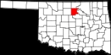
Noble County is a county located in the U.S. state
of Oklahoma
. As of 2010, the population was 11,561. Its county seat
is Perry
.
(Phase II) was constructed north to south through Noble County.
, the county has a total area of 1,923 km² (742 mi²). 1,896 km² (732 mi²) of it is land and 27 km² (11 mi²) of it (1.42%) is water.
of 2000, there were 11,411 people, 4,504 households, and 3,211 families residing in the county. The population density
was 6/km² (16/mi²). There were 5,082 housing units at an average density of 3/km² (7/mi²). The racial makeup of the county was 86.44% White
, 1.58% Black
or African American
, 7.57% Native American
, 0.33% Asian
, 0.03% Pacific Islander
, 0.65% from other races
, and 3.40% from two or more races. 1.80% of the population were Hispanic
or Latino
of any race.
There were 4,504 households out of which 32.00% had children under the age of 18 living with them, 59.00% were married couples
living together, 8.40% had a female householder with no husband present, and 28.70% were non-families. 25.50% of all households were made up of individuals and 11.20% had someone living alone who was 65 years of age or older. The average household size was 2.47 and the average family size was 2.97.
In the county, the population was spread out with 25.50% under the age of 18, 7.90% from 18 to 24, 27.50% from 25 to 44, 23.90% from 45 to 64, and 15.20% who were 65 years of age or older. The median age was 38 years. For every 100 females there were 97.40 males. For every 100 females age 18 and over, there were 96.00 males.
The median income for a household in the county was $33,968, and the median income for a family was $40,180. Males had a median income of $32,224 versus $21,235 for females. The per capita income
for the county was $17,022. About 9.60% of families and 12.80% of the population were below the poverty line, including 16.40% of those under age 18 and 11.00% of those age 65 or over.
McVeigh's arresting officer, Charlie Hanger, was elected Noble County Sheriff in 2004.
:
U.S. state
A U.S. state is any one of the 50 federated states of the United States of America that share sovereignty with the federal government. Because of this shared sovereignty, an American is a citizen both of the federal entity and of his or her state of domicile. Four states use the official title of...
of Oklahoma
Oklahoma
Oklahoma is a state located in the South Central region of the United States of America. With an estimated 3,751,351 residents as of the 2010 census and a land area of 68,667 square miles , Oklahoma is the 28th most populous and 20th-largest state...
. As of 2010, the population was 11,561. Its county seat
County seat
A county seat is an administrative center, or seat of government, for a county or civil parish. The term is primarily used in the United States....
is Perry
Perry, Oklahoma
Perry is a city in Noble County, Oklahoma, United States. As of the 2010 census, the city population was 5,126. It is the county seat of Noble County.-19th century:...
.
21st century
In 2010, the Keystone-Cushing PipelineKeystone Pipeline
The Keystone Pipeline System is a pipeline system to transport synthetic crude oil and diluted bitumen from the Athabasca Oil Sands in northeastern Alberta, Canada to multiple destinations in the United States, which include refineries in Illinois, Cushing oil distribution hub in Oklahoma, and...
(Phase II) was constructed north to south through Noble County.
Geography
According to the U.S. Census BureauUnited States Census Bureau
The United States Census Bureau is the government agency that is responsible for the United States Census. It also gathers other national demographic and economic data...
, the county has a total area of 1,923 km² (742 mi²). 1,896 km² (732 mi²) of it is land and 27 km² (11 mi²) of it (1.42%) is water.
Major highways
 Interstate 35
 U.S. Highway 64
 U.S. Highway 77
 U.S. Highway 177
 U.S. Highway 412
 State Highway 86State Highway 86 (Oklahoma)State Highway 86 is a minor state highway that connects SH-51 with Perry. The highway is contained wholly in Payne and Noble Counties.-Route description:...
- State Highway 156State Highway 156 (Oklahoma)State Highway 156, also known as SH-156 or OK-156, is a highway maintained by the U.S. state of Oklahoma. Spanning 17 miles through the north-central part of the state, it connects the town of Marland, Oklahoma to US-77/US-177 in the north to US-77 in the west. It is the former alignment of...
Adjacent counties
- Kay CountyKay County, OklahomaKay County is a county located in the U.S. state of Oklahoma. As of 2000, the population was 48,080. Its county seat is Newkirk. The largest city in Kay County is Ponca City.-19th century:...
(north) - Osage CountyOsage County, OklahomaOsage County is a county in the northern part of the U.S. state of Oklahoma. Coterminous with the Osage Indian Reservation, it is the home of the federally recognized Osage Nation. As of the 2010 census, the population was 47,472 a 6.8 percent increase from 2000, when the population was 44,437...
(northeast) - Pawnee CountyPawnee County, OklahomaPawnee County is a county located in the U.S. state of Oklahoma. As of 2000, the population was 16,612. Its county seat is Pawnee.-History:The Osage Tribe used the area that contains present day Pawnee County as buffalo hunting grounds...
(east) - Payne CountyPayne County, OklahomaPayne County is a county in the U.S. state of Oklahoma. The population as of 2010 was 77,350. Its county seat is Stillwater, and the county is named for Capt. David L. Payne...
(south) - Logan CountyLogan County, OklahomaLogan County is a county located in the U.S. state of Oklahoma. The population as of 2009 was 39,301. Its county seat is Guthrie. Logan County is part of the Oklahoma City Metropolitan Statistical Area.-Geography:...
(southwest) - Garfield CountyGarfield County, OklahomaGarfield County is a county located in the U.S. state of Oklahoma named after President James A. Garfield. As of 2010, the population was 60,580. Enid is the county seat and largest city within Garfield County...
(west)
Demographics
As of the censusCensus
A census is the procedure of systematically acquiring and recording information about the members of a given population. It is a regularly occurring and official count of a particular population. The term is used mostly in connection with national population and housing censuses; other common...
of 2000, there were 11,411 people, 4,504 households, and 3,211 families residing in the county. The population density
Population density
Population density is a measurement of population per unit area or unit volume. It is frequently applied to living organisms, and particularly to humans...
was 6/km² (16/mi²). There were 5,082 housing units at an average density of 3/km² (7/mi²). The racial makeup of the county was 86.44% White
Race (United States Census)
Race and ethnicity in the United States Census, as defined by the Federal Office of Management and Budget and the United States Census Bureau, are self-identification data items in which residents choose the race or races with which they most closely identify, and indicate whether or not they are...
, 1.58% Black
Race (United States Census)
Race and ethnicity in the United States Census, as defined by the Federal Office of Management and Budget and the United States Census Bureau, are self-identification data items in which residents choose the race or races with which they most closely identify, and indicate whether or not they are...
or African American
Race (United States Census)
Race and ethnicity in the United States Census, as defined by the Federal Office of Management and Budget and the United States Census Bureau, are self-identification data items in which residents choose the race or races with which they most closely identify, and indicate whether or not they are...
, 7.57% Native American
Race (United States Census)
Race and ethnicity in the United States Census, as defined by the Federal Office of Management and Budget and the United States Census Bureau, are self-identification data items in which residents choose the race or races with which they most closely identify, and indicate whether or not they are...
, 0.33% Asian
Race (United States Census)
Race and ethnicity in the United States Census, as defined by the Federal Office of Management and Budget and the United States Census Bureau, are self-identification data items in which residents choose the race or races with which they most closely identify, and indicate whether or not they are...
, 0.03% Pacific Islander
Race (United States Census)
Race and ethnicity in the United States Census, as defined by the Federal Office of Management and Budget and the United States Census Bureau, are self-identification data items in which residents choose the race or races with which they most closely identify, and indicate whether or not they are...
, 0.65% from other races
Race (United States Census)
Race and ethnicity in the United States Census, as defined by the Federal Office of Management and Budget and the United States Census Bureau, are self-identification data items in which residents choose the race or races with which they most closely identify, and indicate whether or not they are...
, and 3.40% from two or more races. 1.80% of the population were Hispanic
Race (United States Census)
Race and ethnicity in the United States Census, as defined by the Federal Office of Management and Budget and the United States Census Bureau, are self-identification data items in which residents choose the race or races with which they most closely identify, and indicate whether or not they are...
or Latino
Race (United States Census)
Race and ethnicity in the United States Census, as defined by the Federal Office of Management and Budget and the United States Census Bureau, are self-identification data items in which residents choose the race or races with which they most closely identify, and indicate whether or not they are...
of any race.
There were 4,504 households out of which 32.00% had children under the age of 18 living with them, 59.00% were married couples
Marriage
Marriage is a social union or legal contract between people that creates kinship. It is an institution in which interpersonal relationships, usually intimate and sexual, are acknowledged in a variety of ways, depending on the culture or subculture in which it is found...
living together, 8.40% had a female householder with no husband present, and 28.70% were non-families. 25.50% of all households were made up of individuals and 11.20% had someone living alone who was 65 years of age or older. The average household size was 2.47 and the average family size was 2.97.
In the county, the population was spread out with 25.50% under the age of 18, 7.90% from 18 to 24, 27.50% from 25 to 44, 23.90% from 45 to 64, and 15.20% who were 65 years of age or older. The median age was 38 years. For every 100 females there were 97.40 males. For every 100 females age 18 and over, there were 96.00 males.
The median income for a household in the county was $33,968, and the median income for a family was $40,180. Males had a median income of $32,224 versus $21,235 for females. The per capita income
Per capita income
Per capita income or income per person is a measure of mean income within an economic aggregate, such as a country or city. It is calculated by taking a measure of all sources of income in the aggregate and dividing it by the total population...
for the county was $17,022. About 9.60% of families and 12.80% of the population were below the poverty line, including 16.40% of those under age 18 and 11.00% of those age 65 or over.
Cities and towns
|
Morrison, Oklahoma Morrison is a town in Noble County, Oklahoma. The population was 636 at the 2000 census.-History:Morrison, OK is located in the Cherokee Outlet, which was created for the Cherokee Nation in 1835. The Outlet was opened to non-Indian settlement by the Cherokee Strip Land Run in September 1893... Perry, Oklahoma Perry is a city in Noble County, Oklahoma, United States. As of the 2010 census, the city population was 5,126. It is the county seat of Noble County.-19th century:... |
Red Rock, Oklahoma Red Rock is a town in Noble County, Oklahoma, United States. The population was 293 at the 2000 census... |
Notable Event
Oklahoma City bomber Timothy McVeigh was arrested in Noble County April 19, 1995 heading north bound on Interstate 35. McVeigh was stopped for not having a car tag on his car. He was minutes from being released when the Noble County Sheriff's Department was notified to hold McVeigh. McVeigh was tried and convicted for the bombing attack that killed 168 persons and injured many more. He was executed in 2001.McVeigh's arresting officer, Charlie Hanger, was elected Noble County Sheriff in 2004.
NRHP sites
The following sites in Noble County are listed on the National Register of Historic PlacesNational Register of Historic Places
The National Register of Historic Places is the United States government's official list of districts, sites, buildings, structures, and objects deemed worthy of preservation...
:
|
|