

History of St Helens, Merseyside
Encyclopedia
St Helens, Merseyside
St Helens is a large town in Merseyside, England. It is the largest settlement and administrative centre of the Metropolitan Borough of St Helens with a population of just over 100,000, part of an urban area with a total population of 176,843 at the time of the 2001 Census...
is a large town and the administrative seat of the Metropolitan Borough of St Helens
Metropolitan Borough of St Helens
The Metropolitan Borough of St Helens is a metropolitan borough of Merseyside, in North West England. It is named after its largest town St Helens, and covers an area which includes the settlements of Newton-le-Willows, Earlestown, Haydock, Rainhill, Eccleston, Clock Face, Billinge and...
in Merseyside
Merseyside
Merseyside is a metropolitan county in North West England, with a population of 1,365,900. It encompasses the metropolitan area centred on both banks of the lower reaches of the Mersey Estuary, and comprises five metropolitan boroughs: Knowsley, St Helens, Sefton, Wirral, and the city of Liverpool...
, England. The town was incorporated as a Municipal Borough
Municipal borough
Municipal boroughs were a type of local government district which existed in England and Wales between 1835 and 1974, in Northern Ireland from 1840 to 1973 and in the Republic of Ireland from 1840 to 2002...
in 1868, responsible for the administration of the four townships and manors of Ecclestone
Eccleston, Merseyside
Eccleston is a civil parish within the Metropolitan Borough of St Helens, Merseyside, England. According to the 2001 Census it had a population of 10,528....
, Parr, Sutton and Windle
Windle, Merseyside
Windle is a suburb of St. Helens, and Ward of the metropolitan borough of the same name. The 2001 census gives Windle a population of 8,621 in 3,607 households. It borders the villages of Eccleston and Rainford. It was one of the original four townships alongside Eccleston, Parr and Sutton formed...
. In 1887 this was role was expanded to a County Borough
County borough
County borough is a term introduced in 1889 in the United Kingdom of Great Britain and Ireland , to refer to a borough or a city independent of county council control. They were abolished by the Local Government Act 1972 in England and Wales, but continue in use for lieutenancy and shrievalty in...
in 1887, and which was superseded in 1974 by the larger Metropolitan Borough
Metropolitan borough
A metropolitan borough is a type of local government district in England, and is a subdivision of a metropolitan county. Created in 1974 by the Local Government Act 1972, metropolitan boroughs are defined in English law as metropolitan districts, however all of them have been granted or regranted...
.
St Helens is in the far south west of the historic county
Historic counties of England
The historic counties of England are subdivisions of England established for administration by the Normans and in most cases based on earlier Anglo-Saxon kingdoms and shires...
of Lancashire
Lancashire
Lancashire is a non-metropolitan county of historic origin in the North West of England. It takes its name from the city of Lancaster, and is sometimes known as the County of Lancaster. Although Lancaster is still considered to be the county town, Lancashire County Council is based in Preston...
in North West England
North West England
North West England, informally known as The North West, is one of the nine official regions of England.North West England had a 2006 estimated population of 6,853,201 the third most populated region after London and the South East...
, six miles (10 km) north of the River Mersey
River Mersey
The River Mersey is a river in North West England. It is around long, stretching from Stockport, Greater Manchester, and ending at Liverpool Bay, Merseyside. For centuries, it formed part of the ancient county divide between Lancashire and Cheshire....
. This portion of the county was partially settled by the Celtic Brigantes
Brigantes
The Brigantes were a Celtic tribe who in pre-Roman times controlled the largest section of what would become Northern England, and a significant part of the Midlands. Their kingdom is sometimes called Brigantia, and it was centred in what was later known as Yorkshire...
who were subsequently subjugated by the Romans in the 1st Century, with nearby Wigan
Wigan
Wigan is a town in Greater Manchester, England. It stands on the River Douglas, south-west of Bolton, north of Warrington and west-northwest of Manchester. Wigan is the largest settlement in the Metropolitan Borough of Wigan and is its administrative centre. The town of Wigan had a total...
probably the location of the Roman settlement of Coccium. No archaeological evidence has been uncovered to tie either group specifically to the St Helens area, though Eccleston derives its name from either the Latin Ecclesia or Welsh Eglwys suggesting a link to a church, (none are formally recorded in the township until the 19th century).
The first settlements are the manors, parishes and titled lands listed in the Domesday Book
Domesday Book
Domesday Book , now held at The National Archives, Kew, Richmond upon Thames in South West London, is the record of the great survey of much of England and parts of Wales completed in 1086...
ten centuries later in the 12th century that encompass the modern townships as part of their fiefdoms, though it may be inferred from tithes that the land was populated before then.
The area developed during the 18th and 19th centuries into a significant centre for coal mining
Coal mining
The goal of coal mining is to obtain coal from the ground. Coal is valued for its energy content, and since the 1880s has been widely used to generate electricity. Steel and cement industries use coal as a fuel for extraction of iron from iron ore and for cement production. In the United States,...
, and glassmaking. Before and during this time there was a cotton
Cotton
Cotton is a soft, fluffy staple fiber that grows in a boll, or protective capsule, around the seeds of cotton plants of the genus Gossypium. The fiber is almost pure cellulose. The botanical purpose of cotton fiber is to aid in seed dispersal....
and linen
Linen
Linen is a textile made from the fibers of the flax plant, Linum usitatissimum. Linen is labor-intensive to manufacture, but when it is made into garments, it is valued for its exceptional coolness and freshness in hot weather....
industry, particularly sail making, that lasted until the mid-19th century as well as salt
Salt
In chemistry, salts are ionic compounds that result from the neutralization reaction of an acid and a base. They are composed of cations and anions so that the product is electrically neutral...
, lime
Lime (mineral)
Lime is a general term for calcium-containing inorganic materials, in which carbonates, oxides and hydroxides predominate. Strictly speaking, lime is calcium oxide or calcium hydroxide. It is also the name for a single mineral of the CaO composition, occurring very rarely...
and alkali
Alkali
In chemistry, an alkali is a basic, ionic salt of an alkali metal or alkaline earth metal element. Some authors also define an alkali as a base that dissolves in water. A solution of a soluble base has a pH greater than 7. The adjective alkaline is commonly used in English as a synonym for base,...
pits, copper smelting, and brewing
Brewing
Brewing is the production of beer through steeping a starch source in water and then fermenting with yeast. Brewing has taken place since around the 6th millennium BCE, and archeological evidence suggests that this technique was used in ancient Egypt...
.
The town and greater area are notable for the construction of the St. Helens sections of the Sankey Canal
Sankey Canal
The Sankey Canal, which is also known as the Sankey Brook Navigation and the St Helens Canal, is a canal in Cheshire, extending into Merseyside, in the northwest of England, connecting St Helens with the River Mersey...
and also the first competition for steam locomotives at the Rainhill Trials
Rainhill Trials
The Rainhill Trials were an important competition in the early days of steam locomotive railways, run in October 1829 in Rainhill, Lancashire for the nearly completed Liverpool and Manchester Railway....
.
The borough is home to 147 listed buildings, and 12 Scheduled Ancient Monuments. Some of the most prominent include Windle Chantry (dating to the early 15th century), St Mary's Lowe House (known as “The Poor Man’s Cathedral” due to its construction from donated funds from the working class), the red brick Gamble Institute (home to the Central Library and other local authority offices constructed in 1896), the Beechams Clock Tower (built 1877) and The Quaker Friends Meeting House. Converted for use as a meeting place by George Shaw of Bickerstaffe, in 1678, a sign at the front of the building reads "so used" since 1678, partly leading local historians to believe the building had been used for another purpose for quite a number of years before then.
Formation of the Town
St Helens did not exist as a townTown
A town is a human settlement larger than a village but smaller than a city. The size a settlement must be in order to be called a "town" varies considerably in different parts of the world, so that, for example, many American "small towns" seem to British people to be no more than villages, while...
in its own right until the middle of the 19th century. The town had a complex evolution spurred on by rapid population growth during the Industrial Revolution
Industrial Revolution
The Industrial Revolution was a period from the 18th to the 19th century where major changes in agriculture, manufacturing, mining, transportation, and technology had a profound effect on the social, economic and cultural conditions of the times...
. Between 1629 and 1839 St Helens grew from a small group of dwellings surrounding the chapel, to a village centred around a larger church within a township
Township
The word township is used to refer to different kinds of settlements in different countries. Township is generally associated with an urban area. However there are many exceptions to this rule. In Australia, the United States, and Canada, they may be settlements too small to be considered urban...
, before becoming the significant urban centre for the four primary feudal
Feudalism
Feudalism was a set of legal and military customs in medieval Europe that flourished between the 9th and 15th centuries, which, broadly defined, was a system for ordering society around relationships derived from the holding of land in exchange for service or labour.Although derived from the...
lay manors
Manorialism
Manorialism, an essential element of feudal society, was the organizing principle of rural economy that originated in the villa system of the Late Roman Empire, was widely practiced in medieval western and parts of central Europe, and was slowly replaced by the advent of a money-based market...
that make up the modern town.
The origin of the name "St Helens" stretches back to a "chapel of ease
Chapel of ease
A chapel of ease is a church building other than the parish church, built within the bounds of a parish for the attendance of those who cannot reach the parish church conveniently....
" dedicated to St Elyn, the earliest reference to which is in 1552. The first time the chapel is referred to is in 1558 when Thomas Parr of Parr bequeathed money towards maintaining the chapel and finding a man of the cloth to take residence.
Early maps show that the chapel was on Chapel Lane, around the site of the modern, pedestrianised Church Street. Historically this was within the berewick of Hardshaw, a holding in the township of Windle entailing the southern border of that area abutting onto the open farmland of Parr to the east, and sharing boundaries with Sutton and Eccleston to the south and west respectively.
Throughout the Middle Ages
Middle Ages
The Middle Ages is a periodization of European history from the 5th century to the 15th century. The Middle Ages follows the fall of the Western Roman Empire in 476 and precedes the Early Modern Era. It is the middle period of a three-period division of Western history: Classic, Medieval and Modern...
the area was predominantly arable land and was noted for large swathes of moss, heath and bog land while elsewhere it was covered by the greater Mersey Forest (the larger "Community Forest"
Mersey Forest
This article is about a community forest in the United Kingdom. See also Mersey Forest, Tasmania.The Mersey Forest is a network of woodlands and green spaces being created across Merseyside and North Cheshire by a wide-ranging partnership of different organisations including local authorities,...
was not established until much later).
Largely flat, the elevation increased further away from the Mersey, and several small tributaries flowed to the river. The lay of the land was conducive to moving goods to the south and west respectively, towards the larger population centres of ancient Warrington
Warrington
Warrington is a town, borough and unitary authority area of Cheshire, England. It stands on the banks of the River Mersey, which is tidal to the west of the weir at Howley. It lies 16 miles east of Liverpool, 19 miles west of Manchester and 8 miles south of St Helens...
and Chester
Chester
Chester is a city in Cheshire, England. Lying on the River Dee, close to the border with Wales, it is home to 77,040 inhabitants, and is the largest and most populous settlement of the wider unitary authority area of Cheshire West and Chester, which had a population of 328,100 according to the...
, plus the rapidly growing and more influential Liverpool
Liverpool
Liverpool is a city and metropolitan borough of Merseyside, England, along the eastern side of the Mersey Estuary. It was founded as a borough in 1207 and was granted city status in 1880...
.
The name St Helens was not set in stone until the 19th century, and it was variously named as St Hellins, St Helins, St Hellens, St Helyns, St Elyns or variations after it was officially incorporated in 1868.
Lords and Earls
In 1139 the PeeragePeerage of England
The Peerage of England comprises all peerages created in the Kingdom of England before the Act of Union in 1707. In that year, the Peerages of England and Scotland were replaced by one Peerage of Great Britain....
"Earl of Derby
Earl of Derby
Earl of Derby is a title in the Peerage of England. The title was first adopted by Robert de Ferrers, 1st Earl of Derby under a creation of 1139. It continued with the Ferrers family until the 6th Earl forfeited his property toward the end of the reign of Henry III and died in 1279...
" was created. His lands encompassed a region from Liverpool to Manchester, and to the north beyond Lancaster
Lancaster, Lancashire
Lancaster is the county town of Lancashire, England. It is situated on the River Lune and has a population of 45,952. Lancaster is a constituent settlement of the wider City of Lancaster, local government district which has a population of 133,914 and encompasses several outlying towns, including...
and were primarily turned to meeting the pastoral needs of the people.
Norman descendent Robert De Ferrers
Robert de Ferrers, 1st Earl of Derby
Robert I de Ferrers, 1st Earl of Derby was born in Derbyshire, England, a younger son of Henry de Ferrières and his wife Bertha Roberts . His father, born in Ferrières, Normandy, France accompanied William the Conqueror during his invasion of England...
was installed as the 1st Earl. The family held the title for 150 years before it was forfeited to Henry III
Henry III of England
Henry III was the son and successor of John as King of England, reigning for 56 years from 1216 until his death. His contemporaries knew him as Henry of Winchester. He was the first child king in England since the reign of Æthelred the Unready...
's family whereupon Henry of Grosmont, 1st Duke of Lancaster and subsequently John of Gaunt, 1st Duke of Lancaster became Earl before it merged with the Crown under his son, Henry IV
Henry IV of England
Henry IV was King of England and Lord of Ireland . He was the ninth King of England of the House of Plantagenet and also asserted his grandfather's claim to the title King of France. He was born at Bolingbroke Castle in Lincolnshire, hence his other name, Henry Bolingbroke...
.
In 1485 the title was re-established and granted to the Stanley
Audley-Stanley family
The Audley-Stanley family is a family with many notable members including the Earls of Derby who are descended from the early holders of Audley, Staffordshire. The first mention of Audley is in the Domesday book of 1086, when it was called Aldidelege , when the lands were held by an English thegn...
family. The Stanley ancestral home was established in Knowsley
Knowsley
-Places:in England*Knowsley, Merseyside, a village.**Knowsley Safari Park*Metropolitan Borough of Knowsley, a local government district of Merseyside.*Knowsley Safari Park, a zoological tourist attraction....
, to the west of the modern St. Helens borough, with the foundation of a hunting lodge in the 15th century and Knowsley Hall
Knowsley Hall
Knowsley Hall is a stately home near Liverpool within the Metropolitan Borough of Knowsley, in Merseyside, England. It has been designated by English Heritage as a Grade II* listed building, and is the ancestral home of the Stanley family, the Earls of Derby. The hall is surrounded by of...
in the 18th century.
Townships and manors
The completion of the Domesday BookDomesday Book
Domesday Book , now held at The National Archives, Kew, Richmond upon Thames in South West London, is the record of the great survey of much of England and parts of Wales completed in 1086...
in 1086 reveals several manors existed although there are no specific references to "St Elyn", or the "vills" or villages. Windle
Windle, Merseyside
Windle is a suburb of St. Helens, and Ward of the metropolitan borough of the same name. The 2001 census gives Windle a population of 8,621 in 3,607 households. It borders the villages of Eccleston and Rainford. It was one of the original four townships alongside Eccleston, Parr and Sutton formed...
was recorded as "Windhull" (or variations thereof) in 1201, Bold
Bold, Merseyside
Bold is a civil parish in the Metropolitan Borough of St Helens in Merseyside, England. Bold itself is situated to the south east of St Helens, near to the boundaries with Halton and Warrington in Cheshire. The parish extends southwards beyond the M62 motorway and includes the hamlet of Bold Heath...
in 1212 (as Bolde) and Parr, or Parre in 1246, whilst Sutton and Ecclestone
Eccleston, Merseyside
Eccleston is a civil parish within the Metropolitan Borough of St Helens, Merseyside, England. According to the 2001 Census it had a population of 10,528....
composed part of the Widnes "fee", a hereditary entitlement of ownership under a Knight or Earl. Many of the original parishes, townships and local areas are named for the families that owned the land between the 11th and 18th century.
The Hospitallers
Knights Hospitaller
The Sovereign Military Hospitaller Order of Saint John of Jerusalem of Rhodes and of Malta , also known as the Sovereign Military Order of Malta , Order of Malta or Knights of Malta, is a Roman Catholic lay religious order, traditionally of military, chivalrous, noble nature. It is the world's...
held lands in Hardshaw as early as 1292. Their land was known as Crossgate, located in the vicinity of the former Cross Street in the town centre now buried beneath the College campus.
The Ecclestone family owned the Eccleston lands. Their ancestral home dates to 1100, built by Hugh Ecclestone, and lived there until the 18th century when they moved to Southport
Southport
Southport is a seaside town in the Metropolitan Borough of Sefton in Merseyside, England. During the 2001 census Southport was recorded as having a population of 90,336, making it the eleventh most populous settlement in North West England...
The manor of Parr remained in control of the Parr family and their descendents throughout the 13th to the early 15th centuries when William Parr, 1st Marquess of Northampton
William Parr, 1st Marquess of Northampton
William Parr, 1st Marquess of Northampton, 1st Earl of Essex and 1st Baron Parr, KG was the son of Sir Thomas Parr and his wife, Maud Green, daughter of Sir Thomas Green, of Broughton and Greens Norton...
, brother of Henry VIII's wife Catherine Parr, sold the manor to the Byroms of Lowton
Lowton
Lowton is a village, part of the Metropolitan Borough of Wigan, in Greater Manchester, England. It is around from Leigh and south of Wigan. The settlement lies across the A580 East Lancashire Road....
. The Byroms supported the Royalists during the English Civil War
English Civil War
The English Civil War was a series of armed conflicts and political machinations between Parliamentarians and Royalists...
and Henry Byrom, son of the Lord of the Manor, died at the Battle of Edgehill
Battle of Edgehill
The Battle of Edgehill was the first pitched battle of the First English Civil War. It was fought near Edge Hill and Kineton in southern Warwickshire on Sunday, 23 October 1642....
.
The extensive lands of Sutton Manor stretched across open and flat land leading towards the Mersey. In 1212 William de Daresbury was the title holder of the manors. The manor's name is of unknown origin, but the land within the enlarged estate belonged to several leading families including the Elton Heads, Ravenheads, and Sherdleys. The Sherdley family trace back to the Northales who had settled in the area since 1276 when they are referred to as plaintiffs in a boundary dispute with the Lords of Rainhill.
Windle contained the Hardshaw (or antiquated Hardsheigh), described as a Berewick in the Domesday Book. The Windle Family were Lords of the manor from the Norman period onward, before ceding control to the Gerards of Bryn
Bryn
Bryn is a component ward of the Metropolitan Borough of Wigan, in Greater Manchester, England. It is part of the larger town of Ashton-in-Makerfield and is geographically indistinguishable from it. It forms a separate local council ward...
. The Chapel of St Elyn was in Chapel Lane, Hardshaw.
In 1956, construction work in the vicinity of Bridge Street / Church Street in the town centre unearthed remains of grain pounders and two ancient wells, dating back several centuries.
Chapel of St Elyn
In 1552 the was noted as "consisting only of a 'challis and a lytle bell". The chapel was at the crux of the four townships of Eccleston, Parr, Sutton and Windle, and lay on the intersecting roads that that served as a major thoroughfare for traffic between Lancashire towns such as Liverpool, OrmskirkOrmskirk
Ormskirk is a market town in West Lancashire, England. It is situated north of Liverpool city centre, northwest of St Helens, southeast of Southport and southwest of Preston.-Geography and administration:...
, Lathom
Lathom
Lathom is a village and civil parish in Lancashire, England, about 5 km northeast of Ormskirk. It is in the district of West Lancashire, and with the parish of Newburgh forms part of Newburgh ward...
and Cheshire
Cheshire
Cheshire is a ceremonial county in North West England. Cheshire's county town is the city of Chester, although its largest town is Warrington. Other major towns include Widnes, Congleton, Crewe, Ellesmere Port, Runcorn, Macclesfield, Winsford, Northwich, and Wilmslow...
towns south of the River Mersey
River Mersey
The River Mersey is a river in North West England. It is around long, stretching from Stockport, Greater Manchester, and ending at Liverpool Bay, Merseyside. For centuries, it formed part of the ancient county divide between Lancashire and Cheshire....
such as Warrington
Warrington
Warrington is a town, borough and unitary authority area of Cheshire, England. It stands on the banks of the River Mersey, which is tidal to the west of the weir at Howley. It lies 16 miles east of Liverpool, 19 miles west of Manchester and 8 miles south of St Helens...
and Chester. The chapel was sited between the port of Liverpool, and the landlocked Lancashire townships that would become important in the development of St Helens and Wigan
Wigan
Wigan is a town in Greater Manchester, England. It stands on the River Douglas, south-west of Bolton, north of Warrington and west-northwest of Manchester. Wigan is the largest settlement in the Metropolitan Borough of Wigan and is its administrative centre. The town of Wigan had a total...
.
The road links are attested to by the existence of Chester Lane, the modern B5419, that originally wound through the west of the town heading south to the Mersey crossing point of Warrington and beyond to the ancient Chester Road that is part of the A56 between Chester and the Manchester
Manchester
Manchester is a city and metropolitan borough in Greater Manchester, England. According to the Office for National Statistics, the 2010 mid-year population estimate for Manchester was 498,800. Manchester lies within one of the UK's largest metropolitan areas, the metropolitan county of Greater...
townships.
As a busy thoroughfare it is suggested by historian and genealogist, William Farrer, that a village existed in the vicinity for centuries, later sharing the name of the chapel. It is known from the diaries of a local Puritan
Puritan
The Puritans were a significant grouping of English Protestants in the 16th and 17th centuries. Puritanism in this sense was founded by some Marian exiles from the clergy shortly after the accession of Elizabeth I of England in 1558, as an activist movement within the Church of England...
by the name of Adam Martindale
Adam Martindale
Adam Martindale was a British presbyterian minister, closely involved in the evolution of presbyterianism in Lancashire in the seventeenth century.-Biography:...
, that by the time the King's Head Inn was constructed in 1629 on "the great road" between Warrington and Ormskirk, there were a number of houses, farms and manors in the area. Martindale noted that by 1618 that the original chapel had been demolished and rebuilt. A school was later built after a donation by local resident John Lyon and in 1679 the Friends Meeting House was established by George Shaw of Bickerstaffe, it is a Grade II Listed building.
Religious ties
The strong link to Roman Catholicism in the area was maintained by the Lords of Sutton Manor, the De Holland family, starting in 1321. Roger Holland was burnt at the stake for "heresy" for his professed belief in the Reformed churchesReformed churches
The Reformed churches are a group of Protestant denominations characterized by Calvinist doctrines. They are descended from the Swiss Reformation inaugurated by Huldrych Zwingli but developed more coherently by Martin Bucer, Heinrich Bullinger and especially John Calvin...
in 1558, during the Marian persecutions
Marian Persecutions
The Marian Persecutions were carried out against religious reformers, Protestants, and other dissenters for their heretical beliefs during the reign of Mary I of England. The excesses of this period were mythologized in the historical record of Foxe's Book of Martyrs...
of Queen Mary
Mary I of England
Mary I was queen regnant of England and Ireland from July 1553 until her death.She was the only surviving child born of the ill-fated marriage of Henry VIII and his first wife Catherine of Aragon. Her younger half-brother, Edward VI, succeeded Henry in 1547...
. Thomas Holland, a local Jesuit priest, was arrested and tried for high treason in October, 1642 as "taking orders by authority of the see of Rome and returning to England" which was the first step in the process of beatification by Pope Leo XIII
Pope Leo XIII
Pope Leo XIII , born Vincenzo Gioacchino Raffaele Luigi Pecci to an Italian comital family, was the 256th Pope of the Roman Catholic Church, reigning from 1878 to 1903...
in 1886. Ravenhead Hall was the site of a Catholic chapel during the Catholic Persecutions in the 17th and 18th century. The Lathom family and the Ecclestons maintained Rainford's close connections with Catholicism.
Windle has a connection to witches. In 1602 two women were sent to Lancaster Castle
Lancaster Castle
Lancaster Castle is a medieval castle located in Lancaster in the English county of Lancashire. Its early history is unclear, but may have been founded in the 11th century on the site of a Roman fort overlooking a crossing of the River Lune. In 1164, the Honour of Lancaster, including the...
for trial, and a decade later, Isobel Roby was submitted to Sir Thomas Gerard, Lord of the Manor, accused of upsetting the ship upon which Princess Anne of Denmark
Anne of Great Britain
Anne ascended the thrones of England, Scotland and Ireland on 8 March 1702. On 1 May 1707, under the Act of Union, two of her realms, England and Scotland, were united as a single sovereign state, the Kingdom of Great Britain.Anne's Catholic father, James II and VII, was deposed during the...
was travelling. She was executed at Lancaster, along with the Pendle and Salmesbury witches, on the 20th August 1612 as result of the religiously fuelled witch-hunt
Witch-hunt
A witch-hunt is a search for witches or evidence of witchcraft, often involving moral panic, mass hysteria and lynching, but in historical instances also legally sanctioned and involving official witchcraft trials...
s in the era.
The precedence of St Helens
In 1746 St Helens, composed of the area of the four townships (and their collieries) beyond PrescotPrescot
Prescot is a town and civil parish, within the Metropolitan Borough of Knowsley in Merseyside, England. It is 8 miles to the east of Liverpool city centre and lies within the historic boundaries of Lancashire. At the 2001 Census, the population was 11,184 .Prescot marks the beginning of the...
, was referred to in a statement in Parliament related to the extension of the extension of the Liverpool to Prescot Turnpike.
The rapid growth of St Helens at the epicentre of the townships is attested to by several authors. The Penny Cyclopaedia
Penny Cyclopaedia
The Penny Cyclopædia of the Society for the Diffusion of Useful Knowledge was a multi-volume encyclopedia edited by George Long and published by Charles Knight alongside the Penny Magazine. The volumes were published from 1833 to 1843.-External links:...
states in 1839 that "Saint Helen’s, Lancashire, is in the township of Windle, in the chapelry of St Helen’s, Prescott parish. The township contains 3,540 acres, and had in 1831 a population of 5,825'. The town has risen into importance of late years"
In contrast by 1854, 20 years before the establishment of the Borough of St Helens, George Routledge stated a reversal of the roles, "St Helens, originally an inconsiderable village, is now a very thriving town" and later states that the town "...may be said to contain the four townships of Sutton, Parr, Windle and Eccleston".
The composition of the town described by Routledge largely mirrors those observations made by Samuel Lewis in 1848 and later still in 1874 by John Marius Wilson and John Bartholemew in 1887.
Census figures from 1801 suggest the population of the district of St Helens was 12,500 which by 1861 had reached between 37,631 and 55,523 (John Marius Wilson placing populace at the lower number, with total households at the specific figure of 6,539) in the wider area with St Helens itself comprising a population of 20,176 in 3,577 households. The Ordnance Survey of 1843 shows St Helens as the significant urban centre
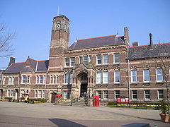
The original Town Hall was constructed in 1839, and was described as "in the Italian style, with a Corinthian portico; and contains a lock-up, a news room, and a large hall for courts, concerts, balls, and public meetings". The cloistered Market Hall was constructed next to the church in 1851. The civil parish of St Helens was instituted in 1852 and was "more extensive than the town.".
In 1832 St Helens had a gas supply for lighting purposes, with street lights installed soon after. In 1845 a civil ordinance raised funds to pay for permanent maintenance of the existing streets, lighting, and paving and lighting rural and muddy lanes and avenues.
On the 2nd February 1868 Queen Victoria granted a Charter of Incorporation, defining St Helens as a Municipal Borough. The first election of councillors took place on the 9th of May the same year, followed by the first Town Council meeting on the 18th. Twenty years later in 1887 St Helens became a County Borough
Parliamentary borough
Parliamentary boroughs are a type of administrative division, usually covering urban areas, that are entitled to representation in a Parliament...
granting it two representatives in Parliament.
In 1894 the Parish of St Helens was officially incorporated by the 1893 St Helens Corporation Act. This was achieved by the abolition of the civil parishes of Parr
Parr, St Helens
Parr is a former village, now situated within St. Helens, England and is located towards the eastern side of the town. However the area dates back to the West Derby hundred district from the 12th century. The area is located within walking distance of St...
, Sutton and amalgamation of their townships. The civil parishes of Eccleston and Windle
Windle, Merseyside
Windle is a suburb of St. Helens, and Ward of the metropolitan borough of the same name. The 2001 census gives Windle a population of 8,621 in 3,607 households. It borders the villages of Eccleston and Rainford. It was one of the original four townships alongside Eccleston, Parr and Sutton formed...
both ceded a portion of their area to St Helens.
St Helens, administrative centre of the Metropolitan Borough
The modern Borough of St Helens covers areas traditionally not associated with the town. The 1974 creation of the Ceremonial County of MerseysideMerseyside
Merseyside is a metropolitan county in North West England, with a population of 1,365,900. It encompasses the metropolitan area centred on both banks of the lower reaches of the Mersey Estuary, and comprises five metropolitan boroughs: Knowsley, St Helens, Sefton, Wirral, and the city of Liverpool...
appended the former urban district
Urban district
In the England, Wales and Ireland, an urban district was a type of local government district that covered an urbanised area. Urban districts had an elected Urban District Council , which shared local government responsibilities with a county council....
s of Haydock
Haydock
Haydock is a village within the Metropolitan Borough of St Helens, in Merseyside, England. It contains all of the Haydock electoral ward and a section of the Blackbrook electoral ward. The village is located roughly mid-way between Liverpool and Manchester, close to the junction of the M6 motorway...
, Newton-le-Willows
Newton-le-Willows
Newton-le-Willows is a small market town within the Metropolitan Borough of St Helens, in Merseyside, England. Historically a part of Lancashire, it is situated about midway between the cities of Manchester and Liverpool, to the east of St Helens, to the north of Warrington and to the south of...
and Rainford
Rainford
Rainford is a village and civil parish within Metropolitan Borough of St Helens, in Merseyside, England. It is around north of St Helens. At the 2001 Census the population of the civil parish was 8,344....
, and parts of Billinge-and-Winstanley
Billinge and Winstanley Urban District
Billinge was, from 1894 to 1974, a local government district in the administrative county of Lancashire, England....
and Ashton-in-Makerfield
Ashton-in-Makerfield
Ashton-in-Makerfield is a town in the Metropolitan Borough of Wigan, Greater Manchester. It is situated south of Wigan, north-northwest of Warrington and west of the city of Manchester. In 2001 it had a population of 28,505....
urban districts, along with part of Whiston Rural District
Whiston Rural District
Whiston Rural District was a rural district of the administrative county of Lancashire, England. It was created in 1895 by renaming the Prescot Rural District when the parish of Prescot was removed from that rural district and created a separate urban district. Later the parish of Speke was...
, all from the administrative county
Administrative counties of England
Administrative counties were a level of subnational division of England used for the purposes of local government from 1889 to 1974. They were created by the Local Government Act 1888 as the areas for which county councils were elected. Some large counties were divided into several administrative...
of Lancashire
Lancashire
Lancashire is a non-metropolitan county of historic origin in the North West of England. It takes its name from the city of Lancaster, and is sometimes known as the County of Lancaster. Although Lancaster is still considered to be the county town, Lancashire County Council is based in Preston...
. The urban sprawl of St Helens extended to the boundaries of Haydock and Rainhill, where inhabitants may consider themselves either part of either both St Helens the 'Town' and 'Borough', or just the Borough.
Industrial Development
St Helens and early industry
Until the mid-18th century, industry was almost entirely based on small scale home based industries such as linen weaving. The landscape was dotted with small scale excavation and mining operations, primarily for clay and peat, but also for coalCoal
Coal is a combustible black or brownish-black sedimentary rock usually occurring in rock strata in layers or veins called coal beds or coal seams. The harder forms, such as anthracite coal, can be regarded as metamorphic rock because of later exposure to elevated temperature and pressure...
. It is coal to which the region owes its initial impetus for growth and development with its symbiotic relationship with the coal dependent copper smelting and glass industries paramount.
Before 1700 most of the land had been used for arable farming since the 12th century according to the historical family records of William De Daresbury. The township of Sutton was described as "assessed at four plough-lands". Plow or ploughlands are assessed at 120 acre (0.4856232 km²) apiece. The pastoral nature of the local area was still common in 1901 with William Farrer noting of Eccleston that the "country is of an undulating nature and principally dedicated to agriculture, fields of rich and fertile soil being predominant" and describing the produce as "chiefly potatoes, oats, and wheat on a clayey soil which alternates with peat". Farrer noted that several old quarries and shafts existed in the area and referred to a "brewery at Portico, and a pottery near Prescot, while glass, watchmakers' tools, and mineral waters are also manufactured".
In contrast two hundred years earlier St Helens was far more scarred and pitted by shallow mining operations, often quickly abandoned, left to flood and prone to collapse. The primitive mining techniques, and limited ability to pump out water meant many pits had short lifespans. Complaints to the Holland family, by then Lords of Sutton Manor, are recorded from 1611, particularly in Sutton Heath, about plans to expand out such short lived mine shafts across the town, decrying the destruction of the land and waste. Money and public demand prevailed over any reservations held and shallow mining operations expanded rapidly.
In 2009, four hundred years after it began, the Council underlined the finality of the coal industries decline in the area when it rejected a planning application for an open cast mine.
Coal
Sited on the Lancashire Coalfield, the town was built both physically and metaphorically on coalCoal mining
The goal of coal mining is to obtain coal from the ground. Coal is valued for its energy content, and since the 1880s has been widely used to generate electricity. Steel and cement industries use coal as a fuel for extraction of iron from iron ore and for cement production. In the United States,...
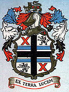
; the original motto on the borough coat of arms was "Ex Terra Lucem" (roughly translated from Latin to "From the Ground, Light") and local collieries employed up to 5,000 men in the 1970s. During the boom years of the British coal industry (with 1913 the peak year of production with 1 million being employed in UK mining industry) the St.Helens division of the Lancashire and Cheshire Miners' Federation (the local miners' union) had the largest membership (10%) of that federation.
The discovery of winnable coal seams is mentioned in a deposition of 1556, referred to as "Beds of cinders or coke...have been discovered three feet thick" during the digging of a clay pit and commonly is attributed to the Eltonhead family (Elton Head Road, modern B5204, shares the name of the family) who had recently taken residence at Gifforth House. Reference to the significant distribution of "potsherds"
Sherd
In archaeology, a sherd is commonly a historic or prehistoric fragment of pottery, although the term is occasionally used to refer to fragments of stone and glass vessels as well....
during excavation suggest that some industry had been under way for some time before, possibly the 13th century, and the clay and pottery industries lasted until the early 20th century. The discovery sparked a dispute between the landlord Bolds, and their tenants, the Eltonheads, eventually resulting in an agreement to compensate the Bold family 4d
Penny (British pre-decimal coin)
The penny of the Kingdom of Great Britain and later of the United Kingdom, was in circulation from the early 18th century until February 1971, Decimal Day....
(the equivalent of a groat). The depositions were taken at Winwick in April, 1556.
In the 18th century coal was the enabling force that opened up opportunities for further commercial and industrial developments, that in turn drove demand for the movement of raw goods not simply out of the town such as coal to Liverpool to fuel its shipping, steel works and its salt works but also in promoting an influx of raw products to be processed within the town itself.
The importance of transport links to and from the St Helens coal beds is made evident through claims made to Parliament in 1746 for maintenance, and extension of the Turnpike road after localised flooding had damaged it.
St Helens development owes as much to its location on the south Lancashire Coalfield as it does the fact that Liverpool, Chester and other centres of industry were not, and provided ready markets for the coal.
Sankey Canal
St Helens distant location from the Mersey and its dependence upon strong land transport links emphasised in the 1746 case brought before Parliament made it vital for the townships to continue to promote themselves as rich resource centres essential for the growth of Liverpool, Chester and other coal hungry large industrial towns desperate for raw materials. Liverpool recognised their need for a ready supply of coal for its forges, salt manufacture and ship building and first petitioned for the extension of The Liverpool to Prescot Turnpike turnpike road before later extending their designs to a canal system.The original concept was to make the Sankey Brook navigable, but the result was a fully man-made canal linking St. Helens initially to the River Mersey and thereby the city of Liverpool. The Sankey Canal
Sankey Canal
The Sankey Canal, which is also known as the Sankey Brook Navigation and the St Helens Canal, is a canal in Cheshire, extending into Merseyside, in the northwest of England, connecting St Helens with the River Mersey...
was opened in 1757, and extended in 1775, to transport coal from the pits in Ravenhead
Ravenhead
Ravenhead is an area of St Helens in the North West of England. It is bordered by Thatto Heath, Sutton Heath, Eccleston and the Town Centre. The area is thought to take its name from a farm once located nearby , while the 'head' portion of the name represents its location at one of the higher...
, Haydock
Haydock
Haydock is a village within the Metropolitan Borough of St Helens, in Merseyside, England. It contains all of the Haydock electoral ward and a section of the Blackbrook electoral ward. The village is located roughly mid-way between Liverpool and Manchester, close to the junction of the M6 motorway...
and Parr to Liverpool, and for raw materials to be shipped to St Helens. The canal networks were to extend out across Britain over the next century to many more major industrial centres.
The transport revolution in the region encouraged an influx of business opportunities to a previously sparsely populated area bringing with it work opportunities. The net result was a significant population boom and St Helens grew from a sparsely populated array of manor houses and their tenants in 1700 into a sprawling span of expansive mining operations, forges and pottery manufacturers by the early 19th century.
The industrialists
The foundation of these new ventures owed much to industrialists from outside the town, the length and breadth of the country. Firstly the development of the James WattsJames Watts
James Watts may refer to:* James Watts , Wales international rugby union player* James Watts , Conservative Member of Parliament for Manchester Moss Side 1959–1961* James W...
's stationery steam engine in the 1770s was a significant factor. Collieries would now be able to pump water from greater depths and shafts could be driven to find even deeper coal seams. At the same time the use of machinery for cotton mills such as the spinning mule
Spinning mule
The spinning mule was a machine used to spin cotton and other fibres in the mills of Lancashire and elsewhere from the late eighteenth to the early twentieth century. Mules were worked in pairs by a minder, with the help of two boys: the little piecer and the big or side piecer...
and later still the forges with the invention of the steam hammer
Steam hammer
A steam hammer is a power-driven hammer used to shape forgings. It consists of a hammer-like piston located within a cylinder. The hammer is raised by the pressure of steam injected into the lower part of a cylinder and falls down with a force by removing the steam. Usually, the hammer is made to...
increased the demand exponentially for coal.
The local gentry moved out of the growing towns which filled with the working classes. In their place came wealthy industrialists such as John Mackay, who leased land in St Helens in the 1760s from King George III before buying Ravenhead Farm from the Archbishop of York, as well as Michael Hughes, the Gambles, and later Thomas Beecham, Thomas Greenall and the Pilkingtons. A few remained such as the Gerards of Bryn who moved into Windle Hall.
Their drive and investments established the foundations of the towns resurgence between 1780 and 1830 that ultimately saw St Helens grow into its role as a modern market town.
Copper
One of the first industries to grow out of the transport innovations was copper smelting. The Parys Mining company, led by Michael Hughes, leased land from John Mackay close to the newly constructed Sankey Canal at Ravenhead (near Ravenhead Colliery) in late 1779. Copper ore was carried from Amlech in North Wales to St Helens via the Mersey directly to the point where coal was mined. Some 10,000 tons of copper ore yielding over 1,300 tons of copper passed along this route.At the same time, the Gerards rented land at Stanley Bank, beside the Black Brook, in Ashton in Makerfield to the Patten & Co company from Warrington. The company smelted iron and copper using coal from the Gerard's mines, then moved the end product downstream from a private wharf on the navigable brook.
The boom did not last and by 1783 coal owners such as Mackay, Sarah Clayton and Thomas Case were dead, penniless or both. The global constriction on coal shipments during a turbulent struggle with the USA, and the reliance on shipping to the USA during the War of Independence 1775-1783 brought ruin to many and led to the permanent loss of several smaller industries. The Mining industry recovered when the embargo was lifted, and some lower level smelting returned when the demand for steam engines grew in the later parts of the 19th century.
Plate Glass
The abundance of coal, the quality of local sand, the availability of Cheshire salt made glass making an industry in Sutton since 1688 when the French Huguenot descendent John Leaf Snr. is recorded paying the Eltonhead family £50 for a lease of 2½ acres of Sutton's Lower Hey. The glass industry was boosted when the CrownThe Crown
The Crown is a corporation sole that in the Commonwealth realms and any provincial or state sub-divisions thereof represents the legal embodiment of governance, whether executive, legislative, or judicial...
in 1786 authorised the establishment of the "British Cast Plate Glass Company" in Ravenhead and set the region as the market leader for glass.
Chemics, chemists and engineers
The Gamble family started lime and alkali pits, fulfilling the need of the glass industry and saving on import costs. The growing demand for chemical processing also contributed heavily to the growth of WidnesWidnes
Widnes is an industrial town within the borough of Halton, in Cheshire, England, with an urban area population of 57,663 in 2004. It is located on the northern bank of the River Mersey where the estuary narrows to form the Runcorn Gap. Directly to the south across the Mersey is the town of Runcorn...
.
In 1830 the Liverpool and Manchester Railway
Liverpool and Manchester Railway
The Liverpool and Manchester Railway was the world's first inter-city passenger railway in which all the trains were timetabled and were hauled for most of the distance solely by steam locomotives. The line opened on 15 September 1830 and ran between the cities of Liverpool and Manchester in North...
passed through the southern edge of the town at Rainhill and St Helens Junction, furthering its economic development as a centre of industry.
The decline of the mining industry
The many coal mines in St Helens and the outlying area, including Clock Face, Ravenhead, Sutton, BoldBold, Merseyside
Bold is a civil parish in the Metropolitan Borough of St Helens in Merseyside, England. Bold itself is situated to the south east of St Helens, near to the boundaries with Halton and Warrington in Cheshire. The parish extends southwards beyond the M62 motorway and includes the hamlet of Bold Heath...
, Wood Pit (Haydock), Lyme Pit (Haydock), Old Boston (Haydock) and Lea Green, were closed between the 1950s and early 1990s. By 1992 all the mines had been shut with Sutton Manor Colliery the last to go in St Helens proper, finally closing its doors on 24 May 1991. The events leading to the collapse of the coal mining industry were ultimately reflected by events during the Miners strikes
UK miners' strike (1984–1985)
The UK miners' strike was a major industrial action affecting the British coal industry. It was a defining moment in British industrial relations, and its defeat significantly weakened the British trades union movement...
in the '80s and St. Helens was but one of dozens of towns in the UK that was immediately set to lose a long standing employer due to what was put down as rising costs. In the case of Sutton Manor Colliery, it was estimated to have 40 years of winnable coal still beneath the surface. The last colliery in the modern metropolitan borough
Metropolitan borough
A metropolitan borough is a type of local government district in England, and is a subdivision of a metropolitan county. Created in 1974 by the Local Government Act 1972, metropolitan boroughs are defined in English law as metropolitan districts, however all of them have been granted or regranted...
and in the St Helens area of the South Lancashire Coalfield, was Parkside, in Newton-le-Willows
Newton-le-Willows
Newton-le-Willows is a small market town within the Metropolitan Borough of St Helens, in Merseyside, England. Historically a part of Lancashire, it is situated about midway between the cities of Manchester and Liverpool, to the east of St Helens, to the north of Warrington and to the south of...
, which was closed in 1992.
The glass industry in St Helens
Parish, District & Borough
A section dedicated to the changing political structure of St Helens between 1700 and 1974Monuments & Buildings
There are 147 listed buildings and 12 Scheduled Ancient Monuments in the Metropolitan Borough of St Helens.| LBS Uid | NGR | Building name | Street Name | Grade | Parish |
|---|---|---|---|---|---|
| 216298 | SJ5247999591 | Church Of St Mary And Presbytery | Birchley Road | II | Billinge |
| 216299 | SJ5219999452 | Lime Vale | Birchley Road | II | Billinge |
| 216300 | SJ5241999817 | Birchley Hall | Birchley Road | II* | Billinge |
| 216301 | SJ5299399709 | Nugent House Special School | Carr Mill Road | II | Billinge |
| 216302 | SJ5239898808 | Otters Swift Farm Barn | Carr Mill Road | II | Billinge |
| 216303 | SJ5242398804 | Otters Swift Farm Building To East Of Barn | Carr Mill Road | II | Billinge |
| 216304 | SD5332600697 | Church Of St Aidan | Main Street | II* | Billinge |
| 216305 | SD5329800683 | Wall And Piers On South And West Side Of Church Of Saint Aidan | Main Street | II | Billinge |
| 216306 | SD5332800675 | Tomb Of George And Kitty Smith On South Side Of Church Of Saint Aidan | Main Street | II | Billinge |
| 216307 | SD5260000377 | Crookhurst Farmhouse | Rainford Road | II | Billinge |
| 216308 | SD5260900342 | Barn To South East Of Crookhurst Farmhouse | Rainford Road | II | Billinge |
| 216309 | SD5200200835 | Great Houghwood Farmhouse | Red Barn Lane | II | Billinge |
| 216310 | SD5196300798 | Great Houghwood Cottage | Red Barn Lane | II | Billinge |
| 216311 | SJ5444797057 | Pear Tree Farmhouse | Clipsley Lane | II | Newton |
| 216312 | SJ5563096002 | The Grange | Grange Road | II | Newton |
| 216313 | SJ5734394436 | Bradley Lock | Bradleigh Road | II | Newton |
| 216314 | SJ5761094425 | Bradley Swing Bridge | Bradleigh Road | II | Newton |
| 216315 | SJ5687194713 | Sankey Viaduct Over Sankey Brook (That Part In St Helens District) | Bradley Lane | I | Newton |
| 216316 | SJ5930095643 | Church Of St Peter | Church Street | II | Newton |
| 216317 | SJ5927695640 | Parish Stocks | Church Street | II | Newton |
| 216318 | SJ5854795727 | United Reformed Chapel | Crow Lane East | II | Newton |
| 216319 | SJ5852595745 | Memorial To North West Of Burial Ground Of United Reformed Chapel | Crow Lane East | II | Newton |
| 216320 | SJ5820095685 | 159, 161 And 163 | Crow Lane East | II* | Newton |
| 216321 | SJ5811695666 | Church Of St Mary And St John | Crow Lane East | II | Newton |
| 216322 | SJ5865995870 | Fairbrothers Farmhouse 68 | Crow Lane East | II | Newton |
| 216323 | SJ5881895898 | Entrance Archway To Randall's Nursery | High Street | II* | Newton |
| 216324 | SJ5875495933 | 158 And 160 | High Street | II | Newton |
| 216325 | SJ5747595323 | Obelisk | Market Place | II | Newton |
| 216326 | SJ5739095328 | South African War Memorial | Market Street | II | Newton |
| 216327 | SJ5974894973 | Newton Park Farmhouse | Mill Lane | II | Newton |
| 216328 | SJ5980394983 | Barn To East Of Newton Park Farmhouse | Mill Lane | II | Newton |
| 216329 | SJ5934395335 | Newton Station | Mill Lane | II | Newton |
| 216330 | SJ5927095320 | Newton Viaduct To West Of Station | Mill Lane | II | Newton |
| 216331 | SJ5919596604 | Dean School Cottage | Newton Lane | II | Newton |
| 216335 | SJ6016195427 | Huskisson Memorial On South Side Of Railway, 60 Metres From Road | Parkside Road | II | Newton |
| 216336 | SJ5775895120 | Earlstown Station Building To South Of Railway | Railway Street | II | Newton |
| 216337 | SD4782200739 | Golden Lion Public House | Church Road | II | Rainford |
| 216338 | SD4786600668 | Church Of All Saints | Church Road | II | Rainford |
| 216339 | SD4800900519 | Village Stocks At Corner Of Mossborough Road | Church Road | II | Rainford |
| 216340 | SJ5012799561 | Heysome House | Crank Hill | II | Rainford |
| 216341 | SJ5014399599 | Barn To North Of Heysome House | Crank Hill | II | Rainford |
| 216342 | SJ5010999599 | Stable To North West Of Heysome House | Crank Hill | II | Rainford |
| 216343 | SD5114400211 | Guildhall Farmhouse | Gores Lane | II* | Rainford |
| 216344 | SD5116700177 | Barn To East Of Guildhall Farmhouse, Alongside The Lane | Gores Lane | II | Rainford |
| 216345 | SD4851500819 | Farm Building At Whitehouse Farm | Higher Lane | II | Rainford |
| 216346 | SD4851300864 | Duck Houses To North Of Buildings At White House Farm | Higher Lane | II | Rainford |
| 216347 | SD4878200322 | Dial House | Higher Lane | II | Rainford |
| 216348 | SD4879700332 | Barn To North Of Dial House | Higher Lane | II | Rainford |
| 216349 | SD4857302719 | Maggot's Nook Farmhouse | Maggot's Nook Road | II | Rainford |
| 216350 | SD4836302182 | Scythe Stone Delph Farmhouse | Maggot's Nook Road | II | Rainford |
| 216351 | SJ4649198953 | Mossborough Hall | Mossborough Hall Ln | II | Rainford |
| 216352 | SJ4645898996 | Cow Houses To North West Of Mossborough Hall | Mossborough Hall Ln | II | Rainford |
| 216353 | SJ4643099017 | Building To North West Of Cowhouses At Mosborough Hall | Mossborough Hall Ln | II | Rainford |
| 216354 | SJ4639599008 | Smithy To West Of Barn At Mossborough Hall | Mossborough Hall Ln | II | Rainford |
| 216355 | SJ4996296958 | Ruins Of Windleshaw Abbey In Roman Catholic Cemetery (Chapel Of Saint Thomas Of Canterbury) | Abbey Road | II* | St Helens |
| 216356 | SJ4997496950 | Cross To South Of Windleshaw Abbey | Abbey Road | II | St Helens |
| 216357 | SJ5337496623 | Church Of St Mary Immaculate | Blackbrook Road | II | St Helens |
| 216358 | SJ5358896094 | Old Double Lock | Blackbrook Road | II | St Helens |
| 216359 | SJ5355195480 | Church Of St Peter | Broad Oak Road | II | St Helens |
| 216360 | SJ5128995238 | Church Of St Helen | Church Street | II | St Helens |
| 216361 | SJ5143395243 | Friend's Meeting House | Church Street | II | St Helens |
| 216362 | SJ5072096488 | The Mansion House | City Road | II | St Helens |
| 216363 | SJ5087396337 | Lodge To Victoria Park | City Road | II | St Helens |
| 216364 | SJ5070596540 | Grotto By Lake To North Of Victoria Park House | City Road | II | St Helens |
| 216365 | SJ5148795464 | Church Of Holy Cross And Saint Helen | Corporation Street | II | St Helens |
| 216366 | SJ4986594093 | Church Of St John Evangelist | Crossley Road | II | St Helens |
| 216367 | SJ4998594350 | Offices Of Pilkington's Ravenhead Works | Factory Row | II | St Helens |
| 216368 | SJ5090895097 | Offices At Pilkington's Glass Works | Grove Street | II | St Helens |
| 216369 | SJ5090295043 | Offices At Pilkington's Glass Works To South Of Watson Street Junction | Grove Street | II | St Helens |
| 216370 | SJ5125495390 | Former National Westminster Bank At Corner Of Claughton Street | Hardshaw Street | II | St Helens |
| 216372 | SJ5360193191 | 2 | Lionel Street | II | St Helens |
| 216373 | SJ5198396211 | New Double Lock On The Sankey Canal | Lock Street | II | St Helens |
| 216374 | SJ5193892467 | Bridge Over Railway | Marshall's Cross Road | II | St Helens |
| 216375 | SJ5218592631 | Church Of St Nicholas | New Street | II | St Helens |
| 216376 | SJ5224592610 | Bridge Over Railway | New Street | II | St Helens |
| 216377 | SJ5093595844 | Church Of St Mary, Lowe House | North Road | II | St Helens |
| 216378 | SJ4963892983 | Nutgrove Hall | Nutgrove Road | II | St Helens |
| 216379 | SJ4910395279 | Home Farmhouse And Attached Barn | Old Eccleston Lane | II | St Helens |
| 216380 | SJ4876593965 | Seddon's Cottage | Prescot Road | II | St Helens |
| 216381 | SJ5115093283 | Sherdley Hall Farmhouse | Sherdley Road | II | St Helens |
| 216382 | SJ5156894785 | Bottle Shop At Former Ravenhead Glass Bottle Works 7 | Sutton Lodge Road | II | St Helens |
| 216383 | SJ5304693956 | 2 | Lancots Lane | II | St Helens |
| 216384 | SJ5222095412 | Church Of Holy Trinity | Traverse Street | II | St Helens |
| 216385 | SJ5126195476 | Statue Of Queen Victoria In Centre Of Square | Victoria Square | II* | St Helens |
| 216386 | SJ5121495014 | Tank House, Beside Canal At Crown Glass Works 9 | Watson Street | II* | St Helens |
| 216387 | SJ5527499215 | Manor House 317 | Garswood Road | II | Seneley Green |
| 216388 | SJ5612198515 | Le Chateau | Millfield Lane | II | Seneley Green |
| 216389 | SJ5374298532 | Hollin Hey Farmhouse | Old Garswood Road | II | Seneley Green |
| 216390 | SJ5360098540 | Hollin Hey House | Old Garswood Road | II | Seneley Green |
| 216391 | SD5576900463 | Holy Trinity Church | Rectory Road | II | Seneley Green |
| 216392 | SD5579300478 | The Old Rectory | Rectory Road | II | Seneley Green |
| 216393 | SJ5543499283 | Garswood Branch Library | School Lane | II | Seneley Green |
| 216394 | SJ4947892592 | Rainhill Hosptial (Sherdley Division) | Nutgrove Road | DL | St Helens |
| 216395 | SD4824100194 | Two Statues The Images At Numbers 133 And 135 133 And 135 | Church Road | II | Rainford |
| 216396 | SJ5125995510 | Pair Of K6 Telephone Kiosks Flanking Steps To The Town Hall | Corporation Street | II | St Helens |
| 216397 | SJ5337593621 | Church Of All Saints | Ellamsbridge Road | II | St Helens |
| 358741 | SJ5088095415 | Beechams Clock Tower And Offices | Westfield Street | II | St Helens |
| 358742 | SJ5020494248 | Part Of Numbers 96 And 98 Former Windmill Tower, Ravenhead 96 And 98 | Ravenhead Road | II | St Helens |
| 402560 | SD5125901559 | Billinge Hall | Crank Road | II | Billinge |
| 402563 | SD5116001406 | Derbyshire House | Crank Road | II | Billinge |
| 402565 | SD5130601376 | Barn South West Of Crow's Nest | Crank Road | II | Billinge |
| 402574 | SD5126701405 | Former Mill To West Of Crow's Nest | Crank Road | II | Billinge |
| 402582 | SD5053102168 | Maddocks Farmhouse | Pimbo Road | II | Rainford |
| 402583 | SD5057601291 | Fir Tree House | Pimbo Road | II | Rainford |
| 402584 | SD5063701248 | Gazebo Approximately 80 Metres To North East Of Number 52 | Pimbo Road | II | Rainford |
| 403300 | SD5160401688 | Shaley Brow Farm Barn | Crank Road | II | Rainford |
| 436381 | SJ5418890328 | Gate Piers At Bold Old Hall | II | Bold | |
| 436382 | SJ5420890329 | Bridge At Bold Old Hall | II | Bold | |
| 436388 | SJ4706095388 | Clay Lane Farmhouse | Clay Lane | II | Eccleston |
| 436389 | SJ4897393395 | Scholes House | Scholes Lane | II* | Eccleston |
| 436390 | SJ4897293395 | Adjacent Ruins At Scholes House | Scholes Lane | II* | Eccleston |
| 436391 | SJ4891893396 | Effigy Pedestal In Garden Of Scholes House | Scholes Lane | II* | Eccleston |
| 436397 | SJ4897690254 | Old Hall Farmhouse | Blundell's Lane | II* | Rainhill |
| 436398 | SJ4853890372 | Dean's Farmhouse | Blundell's Lane | II | Rainhill |
| 436399 | SJ4849590354 | Range Of Adjoining Farm Buildings In L Plan (Rear Of Dean's Farmhouse) | Blundell's Lane | II | Rainhill |
| 436400 | SJ4998090120 | Manor Farmhouse | Mill Lane | II* | Rainhill |
| 436401 | SJ4945290340 | Cross | Mill Lane | II | Rainhill |
| 436402 | SJ4905691398 | Skew Bridge | Warrington Road | II | Rainhill |
| 436403 | SJ4908691392 | Milestone On Skew Bridge | Warrington Road | II | Rainhill |
| 436404 | SJ4932791252 | Church Of St Anne | Warrington Road | C | Rainhill |
| 436405 | SJ5097590699 | Wood's House Farmhouse | School Lane | II | Rainhill |
| 436406 | SJ5017890352 | Roman Catholic Church Of St Bartholomew | Warrington Road | II | Rainhill |
| 436407 | SJ5012490608 | Loyola Hall | Warrington Road | II | Rainhill |
| 436408 | SJ5077589715 | Rainhill Cottage | Warrington Road | II | Rainhill |
| 436420 | SJ4939196793 | 53 And 55 | Rainford Road | II | Windle |
| 436688 | SJ4938696792 | Cockleshell Cottage 57 | Rainford Road | II | Windle |
| 436689 | SJ4938296794 | 59 | Rainford Road | II | Windle |
| 436694 | SJ5013390079 | Smithy Cottage And That Part Of The Same House In Corporated Within Smity House | Warrington Road | II | Rainhill |
| 440456 | SJ5056296122 | Cowley Hill School, North Block | Cowley Hill Lane | DL | St Helens |
| 440457 | SJ5055796075 | Cowley High School, South Block | Cowley Hill Lane | II | St Helens |
| 444001 | SJ5040094819 | Head Offices, Steps To Lake And Canteen At Pilkington Glassworks | Borough Road | II | St Helens |
| 444088 | SJ5042794762 | St Helens South Lake Surrounds And Bridge At Pilkington Glassworks | Borough Road | II | St Helens |
| 449412 | SJ4945696823 | The Malthouse | Rainford Road | II | Windle |
| 488034 | SJ5097195970 | West Derby War Memorial At Eccleston Park | II | St Helens | |
| 489783 | Farm Outbuilding, Formerly Stables, At Former Bold Hall Estate | II | Bold | ||
| 489784 | Farmhouse At Former Bold Hall Estate | II | Bold | ||
| 491589 | SJ5428791664 | Walled Garden Adjoining Site Of Former Bold Hall | II | Bold | |
| 492355 | SJ4951290269 | Briars Hey | Mill Lane | II | Rainhill |
| 502149 | SJ4915591422 | Rainhill Station | Station Road | II | Rainhill |
| 502835 | SJ4927891294 | Former St Annes Church School | Warrington Road | II | Rainhill |
| 504634 | SJ5737195338 | Earlestown Town Hall | Market Street | II | St Helens |
| 505083 | SJ5604198676 | Gate Piers, Gates And Flanking Walls At Ashton Cross | Millfield Lane | II | Seneley Green |
| 505555 | SJ4844595558 | Christ Church | Church Road | II | Eccleston |
| 505587 | SJ4873295036 | Eccleston Hall | Holme Road | II | Eccleston |
| 506291 | SJ4847692202 | Greenshouse Farmhouse | Longton Lane | II | Rainhill |
| 506292 | SJ4848492173 | Range Of Barn, Stables And Associated Buildings South South East Of Greenshouse Farmhouse | Longton Lane | II | Rainhill |
| 507533 | SJ5033991816 | Bourne's Tunnel At Sj5033491804 | A570 | II | St Helens |
See also
- Blackbrook, MerseysideBlackbrook, MerseysideBlackbrook is an electoral ward in St Helens, Merseyside. The area is so called for the brook of the same name. The Blackbrook area is situated at the north east of St.Helens Borough and is historically part of the Parr township....
- Bold, MerseysideBold, MerseysideBold is a civil parish in the Metropolitan Borough of St Helens in Merseyside, England. Bold itself is situated to the south east of St Helens, near to the boundaries with Halton and Warrington in Cheshire. The parish extends southwards beyond the M62 motorway and includes the hamlet of Bold Heath...
- Clock Face, MerseysideClock Face, MerseysideClock Face is an area of St. Helens, Merseyside, England, south of the town centre, situated near Sutton Manor in the district of Sutton, and just north of the M62 motorway. Historically a part of Lancashire, Clock Face forms part of the parish of Bold. It is also a ward within the Metropolitan...
- Eccleston, MerseysideEccleston, MerseysideEccleston is a civil parish within the Metropolitan Borough of St Helens, Merseyside, England. According to the 2001 Census it had a population of 10,528....
- HaydockHaydockHaydock is a village within the Metropolitan Borough of St Helens, in Merseyside, England. It contains all of the Haydock electoral ward and a section of the Blackbrook electoral ward. The village is located roughly mid-way between Liverpool and Manchester, close to the junction of the M6 motorway...
- Parr, St HelensParr, St HelensParr is a former village, now situated within St. Helens, England and is located towards the eastern side of the town. However the area dates back to the West Derby hundred district from the 12th century. The area is located within walking distance of St...
- Sutton, Merseyside
- Windle, MerseysideWindle, MerseysideWindle is a suburb of St. Helens, and Ward of the metropolitan borough of the same name. The 2001 census gives Windle a population of 8,621 in 3,607 households. It borders the villages of Eccleston and Rainford. It was one of the original four townships alongside Eccleston, Parr and Sutton formed...