
High Peak
Encyclopedia
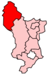
High Peak is a non-metropolitan district
and borough
of the non-metropolitan county of Derbyshire
, England
. Administered from Buxton
, it is mostly composed of high moorland
plateau
in the Dark Peak
of the Peak District
.
High Peak Hundred was the name of a hundred
of the ancient county
of Derbyshire covering roughly the same area as the current district. It may have derived its name from the ancient Forest of High Peak
a royal hunting reserve, administered by William Peverel
, an illegitimate son of William I
, who was based at Peak Castle
. High Peak is also an alternative name for the Dark Peak.
s of Buxton
and Glossop
, the urban district
s of New Mills
and Whaley Bridge
and the rural district
of Chapel-en-le-Frith
, all of which had previously been in the administrative county
of Derbyshire, as well as the rural district of Tintwistle
and Woodhead which had been in the administrative county of Cheshire
.
and Barnsley
in South Yorkshire
, the metropolitan borough of Kirklees
in West Yorkshire
, the metropolitan boroughs of Stockport
, Tameside
and Oldham
in Greater Manchester
, the district of Derbyshire Dales
in Derbyshire, the unitary district of Cheshire East
in Cheshire
and the district of Staffordshire Moorlands
in Staffordshire
.
in the east. The northern part of the borough is close to the Manchester
urban area. Some of the northern parts of High Peak were considered for inclusion in Greater Manchester
. These areas have closer links to Stockport
and Manchester
than to settlements nearer Derby
. Similarly, the villages of the Hope Valley are more closely linked to Sheffield and it has been considered whether these communities should be incorporated into that city.
Settlements in the borough include:
The larger settlements are Glossop, Buxton, New Mills, Chapel-en-le-Frith and Whaley Bridge, which contain most of the services for the borough such as retail, public sector, leisure and entertainment as well as most of the major transport links such as railways and buses.
is a major landowner in the district, owning extensive tracts of moorland and a number of farms, including some in Edale. Features of the Trust's High Peak Estate
include Kinder Scout
, Odin Mine
and Mam Tor
.
Non-metropolitan district
Non-metropolitan districts, or colloquially shire districts, are a type of local government district in England. As created, they are sub-divisions of non-metropolitan counties in a so-called "two-tier" arrangement...
and borough
Borough
A borough is an administrative division in various countries. In principle, the term borough designates a self-governing township although, in practice, official use of the term varies widely....
of the non-metropolitan county of Derbyshire
Derbyshire
Derbyshire is a county in the East Midlands of England. A substantial portion of the Peak District National Park lies within Derbyshire. The northern part of Derbyshire overlaps with the Pennines, a famous chain of hills and mountains. The county contains within its boundary of approx...
, England
England
England is a country that is part of the United Kingdom. It shares land borders with Scotland to the north and Wales to the west; the Irish Sea is to the north west, the Celtic Sea to the south west, with the North Sea to the east and the English Channel to the south separating it from continental...
. Administered from Buxton
Buxton
Buxton is a spa town in Derbyshire, England. It has the highest elevation of any market town in England. Located close to the county boundary with Cheshire to the west and Staffordshire to the south, Buxton is described as "the gateway to the Peak District National Park"...
, it is mostly composed of high moorland
Moorland
Moorland or moor is a type of habitat, in the temperate grasslands, savannas, and shrublands biome, found in upland areas, characterised by low-growing vegetation on acidic soils and heavy fog...
plateau
Plateau
In geology and earth science, a plateau , also called a high plain or tableland, is an area of highland, usually consisting of relatively flat terrain. A highly eroded plateau is called a dissected plateau...
in the Dark Peak
Dark Peak
The Dark Peak is the higher, wilder northern part of the Peak District in England.It gets its name because , the underlying limestone is covered by a cap of Millstone Grit which means that in winter the soil is almost always saturated with water...
of the Peak District
Peak District
The Peak District is an upland area in central and northern England, lying mainly in northern Derbyshire, but also covering parts of Cheshire, Greater Manchester, Staffordshire, and South and West Yorkshire....
.
High Peak Hundred was the name of a hundred
Hundred (division)
A hundred is a geographic division formerly used in England, Wales, Denmark, South Australia, some parts of the United States, Germany , Sweden, Finland and Norway, which historically was used to divide a larger region into smaller administrative divisions...
of the ancient county
Historic counties of England
The historic counties of England are subdivisions of England established for administration by the Normans and in most cases based on earlier Anglo-Saxon kingdoms and shires...
of Derbyshire covering roughly the same area as the current district. It may have derived its name from the ancient Forest of High Peak
Forest of High Peak
The Forest of High Peak was, in medieval times, a moorland forest covering most of the North West of Derbyshire, in England as far south as Tideswell and Buxton....
a royal hunting reserve, administered by William Peverel
William Peverel
William Peverell , was a Norman knight, and is shown in 'The Battle Abbey Roll' to have fought at the Battle of Hastings.-Biography:...
, an illegitimate son of William I
William I of England
William I , also known as William the Conqueror , was the first Norman King of England from Christmas 1066 until his death. He was also Duke of Normandy from 3 July 1035 until his death, under the name William II...
, who was based at Peak Castle
Peveril Castle
Peveril Castle is a medieval building overlooking the village of Castleton in the English county of Derbyshire. Its site provides views across the Hope Valley and Cave Dale. The castle is named after its founder, William Peveril, who held lands in Nottinghamshire and Derbyshire on behalf of the king...
. High Peak is also an alternative name for the Dark Peak.
Creation
The borough was formed on 1 April 1974, by absorbing the municipal boroughMunicipal borough
Municipal boroughs were a type of local government district which existed in England and Wales between 1835 and 1974, in Northern Ireland from 1840 to 1973 and in the Republic of Ireland from 1840 to 2002...
s of Buxton
Buxton
Buxton is a spa town in Derbyshire, England. It has the highest elevation of any market town in England. Located close to the county boundary with Cheshire to the west and Staffordshire to the south, Buxton is described as "the gateway to the Peak District National Park"...
and Glossop
Glossop
Glossop is a market town within the Borough of High Peak in Derbyshire, England. It lies on the Glossop Brook, a tributary of the River Etherow, about east of the city of Manchester, west of the city of Sheffield. Glossop is situated near Derbyshire's county borders with Cheshire, Greater...
, the urban district
Urban district
In the England, Wales and Ireland, an urban district was a type of local government district that covered an urbanised area. Urban districts had an elected Urban District Council , which shared local government responsibilities with a county council....
s of New Mills
New Mills
New Mills is a town in Derbyshire, England approximately south-east of Stockport and from Manchester. It is sited at the confluence of the rivers Goyt and Sett, on the border of Cheshire. The town stands above the Torrs, a deep gorge, cut through Woodhead Hill Sandstone of the Carboniferous period...
and Whaley Bridge
Whaley Bridge
Whaley Bridge is a small town and civil parish in the High Peak district of Derbyshire, England, situated on the River Goyt. Whaley Bridge is approximately south of Manchester, north of Buxton , east of Macclesfield and west of Sheffield, and had a population of 6,226 at the 2001 census. This...
and the rural district
Rural district
Rural districts were a type of local government area – now superseded – established at the end of the 19th century in England, Wales, and Ireland for the administration of predominantly rural areas at a level lower than that of the administrative counties.-England and Wales:In England...
of Chapel-en-le-Frith
Chapel-en-le-Frith
Chapel-en-le-Frith is a small town in Derbyshire, England, on the edge of the Peak District near the border with Cheshire, from Manchester. Dubbed "The Capital of the Peak District", the settlement was established by the Normans in the 12th century, originally as a hunting lodge within the Forest...
, all of which had previously been in the administrative county
Administrative county
An administrative county was an administrative division in England and Wales and Ireland used for the purposes of local government. They are now abolished, although in Northern Ireland their former areas are used as the basis for lieutenancy....
of Derbyshire, as well as the rural district of Tintwistle
Tintwistle Rural District
Tintwistle Rural District was a local government district in north east Cheshire, England from 1894 to 1974.It was created a rural district by the Local Government Act 1894 from the part of the Ashton-under-Lyne rural sanitary district which was in Cheshire and consisted of the civil parishes...
and Woodhead which had been in the administrative county of Cheshire
Cheshire
Cheshire is a ceremonial county in North West England. Cheshire's county town is the city of Chester, although its largest town is Warrington. Other major towns include Widnes, Congleton, Crewe, Ellesmere Port, Runcorn, Macclesfield, Winsford, Northwich, and Wilmslow...
.
Neighbouring local government districts
The borough adjoins the metropolitan boroughs of the City of SheffieldSheffield
Sheffield is a city and metropolitan borough of South Yorkshire, England. Its name derives from the River Sheaf, which runs through the city. Historically a part of the West Riding of Yorkshire, and with some of its southern suburbs annexed from Derbyshire, the city has grown from its largely...
and Barnsley
Barnsley
Barnsley is a town in South Yorkshire, England. It lies on the River Dearne, north of the city of Sheffield, south of Leeds and west of Doncaster. Barnsley is surrounded by several smaller settlements which together form the Metropolitan Borough of Barnsley, of which Barnsley is the largest and...
in South Yorkshire
South Yorkshire
South Yorkshire is a metropolitan county in the Yorkshire and the Humber region of England. It has a population of 1.29 million. It consists of four metropolitan boroughs: Barnsley, Doncaster, Rotherham, and City of Sheffield...
, the metropolitan borough of Kirklees
Kirklees
The Metropolitan Borough of Kirklees is a metropolitan borough of West Yorkshire, England. It has a population of 401,000 and includes the settlements of Batley, Birstall, Cleckheaton, Denby Dale, Dewsbury, Heckmondwike, Holmfirth, Huddersfield, Kirkburton, Marsden, Meltham, Mirfield and Slaithwaite...
in West Yorkshire
West Yorkshire
West Yorkshire is a metropolitan county within the Yorkshire and the Humber region of England with a population of 2.2 million. West Yorkshire came into existence as a metropolitan county in 1974 after the passage of the Local Government Act 1972....
, the metropolitan boroughs of Stockport
Metropolitan Borough of Stockport
The Metropolitan Borough of Stockport is a metropolitan borough of Greater Manchester, in north west England, centred around the town of Stockport. It has a population of about 280,600 and includes the outyling areas of Cheadle and Cheadle Hulme, Marple, Bredbury, Reddish and Romiley...
, Tameside
Tameside
The Metropolitan Borough of Tameside is a metropolitan borough of Greater Manchester in North West England. It is named after the River Tame which flows through the borough and spans the towns of Ashton-under-Lyne, Audenshaw, Denton, Droylsden, Dukinfield, Hyde, Mossley and Stalybridge. Its western...
and Oldham
Metropolitan Borough of Oldham
The Metropolitan Borough of Oldham is a metropolitan borough of Greater Manchester, England. It has a population of 219,600, and spans . The borough is named after its largest town, Oldham, but also includes the outlying towns of Chadderton, Failsworth, Royton and Shaw and Crompton, the village of...
in Greater Manchester
Greater Manchester
Greater Manchester is a metropolitan county in North West England, with a population of 2.6 million. It encompasses one of the largest metropolitan areas in the United Kingdom and comprises ten metropolitan boroughs: Bolton, Bury, Oldham, Rochdale, Stockport, Tameside, Trafford, Wigan, and the...
, the district of Derbyshire Dales
Derbyshire Dales
Derbyshire Dales is a local government district in Derbyshire, England. Much of the district is situated in the Peak District, although most of its population lies along the River Derwent....
in Derbyshire, the unitary district of Cheshire East
Cheshire East
Cheshire East is a unitary authority area with borough status in the ceremonial county of Cheshire, England.The borough was established in April 2009 as part of the 2009 structural changes to local government in England, by virtue of an order under the Local Government and Public Involvement in...
in Cheshire
Cheshire
Cheshire is a ceremonial county in North West England. Cheshire's county town is the city of Chester, although its largest town is Warrington. Other major towns include Widnes, Congleton, Crewe, Ellesmere Port, Runcorn, Macclesfield, Winsford, Northwich, and Wilmslow...
and the district of Staffordshire Moorlands
Staffordshire Moorlands
Staffordshire Moorlands is a local government district in Staffordshire, England. Its council, Staffordshire Moorlands District Council, is based in Leek and is located between the city of Stoke-on-Trent and the Peak District National Park. The 2001 census recorded the population as...
in Staffordshire
Staffordshire
Staffordshire is a landlocked county in the West Midlands region of England. For Eurostat purposes, the county is a NUTS 3 region and is one of four counties or unitary districts that comprise the "Shropshire and Staffordshire" NUTS 2 region. Part of the National Forest lies within its borders...
.
Main settlements
There are five main areas of settlement in the borough: around Buxton in the south west, around New Mills in the west, around Glossop in the north west, around Whaley Bridge and Chapel-en-le-Frith in the central part of the borough, and the Hope ValleyHope Valley, Derbyshire
The Hope Valley is a rural area centred on the village of Hope, Derbyshire in the Peak District in the northern Midlands of England.The name also applies to the Post Town which includes the surrounding villages.-The Valley:...
in the east. The northern part of the borough is close to the Manchester
Greater Manchester Urban Area
The Greater Manchester Urban Area is an area of land defined by the Office for National Statistics consisting of the large conurbation that encompasses the city of Manchester and the continuous metropolitan area that spreads outwards from it, forming much of Greater Manchester in North West England...
urban area. Some of the northern parts of High Peak were considered for inclusion in Greater Manchester
Greater Manchester
Greater Manchester is a metropolitan county in North West England, with a population of 2.6 million. It encompasses one of the largest metropolitan areas in the United Kingdom and comprises ten metropolitan boroughs: Bolton, Bury, Oldham, Rochdale, Stockport, Tameside, Trafford, Wigan, and the...
. These areas have closer links to Stockport
Stockport
Stockport is a town in Greater Manchester, England. It lies on elevated ground southeast of Manchester city centre, at the point where the rivers Goyt and Tame join and create the River Mersey. Stockport is the largest settlement in the metropolitan borough of the same name...
and Manchester
Manchester
Manchester is a city and metropolitan borough in Greater Manchester, England. According to the Office for National Statistics, the 2010 mid-year population estimate for Manchester was 498,800. Manchester lies within one of the UK's largest metropolitan areas, the metropolitan county of Greater...
than to settlements nearer Derby
Derby
Derby , is a city and unitary authority in the East Midlands region of England. It lies upon the banks of the River Derwent and is located in the south of the ceremonial county of Derbyshire. In the 2001 census, the population of the city was 233,700, whilst that of the Derby Urban Area was 229,407...
. Similarly, the villages of the Hope Valley are more closely linked to Sheffield and it has been considered whether these communities should be incorporated into that city.
Settlements in the borough include:
- AshoptonAshoptonAshopton was a village in Derbyshire, England, that was lost along with neighbouring Derwent when the Ladybower Reservoir was constructed in the late 1930s and early 1940s....
- BamfordBamfordBamford is a village in the Derbyshire Peak District, England, close to the River Derwent. To the north-east is Bamford Edge, and to the south-east the location of the water treatment works covering the Ladybower, Derwent and Howden Reservoirs. Though locally Bamford is described as being in the...
, BuxtonBuxtonBuxton is a spa town in Derbyshire, England. It has the highest elevation of any market town in England. Located close to the county boundary with Cheshire to the west and Staffordshire to the south, Buxton is described as "the gateway to the Peak District National Park"...
, BuxworthBuxworthBuxworth is a village in the High Peak of Derbyshire, England. The area, which was once an important centre for the limestone industry, became the terminus of the Peak Forest Canal. Its pub, the Navigation Inn, was once owned by Coronation Street actress Pat Phoenix... - Castleton, Chapel-en-le-FrithChapel-en-le-FrithChapel-en-le-Frith is a small town in Derbyshire, England, on the edge of the Peak District near the border with Cheshire, from Manchester. Dubbed "The Capital of the Peak District", the settlement was established by the Normans in the 12th century, originally as a hunting lodge within the Forest...
, CharlesworthCharlesworth, DerbyshireCharlesworth is a village near Glossop, Derbyshire, England. It is located 2 miles south-west of Glossop's town centre and very close to the borders of Greater Manchester with the nearby village of Broadbottom in Tameside. The parish church of St John the Baptist was built in 1848-49. The...
, ChinleyChinleyChinley is a rural village in High Peak Borough, situated on the western edge of the Peak District National Park in Derbyshire, England, with a population of around 2000. Before the railway, the area was economically dominated by agriculture and quarrying. Three textile mills were established in...
, CrowdenCrowden, DerbyshireCrowden is a landmark hamlet in the High Peak district of Derbyshire, miles northeast of Glossop and miles southwest of Holme in West Yorkshire, as well as from the larger city of Manchester and from the town of Barnsley... - DerwentDerwent, DerbyshireDerwent is a village 'drowned' under the Ladybower Reservoir in Derbyshire, England. The village of Ashopton, Derwent Woodlands church and Derwent Hall were also 'drowned' in the construction of the reservoir. There is no formal memorial to any of the villages...
, Dove HolesDove HolesDove Holes is a village in the High Peak district of Derbyshire, England. It has a population of about 1,200. It straddles the A6 road and it lies three miles from Buxton and three miles from Chapel-en-le-Frith. Trains run from Dove Holes railway station into Manchester.Residents of the village... - EdaleEdaleEdale is a small Derbyshire village and Civil parish in the Peak District, in the Midlands of England. The Parish of Edale,area ,is in the Borough of High Peak....
- Fernilee, Furness ValeFurness ValeFurness Vale is a village in the High Peak district of Derbyshire, England situated between New Mills and Whaley Bridge. It is bisected by the A6 road and the Peak Forest Canal...
- GamesleyGamesleyGamesley is a residential area within the Borough of High Peak in Derbyshire, England, west of Glossop and north of New Mills. It lies close to the River Etherow which is the boundary with Tameside in Greater Manchester.-Early:...
, GlossopGlossopGlossop is a market town within the Borough of High Peak in Derbyshire, England. It lies on the Glossop Brook, a tributary of the River Etherow, about east of the city of Manchester, west of the city of Sheffield. Glossop is situated near Derbyshire's county borders with Cheshire, Greater... - HadfieldHadfield, DerbyshireHadfield is a parish and small residential town in High Peak, Derbyshire, England. It lies very close to the River Etherow which forms the border between Derbyshire and Greater Manchester...
, HayfieldHayfieldHayfield is a village and civil parish in the Borough of High Peak, in the county of Derbyshire, England. The village lies approximately east of New Mills, south of Glossop and north of Buxton by road....
, HopeHope, DerbyshireHope is a village in the Derbyshire Peak District, in England. It lies in the Hope Valley, at the point where Peakshole Water flows into the River Noe. To the north, Win Hill and Lose Hill stand either side of the Noe....
, Horwich End - New MillsNew MillsNew Mills is a town in Derbyshire, England approximately south-east of Stockport and from Manchester. It is sited at the confluence of the rivers Goyt and Sett, on the border of Cheshire. The town stands above the Torrs, a deep gorge, cut through Woodhead Hill Sandstone of the Carboniferous period...
- PadfieldPadfieldPadfield is a small village, near Hadfield in High Peak, Derbyshire, England. The village is on the west side of the Peak District National Park, and the nearest town is Glossop where many local amenities and services are based...
, Peak ForestPeak ForestPeak Forest is a small village on the main road the from Chapel-en-le-Frith to Chesterfield in England.The village grew from the earlier settlement of Dam at the conjunction of Perrydale and Damdale. There is an inn, a village shop and a Primary School... - RowarthRowarthRowarth is a hamlet about 2.5 miles north of New Mills in the High Peak borough of Derbyshire, England. It is on the edge of the Peak District, in the hills between New Mills and Marple Bridge. It is within the boundaries of the former town....
- SparrowpitSparrowpitSparrowpit is a small hamlet between Chapel-en-le-Frith and Peak Forest in the High Peak area of the Peak District, Derbyshire, England.The name is derived from 'spar row pit' from the fluorspar mines....
- Taxal, TintwistleTintwistleTintwistle is a village and civil parish in the High Peak district of the non-metropolitan county of Derbyshire, England. According to the 2001 census the parish had a population of 1,401. The village is just north of Glossop at the lower end of Longdendale Valley...
, ThornhillThornhill, DerbyshireThornhill is a village in the county of Derbyshire, England, in the Peak District, south of Ladybower Reservoir and east of Castleton.... - Whaley BridgeWhaley BridgeWhaley Bridge is a small town and civil parish in the High Peak district of Derbyshire, England, situated on the River Goyt. Whaley Bridge is approximately south of Manchester, north of Buxton , east of Macclesfield and west of Sheffield, and had a population of 6,226 at the 2001 census. This...
, Woodhead
The larger settlements are Glossop, Buxton, New Mills, Chapel-en-le-Frith and Whaley Bridge, which contain most of the services for the borough such as retail, public sector, leisure and entertainment as well as most of the major transport links such as railways and buses.
National Trust
The National TrustNational Trust for Places of Historic Interest or Natural Beauty
The National Trust for Places of Historic Interest or Natural Beauty, usually known as the National Trust, is a conservation organisation in England, Wales and Northern Ireland...
is a major landowner in the district, owning extensive tracts of moorland and a number of farms, including some in Edale. Features of the Trust's High Peak Estate
High Peak Estate
The High Peak Estate is an area of Pennine moorland in the ownership of the National Trust in the Dark Peak area of Derbyshire, England.The National Trust High Peak Estate is to be known as the 'Dark Peak Area' from summer 2010 which is now part of the Peak District Estate...
include Kinder Scout
Kinder Scout
Kinder Scout is a moorland plateau in the Dark Peak of the Derbyshire Peak District in England. Part of the moor, at 636 m above sea level, is the highest point in the Peak District, the highest point in Derbyshire, and the highest point in the East Midlands. It is accessible from the villages of...
, Odin Mine
Odin Mine
Odin Mine is a disused lead mine in the Peak District National Park, situated at grid reference . It lies on a site of 25 hectares near the village of Castleton, England. It is the oldest documented mine in Derbyshire and is thought to be one of the oldest lead mines in England...
and Mam Tor
Mam Tor
Mam Tor is a hill near Castleton in the High Peak of Derbyshire, England. Its name literally translates as Heights of the Mother and it is also known as the Shivering Mountain on account of the instability of its lower shale layers...
.