

New Mills
Encyclopedia
New Mills is a town in Derbyshire
, England
approximately 8 miles (12.9 km) south-east of Stockport
and 15 miles (24.1 km) from Manchester
. It is sited at the confluence of the rivers Goyt and Sett
, on the border of Cheshire
. The town stands above the Torrs, a 70 feet (21.3 m) deep gorge, cut through Woodhead Hill Sandstone of the Carboniferous
period. It is situated at the north-western edge of the Peak District
, England's first national park
. It has a population of approximately 10,000. New Mills can refer to the built-up area that includes Newtown
and Low Leighton, or the civil parish that includes the villages and hamlets of Thornsett, Hague Bar
, Rowarth
, Brookbottom
, Gowhole, and most of Birch Vale
.
New Mills was first noted for coal mining
, and then for cotton spinning
and then bleaching
and calico printing. New Mills was served by the Peak Forest Canal
, three railway lines and the A6 trunk road. Redundant mills were bought up in the mid-twentieth century by a children's sweet manufacturer. New Mills was a stronghold of Methodism
.
in the hamlet of Ollersett
. This was adjacent to a convenient bridge over the Sett. By the late sixteenth century the name was applied to the group of houses that grew up round it. Coal mining
was the first industry of the district, with up to 40 small pits and mines exploiting the Yard Seam. The climate, good construction stone and the availability of stable land by fast-flowing water was ideal for cotton spinning. Cotton mill
s and print-works were built in the Torrs Gorge from 1788. Dwellings were built on the sides of the gorge, sometimes with one home built on top of another, both being entered at their respective street levels. Examples still exist on Station Road and Meal Street.
By 1810, New Mills had nine cotton mills, plus three weaving mills and at least three printworks.
Pigot's Directory 1835 describes New Mills:
A second group of 'later' mills formed by the newly opened Peak Forest Canal
in Newtown, a hamlet 800 m away on the other side of the Goyt in what was then the parish of Disley
in Cheshire
. Increasingly these mills and houses merged into New Mills. The soft iron-free water was suitable for bleaching and finishing and printing. With the advent of steam, and the growth of the canal network to transport raw cotton, coal and the finished product, bigger mills were built and the smaller isolated rural mills were no longer competitive. By 1846, most of New Mills' mills had stopped spinning. The small mills moved out of cotton; the larger mills along the canal moved into finishing. Torr Vale Mill had added a weaving shed in 1836, and moved into producing towelling.
The commercial method of calico printing using engraved rollers was invented in 1821 in New Mills. John Potts
of Potts, Oliver and Potts used a copper-engraved master to produce rollers to transfer the inks.
Before the construction of the high-level bridges the Torrs was a major obstacle; traffic had to descend 70 feet (21.3 m) to cross the Goyt and then climb 70 feet (21.3 m) on the other bank. The first bridge to be constructed was the Queens Bridge on Church Road. The Union Road bridge was built in 1884; obtaining the land was difficult, as the arches needed to pass close to Torr Mill and properties on the Cheshire (south) bank, and Torr Top Hall had to be demolished. The new road was named after the 'union' of the two halves of the town. The first station in New Mills was at Newtown, on the Stockport, Disley and Whaley Bridge Railway
; this opened 9 June 1855. This followed the line of the Peak Forest Canal
staying safely away from the Torrs. The Sheffield and Midland Railway Companies' Committee
company built two viaducts across the Goyt: one for a line to New Mills Central that opened in 1864, and one for the fast line through the Disley Tunnel
which opened in 1904.
Cotton continued to be worked at Torr Vale Mill until 2000, giving the mill over two hundred years of service.
In the great storm of June 1872, Grove Mill and Torr Vale weir were destroyed; at Rock Mill, then being used to make paper, two blocks of buildings and considerable stock and some machinery were lost, but the only fatalities were two cows.
This was minor compared with events at Whaley Bridge
, where Toddbrook Reservoir
was overtopped and another reservoir known as Adsheads Pools breached completely, the waters sweeping through the centre of the village of Hurdsfield. The June 1930 flood was more serious for New Mills. Heavy rain over the area culminating in a cloudburst over Rowarth caused the River Sett to rise rapidly by up to 20 feet (6.1 m). Many properties on Brookside were flooded and destroyed and one rescuer was drowned. Hyde Bank Road was engulfed and buildings collapsed at Arnfield's foundry. At Rowarth
, the remains of the Little Mill and the landlord of the Little Mill Inn were swept away. At Watford Bridge the river took away part of the printworks, and at Bate Mill gouged a new channel taking with it the sewage plant, 250 tons of coal, most of the road and the gas main. At Birch Vale, the problem was caused by the waters cascading down from Lantern Pike
; the culvert being inadequate, the roadways became rivers washing away sections of walling. Much livestock perished.
 Now almost entirely in Derbyshire
, New Mills straddled the historic county boundaries
of Derbyshire and Cheshire
. The traditional boundary was the River Goyt: Low Leighton, Torr Top and Hidebank were always in Derbyshire, but Torr Vale Road and all of Newtown were in Cheshire. Indeed, today, all the housing to the west of the traffic lights on the Buxton Road remains in the parish of Disley
in Cheshire.
The area was part of the Royal Forest of the Peak
which passed into the hands of the Duchy of Lancaster
in 1372. The ten hamlets, in three groups:
made up Bowden Middlecale. The new manorial mill or the New Mylne of 1391 was at Beard. In 1713 the hamlets of Beard, Ollersett, Thornsett and Whitle were formed into a township and a new corn mill was built at Ollersett. This was superseded by the New Mills Urban Sanitary Authority in 1876. The New Mills Urban District Council operated from 1894 until 1974, when it was abolished. The town now has a town council, is part of High Peak Council
, and Derbyshire County Council.
Andrew Bingham
, a Conservative Party
member, is the member of Parliament
for the High Peak constituency.
On Derbyshire County Council, New Mills is in the New Mills division along with Hayfield and Sett. The seat is held by Beth Atkins for the Liberal Democrats. On High Peak Council, Sett has one councillor, New Mills East has two councillors and New Mills West has two councillors. The New Mills Town Council is chaired by the Liberal Democrats
.
, in Cheshire
, and Marple
, in the Stockport Metropolitan Borough
in Greater Manchester
. The town is on the north-western edge of the Peak District
, but only a small part of it is included within the boundaries of the National Park. The town includes the hamlets of Thornsett, Hague Bar, Rowarth
, Brookbottom
, Gowhole, and most of Birch Vale
.
At its lowest point the parish is about 120m above sea level, but the valley sides rise to 370m at the highest points above Rowarth. The watercourses to the north, particularly the Rowarth Brook, drain the southward slopes of Mellor Moor, Cown Edge and Lantern Pike
. The Sett
and its tributary the Kinder
drain much of the plateau of Kinder Scout
; the Sett flows through Hayfield
before passing through Birch Vale to the Torrs and the River Goyt. The Goyt rises on the moors of Axe Edge, near the River Dane
and the Cat and Fiddle Inn
between Buxton
and Macclesfield
. It passes through Whaley Bridge
, where it is joined by the Todd Brook and the Black Brook from Chapel-en-le-Frith
. The sides of the Goyt valley have been used to carry two railway lines, the Peak Forest Canal
and the A6 trunk road from London
to Carlisle via Manchester
; these all pass through New Mills.
Geologically speaking, New Mills lies in the north–south-orientated syncline
, the Goyt Trough. The base rocks are from the Carboniferous
period, with underlying Namurian
gritstone
sandstones, from 333 M a.to 313 M a. Above there are coal measures present (Langsettian from 312 M a.). This was folded in the Variscan orogeny
into the Goyt Trough syncline. Coal has been mined at over 30 locations in the area, including Pingot Pit. There are three narrow seams of coal present: the Red Ash, Little Mine and the Yard Seam. The Yard Coal is so named because that is the average thickness of the seam; it is the lowest seam and rests on Woodhead Hill Sandstone
. In these seams lead ore has also been extracted. Beardmoor Colliery, Ollersett or Burnt Edge Colliery and Lee or New Mills Colliery all worked the 3 foot (0.9144 m) seam. 1 cubic yard (0.764554858 m³) of coal weighs about half an imperial ton, and the Yard Seam would produce 4500 tons per acre. Bigrave Edge or Broadmoor Edge Colliery worked the Red Ash seam, which was only 18 inch thick.
The syncline was buried in younger rocks of the Tertiary Period. These were eroded, not least by the scouring of the Ice Age
ice sheets and the pressures of the meltwaters when temperatures rose. New Mills was on the margins of glaciation, and the meltwaters sought additional routes under the ice for run off. They exploited faults and crevices in the underlying rock. In the Torrs Gorge, the Rivers Goyt and Sett cut a new channel into the strata of the Woodhead Hill Sandstone which forms the centre of New Mills. A mantle of glacial sediment, principally gravels, covered the whole of the braided valleys. In the Pleistocene
period, of 12.9 k a to 11.6 k a, the rivers re-formed into single channels, and meanders were formed. These became very distorted above the constrictions of the gorges. Down cutting occurred, exposing previous layers, creating terraces that were covered with silty clay alluvium
.
on the Hope Valley line
on the north bank of the River Goyt, and New Mills Newtown
on the Buxton Line
which runs on the south bank on the 175m contour. The main Manchester to Sheffield 'fast' line passes through between the town centre and Newtown, by-passing the stations. It emerges from the Disley Tunnel on a lower (150m) contour than the canal on the south bank, crosses the Goyt on a viaduct, and is joined by the Hope Valley Line at New Mills South Junction. A short branch of the Midland railway once led to the village of Hayfield
. This was dismantled in 1970 and is now the Sett Valley Trail
, which stretches for 2½ miles to the north-east of the town.
/New Mills/Buxton
), Bowers Coaches 62 and 62a (Chapel-en-le-Frith
/Hayfield
/New Mills/Marple
), TM Travel 67 (Manchester
/New Mills/Tideswell
/Chesterfield
), Stagecoach Manchester 358 (Hayfield/New Mills/Marple/Stockport
) and Bowers Coaches 389 (New Mills town services).
The Peak Forest Canal
was watered in 1796. It passes through Newtown, where there is a marina
. It follows the 155m contour.
. This comprehensive school occupies the buildings of the former New Mills Grammar School and educates children from 11 to 19 years of age. There are six primary schools: St. George's school (CE), St. Mary's (RC), New Mills County Primary, Newtown, Hague Bar and Thornsett.
, who make children's sweets, is a large employer. The company transferred to New Mills from London during the Blitz
and has remained ever since. Famous brands include 'Parma Violets
', 'Refresher' chews, 'Drumstick' lollies and - perhaps most famously - Love Hearts
. Folk memory relates that children from local schools were often asked to test new sweet flavours that were created..
There is also a history of iron working, though this has ceased. Ironstone was also found in shales of the lower coal measures, and early water-powered charcoal furnaces was located at Jow-Hole furnace towards Furness Vale
. In the nineteenth century, the Midland Iron Works occupied Barnes Mill in the Torrs; the Victoria Foundry was on Hyde Bank Road (among their products were gas lamp posts for the town council) as was the other small foundry in Wilde's scrapyard. On Albion Road in Newtown is John Hawthorn's foundry. There was also a brass foundry, on the site of the current Heritage Centre.
Tourism was boosted in 1984 when the Torrs was reopened as a riverside park, and further when the spectacular Millennium Walkway opened in 1999, joining the two ends of the gorge.
The Plain English Campaign
has its headquarters in the town.
, a Grade II* listed building. The Torrs Millennium Walkway, overlooking the mill, was built at a cost of £525,000 (almost half from the Millennium Commission) by Derbyshire County Council’s in-house engineers. The walkway spans the otherwise inaccessible cliff wall above the River Goyt. Part rises from the riverbed on stilts and part is cantilevered off the railway retaining wall. It provided the final link in the 225 miles (362.1 km) Midshires Way
and was opened in April 2000.
Torrs Hydro
is a 2.4-metre-diameter 'Reverse Archimedean Screw' micro hydroelectric scheme at the Torr Weir on the Goyt. It generates 70 kW of electricity. Nicknamed 'Archie', it is owned by the community. The electriciy is supplied to the Co-operative supermarket, and any excess is fed back into the National Grid.
and New Mills has a strong Methodist tradition. John Wesley
first preached in the area in 1740, at a sheepfold at the Bongs in neighbouring Mellor. He visited again on 28 April 1745, 12 May 1747 and 31 August 1748. The Wesleyan Methodists
were established in 1748. At first, meetings were held in people's homes; then land was bought on the High Street for a Wesleyan chapel in 1766. This was the first place of worship in the town. Wesley visited again in 1768, 1772, 1774, 1776, 1779, 1782 and 1788. By 1808 that chapel was too small, and a larger one was built in St Georges Road, Brookside (Low Leighton).The church was influential and many of the millowners were members: Samuel Schofield, of Warksmoor House and of Torr Mill, the Armstrongs of Torr Vale Mill, the Hibbert family, including Robert Hibbert, of Warksmoor who built the first cotton mill in Newtown, the Barnes, Thatchers, Arnfields, Bridges, Willans and Bennetts, all industrialists, are buried in the chapel. The larger chapel was closed and demolished in the 1960s and the Methodists have reverted to the High Street Chapel. The Association Methodists' stone chapel was erected in 1838, and the Primitive Methodists built one in 1827. The Friends Meeting House dating from 1717 is in Low Leighton, and the independents, the Congregational church (Providence church), was built on Mellor Road, Whitle, in 1823.
The hamlets of Bowden Middlecale and Mellor were originally in the ancient parish of Glossop. Chapelries were established at Mellor and Hayfield, and New Mills was split between the two. The Church of England
parish church of St George's was built in 1839 to a simple renaissance plan with galleries; it has 7 bays, decorated with simple Gothic-style lancet windows. It 1844 the hamlets of Beard, Ollersett, Thornsett and Whitle became a parish.
The Church of the Annunciation, St. Mary's Road is the Roman Catholic
church. It is in the parish of St Mary'ś, Marple Bridge and New Mills in the Diocese of Nottingham. The building was built in the Decorated Gothic style in 1846; its spire is 110 feet (33.5 m) high.
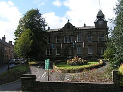
High Peak Borough Council have produced a Conservation Area Character Appraisal document, outlining the reasons that the Conservation Area has been designated as such. In justifying the reasons for designation, this document states of the town: “New Mills is a town of dramatic topography and origins that date back to the 14th century. Its topography and the supply of fast flowing waters led to its development as a thriving mill town and important centre for the textile industry. Its impressive landscape developed much of its developed form and the townscape that we still see today.”
('The Millers') are the local football team and play in the North West Counties League
Premier Division. The football ground at Church Lane boasts two pitches — one 'all weather' — and floodlights. New Mills Cricket Club, with their ground on Church Road, play in the Derbyshire and Cheshire League. There is a leisure centre, including a swimming pool, which opened in 1980. Until the early 1980s, the town held an annual cycle race.
New Mills Golf Club is a members' club set on the top of the northerly hill overlooking the town, with views of Kinder Scout, the city of Manchester and the Welsh mountains. The course was formed in 1907 and extended to its current 18-hole, 5604-yard par 69 course in 2003 prior to the clubhouse extension and centenary celebration in 2007.
Derbyshire
Derbyshire is a county in the East Midlands of England. A substantial portion of the Peak District National Park lies within Derbyshire. The northern part of Derbyshire overlaps with the Pennines, a famous chain of hills and mountains. The county contains within its boundary of approx...
, England
England
England is a country that is part of the United Kingdom. It shares land borders with Scotland to the north and Wales to the west; the Irish Sea is to the north west, the Celtic Sea to the south west, with the North Sea to the east and the English Channel to the south separating it from continental...
approximately 8 miles (12.9 km) south-east of Stockport
Stockport
Stockport is a town in Greater Manchester, England. It lies on elevated ground southeast of Manchester city centre, at the point where the rivers Goyt and Tame join and create the River Mersey. Stockport is the largest settlement in the metropolitan borough of the same name...
and 15 miles (24.1 km) from Manchester
Manchester
Manchester is a city and metropolitan borough in Greater Manchester, England. According to the Office for National Statistics, the 2010 mid-year population estimate for Manchester was 498,800. Manchester lies within one of the UK's largest metropolitan areas, the metropolitan county of Greater...
. It is sited at the confluence of the rivers Goyt and Sett
River Sett
The River Sett is a river that flows through the High Peak borough of Derbyshire, in north western England. It rises near Edale Cross on Kinder Scout and flows through the villages of Hayfield and Birch Vale to join the River Goyt at New Mills...
, on the border of Cheshire
Cheshire
Cheshire is a ceremonial county in North West England. Cheshire's county town is the city of Chester, although its largest town is Warrington. Other major towns include Widnes, Congleton, Crewe, Ellesmere Port, Runcorn, Macclesfield, Winsford, Northwich, and Wilmslow...
. The town stands above the Torrs, a 70 feet (21.3 m) deep gorge, cut through Woodhead Hill Sandstone of the Carboniferous
Carboniferous
The Carboniferous is a geologic period and system that extends from the end of the Devonian Period, about 359.2 ± 2.5 Mya , to the beginning of the Permian Period, about 299.0 ± 0.8 Mya . The name is derived from the Latin word for coal, carbo. Carboniferous means "coal-bearing"...
period. It is situated at the north-western edge of the Peak District
Peak District
The Peak District is an upland area in central and northern England, lying mainly in northern Derbyshire, but also covering parts of Cheshire, Greater Manchester, Staffordshire, and South and West Yorkshire....
, England's first national park
National parks of England and Wales
The national parks of England and Wales are areas of relatively undeveloped and scenic landscape that are designated under the National Parks and Access to the Countryside Act 1949...
. It has a population of approximately 10,000. New Mills can refer to the built-up area that includes Newtown
Newtown, Derbyshire
Newtown is an area of the town of New Mills in the High Peak borough of Derbyshire, England. It is situated west of New Mills proper, on the road to Disley. The county boundary between Cheshire and Derbyshire divides the area between the two counties...
and Low Leighton, or the civil parish that includes the villages and hamlets of Thornsett, Hague Bar
Hague Bar
Hague Bar is a village in Derbyshire, England, UK, near New Mills, Furness Vale and Stockport. The railway passes through the Goyt valley at this point.-External links:****...
, Rowarth
Rowarth
Rowarth is a hamlet about 2.5 miles north of New Mills in the High Peak borough of Derbyshire, England. It is on the edge of the Peak District, in the hills between New Mills and Marple Bridge. It is within the boundaries of the former town....
, Brookbottom
Brookbottom
Brookbottom is a hamlet about a mile outside New Mills in the High Peak borough of Derbyshire, England.It has one pub, the Fox Inn, a Methodist chapel, one phonebox but two street lights....
, Gowhole, and most of Birch Vale
Birch Vale
Birch Vale is a village in the High Peak district of Derbyshire, just outside the boundary of the Peak District National Park, between New Mills and Hayfield...
.
New Mills was first noted for coal mining
Coal mining
The goal of coal mining is to obtain coal from the ground. Coal is valued for its energy content, and since the 1880s has been widely used to generate electricity. Steel and cement industries use coal as a fuel for extraction of iron from iron ore and for cement production. In the United States,...
, and then for cotton spinning
Cotton mill
A cotton mill is a factory that houses spinning and weaving machinery. Typically built between 1775 and 1930, mills spun cotton which was an important product during the Industrial Revolution....
and then bleaching
Textile bleaching
Textile bleaching is one of the stages in the manufacture of textiles. All raw textile materials, when they are in natural form, are known as 'greige' material. This greige material will be with its natural color, odour and impurities that are not suitable for clothing materials...
and calico printing. New Mills was served by the Peak Forest Canal
Peak Forest Canal
The Peak Forest Canal, is a narrow locked artificial waterway in northern England. It is long and forms part of the connected English/Welsh inland waterway network.-General description:...
, three railway lines and the A6 trunk road. Redundant mills were bought up in the mid-twentieth century by a children's sweet manufacturer. New Mills was a stronghold of Methodism
Methodism
Methodism is a movement of Protestant Christianity represented by a number of denominations and organizations, claiming a total of approximately seventy million adherents worldwide. The movement traces its roots to John Wesley's evangelistic revival movement within Anglicanism. His younger brother...
.
History
New Mills is in the area formerly known as Bowden Middlecale which was a grouping of ten hamlets. The name of New Mylne (New Mills) was given to it from a corn-mill, erected in 1391, near to the present Salem Mill on the River SettRiver Sett
The River Sett is a river that flows through the High Peak borough of Derbyshire, in north western England. It rises near Edale Cross on Kinder Scout and flows through the villages of Hayfield and Birch Vale to join the River Goyt at New Mills...
in the hamlet of Ollersett
Ollersett
Ollersett is a small hamlet about northeast of New Mills town centre between St. George's Road and High Hill Road, New Mills, Derbyshire, England. It is about long with about 100 houses. It was built in the late 1940s.-Ollersett Field:...
. This was adjacent to a convenient bridge over the Sett. By the late sixteenth century the name was applied to the group of houses that grew up round it. Coal mining
Coal mining
The goal of coal mining is to obtain coal from the ground. Coal is valued for its energy content, and since the 1880s has been widely used to generate electricity. Steel and cement industries use coal as a fuel for extraction of iron from iron ore and for cement production. In the United States,...
was the first industry of the district, with up to 40 small pits and mines exploiting the Yard Seam. The climate, good construction stone and the availability of stable land by fast-flowing water was ideal for cotton spinning. Cotton mill
Cotton mill
A cotton mill is a factory that houses spinning and weaving machinery. Typically built between 1775 and 1930, mills spun cotton which was an important product during the Industrial Revolution....
s and print-works were built in the Torrs Gorge from 1788. Dwellings were built on the sides of the gorge, sometimes with one home built on top of another, both being entered at their respective street levels. Examples still exist on Station Road and Meal Street.
By 1810, New Mills had nine cotton mills, plus three weaving mills and at least three printworks.
Pigot's Directory 1835 describes New Mills:
- NEW MILLS, an extensive hamlet, in the parish of Glossop, and in the High Peak hundred, is 14 miles from Manchester, 6 from Chapel-en-le-Frith, and 8 from Stockport. It is pleasantly situate on the borders of Derbyshire and Cheshire; and, within a comparatively few years, has risen to importance in the manufacturing district; cotton spinning being carried on here to a considerable extent, affording employment to numerous hands.
- The factories are in a great measure hid from public view in passing through the village, being built at the foot of the stream, under high towering rocks. Good house coal, as well as other kinds for the purposes of machinery, is obtained near to the village, the top bed strata running from sixteen to twenty inches thick. The village is built chiefly upon a stone quarry, but the soil in many parts is fertile, producing good crops of wheat and potatoes.
A second group of 'later' mills formed by the newly opened Peak Forest Canal
Peak Forest Canal
The Peak Forest Canal, is a narrow locked artificial waterway in northern England. It is long and forms part of the connected English/Welsh inland waterway network.-General description:...
in Newtown, a hamlet 800 m away on the other side of the Goyt in what was then the parish of Disley
Disley
Disley is a village and civil parish in the unitary authority of Cheshire East and the ceremonial county of Cheshire, England. It is located on the very edge of the Peak District, in the Goyt Valley, very close to the county boundary with Derbyshire at New Mills, and south of Stockport, Greater...
in Cheshire
Cheshire
Cheshire is a ceremonial county in North West England. Cheshire's county town is the city of Chester, although its largest town is Warrington. Other major towns include Widnes, Congleton, Crewe, Ellesmere Port, Runcorn, Macclesfield, Winsford, Northwich, and Wilmslow...
. Increasingly these mills and houses merged into New Mills. The soft iron-free water was suitable for bleaching and finishing and printing. With the advent of steam, and the growth of the canal network to transport raw cotton, coal and the finished product, bigger mills were built and the smaller isolated rural mills were no longer competitive. By 1846, most of New Mills' mills had stopped spinning. The small mills moved out of cotton; the larger mills along the canal moved into finishing. Torr Vale Mill had added a weaving shed in 1836, and moved into producing towelling.
The commercial method of calico printing using engraved rollers was invented in 1821 in New Mills. John Potts
John Potts (Engraver)
John Potts was the inventor of a method of calico printing by theuse of copper rollers onto which patterns had been engraved. He was born in Manchester, he moved to New Mills, Derbyshire in 1820. He founded the firm of engravers to calico printers known as Potts, Oliver and Potts, with his...
of Potts, Oliver and Potts used a copper-engraved master to produce rollers to transfer the inks.
Before the construction of the high-level bridges the Torrs was a major obstacle; traffic had to descend 70 feet (21.3 m) to cross the Goyt and then climb 70 feet (21.3 m) on the other bank. The first bridge to be constructed was the Queens Bridge on Church Road. The Union Road bridge was built in 1884; obtaining the land was difficult, as the arches needed to pass close to Torr Mill and properties on the Cheshire (south) bank, and Torr Top Hall had to be demolished. The new road was named after the 'union' of the two halves of the town. The first station in New Mills was at Newtown, on the Stockport, Disley and Whaley Bridge Railway
Stockport, Disley and Whaley Bridge Railway
The Stockport, Disley and Whaley Bridge Railway was an early railway company in England which was opened in 1857 between Stockport Edgeley and Whaley Bridge.- Origins :...
; this opened 9 June 1855. This followed the line of the Peak Forest Canal
Peak Forest Canal
The Peak Forest Canal, is a narrow locked artificial waterway in northern England. It is long and forms part of the connected English/Welsh inland waterway network.-General description:...
staying safely away from the Torrs. The Sheffield and Midland Railway Companies' Committee
Sheffield and Midland Railway Companies' Committee
The Sheffield and Midland Railway Companies' Committee was incorporated by Act of Parliament in 1869 as a joint venture between the Midland Railway and the Manchester, Sheffield and Lincolnshire Railway.-Origins:...
company built two viaducts across the Goyt: one for a line to New Mills Central that opened in 1864, and one for the fast line through the Disley Tunnel
Disley Tunnel
Disley Tunnel [UK] was built by the Midland Railway in 1902 on its line between New Mills South Junction and Manchester Central, which was more direct than the congested and difficult lines through Stockport Tiviot Dale....
which opened in 1904.
Cotton continued to be worked at Torr Vale Mill until 2000, giving the mill over two hundred years of service.
In the great storm of June 1872, Grove Mill and Torr Vale weir were destroyed; at Rock Mill, then being used to make paper, two blocks of buildings and considerable stock and some machinery were lost, but the only fatalities were two cows.
The River Goyt at about two o’clock a.m. on Wednesday was from 12ft to 14ft above its usual height...At New Mills, where the Goyt is joined by the River Kinder, extensive damage was done to property. The paper works of Messrs. Schlosser and Co. were damaged upwards of £1,500 as two blocks of buildings were completely washed away – one portion contained a large quantity of paper. The works of Mr. W.S. Lowe also sufferd severely, the damage being estimated at £300. Two strong stone weirs were washed away and two bridges; many acres of land were flooded. - Manchester Times
This was minor compared with events at Whaley Bridge
Whaley Bridge
Whaley Bridge is a small town and civil parish in the High Peak district of Derbyshire, England, situated on the River Goyt. Whaley Bridge is approximately south of Manchester, north of Buxton , east of Macclesfield and west of Sheffield, and had a population of 6,226 at the 2001 census. This...
, where Toddbrook Reservoir
Toddbrook Reservoir
Toddbrook Reservoir was built in 1831 as a feeder for the Peak Forest Canal. It is in the heart of Whaley Bridge in the High Peak, Derbyshire. The reservoir is a Site of Special Scientific Interest . The reservoir is a habitat for herons, ducks and other animals and fish. Also many rare mosses and...
was overtopped and another reservoir known as Adsheads Pools breached completely, the waters sweeping through the centre of the village of Hurdsfield. The June 1930 flood was more serious for New Mills. Heavy rain over the area culminating in a cloudburst over Rowarth caused the River Sett to rise rapidly by up to 20 feet (6.1 m). Many properties on Brookside were flooded and destroyed and one rescuer was drowned. Hyde Bank Road was engulfed and buildings collapsed at Arnfield's foundry. At Rowarth
Rowarth
Rowarth is a hamlet about 2.5 miles north of New Mills in the High Peak borough of Derbyshire, England. It is on the edge of the Peak District, in the hills between New Mills and Marple Bridge. It is within the boundaries of the former town....
, the remains of the Little Mill and the landlord of the Little Mill Inn were swept away. At Watford Bridge the river took away part of the printworks, and at Bate Mill gouged a new channel taking with it the sewage plant, 250 tons of coal, most of the road and the gas main. At Birch Vale, the problem was caused by the waters cascading down from Lantern Pike
Lantern Pike
Lantern Pike is a hill located just outside Hayfield, in Derbyshire, England. The land lies within the Peak District National Park and is owned and maintained by the National Trust. It is permanently open to the public...
; the culvert being inadequate, the roadways became rivers washing away sections of walling. Much livestock perished.
Governance
Derbyshire
Derbyshire is a county in the East Midlands of England. A substantial portion of the Peak District National Park lies within Derbyshire. The northern part of Derbyshire overlaps with the Pennines, a famous chain of hills and mountains. The county contains within its boundary of approx...
, New Mills straddled the historic county boundaries
Historic counties of England
The historic counties of England are subdivisions of England established for administration by the Normans and in most cases based on earlier Anglo-Saxon kingdoms and shires...
of Derbyshire and Cheshire
Cheshire
Cheshire is a ceremonial county in North West England. Cheshire's county town is the city of Chester, although its largest town is Warrington. Other major towns include Widnes, Congleton, Crewe, Ellesmere Port, Runcorn, Macclesfield, Winsford, Northwich, and Wilmslow...
. The traditional boundary was the River Goyt: Low Leighton, Torr Top and Hidebank were always in Derbyshire, but Torr Vale Road and all of Newtown were in Cheshire. Indeed, today, all the housing to the west of the traffic lights on the Buxton Road remains in the parish of Disley
Disley
Disley is a village and civil parish in the unitary authority of Cheshire East and the ceremonial county of Cheshire, England. It is located on the very edge of the Peak District, in the Goyt Valley, very close to the county boundary with Derbyshire at New Mills, and south of Stockport, Greater...
in Cheshire.
The area was part of the Royal Forest of the Peak
Forest of High Peak
The Forest of High Peak was, in medieval times, a moorland forest covering most of the North West of Derbyshire, in England as far south as Tideswell and Buxton....
which passed into the hands of the Duchy of Lancaster
Duchy of Lancaster
The Duchy of Lancaster is one of the two royal duchies in England, the other being the Duchy of Cornwall. It is held in trust for the Sovereign, and is used to provide income for the use of the British monarch...
in 1372. The ten hamlets, in three groups:
- Great Hamlet, Phoside and Kinder;
- Beard, Ollersett, Thornsett and Whitle;
- Chinley, Bugsworth and Brownside
made up Bowden Middlecale. The new manorial mill or the New Mylne of 1391 was at Beard. In 1713 the hamlets of Beard, Ollersett, Thornsett and Whitle were formed into a township and a new corn mill was built at Ollersett. This was superseded by the New Mills Urban Sanitary Authority in 1876. The New Mills Urban District Council operated from 1894 until 1974, when it was abolished. The town now has a town council, is part of High Peak Council
High Peak Borough Council
High Peak Borough Council is a non-metropolitan district council with borough status in the north of Derbyshire, England. It forms part of the two tier system of local government alongside Derbyshire County Council for the High Peak. The administrative base of High Peak Borough Council is split...
, and Derbyshire County Council.
Andrew Bingham
Andrew Bingham
Andrew Russell Bingham is a British Conservative Party politician. He has been Member of Parliament for High Peak in Derbyshire since winning the seat at the 2010 general election.-Early life:...
, a Conservative Party
Conservative Party (UK)
The Conservative Party, formally the Conservative and Unionist Party, is a centre-right political party in the United Kingdom that adheres to the philosophies of conservatism and British unionism. It is the largest political party in the UK, and is currently the largest single party in the House...
member, is the member of Parliament
Member of Parliament
A Member of Parliament is a representative of the voters to a :parliament. In many countries with bicameral parliaments, the term applies specifically to members of the lower house, as upper houses often have a different title, such as senate, and thus also have different titles for its members,...
for the High Peak constituency.
On Derbyshire County Council, New Mills is in the New Mills division along with Hayfield and Sett. The seat is held by Beth Atkins for the Liberal Democrats. On High Peak Council, Sett has one councillor, New Mills East has two councillors and New Mills West has two councillors. The New Mills Town Council is chaired by the Liberal Democrats
Liberal Democrats
The Liberal Democrats are a social liberal political party in the United Kingdom which supports constitutional and electoral reform, progressive taxation, wealth taxation, human rights laws, cultural liberalism, banking reform and civil liberties .The party was formed in 1988 by a merger of the...
.
Geography
New Mills is approximately 182 miles (292.9 km) NNW of London and 8 miles (13 km) south-east of Stockport. It borders on DisleyDisley
Disley is a village and civil parish in the unitary authority of Cheshire East and the ceremonial county of Cheshire, England. It is located on the very edge of the Peak District, in the Goyt Valley, very close to the county boundary with Derbyshire at New Mills, and south of Stockport, Greater...
, in Cheshire
Cheshire
Cheshire is a ceremonial county in North West England. Cheshire's county town is the city of Chester, although its largest town is Warrington. Other major towns include Widnes, Congleton, Crewe, Ellesmere Port, Runcorn, Macclesfield, Winsford, Northwich, and Wilmslow...
, and Marple
Marple, Greater Manchester
Marple is a small town within the Metropolitan Borough of Stockport, in Greater Manchester, England. It lies on the River Goyt southeast of Stockport.Historically part of Cheshire, Marple has a population of 23,480 .-Toponymy:...
, in the Stockport Metropolitan Borough
Metropolitan Borough of Stockport
The Metropolitan Borough of Stockport is a metropolitan borough of Greater Manchester, in north west England, centred around the town of Stockport. It has a population of about 280,600 and includes the outyling areas of Cheadle and Cheadle Hulme, Marple, Bredbury, Reddish and Romiley...
in Greater Manchester
Greater Manchester
Greater Manchester is a metropolitan county in North West England, with a population of 2.6 million. It encompasses one of the largest metropolitan areas in the United Kingdom and comprises ten metropolitan boroughs: Bolton, Bury, Oldham, Rochdale, Stockport, Tameside, Trafford, Wigan, and the...
. The town is on the north-western edge of the Peak District
Peak District
The Peak District is an upland area in central and northern England, lying mainly in northern Derbyshire, but also covering parts of Cheshire, Greater Manchester, Staffordshire, and South and West Yorkshire....
, but only a small part of it is included within the boundaries of the National Park. The town includes the hamlets of Thornsett, Hague Bar, Rowarth
Rowarth
Rowarth is a hamlet about 2.5 miles north of New Mills in the High Peak borough of Derbyshire, England. It is on the edge of the Peak District, in the hills between New Mills and Marple Bridge. It is within the boundaries of the former town....
, Brookbottom
Brookbottom
Brookbottom is a hamlet about a mile outside New Mills in the High Peak borough of Derbyshire, England.It has one pub, the Fox Inn, a Methodist chapel, one phonebox but two street lights....
, Gowhole, and most of Birch Vale
Birch Vale
Birch Vale is a village in the High Peak district of Derbyshire, just outside the boundary of the Peak District National Park, between New Mills and Hayfield...
.
At its lowest point the parish is about 120m above sea level, but the valley sides rise to 370m at the highest points above Rowarth. The watercourses to the north, particularly the Rowarth Brook, drain the southward slopes of Mellor Moor, Cown Edge and Lantern Pike
Lantern Pike
Lantern Pike is a hill located just outside Hayfield, in Derbyshire, England. The land lies within the Peak District National Park and is owned and maintained by the National Trust. It is permanently open to the public...
. The Sett
River Sett
The River Sett is a river that flows through the High Peak borough of Derbyshire, in north western England. It rises near Edale Cross on Kinder Scout and flows through the villages of Hayfield and Birch Vale to join the River Goyt at New Mills...
and its tributary the Kinder
River Kinder
The River Kinder is a small river, only about long, in northwestern Derbyshire, England. Rising on the peat moorland plateau of Kinder Scout, it flows generally westwards to its confluence with the River Sett at Bowden Bridge...
drain much of the plateau of Kinder Scout
Kinder Scout
Kinder Scout is a moorland plateau in the Dark Peak of the Derbyshire Peak District in England. Part of the moor, at 636 m above sea level, is the highest point in the Peak District, the highest point in Derbyshire, and the highest point in the East Midlands. It is accessible from the villages of...
; the Sett flows through Hayfield
Hayfield
Hayfield is a village and civil parish in the Borough of High Peak, in the county of Derbyshire, England. The village lies approximately east of New Mills, south of Glossop and north of Buxton by road....
before passing through Birch Vale to the Torrs and the River Goyt. The Goyt rises on the moors of Axe Edge, near the River Dane
River Dane
The River Dane is a river mainly in Cheshire in the north west of England.The river rises in Derbyshire, close to the source of the River Goyt just to the south west of Buxton, on Axe Edge Moor...
and the Cat and Fiddle Inn
Cat and Fiddle Inn
The Cat and Fiddle Inn is the second-highest inn or public house in England . The inn is situated on the eastern fringes of Cheshire in the Peak District National Park on the A537 road just west of the Derbyshire/Cheshire county boundary, on the western side of Axe Edge Moor...
between Buxton
Buxton
Buxton is a spa town in Derbyshire, England. It has the highest elevation of any market town in England. Located close to the county boundary with Cheshire to the west and Staffordshire to the south, Buxton is described as "the gateway to the Peak District National Park"...
and Macclesfield
Macclesfield
Macclesfield is a market town within the unitary authority of Cheshire East, the county palatine of Chester, also known as the ceremonial county of Cheshire, England. The population of the Macclesfield urban sub-area at the time of the 2001 census was 50,688...
. It passes through Whaley Bridge
Whaley Bridge
Whaley Bridge is a small town and civil parish in the High Peak district of Derbyshire, England, situated on the River Goyt. Whaley Bridge is approximately south of Manchester, north of Buxton , east of Macclesfield and west of Sheffield, and had a population of 6,226 at the 2001 census. This...
, where it is joined by the Todd Brook and the Black Brook from Chapel-en-le-Frith
Chapel-en-le-Frith
Chapel-en-le-Frith is a small town in Derbyshire, England, on the edge of the Peak District near the border with Cheshire, from Manchester. Dubbed "The Capital of the Peak District", the settlement was established by the Normans in the 12th century, originally as a hunting lodge within the Forest...
. The sides of the Goyt valley have been used to carry two railway lines, the Peak Forest Canal
Peak Forest Canal
The Peak Forest Canal, is a narrow locked artificial waterway in northern England. It is long and forms part of the connected English/Welsh inland waterway network.-General description:...
and the A6 trunk road from London
London
London is the capital city of :England and the :United Kingdom, the largest metropolitan area in the United Kingdom, and the largest urban zone in the European Union by most measures. Located on the River Thames, London has been a major settlement for two millennia, its history going back to its...
to Carlisle via Manchester
Manchester
Manchester is a city and metropolitan borough in Greater Manchester, England. According to the Office for National Statistics, the 2010 mid-year population estimate for Manchester was 498,800. Manchester lies within one of the UK's largest metropolitan areas, the metropolitan county of Greater...
; these all pass through New Mills.
Geologically speaking, New Mills lies in the north–south-orientated syncline
Syncline
In structural geology, a syncline is a fold, with younger layers closer to the center of the structure. A synclinorium is a large syncline with superimposed smaller folds. Synclines are typically a downward fold, termed a synformal syncline In structural geology, a syncline is a fold, with younger...
, the Goyt Trough. The base rocks are from the Carboniferous
Carboniferous
The Carboniferous is a geologic period and system that extends from the end of the Devonian Period, about 359.2 ± 2.5 Mya , to the beginning of the Permian Period, about 299.0 ± 0.8 Mya . The name is derived from the Latin word for coal, carbo. Carboniferous means "coal-bearing"...
period, with underlying Namurian
Namurian
The Namurian is a stage in the regional stratigraphy of northwest Europe with an age between roughly 326 and 313 Ma . It is a subdivision of the Carboniferous system or period and the regional Silesian series. The Namurian is named for the Belgian city and province of Namur where strata of this age...
gritstone
Gritstone
Gritstone or Grit is a hard, coarse-grained, siliceous sandstone. This term is especially applied to such sandstones that are quarried for building material. British gritstone was used for millstones to mill flour, to grind wood into pulp for paper and for grindstones to sharpen blades. "Grit" is...
sandstones, from 333 M a.to 313 M a. Above there are coal measures present (Langsettian from 312 M a.). This was folded in the Variscan orogeny
Variscan orogeny
The Variscan orogeny is a geologic mountain-building event caused by Late Paleozoic continental collision between Euramerica and Gondwana to form the supercontinent of Pangaea.-Naming:...
into the Goyt Trough syncline. Coal has been mined at over 30 locations in the area, including Pingot Pit. There are three narrow seams of coal present: the Red Ash, Little Mine and the Yard Seam. The Yard Coal is so named because that is the average thickness of the seam; it is the lowest seam and rests on Woodhead Hill Sandstone
Gritstone
Gritstone or Grit is a hard, coarse-grained, siliceous sandstone. This term is especially applied to such sandstones that are quarried for building material. British gritstone was used for millstones to mill flour, to grind wood into pulp for paper and for grindstones to sharpen blades. "Grit" is...
. In these seams lead ore has also been extracted. Beardmoor Colliery, Ollersett or Burnt Edge Colliery and Lee or New Mills Colliery all worked the 3 foot (0.9144 m) seam. 1 cubic yard (0.764554858 m³) of coal weighs about half an imperial ton, and the Yard Seam would produce 4500 tons per acre. Bigrave Edge or Broadmoor Edge Colliery worked the Red Ash seam, which was only 18 inch thick.
The syncline was buried in younger rocks of the Tertiary Period. These were eroded, not least by the scouring of the Ice Age
Ice age
An ice age or, more precisely, glacial age, is a generic geological period of long-term reduction in the temperature of the Earth's surface and atmosphere, resulting in the presence or expansion of continental ice sheets, polar ice sheets and alpine glaciers...
ice sheets and the pressures of the meltwaters when temperatures rose. New Mills was on the margins of glaciation, and the meltwaters sought additional routes under the ice for run off. They exploited faults and crevices in the underlying rock. In the Torrs Gorge, the Rivers Goyt and Sett cut a new channel into the strata of the Woodhead Hill Sandstone which forms the centre of New Mills. A mantle of glacial sediment, principally gravels, covered the whole of the braided valleys. In the Pleistocene
Pleistocene
The Pleistocene is the epoch from 2,588,000 to 11,700 years BP that spans the world's recent period of repeated glaciations. The name pleistocene is derived from the Greek and ....
period, of 12.9 k a to 11.6 k a, the rivers re-formed into single channels, and meanders were formed. These became very distorted above the constrictions of the gorges. Down cutting occurred, exposing previous layers, creating terraces that were covered with silty clay alluvium
Alluvium
Alluvium is loose, unconsolidated soil or sediments, eroded, deposited, and reshaped by water in some form in a non-marine setting. Alluvium is typically made up of a variety of materials, including fine particles of silt and clay and larger particles of sand and gravel...
.
Transport
Rail
New Mills is served by two railway stations: New Mills CentralNew Mills Central railway station
New Mills Central railway station serves the town of New Mills in Derbyshire, England. It is on the Hope Valley Line between Manchester Piccadilly and Sheffield...
on the Hope Valley line
Hope Valley Line
The Hope Valley Line is a railway line in England linking Sheffield with Manchester. It was completed in 1894.From Sheffield, trains head down the Midland Main Line to Dore, where the Hope Valley Line branches off to run through the Totley Tunnel .It emerges in the stunning scenery of the Hope...
on the north bank of the River Goyt, and New Mills Newtown
New Mills Newtown railway station
New Mills Newtown railway station serves the town of New Mills in Derbyshire, England. The station is 23 km south east of Manchester Piccadilly on the Manchester to Buxton line...
on the Buxton Line
Buxton Line
The Buxton Line is a railway line in northern England, connecting Manchester with Buxton in Derbyshire. Passenger services on the line are currently operated by Northern Rail and most continue through Manchester from Blackpool North.-History:...
which runs on the south bank on the 175m contour. The main Manchester to Sheffield 'fast' line passes through between the town centre and Newtown, by-passing the stations. It emerges from the Disley Tunnel on a lower (150m) contour than the canal on the south bank, crosses the Goyt on a viaduct, and is joined by the Hope Valley Line at New Mills South Junction. A short branch of the Midland railway once led to the village of Hayfield
Hayfield
Hayfield is a village and civil parish in the Borough of High Peak, in the county of Derbyshire, England. The village lies approximately east of New Mills, south of Glossop and north of Buxton by road....
. This was dismantled in 1970 and is now the Sett Valley Trail
Sett Valley Trail
The Sett Valley Trail is a cycle- and bridleway in Derbyshire, England, linking the village of Hayfield and the town of New Mills . It runs along the lower valley of the River Sett and follows the trackbed of a former branch railway line from to , which opened in 1868 and closed in 1970...
, which stretches for 2½ miles to the north-east of the town.
Bus
The town also has a bus station, which is served by Bowers Coaches 61 (GlossopGlossop
Glossop is a market town within the Borough of High Peak in Derbyshire, England. It lies on the Glossop Brook, a tributary of the River Etherow, about east of the city of Manchester, west of the city of Sheffield. Glossop is situated near Derbyshire's county borders with Cheshire, Greater...
/New Mills/Buxton
Buxton
Buxton is a spa town in Derbyshire, England. It has the highest elevation of any market town in England. Located close to the county boundary with Cheshire to the west and Staffordshire to the south, Buxton is described as "the gateway to the Peak District National Park"...
), Bowers Coaches 62 and 62a (Chapel-en-le-Frith
Chapel-en-le-Frith
Chapel-en-le-Frith is a small town in Derbyshire, England, on the edge of the Peak District near the border with Cheshire, from Manchester. Dubbed "The Capital of the Peak District", the settlement was established by the Normans in the 12th century, originally as a hunting lodge within the Forest...
/Hayfield
Hayfield
Hayfield is a village and civil parish in the Borough of High Peak, in the county of Derbyshire, England. The village lies approximately east of New Mills, south of Glossop and north of Buxton by road....
/New Mills/Marple
Marple, Greater Manchester
Marple is a small town within the Metropolitan Borough of Stockport, in Greater Manchester, England. It lies on the River Goyt southeast of Stockport.Historically part of Cheshire, Marple has a population of 23,480 .-Toponymy:...
), TM Travel 67 (Manchester
Manchester
Manchester is a city and metropolitan borough in Greater Manchester, England. According to the Office for National Statistics, the 2010 mid-year population estimate for Manchester was 498,800. Manchester lies within one of the UK's largest metropolitan areas, the metropolitan county of Greater...
/New Mills/Tideswell
Tideswell
Tideswell is a village and civil parish in the Peak District of Derbyshire, in England. It lies east of Buxton on the B6049, in a wide dry valley on a limestone plateau, at an altitude of above sea level, and is within the District of Derbyshire Dales...
/Chesterfield
Chesterfield
Chesterfield is a market town and a borough of Derbyshire, England. It lies north of Derby, on a confluence of the rivers Rother and Hipper. Its population is 70,260 , making it Derbyshire's largest town...
), Stagecoach Manchester 358 (Hayfield/New Mills/Marple/Stockport
Stockport
Stockport is a town in Greater Manchester, England. It lies on elevated ground southeast of Manchester city centre, at the point where the rivers Goyt and Tame join and create the River Mersey. Stockport is the largest settlement in the metropolitan borough of the same name...
) and Bowers Coaches 389 (New Mills town services).
Road & canal
The A6 road passes through Newtown, a little to the south and slightly above the Buxton Line.The Peak Forest Canal
Peak Forest Canal
The Peak Forest Canal, is a narrow locked artificial waterway in northern England. It is long and forms part of the connected English/Welsh inland waterway network.-General description:...
was watered in 1796. It passes through Newtown, where there is a marina
Marina
A marina is a dock or basin with moorings and supplies for yachts and small boats.A marina differs from a port in that a marina does not handle large passenger ships or cargo from freighters....
. It follows the 155m contour.
Education
The principal secondary school is the New Mills School Business & Enterprise CollegeNew Mills School Business & Enterprise College
New Mills School Business & Enterprise College is an average sized comprehensive school, situated in the northwest of Derbyshire within in the Peak District.-Admissions:...
. This comprehensive school occupies the buildings of the former New Mills Grammar School and educates children from 11 to 19 years of age. There are six primary schools: St. George's school (CE), St. Mary's (RC), New Mills County Primary, Newtown, Hague Bar and Thornsett.
Economy
New Mills' economy was originally built on agriculture, then coal mining and then cotton spinning and bleaching. There was a little weaving but cotton bleaching and calico printing continued into the second half of the twentieth century. The mills have now all closed. Today Swizzels MatlowSwizzels Matlow
Swizzels Matlow is a British-based traditional confectionery manufacturer.Their best known sweets include Love Hearts, Double Lollies, Drumsticks, Refreshers , Fizzers and Parma Violets...
, who make children's sweets, is a large employer. The company transferred to New Mills from London during the Blitz
The Blitz
The Blitz was the sustained strategic bombing of Britain by Nazi Germany between 7 September 1940 and 10 May 1941, during the Second World War. The city of London was bombed by the Luftwaffe for 76 consecutive nights and many towns and cities across the country followed...
and has remained ever since. Famous brands include 'Parma Violets
Parma Violets
Parma Violets are a British violet-flavoured tablet confectionery manufactured by the Derbyshire company Swizzels Matlow. The sweets are hard, biconcave disc-shaped sweets, similar to the Fizzers product from the same company but without their fizziness...
', 'Refresher' chews, 'Drumstick' lollies and - perhaps most famously - Love Hearts
Love Hearts
Love Hearts are a type of confectionery manufactured by Swizzels Matlow in the United Kingdom. They are hard, fizzy, tablet-shaped sweets in a variety of fruit flavours featuring a short, love-related message on one side of the sweet....
. Folk memory relates that children from local schools were often asked to test new sweet flavours that were created..
There is also a history of iron working, though this has ceased. Ironstone was also found in shales of the lower coal measures, and early water-powered charcoal furnaces was located at Jow-Hole furnace towards Furness Vale
Furness Vale
Furness Vale is a village in the High Peak district of Derbyshire, England situated between New Mills and Whaley Bridge. It is bisected by the A6 road and the Peak Forest Canal...
. In the nineteenth century, the Midland Iron Works occupied Barnes Mill in the Torrs; the Victoria Foundry was on Hyde Bank Road (among their products were gas lamp posts for the town council) as was the other small foundry in Wilde's scrapyard. On Albion Road in Newtown is John Hawthorn's foundry. There was also a brass foundry, on the site of the current Heritage Centre.
Tourism was boosted in 1984 when the Torrs was reopened as a riverside park, and further when the spectacular Millennium Walkway opened in 1999, joining the two ends of the gorge.
The Plain English Campaign
Plain English Campaign
The Plain English Campaign is a commercial editing and training firm based in the United Kingdom. Founded in 1979 by Chrissie Maher, the company positions itself as a leader in plain-language advocacy, working to persuade organisations in the UK and abroad to communicate with the public in plain...
has its headquarters in the town.
Landmarks
New Mills sits atop The Torrs, a dramatic gorge through which the Rivers Goyt and Sett flow. Nestled in a bend of the Goyt is Torr Vale MillTorr Vale Mill
Torr Vale Mill is a Grade II* listed former cotton mill located in New Mills, Derbyshire, England. It is sited on a small rocky outcrop at the bottom of the Torrs gorge in a bend of the River Goyt....
, a Grade II* listed building. The Torrs Millennium Walkway, overlooking the mill, was built at a cost of £525,000 (almost half from the Millennium Commission) by Derbyshire County Council’s in-house engineers. The walkway spans the otherwise inaccessible cliff wall above the River Goyt. Part rises from the riverbed on stilts and part is cantilevered off the railway retaining wall. It provided the final link in the 225 miles (362.1 km) Midshires Way
Midshires Way
The Midshires Way is a long distance footpath and bridleway that runs for through Middle England from Bledlow in Buckinghamshire to Stockport, Greater Manchester....
and was opened in April 2000.
Torrs Hydro
Torrs Hydro, New Mills
Torrs Hydro is a micro hydroelectric scheme, owned by the community, in New Mills, Derbyshire.It is located on the River Goyt, immediately after its confluence with the River Sett at the Torr weir...
is a 2.4-metre-diameter 'Reverse Archimedean Screw' micro hydroelectric scheme at the Torr Weir on the Goyt. It generates 70 kW of electricity. Nicknamed 'Archie', it is owned by the community. The electriciy is supplied to the Co-operative supermarket, and any excess is fed back into the National Grid.
Religious sites
The area around MellorMellor, Greater Manchester
Mellor is a village within the Metropolitan Borough of Stockport, in Greater Manchester, England. Mellor, situated between Marple Bridge and New Mills, runs along a tributary of the River Goyt. It extends from the start of the old turnpike road at the boundary of Marple Bridge to the current county...
and New Mills has a strong Methodist tradition. John Wesley
John Wesley
John Wesley was a Church of England cleric and Christian theologian. Wesley is largely credited, along with his brother Charles Wesley, as founding the Methodist movement which began when he took to open-air preaching in a similar manner to George Whitefield...
first preached in the area in 1740, at a sheepfold at the Bongs in neighbouring Mellor. He visited again on 28 April 1745, 12 May 1747 and 31 August 1748. The Wesleyan Methodists
Methodist Church of Great Britain
The Methodist Church of Great Britain is the largest Wesleyan Methodist body in the United Kingdom, with congregations across Great Britain . It is the United Kingdom's fourth largest Christian denomination, with around 300,000 members and 6,000 churches...
were established in 1748. At first, meetings were held in people's homes; then land was bought on the High Street for a Wesleyan chapel in 1766. This was the first place of worship in the town. Wesley visited again in 1768, 1772, 1774, 1776, 1779, 1782 and 1788. By 1808 that chapel was too small, and a larger one was built in St Georges Road, Brookside (Low Leighton).The church was influential and many of the millowners were members: Samuel Schofield, of Warksmoor House and of Torr Mill, the Armstrongs of Torr Vale Mill, the Hibbert family, including Robert Hibbert, of Warksmoor who built the first cotton mill in Newtown, the Barnes, Thatchers, Arnfields, Bridges, Willans and Bennetts, all industrialists, are buried in the chapel. The larger chapel was closed and demolished in the 1960s and the Methodists have reverted to the High Street Chapel. The Association Methodists' stone chapel was erected in 1838, and the Primitive Methodists built one in 1827. The Friends Meeting House dating from 1717 is in Low Leighton, and the independents, the Congregational church (Providence church), was built on Mellor Road, Whitle, in 1823.
The hamlets of Bowden Middlecale and Mellor were originally in the ancient parish of Glossop. Chapelries were established at Mellor and Hayfield, and New Mills was split between the two. The Church of England
Church of England
The Church of England is the officially established Christian church in England and the Mother Church of the worldwide Anglican Communion. The church considers itself within the tradition of Western Christianity and dates its formal establishment principally to the mission to England by St...
parish church of St George's was built in 1839 to a simple renaissance plan with galleries; it has 7 bays, decorated with simple Gothic-style lancet windows. It 1844 the hamlets of Beard, Ollersett, Thornsett and Whitle became a parish.
The Church of the Annunciation, St. Mary's Road is the Roman Catholic
Roman Catholic Church
The Catholic Church, also known as the Roman Catholic Church, is the world's largest Christian church, with over a billion members. Led by the Pope, it defines its mission as spreading the gospel of Jesus Christ, administering the sacraments and exercising charity...
church. It is in the parish of St Mary'ś, Marple Bridge and New Mills in the Diocese of Nottingham. The building was built in the Decorated Gothic style in 1846; its spire is 110 feet (33.5 m) high.
Culture and community
New Mills plays host to the One World Festival every June. The festival incorporates "a mixture of serious issues, good music and fun in the open air". The free one-day event raises awareness of organisations that work "for a better, fairer world". In 2008 the festival's theme was 'Reduce, Re-use, Recycle'. Part of this theme has been to launch a campaign to make New Mills plastic-bag-free under the banner 'One World, One Bag'.Conservation Area
New Mills town centre has been designated a Conservation Area. The Conservation Area was originally established in 1985, although has been extended several times since then. Currently, the Conservation Area extends to encompass the Jodrell Street, Spring Bank and High Lea areas of the town.High Peak Borough Council have produced a Conservation Area Character Appraisal document, outlining the reasons that the Conservation Area has been designated as such. In justifying the reasons for designation, this document states of the town: “New Mills is a town of dramatic topography and origins that date back to the 14th century. Its topography and the supply of fast flowing waters led to its development as a thriving mill town and important centre for the textile industry. Its impressive landscape developed much of its developed form and the townscape that we still see today.”
Sport and leisure
New Mills A.F.C.New Mills A.F.C.
New Mills Association Football Club are an English football club based in New Mills, Derbyshire. They currently play in Northern Premier League Division One South.-History:...
('The Millers') are the local football team and play in the North West Counties League
North West Counties Football League
The North West Counties Football League is a football league in North west of England. As of 2011, the league covers Cheshire, Greater Manchester, Lancashire, Merseyside, Southern Cumbria, Northern Staffordshire, the High Peak area of Derbyshire, and the far west of West Yorkshire. In the past, the...
Premier Division. The football ground at Church Lane boasts two pitches — one 'all weather' — and floodlights. New Mills Cricket Club, with their ground on Church Road, play in the Derbyshire and Cheshire League. There is a leisure centre, including a swimming pool, which opened in 1980. Until the early 1980s, the town held an annual cycle race.
New Mills Golf Club is a members' club set on the top of the northerly hill overlooking the town, with views of Kinder Scout, the city of Manchester and the Welsh mountains. The course was formed in 1907 and extended to its current 18-hole, 5604-yard par 69 course in 2003 prior to the clubhouse extension and centenary celebration in 2007.
Notable residents
- Thomas Handford: The interpretation plaque at the town's former prison tells it all:
- ‘ A working man, a teetotaler for ten years, who was formerly a notorious drinker and a notorious poacher has recently invested his sober earnings in the purchase of the town prison which he has converted into a comfortable dwelling house. Frequently an inmate of the prison whilst a drunkard and poacher, he is now owner of the whole and occupier of the premises. Thomas Handford 1854 ’.