
Hanstholm
Encyclopedia
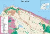
Hanstholm is a small town and a former island, now elevated area in Thisted municipality
of Region Nordjylland
, located in the northern part of Denmark
. Coordinates: 57°07′12"N 08°37′12"E. Population of the area is about 3,500 (2004), and the town has a population of 2,361 (1 January 2011).

, churches were built in Vigsø, Ræhr and Hansted, forming three parish
es.
In the end of the 20th century, Denmark's largest harbor was built in Hansted, and a 10-fold bigger harbor town was needed. A new town was planned, covering the places Hansted, Gårddal and Nørby, and the new town was officially named Hanstholm. This has led to quite some confusion, because the people from the towns Ræhr and Vigsø live on Hanstholm, the former island, they live in Hanstholm postal district, they live in Hanstholm municipality
, but they don't live in Hanstholm town.
However, since all the parts of this new harbor town belongs to Hansted parish, and because Hansted has been the harbor town for so many centuries, many people refer to this town simply as Hansted instead of Hanstholm.
Besides Hanstholm and Hansted, one more name is related to this, Hanherred:
 To the north is Vigsø Bay (‘’Vigsø Bugt’’) a part of Skagerrak
. To the west is the North Sea
.
The ferry
MV Norröna of Smyril Line
operates a weekly summer service to the Faroe Islands
and Iceland
. It is the only way to transport a car to the Faroe Islands
and Iceland
.
The northern part of Denmark is rising because of plate tectonics
, and has lifted the island of Hanstholm out of the water, so that it is no longer an island, but an elevated area. You can still see two old farms: Bådsgård, which means boat farm, is located on the previous island Hanstholm; Færgegård is located in Sårup towards Hansted. Today you can simply drive between Sårup and Hansted.
was applied. It seems to have been modeled in the same way as other growing Danish towns in the 1960s, which basically means that you can drive through the city without noticing the size of it.
Most shopping is concentrated in a shopping mall (Hanstholm Centret), and there are separate pedestrian and bicycle path covering most of the city.
inhabited the area, but left in a big exodus, together with the Cimbri
, towards the south, where they encountered the Romans.
s, and nearby was the gathering point for the Vikings for their invasions of England
and France
.
church in the Thy area was built in 1040 in Vestervig, where Christian priests coming from England entered Denmark. A big monastery was later built here and this was the beginning to the end of the Viking era.
The churches in Ræhr, Hansted and Vigsø were built in the 12th century i Roman style, and on Hansted church, one of the stones shows the picture of a trading vessel. This trading vessel has been used as model for the arms of the former Hanstholm municipality
.
, which was a part of Denmark at that time, with special boats across Skagerrak
. They exported food, mostly grain, and imported logs
. There were no trees in the whole area, so wood was hard needed. The primary harbors for this trade were Vigsø and Klitmøller
, the latter because they had water mills to produce flour
.
For this trade, special ships were designed, named "sandskuder", meaning sand boats. They were able to sail directly onto the beach and were designed for transport of grain, flour and logs.
suggested to abandon the parish and the church. However, people stayed in the area, and the parish kept active. The other parishes were hit hard, as well, and in 1690, there were dunes on the pastor's fields, more than 12 meters high.
Numerous attempts to stop the sand drift finally succeeded in the 19th century by planting trees and lyme grass. However, many low coastal areas between the former islands had already been covered with dunes. South of Hanstholm an area of ca 4000 hectars unique dune landscape has become a wildlife reservation, named Hansted Reservat.
In many places, where you have large areas with sand today, you find very good soil just beneath.
From the top of the lighthouse, 65 meters above the ocean, you can see the entire area.
, the citizens of Hansted were removed and Europe's biggest fortress was built by the Germans in this area. Cannons were installed, that could shoot almost half the distance to Norway
, in order to block allied entry into the Kattegat
and thus the Baltic sea
. Similar cannons were installed in Kristiansand
in Norway. Thousands of bunker
s were constructed in the area. After the war it was too dangerous to blow them away and the bunkers themselves were too solid to remove in other ways. Therefore, most bunkers are still remaining in the ground, and some can even be seen on beaches or in the water, where the ocean has moved the coastline (the coastline moved, but the bunkers did not). Only a few bunkers lying in the way for road constructions have later been blown up using a special method by filling them with water before the explosion. A museum in Hanstholm gives access to the central parts of this World War II fortress.
After the war, a lot of conifers were planted in order to provide shelter against the wind and in order to hide the German concrete constructions (ref. SkovOgNatur brochure).
, and this edge consists of very hard chalk, which is the reason that ice age erosion did not remove these formations. Because of the ways that the ocean streams go in this area preventing the ocean from freezing, and because of Hanstholms geographic location, Hanstholm is the perfect place to have an industrial harbor
, open all year.
In 1917, the Danish Parliament
decided by law to build a harbor in Hanstholm. However, this was delayed by numerous incidents, including the low grants in the 1930s, and even though the Germans had plans to use the harbor as part of their strategy, when they occupied Denmark in the second world war, they stopped all construction in June 1943, removed all machines and blew up the buildings on the beach.
After the Second World War
, a political struggle started to get the harbor finished, but the other harbors in Denmark feared this. A new law saw the day of light on April 29, 1960. Finally, the harbor was completed and opened in 1967, and today it is the biggest harbor in Denmark.
From the harbor sailed shipping company Fjord Line
ferries until autumn 2008 to Western Norway
(Egersund
, Haugesund
and Bergen
). Kristiansand
sailed Fjord Line's fast ferry Fjord Cat (ex MasterCat and Mads Mols) until October 2009.
There have also previously been a ferry service to the Faroe Islands
and Iceland
from Hanstholm with the ferry Norröna
owned by the Faroese shipping company Smyril Line
. But after about 20 years where the ferry from the Faroe Islands and Iceland has regularly sailed to and from Hanstholm the shipping company Smyril Line a little unexpected, chose to stop all its operations from and to Hanstholm in the autumn of 2010 and instead move all its operations in Denmark
to Hirtshals
approximately 140 km north of Hanstholm.
With the loss of the ferry to the Faroe Islands and Iceland Hanstholm also lost its last ferry service from and to the city, but there are still people how is working hard to try to get new ferry routes to the city, and at the same time try to get some of the old ferry routes back to the port of Hanstholm.
will merge with two other municipalities during the period 2006–2007. After that, Hanstholm municipality will cease to exist, and Hanstholm will be a part of the Thisted municipality
. At the same time Viborg Amt will cease to exist and Hanstholm be a part of the new North Jutland Region.
The conifers, that were planted to hide German remains after World War II, are now slowly being replaced by broadleaf tree
s, which are more natural to area.
Thisted municipality
Thisted municipality is a municipality in North Denmark Region, Denmark. The municipality covers an area of 1,072 km², and has a total population of 45,549 . Its mayor is Erik Hove Olesen, a member of the Social Democrats...
of Region Nordjylland
Region Nordjylland
North Denmark Region or North Jutland Region is an administrative region of Denmark established on January 1, 2007 as part of the 2007 Danish Municipal Reform, which replaced the traditional counties with five larger regions. At the same time, smaller municipalities were merged into larger...
, located in the northern part of Denmark
Denmark
Denmark is a Scandinavian country in Northern Europe. The countries of Denmark and Greenland, as well as the Faroe Islands, constitute the Kingdom of Denmark . It is the southernmost of the Nordic countries, southwest of Sweden and south of Norway, and bordered to the south by Germany. Denmark...
. Coordinates: 57°07′12"N 08°37′12"E. Population of the area is about 3,500 (2004), and the town has a population of 2,361 (1 January 2011).
The name
The former island Hanstholm (short form of the original name Hansted Holm) has many placenames, including Hansted, Nørby, Gårddal, Ræhr, Hamborg, Bjerre, Febbersted, Krog, Nytorp and Vigsø. In the beginning of the 2nd millennium2nd millennium
File:2nd millennium montage.png|From left, clockwise: In 1492, Christopher Columbus; The American Revolution; The French Revolution; The Atomic Bomb from World War II; An alternate source of light, the Light Bulb; For the first time, a human being sets foot on the moon in 1969 during the Apollo 11...
, churches were built in Vigsø, Ræhr and Hansted, forming three parish
Parish
A parish is a territorial unit historically under the pastoral care and clerical jurisdiction of one parish priest, who might be assisted in his pastoral duties by a curate or curates - also priests but not the parish priest - from a more or less central parish church with its associated organization...
es.
In the end of the 20th century, Denmark's largest harbor was built in Hansted, and a 10-fold bigger harbor town was needed. A new town was planned, covering the places Hansted, Gårddal and Nørby, and the new town was officially named Hanstholm. This has led to quite some confusion, because the people from the towns Ræhr and Vigsø live on Hanstholm, the former island, they live in Hanstholm postal district, they live in Hanstholm municipality
Hanstholm municipality
Until 1 January 2007 Hanstholm municipality was a Danish municipality in Viborg County on the northwest coast of Vendsyssel-Thy, a part of the Jutland peninsula in west Denmark. The municipality covered an area of 216 km², and had a total population of 5,786...
, but they don't live in Hanstholm town.
However, since all the parts of this new harbor town belongs to Hansted parish, and because Hansted has been the harbor town for so many centuries, many people refer to this town simply as Hansted instead of Hanstholm.
Besides Hanstholm and Hansted, one more name is related to this, Hanherred:
- Hansted means "The place of Han". This suffix is often used with town names in DenmarkDenmarkDenmark is a Scandinavian country in Northern Europe. The countries of Denmark and Greenland, as well as the Faroe Islands, constitute the Kingdom of Denmark . It is the southernmost of the Nordic countries, southwest of Sweden and south of Norway, and bordered to the south by Germany. Denmark...
. - Hanstholm means "The island of Hansted".
- Hanherred means "The herred of Han", where herred is an old-age administrative division.
Geography
Skagerrak
The Skagerrak is a strait running between Norway and the southwest coast of Sweden and the Jutland peninsula of Denmark, connecting the North Sea and the Kattegat sea area, which leads to the Baltic Sea.-Name:...
. To the west is the North Sea
North Sea
In the southwest, beyond the Straits of Dover, the North Sea becomes the English Channel connecting to the Atlantic Ocean. In the east, it connects to the Baltic Sea via the Skagerrak and Kattegat, narrow straits that separate Denmark from Norway and Sweden respectively...
.
The ferry
Ferry
A ferry is a form of transportation, usually a boat, but sometimes a ship, used to carry primarily passengers, and sometimes vehicles and cargo as well, across a body of water. Most ferries operate on regular, frequent, return services...
MV Norröna of Smyril Line
Smyril Line
Smyril Line is a Faroese shipping company, linking the Faroe Islands with Denmark and Iceland, previously, it also served Norway and the United Kingdom. Smyril is the Faroese word for the merlin....
operates a weekly summer service to the Faroe Islands
Faroe Islands
The Faroe Islands are an island group situated between the Norwegian Sea and the North Atlantic Ocean, approximately halfway between Scotland and Iceland. The Faroe Islands are a self-governing territory within the Kingdom of Denmark, along with Denmark proper and Greenland...
and Iceland
Iceland
Iceland , described as the Republic of Iceland, is a Nordic and European island country in the North Atlantic Ocean, on the Mid-Atlantic Ridge. Iceland also refers to the main island of the country, which contains almost all the population and almost all the land area. The country has a population...
. It is the only way to transport a car to the Faroe Islands
Faroe Islands
The Faroe Islands are an island group situated between the Norwegian Sea and the North Atlantic Ocean, approximately halfway between Scotland and Iceland. The Faroe Islands are a self-governing territory within the Kingdom of Denmark, along with Denmark proper and Greenland...
and Iceland
Iceland
Iceland , described as the Republic of Iceland, is a Nordic and European island country in the North Atlantic Ocean, on the Mid-Atlantic Ridge. Iceland also refers to the main island of the country, which contains almost all the population and almost all the land area. The country has a population...
.
The northern part of Denmark is rising because of plate tectonics
Tectonics
Tectonics is a field of study within geology concerned generally with the structures within the lithosphere of the Earth and particularly with the forces and movements that have operated in a region to create these structures.Tectonics is concerned with the orogenies and tectonic development of...
, and has lifted the island of Hanstholm out of the water, so that it is no longer an island, but an elevated area. You can still see two old farms: Bådsgård, which means boat farm, is located on the previous island Hanstholm; Færgegård is located in Sårup towards Hansted. Today you can simply drive between Sårup and Hansted.
Tourism
There are many reasons to visit Hanstholm, and many people do so:- Remains of the largest World War II fortress.
- The largest industrial harbor in Denmark, fish auctions at 06:30 in the morning etc.
- West coast of Denmark. It's rough, it's windy.
- Fishing. You can go on a trip to fish in the ocean at the Yellow Reef, fish from the beaches or in put-and-take lakes.
- Geology. You can see the old stone ageStone AgeThe Stone Age is a broad prehistoric period, lasting about 2.5 million years , during which humans and their predecessor species in the genus Homo, as well as the earlier partly contemporary genera Australopithecus and Paranthropus, widely used exclusively stone as their hard material in the...
coast lines, and even find fossils at many places. - Nature. Hansted reservat and many places on Hanstholm have unique plants, animals and places that don't survive in other places.
- The lighthouse.
- Small plane flying. There is a small airport nearby.
- Excellent Windsurfing,surfing and kitesurfing scene, also known as "Cold Hawaii"
Urban planning
As Hansted grew from a couple of hundred people to several thousand people during the 20th century, some urban planningUrban planning
Urban planning incorporates areas such as economics, design, ecology, sociology, geography, law, political science, and statistics to guide and ensure the orderly development of settlements and communities....
was applied. It seems to have been modeled in the same way as other growing Danish towns in the 1960s, which basically means that you can drive through the city without noticing the size of it.
Most shopping is concentrated in a shopping mall (Hanstholm Centret), and there are separate pedestrian and bicycle path covering most of the city.
Prehistoric
Several excavations have shown, that Hanstholm area was inhabited by farmers 1000 B.C.Teutons
In the year 120 B.C., teutonsTeutons
The Teutons or Teutones were mentioned as a Germanic tribe by Greek and Roman authors, notably Strabo and Marcus Velleius Paterculus and normally in close connection with the Cimbri, whose ethnicity is contested between Gauls and Germani...
inhabited the area, but left in a big exodus, together with the Cimbri
Cimbri
The Cimbri were a tribe from Northern Europe, who, together with the Teutones and the Ambrones threatened the Roman Republic in the late 2nd century BC. The Cimbri were probably Germanic, though some believe them to be of Celtic origin...
, towards the south, where they encountered the Romans.
Age of the Vikings
In the years 800 to 1050, Hanstholm and the area around it were islandIsland
An island or isle is any piece of sub-continental land that is surrounded by water. Very small islands such as emergent land features on atolls can be called islets, cays or keys. An island in a river or lake may be called an eyot , or holm...
s, and nearby was the gathering point for the Vikings for their invasions of England
England
England is a country that is part of the United Kingdom. It shares land borders with Scotland to the north and Wales to the west; the Irish Sea is to the north west, the Celtic Sea to the south west, with the North Sea to the east and the English Channel to the south separating it from continental...
and France
France
The French Republic , The French Republic , The French Republic , (commonly known as France , is a unitary semi-presidential republic in Western Europe with several overseas territories and islands located on other continents and in the Indian, Pacific, and Atlantic oceans. Metropolitan France...
.
First Christianity
According to the legend, the first ChristianChristianity
Christianity is a monotheistic religion based on the life and teachings of Jesus as presented in canonical gospels and other New Testament writings...
church in the Thy area was built in 1040 in Vestervig, where Christian priests coming from England entered Denmark. A big monastery was later built here and this was the beginning to the end of the Viking era.
The churches in Ræhr, Hansted and Vigsø were built in the 12th century i Roman style, and on Hansted church, one of the stones shows the picture of a trading vessel. This trading vessel has been used as model for the arms of the former Hanstholm municipality
Hanstholm municipality
Until 1 January 2007 Hanstholm municipality was a Danish municipality in Viborg County on the northwest coast of Vendsyssel-Thy, a part of the Jutland peninsula in west Denmark. The municipality covered an area of 216 km², and had a total population of 5,786...
.
Norwegian trade
From approximately 1600 to approximately 1850, people from the area of Hanstholm traded a lot with NorwayNorway
Norway , officially the Kingdom of Norway, is a Nordic unitary constitutional monarchy whose territory comprises the western portion of the Scandinavian Peninsula, Jan Mayen, and the Arctic archipelago of Svalbard and Bouvet Island. Norway has a total area of and a population of about 4.9 million...
, which was a part of Denmark at that time, with special boats across Skagerrak
Skagerrak
The Skagerrak is a strait running between Norway and the southwest coast of Sweden and the Jutland peninsula of Denmark, connecting the North Sea and the Kattegat sea area, which leads to the Baltic Sea.-Name:...
. They exported food, mostly grain, and imported logs
Logging
Logging is the cutting, skidding, on-site processing, and loading of trees or logs onto trucks.In forestry, the term logging is sometimes used in a narrow sense concerning the logistics of moving wood from the stump to somewhere outside the forest, usually a sawmill or a lumber yard...
. There were no trees in the whole area, so wood was hard needed. The primary harbors for this trade were Vigsø and Klitmøller
Klitmøller
Klitmøller is a Danish town in Thisted Municipality, the North Denmark Region. Klitmøller has a population of 805 . The town is 11 km southwest of Hanstholm and 18 km northwest of Thisted...
, the latter because they had water mills to produce flour
Flour
Flour is a powder which is made by grinding cereal grains, other seeds or roots . It is the main ingredient of bread, which is a staple food for many cultures, making the availability of adequate supplies of flour a major economic and political issue at various times throughout history...
.
For this trade, special ships were designed, named "sandskuder", meaning sand boats. They were able to sail directly onto the beach and were designed for transport of grain, flour and logs.
Sand drift
A lot of sand began to drift from the west coast towards east in the 14th century. In 1555, the sand drift had damaged a large area of Vigsø parish, and the local pastorPastor
The word pastor usually refers to an ordained leader of a Christian congregation. When used as an ecclesiastical styling or title, this role may be abbreviated to "Pr." or often "Ps"....
suggested to abandon the parish and the church. However, people stayed in the area, and the parish kept active. The other parishes were hit hard, as well, and in 1690, there were dunes on the pastor's fields, more than 12 meters high.
Numerous attempts to stop the sand drift finally succeeded in the 19th century by planting trees and lyme grass. However, many low coastal areas between the former islands had already been covered with dunes. South of Hanstholm an area of ca 4000 hectars unique dune landscape has become a wildlife reservation, named Hansted Reservat.
In many places, where you have large areas with sand today, you find very good soil just beneath.
Hanstholm Lighthouse 1843
The lighthouse was initially built in 1842, but the construction was too weak, so it had to be torn down and rebuilt in 1843. It was the first lens-based lighthouse in Denmark. When it was electrified in 1889, it became the strongest lighthouse in Denmark, and still is today, even though the light intensity has been lowered today. In a period of its life, it was also the strongest lighthouse in the world. The lighthouse was automated in 1970, and in 1979 the buildings associated with the lighthouse were converted to a museum about the nature and history of the surrounding area.From the top of the lighthouse, 65 meters above the ocean, you can see the entire area.
World War II
During the Second World WarWorld War II
World War II, or the Second World War , was a global conflict lasting from 1939 to 1945, involving most of the world's nations—including all of the great powers—eventually forming two opposing military alliances: the Allies and the Axis...
, the citizens of Hansted were removed and Europe's biggest fortress was built by the Germans in this area. Cannons were installed, that could shoot almost half the distance to Norway
Norway
Norway , officially the Kingdom of Norway, is a Nordic unitary constitutional monarchy whose territory comprises the western portion of the Scandinavian Peninsula, Jan Mayen, and the Arctic archipelago of Svalbard and Bouvet Island. Norway has a total area of and a population of about 4.9 million...
, in order to block allied entry into the Kattegat
Kattegat
The Kattegat , or Kattegatt is a sea area bounded by the Jutland peninsula and the Straits islands of Denmark on the west and south, and the provinces of Västergötland, Scania, Halland and Bohuslän in Sweden on the east. The Baltic Sea drains into the Kattegat through the Øresund and the Danish...
and thus the Baltic sea
Baltic Sea
The Baltic Sea is a brackish mediterranean sea located in Northern Europe, from 53°N to 66°N latitude and from 20°E to 26°E longitude. It is bounded by the Scandinavian Peninsula, the mainland of Europe, and the Danish islands. It drains into the Kattegat by way of the Øresund, the Great Belt and...
. Similar cannons were installed in Kristiansand
Kristiansand
-History:As indicated by archeological findings in the city, the Kristiansand area has been settled at least since 400 AD. A royal farm is known to have been situated on Oddernes as early as 800, and the first church was built around 1040...
in Norway. Thousands of bunker
Bunker
A military bunker is a hardened shelter, often buried partly or fully underground, designed to protect the inhabitants from falling bombs or other attacks...
s were constructed in the area. After the war it was too dangerous to blow them away and the bunkers themselves were too solid to remove in other ways. Therefore, most bunkers are still remaining in the ground, and some can even be seen on beaches or in the water, where the ocean has moved the coastline (the coastline moved, but the bunkers did not). Only a few bunkers lying in the way for road constructions have later been blown up using a special method by filling them with water before the explosion. A museum in Hanstholm gives access to the central parts of this World War II fortress.
After the war, a lot of conifers were planted in order to provide shelter against the wind and in order to hide the German concrete constructions (ref. SkovOgNatur brochure).
The harbor
Hanstholm is located on the northern edge of a salt domeSalt dome
A salt dome is a type of structural dome formed when a thick bed of evaporite minerals found at depth intrudes vertically into surrounding rock strata, forming a diapir....
, and this edge consists of very hard chalk, which is the reason that ice age erosion did not remove these formations. Because of the ways that the ocean streams go in this area preventing the ocean from freezing, and because of Hanstholms geographic location, Hanstholm is the perfect place to have an industrial harbor
Harbor
A harbor or harbour , or haven, is a place where ships, boats, and barges can seek shelter from stormy weather, or else are stored for future use. Harbors can be natural or artificial...
, open all year.
In 1917, the Danish Parliament
Folketing
The Folketing , is the national parliament of Denmark. The name literally means "People's thing"—that is, the people's governing assembly. It is located in Christiansborg Palace, on the islet of Slotsholmen in central Copenhagen....
decided by law to build a harbor in Hanstholm. However, this was delayed by numerous incidents, including the low grants in the 1930s, and even though the Germans had plans to use the harbor as part of their strategy, when they occupied Denmark in the second world war, they stopped all construction in June 1943, removed all machines and blew up the buildings on the beach.
After the Second World War
World War II
World War II, or the Second World War , was a global conflict lasting from 1939 to 1945, involving most of the world's nations—including all of the great powers—eventually forming two opposing military alliances: the Allies and the Axis...
, a political struggle started to get the harbor finished, but the other harbors in Denmark feared this. A new law saw the day of light on April 29, 1960. Finally, the harbor was completed and opened in 1967, and today it is the biggest harbor in Denmark.
From the harbor sailed shipping company Fjord Line
Fjord Line
Fjord Line is a Norwegian ferry operator offering services between Norway and Denmark. In addition to passenger transport, Fjord line operates cargo transport through its cargo division in Norway and Denmark.-History:Fjord Line was founded in 1993...
ferries until autumn 2008 to Western Norway
Norway
Norway , officially the Kingdom of Norway, is a Nordic unitary constitutional monarchy whose territory comprises the western portion of the Scandinavian Peninsula, Jan Mayen, and the Arctic archipelago of Svalbard and Bouvet Island. Norway has a total area of and a population of about 4.9 million...
(Egersund
Egersund
The town of Egersund was established as a municipality January 1, 1838 . It was merged with the surrounding municipality of Eigersund January 1, 1965....
, Haugesund
Haugesund
is a town and municipality in the county of Rogaland, Norway.-Location:Haugesund was separated from Torvastad as a town and municipality of its own in 1855. The rural municipality of Skåre was merged with Haugesund on January 1, 1958. Haugesund is a small municipality, only 73 km²...
and Bergen
Bergen
Bergen is the second largest city in Norway with a population of as of , . Bergen is the administrative centre of Hordaland county. Greater Bergen or Bergen Metropolitan Area as defined by Statistics Norway, has a population of as of , ....
). Kristiansand
Kristiansand
-History:As indicated by archeological findings in the city, the Kristiansand area has been settled at least since 400 AD. A royal farm is known to have been situated on Oddernes as early as 800, and the first church was built around 1040...
sailed Fjord Line's fast ferry Fjord Cat (ex MasterCat and Mads Mols) until October 2009.
There have also previously been a ferry service to the Faroe Islands
Faroe Islands
The Faroe Islands are an island group situated between the Norwegian Sea and the North Atlantic Ocean, approximately halfway between Scotland and Iceland. The Faroe Islands are a self-governing territory within the Kingdom of Denmark, along with Denmark proper and Greenland...
and Iceland
Iceland
Iceland , described as the Republic of Iceland, is a Nordic and European island country in the North Atlantic Ocean, on the Mid-Atlantic Ridge. Iceland also refers to the main island of the country, which contains almost all the population and almost all the land area. The country has a population...
from Hanstholm with the ferry Norröna
Norröna
Norröna is the Faroes' largest ferry. It sails between Hirtshals, Denmark to Tórshavn, the Faroe Islands and Seyðisfjörður, Iceland.- Travel to the Faroe Islands and Iceland :...
owned by the Faroese shipping company Smyril Line
Smyril Line
Smyril Line is a Faroese shipping company, linking the Faroe Islands with Denmark and Iceland, previously, it also served Norway and the United Kingdom. Smyril is the Faroese word for the merlin....
. But after about 20 years where the ferry from the Faroe Islands and Iceland has regularly sailed to and from Hanstholm the shipping company Smyril Line a little unexpected, chose to stop all its operations from and to Hanstholm in the autumn of 2010 and instead move all its operations in Denmark
Denmark
Denmark is a Scandinavian country in Northern Europe. The countries of Denmark and Greenland, as well as the Faroe Islands, constitute the Kingdom of Denmark . It is the southernmost of the Nordic countries, southwest of Sweden and south of Norway, and bordered to the south by Germany. Denmark...
to Hirtshals
Hirtshals
Hirtshals is a town in Hjørring municipality in Region Nordjylland on the north coast of the island of Vendsyssel-Thy at the top of the Jutland peninsula in northern Denmark, Europe.-The town of Hirtshals:...
approximately 140 km north of Hanstholm.
With the loss of the ferry to the Faroe Islands and Iceland Hanstholm also lost its last ferry service from and to the city, but there are still people how is working hard to try to get new ferry routes to the city, and at the same time try to get some of the old ferry routes back to the port of Hanstholm.
Future
In the framework of the Danish administrative reform Hanstholm municipalityMunicipality
A municipality is essentially an urban administrative division having corporate status and usually powers of self-government. It can also be used to mean the governing body of a municipality. A municipality is a general-purpose administrative subdivision, as opposed to a special-purpose district...
will merge with two other municipalities during the period 2006–2007. After that, Hanstholm municipality will cease to exist, and Hanstholm will be a part of the Thisted municipality
Thisted municipality
Thisted municipality is a municipality in North Denmark Region, Denmark. The municipality covers an area of 1,072 km², and has a total population of 45,549 . Its mayor is Erik Hove Olesen, a member of the Social Democrats...
. At the same time Viborg Amt will cease to exist and Hanstholm be a part of the new North Jutland Region.
The conifers, that were planted to hide German remains after World War II, are now slowly being replaced by broadleaf tree
Tree
A tree is a perennial woody plant. It is most often defined as a woody plant that has many secondary branches supported clear of the ground on a single main stem or trunk with clear apical dominance. A minimum height specification at maturity is cited by some authors, varying from 3 m to...
s, which are more natural to area.
Museums
There are two museums in Hanstholm, but the most interesting one might be the one where you can go down into the bunkers from World War II, see how the soldiers lived, drive the ammunition train from ammunition depots to the cannons, and you can see the places of the huge cannons and get your own impression of how huge they were.External links
- Hanstholm portal
- Port of Hanstholm
- A temporary homepage for the new municipality under which Hanstholm will belong
- The homepage of the municipality to which Hanstholm has belonged since 2007
- Hansted church community
- Ræhr church community
- Vigsø church community
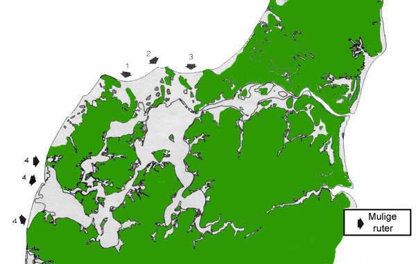
- Map of the coastline about year 1000
- Danish government tour guides
- A description of the town Sårup
- An old map showing the southern part of Hanstholm