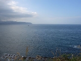
east of China. It is a part of the Pacific Ocean
and covers an area of 1,249,000 km² or 750,000 square miles.
The East China Sea is bounded on the east by the Kyūshū
and Ryukyu Islands
of Japan
, on the south by the island of Taiwan
, and on the west by mainland China
and the Asia
n continent. It is connected with the South China Sea
by the Taiwan Strait
and with the Sea of Japan
by the Korea Strait
; it opens in the north to the Yellow Sea
.
States with borders on the sea (clockwise from north) include: South Korea, Japan, Republic of China (Taiwan)
and the People's Republic of China.
Max depth: 3,000 m.
The International Hydrographic Organization
defines the limits of the "Eastern China Sea (Tung Hai)" as follows:
On the south. The northern limit of the South China SeaSouth China SeaThe South China Sea is a marginal sea that is part of the Pacific Ocean, encompassing an area from the Singapore and Malacca Straits to the Strait of Taiwan of around...
[From Fuki Kaku the north point of FormosaTaiwanTaiwan , also known, especially in the past, as Formosa , is the largest island of the same-named island group of East Asia in the western Pacific Ocean and located off the southeastern coast of mainland China. The island forms over 99% of the current territory of the Republic of China following...
to Kiushan Tao (Turnabout Island)Kiushan TaoKiushan Tao is an island east of China. It is also known as Niushan Dao , Niu Shan, and Turnabout Island. The island forms a part of the boundary between the East China Sea and the South China Sea.-External links:...
on to the south point of Haitan TaoPingtan IslandPingtan Island is located in eastern coastal area in Fujian province, China. It is the largest island in Fujian, and the fifth largest island in China...
(25°25'N) and thence westward on the parallel of 25°24' north to the coast of FukienFujian' , formerly romanised as Fukien or Huguing or Foukien, is a province on the southeast coast of mainland China. Fujian is bordered by Zhejiang to the north, Jiangxi to the west, and Guangdong to the south. Taiwan lies to the east, across the Taiwan Strait...] , thence from Santyo the northeastern point of Formosa to the west point of Yonakuni IslandYonaguniis one of the Yaeyama Islands. It is the westernmost inhabited island of Japan and lies from the east coast of Taiwan, between the East China Sea and the Pacific Ocean proper....
and thence to Haderuma SimaHaterumaHateruma is an island in the Yaeyama District of Okinawa Prefecture, Japan. Part of the town Taketomi, it is the southern-most inhabited island in Japan at 24°2’25” north latitude, 123°47’16” east longitude...
(24°03′N 123°47′E).
On the east. From Haderuma Sima a line including the Miyako Retto
Miyako IslandsThe are a group of islands in Okinawa Prefecture, Japan, east of the Yaeyama Islands.-Islands grouping:*Japanese Archipelago**Nansei Islands***Ryūkyū Shotō****Sakishima Islands*****Miyako Islands-Inhabited islands:*Miyako Islands...
to the east point of Miyako SimaMiyako-jimaMiyakojima is the largest and the most populous island among the Miyako Islands of Okinawa Prefecture, Japan. It lies approximately 400 kilometres east of Taipei, Taiwan...
and thence to Okinan Kaku, the southern extremity of Okinawa SimaOkinawa IslandOkinawa Island is the largest of the Okinawa Islands and the Ryukyu Islands of Japan, and is home to Naha, the capital of Okinawa Prefecture. The island has an area of...
through this island to Ada-Ko Sima (Sidmouth Island) on to the East point of Kikai SimaKikai, Kagoshimais a town located in Ōshima District, Kagoshima, Japan.As of 2008, the town had an estimated population of 8,207 and the density of 144 persons per km². The total area is 56.94 km².Kikai Airport is located in the town....
(28°20'N) through Tanegra SimaTanegashimais an island lying to the south of Kyushu, in southern Japan, and is part of Kagoshima Prefecture. The island is the second largest of the Ōsumi Islands....
(30°30'N) to the north point thereof and on to Hi-Saki (31'17'N) in KyūshūKyushuis the third largest island of Japan and most southwesterly of its four main islands. Its alternate ancient names include , , and . The historical regional name is referred to Kyushu and its surrounding islands....
.
On the north. From Nomo Saki (32°35'N) in Kyusyu to the south point of Hukae Sima (Goto Retto
Goto IslandsThe are Japanese islands in the East China Sea, off the western coast of Kyūshū. The islands are a part of Nagasaki Prefecture.- Geography :There are 140 islands in total, including five main islands:,,,, and....
) and on through this island to Ose Saki (Cape Goto) and to Hunan Kan, the South point of Saisyu ToJeju-doJeju-do is the only special autonomous province of South Korea, situated on and coterminous with the country's largest island. Jeju-do lies in the Korea Strait, southwest of Jeollanam-do Province, of which it was a part before it became a separate province in 1946...
(Quelpart), through this island to its western extreme and thence along the parallel of 33°17' north to the mainland.
On the west. The mainland of China.
The Yangtze River
(Chang Jiang) is the largest river flowing into the East China Sea.
- Senkaku IslandsSenkaku IslandsThe , also known as the Diaoyu Islands or Diaoyutai Islands or the Pinnacle Islands, are a group of disputed uninhabited islands in the East China Sea...
(Japanese) or Diaoyu Islands (Chinese).
east of China. It is a part of the Pacific Ocean
and covers an area of 1,249,000 km² or 750,000 square miles.
Geography
The East China Sea is bounded on the east by the Kyūshūand Ryukyu Islands
of Japan
, on the south by the island of Taiwan
, and on the west by mainland China
and the Asia
n continent. It is connected with the South China Sea
by the Taiwan Strait
and with the Sea of Japan
by the Korea Strait
; it opens in the north to the Yellow Sea
.
States with borders on the sea (clockwise from north) include: South Korea, Japan, Republic of China (Taiwan)
and the People's Republic of China.
Max depth: 3,000 m.
Extent
The International Hydrographic Organizationdefines the limits of the "Eastern China Sea (Tung Hai)" as follows:
On the south. The northern limit of the South China SeaSouth China SeaThe South China Sea is a marginal sea that is part of the Pacific Ocean, encompassing an area from the Singapore and Malacca Straits to the Strait of Taiwan of around...
[From Fuki Kaku the north point of FormosaTaiwanTaiwan , also known, especially in the past, as Formosa , is the largest island of the same-named island group of East Asia in the western Pacific Ocean and located off the southeastern coast of mainland China. The island forms over 99% of the current territory of the Republic of China following...
to Kiushan Tao (Turnabout Island)Kiushan TaoKiushan Tao is an island east of China. It is also known as Niushan Dao , Niu Shan, and Turnabout Island. The island forms a part of the boundary between the East China Sea and the South China Sea.-External links:...
on to the south point of Haitan TaoPingtan IslandPingtan Island is located in eastern coastal area in Fujian province, China. It is the largest island in Fujian, and the fifth largest island in China...
(25°25'N) and thence westward on the parallel of 25°24' north to the coast of FukienFujian' , formerly romanised as Fukien or Huguing or Foukien, is a province on the southeast coast of mainland China. Fujian is bordered by Zhejiang to the north, Jiangxi to the west, and Guangdong to the south. Taiwan lies to the east, across the Taiwan Strait...] , thence from Santyo the northeastern point of Formosa to the west point of Yonakuni IslandYonaguniis one of the Yaeyama Islands. It is the westernmost inhabited island of Japan and lies from the east coast of Taiwan, between the East China Sea and the Pacific Ocean proper....
and thence to Haderuma SimaHaterumaHateruma is an island in the Yaeyama District of Okinawa Prefecture, Japan. Part of the town Taketomi, it is the southern-most inhabited island in Japan at 24°2’25” north latitude, 123°47’16” east longitude...
(24°03′N 123°47′E).
On the east. From Haderuma Sima a line including the Miyako Retto
Miyako IslandsThe are a group of islands in Okinawa Prefecture, Japan, east of the Yaeyama Islands.-Islands grouping:*Japanese Archipelago**Nansei Islands***Ryūkyū Shotō****Sakishima Islands*****Miyako Islands-Inhabited islands:*Miyako Islands...
to the east point of Miyako SimaMiyako-jimaMiyakojima is the largest and the most populous island among the Miyako Islands of Okinawa Prefecture, Japan. It lies approximately 400 kilometres east of Taipei, Taiwan...
and thence to Okinan Kaku, the southern extremity of Okinawa SimaOkinawa IslandOkinawa Island is the largest of the Okinawa Islands and the Ryukyu Islands of Japan, and is home to Naha, the capital of Okinawa Prefecture. The island has an area of...
through this island to Ada-Ko Sima (Sidmouth Island) on to the East point of Kikai SimaKikai, Kagoshimais a town located in Ōshima District, Kagoshima, Japan.As of 2008, the town had an estimated population of 8,207 and the density of 144 persons per km². The total area is 56.94 km².Kikai Airport is located in the town....
(28°20'N) through Tanegra SimaTanegashimais an island lying to the south of Kyushu, in southern Japan, and is part of Kagoshima Prefecture. The island is the second largest of the Ōsumi Islands....
(30°30'N) to the north point thereof and on to Hi-Saki (31'17'N) in KyūshūKyushuis the third largest island of Japan and most southwesterly of its four main islands. Its alternate ancient names include , , and . The historical regional name is referred to Kyushu and its surrounding islands....
.
On the north. From Nomo Saki (32°35'N) in Kyusyu to the south point of Hukae Sima (Goto Retto
Goto IslandsThe are Japanese islands in the East China Sea, off the western coast of Kyūshū. The islands are a part of Nagasaki Prefecture.- Geography :There are 140 islands in total, including five main islands:,,,, and....
) and on through this island to Ose Saki (Cape Goto) and to Hunan Kan, the South point of Saisyu ToJeju-doJeju-do is the only special autonomous province of South Korea, situated on and coterminous with the country's largest island. Jeju-do lies in the Korea Strait, southwest of Jeollanam-do Province, of which it was a part before it became a separate province in 1946...
(Quelpart), through this island to its western extreme and thence along the parallel of 33°17' north to the mainland.
On the west. The mainland of China.
Rivers
The Yangtze River(Chang Jiang) is the largest river flowing into the East China Sea.
Islands and reefs
- Senkaku IslandsSenkaku IslandsThe , also known as the Diaoyu Islands or Diaoyutai Islands or the Pinnacle Islands, are a group of disputed uninhabited islands in the East China Sea...
(Japanese) or Diaoyu Islands (Chinese). Disputed. - Tong Island
There is a cluster of submerged reef
s in the northern East China Sea. These include:
- Socotra RockSocotra RockSocotra Rock is a submerged rock 4.6 meters below sea level located in the East China Sea. The rock is the subject of a territorial dispute between South Korea, which considers it to lie within its exclusive economic zone, referring to it as Ieodo or Parangdo , and China, which considers it to...
, also called Suyan Rock or Ieodo, subject of an EEZ dispute between the People's Republic of China and South Korea. - Hupijiao Rock (虎皮礁)
- Yajiao Rock (鸭礁)
Nomenclature
Within the 19th Century, the sea was known as the Mer de Corée (Sea of Korea) in French, and was one of the three main seas within East Asia, the other two being Mer du Japon (Sea of Japan) to the north and Mer de Chine (Sea of China, today the South China Sea
) to the south.
Until World War II, the sea was referred to as 東支那海 (Higashi Shina Kai; "East Shina
Sea") in Japanese. In 2004, official documents of the Japanese Foreign Ministry and other departments switched to the name 東シナ海 , which has become the standard usage in Japan.
EEZ disputes
There are disputes between the People's Republic of China(PRC), Japan
, and South Korea
over the extent of their respective exclusive economic zone
s.
The dispute between PRC and Japan concerns the different application of UNCLOS II and UNCLOSE III. Japan proposed the 200 nm / Median line division of EEZ based on UNCLOS II. China proposed UNCLOS III which is more favorable to continental nations, which used the continental shelf as the basis for EEZ division.
The People's Republic of China (PRC) recently discovered that there exists an undersea natural gas
field in the East China Sea, part of the field lies within the Chinese EEZ while the remaining lies on the disputed EEZ between Japan and the PRC.

' Law of the Sea
, the PRC claims the disputed ocean territory as its own Exclusive Economic Zone
(EEZ) due to its being part of PRC's natural extension of its continental shelf
, while Japan claims the disputed ocean territory as its own EEZ because it is within 200 nautical miles (370 km) from Japan's coast, and proposed a median line as the boundary between the EEZ of China and Japan. About 40,000 square kilometers of EEZ are in dispute. China and Japan both claim 200 nautical miles EEZ rights, but the East China Sea width is only 360 nautical miles. China claims an EEZ extending to the eastern end of the Chinese continental shelf (based on UNCLOS III) which goes deep into the Japanese's claimed EEZ.
Japan has objected to PRC development of natural gas resources in the East China Sea in an area where the two countries Exclusive Economic Zone
(EEZ) claims overlap. The specific development in dispute is the PRC's drilling in the Chunxiao gas field
, which is located in undisputed areas on China's side, three or four miles (6 km) west of the median line proposed by Japan. Japan maintains that although the Chunxiao gas field rigs are on the PRC side of a median line that Tokyo regards as the two sides' sea boundary, they may tap into a field that stretches underground into the disputed area. Japan therefore seeks a share in the natural gas resources. The Chunxiao gas field in Xihu Sag in the East China Sea is estimated to hold reserves of more than 1.6 tcf
of natural gas
and is expected to become a major producer in the next ten years. Commercial operation was expected to begin in mid-2005 at a production rate of 70 bcf
per year, rising to 282 bcf by 2010. Sinopec Star has reserves of 7 tcf of gas, 1.9 tcf of which is held in the Chunxiao area. This new round of disputes has triggered both official and civilian protests and demonstrations in both countries.
The dispute between PRC and South Korea concerns Socotra Rock
, a submerged reef
on which South Korea has constructed a scientific research station. While neither country claims the rock as territory, the PRC has objected to Korean activities there as a breach of its EEZ rights.
East China Sea in astronomy
Possibly, East China Sea (Donghai in Chinese) is represented with the star Eta Serpentis
in asterism Left Wall, Heavenly Market enclosure
(see Chinese constellation
).
See also
- Geography of ChinaGeography of ChinaChina stretches some across the East Asian landmass bordering the East China Sea, Korea Bay, Yellow Sea, and South China Sea, between North Korea and Vietnam in a changing configuration of broad plains, expansive deserts, and lofty mountain ranges, including vast areas of inhospitable terrain...
- Xihu TroughXihu TroughThe Xihu Trough is a region in the East China Sea, located approximately 400 kilometres east of the cities of Shanghai and Ningbo, China. The region is a repository for natural gas, and consists of the Chunxiao, Tianwaitian, Canxue, Duanqiao, and Pinghue fields...
- Xihu Trough
- Geography of JapanGeography of JapanJapan is an island nation in East Asia comprising a stratovolcanic archipelago extending along the Pacific coast of Asia. Measured from the geographic coordinate system, Japan stretches from 24° to 46° north latitude and from 123° to 146° east longitude...
- Senkaku IslandsSenkaku IslandsThe , also known as the Diaoyu Islands or Diaoyutai Islands or the Pinnacle Islands, are a group of disputed uninhabited islands in the East China Sea...
(Diaoyu Islands in Chinese)
- Senkaku Islands
- South China SeaSouth China SeaThe South China Sea is a marginal sea that is part of the Pacific Ocean, encompassing an area from the Singapore and Malacca Straits to the Strait of Taiwan of around...
External links
- Disputed Claims in the East China Sea, Interview with James Manicom (July 2011)
- Kosuke TakahashiKosuke Takahashiis a Japanese journalist based in Tokyo, who writes in both English and Japanese. He currently works for Asia Times Online, Jane's Defence Weekly, Institutional Investor Magazine and Nikkei CNBC Japan. Previously, he had worked for The Asahi Shimbun and Bloomberg News as staff writer...
. Gas and oil rivalry in the East China Sea Asia Times Online. July 27, 2004. - Chinese submarine enters Japanese waters. Wikinews. November 18, 2004. Retrieved March 7, 2006.
- Oil and gas in troubled waters The Economist. October 6, 2005.
- J Sean Curtin. Stakes rise in Japan, China gas dispute Asia Times Online. October 19, 2005.
- Chinese Suyan Rock community
- Alexander M. Peterson's 2009 Note in the Cornell International Law Journal detailing the dispute, clarifying the legal impact of the 2008 Sino-Japanese arrangement to cooperate in the East China Sea, and proposing increased Sino-Japanese cooperation.