

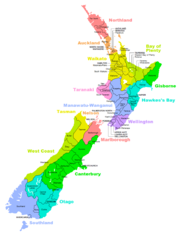
Districts of New Zealand
Encyclopedia
District
Districts are a type of administrative division, in some countries managed by a local government. They vary greatly in size, spanning entire regions or counties, several municipalities, or subdivisions of municipalities.-Austria:...
in New Zealand is a territorial authority area governed by a District Council as a second-tier local government unit. They were formed as a result of local government reforms in 1989.
Districts
There are currently 53 districts:- Ashburton District
- Buller DistrictBuller District200px|rightBuller District, administered by the Buller District Council is an administrative region in the West Coast Region of New Zealand. It covers Westport, Karamea, Reefton and Inangahua Junction. Its land area is 7,953.12 km²...
- Carterton District
- Central Hawke's Bay DistrictCentral Hawke's Bay DistrictCentral Hawke's Bay District is a district located in the North Island of New Zealand. It covers an area of 3,327.92 square kilometres with a population of It covers the area from Pukehou in the north to Takapau in the south, and from the western Ruahine Ranges to the Pacific coast in the...
- Central Otago District
- Clutha DistrictClutha DistrictThe Clutha District is an administrative district of southern New Zealand, with its headquarters in the Otago town of Balclutha. The Clutha District has a land area of 6,362.86 km² and a 2006 census population of 16,839 usual residents...
- Far North DistrictFar North DistrictThe Far North District of New Zealand, as its name suggests, is the northernmost district within New Zealand, consisting of the northern tip of the North Island. The current mayor is Wayne Brown.-Geography:...
- Gisborne District
- Gore DistrictGore, New ZealandGore is a town, surrounding borough, and district in the Southland region of the South Island of New Zealand.-Geography:The Gore District has a land area of 1,251.62 km² and a resident population of...
- Grey DistrictGrey DistrictGrey District Council in the West Coast region of New Zealand is a municipality that covers Greymouth, Runanga, Blackball, Cobden and settlements along the Grey River. It has a land area of 3,516.48 km²...
- Hastings District
- Hauraki DistrictHauraki DistrictThe Hauraki District Council is a municipality in the Waikato Region of New Zealand. The seat of the council is at Paeroa.The area covered by the district extends from the southwest corner of the Firth of Thames southeast towards Te Aroha, although that town lies beyond its boundaries...
- Horowhenua DistrictHorowhenua DistrictHorowhenua is a district on the west coast of the North Island of New Zealand. It forms part of the Manawatu-Wanganui Region.Located north of Wellington and Kapiti, the district stretches from slightly north of the town of Otaki in the south to just south of Himatangi in the north, and from the...
- Hurunui DistrictHurunui DistrictThe Hurunui District is a political district on the east coast of New Zealand's South Island, north of Christchurch, New Zealand. It forms part of the Canterbury region and stretches from the east coast to the main divide. Its land area is ....
- Kaikoura District
- Kaipara DistrictKaipara District-Geography:Kaipara District is located in the low hills around the northern shores of the Kaipara Harbour, a large natural harbour open to the Tasman Sea...
- Kapiti Coast DistrictKapiti Coast DistrictThe Kapiti Coast District is a local government district in the lower North Island of New Zealand 50 km north of Wellington.The district is named after Kapiti Island a prominent landmark 5 km offshore. The population of the district is concentrated in the chain of coastal settlements...
- Kawerau District
- Mackenzie DistrictMackenzie DistrictMackenzie District is a political district in New Zealand's South Island. It is part of the larger Canterbury Region.-Principal settlements:*Fairlie*Twizel*Cave*Mount Cook Village*Albury*TekapoAlso*Burkes Pass-Geography:See Mackenzie Basin,...
- Manawatu DistrictManawatu DistrictThe Manawatu District is a district in the Manawatu-Wanganui Region in the North Island of New Zealand.-Location:"The Manawatu", as it is usually called, is located in the southwest of the island, close to the river which shares its name...
- Marlborough District
- Masterton District
- Matamata-Piako DistrictMatamata-Piako DistrictThe Matamata-Piako District is a local government area in the Waikato region of New Zealand. It lies to the east of the city of Hamilton.The district encompasses the southern end of the Hauraki Plains and much of the Thames Valley, and is bounded in the east by the Kaimai Range...
- New Plymouth DistrictNew Plymouth DistrictNew Plymouth District is one of the districts of New Zealand. It includes the city of New Plymouth and smaller towns such as Inglewood and Waitara....
- Opotiki District
- Otorohanga District
- Queenstown-Lakes District
- Rangitikei DistrictRangitikei DistrictThe Rangitikei District is a Territorial Authority located primarily in the Manawatu-Wanganui Region in the North Island of New Zealand, although a small part, the town of Ngamatea , of it lies in the Hawke's Bay Region...
- Rotorua District
- Ruapehu DistrictRuapehu DistrictRuapehu District is a territorial authority near the centre of New Zealand's North Island.It has an area of 6,730.185 square kilometers and a population of 13,569 at the 2006 census .-Features:...
- Selwyn DistrictSelwyn DistrictThe Selwyn District is a predominantly rural area in central Canterbury, on the east coast of New Zealand's South Island. It is named after the Selwyn River, which is in turn named after Bishop George Selwyn, the first Anglican bishop of New Zealand who, in 1843 and 1844, travelled the length of...
- South Taranaki DistrictSouth Taranaki DistrictSouth Taranaki is a territorial authority on the west coast of New Zealand's North Island that contains the towns of Hawera, Manaia, Opunake, Patea, Eltham, and Waverley...
- South Waikato DistrictSouth Waikato DistrictThe South Waikato District is a municipality in the Waikato region of the North Island of New Zealand. It is located between the cities of Hamilton to the north, Rotorua to the east, Taupo to the south and Ruapehu District to the west....
- South Wairarapa DistrictSouth Wairarapa DistrictSouth Wairarapa District is at the south-east tip of the North Island of New Zealand.-Introduction:South Wairarapa includes three towns and several localities that have a wide range of economic activity, natural features, and visitor attractions, only a few of which are noted here. Martinborough is...
- Southland DistrictSouthland DistrictSouthland District is a territorial authority in the South Island of New Zealand. Southland District covers the majority of the land area of Southland Region, although the region also covers Gore District, Invercargill City and adjacent territorial waters...
- Stratford District
- Tararua DistrictTararua DistrictThe Tararua District lies near the south-east corner of New Zealand's North Island. Created in 1989, it was named after the Tararua Range, which forms much of its western boundary. It has a population of and an area of 4,360.56 km²....
- Tasman District
- Taupo DistrictTaupo DistrictThe Taupo District covers 6,350 km² of land, as well as a further 610 km² of lake area, both in Lake Taupo, New Zealand's largest lake, and also in the smaller Lake Rotoaira. The district stretches from the small town of Mangakino in the northwest to the Tongariro National Park in the...
- Thames-Coromandel DistrictThames-Coromandel DistrictThe Thames-Coromandel District Council in the North Island of New Zealand is seated in the town of Thames. It is located in the region around the Firth of Thames and Coromandel Peninsula, to the southeast of Auckland...
- Timaru District
- Waikato DistrictWaikato DistrictWaikato District is a territorial authority of New Zealand, in the northern part of Waikato Region, North Island. Waikato District is administered by the Waikato District Council, with headquarters in Ngaruawahia....
- Waimakariri DistrictWaimakariri DistrictThe Waimakariri District is a political district of New Zealand, located in the South Island, on the eastern coast of north Canterbury. It is north of Christchurch and the Waimakariri River and is a part of the greater Canterbury region. The name is Māori for cold river.The district was established...
- Waimate District
- Waipa DistrictWaipa DistrictWaipa District Council in the Waikato region of New Zealand is a municipality that covers Te Awamutu, Cambridge and several small towns. The seat of the council is at Te Awamutu. The district's population at the was , of whom approximately 35% lived in each of the main two towns. The district has...
- Wairoa District
- Waitaki DistrictWaitaki DistrictThe Waitaki district, in the Canterbury and Otago regions of New Zealand, straddles the traditional border between the two regions, the Waitaki River. It has a land area of 7,151.94 km² , divided 59.28% to Canterbury Region and 40.72% to Otago Region. It is the only district on the South...
- Waitomo DistrictWaitomo DistrictWaitomo District is a territorial authority in the north of the King Country region in the North Island of New Zealand. A small part of the district, the town of Tiroa, however, lies in the Manawatu-Wanganui region....
- Wanganui District
- Western Bay of Plenty DistrictWestern Bay of Plenty District200px|rightThe Western Bay of Plenty District Council is a municipality in the Bay of Plenty Region of New Zealand. The seat of the district council is at Greerton in Tauranga City...
- Westland DistrictWestland DistrictWestland District is a territorial authority on the west coast of New Zealand's South Island. Its population is - Government :The Westland District is governed by an elected Council, headed by an elected Mayor. The Mayor is elected at large. The current Mayor is Maureen Pugh. Councillors are...
- Whakatane District
- Whangarei DistrictWhangarei DistrictThe Whangarei District is located in Northland, New Zealand. Whangarei is the principal town and the district seat. Other towns include Hukerenui, Hikurangi, Titoki, Ruakaka and Waipu...
- The Tasman, Marlborough and Gisborne Districts are governed by councils that are unitary authoritiesUnitary authorityA unitary authority is a type of local authority that has a single tier and is responsible for all local government functions within its area or performs additional functions which elsewhere in the relevant country are usually performed by national government or a higher level of sub-national...
. - Kaikoura District was transferred from the Nelson-Marlborough Region to the Canterbury Region in 1992.
- Banks Peninsula DistrictBanks Peninsula DistrictThe Banks Peninsula District was a former territorial authority in New Zealand. It amalgamated with the Christchurch City Council in 2006....
became part of ChristchurchChristchurchChristchurch is the largest city in the South Island of New Zealand, and the country's second-largest urban area after Auckland. It lies one third of the way down the South Island's east coast, just north of Banks Peninsula which itself, since 2006, lies within the formal limits of...
as a result of 2005 referendum. - Franklin DistrictFranklin DistrictThe territorial authority of Franklin District was abolished on 31 October 2010 and was divided between Auckland Council in the Auckland Region to the north and Waikato and Hauraki districts in the Waikato Region to the south and east. It was administered from the town of Pukekohe...
, Papakura District and Rodney DistrictRodney DistrictThe Rodney District of New Zealand was a local government area in the northernmost part in New Zealand's Auckland Region, created in 1989 from the amalgamation of Helensville Borough and Rodney County. The seat of the district council is at Orewa, and the district includes Kawau Island to the...
no longer exist as of 2010. They became part of other districts and Auckland RegionAuckland RegionThe Auckland Region was one of the sixteen regions of New Zealand, named for the city of Auckland, the country's largest urban area. With one third of the nation's residents, it was by far the biggest population and economy of any region of New Zealand, but the second-smallest land area.On 1...
.