

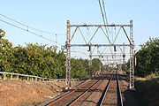
Corridor selection history for Australian High Speed Rail
Encyclopedia
Corridor selection
These include long intercity routes (mainly along the east coast corridor) and shorter inner city routes, such as Sydney to Newcastle, Sydney to Penrith and Sydney to Macarthur.
East Coast corridor
The most frequently studied route for high-speed rail in Australia is between Melbourne, Canberra, Sydney and Brisbane. There are two broad corridor alignment options between each capital city on the route — a coastal and an inland corridor. Each has its own advantages and disadvantages from engineering, environmental, population and national development points of view.- Melbourne—Canberra
- Inland — Exiting Melbourne via the existing Broadmeadows corridor, the line would cross the Dividing Range at SeymourSeymour, VictoriaSeymour is a township in the Shire of Mitchell in the state of Victoria, Australia and is located north of Melbourne. At the 2006 census, Seymour had a population of 6,063...
. It would then join the existing North East railway corridor through BenallaBenalla, VictoriaBenalla is a city of just over 9,000 people located just off the Hume Freeway in north-eastern Victoria, Australia, about southwest of Wangaratta. Its Local Government Area is the Rural City of Benalla.- Overview :...
and WangarattaWangaratta, VictoriaWangaratta is a cathedral city of almost 17,000 people in the northeast of Victoria, Australia, about from Melbourne along the Hume Highway, with Benalla to the southwest, and Albury-Wodonga to the northeast. It is located at the junction of the Ovens and King rivers which flow from the...
, which would require only minimal straightening. AlburyAlbury, New South WalesAlbury is a major regional city in New South Wales, Australia, located on the Hume Highway on the northern side of the Murray River. It is located wholly within the boundaries of the City of Albury Local Government Area...
would be approached either from the east via the River Murray flats, or from the south via a new corridor through BeechworthBeechworth, VictoriaBeechworth is a well-preserved historical town located in the north-east of Victoria, Australia, famous for its major growth during the gold rush days of the mid-1850s...
. North of Albury, there are three options - one is to remain with the Hume Highway corridor through the increasingly dissected countryside through GundagaiGundagai, New South WalesGundagai is a town in New South Wales, Australia. Although a small town, Gundagai is a popular topic for writers and has become a representative icon of a typical Australian country town...
and YassYass, New South WalesYass is a town in the Southern Tablelands of New South Wales, Australia in Yass Valley Shire. The name appears to have been derived from an Aboriginal word, "Yarrh" , said to mean 'running water'....
before entering Canberra from the north. The other options are a more southerly route cutting through the Brindabella RangesBrindabella RangesThe Brindabella Range is a mountain range located on the border between New South Wales and the Australian Capital Territory, Australia. The ranges rise to the west of Canberra, the capital city of Australia, and include the Namadgi National Park in the A.C.T. and Bimberi Nature Reserve and...
direct to Canberra (which would require extensive tunneling), or diverting north along the Main Southern railwayMain Southern railway line, New South WalesThe Main Southern Railway is a major railway in New South Wales, Australia. It runs through the Southern Highlands, Southern Tablelands, South West Slopes and the Riverina regions.- Description of route :...
to service the large regional centre of Wagga WaggaWagga Wagga, New South WalesWagga Wagga is a city in New South Wales, Australia. Straddling the Murrumbidgee River, and with an urban population of 46,735 people, Wagga Wagga is the state's largest inland city, as well as an important agricultural, military, and transport hub of Australia...
. Although this would be a longer route, the engineering costs would be lower due to the less mountainous terrain. After Wagga Wagga, the line would either continue on the Main Southern line to CootamundraCootamundra, New South WalesCootamundra is a town and Local Government Area in the South West Slopes region of New South Wales, Australia and within the Riverina. At the 2006 census, Cootamundra had a population of 5,566. It is located on the Olympic Highway at the point where it crosses the Muttama Creek, between Junee and...
and Yass and enter Canberra from the north, or divert east through the Murrumbidgee RiverMurrumbidgee RiverThe Murrumbidgee River is a major river in the state of New South Wales, Australia, and the Australian Capital Territory . A major tributary of the Murray River, the Murrumbidgee flows in a west-northwesterly direction from the foot of Peppercorn Hill in the Fiery Range of the Snowy Mountains,...
valley to a shorter tunnel beginning at TumutTumut, New South WalesTumut is a town in the Riverina region of New South Wales, Australia, situated on the banks of the Tumut River. Tumut is at the foothills of the Snowy Mountains and is referred to as the gateway to the Snowy Mountains Scheme...
and enter Canberra from the west. Due to the better regional development opportunities along the inland corridor, and perhaps fewer environmental issues, the Arup/TMG study identified this corridor as the preferred alignment. - Coastal — Exiting Melbourne via the broad-gauge Pakenham corridor, the line would traverse the generally flat GippslandGippslandGippsland is a large rural region in Victoria, Australia. It begins immediately east of the suburbs of Melbourne and stretches to the New South Wales border, lying between the Great Dividing Range to the north and Bass Strait to the south...
region, encompassing the towns of TraralgonTraralgon, VictoriaTraralgon is a regional city located in the Latrobe Valley in the Gippsland region of Victoria, Australia. Traralgon is a city within the City of Latrobe....
, SaleSale, VictoriaSale is a city in the Gippsland region of the Australian state of Victoria. It is the seat of the Shire of Wellington as well as the Roman Catholic Diocese of Sale and the Anglican Diocese of Gippsland. It has a population of around 13,336, and is expected to reach a population of 14,000 soon...
, BairnsdaleBairnsdale, VictoriaBairnsdale is a small city in Gippsland, Victoria, Australia. With a population at the 2006 census of 11,282, it is a major regional centre of eastern Victoria along with Traralgon and Sale....
and OrbostOrbost, VictoriaOrbost is a town in the Shire of East Gippsland, Victoria, Australia, located east of Melbourne and south of Canberra where the Princes Highway crosses the Snowy River. It is about from the town of Marlo on the coast of Bass Strait. At the 2006 census, Orbost had a population of 2452...
, before turning north into heavily dissected country. This climb from Gippsland to the Monaro region will necessitate numerous tunnels and viaducts, and possibly a prevailing grade of up to 3.5%. The line would generally follow the Monaro HighwayMonaro HighwayThe Monaro Highway is a state highway in New South Wales, the Australian Capital Territory and Victoria, Australia. The Victorian section was formerly known as the Cann Valley Highway until the 1980s....
to a summit of 1070 m (3,510.5 ft) near NimmitabelNimmitabel, New South WalesNimmitabel is a small town in the Monaro region in southeast New South Wales, Australia, in the Cooma-Monaro Shire Local government area. At the 2006 census, Nimmitabel had a population of 237 people....
, and then continue on to CoomaCooma, New South Wales-Education: is Cooma's only public high school, it serves the town and seven of the neighbouring rural towns and villages such as Berridale, Jindabyne, Nimmitabel, Bredbo and Dalgety....
and QueanbeyanQueanbeyan, New South WalesQueanbeyan is a regional centre in the Southern Tablelands in south-eastern New South Wales adjacent to the Australian Capital Territory. The city's mixed economy is based on light construction, high technology, manufacturing, service, retail and agriculture. It is the council seat of the...
. This alignment must necessarily pass through several National Parks and other regions of environmental significance, which could count against the selection of this corridor. Additionally, a station in central Canberra is difficult to achieve on this alignment; it would most likely have to be located at Canberra Airport or Queanbeyan.
- Inland — Exiting Melbourne via the existing Broadmeadows corridor, the line would cross the Dividing Range at Seymour
- Canberra—Sydney
- Inland — The railway would exit Canberra to the north or east on a new alignment, roughly following the Hume Highway corridor through GoulburnGoulburn, New South WalesGoulburn is a provincial city in the Southern Tablelands of New South Wales, Australia in Goulburn Mulwaree Council Local Government Area. It is located south-west of Sydney on the Hume Highway and above sea-level. On Census night 2006, Goulburn had a population of 20,127 people...
, BowralBowral, New South Wales-Attractions:Bowral is perhaps the best known of the towns and villages of the Southern Highlands, and in recent years has become the commercial centre of the Wingecarribee Shire. Bowral is known for its boutiques, antique stores, gourmet restaurants, and rich coffee culture.Bowral is home to the...
and CampbelltownCampbelltown, New South WalesCampbelltown is a suburb in south-western Sydney, in the state of New South Wales, Australia. Campbelltown is located 51 kilometres south-west of the Sydney central business district and is the administrative centre for the local government area of the City of Campbelltown.- History :Campbelltown...
. Entry to metropolitan Sydney could be effected by utilising the existing East Hills Line via Sydney Airport. - Coastal — This corridor would be the same until Goulburn, where the line would turn east towards WollongongWollongong, New South WalesWollongong is a seaside city located in the Illawarra region of New South Wales, Australia. It lies on the narrow coastal strip between the Illawarra Escarpment and the Pacific Ocean, 82 kilometres south of Sydney...
. This alignment would present major engineering challenges due to having to cross the Illawarra escarpmentIllawarra escarpmentThe Illawarra Escarpment is the fold created cliffs and plateau eroded outcrop mountain range west of the Illawarra coastal plain south of Sydney, Australia, enclosing the region known as the Illawarra which stretches from Stanwell Park in the north to Kiama, Gerringong and the Shoalhaven river in...
twice, necessitating a 40 km (24.9 mi) tunnel on the southern approach, and several tunnels in the order of 10 km (6.2 mi) on the northern exit from Wollongong. The line could then utilise the undeveloped M6 motorway corridor from SutherlandSutherland, New South WalesSutherland is a suburb in southern Sydney, in the state of New South Wales, Australia. Sutherland is located 26 kilometres south of the Sydney central business district and is the administrative centre for the local government area of the Sutherland Shire....
to Sydney AirportSydney AirportSydney Airport may refer to:* Sydney Airport, also known as Kingsford Smith International Airport, in Sydney, Australia* Sydney/J.A. Douglas McCurdy Airport, in Nova Scotia, Canada...
, from which it would use the subway system to reach Central StationCentral railway station, SydneyCentral Railway Station, the largest railway station in Australia, is at the southern end of the Sydney CBD. It services almost all the lines on the CityRail network, and is the major terminus for interurban and interstate rail services...
. Some have suggested an alignment to NowraNowra, New South WalesNowra is a city in the South Coast region of New South Wales, Australia. Located SSW and approximately by road south of the state capital of Sydney, it has an estimated population together with its twin-town of Bomaderry of 34,479. It is also the seat and commercial centre of the City of Shoalhaven...
, thereafter continuing to Wollongong and Sydney,, however the engineering and environmental considerations on such a route would be significant.
- Inland — The railway would exit Canberra to the north or east on a new alignment, roughly following the Hume Highway corridor through Goulburn
- Sydney—Brisbane
- Newcastle leg — Due to the density of existing development and the formidable terrain, there is no easy way of exiting Sydney to the north. One option is to use the North Shore line to reach HornsbyHornsby, New South Wales* Highest Maximum Temperature: 42 °C* Lowest Maximum Temperature: 4.9 °C* Warmest Month: January* Coolest Month: July* Highest Precipitation: February* Lowest Precipitation: July-Notable residents:...
, whereupon a new alignment would follow the existing F3 FreewaySydney-Newcastle FreewayThe Sydney-Newcastle Freeway is a stretch of motorway linking Sydney to the Central Coast, Newcastle and Hunter regions of New South Wales. It is part of the AusLink road corridor between Sydney and Brisbane, carrying the route designation....
corridor, cross Broken BayBroken BayBroken Bay is a large inlet of the Pacific Ocean located about 50 km north of Sydney on the coast of New South Wales, Australia, and is the first major bay north of Sydney's Port Jackson.- Geography :...
via bridge or tunnel and enter Woy WoyWoy Woy, New South WalesWoy Woy is a coastal town and a southern suburb of the Central Coast region of New South Wales, Australia, located on the southern reaches of Brisbane Water north of Sydney...
and GosfordGosford, New South WalesGosford is a city located on the Central Coast of New South Wales, Australia, approximately 76 km north of the Sydney central business district...
via a series of tunnels and viaducts. A second option is to tunnel from North SydneyNorth Sydney, New South WalesNorth Sydney is a suburb and commercial district on the Lower North Shore of Sydney, in the state of New South Wales, Australia. North Sydney is located 3 kilometres north of the Sydney central business district and is the administrative centre for the local government area of North Sydney...
directly to Woy Woy via a 40 km (24.9 mi) tunnel (making it one of the longest tunnels in the world). The alignment would then continue to NewcastleNewcastle, New South WalesThe Newcastle metropolitan area is the second most populated area in the Australian state of New South Wales and includes most of the Newcastle and Lake Macquarie Local Government Areas...
following the existing road and rail corridors. This route could use the iconic Sydney Harbour BridgeSydney Harbour BridgeThe Sydney Harbour Bridge is a steel through arch bridge across Sydney Harbour that carries rail, vehicular, bicycle and pedestrian traffic between the Sydney central business district and the North Shore. The dramatic view of the bridge, the harbour, and the nearby Sydney Opera House is an iconic...
if two of the existing highway lanes were returned to rail use. - Inland — From Newcastle, the line would transit the Hunter ValleyHunter ValleyThe Hunter Region, more commonly known as the Hunter Valley, is a region of New South Wales, Australia, extending from approximately to north of Sydney with an approximate population of 645,395 people. Most of the population of the Hunter Region lives within of the coast, with 55% of the entire...
through SingletonSingleton, New South Wales-Industry & Commerce:Major industries near Singleton include coal mining, energy generation, light industry, vineyards, horse breeding and cattle production. Dairying was once a mainstay in the area, but has declined....
and MuswellbrookMuswellbrook, New South WalesMuswellbrook, a corruption of 'Muscle Brook', is a town and Local Government Area in New South Wales, Australia. The original spelling and etymology of the town's name is a matter of some debate...
before crossing the Divide at ArdglenArdglen, New South WalesArdglen is a village on the Main North railway line and close to the New England Highway on the North West Slopes region of New South Wales, Australia.-History:...
. After TamworthTamworth, New South WalesTamworth is a city in the New England region of New South Wales, Australia. Straddling the Peel River, Tamworth, which contains an estimated population of 47,595 people, is the major regional centre for southern New England and in the local government area of Tamworth Regional Council. The city...
, the line would have to climb to over 1060 metres (3,477.7 ft) above sea level to reach the New England TablelandNew England (Australia)New England or New England North West is the name given to a generally undefined region about 60 kilometres inland, that includes the Northern Tablelands and the North West Slopes regions in the north of the state of New South Wales, Australia.-History:The region has been occupied by Indigenous...
. After ArmidaleArmidale, New South WalesArmidale is a city in the Northern Tablelands, New South Wales, Australia. Armidale Dumaresq Shire had a population of 19,485 people according to the 2006 census. It is the administrative centre for the Northern Tablelands region...
, it would climb even higher (peaking at 1380 metres (4,527.6 ft) above sea level) before reaching Glen InnesGlen Innes, New South WalesGlen Innes is a parish and town on the Northern Tablelands, in the New England region of New South Wales, Australia. It is the centre of the Glen Innes Severn Shire Council. The town is located at the intersection of the New England Highway and the Gwydir Highway...
, TenterfieldTenterfield, New South WalesTenterfield is a town in New South Wales, Australia. It is located in the New England region at the intersection of the New England and Bruxner Highways. Tenterfield is a three-hour drive from Brisbane, 2.5 hours from Byron Bay, two hours from Armidale, New South Wales and 10 hours from Sydney....
, WarwickWarwick, QueenslandWarwick is a town in Queensland, Australia, lying south-west of Brisbane. It is the administrative centre of the Southern Downs Local Government Area. In 2006 the town of Warwick had a population of 12,562....
and ToowoombaToowoomba, QueenslandToowoomba is a city in Southern Queensland, Australia. It is located west of Queensland's capital city, Brisbane. With an estimated district population of 128,600, Toowoomba is Australia's second largest inland city and its largest non-capital inland city...
. The existing rail corridor on the Tableland would require extensive straightening and sections of new alignment. After Toowoomba, a favourable grade (albeit involving several 5–10 km tunnels) would take the railway through IpswichIpswich, QueenslandIpswich is a city in South-East Queensland, Australia. Situated along the Bremer River Valley approximately 40 kilometres away from the state's capital Brisbane. The suburb by the same name forms the city's Central Business District and administrative centre...
and into BrisbaneBrisbaneBrisbane is the capital and most populous city in the Australian state of Queensland and the third most populous city in Australia. Brisbane's metropolitan area has a population of over 2 million, and the South East Queensland urban conurbation, centred around Brisbane, encompasses a population of... - Coastal — This route would follow the coast through TareeTaree, New South WalesTaree is a city on the Mid North Coast, New South Wales, Australia. Taree and nearby Cundletown were settled in 1831 by William Wynter. Since then Taree has grown to a population of around 20,000 people and is the centre of a significant agricultural district. It is 16 km from the sea coast,...
, Port MacquariePort Macquarie, New South WalesPort Macquarie is a city on the Mid North Coast of New South Wales, Australia, located about north of Sydney, and south of Brisbane. The city is located on the coast, at the mouth of the Hastings River, and has an estimated population of 44,313....
, Coffs HarbourCoffs Harbour, New South Wales-History:By the early 1900s, the Coffs Harbour area had become an important timber production centre. Before the opening of the North Coast Railway Line, the only way to transport large items of heavy but low value, such as timber, was by coastal shipping. This meant sawmillers on the North Coast...
, GraftonGrafton, New South WalesThe city of Grafton is the commercial hub of the Clarence River Valley. Established in 1851, Grafton features many historic buildings and tree-lined streets. Located approximately 630 kilometres north of Sydney and 340 km south of Brisbane, Grafton and the Clarence Valley can be reached...
, LismoreLismore, New South WalesLismore is a subtropical town in northeastern New South Wales, Australia. Lismore is the main population centre in the City of Lismore local government area. Lismore is a regional centre in the Northern Rivers region of the State.-History:...
and the Gold CoastGold Coast, QueenslandGold Coast is a coastal city of Australia located in South East Queensland, 94km south of the state capital Brisbane. With a population approximately 540,000 in 2010, it is the second most populous city in the state, the sixth most populous city in the country, and also the most populous...
before entering Brisbane via the Gold Coast railway. Although there are no significant mountains to cross except the escarpment near the Queensland border, there are numerous major estuaries which will require long viaducts. This route is shorter than the inland option, presents less challenging engineering obstacles, and passes through regions of greater population density. For this reason the Arup-TMG study identified it as being slightly preferable to the inland route.
- Newcastle leg — Due to the density of existing development and the formidable terrain, there is no easy way of exiting Sydney to the north. One option is to use the North Shore line to reach Hornsby
Greater Melbourne
In late 2008, TransrapidTransrapid
Transrapid is a German high-speed monorail train using magnetic levitation. Based on a patent from 1934, planning of the Transrapid system started in 1969. The test facility for the system in Emsland, Germany was completed in 1987...
re-entered the Australian high-speed rail debate with a proposal put forward to the Government of Victoria
Government of Victoria
The Government of Victoria, under the Constitution of Australia, ceded certain legislative and judicial powers to the Commonwealth, but retained complete independence in all other areas...
to build a privately funded and operated Maglev line to service the Greater Melbourne metropolitan area. It was presented as an alternative to the Cross-City Tunnel proposed in the Eddington Transport Report
Eddington Transport Report, Victoria
The "" or Eddington Transport Report or Sir Rod Eddington Plan was a major transport study undertaken in Victoria, Australia, by Sir Rod Eddington in 2007 concentrating on solutions for transportation in Melbourne with a primary focus on reducing congestion of road transport in Victoria.The report...
, which neglected to investigate above-ground transport options.
The proposed Maglev would connect the city of Geelong to metropolitan Melbourne's outer suburban growth corridors, Tullamarine and Avalon domestic and international terminals in under 20 minutes, continuing on to Frankston, Victoria
Frankston, Victoria
Frankston is a suburb within the Greater Melbourne metropolitan area in Victoria, Australia. It is located 40 km southeast of the state capital Melbourne at the southernmost edge of Greater Melbourne, near the beginnings of the Mornington Peninsula...
in under 30 minutes. It would service a population of over 4 million, and Transrapid claimed a price of A$4 billion. However, the Victorian government dismissed the proposal in favour of the underground metropolitan network suggested by the Eddington Report.
Noosa-Gold Coast
The 2010 IPA report identified NoosaNoosa, Queensland
The Shire of Noosa was a Local Government Area located about north of Brisbane in the Sunshine Coast region of South East Queensland, Australia...
-Brisbane-Gold Coast
Gold Coast, Queensland
Gold Coast is a coastal city of Australia located in South East Queensland, 94km south of the state capital Brisbane. With a population approximately 540,000 in 2010, it is the second most populous city in the state, the sixth most populous city in the country, and also the most populous...
as a potentially viable high-speed rail link, and a possible precursor to a full east-coast system. The report predicted that a 350kph system would reduce travel times between Cooroy
Cooroy, Queensland
Cooroy is a town in Queensland, Australia, located in the northern Sunshine Coast hinterland about west of Noosa Heads. Cooroy's name came from Cooroy Mountain, which was originally called Coorooey, from the Aboriginal word for possum, kurui....
(22 km west of Noosa) and Brisbane to 31 minutes (currently 2:08 hours), capturing as much as 84% of the total commuter market. Travel time between Brisbane and the Gold Coast would be reduced to 21 minutes, capturing up to 27% of commuters.
Perth-Bunbury
In January 2010, Western Australia's Public Transport Authority completed a feasibility study into a high-speed rail link between PerthPerth, Western Australia
Perth is the capital and largest city of the Australian state of Western Australia and the fourth most populous city in Australia. The Perth metropolitan area has an estimated population of almost 1,700,000....
and Bunbury
Bunbury, Western Australia
The port city of Bunbury is the third largest city in Western Australia after the State Capital Perth and Mandurah. It is situated south of Perth's central business district...
. The proposed route would follow the existing narrow gauge
Narrow gauge
A narrow gauge railway is a railway that has a track gauge narrower than the of standard gauge railways. Most existing narrow gauge railways have gauges of between and .- Overview :...
Mandurah line to Anketell
Anketell, Western Australia
Anketell is a suburb of Perth, Western Australia, located within the Town of Kwinana.Anketell was part of early settler Thomas Peel's land grant, used for the 1920s Group Settlement Scheme in "Peel Estate". It is named after Peel Estate's surveyor, Richard John Anketell....
, and then follow the Kwinana Freeway
Kwinana Freeway
The Kwinana Freeway is a major arterial road in Perth, Western Australia, linking Perth with the southern suburbs and then further on towards Mandurah, a distance of . It has a speed limit of , except in central Perth and south of Lakes Road . Like all Western Australian freeways, the minimum...
and Forrest Highway to Lake Clifton
Lake Clifton, Western Australia
Lake Clifton is a small town located on the east side of the lake of the same name in the Peel region of Western Australia just off the Old Coast Road, between Mandurah and Bunbury at the north end of the Yalgorup National Park...
, including 140 km of new track. It would replace the existing Transwa Australind
Transwa Australind
The Transwa Australind is a diesel railcar train operated by Transwa that runs between Perth, Western Australia, and the south-west city of Bunbury on the South Western Railway . The Australind fleet consists of three powered railcars ADP101, ADP102 and ADP103, with two non-driving trailers ADQ121...
passenger service, which is under increasing use for freight traffic.
The proposed service would have a maximum speed of 160 km/h, at which the travel time from Perth Underground
Perth railway station
Perth Station including Perth Underground is the largest railway station in Perth, Western Australia, and functions as an interchange between the Transperth Trains Armadale / Thornlie, Fremantle, Joondalup, Mandurah and Midland railway lines, as well as the Transwa Australind.-History:The Victorian...
to a new station in central Bunbury would be 91 minutes. However, the notional corridor allows for future upgrade to 200 km/h.