

Cincinnati streetcars
Encyclopedia
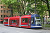
Cincinnati streetcars were the main form of public transportation in Cincinnati, Ohio
at the turn of the twentieth century. The original streetcar system was dismantled in 1951.
In 2007 the city completed a study to determine if installing modern streetcars would be beneficial. On April 23, 2008 Cincinnati City Council approved a plan to build a new streetcar line, and in July 2010 the project secured $25 million in federal funding. The earliest that a new system might open is spring 2013. In 2009 and 2011 the city voted on a referendum to stop the construction of the streetcar project, but in both cases the citizens voted in favor of the project.
).
Cincinnati's first settlers made their home on the large flat basin that now includes downtown
, Over-the-Rhine
, and the West End
. By the 1850s the city's population was too large for the basin alone, and people started moving to the city's surrounding hills. At that time horsecar
s were the main form of transportation, but were inadequate because the animals would fatigue and the hills were impossible to climb in bad weather. Cities with hilly terrain such as Cincinnati and San Francisco began adopting cable cars
because they were faster and more reliable than horses.
The first cable car routes in Cincinnati were on Gilbert Avenue, Mount Auburn, and Vine Street. Cable cars require that the car be pulled by a constantly-running cable hidden under the street. Electricity proved to be cheaper and more reliable than cable cars, which required that the cable be replaced periodically. Consequently, starting on August 17, 1889, the first streetcars
were introduced, and the existing cable cars were converted to electric streetcars or abandoned. The lines grew until there were 222 miles (357.3 km) of streetcar tracks
in Cincinnati and Northern Kentucky
. For decades Cincinnati's streetcar system consistently carried over 100 million passengers a year. Comparatively, in 2000 approximately 25 million people rode Cincinnati's Metro bus system
.
Cincinnati was one of only three cities in North America whose streetcars used double overhead trolley wire
(two wires for each track) and twin trolley pole
s on each streetcar, the only others being Havana
, Cuba
, and the small Merrill, Wisconsin
system. All routes used double trolley wire, the only exception being on route 78, a portion of which outside the city limits had only a single wire for each track. On all other North American streetcar systems the rails served as the return path for the electrical current collected via the trolley pole, but this requires proper bonding of the rails to prevent stray current from escaping and interfering with nearby utility lines, such as telephone lines. In Cincinnati, the primary early streetcar operating company, the Cincinnati Street Railway, chose to install double-wire from the beginning, to save money.
The streetcars were used in conjunction with four of Cincinnati's inclined railways
, the Mount Adams Incline
, Mount Auburn Incline, Bellevue Incline, and Fairview Incline. Except for the Fairview Incline, these originally conveyed horsecars, but were later equipped to carry electric streetcars. The cars would be driven onto the incline platform, which was level and was equipped with rails and (in most cases) overhead trolley wires. The platform, riding on its own rails, would then be pulled up the hill by the cable, carrying the streetcar. Once reaching the top, the streetcar could simply be driven off of the platform, onto the fixed-in-place track along city streets.
The streetcars remained the main form of public transportation for the city until the popularity of the automobile caused ridership to wane. With the creation of Interstates 71 and 75 in the 1940s citizens were able to own more land and still be able to conveniently drive into the city to enjoy its benefits. The streetcars were slowly phased out in favor of buses and trolley buses
, and on April 29, 1951 the last streetcars were retired. The Mount Adams Incline
closed in 1948 when routine inspection in preparation for repairs revealed that the undergirding timbers were dangerously decayed. This was the death knell of the incline, following complaints that it was "unsightly," cost too much, caused roadblocks, and was rendered useless by the automobile. At the time it was closed, the Mount Adams Incline was Cincinnati's top tourist attraction.
The last two streetcar lines, abandoned on April 29, 1951, were routes 21-Westwood-Cheviot and 55-Vine-Clifton. They were converted to trolley buses
—commonly known as "trolley coaches" at that time—as had happened previously with several other streetcar lines. The city's trolley bus system lasted another 14 years, until June 18, 1965.
Cincinnati has been criticized for closing the streetcars and inclines without realizing their potential for tourism dollars. In 1947, San Francisco's cable car system
was threatened with closure for similar reasons. A plan was put in place that would have replaced the city's cable cars with a new "super bus" system, but a public vote saved the cable cars. Today San Francisco's cable cars are vital to the city's tourism industry, carry 7.5 million passengers a year, and generate more than $20 million in fare revenue. Cincinnati mayor Mark Mallory, a supporter of the streetcars, acknowledged the possibility of reinstalling one or more inclines if the new proposal for streetcars is successful enough. The city still owns the rights-of-way where the inclines once sat.
 The streetcar line was conceived as a way to energize housing and development in Over-the-Rhine
, Downtown Cincinnati
, and the "uptown" neighborhoods that surround the University of Cincinnati
. The fundamental goal of the streetcar proposal is to create transit-oriented development
.
At the end of the twentieth century Over-the-Rhine, which is adjacent to downtown, was one of the most economically distressed areas in the United States. Over-the-Rhine's instability was preventing growth and investment in the city's Central Business District
, which, in turn, has been affecting the health of the entire region. Ideally, the streetcar line would attract downtown (and uptown) workers to live near the line, provide economic stimulation and development, and provide transportation for local residents and tourists. The streetcars appeared in Cincinnati's massive 2002 transit plan, MetroMoves
, which was rejected when taken to a public vote.
In July of 2010, the city received a $25 million federal grant, which makes the construction of the streetcar system in the near future almost certain.
was completed in 2007 that focused on a 3.9 miles (6.3 km) loop from The Banks
, through downtown and Over-the-Rhine. According to the study the city would gain between 1,200 and 3,400 additional residences, raise an additional $34,000,000 in property taxes, and yield $17,000,000 in retail activity per year from new residents. Within a quarter mile of the line there are 97 acres (39.3 ha) of surface parking lots along the downtown and Over-the-Rhine line. The potential yield of the parking lots for redevelopment is 3,787 housing units or 7412900 sq ft (688,680.9 m²) of commercial/office/hotel space. The study says lots would create between $54 million and $193 million additional redevelopment per year, with a conservative estimate of $112 million per year. A total property value premium of $379,000,000 plus $1,480,000,000 of redevelopment over 10 years (conservative estimate) would equal a total of $1,911,000,000 of benefits for the city. The study concludes that the benefit-cost ratio
of the downtown and Over-the-Rhine line would be 15.2 to 1, which means for every dollar Cincinnati spends it will receive $15.20 in return. The University of Cincinnati "checked the math" of the study and found that the "projections of the benefits of ridership and economic development" are "credible."
The study projected that a 2010 opening year would draw an estimated 4,600 riders of the downtown and Over-the-Rhine portion of the line each weekday. According to city leaders, if 2 percent of downtown workers, and 2 percent of convention attendees, and 2 percent of Over-the-Rhine residents ride the streetcars it will meet that daily ridership. By 2015 about 6,400 people are estimated to ride the streetcars per weekday. Ridership numbers for the uptown line were not included in the study.
The 2007 study also claims the streetcar system would have four significant economic effects:
The line would start on Freedom Way, near 2nd Street. The line would then travel north on Main Street through downtown until it reached 12th Street in Over-the-Rhine. The line would then turn west on 12th street. The streetcar would continue until it reaches Elm Street, where it would turn north. The line continues heading north until it reaches McMicken Avenue, at which point it would turn south-east a short distance before turning south on Race Street. The line would follow Race Street until it reaches Central Parkway, where it would turn east. The last turn would be south on Walnut Street where it would continue until it returned to Freedom Way.
The south portion of the line, below Central Parkway, would provide service to Cincinnati's Central Business District. Places of interest directly on the line include The Banks
, National Underground Railroad Freedom Center
, Great American Ball Park
, Government Square (Metro's main bus hub)
, Fountain Square
, Aronoff Center
, Contemporary Arts Center
, Mercantile Library of Cincinnati
, Court Street Historic District, and Cincinnati Public Library (Main Library). Other places of interest that are within walking distance of the line are U.S. Bank Arena
, Paul Brown Stadium
, Taft Theatre
, John A. Roebling Suspension Bridge
, Carew Tower/Tower Place Mall
, Piatt Park
, Lytle Park Historic District, Taft Museum, Yeatman's Cove, Sawyer Point, and The Purple People Bridge
. Major employers on or within walking distance the line include Fifth Third Bank
, Procter & Gamble
, Duke Energy
, American Financial Group
, E. W. Scripps Company
, Convergys Corporation, and the Federal Bureau of Investigation
.
The center portion of the line follows Central Parkway and southern Over-the-Rhine, in a small area that is home to much of Cincinnati's performing arts. Places of interest that are directly on the line include Music Hall
(home of the Cincinnati Symphony Orchestra
and the Cincinnati Opera
), Gateway Quarter, Ensemble Theatre, Memorial Hall, Know Theatre
, Emery Theatre
, School for Creative and Performing Arts
, and Washington Park. Kroger Corporate Headquarters
is along this portion of the line.
The northern portion of the line would serve residents of Over-the-Rhine. Places of interest include Findlay Market
and Rookwood Pottery.
, the Cincinnati Zoo, and to the neighborhood of Clifton
. Other extensions include a line through the West End
to Union Terminal
, a line to the East End
neighborhood using an abandoned track, and a line across the Taylor-Southgate Bridge
to Newport on the Levee
in Newport, Kentucky
. The cities of Newport, Kentucky
and Covington, Kentucky
across the Ohio River
officially supports Cincinnati's streetcar proposal, and would like to install a system that links with the Cincinnati system if it is built.
On April 23, 2008 Cincinnati City Council voted 6-2 in favor of building the lines that link downtown, Over-the-Rhine, and uptown. Originally, the city wanted to build the line that connects Over-the-Rhine and downtown in the first phase, and then build the uptown link in a second phase. However, a council majority wanted a mixture of both in the first phase. Opening of the first streetcar line would not take place before 2011 or 2012.
The uptown extension has not yet been finalized, but the most likely candidates are the Vine Street hill or West Clifton Avenue. Vine Street was a path for the original streetcars, but an "extreme hillside" to the west of the street and a city park and an elementary school to the east leaves less land for development when compared to West Clifton Avenue. West Clifton Avenue passes through Clifton Heights, which is one of the densest neighborhoods in the city due to its concentration of UC students. The final path to uptown will be based on whether or not West Clifton Avenue is too steep for streetcar travel, and which path could tap into more federal funding. Other paths to uptown, which are less likely to be chosen, include Ravine Street and Gilbert Avenue.
The money to fund the $102 million Downtown/Over-the-Rhine line would be attained from a variety of sources. Of those, $25 million would come from capital bonds; $25 million from tax increment financing
from downtown property taxes; $31 million from private contributors, partners and sponsors; $11 million from proceeds from the sale of the Blue Ash Airport; and $10 million from state grants. The remaining $80 million to $85 million for the full Uptown system was planned to be built later, mostly with federal funds. However, after city council approved the streetcar plan they decided to look for an additional $35 million to "get up the hill" to the University of Cincinnati. (Engineering and construction costs for the uphill portion of the line would cost more than the portion of the line built on flat land.) The $35 million would only take the streetcars up to the University, that money would not extend it to the Cincinnati Zoo.
Annual operating costs were estimated between $2.0 and $2.7 million per year for the Downtown/Over-the-Rhine line. The estimate includes labor for streetcar operators, for maintenance of the streetcars, track and other facilities, and for ongoing management and administration of the service. A portion of the cost would be covered by a fare, if there is one. The fare policy has not been decided and could cost anywhere from "the current local bus fare" ($1.50 as of 2009) to free. According to City Council member Chris Bortz, the remaining operating cost could be covered by a variety of means, the most likely being revenue from advertisements inside and/or outside the streetcar—similar to how ads are done with Cincinnati's bus system.
Due to the severe economic downturn of 2008 and 2009 the city has had trouble raising the full $35 million needed from private sources. (Duke Energy has promised to donate $3.5 million.) City officials have made several trips to Washington to lobby for federal money for the streetcar system.
As of May 2010 the city has raised over 90 million in funds, and expects federal grants in the summer of 2010 to cover the remaining cost.
s COAST (Coalition Opposed to Additional Spending and Taxes) and the Cincinnati NAACP both oppose the streetcar system. Both groups gathered signatures for a ballot initiative that would amend the city's charter and force a public vote on the streetcars. However, the amendment would affect more than just streetcars forcing a public vote on any rail-based system including the proposed high-speed rail that connects Cincinnati to Columbus
and Cleveland
, and potentially even the "Safari Train" at the Cincinnati Zoo
. Since the amendment is usually described as a vote on the streetcars CityBeat
has suggested the amendment is "deceptive" and an attempt to reverse "COAST's waning political influence" in the city. (COAST has been described as "rabidly anti-mass transit.") The Cincinnati Enquirer
, who believes the city is not ready for streetcars, called the proposed amendment a "poison pill" that is "DECEPTIVE in its language and intent."
A political action committee
called Cincinnatians for Progress was formed to oppose the amendment proposed by COAST and the NAACP. According to Cincinnatians for Progress, the amendment would unnecessarily delay projects by 10 to 12 months while the city waits on a public vote, and put Cincinnati at a competitive disadvantage with other cities.. In the November 3, 2009 local elections however, this city charter amendment proposal failed, losing 56% to 44%.
The Cincinnati Enquirer endorsed a "No" vote on Issue 48, stating, "we vigorously oppose Issue 48 and urge voters to reject it. ... Issue 48 is a bad, bad, bad idea." According to "a majority of legal experts" interviewed by the Cincinnati Enquirer, Issue 48 "is written so broadly it could stop other rail projects in the city." Non-streetcar commuter rail projects that may be affected include the county-backed Eastern Rail Corridor project, which plans to connect the eastern suburbs to downtown using an abandoned rail line. Others who endorsed a "No" vote were Cincinnati CityBeat,, League of Women Voters of the Cincinnati Area,, and former leaders of the local NAACP.
Issue 48 was defeated 52% to 48% on November 8, 2011. This, along with Cincinnati electing a more progressive city council, is expected to allow the streetcar project to proceed.
Ohio
Ohio is a Midwestern state in the United States. The 34th largest state by area in the U.S.,it is the 7th‑most populous with over 11.5 million residents, containing several major American cities and seven metropolitan areas with populations of 500,000 or more.The state's capital is Columbus...
at the turn of the twentieth century. The original streetcar system was dismantled in 1951.
In 2007 the city completed a study to determine if installing modern streetcars would be beneficial. On April 23, 2008 Cincinnati City Council approved a plan to build a new streetcar line, and in July 2010 the project secured $25 million in federal funding. The earliest that a new system might open is spring 2013. In 2009 and 2011 the city voted on a referendum to stop the construction of the streetcar project, but in both cases the citizens voted in favor of the project.
Historic streetcar system
The track gauge was (Pennsylvania trolley gaugePennsylvania trolley gauge
A number of North American streetcar lines intentionally varied from standard gauge. This may have been to make the streetcar companies less-tempting targets for takeovers by the steam railroads , which would be unable to run their trains over the streetcar tracks...
).
Cincinnati's first settlers made their home on the large flat basin that now includes downtown
Downtown Cincinnati
Downtown Cincinnati is the central business district of Cincinnati, Ohio, and one of its 52 neighborhoods.-Geography:Downtown Cincinnati's streets are arranged in a grid configuration. It is bisected by Vine Street....
, Over-the-Rhine
Over-the-Rhine
Over-the-Rhine, sometimes shortened to OTR, is a neighborhood in Cincinnati, Ohio. It is believed to be the largest, most intact urban historic district in the United States. Over-the-Rhine was added to the National Register of Historic Places in 1983 with 943 contributing buildings...
, and the West End
West End, Cincinnati, Ohio
West End is a neighborhood in Cincinnati, Ohio, located north-west of downtown, east of Queensgate, west of Over-the-Rhine, and south-east of Fairview....
. By the 1850s the city's population was too large for the basin alone, and people started moving to the city's surrounding hills. At that time horsecar
Horsecar
A horsecar or horse-drawn tram is an animal-powered streetcar or tram.These early forms of public transport developed out of industrial haulage routes that had long been in existence, and from the omnibus routes that first ran on public streets in the 1820s, using the newly improved iron or steel...
s were the main form of transportation, but were inadequate because the animals would fatigue and the hills were impossible to climb in bad weather. Cities with hilly terrain such as Cincinnati and San Francisco began adopting cable cars
Cable car (railway)
A cable car or cable railway is a mass transit system using rail cars that are hauled by a continuously moving cable running at a constant speed. Individual cars stop and start by releasing and gripping this cable as required...
because they were faster and more reliable than horses.
The first cable car routes in Cincinnati were on Gilbert Avenue, Mount Auburn, and Vine Street. Cable cars require that the car be pulled by a constantly-running cable hidden under the street. Electricity proved to be cheaper and more reliable than cable cars, which required that the cable be replaced periodically. Consequently, starting on August 17, 1889, the first streetcars
Tram
A tram is a passenger rail vehicle which runs on tracks along public urban streets and also sometimes on separate rights of way. It may also run between cities and/or towns , and/or partially grade separated even in the cities...
were introduced, and the existing cable cars were converted to electric streetcars or abandoned. The lines grew until there were 222 miles (357.3 km) of streetcar tracks
Tramway track
Tramway track is used on tramways or light rail operations. Grooved rails are often used in order to make street running feasible...
in Cincinnati and Northern Kentucky
Northern Kentucky
Northern Kentucky is the name often given to the northernmost counties in Kentucky...
. For decades Cincinnati's streetcar system consistently carried over 100 million passengers a year. Comparatively, in 2000 approximately 25 million people rode Cincinnati's Metro bus system
Southwest Ohio Regional Transit Authority
Southwest Ohio Regional Transit Authority , is the public transport agency serving Cincinnati, Ohio and its suburbs. The agency operates transit bus services under the name Metro...
.
Cincinnati was one of only three cities in North America whose streetcars used double overhead trolley wire
Overhead lines
Overhead lines or overhead wires are used to transmit electrical energy to trams, trolleybuses or trains at a distance from the energy supply point...
(two wires for each track) and twin trolley pole
Trolley pole
A trolley pole is a tapered cylindrical pole of wood or metal, used to transfer electricity from a "live" overhead wire to the control and propulsion equipment of a tram or trolley bus. The use of overhead wire in a system of current collection is reputed to be the 1880 invention of Frank J....
s on each streetcar, the only others being Havana
Havana
Havana is the capital city, province, major port, and leading commercial centre of Cuba. The city proper has a population of 2.1 million inhabitants, and it spans a total of — making it the largest city in the Caribbean region, and the most populous...
, Cuba
Cuba
The Republic of Cuba is an island nation in the Caribbean. The nation of Cuba consists of the main island of Cuba, the Isla de la Juventud, and several archipelagos. Havana is the largest city in Cuba and the country's capital. Santiago de Cuba is the second largest city...
, and the small Merrill, Wisconsin
Merrill Railway & Lighting Co.
The Merrill Railway & Lighting Co was set up in 1889. During the first months of operation, problems with poor bonding of the track led to the electrocution of several animals. This led the company to develop the first use by a trolley company of a second suspended wire for return power.The company...
system. All routes used double trolley wire, the only exception being on route 78, a portion of which outside the city limits had only a single wire for each track. On all other North American streetcar systems the rails served as the return path for the electrical current collected via the trolley pole, but this requires proper bonding of the rails to prevent stray current from escaping and interfering with nearby utility lines, such as telephone lines. In Cincinnati, the primary early streetcar operating company, the Cincinnati Street Railway, chose to install double-wire from the beginning, to save money.
The streetcars were used in conjunction with four of Cincinnati's inclined railways
Funicular
A funicular, also known as an inclined plane or cliff railway, is a cable railway in which a cable attached to a pair of tram-like vehicles on rails moves them up and down a steep slope; the ascending and descending vehicles counterbalance each other.-Operation:The basic principle of funicular...
, the Mount Adams Incline
Mount Adams Incline
The Mount Adams Incline was a funicular, or inclined plane, located in the Cincinnati neighborhood of Mount Adams. Completed in 1872, it was the longest-running of the city's five inclines, closing in 1948. It has since been demolished.-External links:**...
, Mount Auburn Incline, Bellevue Incline, and Fairview Incline. Except for the Fairview Incline, these originally conveyed horsecars, but were later equipped to carry electric streetcars. The cars would be driven onto the incline platform, which was level and was equipped with rails and (in most cases) overhead trolley wires. The platform, riding on its own rails, would then be pulled up the hill by the cable, carrying the streetcar. Once reaching the top, the streetcar could simply be driven off of the platform, onto the fixed-in-place track along city streets.
The streetcars remained the main form of public transportation for the city until the popularity of the automobile caused ridership to wane. With the creation of Interstates 71 and 75 in the 1940s citizens were able to own more land and still be able to conveniently drive into the city to enjoy its benefits. The streetcars were slowly phased out in favor of buses and trolley buses
Trolleybus
A trolleybus is an electric bus that draws its electricity from overhead wires using spring-loaded trolley poles. Two wires and poles are required to complete the electrical circuit...
, and on April 29, 1951 the last streetcars were retired. The Mount Adams Incline
Mount Adams Incline
The Mount Adams Incline was a funicular, or inclined plane, located in the Cincinnati neighborhood of Mount Adams. Completed in 1872, it was the longest-running of the city's five inclines, closing in 1948. It has since been demolished.-External links:**...
closed in 1948 when routine inspection in preparation for repairs revealed that the undergirding timbers were dangerously decayed. This was the death knell of the incline, following complaints that it was "unsightly," cost too much, caused roadblocks, and was rendered useless by the automobile. At the time it was closed, the Mount Adams Incline was Cincinnati's top tourist attraction.
The last two streetcar lines, abandoned on April 29, 1951, were routes 21-Westwood-Cheviot and 55-Vine-Clifton. They were converted to trolley buses
Trolleybus
A trolleybus is an electric bus that draws its electricity from overhead wires using spring-loaded trolley poles. Two wires and poles are required to complete the electrical circuit...
—commonly known as "trolley coaches" at that time—as had happened previously with several other streetcar lines. The city's trolley bus system lasted another 14 years, until June 18, 1965.
Cincinnati has been criticized for closing the streetcars and inclines without realizing their potential for tourism dollars. In 1947, San Francisco's cable car system
San Francisco cable car system
The San Francisco cable car system is the world's last permanently operational manually operated cable car system, in the US sense of a tramway whose cars are pulled along by cables embedded in the street. It is an icon of San Francisco, California...
was threatened with closure for similar reasons. A plan was put in place that would have replaced the city's cable cars with a new "super bus" system, but a public vote saved the cable cars. Today San Francisco's cable cars are vital to the city's tourism industry, carry 7.5 million passengers a year, and generate more than $20 million in fare revenue. Cincinnati mayor Mark Mallory, a supporter of the streetcars, acknowledged the possibility of reinstalling one or more inclines if the new proposal for streetcars is successful enough. The city still owns the rights-of-way where the inclines once sat.
Modern streetcar proposal
Over-the-Rhine
Over-the-Rhine, sometimes shortened to OTR, is a neighborhood in Cincinnati, Ohio. It is believed to be the largest, most intact urban historic district in the United States. Over-the-Rhine was added to the National Register of Historic Places in 1983 with 943 contributing buildings...
, Downtown Cincinnati
Downtown Cincinnati
Downtown Cincinnati is the central business district of Cincinnati, Ohio, and one of its 52 neighborhoods.-Geography:Downtown Cincinnati's streets are arranged in a grid configuration. It is bisected by Vine Street....
, and the "uptown" neighborhoods that surround the University of Cincinnati
University of Cincinnati
The University of Cincinnati is a comprehensive public research university in Cincinnati, Ohio, and a part of the University System of Ohio....
. The fundamental goal of the streetcar proposal is to create transit-oriented development
Transit-oriented development
A transit-oriented development is a mixed-use residential or commercial area designed to maximize access to public transport, and often incorporates features to encourage transit ridership...
.
At the end of the twentieth century Over-the-Rhine, which is adjacent to downtown, was one of the most economically distressed areas in the United States. Over-the-Rhine's instability was preventing growth and investment in the city's Central Business District
Central business district
A central business district is the commercial and often geographic heart of a city. In North America this part of a city is commonly referred to as "downtown" or "city center"...
, which, in turn, has been affecting the health of the entire region. Ideally, the streetcar line would attract downtown (and uptown) workers to live near the line, provide economic stimulation and development, and provide transportation for local residents and tourists. The streetcars appeared in Cincinnati's massive 2002 transit plan, MetroMoves
MetroMoves
MetroMoves was a 2002 proposal by the Southwest Ohio Regional Transit Authority to expand and improve public transportation in the greater Cincinnati metropolitan area. The 30-year vision included the addition of light rail lines, commuter rail lines, streetcars in the downtown area, and expanded...
, which was rejected when taken to a public vote.
In July of 2010, the city received a $25 million federal grant, which makes the construction of the streetcar system in the near future almost certain.
Feasibility study
A feasibility studyFeasibility study
Feasibility studies aim to objectively and rationally uncover the strengths and weaknesses of the existing business or proposed venture, opportunities and threats as presented by the environment, the resources required to carry through, and ultimately the prospects for success. In its simplest...
was completed in 2007 that focused on a 3.9 miles (6.3 km) loop from The Banks
The Banks
The Banks is the name given to the current mixed-use project being developed on the land between Paul Brown Stadium and Great American Ball Park along the Ohio River in Cincinnati, Ohio.-History:...
, through downtown and Over-the-Rhine. According to the study the city would gain between 1,200 and 3,400 additional residences, raise an additional $34,000,000 in property taxes, and yield $17,000,000 in retail activity per year from new residents. Within a quarter mile of the line there are 97 acres (39.3 ha) of surface parking lots along the downtown and Over-the-Rhine line. The potential yield of the parking lots for redevelopment is 3,787 housing units or 7412900 sq ft (688,680.9 m²) of commercial/office/hotel space. The study says lots would create between $54 million and $193 million additional redevelopment per year, with a conservative estimate of $112 million per year. A total property value premium of $379,000,000 plus $1,480,000,000 of redevelopment over 10 years (conservative estimate) would equal a total of $1,911,000,000 of benefits for the city. The study concludes that the benefit-cost ratio
Benefit-cost ratio
A benefit-cost ratio is an indicator, used in the formal discipline of cost-benefit analysis, that attempts to summarize the overall value for money of a project or proposal. A BCR is the ratio of the benefits of a project or proposal, expressed in monetary terms, relative to its costs, also...
of the downtown and Over-the-Rhine line would be 15.2 to 1, which means for every dollar Cincinnati spends it will receive $15.20 in return. The University of Cincinnati "checked the math" of the study and found that the "projections of the benefits of ridership and economic development" are "credible."
The study projected that a 2010 opening year would draw an estimated 4,600 riders of the downtown and Over-the-Rhine portion of the line each weekday. According to city leaders, if 2 percent of downtown workers, and 2 percent of convention attendees, and 2 percent of Over-the-Rhine residents ride the streetcars it will meet that daily ridership. By 2015 about 6,400 people are estimated to ride the streetcars per weekday. Ridership numbers for the uptown line were not included in the study.
The 2007 study also claims the streetcar system would have four significant economic effects:
- Customer base and customer access will expand for existing businesses.
- Improved market values of existing properties.
- Catalyst for new transit-oriented development where less parking is required.
- Supporting neighborhoods by making them more walkable.
Route
The streetcar route would connect various Cincinnati landmarks and businesses to 92 acres (372,311.1 m²) of surface parking and dozens of abandoned or underused buildings. According to city leaders the parking lots and abandoned buildings are "ripe for redevelopment."The line would start on Freedom Way, near 2nd Street. The line would then travel north on Main Street through downtown until it reached 12th Street in Over-the-Rhine. The line would then turn west on 12th street. The streetcar would continue until it reaches Elm Street, where it would turn north. The line continues heading north until it reaches McMicken Avenue, at which point it would turn south-east a short distance before turning south on Race Street. The line would follow Race Street until it reaches Central Parkway, where it would turn east. The last turn would be south on Walnut Street where it would continue until it returned to Freedom Way.
The south portion of the line, below Central Parkway, would provide service to Cincinnati's Central Business District. Places of interest directly on the line include The Banks
The Banks
The Banks is the name given to the current mixed-use project being developed on the land between Paul Brown Stadium and Great American Ball Park along the Ohio River in Cincinnati, Ohio.-History:...
, National Underground Railroad Freedom Center
National Underground Railroad Freedom Center
The National Underground Railroad Freedom Center is a museum in downtown Cincinnati, Ohio based on the history of the Underground Railroad. The Center also pays tribute to all efforts to "abolish human enslavement and secure freedom for all people." Billed as part of a new group of "museums of...
, Great American Ball Park
Great American Ball Park
The Great American Ball Park is a Major League Baseball park in Cincinnati, Ohio. It is the home of the National League's Cincinnati Reds. It opened in 2003, replacing the Reds' former home, Cinergy Field, which was known as Riverfront Stadium from its opening in June 1970 until the 1996...
, Government Square (Metro's main bus hub)
Southwest Ohio Regional Transit Authority
Southwest Ohio Regional Transit Authority , is the public transport agency serving Cincinnati, Ohio and its suburbs. The agency operates transit bus services under the name Metro...
, Fountain Square
Fountain Square, Cincinnati
Fountain Square is a city square in Cincinnati. Founded in 1871, it was renovated in 1971 and 2005 and currently features many shops, restaurants, hotels, and offices.- History :...
, Aronoff Center
Aronoff Center
The Aronoff Center is a large performing arts center in downtown Cincinnati, Ohio. Events that can typically be found at the Aronoff Center include: plays, ballet, popular music concerts, stand-up comedy shows, and musicals...
, Contemporary Arts Center
Contemporary Arts Center
The Contemporary Arts Center is a pioneering contemporary art museum located in Cincinnati, Ohio. The CAC is a non-collecting museum that focuses on new developments in painting, sculpture, photography, architecture, performance art and new media...
, Mercantile Library of Cincinnati
Mercantile Library of Cincinnati
The Mercantile Library of Cincinnati is a membership library located in downtown Cincinnati, Ohio. The name of the Library refers not to the type of items in its collection but to the forty-five merchants and clerks who founded it on April 18, 1835 as the Young Men's Mercantile Library Association...
, Court Street Historic District, and Cincinnati Public Library (Main Library). Other places of interest that are within walking distance of the line are U.S. Bank Arena
U.S. Bank Arena
U.S. Bank Arena is an indoor arena, located in downtown Cincinnati, Ohio, along the banks of the Ohio River, next to the Great American Ball Park. Completed in September 1975, the arena seats 17,556 people...
, Paul Brown Stadium
Paul Brown Stadium
Paul Brown Stadium is an American sports stadium located in Cincinnati, Ohio. It is the home venue of the Cincinnati Bengals of the National Football League. It opened on August 19, 2000. The stadium was named after Bengals' founder Paul Brown. The stadium is located on approximately of land and...
, Taft Theatre
Taft Theatre
The Taft Theatre is a 2,500-seat theater, located in Cincinnati, Ohio, at 317 East Fifth Street. The theatre was built in 1928, as evidenced by its Art Deco interior. All seats are unobstructed, giving every seat a clear view of the stage. It is part of the Masonic Temple Building at Fifth and...
, John A. Roebling Suspension Bridge
John A. Roebling Suspension Bridge
The John A. Roebling Suspension Bridge spans the Ohio River between Cincinnati, Ohio and Covington, Kentucky. When the first pedestrians crossed on December 1, 1866, it was the longest suspension bridge in the world at 1,057 feet main span. Today, many pedestrians use the bridge to get between...
, Carew Tower/Tower Place Mall
Carew Tower
Carew Tower is the second tallest building in Cincinnati, Ohio, United States. However, it is still the highest elevated building in the city. The Great American Insurance building is only taller because of the basement. Completed in 1930, it stands 49 stories tall in the heart of downtown,...
, Piatt Park
Piatt Park
Piatt Park , is the oldest park in Cincinnati, Ohio. It stretches two blocks between Elm Street and Vine Street on Garfield Place/8th Street. The park is owned and maintained by the Cincinnati Park Board.-History:...
, Lytle Park Historic District, Taft Museum, Yeatman's Cove, Sawyer Point, and The Purple People Bridge
Newport Southbank Bridge
The Newport Southbank Bridge stretches 2,670 feet over the Ohio River, connecting Newport, Kentucky to downtown Cincinnati, Ohio.- History :...
. Major employers on or within walking distance the line include Fifth Third Bank
Fifth Third Bank
Fifth Third Bank is a U.S. regional banking corporation, headquartered in Cincinnati, Ohio and is the principal subsidiary of holding company Fifth Third Bancorp ....
, Procter & Gamble
Procter & Gamble
Procter & Gamble is a Fortune 500 American multinational corporation headquartered in downtown Cincinnati, Ohio and manufactures a wide range of consumer goods....
, Duke Energy
Duke Energy
Duke Energy , headquartered in Charlotte, North Carolina, is an energy company with assets in the United States, Canada and Latin America.-Overview:...
, American Financial Group
American Financial Group
American Financial Group Incorporated is a holding company based in Cincinnati, Ohio whose primary business is insurance and investments. American Financial Group's purpose is to enable businesses and individuals to manage risk using insurance products and services tailored to meet their specific...
, E. W. Scripps Company
E. W. Scripps Company
The E. W. Scripps Company is an American media conglomerate founded by Edward W. Scripps on November 2, 1878. The company is headquartered inside the Scripps Center in Cincinnati, Ohio. Its corporate motto is "Give light and the people will find their own way."On October 16, 2007, the company...
, Convergys Corporation, and the Federal Bureau of Investigation
Federal Bureau of Investigation
The Federal Bureau of Investigation is an agency of the United States Department of Justice that serves as both a federal criminal investigative body and an internal intelligence agency . The FBI has investigative jurisdiction over violations of more than 200 categories of federal crime...
.
The center portion of the line follows Central Parkway and southern Over-the-Rhine, in a small area that is home to much of Cincinnati's performing arts. Places of interest that are directly on the line include Music Hall
Music Hall (Cincinnati)
Music Hall, completed in 1878, is Cincinnati's premier classical music performance hall. It serves as the home for the Cincinnati Symphony Orchestra, Cincinnati Opera, May Festival Chorus, and the Cincinnati Pops Orchestra. In January, 1975, it was recognized as a National Historic Landmark by the...
(home of the Cincinnati Symphony Orchestra
Cincinnati Symphony Orchestra
As the fifth oldest orchestra in the United States, the Cincinnati Symphony Orchestra has a legacy of fine music making as reflected in its performances in historic Music Hall, recordings, and international tours...
and the Cincinnati Opera
Cincinnati Opera
Cincinnati Opera is an American opera company based in Cincinnati, Ohio and the second oldest opera company in the United States .-History:...
), Gateway Quarter, Ensemble Theatre, Memorial Hall, Know Theatre
Know Theatre of Cincinnati
Know Theatre of Cincinnati is a non-profit theatre company located in the historical Over-the-Rhine neighborhood of Cincinnati, Ohio, which produces contemporary and collaborative theatre that tends to be edgy, challenging, and thought-provoking. Season performances occur in a 99-seat versatile...
, Emery Theatre
Emery Theatre
The Emery Theatre, or Emery Auditorium, is a historic, acoustically exceptional theater located in the Over-the-Rhine neighborhood of Cincinnati, Ohio...
, School for Creative and Performing Arts
School for Creative and Performing Arts
The School for Creative and Performing Arts is a magnet arts school in Cincinnati, Ohio, United States, and part of the Cincinnati Public Schools...
, and Washington Park. Kroger Corporate Headquarters
Kroger
The Kroger Co. is an American supermarket chain founded by Bernard Kroger in 1883 in Cincinnati, Ohio. It reported US$ 76.7 billion in sales during fiscal year 2009. It is the country's largest grocery store chain and its second-largest grocery retailer by volume and second-place general retailer...
is along this portion of the line.
The northern portion of the line would serve residents of Over-the-Rhine. Places of interest include Findlay Market
Findlay Market
Findlay Market in historic Over-the-Rhine, Cincinnati, Ohio, is the state's oldest continuously operated public market. The Findlay Market Building was listed on the National Register of Historic Places on June 5, 1972...
and Rookwood Pottery.
Line extensions
The feasibility study suggested the possibility of several extensions or future additions including a line through Cincinnati's "uptown" neighborhoods to the University of CincinnatiUniversity of Cincinnati
The University of Cincinnati is a comprehensive public research university in Cincinnati, Ohio, and a part of the University System of Ohio....
, the Cincinnati Zoo, and to the neighborhood of Clifton
Clifton, Cincinnati, Ohio
Clifton, incorporated as a village in 1850, is now a neighborhood in the north central part of Cincinnati, Ohio, United States. The area includes the Ludlow Avenue Shopping and Dining District. Clifton is situated around Clifton Avenue, north of Dixmyth Avenue, approximately three miles north of...
. Other extensions include a line through the West End
West End, Cincinnati, Ohio
West End is a neighborhood in Cincinnati, Ohio, located north-west of downtown, east of Queensgate, west of Over-the-Rhine, and south-east of Fairview....
to Union Terminal
Cincinnati Museum Center at Union Terminal
The Cincinnati Museum Center at Union Terminal, originally Cincinnati Union Terminal, is a passenger railroad station in the Queensgate neighborhood of Cincinnati, Ohio, United States...
, a line to the East End
East End, Cincinnati, Ohio
East End is a neighborhood in Cincinnati, Ohio. It is the location of the Cincinnati Municipal Lunken Airport and Columbia Parkway....
neighborhood using an abandoned track, and a line across the Taylor-Southgate Bridge
Taylor-Southgate Bridge
The Taylor–Southgate Bridge is a continuous truss bridge that was built in 1995. It has a main span of 850 feet , and a total span of 1850 feet . The bridge carries U.S...
to Newport on the Levee
Newport on the Levee
Newport on the Levee is a lifestyle center located on Third Street in Newport, Kentucky. It is located adjacent to the Purple People Bridge along the Ohio River and has a view of Cincinnati. The Levee is only one block away from the East Row Historic District and the Monmouth Street Historic District...
in Newport, Kentucky
Newport, Kentucky
Newport is a city in Campbell County, Kentucky, United States, at the confluence of the Ohio and Licking rivers. The population was 15,273 at the 2010 census. Historically, it was one of four county seats of Campbell County. Newport is part of the Greater Cincinnati, Ohio Metro Area which...
. The cities of Newport, Kentucky
Newport, Kentucky
Newport is a city in Campbell County, Kentucky, United States, at the confluence of the Ohio and Licking rivers. The population was 15,273 at the 2010 census. Historically, it was one of four county seats of Campbell County. Newport is part of the Greater Cincinnati, Ohio Metro Area which...
and Covington, Kentucky
Covington, Kentucky
-Demographics:As of the census of 2000, there were 43,370 people, 18,257 households, and 10,132 families residing in the city. The population density was 3,301.3 people per square mile . There were 20,448 housing units at an average density of 1,556.5 per square mile...
across the Ohio River
Ohio River
The Ohio River is the largest tributary, by volume, of the Mississippi River. At the confluence, the Ohio is even bigger than the Mississippi and, thus, is hydrologically the main stream of the whole river system, including the Allegheny River further upstream...
officially supports Cincinnati's streetcar proposal, and would like to install a system that links with the Cincinnati system if it is built.
On April 23, 2008 Cincinnati City Council voted 6-2 in favor of building the lines that link downtown, Over-the-Rhine, and uptown. Originally, the city wanted to build the line that connects Over-the-Rhine and downtown in the first phase, and then build the uptown link in a second phase. However, a council majority wanted a mixture of both in the first phase. Opening of the first streetcar line would not take place before 2011 or 2012.
The uptown extension has not yet been finalized, but the most likely candidates are the Vine Street hill or West Clifton Avenue. Vine Street was a path for the original streetcars, but an "extreme hillside" to the west of the street and a city park and an elementary school to the east leaves less land for development when compared to West Clifton Avenue. West Clifton Avenue passes through Clifton Heights, which is one of the densest neighborhoods in the city due to its concentration of UC students. The final path to uptown will be based on whether or not West Clifton Avenue is too steep for streetcar travel, and which path could tap into more federal funding. Other paths to uptown, which are less likely to be chosen, include Ravine Street and Gilbert Avenue.
Cost and funding
The Downtown/Over-the-Rhine line would cost $102 million. A Downtown/Over-the-Rhine/University of Cincinnati line would cost $128 million. The full Downtown/Over-the-Rhine/University of Cincinnati/Uptown/Zoo line would cost $185 million. The cost estimate for the Downtown/Over-the-Rhine line includes approximately 4.5 miles (7.2 km) of track and overhead power supply (for the route and storage/maintenance), 6 streetcars, 18 streetcar stops, a maintenance/storage facility for the streetcars, as well as a 15% to 25% contingency on project line items.The money to fund the $102 million Downtown/Over-the-Rhine line would be attained from a variety of sources. Of those, $25 million would come from capital bonds; $25 million from tax increment financing
Tax increment financing
Tax Increment Financing, or TIF, is a public financing method which has been used as a subsidy for redevelopment and community improvement projects in many countries including the United States for more than 50 years...
from downtown property taxes; $31 million from private contributors, partners and sponsors; $11 million from proceeds from the sale of the Blue Ash Airport; and $10 million from state grants. The remaining $80 million to $85 million for the full Uptown system was planned to be built later, mostly with federal funds. However, after city council approved the streetcar plan they decided to look for an additional $35 million to "get up the hill" to the University of Cincinnati. (Engineering and construction costs for the uphill portion of the line would cost more than the portion of the line built on flat land.) The $35 million would only take the streetcars up to the University, that money would not extend it to the Cincinnati Zoo.
Annual operating costs were estimated between $2.0 and $2.7 million per year for the Downtown/Over-the-Rhine line. The estimate includes labor for streetcar operators, for maintenance of the streetcars, track and other facilities, and for ongoing management and administration of the service. A portion of the cost would be covered by a fare, if there is one. The fare policy has not been decided and could cost anywhere from "the current local bus fare" ($1.50 as of 2009) to free. According to City Council member Chris Bortz, the remaining operating cost could be covered by a variety of means, the most likely being revenue from advertisements inside and/or outside the streetcar—similar to how ads are done with Cincinnati's bus system.
Due to the severe economic downturn of 2008 and 2009 the city has had trouble raising the full $35 million needed from private sources. (Duke Energy has promised to donate $3.5 million.) City officials have made several trips to Washington to lobby for federal money for the streetcar system.
As of May 2010 the city has raised over 90 million in funds, and expects federal grants in the summer of 2010 to cover the remaining cost.
- $15 million from Ohio Transportation Review Advisory Council (TRAC)
- $64 million in bonds by the City of Cincinnati
- $2.6 million in local funds
- $15 million from the Ohio Department of TransportationOhio Department of TransportationThe Ohio Department of Transportation is the organization of state government responsible for developing and maintaining all state and federal roadways in the state of Ohio with exception of the Ohio Turnpike. In addition to highways, the department also helps develop public transportation and...
- $4 million from the Ohio-Kentucky-Indiana Regional Council of Governments
- $25 million from the United States Department of Transportation's Urban Circulator Grant Program
2009 Referendum
Special interest groupSpecial Interest Group
A Special Interest Group is a community with an interest in advancing a specific area of knowledge, learning or technology where members cooperate to effect or to produce solutions within their particular field, and may communicate, meet, and organize conferences...
s COAST (Coalition Opposed to Additional Spending and Taxes) and the Cincinnati NAACP both oppose the streetcar system. Both groups gathered signatures for a ballot initiative that would amend the city's charter and force a public vote on the streetcars. However, the amendment would affect more than just streetcars forcing a public vote on any rail-based system including the proposed high-speed rail that connects Cincinnati to Columbus
Columbus, Ohio
Columbus is the capital of and the largest city in the U.S. state of Ohio. The broader metropolitan area encompasses several counties and is the third largest in Ohio behind those of Cleveland and Cincinnati. Columbus is the third largest city in the American Midwest, and the fifteenth largest city...
and Cleveland
Cleveland, Ohio
Cleveland is a city in the U.S. state of Ohio and is the county seat of Cuyahoga County, the most populous county in the state. The city is located in northeastern Ohio on the southern shore of Lake Erie, approximately west of the Pennsylvania border...
, and potentially even the "Safari Train" at the Cincinnati Zoo
Cincinnati Zoo and Botanical Garden
The Cincinnati Zoo and Botanical Garden is the second-oldest zoo in the United States and is located in Cincinnati, Ohio. It opened in 1875, just 14 months after the Philadelphia Zoo on July 1, 1874. The Reptile House is the oldest zoo building in the United States, dating from 1875.The Cincinnati...
. Since the amendment is usually described as a vote on the streetcars CityBeat
Cincinnati CityBeat
Cincinnati CityBeat is an independent local arts and issues publication covering the Cincinnati, Ohio area. It has the second largest readership in the Cincinnati area behind the daily Cincinnati Enquirer.-History:...
has suggested the amendment is "deceptive" and an attempt to reverse "COAST's waning political influence" in the city. (COAST has been described as "rabidly anti-mass transit.") The Cincinnati Enquirer
The Cincinnati Enquirer
The Cincinnati Enquirer, a daily morning newspaper, is the highest-circulation print publication in Greater Cincinnati and Northern Kentucky. The Cincinnati Enquirer, a daily morning newspaper, is the highest-circulation print publication in Greater Cincinnati (Ohio) and Northern Kentucky. The...
, who believes the city is not ready for streetcars, called the proposed amendment a "poison pill" that is "DECEPTIVE in its language and intent."
A political action committee
Political action committee
In the United States, a political action committee, or PAC, is the name commonly given to a private group, regardless of size, organized to elect political candidates or to advance the outcome of a political issue or legislation. Legally, what constitutes a "PAC" for purposes of regulation is a...
called Cincinnatians for Progress was formed to oppose the amendment proposed by COAST and the NAACP. According to Cincinnatians for Progress, the amendment would unnecessarily delay projects by 10 to 12 months while the city waits on a public vote, and put Cincinnati at a competitive disadvantage with other cities.. In the November 3, 2009 local elections however, this city charter amendment proposal failed, losing 56% to 44%.
2011 Referendum
After losing at the ballot box in 2009, COAST and the local NAACP began collecting signatures in 2011 for a similar ballot initiative. The 2011 ballot initiative, known as Issue 48, differs by banning any spending on rail until December 31, 2020 rather than requiring a city-wide vote for spending. It would ban spending no matter what the source of money (Federal, State, Privately financed, etc.). Critics believe the language of the amendment again applies to all forms of rail transit, including any plans for a streetcar, light rail, or commuter rail.The Cincinnati Enquirer endorsed a "No" vote on Issue 48, stating, "we vigorously oppose Issue 48 and urge voters to reject it. ... Issue 48 is a bad, bad, bad idea." According to "a majority of legal experts" interviewed by the Cincinnati Enquirer, Issue 48 "is written so broadly it could stop other rail projects in the city." Non-streetcar commuter rail projects that may be affected include the county-backed Eastern Rail Corridor project, which plans to connect the eastern suburbs to downtown using an abandoned rail line. Others who endorsed a "No" vote were Cincinnati CityBeat,, League of Women Voters of the Cincinnati Area,, and former leaders of the local NAACP.
Issue 48 was defeated 52% to 48% on November 8, 2011. This, along with Cincinnati electing a more progressive city council, is expected to allow the streetcar project to proceed.
Arguments for the streetcar
- Portland, Oregon spent $57 million to build its streetcar system and recouped $1.6 billion in investment. According to research, the investment in Cincinnati would yield nearly $3 billion in development.
- An economic impact analysis suggested the streetcars would have a 14:1 benefit-cost ratioBenefit-cost ratioA benefit-cost ratio is an indicator, used in the formal discipline of cost-benefit analysis, that attempts to summarize the overall value for money of a project or proposal. A BCR is the ratio of the benefits of a project or proposal, expressed in monetary terms, relative to its costs, also...
over the next decade. - The Economics Center for Education & Research at the University of Cincinnati have independently verified the analysis and projections of the 2007 streetcar study.
- Downtown and Over-the-Rhine has 97 acres (392,545.4 m²) of surface parking lots within 1/4 mile of the line, which is a lot of potential development.
- Much of the recent investment in the Over-the-Rhine neighborhood is based on the belief that the system will be built. Rookwood Pottery moved from Glendora Avenue in CorryvilleCorryville, Cincinnati, OhioCorryville is a neighborhood in Cincinnati, Ohio, east of the University of Cincinnati, south-east of Clifton, south and west of Avondale, north-west of Walnut Hills, and north of Mount Auburn...
to Race Street in Over-the-Rhine, near Findlay Market, so that it would be on the streetcar line. - Everyone in the region will benefit from the increased investment in the city's core because that's where most of the city's jobs are.
- The economic impact of the streetcars would help attract talent, create jobs and a sense of community; which Cincinnati needs to remain competitive in a world market.
- The streetcars themselves would help attract and keep young professionals who can choose to live anywhere after college.
- Over-the-Rhine is about 75% vacant, and the streetcars would help add density back into the neighborhood.
- Forty-six (46) cities either have streetcars, or are trying to develop them.
Arguments against the streetcar
- There's no guarantee the streetcars will be as effective in Cincinnati as they are in any city of the world with successful streetcars today.
- Opponents of the Streetcars have stated that instead of spending money on the streetcars the city should first repair streets and help neighborhood business districts.
- The city is spending a lot of money to benefit very few people.
See also
- Cincinnati SubwayCincinnati SubwayThe Cincinnati Subway is a set of unused tunnels and stations for a rapid transit system beneath the streets of Cincinnati, Ohio. It is recognized as the largest abandoned subway tunnel in the United States...
- List of streetcar systems in the United States (all-time list)
- List of tram and light-rail transit systems (worldwide)
- Streetcars in North AmericaStreetcars in North AmericaElectric streetcars—trams outside North America—once were the chief mode of public transit in scores of North American cities. Most municipal systems were dismantled in the mid-20th century....