

Canterbury-Bankstown
Encyclopedia
Canterbury-Bankstown is a general term used to describe the area located around the Bankstown railway line. The suburbs of the Canterbury-Bankstown region are not specific to the local government areas of City of Canterbury
and the City of Bankstown
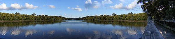
but includes many of them. The Georges River
acts as the southern boundary of this region. This region is sometimes informally called the inner south-west.
 The original inhabitants of Canterbury and Bankstown were the Gweagal
, Bidjigal
, (also known as Bediagal) and a small portion of the Dharug
people.
Five years after the First Fleet
arrived in Sydney Cove
in 1788, a man by the name of Rev Richard Johnson, a chaplain aboard the First Fleet, was the first to receive a land grant of 40 hectares in what is now known as the 'Canterbury-Bankstown region'. The land was located in the Ashbury
-Hurlstone Park
area. He named his estate 'Canterbury Vale', presumably after the See of Canterbury
in England. The date of the grant was May 1793 although he (Johnson) occupied the land months earlier. Johnson also cultivated land around his cottage in Bridge St Sydney and at another location called the Brickfield near Central Station. Johnson was praised by Watkin Tench
as being one of the best farmers in the colony.
 The first ambulance to service the area was in 1908. It was called the 'Canterbury District Ambulance Corps' and it used volunteers to transport patients to the hospital. A stretcher on wheels with a hooded cover over it (hand litter) was used to transport patients to the Western Suburbs Hospital. If a patient lived in an area around Belmore, the hand litter was transported by train from Campsie to Belmore, then it was pushed along the rough unsealed roads to the patients home, back to Belmore station, then taken by train to Campsie Station and along the streets to hospital.
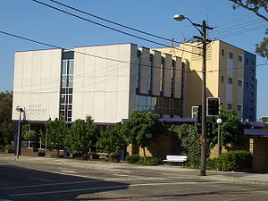
The Canterbury District Memorial Hospital commenced business on the 26th Oct 1929. The hospital was opened by Secretary for Public Works Buttenshaw. Prior to the opening of the hospital [in Canterbury], residents attended the Western Suburbs Hospital or the cottage hospital located in Marrickville, which was established in 1895.
In 1940, the events of World War II
were made known to the residents of Canterbury-Bankstown. Men and women who were drafted had to report for duty at a drill hall located on Canterbury Road Belmore. Camps were set up in Canterbury Race Course and surrounding parks in the region. In that same year thousands of Australian troops travelled along the goods line to Darling Harbour, ready to embark for the Middle East
.
 In 1940 the department of Civil Aviation purchased 250 hectares of land in Bankstown for the construction of Bankstown Airport and an RAAF Station was formed. The facility was a secondary airport to Mascot Airport
. In 1942 a command bunker (Sydney Air Defence Headquarters) of semi underground construction was established on the corner of Edgar and Marion Street Bankstown. The bunker was manned by No. 1 Fighter Sector RAAF
, members of the No.2 Volunteer Air Observer Corps
, the WAAAF's
, the RAAF
and the United States Army Air Forces
. The primary use of the Sydney Air Defence Headquarters was the location, tracking and interception of all planes in the eastern area of the South West Pacific.
In 1941 WAAAF's were posted to Bankstown. The women were trained as clerks, wireless telegraphists, mess orderlies, drill instructors and drivers
, a portion of these women were assigned to work in the command centre (Bankstown Bunker) located on Black Charlies Hill. In 1942, Belmore House, the current sight of today's Roselands Shopping Centre was used by the Australian Army
for the training of troops. Tents on the property were used to house an infantry battalion and an ambulance corps. The site was vacated after a year. Units of the US Air Force were based in Bankstown after 1942, earning the suburb the nickname 'Yankstown'. Also in 1942 a military hospital was established for the U.S. Army
at Herne Bay
, now known as Riverwood. It was the largest military hospital in Australia
during World War II
. Known as the 118 General Hospital
it consisted of 490 timber barracks-type buildings, which could house a total of 4,250 beds and accommodate up to 1,250 patients and 3,500 staff.
 Within the same year 16 US fighter planes that were based at Bankstown airport flew over Canterbury racecourse at low altitude during a race meet. This was to let the Australian public, especially those of the district to know that they, their allies were there for their protection. Regardless of these events, punters were annoyed at the disruption caused.
From 1944 to 1945 a Volunteer Air Observer Corps
operated in Bankstown. These volunteers were both male and female, were of 15 to 60 years of age and were given several weeks training. There were over 300 volunteers who worked in shifts that the air force called 'flights' 24 hours a day, seven days a week. This freed RAAF personnel for other duties. In 1945 Bankstown Airport was occupied by the British Fleet Air Arm
, known as HMS Nabberley
, and the RAAF by 1946.
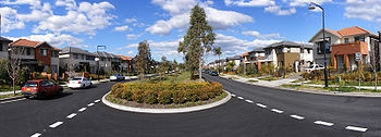
 The Canterbury-Bankstown region is characterised by high-density housing towards the east and larger family homes towards the west with large natural parklands toward the south, such as those around Salt Pan Creek
. Suburbs within the region have a multicultural nature.
The region is regarded by some as the poor relation of Sydney's trendy Inner West
region. Young families and couples are opting to live in the Canterbury-Bankstown region as a cheaper alternative to living in Sydney's Inner West, whilst at the same time residents of the region are suffering heavily from mortgagee repossession which is forcing poorer families to move into Sydney's Outer Western suburbs.
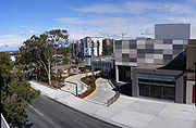
 The biggest commercial areas in the Canterbury-Bankstown area are located at Bankstown
, Campsie
and Roselands
. Bankstown is the largest central business district
in the region and features a large shopping centre
called Centro Bankstown
. Roselands also features a large shopping centre called Centro Roselands
. The Canterbury-Bankstown region also has a variety of Vietnamese, Lebanese, Greek, Italian, Spanish, African and Australian restaurants, delicatessens, sweet shops, grocery and fresh food markets.
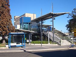
's Bankstown railway line runs in a loop from Central station
via Campsie to Bankstown and back again via Strathfield
. CityRail's East Hills railway line runs from Central and has services that terminate at Revesby, however some continue onto the Macarthur
regions Macarthur and Campbelltown stations. The East Hills line also has services to Sydney Kingsford-Smith Airport. There are various bus routes provided largely by Sydney Buses and privately owned company Veolia.
.
Notable former residents include the former Prime Ministers
John Howard
and Paul Keating
and Olympian Ian Thorpe
.

takes its name from the suburb of Canterbury
but its administrative centre is located in the adjacent suburb of Campsie
which is also a large commercial centre. The City of Bankstown
has its administrative centre in the suburb of Bankstown
.
City of Canterbury, New South Wales
The City of Canterbury, previously the Municipality of Canterbury, is a Local Government Area in Sydney, New South Wales, Australia. It lies southwest of the central business district and forms part of the Greater Sydney metropolitan area....
and the City of Bankstown
City of Bankstown
The City of Bankstown is a city and Local Government Area in the Canterbury-Bankstown region of Sydney, New South Wales, Australia, centred on the suburb of Bankstown....
but includes many of them. The Georges River
Georges River
The Georges River is a waterway in the state of New South Wales in Australia. It rises to the south-west of Sydney near the coal mining town of Appin, and then flows north past Campbelltown, roughly parallel to the Main South Railway...
acts as the southern boundary of this region. This region is sometimes informally called the inner south-west.
History
Gweagal
The Gweagal are a clan of the Tharawal tribe of Indigenous Australians, who are traditional custodians of the southern geographic areas of Sydney, New South Wales, Australia....
, Bidjigal
Bidjigal
The Bidjigal people are a group of Indigenous Australians living to the West of Sydney. Their geographical location is confusing, as they seem to have been based in southern Sydney, in the region between the Cooks River and the Georges River and yet also seem to have inhabited land in...
, (also known as Bediagal) and a small portion of the Dharug
Darug people
The Darug people are a language group of Indigenous Australians, who are traditional custodians of much of what is modern day Sydney. There is some dispute about the extent of the Darug nation. Some historians believe the coastal Eora people were a separate tribe to the Darug...
people.
Five years after the First Fleet
First Fleet
The First Fleet is the name given to the eleven ships which sailed from Great Britain on 13 May 1787 with about 1,487 people, including 778 convicts , to establish the first European colony in Australia, in the region which Captain Cook had named New South Wales. The fleet was led by Captain ...
arrived in Sydney Cove
Sydney Cove
Sydney Cove is a small bay on the southern shore of Port Jackson , on the coast of the state of New South Wales, Australia....
in 1788, a man by the name of Rev Richard Johnson, a chaplain aboard the First Fleet, was the first to receive a land grant of 40 hectares in what is now known as the 'Canterbury-Bankstown region'. The land was located in the Ashbury
Ashbury, New South Wales
Ashbury is a suburb in inner-west Sydney, in the state of New South Wales, Australia. It is located 10 kilometres south-west of the Sydney central business district. The suburb lies in the local government area of the City of Canterbury with some areas in Ashfield Municipality...
-Hurlstone Park
Hurlstone Park, New South Wales
Hurlstone Park is a suburb in the inner-west of Sydney, in the state of New South Wales, Australia. Hurlstone Park is located 10 kilometres south-west of the Sydney central business district and is mostly in the local government area of the City of Canterbury, and partly in the Municipality of...
area. He named his estate 'Canterbury Vale', presumably after the See of Canterbury
Canterbury
Canterbury is a historic English cathedral city, which lies at the heart of the City of Canterbury, a district of Kent in South East England. It lies on the River Stour....
in England. The date of the grant was May 1793 although he (Johnson) occupied the land months earlier. Johnson also cultivated land around his cottage in Bridge St Sydney and at another location called the Brickfield near Central Station. Johnson was praised by Watkin Tench
Watkin Tench
Lieutenant-General Watkin Tench was a British Marine officer who is best known for publishing two books describing his experiences in the First Fleet, which established the first settlement in Australia in 1788...
as being one of the best farmers in the colony.
The Canterbury District Memorial Hospital commenced business on the 26th Oct 1929. The hospital was opened by Secretary for Public Works Buttenshaw. Prior to the opening of the hospital [in Canterbury], residents attended the Western Suburbs Hospital or the cottage hospital located in Marrickville, which was established in 1895.
In 1940, the events of World War II
World War II
World War II, or the Second World War , was a global conflict lasting from 1939 to 1945, involving most of the world's nations—including all of the great powers—eventually forming two opposing military alliances: the Allies and the Axis...
were made known to the residents of Canterbury-Bankstown. Men and women who were drafted had to report for duty at a drill hall located on Canterbury Road Belmore. Camps were set up in Canterbury Race Course and surrounding parks in the region. In that same year thousands of Australian troops travelled along the goods line to Darling Harbour, ready to embark for the Middle East
Middle East
The Middle East is a region that encompasses Western Asia and Northern Africa. It is often used as a synonym for Near East, in opposition to Far East...
.
Sydney Airport
Sydney Airport may refer to:* Sydney Airport, also known as Kingsford Smith International Airport, in Sydney, Australia* Sydney/J.A. Douglas McCurdy Airport, in Nova Scotia, Canada...
. In 1942 a command bunker (Sydney Air Defence Headquarters) of semi underground construction was established on the corner of Edgar and Marion Street Bankstown. The bunker was manned by No. 1 Fighter Sector RAAF
No. 1 Fighter Sector RAAF
No. 1 Fighter Sector was a Royal Australian Air Force unit formed at Bankstown, New South Wales on 25 February 1942.The RAAF commandeered Capitol Theatre at Bankstown for use as an operations and plotting facility on 14 March 1942....
, members of the No.2 Volunteer Air Observer Corps
Volunteer Air Observers Corps (Australia)
The Volunteer Air Observers Corps was an Australian air defence organisation of World War II. The VAOC was formed on 31 December 1941 to support the Royal Australian Air Force by sighting and observing aircraft over Australia. The VAOC swiftly established observation posts across Australia and...
, the WAAAF's
Women's Auxiliary Australian Air Force
The Women's Auxiliary Australian Air Force was formed in March 1941 after considerable lobbying by women keen to serve and by the Chief of the Air Staff who wanted to release male personnel serving in Australia for service overseas. The WAAAF was the first and largest of the World War II...
, the RAAF
Royal Australian Air Force
The Royal Australian Air Force is the air force branch of the Australian Defence Force. The RAAF was formed in March 1921. It continues the traditions of the Australian Flying Corps , which was formed on 22 October 1912. The RAAF has taken part in many of the 20th century's major conflicts...
and the United States Army Air Forces
United States Army Air Forces
The United States Army Air Forces was the military aviation arm of the United States of America during and immediately after World War II, and the direct predecessor of the United States Air Force....
. The primary use of the Sydney Air Defence Headquarters was the location, tracking and interception of all planes in the eastern area of the South West Pacific.
In 1941 WAAAF's were posted to Bankstown. The women were trained as clerks, wireless telegraphists, mess orderlies, drill instructors and drivers
Chauffeur
A chauffeur is a person employed to drive a passenger motor vehicle, especially a luxury vehicle such as a large sedan or limousine.Originally such drivers were always personal servants of the vehicle owner, but now in many cases specialist chauffeur service companies, or individual drivers provide...
, a portion of these women were assigned to work in the command centre (Bankstown Bunker) located on Black Charlies Hill. In 1942, Belmore House, the current sight of today's Roselands Shopping Centre was used by the Australian Army
Australian Army
The Australian Army is Australia's military land force. It is part of the Australian Defence Force along with the Royal Australian Navy and the Royal Australian Air Force. While the Chief of Defence commands the Australian Defence Force , the Army is commanded by the Chief of Army...
for the training of troops. Tents on the property were used to house an infantry battalion and an ambulance corps. The site was vacated after a year. Units of the US Air Force were based in Bankstown after 1942, earning the suburb the nickname 'Yankstown'. Also in 1942 a military hospital was established for the U.S. Army
United States Army
The United States Army is the main branch of the United States Armed Forces responsible for land-based military operations. It is the largest and oldest established branch of the U.S. military, and is one of seven U.S. uniformed services...
at Herne Bay
Riverwood, New South Wales
Riverwood is a suburb in southern Sydney, in the state of New South Wales, Australia. Riverwood is located 18 kilometres south-west of the Sydney central business district and is part of the St George area...
, now known as Riverwood. It was the largest military hospital in Australia
Australia
Australia , officially the Commonwealth of Australia, is a country in the Southern Hemisphere comprising the mainland of the Australian continent, the island of Tasmania, and numerous smaller islands in the Indian and Pacific Oceans. It is the world's sixth-largest country by total area...
during World War II
World War II
World War II, or the Second World War , was a global conflict lasting from 1939 to 1945, involving most of the world's nations—including all of the great powers—eventually forming two opposing military alliances: the Allies and the Axis...
. Known as the 118 General Hospital
118th General Hospital US Army
The 118th General Hospital was a U.S. Army military hospital built in 1942 at Herne Bay, New South Wales. This was the largest military hospital in Australia, during World War II....
it consisted of 490 timber barracks-type buildings, which could house a total of 4,250 beds and accommodate up to 1,250 patients and 3,500 staff.
From 1944 to 1945 a Volunteer Air Observer Corps
Volunteer Air Observers Corps (Australia)
The Volunteer Air Observers Corps was an Australian air defence organisation of World War II. The VAOC was formed on 31 December 1941 to support the Royal Australian Air Force by sighting and observing aircraft over Australia. The VAOC swiftly established observation posts across Australia and...
operated in Bankstown. These volunteers were both male and female, were of 15 to 60 years of age and were given several weeks training. There were over 300 volunteers who worked in shifts that the air force called 'flights' 24 hours a day, seven days a week. This freed RAAF personnel for other duties. In 1945 Bankstown Airport was occupied by the British Fleet Air Arm
Fleet Air Arm
The Fleet Air Arm is the branch of the British Royal Navy responsible for the operation of naval aircraft. The Fleet Air Arm currently operates the AgustaWestland Merlin, Westland Sea King and Westland Lynx helicopters...
, known as HMS Nabberley
HMS Nabberley
H.M.S. Nabberley, was a Royal Navy, Mobile Naval Operating Air Base , at the Royal Australian Air Force base RAAF Bankstown at Bansktown, New South Wales, Australia. H.M.S. Nabberley was also known as MONAB II and Royal Naval Air Station Bankstown.-History:Assembled at RNAS Ludham and Royal Navy...
, and the RAAF by 1946.
Character
Salt Pan Creek
Salt Pan Creek is a small creek located in the Salt Pan Creek catchment area, in south-western Sydney, in the state of New South Wales, Australia. It is located between the suburbs of Padstow and Riverwood and feeds into the Georges River. The catchment area covers about 26km2, with 11.7km2 of this...
. Suburbs within the region have a multicultural nature.
The region is regarded by some as the poor relation of Sydney's trendy Inner West
Inner West (Sydney)
The Inner West is a general term which is used to describe the metropolitan area directly to the west of the Sydney central business district, New South Wales, Australia...
region. Young families and couples are opting to live in the Canterbury-Bankstown region as a cheaper alternative to living in Sydney's Inner West, whilst at the same time residents of the region are suffering heavily from mortgagee repossession which is forcing poorer families to move into Sydney's Outer Western suburbs.
Suburbs
The Canterbury-Bankstown region is not an exact area, although the following suburbs are usually agreed to be a part of the region:- BankstownBankstown, New South WalesBankstown is a suburb of south-western Sydney, in the state of New South Wales, Australia. Bankstown is located 20 kilometres south-west of the Sydney central business district and is the administrative centre of the local government area of the City of Bankstown.-History:Prior to European...
- Bass HillBass Hill, New South WalesBass Hill, a suburb of local government area City of Bankstown, is located 23 kilometres south-west of the Sydney central business district, in the state of New South Wales, Australia, and is a part of the South-western Sydney region.-History:...
- BelfieldBelfield, New South WalesBelfield is a suburb in south-western Sydney, in the state of New South Wales, Australia. Belfield is located 14 kilometres south-west of the Sydney central business district, in the local government area of the City of Canterbury and partly in the Municipality of Strathfield.-Location:Belfield has...
- BelmoreBelmore, New South WalesBelmore is a suburb, of Sydney, New South Wales, Australia. Belmore is located 15 kilometres south-west of the Sydney central business district, in the local government area of the City of Canterbury.-History:...
- Beverly HillsBeverly Hills, New South WalesBeverly Hills is a suburb in southern Sydney, in the state of New South Wales, Australia. Beverly Hills is located 17 kilometres south of the Sydney central business district and is part of the St George area. Beverly Hills lies across two local government areas, the City of Hurstville and the...
- BirrongBirrong, New South WalesBirrong, a suburb of local government area City of Bankstown, is located 22 kilometres south-west of the Sydney central business district, in the state of New South Wales, Australia, and is a part of the South-western Sydney region...
- CanterburyCanterbury, New South Wales-Commercial area:Canterbury has a mixture of residential, commercial and industrial developments. Commercial developments are mostly situated on Canterbury Road and surrounding streets...
- CampsieCampsie, New South WalesCampsie is a suburb in south-western Sydney, in the state of New South Wales, Australia. Campsie is located 13 kilometres south-west of the Sydney central business district, on the southern bank of the Cooks River. Campsie is the commercial and administrative centre of the City of...
- Chester HillChester Hill, New South WalesChester Hill, a suburb of local government area City of Bankstown is located 25 kilometres west of the Sydney central business district, in the state of New South Wales, Australia, and is part of the Greater Western Sydney region...
- ChulloraChullora, New South WalesChullora, a suburb of local government areas City of Bankstown and the Municipality of Strathfield, is located 15 kilometres west of the Sydney central business district, in the state of New South Wales, Australia, and forms a part of the Greater Western Sydney region.-History:The suburb of...
- Clemton ParkClemton Park, New South WalesClemton Park is a suburb in south-western Sydney, in the state of New South Wales, Australia. Clemton Park is located 13 kilometres south-west of the Sydney central business district in the City of Canterbury. A small group of shops is located at the intersection of Bexley Road and William Street....
- Condell ParkCondell Park, New South WalesCondell Park, a suburb of local government area City of Bankstown, is located 22 kilometres south-west of the Sydney central business district, in the state of New South Wales, Australia, and is a part of the South-western Sydney region...
- Croydon ParkCroydon Park, New South WalesCroydon Park is a suburb, in the inner-west of Sydney, in the state of New South Wales, Australia. Croydon Park is about 13 kilometres south-west of the Sydney central business district and is divided between the local government areas of the City of Canterbury, Burwood Council and Municipality of...
- EarlwoodEarlwood, New South WalesEarlwood is a suburb in the inner-west of Sydney, in the state of New South Wales, Australia. Earlwood is located 12 kilometres south of the Sydney central business district, in the local government area of the City of Canterbury...
- Georges HallGeorges Hall, New South WalesGeorges Hall, a suburb of local government area City of Bankstown, is located 24 kilometres south-west of the Sydney central business district in the state of New South Wales, Australia, and is part of the South-western Sydney region....
- GreenacreGreenacre, New South WalesGreenacre, a suburb of local government areas City of Bankstown and the Municipality of Strathfield, is located 17 kilometres south-west of the Sydney central business district in the state of New South Wales, Australia, and is a part of the South-western Sydney region.-History:This area was once...
- Kingsgrove
- LakembaLakemba, New South WalesLakemba is a suburb in south-western Sydney, in the state of New South Wales, Australia. Lakemba is located 15 kilometres south-west of the Sydney central business district, in the local government area of the City of Canterbury....
- LansdowneLansdowne, New South WalesLansdowne is a suburb in south-western Sydney, in the state of New South Wales, Australia. Lansdowne is located 27 kilometres west of the Sydney central business district, in the local government areas of the City of Bankstown and is part of the South-western Sydney region.-History:Lansdowne took...
- LeightonfieldLeightonfield, New South WalesLeightonfield is a suburb of Sydney, New South Wales, Australia. It is serviced by Cityrail and various bus routes. Leightonfield's postcode is 2163....
- MilperraMilperra, New South WalesMilperra, a suburb of local government area City of Bankstown, is located 24 kilometres south-west of the Sydney central business district in the state of New South Wales, Australia, and is a part of the South-western Sydney region.-History:...
- Mount LewisMount Lewis, New South WalesMount Lewis, a suburb of local government area City of Bankstown, is located 18km south-west of the Sydney central business district, in the state of New South Wales, Australia, and is a part of the South-western Sydney region.-History:...
- NarweeNarwee, New South WalesNarwee is a suburb in southern Sydney, in the state of New South Wales, Australia. Narwee is located 18 kilometres south of the Sydney central business district and is part of the St George area. Narwee lies across the local government areas of the City of Hurstville and the City of Canterbury...
- PadstowPadstow, New South WalesPadstow, a suburb of local government area City of Bankstown, is located 22 kilometres inner south-west of the Sydney central business district, in the state of New South Wales, Australia, and is a part of the South-western Sydney region....
- Padstow HeightsPadstow Heights, New South WalesPadstow Heights, a suburb of local government area City of Bankstown, is located 23 kilometres south-west of the Sydney central business district, in the state of New South Wales, Australia, and is a part of the South-western Sydney region...
- PananiaPanania, New South WalesPanania, a suburb of local government area City of Bankstown, is located 23 kilometres inner south-west of the Sydney central business district in the state of New South Wales, Australia, and is a part of the South-western Sydney region...
- Picnic PointPicnic Point, New South WalesPicnic Point, a suburb of local government area City of Bankstown, is located 23 kilometres south-west of the Sydney central business district, in the state of New South Wales, Australia, and is a part of South-western Sydney region...
- Potts HillPotts Hill, New South WalesPotts Hill, a suburb of local government area City of Bankstown, is located 21 kilometres south-west of the Sydney central business district, in the state of New South Wales, Australia, and is a part of the South-western Sydney region....
- PunchbowlPunchbowl, New South WalesPunchbowl, a suburb of local government areas City of Bankstown and the City of Canterbury is located 17 kilometres south-west of the Sydney central business district, in the state of New South Wales, Australia, and is a part of the South-western Sydney region.- History :Punchbowl is named for a...
- Regents ParkRegents Park, New South WalesAlternate uses: Regents Park Regents Park is a western suburb of Sydney, in the state of New South Wales, Australia. Regents Park is located 22 kilometres west of the Sydney central business district, in the local government area of Auburn Council.-History:The suburb took its name from a local...
- RevesbyRevesby, New South WalesRevesby, a suburb of local government area City of Bankstown, is located 22 kilometres south-west of the Sydney central business district, in the state of New South Wales, Australia, and is a part of the South-western Sydney region....
- Revesby HeightsRevesby Heights, New South WalesRevesby Heights, a suburb of local government area City of Bankstown, is located 23 kilometres south-west of the Sydney central business district, in the state of New South Wales, Australia, and is a part of the South-western Sydney region....
- RiverwoodRiverwood, New South WalesRiverwood is a suburb in southern Sydney, in the state of New South Wales, Australia. Riverwood is located 18 kilometres south-west of the Sydney central business district and is part of the St George area...
- RoselandsRoselands, New South WalesRoselands is a suburb, in south-western Sydney, in the state of New South Wales, Australia. Roselands is located 16 kilometres south-west of the Sydney central business district in the City of Canterbury.-Geography:...
- SeftonSefton, New South WalesSefton, a suburb of local government area City of Bankstown, is located 23 kilometres west of the Sydney central business district, in the state of New South Wales, Australia, and is a part of the Western Sydney region....
- UndercliffeUndercliffe, New South WalesUndercliffe is a suburb in south-western Sydney, in the state of New South Wales, Australia. Undercliffe is located 10 kilometres south-west of the Sydney central business district in the local government area of the City of Canterbury....
- VillawoodVillawood, New South WalesVillawood, a suburb of local government areas City of Bankstown and City of Fairfield, is located 25 kilometres west of the Sydney central business district, in the state of New South Wales, Australia, and is a part of the Greater Western Sydney region....
- Wiley ParkWiley Park, New South WalesWiley Park is a suburb in south-western Sydney, in the state of New South Wales, Australia. Wiley Park is located 17 kilometres south-west of the Sydney central business district in the City of Canterbury.-History:...
- YagoonaYagoona, New South WalesYagoona, a suburb of local government area City of Bankstown, is located 20 kilometres south-west of the Sydney central business district, in the state of New South Wales, Australia, and is a part of the South-western Sydney region. Yagoona is an Aboriginal word meaning 'now' or...
Commercial areas
Bankstown, New South Wales
Bankstown is a suburb of south-western Sydney, in the state of New South Wales, Australia. Bankstown is located 20 kilometres south-west of the Sydney central business district and is the administrative centre of the local government area of the City of Bankstown.-History:Prior to European...
, Campsie
Campsie, New South Wales
Campsie is a suburb in south-western Sydney, in the state of New South Wales, Australia. Campsie is located 13 kilometres south-west of the Sydney central business district, on the southern bank of the Cooks River. Campsie is the commercial and administrative centre of the City of...
and Roselands
Roselands, New South Wales
Roselands is a suburb, in south-western Sydney, in the state of New South Wales, Australia. Roselands is located 16 kilometres south-west of the Sydney central business district in the City of Canterbury.-Geography:...
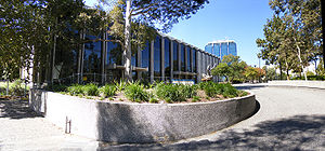
. Bankstown is the largest central business district
Central business district
A central business district is the commercial and often geographic heart of a city. In North America this part of a city is commonly referred to as "downtown" or "city center"...
in the region and features a large shopping centre
Shopping mall
A shopping mall, shopping centre, shopping arcade, shopping precinct or simply mall is one or more buildings forming a complex of shops representing merchandisers, with interconnecting walkways enabling visitors to easily walk from unit to unit, along with a parking area — a modern, indoor version...
called Centro Bankstown
Centro Bankstown
Centro Bankstown, formerly known as Bankstown Square, is a major regional shopping centre situated in the central business district of the City of Bankstown. It has over 310 specialty stores including a number of major retail stores. Opened in 1966, the shopping centre has undergone several...
. Roselands also features a large shopping centre called Centro Roselands
Centro Roselands
Centro Roselands is a medium-sized shopping centre in Roselands, a suburb in south-western Sydney, in the state of New South Wales, Australia...
. The Canterbury-Bankstown region also has a variety of Vietnamese, Lebanese, Greek, Italian, Spanish, African and Australian restaurants, delicatessens, sweet shops, grocery and fresh food markets.
Transport
Canterbury, Liverpool and Punchbowl Roads are the main roads through the area. Public transport in the region includes trains and buses. CityRailCityRail
CityRail is an operating brand of RailCorp, a corporation owned by the state government of New South Wales, Australia. It is responsible for providing commuter rail services, and some coach services, in and around Sydney, Newcastle and Wollongong, the three largest cities of New South Wales. It is...
's Bankstown railway line runs in a loop from Central station
Central railway station, Sydney
Central Railway Station, the largest railway station in Australia, is at the southern end of the Sydney CBD. It services almost all the lines on the CityRail network, and is the major terminus for interurban and interstate rail services...
via Campsie to Bankstown and back again via Strathfield
Strathfield, New South Wales
Strathfield is an Inner West suburb of Sydney, in the state of New South Wales, Australia. Strathfield is located 14 kilometres west of the Sydney central business district and is the administrative centre of the local government area of the Municipality of Strathfield...
. CityRail's East Hills railway line runs from Central and has services that terminate at Revesby, however some continue onto the Macarthur
MacArthur
MacArthur or Macarthur may refer to:-Geography:* Division of Macarthur, Sydney* General MacArthur, Eastern Samar, Philippines* John D...
regions Macarthur and Campbelltown stations. The East Hills line also has services to Sydney Kingsford-Smith Airport. There are various bus routes provided largely by Sydney Buses and privately owned company Veolia.
Education
The Canterbury-Bankstown area houses the Bankstown Campus of the University of Western SydneyUniversity of Western Sydney
The University of Western Sydney, also known as UWS, is a multi-campus university in the Greater Western region of Sydney, New South Wales, Australia...
.
Population
Like Sydney's inner west, Canterbury-Bankstown is multi-cultural. There are many people from Chinese, Indian, Korean, Fijian, Vietnamese, Lebanese, Greek, Italian, Spanish and African backgrounds. This is also reflected in the variety and style of many local businesses, including a variety of cuisines.Notable former residents include the former Prime Ministers
Prime Minister of Australia
The Prime Minister of the Commonwealth of Australia is the highest minister of the Crown, leader of the Cabinet and Head of Her Majesty's Australian Government, holding office on commission from the Governor-General of Australia. The office of Prime Minister is, in practice, the most powerful...
John Howard
John Howard
John Winston Howard AC, SSI, was the 25th Prime Minister of Australia, from 11 March 1996 to 3 December 2007. He was the second-longest serving Australian Prime Minister after Sir Robert Menzies....
and Paul Keating
Paul Keating
Paul John Keating was the 24th Prime Minister of Australia, serving from 1991 to 1996. Keating was elected as the federal Labor member for Blaxland in 1969 and came to prominence as the reformist treasurer of the Hawke Labor government, which came to power at the 1983 election...
and Olympian Ian Thorpe
Ian Thorpe
Ian James Thorpe OAM , nicknamed the Thorpedo and Thorpey, is an Australian swimmer who specialises in freestyle, but also competes in backstroke and the individual medley. He has won five Olympic gold medals, the most won by any Australian, and with three gold and two silver medals, was the most...
.
Organisations
- The Canterbury-Bankstown Rugby League Football Club
- Canterbury-Bankstown Express, local newspaper
- Canterbury-Bankstown Migrant Resource Centre
Politics
The region covers two local government area. The City of CanterburyCity of Canterbury, New South Wales
The City of Canterbury, previously the Municipality of Canterbury, is a Local Government Area in Sydney, New South Wales, Australia. It lies southwest of the central business district and forms part of the Greater Sydney metropolitan area....
takes its name from the suburb of Canterbury
Canterbury, New South Wales
-Commercial area:Canterbury has a mixture of residential, commercial and industrial developments. Commercial developments are mostly situated on Canterbury Road and surrounding streets...
but its administrative centre is located in the adjacent suburb of Campsie
Campsie, New South Wales
Campsie is a suburb in south-western Sydney, in the state of New South Wales, Australia. Campsie is located 13 kilometres south-west of the Sydney central business district, on the southern bank of the Cooks River. Campsie is the commercial and administrative centre of the City of...
which is also a large commercial centre. The City of Bankstown
City of Bankstown
The City of Bankstown is a city and Local Government Area in the Canterbury-Bankstown region of Sydney, New South Wales, Australia, centred on the suburb of Bankstown....
has its administrative centre in the suburb of Bankstown
Bankstown, New South Wales
Bankstown is a suburb of south-western Sydney, in the state of New South Wales, Australia. Bankstown is located 20 kilometres south-west of the Sydney central business district and is the administrative centre of the local government area of the City of Bankstown.-History:Prior to European...
.