
Burwell, Cambridgeshire
Encyclopedia
Burwell ˈbɝːwɛl is a large fen-edge
village and civil parish
in Cambridgeshire, England, about 10 miles (16 km) north east of Cambridge
. It is situated on the south-eastern edge of The Fens
, a large area of relatively flat former marshland which lies close to sea level and covers the majority of Cambridgeshire and neighbouring Lincolnshire
. The fens to the west of the village are drained with the help of the man-made Cambridgeshire Lode
waterways, including Burwell Lode which has been important in the growth of the village.
origin and refers to a fort (burh-) located close to a spring (-well). The first record of the name in the area dates from 1060 and the village is recorded in the Domesday Book
under the spellings Burewelle, Burwella and Burwelle. A spring is situated in the south of the village close to the remains of 12th century Burwell Castle, although there is evidence of prior settlement on or near the castle site.
Old maps sometimes label the village as the plural "Burwells", which refer to either Burwell St Mary and Burwell St Andrew parishes or the split between the High Town around the churches in the south of the village and the newer North Street and Newnham parts of the village which were separated by a causeway.
. Flint tools including axes dating from the Palaeolithic and Mesolithic
have been found on the west side of the village. Further burned and worked flint has been found close to the spring dating from the late Neolithic
but the majority of activity in the area at the time seemed to be on the actual Fen to the west of the village, where the discovery of a large number of flint and stone tools on a raised piece of ground suggests that there was already settlement in the parish before the onset of the Bronze Age. During the Neolithic, peat
had begun to form on the fens around the village which has partly buried prehistoric sites.
Activity on the fen continued into the Bronze Age
, as did activity close to the spring but they were joined by increasing activity on the heath
in the south of the parish, where barrows
are known to have existed. The southern part of the parish is also the highest ground within it, and is close to the ancient Icknield Way
.
As Burwell entered the Iron Age
, activity on the fens to the west of the village appears to have diminished as conditions became more marshy. However, ditch systems and enclosures were found during excavations in 1969 and 1995 in the west of the parish. Activity in proximity to the spring continued with evidence discovered for a burial in a nearby ditch and a settlement was uncovered in 2005 on the eastern edge of the village.
Settlement close to the spring continued after Roman colonisation of Britain
, as evidence for a Roman settlement has been found 500 yards north of St Mary's Church. Various Roman archeology has been found around the village, including pottery, a hoard of vessels and bowls, a lead vat, and coins possibly relating to a villa on Ness Road, north of the village. Evidence for another villa in the same area comes from roof tiles dating from the 2nd century although the findings around the village cover the 2nd – 4th centuries. Reach Lode on the north-west edge of the parish is likely to be of Roman construction, as was the original Burwell Lode which has since been replaced
, a man-made waterway which connects it with the River Cam
. The present course, created in the mid 17th century, replaced an older route which was probably Roman in origin. The lode splits into two at the village, and each branch served a series of basins, warehouses and wharves, which were located at the bottom of long strips of land, with the merchants' houses at the other end of them.
The village and the lode became more important with the opening in the 1850s of the Burwell Chemical Works, owned by T. T. Ball. By the 1890s, it had become the Patent Manure Works, was owned by Colchester and Ball, and around 10,000 tons of goods each year were shipped along the lode, using three steam tugs and a large fleet of lighters. Prentice Brothers Ltd built barges in the village until 1920, and continued repairing them there after they bought the fertilizer factory in 1921. The factory was later owned by Fisons, and boats continued to be used to move the fertiliser to Fenland farms until 1948. Commercial use of the lode ceased in 1963, when the traffic in sugarbeet stopped.
, situated in Spring Close. The final wall was knocked down by the Fire Brigade testing a fire hose in the 1930s, but the dry moat
is still clearly visible. The castle was built during "The Anarchy
", the internal conflict of the mid 12th century in the reign of King Stephen
. Although a settlement had been reached such that the throne would pass to Henry II
on Stephen's death, the Barons of the time took the opportunity to fight their own battles.
Among these Geoffrey de Mandeville
was particularly troublesome and, after turning against Stephen, had set up an impregnable base around Ely
. From his base he would attack local towns, such as Cambridge
, and so the king ordered castles be built to surround Geoffrey. The few sites at which it is known such castles were to be constructed include Rampton
(Giant's Hill), Ramsey
(Booth's Hill) and Burwell.
At Burwell, a moat had been constructed and the stone keep partially built when Geoffrey attacked and was mortally wounded. His revolt thus collapsed and the castle was left unfinished. The narrow lane running along the side of the church next to Spring Close, where the Castle is located, is named "Mandeville".
One person who could not get into the barn sat with a candle
lantern
and peered in to watch the show. However, the person accidentally knocked the lantern into the barn, setting fire to the hay within. With no way to escape, 78 people (51 of them, children) perished in the ensuing blaze.
The deceased are buried in the churchyard
of St. Marys parish church
, at the opposite end of the High Street, with a gravestone engraved with a blazing heart with angels' wings. On 8 September 2005, a plaque was unveiled at the site of the barn in memorial of the fire.
and thus has a parish council to deal with matters within the village. These include the maintenance and provision of both village hall
s, the recreation ground, playgrounds, and allotments. The Parish Council convenes at the Jubilee Reading Room on The Causeway.
Burwell parish falls within Burwell ward and provides three councillors to the local East Cambridgeshire
District Council
which convenes at The Grange in Ely
. A larger Burwell electoral division also provides one councillor to Cambridgeshire County Council
which convenes at Shire Hall in Cambridge
.
 The village falls within the South East Cambridgeshire constituency, which has been a Conservative
stronghold since formation in 1983. James Paice
became the local MP in 1987 and held his seat at the 2010 general election. His predecessor as local MP, Francis Pym
, served as Foreign Secretary
between the Falklands War
and the 1983 general election
and lived in the village.
Cambridgeshire falls entirely within the East of England constituency
for European Parliament
elections, which elects seven MEP's.
Local government boundaries have varied somewhat over the years. At a parish level, the boundary followed Devil's Dyke through the neighbouring village of Reach
bisecting it until it was formed into a new parish in 1961. The other boundaries of the parish have also changed slightly several times over the years, most obviously on the south-eastern edge, where part of the Parish including part of Newmarket Racecourse
was lost to Newmarket when the boundary was adjusted to follow the A14 bypass in 1993. The boundaries with Newmarket and Exning parishes are also the boundary between the county of Cambridgeshire and neighbouring Suffolk
.
As with the rest of England, a system of Hundreds used to cover Cambridgeshire
until the 19th century. Burwell covered the south-western edge of the Staploe Hundred, which also included the nearby parishes of Chippenham
, Fordham
, Isleham
, Kennett
, Landwade
, Snailwell
, Soham
and Wicken
.
East Cambridgeshire District Council only came into being in 1974 with the Local Government Act 1972
. Before the reorganisation, Burwell fell inside the Newmarket Rural District
which had existed since 1894. Between 1875 and 1894, this was part of a larger Newmarket Rural Sanitary District
which also encompassed the Moulton Rural District
in neighbouring West Suffolk
.
The boundaries of Cambridgeshire
itself have also changed somewhat over the years, with the current county only coming into effect in 1974, in the same 1972 Act which created East Cambridgeshire district. Before Huntingdon and Peterborough
joined the county in 1974, Burwell fell within Cambridgeshire and Isle of Ely
which covered the southern and eastern parts of the modern county. Between 1888 and 1965, the village also fell within a smaller administrative county
of Cambridgeshire, covering only the southern part of the modern county.
. The official name comes from an ancient priory which stood nearby also giving its name to some of the local roads, such as Priory Close and Abbey Close.
and Mary-sur-Marne
and one small town: Ocquerre
. These are all situated in France, but only Lizy is mentioned on the signs as you enter the village. Visits from Burwell to the twinned villages are organised by the Burwell Village Twinning Association. A plate commemorating the twinning is located on a wall on the outside of the Year 3 classroom at the village primary school: Burwell Village College (Primary) which educates local 4–11 year olds. The village falls into the catchment area
s of both Bottisham
and Soham
Village College
s, which provide education at secondary school level (11–16 yrs).
Public transport is provided by way of Stagecoach in Cambridge
bus route 10 running through the village between Cambridge and Newmarket. Stagecoach took over what used to be Cambus in the mid-90's, Cambus itself had only split from the Eastern Counties Omnibus Company in 1984. Eastern Counties had absorbed Burwell and District in 1979, the local bus company having provided transport to nearby Cambridge, Newmarket and Bury St Edmunds as well as further afield destinations such as Great Yarmouth and Felixstowe.
Between 1884 and 1965, Burwell had a railway station
in the south of the village on the Cambridge to Mildenhall railway
. The station closed to passengers in 1962, and although nothing of the station remains, its presence is still acknowledged in the names of the streets Railway Close and Station Gate on the site of the former station. There was also a halt on Newmarket Road to the south-east of the village. The B1103 still goes over a railway bridge on the site.
To the north of the village, temporary tramways
provided access from the nearby Ipswich to Ely Line
to the local brickworks, situated near the lode.
Burwell Lode is navigable up to the edge of the village at Anchor Lane. The Lode joins Reach Lode in the north-west corner of the parish before they confluence with the River Cam
at Upware
, 5 miles from Burwell.
and a playgroup
for pre-school age children.
Children attend Burwell Village College (Primary) up until the age of 11 and then go to the secondary schools of either Soham
or Bottisham
.
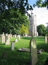
, the church is of a Perpendicular Gothic style in construction, and dates back to the 15th century, although some parts of the building are older. There is a regular congregation of around 50 to 70 people attending Sunday morning services. The current vicar as is Revd Dr Eleanor Williams, who took over from Revd Stephen Earl in April 2011.
Burwell also has a large cemetery located on Ness Road, with a small chapel located on the site.
, with a reserve team in Division 4B and a third "A" team in 5C. There are also two youth football clubs; the Burwell Swallows and Burwell Tigers.
Burwell Cricket
Club is based on Tan House Lane, with a 1st XI in the East Anglian Premier League.
and Heart Cambridgeshire
. For regional television, Burwell is in the BBC East
and ITV Anglia
regions.
Fen Edge
Fen Edge is an area and collection of villages in the South Cambridgeshire district of Cambridgeshire, England. The five villages in Fen Edge are Cottenham, Landbeach, Rampton, Waterbeach and Willingham...
village and civil parish
Civil parish
In England, a civil parish is a territorial designation and, where they are found, the lowest tier of local government below districts and counties...
in Cambridgeshire, England, about 10 miles (16 km) north east of Cambridge
Cambridge
The city of Cambridge is a university town and the administrative centre of the county of Cambridgeshire, England. It lies in East Anglia about north of London. Cambridge is at the heart of the high-technology centre known as Silicon Fen – a play on Silicon Valley and the fens surrounding the...
. It is situated on the south-eastern edge of The Fens
The Fens
The Fens, also known as the , are a naturally marshy region in eastern England. Most of the fens were drained several centuries ago, resulting in a flat, damp, low-lying agricultural region....
, a large area of relatively flat former marshland which lies close to sea level and covers the majority of Cambridgeshire and neighbouring Lincolnshire
Lincolnshire
Lincolnshire is a county in the east of England. It borders Norfolk to the south east, Cambridgeshire to the south, Rutland to the south west, Leicestershire and Nottinghamshire to the west, South Yorkshire to the north west, and the East Riding of Yorkshire to the north. It also borders...
. The fens to the west of the village are drained with the help of the man-made Cambridgeshire Lode
Cambridgeshire Lodes
The Cambridgeshire Lodes are a series of man-made waterways, believed to be Roman in origin, located in the county of Cambridgeshire, England. Bottisham, Swaffham Bulbeck, Reach, Burwell, Wicken and Monks Lodes all connect to the River Cam, while Soham Lode connects to the River Great Ouse. All...
waterways, including Burwell Lode which has been important in the growth of the village.
Etymology
The name "Burwell" is of Anglo-SaxonAnglo-Saxon
Anglo-Saxon may refer to:* Anglo-Saxons, a group that invaded Britain** Old English, their language** Anglo-Saxon England, their history, one of various ships* White Anglo-Saxon Protestant, an ethnicity* Anglo-Saxon economy, modern macroeconomic term...
origin and refers to a fort (burh-) located close to a spring (-well). The first record of the name in the area dates from 1060 and the village is recorded in the Domesday Book
Domesday Book
Domesday Book , now held at The National Archives, Kew, Richmond upon Thames in South West London, is the record of the great survey of much of England and parts of Wales completed in 1086...
under the spellings Burewelle, Burwella and Burwelle. A spring is situated in the south of the village close to the remains of 12th century Burwell Castle, although there is evidence of prior settlement on or near the castle site.
Old maps sometimes label the village as the plural "Burwells", which refer to either Burwell St Mary and Burwell St Andrew parishes or the split between the High Town around the churches in the south of the village and the newer North Street and Newnham parts of the village which were separated by a causeway.
Early settlement
There is evidence of human activity in the vicinity of Burwell since prehistoryPrehistory
Prehistory is the span of time before recorded history. Prehistory can refer to the period of human existence before the availability of those written records with which recorded history begins. More broadly, it refers to all the time preceding human existence and the invention of writing...
. Flint tools including axes dating from the Palaeolithic and Mesolithic
Mesolithic
The Mesolithic is an archaeological concept used to refer to certain groups of archaeological cultures defined as falling between the Paleolithic and the Neolithic....
have been found on the west side of the village. Further burned and worked flint has been found close to the spring dating from the late Neolithic
Neolithic
The Neolithic Age, Era, or Period, or New Stone Age, was a period in the development of human technology, beginning about 9500 BC in some parts of the Middle East, and later in other parts of the world. It is traditionally considered as the last part of the Stone Age...
but the majority of activity in the area at the time seemed to be on the actual Fen to the west of the village, where the discovery of a large number of flint and stone tools on a raised piece of ground suggests that there was already settlement in the parish before the onset of the Bronze Age. During the Neolithic, peat
Peat
Peat is an accumulation of partially decayed vegetation matter or histosol. Peat forms in wetland bogs, moors, muskegs, pocosins, mires, and peat swamp forests. Peat is harvested as an important source of fuel in certain parts of the world...
had begun to form on the fens around the village which has partly buried prehistoric sites.
Activity on the fen continued into the Bronze Age
Bronze Age
The Bronze Age is a period characterized by the use of copper and its alloy bronze as the chief hard materials in the manufacture of some implements and weapons. Chronologically, it stands between the Stone Age and Iron Age...
, as did activity close to the spring but they were joined by increasing activity on the heath
Heath (habitat)
A heath or heathland is a dwarf-shrub habitat found on mainly low quality acidic soils, characterised by open, low growing woody vegetation, often dominated by plants of the Ericaceae. There are some clear differences between heath and moorland...
in the south of the parish, where barrows
Tumulus
A tumulus is a mound of earth and stones raised over a grave or graves. Tumuli are also known as barrows, burial mounds, Hügelgrab or kurgans, and can be found throughout much of the world. A tumulus composed largely or entirely of stones is usually referred to as a cairn...
are known to have existed. The southern part of the parish is also the highest ground within it, and is close to the ancient Icknield Way
Icknield Way
The Icknield Way is an ancient trackway in southern England. It follows the chalk escarpment that includes the Berkshire Downs and Chiltern Hills.-Background:...
.
As Burwell entered the Iron Age
Iron Age
The Iron Age is the archaeological period generally occurring after the Bronze Age, marked by the prevalent use of iron. The early period of the age is characterized by the widespread use of iron or steel. The adoption of such material coincided with other changes in society, including differing...
, activity on the fens to the west of the village appears to have diminished as conditions became more marshy. However, ditch systems and enclosures were found during excavations in 1969 and 1995 in the west of the parish. Activity in proximity to the spring continued with evidence discovered for a burial in a nearby ditch and a settlement was uncovered in 2005 on the eastern edge of the village.
Settlement close to the spring continued after Roman colonisation of Britain
Roman Britain
Roman Britain was the part of the island of Great Britain controlled by the Roman Empire from AD 43 until ca. AD 410.The Romans referred to the imperial province as Britannia, which eventually comprised all of the island of Great Britain south of the fluid frontier with Caledonia...
, as evidence for a Roman settlement has been found 500 yards north of St Mary's Church. Various Roman archeology has been found around the village, including pottery, a hoard of vessels and bowls, a lead vat, and coins possibly relating to a villa on Ness Road, north of the village. Evidence for another villa in the same area comes from roof tiles dating from the 2nd century although the findings around the village cover the 2nd – 4th centuries. Reach Lode on the north-west edge of the parish is likely to be of Roman construction, as was the original Burwell Lode which has since been replaced
Early history
The village is located at the head of Burwell LodeCambridgeshire Lodes
The Cambridgeshire Lodes are a series of man-made waterways, believed to be Roman in origin, located in the county of Cambridgeshire, England. Bottisham, Swaffham Bulbeck, Reach, Burwell, Wicken and Monks Lodes all connect to the River Cam, while Soham Lode connects to the River Great Ouse. All...
, a man-made waterway which connects it with the River Cam
River Cam
The River Cam is a tributary of the River Great Ouse in the east of England. The two rivers join to the south of Ely at Pope's Corner. The Great Ouse connects the Cam to England's canal system and to the North Sea at King's Lynn...
. The present course, created in the mid 17th century, replaced an older route which was probably Roman in origin. The lode splits into two at the village, and each branch served a series of basins, warehouses and wharves, which were located at the bottom of long strips of land, with the merchants' houses at the other end of them.
The village and the lode became more important with the opening in the 1850s of the Burwell Chemical Works, owned by T. T. Ball. By the 1890s, it had become the Patent Manure Works, was owned by Colchester and Ball, and around 10,000 tons of goods each year were shipped along the lode, using three steam tugs and a large fleet of lighters. Prentice Brothers Ltd built barges in the village until 1920, and continued repairing them there after they bought the fertilizer factory in 1921. The factory was later owned by Fisons, and boats continued to be used to move the fertiliser to Fenland farms until 1948. Commercial use of the lode ceased in 1963, when the traffic in sugarbeet stopped.
Burwell Castle
The village is the site of an unfinished castleBurwell Castle
Burwell Castle was an unfinished medieval motte and bailey castle in Burwell, Cambridgeshire, England.-Details:Burwell Castle was built near the village of Burwell in 1143 by Stephen I of England, on the site of a former Roman villa...
, situated in Spring Close. The final wall was knocked down by the Fire Brigade testing a fire hose in the 1930s, but the dry moat
Moat
A moat is a deep, broad ditch, either dry or filled with water, that surrounds a castle, other building or town, historically to provide it with a preliminary line of defence. In some places moats evolved into more extensive water defences, including natural or artificial lakes, dams and sluices...
is still clearly visible. The castle was built during "The Anarchy
The Anarchy
The Anarchy or The Nineteen-Year Winter was a period of English history during the reign of King Stephen, which was characterised by civil war and unsettled government...
", the internal conflict of the mid 12th century in the reign of King Stephen
Stephen of England
Stephen , often referred to as Stephen of Blois , was a grandson of William the Conqueror. He was King of England from 1135 to his death, and also the Count of Boulogne by right of his wife. Stephen's reign was marked by the Anarchy, a civil war with his cousin and rival, the Empress Matilda...
. Although a settlement had been reached such that the throne would pass to Henry II
Henry II of England
Henry II ruled as King of England , Count of Anjou, Count of Maine, Duke of Normandy, Duke of Aquitaine, Duke of Gascony, Count of Nantes, Lord of Ireland and, at various times, controlled parts of Wales, Scotland and western France. Henry, the great-grandson of William the Conqueror, was the...
on Stephen's death, the Barons of the time took the opportunity to fight their own battles.
Among these Geoffrey de Mandeville
Geoffrey de Mandeville, 1st Earl of Essex
Geoffrey de Mandeville II, 1st Earl of Essex was one of the prominent players during the reign of King Stephen of England. His biographer, the 19th-century historian J. H...
was particularly troublesome and, after turning against Stephen, had set up an impregnable base around Ely
Ely, Cambridgeshire
Ely is a cathedral city in Cambridgeshire, England, 14 miles north-northeast of Cambridge and about by road from London. It is built on a Lower Greensand island, which at a maximum elevation of is the highest land in the Fens...
. From his base he would attack local towns, such as Cambridge
Cambridge
The city of Cambridge is a university town and the administrative centre of the county of Cambridgeshire, England. It lies in East Anglia about north of London. Cambridge is at the heart of the high-technology centre known as Silicon Fen – a play on Silicon Valley and the fens surrounding the...
, and so the king ordered castles be built to surround Geoffrey. The few sites at which it is known such castles were to be constructed include Rampton
Rampton, Cambridgeshire
Rampton is a village in Cambridgeshire, England. Situated on the edge of The Fens six miles to the north of Cambridge, it is a relatively small village of only around 400 people but has a thriving community.-History:...
(Giant's Hill), Ramsey
Ramsey, Cambridgeshire
Ramsey is a small Cambridgeshire market town and parish, north of Huntingdon and St Ives. For local government purposes it lies in the district of Huntingdonshire within the local government county of Cambridgeshire....
(Booth's Hill) and Burwell.
At Burwell, a moat had been constructed and the stone keep partially built when Geoffrey attacked and was mortally wounded. His revolt thus collapsed and the castle was left unfinished. The narrow lane running along the side of the church next to Spring Close, where the Castle is located, is named "Mandeville".
The Barn Fire on Cuckolds Row
On the 8 September 1727, a puppet show visited Burwell and put on a show, held in a barn on what is now Cuckolds Row, near the centre of the village. After the barn had filled with an audience from Burwell and surrounding villages, the doors were nailed shut to prevent further people getting in, a simple act which was key to the tragedy which resulted.One person who could not get into the barn sat with a candle
Candle
A candle is a solid block or cylinder of wax with an embedded wick, which is lit to provide light, and sometimes heat.Today, most candles are made from paraffin. Candles can also be made from beeswax, soy, other plant waxes, and tallow...
lantern
Lantern
A lantern is a portable lighting device or mounted light fixture used to illuminate broad areas. Lanterns may also be used for signaling, as 'torches', or as general light sources outdoors . Low light level varieties are used for decoration. The term "lantern" is also used more generically to...
and peered in to watch the show. However, the person accidentally knocked the lantern into the barn, setting fire to the hay within. With no way to escape, 78 people (51 of them, children) perished in the ensuing blaze.
The deceased are buried in the churchyard
Churchyard
A churchyard is a patch of land adjoining or surrounding a church which is usually owned by the relevant church or local parish itself. In the Scots language or Northern English language this can also be known as a kirkyard or kirkyaird....
of St. Marys parish church
Parish church
A parish church , in Christianity, is the church which acts as the religious centre of a parish, the basic administrative unit of episcopal churches....
, at the opposite end of the High Street, with a gravestone engraved with a blazing heart with angels' wings. On 8 September 2005, a plaque was unveiled at the site of the barn in memorial of the fire.
Governance
Burwell is a parishCivil parish
In England, a civil parish is a territorial designation and, where they are found, the lowest tier of local government below districts and counties...
and thus has a parish council to deal with matters within the village. These include the maintenance and provision of both village hall
Village hall
In the United States, a village hall is the seat of government for villages. It functions much as a city hall does within cities.In the United Kingdom, a village hall is usually a building within a village which contains at least one large room, usually owned by and run for the benefit of the local...
s, the recreation ground, playgrounds, and allotments. The Parish Council convenes at the Jubilee Reading Room on The Causeway.
Burwell parish falls within Burwell ward and provides three councillors to the local East Cambridgeshire
East Cambridgeshire
East Cambridgeshire is a local government district in Cambridgeshire, England. Its council is based in Ely....
District Council
Non-metropolitan district
Non-metropolitan districts, or colloquially shire districts, are a type of local government district in England. As created, they are sub-divisions of non-metropolitan counties in a so-called "two-tier" arrangement...
which convenes at The Grange in Ely
Ely, Cambridgeshire
Ely is a cathedral city in Cambridgeshire, England, 14 miles north-northeast of Cambridge and about by road from London. It is built on a Lower Greensand island, which at a maximum elevation of is the highest land in the Fens...
. A larger Burwell electoral division also provides one councillor to Cambridgeshire County Council
Cambridgeshire County Council
Cambridgeshire County Council is the county council of Cambridgeshire, England. The council currently consists of 69 councillors, representing 60 electoral divisions. The Conservative Party has a majority on the council, having gained control in the 1997 local elections...
which convenes at Shire Hall in Cambridge
Cambridge
The city of Cambridge is a university town and the administrative centre of the county of Cambridgeshire, England. It lies in East Anglia about north of London. Cambridge is at the heart of the high-technology centre known as Silicon Fen – a play on Silicon Valley and the fens surrounding the...
.
Conservative Party (UK)
The Conservative Party, formally the Conservative and Unionist Party, is a centre-right political party in the United Kingdom that adheres to the philosophies of conservatism and British unionism. It is the largest political party in the UK, and is currently the largest single party in the House...
stronghold since formation in 1983. James Paice
James Paice
James Edward Thornton "Jim" Paice MP is a Conservative Party politician in the United Kingdom. He is the Member of Parliament for South East Cambridgeshire, and was first elected in the 1987 general election...
became the local MP in 1987 and held his seat at the 2010 general election. His predecessor as local MP, Francis Pym
Francis Pym
-Bibliography:****- External links :...
, served as Foreign Secretary
Secretary of State for Foreign and Commonwealth Affairs
The Secretary of State for Foreign and Commonwealth Affairs, commonly referred to as the Foreign Secretary, is a senior member of Her Majesty's Government heading the Foreign and Commonwealth Office and regarded as one of the Great Offices of State...
between the Falklands War
Falklands War
The Falklands War , also called the Falklands Conflict or Falklands Crisis, was fought in 1982 between Argentina and the United Kingdom over the disputed Falkland Islands and South Georgia and the South Sandwich Islands...
and the 1983 general election
United Kingdom general election, 1983
The 1983 United Kingdom general election was held on 9 June 1983. It gave the Conservative Party under Margaret Thatcher the most decisive election victory since that of Labour in 1945...
and lived in the village.
Cambridgeshire falls entirely within the East of England constituency
East of England (European Parliament constituency)
East of England is a constituency of the European Parliament. It currently elects 7 MEPs using the d'Hondt method of party-list proportional representation.- Boundaries :...
for European Parliament
European Parliament
The European Parliament is the directly elected parliamentary institution of the European Union . Together with the Council of the European Union and the Commission, it exercises the legislative function of the EU and it has been described as one of the most powerful legislatures in the world...
elections, which elects seven MEP's.
Local government boundaries have varied somewhat over the years. At a parish level, the boundary followed Devil's Dyke through the neighbouring village of Reach
Reach, Cambridgeshire
Reach is a small village and civil parish on the edge of the fenland in East Cambridgeshire, England.Reach is located at the north end of Devil's Dyke, about west of Burwell. The dyke split the settlement in two until part of it was refilled to create the current Fair Green in the 18th century...
bisecting it until it was formed into a new parish in 1961. The other boundaries of the parish have also changed slightly several times over the years, most obviously on the south-eastern edge, where part of the Parish including part of Newmarket Racecourse
Newmarket Racecourse
The town of Newmarket, in Suffolk, England, is the headquarters of British horseracing, home to the largest cluster of training yards in the country and many key horse racing organisations. Newmarket Racecourse has two courses - the Rowley Mile Course and the July Course. Both are wide, galloping...
was lost to Newmarket when the boundary was adjusted to follow the A14 bypass in 1993. The boundaries with Newmarket and Exning parishes are also the boundary between the county of Cambridgeshire and neighbouring Suffolk
Suffolk
Suffolk is a non-metropolitan county of historic origin in East Anglia, England. It has borders with Norfolk to the north, Cambridgeshire to the west and Essex to the south. The North Sea lies to the east...
.
As with the rest of England, a system of Hundreds used to cover Cambridgeshire
Hundreds of Cambridgeshire
Between Anglo-Saxon times and the 19th century Cambridgeshire was divided for administrative purposes into 17 hundreds, plus the borough of Cambridge...
until the 19th century. Burwell covered the south-western edge of the Staploe Hundred, which also included the nearby parishes of Chippenham
Chippenham, Cambridgeshire
Chippenham is a village and civil parish in Cambridgeshire, England, part of East Cambridgeshire district around north-east of Newmarket and north-east of Cambridge.-History:The parish of Chippenham covers at the eastern end of Cambridgeshire...
, Fordham
Fordham, Cambridgeshire
Fordham is a village in rural Cambridgeshire, England. Fordham is part of the East Cambridgeshire district. It is four miles north of Newmarket, as well as being close to the settlements of Soham, Burwell, Isleham, Mildenhall and Chippenham.-History:...
, Isleham
Isleham
Isleham is a small village and civil parish in the English county of Cambridgeshire. It is part of the Fens.-Geography:Isleham is located in the Fens of south-east Cambridgeshire. The western parish boundary is formed by the Crooked Ditch, the eastern boundary largely by the Lea Brook and the north...
, Kennett
Kennett, Cambridgeshire
Kennett is a small village and civil parish at the very eastern tip of Cambridgeshire, England. Situated around north-east of Newmarket and north-west of Bury St Edmunds, it falls into the district of East Cambridgeshire.-History:...
, Landwade
Landwade
Landwade is a parish in west Suffolk, England, four miles north of Newmarket. One of the smallest parishes in the county, it is only 1 kilometre from north to south and at most 500m from east to west....
, Snailwell
Snailwell
Snailwell is a small village and civil parish in East Cambridgeshire, England around north of Newmarket.-History:The parish of Snailwell covers an area of in the extension of eastern Cambridgeshire that surrounds the town of Newmarket in Suffolk...
, Soham
Soham
Soham is a small town in the English county of Cambridgeshire. It lies just off the A142 between Ely and Newmarket . Its population is 9,102 , and it is within the district of East Cambridgeshire.-Archaeology:...
and Wicken
Wicken, Cambridgeshire
Wicken is a small village on the edge of the fens near Soham in East Cambridgeshire, 10 miles north east of Cambridge and 5 miles south of Ely. It is the site of Wicken Fen National Nature Reserve.-History:...
.
East Cambridgeshire District Council only came into being in 1974 with the Local Government Act 1972
Local Government Act 1972
The Local Government Act 1972 is an Act of Parliament in the United Kingdom that reformed local government in England and Wales on 1 April 1974....
. Before the reorganisation, Burwell fell inside the Newmarket Rural District
Newmarket Rural District
Newmarket was a rural district in Cambridgeshire, England from 1894 to 1974. It surrounded the town of Newmarket, in Suffolk, on the north, west and south sides....
which had existed since 1894. Between 1875 and 1894, this was part of a larger Newmarket Rural Sanitary District
Sanitary district
Sanitary districts were established in England and Wales in 1875 and in Ireland in 1878. The districts were of two types, based on existing structures:*Urban sanitary districts in towns with existing local government bodies...
which also encompassed the Moulton Rural District
Moulton Rural District
Moulton was a rural district in Suffolk, England from 1894 to 1935. It covered the area to the east of the town of Newmarket.The district was created in 1894 as the Suffolk part of the Newmarket rural sanitary district, the Cambridgeshire part becoming Newmarket Rural District.It was abolished in...
in neighbouring West Suffolk
West Suffolk
West Suffolk was an administrative county of England created in 1889 from part of the county of Suffolk. It survived until 1974 when it was rejoined with East Suffolk. Its county town was Bury St Edmunds....
.
The boundaries of Cambridgeshire
Cambridgeshire
Cambridgeshire is a county in England, bordering Lincolnshire to the north, Norfolk to the northeast, Suffolk to the east, Essex and Hertfordshire to the south, and Bedfordshire and Northamptonshire to the west...
itself have also changed somewhat over the years, with the current county only coming into effect in 1974, in the same 1972 Act which created East Cambridgeshire district. Before Huntingdon and Peterborough
Huntingdon and Peterborough
Huntingdon and Peterborough was a short-lived administrative county in East Anglia in the United Kingdom. It existed from 1965 to 1974, when it became part of Cambridgeshire.-Formation:...
joined the county in 1974, Burwell fell within Cambridgeshire and Isle of Ely
Cambridgeshire and Isle of Ely
Cambridgeshire and Isle of Ely was, from 1965 to 1974, an administrative county of England. In 1974 it became part of an enlarged Cambridgeshire.-Formation:...
which covered the southern and eastern parts of the modern county. Between 1888 and 1965, the village also fell within a smaller administrative county
Administrative county
An administrative county was an administrative division in England and Wales and Ireland used for the purposes of local government. They are now abolished, although in Northern Ireland their former areas are used as the basis for lieutenancy....
of Cambridgeshire, covering only the southern part of the modern county.
Geography
Clunch quarry
Up until the early 20th century the building material clunch was dug in Burwell. Remains of the open quarry can be seen either side of Bloomsfield. Clunch was used to build many of the houses in Burwell and remains the name of the local parish magazine.Priory Wood
Burwell has a small area of woodland. Planted in 1998 as a community project to commemorate the coming millennium, it is owned and maintained by the Woodland TrustWoodland Trust
The Woodland Trust is a conservation charity in the United Kingdom concerned with the protection and sympathetic management of native woodland heritage.-History:...
. The official name comes from an ancient priory which stood nearby also giving its name to some of the local roads, such as Priory Close and Abbey Close.
Carnival
The village hosts an annual carnival in June which raises money for charity. A parade travels from St Margaret's Field in the south of the village to Burwell Village College (Primary)'s school field, where stalls and fairground rides are present.Twinning
The village is twinned with two villages: Lizy-sur-OurcqLizy-sur-Ourcq
Lizy-sur-Ourcq is a commune in the Seine-et-Marne department in the Île-de-France region in north-central France.-External links:* * * *...
and Mary-sur-Marne
Mary-sur-Marne
Mary-sur-Marne is a commune in the Seine-et-Marne department in the Île-de-France region in north-central France.-External links:* * *...
and one small town: Ocquerre
Ocquerre
Ocquerre is a commune in the Seine-et-Marne department in the Île-de-France region in north-central France.-External links:* * *...
. These are all situated in France, but only Lizy is mentioned on the signs as you enter the village. Visits from Burwell to the twinned villages are organised by the Burwell Village Twinning Association. A plate commemorating the twinning is located on a wall on the outside of the Year 3 classroom at the village primary school: Burwell Village College (Primary) which educates local 4–11 year olds. The village falls into the catchment area
Catchment area (human geography)
In human geography, a catchment area is the area and population from which a city or individual service attracts visitors or customers. For example, a school catchment area is the geographic area from which students are eligible to attend a local school...
s of both Bottisham
Bottisham Village College
Bottisham Village College is a comprehensive secondary school located in Cambridgeshire, England. The school opened in 1937 as the second village college in part of the Local Director of Education Henry Morris' vision for providing a good quality education for local people in the countryside around...
and Soham
Soham Village College
Soham Village College is a state secondary school with specialist Foundation Technology College and Language College status in Soham, Cambridgeshire, England. It has around 1350 students, aged 11 to 16. It has a wide catchment area which does not include Ely, although some students from Ely and the...
Village College
Village College
The village college is an institution specific to Cambridgeshire, England . It caters for the education of 11 to 16 year olds during the day,...
s, which provide education at secondary school level (11–16 yrs).
Transport
Road access to Burwell is primarily through the B1102 Cambridge to Mildenhall road which runs the length of the village, and from the B1103 which links the village with Newmarket. The A14 passes along the southernmost edge of Burwell parish on the Cambridgeshire-Suffolk border, but cannot be accessed without leaving the parish.Public transport is provided by way of Stagecoach in Cambridge
Stagecoach in Cambridge
Stagecoach in Cambridge is a bus company, which runs services throughout Cambridgeshire and the surrounding areas. It is part of Stagecoach East....
bus route 10 running through the village between Cambridge and Newmarket. Stagecoach took over what used to be Cambus in the mid-90's, Cambus itself had only split from the Eastern Counties Omnibus Company in 1984. Eastern Counties had absorbed Burwell and District in 1979, the local bus company having provided transport to nearby Cambridge, Newmarket and Bury St Edmunds as well as further afield destinations such as Great Yarmouth and Felixstowe.
Between 1884 and 1965, Burwell had a railway station
Burwell railway station
Burwell railway station was on the Cambridge and Mildenhall branch of the Great Eastern Railway.After the closure of the line, the site of Burwell station was redeveloped, initially as a cardboard factory, and then a few decades later as a housing estate...
in the south of the village on the Cambridge to Mildenhall railway
Cambridge to Mildenhall railway
The Cambridge to Mildenhall railway is a closed railway between Cambridge and Mildenhall in England. The line was built by the Great Eastern Railway and opened from Cambridge to Fordham on 2 June 1884 and then to Mildenhall on 1 April 1885 with a length of ....
. The station closed to passengers in 1962, and although nothing of the station remains, its presence is still acknowledged in the names of the streets Railway Close and Station Gate on the site of the former station. There was also a halt on Newmarket Road to the south-east of the village. The B1103 still goes over a railway bridge on the site.
To the north of the village, temporary tramways
Burwell Tramway
Burwell Tramway was a standard gauge industrial tramway which ran from the Ely-Newmarket line, just south of the Soham-Wicken A1123 road, to industries just north of Burwell Lode...
provided access from the nearby Ipswich to Ely Line
Ipswich to Ely Line
The Ipswich to Ely Line is a railway line linking East Anglia to the English Midlands via Ely. There is also a branch line to . Passenger services are operated by National Express East Anglia...
to the local brickworks, situated near the lode.
Burwell Lode is navigable up to the edge of the village at Anchor Lane. The Lode joins Reach Lode in the north-west corner of the parish before they confluence with the River Cam
River Cam
The River Cam is a tributary of the River Great Ouse in the east of England. The two rivers join to the south of Ely at Pope's Corner. The Great Ouse connects the Cam to England's canal system and to the North Sea at King's Lynn...
at Upware
Upware
Upware is a hamlet in Wicken civil parish, part of East Cambridgeshire, England, lying on the east bank of the River Cam.-History:Situated in the isolated south-west corner of the parish of Wicken, the hamlet of Upware is believed to have existed, and indeed been known by its present name, since at...
, 5 miles from Burwell.
Education
Burwell contains a nursery, a MontessoriMontessori method
Montessori education is an educational approach developed by Italian physician and educator Maria Montessori. Montessori education is practiced in an estimated 20,000 schools worldwide, serving children from birth to eighteen years old.-Overview:...
and a playgroup
Pre-school playgroup
A pre-school playgroup, or in everyday usage just a playgroup, is an organised group providing care and socialisation for children under five. The term is widely used in the United Kingdom. Playgroups are less formal than the pre-school education of nursery schools...
for pre-school age children.
Children attend Burwell Village College (Primary) up until the age of 11 and then go to the secondary schools of either Soham
Soham Village College
Soham Village College is a state secondary school with specialist Foundation Technology College and Language College status in Soham, Cambridgeshire, England. It has around 1350 students, aged 11 to 16. It has a wide catchment area which does not include Ely, although some students from Ely and the...
or Bottisham
Bottisham Village College
Bottisham Village College is a comprehensive secondary school located in Cambridgeshire, England. The school opened in 1937 as the second village college in part of the Local Director of Education Henry Morris' vision for providing a good quality education for local people in the countryside around...
.
Burwell Museum
Rural history museum depicting life through the centuries on the edge of the Cambridgeshire fens. Opened in 1992, it is housed in a collection of interesting buildings, some are reconstructed from other sites (such as the 18th century timber framed barn) and others are built in the local style using mainly reclaimed materials (such as the wagon sheds/granary display area). The neighbouring Grade II* listed windmill, Stevens' Mill, is also part of the Museum and can be visited when the Museum is open.Church of England
Burwell has a large parish church located on the High Street in the south of the village. Dedicated to St Mary the VirginMary (mother of Jesus)
Mary , commonly referred to as "Saint Mary", "Mother Mary", the "Virgin Mary", the "Blessed Virgin Mary", or "Mary, Mother of God", was a Jewish woman of Nazareth in Galilee...
, the church is of a Perpendicular Gothic style in construction, and dates back to the 15th century, although some parts of the building are older. There is a regular congregation of around 50 to 70 people attending Sunday morning services. The current vicar as is Revd Dr Eleanor Williams, who took over from Revd Stephen Earl in April 2011.
Baptist Church
As well as the parish church, at the northern end of the village, Burwell has Baptist Church. It is similar in congregation size to St Mary's, and has a membership of around 50. The current Minister from January 2000 is Revd Kevin Burdett.Trinity Church
Located near to St Mary's, Trinity is a small church founded by the merger of the Methodist and United Reformed churches in 1988. It has a regular congregation size of around 20.Others
The nearest Roman Catholic church is Our Lady and St Etheldreda in neighbouring Newmarket. In addition, the village has a number of former churches converted for residential or commercial use.Burwell also has a large cemetery located on Ness Road, with a small chapel located on the site.
Sport
Burwell Swifts F.C. play football in Division 2B of the BIS Cambridgeshire Football LeagueCambridgeshire Football League
The Cambridgeshire Football League, currently styled as the Kershaw Cambridgeshire League for sponsorship purposes is a football competition covering Cambridgeshire and western parts of Suffolk in England. It has a total of 15 divisions, headed by the Premier Division. The Premier Division sits at...
, with a reserve team in Division 4B and a third "A" team in 5C. There are also two youth football clubs; the Burwell Swallows and Burwell Tigers.
Burwell Cricket
Cricket
Cricket is a bat-and-ball game played between two teams of 11 players on an oval-shaped field, at the centre of which is a rectangular 22-yard long pitch. One team bats, trying to score as many runs as possible while the other team bowls and fields, trying to dismiss the batsmen and thus limit the...
Club is based on Tan House Lane, with a 1st XI in the East Anglian Premier League.
Media
The village of Burwell is served by a variety of different media sources. The community magazine Clunch and the fortnightly newspaper Burwell Bulletin deal with news on a village level. The village is also within the catchment area of the Cambridge News and Newmarket Journal newspapers, as well as radio stations BBC Radio CambridgeshireBBC Radio Cambridgeshire
BBC Radio Cambridgeshire is the BBC Local Radio service for the English county of Cambridgeshire. It originally broadcast from studios on Hills Road close to the train station in Cambridge - which have now moved to a new multi-million pound centre at the Cambridge Business Park on Cowley Road - ...
and Heart Cambridgeshire
Heart Cambridgeshire
Heart Cambridgeshire is an Independent Local Radio Station broadcasting to Cambridgeshire from studios in Peterborough. The station began broadcasting on 2 July 2010 as a result of a merger between Heart Peterborough and Heart Cambridge...
. For regional television, Burwell is in the BBC East
BBC East
BBC East is the BBC English Region serving Norfolk, Suffolk, north Essex, Cambridgeshire, northern and central Hertfordshire, most of Northamptonshire, Bedfordshire, and parts of Buckinghamshire.-Television:...
and ITV Anglia
Anglia Television
Anglia Television is the ITV franchise holder for the East Anglia franchise region. Although Anglia Television takes its name from East Anglia, its transmission coverage extends beyond the generally accepted boundaries of that region. The station is based at Anglia House in Norwich, with regional...
regions.